Ascent Passport
- Ascent class: technical
- Ascent region: North Tien-Shan, Trans-Ili Alatau, Maloe Almatinskoe gorge
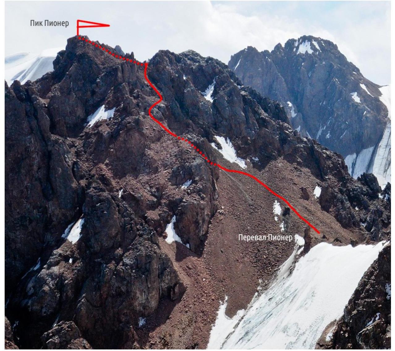
- Peak, route: Pik Pioner (4031 m), from Pioner pass.
- Estimated category of difficulty: 1B
- Height difference: 170 m
total route length: 300 m, wall section length: — of which 5 pitches — 0.6 pitches — 0, average steepness of wall section — 40°, average steepness of route — 40°
- Pitons driven (numbers in denominator — for IT): no data for rock, ice, cams, bolted
- Number of walking hours/days:
- Overnight stays: —
- Leader: no data
Team members: no data
- Coach: no data
- Approach to the route: no data
Summit: no data. Return: no data
Route Photo
Description
R0–R1
From the pass, move right — up the couloir.
R1–R2
An inner corner (II) 3 m long leads to a steep rocky couloir (25 m), which leads to a saddle.
R2–R3
From the saddle, right — up the talus to the exit onto the ridge (100 m).
R3–R4
Along the ridge to the summit (130 m, I). Descent via the ascent route and further to Alpinigrad.
