Otechestvennoy voyny 1Б cat. difficulty via Mayakovsky peak's North ridge
Route description.
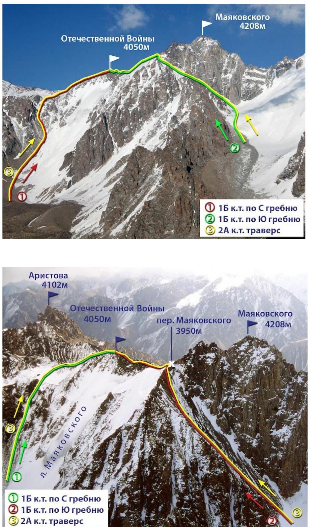
The peak Otechestvennoy voyny is located in the central part of the Maloalmatinsky spur; Mayakovsky peaks rise to the south of it, and Antikainen peak is to the north.
On the western side and northern slopes of the lateral ridge of Mayakovsky peak, a small Mayakovsky Glacier descends.
The eastern slopes are cut by narrow stepped couloirs, separated by steep rocky ridges.
The starting bivouac is near the Mynzhilki weather station. From here, cross the Malaia Alma-Atinka river and go around the Manshuk Mametova glacier at its foot; then ascend to the ablation zone of the Mayakovsky Glacier. Move along the moraine, then along the glacier to the foot of the U-shaped couloir.
Move up the couloir, keeping to the left side (rockfall hazard!), reach its fork, turn into the right branch, and ascend to the ridge of the peak. Turn south and continue the ascent (about 500 m) along the severely damaged ridge. There are many gendarmes on it, which are easily bypassed, except for the last one: it is overcome head-on.
The summit is a small area, elongated from north to south. There's a cairn here. Descent is via the ascent route. The ascent takes 7–8 hours.
The first group to reach the summit was a group of instructors from the mountaineering school on August 17, 1944, consisting of:
- Z. Volkova,
- L. Karapetyan,
- P. Semenov,
- B. Sigitov,
- G. Shur, led by V. Nearonsky.
Recommendations:
- Number of participants — not limited.
- Initial bivouac in the area of Mynzhilki weather station.
- Departure from bivouac at 6:00.
- Equipment for a group of 4 people:
- main rope — 2×40 m
- helmets — 4 pcs.
- ice axes — 4 pcs.
Author: Zhunusov B. Source: Book "Alpinistskie marshruty. Zailiyskiy Alatau". Part 1 from Mountain.kz website.