Muryntau (4539 m)
- Ascent from the Toguzak glacier via the gully of the north-western ridge.
- Traverse Muryntau — Toguzak from the Toguzak glacier.
Ascent from the Toguzak glacier via the gully of the north-western ridge, route category 2. (fig. 10).
The summit of Muryntau is located in the Trans-Ili Alatau ridge in the upper reaches of the right branch of the Toguzak glacier.
To the north-west of it:
- Toguzak pass
- Toguzak peak
The eastern slope of the summit ridge descends into the firn basin of the right branch of the Bogatyr glacier. The western slope is steeper, icy, and drops to the right branch of the Toguzak glacier.
From the summit dome, a ridge of rocks stretches out, resembling a giant human nose in shape. Due to this resemblance, the first ascenders named this peak Muryntau (Nose-mountain).
The starting point of the route is from the bivouac on the right lateral moraine of the right branch
of the Toguzak glacier, then along the moraine and
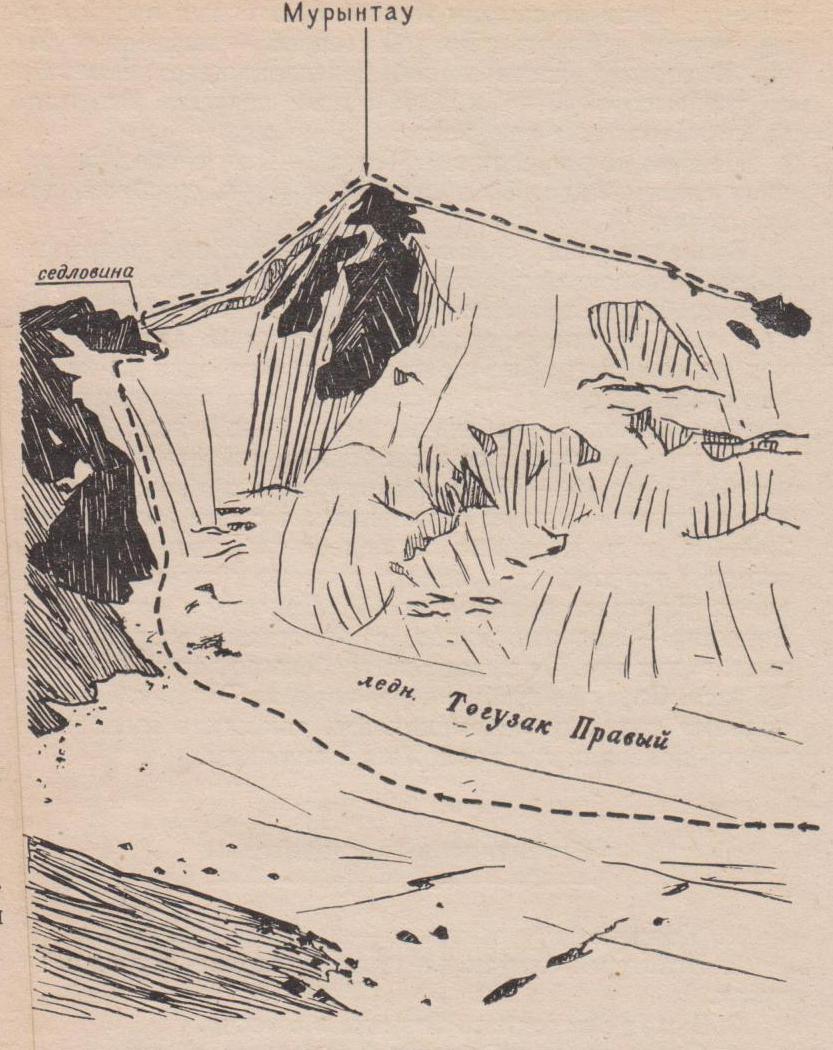
Fig. 10 — along the Toguzak glacier to the foot of the north-western ridge of Muryntau peak. 1.5–2 hours.
The rocky part of the ridge, along which the ascent is made, starts from the Toguzak pass and ends 200–250 m from the summit dome of Muryntau. The ascent is in the right part of the ridge, where it is cut by a narrow gully. The first half-hundred meters of steep firn are climbed on crampons.