Ascent Passport
- Climbing area
- Northern Tian-Shan, 7.2. 251 Trans-Ili Alatau ridge, Maloalmatinskoye gorge, Tuyuk-Su.
- Molodezhnaya peak 4147 m, via the "knife" on the left part of the North wall
- Proposed category of difficulty — 2B. First ascent.
- Route character — ice and snow.
- Elevation gain — 500 m.
- Route length — 1000 m.
- Used on the route: ice screws — 48, rock pitons and protection elements — 0, bolt pitons — 0.
- Pitons left on the route — 0.
- Average steepness of the main part of the route — 45–50°.
- Pitons: ice screws — 48 pcs.
- Travel time — 9 hours. Departure from the camp at "Tashkent overnight stays" — August 15, 2010 at 6:00 AM. Approach to the start of the route — 7:00 AM. Reaching the summit — 1:00 PM. Descent to the camp — 3:00 PM.
- Descent via the north-eastern ridge, to the moraine of the Tuyuk-Su glacier.
- In a team of two. Salnikov D.G. 1st sports category, alpinism instructor (№ 1210). Salnikova M.P. 2nd sports category.
- Coach: Novoselova G.V. (1st sports category, instructor № 373).
- Organization: Tomsk Regional Public Organization "Tomsk Alpinism Federation", Tomsk.
- Compiled by: Salnikov Dmitry Gennadievich d_salnikov@list.ru

Map of the Tuyuk-Su area
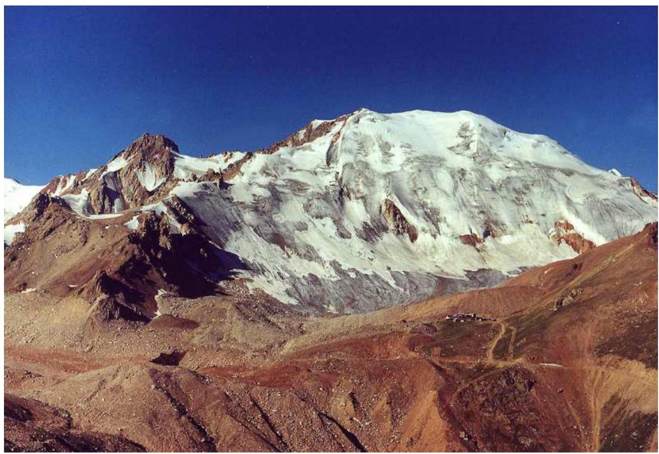
Molodezhnaya peak (4147 m)
Ascent Description
The ascent route starts from the lateral moraine of the Molodezhny glacier. The glacier is approximately 1 km long. The glacier is gentle, no crevasses. Movement in crampons towards the left rocky island on the northern slope of Molodezhnaya.
R0–R1. Two hundred meters below the island, the steepness of the glacier increases to 25–30°. Here it is necessary to rope up. Simultaneous movement using ice axes.
R1–R2. Further, the steepness increases to 45–50°. Along the steep ice slope, bypass the rocky island on the right. Length is 120 m. Along the way, there are ice breaks up to half a meter wide on the slope. Alternating movement, belay through ice screws.
R2–R3. The section leads to a steep ice "knife" 280 m long, leading to the pre-summit ridge of Molodezhnaya.
R3 — Summit. Along the wide pre-summit ridge, the summit is reached in 300–400 m. Movement along the ridge in a north-westerly direction, simultaneous in rope teams. A cairn is built on a rocky elevation. Descent along the north-eastern ridge, via the route of category 1B.
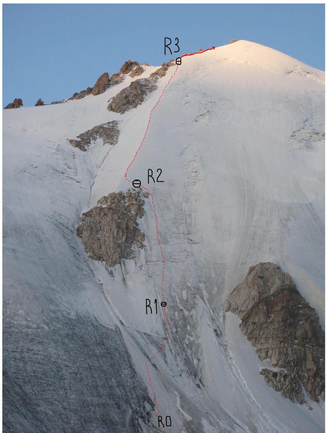
| Section | Length | Steepness | Relief character | Category of difficulty | Number of pitons |
|---|---|---|---|---|---|
| R0–R1 | 200 m | 25–30° | Snow and ice slope | I–II | - |
| R1–R2 | 120 m | 45–50° | Snow and ice slope | III | 25 |
| R2–R3 | 280 m | 40–45° | Snow and ice "knife" | II+ | 23 |
| R3–Summit | 400 m | 10° | Snow and ice ridge | I | - |
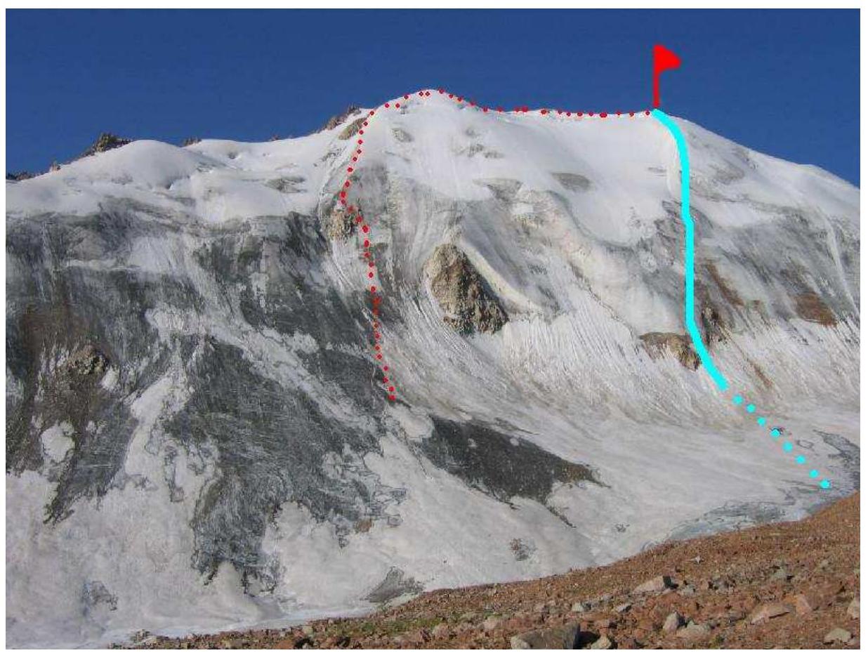
Routes on the northern slope of Molodezhnaya peak
- Right route (blue) 2B N slope (Nearonsky 1948)
- Left route (red dotted line) Salnikov D. – Salnikova M. First ascent August 15, 2010
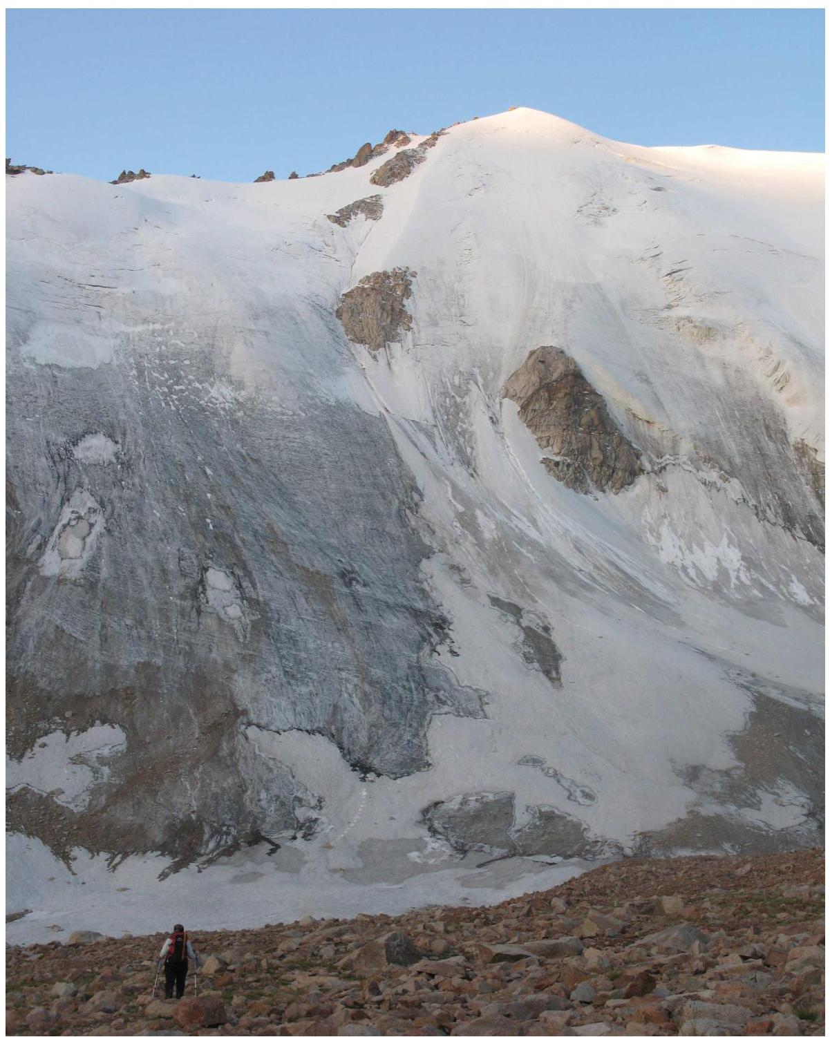
Approach to the route via the Molodezhny glacier moraine. Distance to the route is 1 km.

At the summit.