Route Description
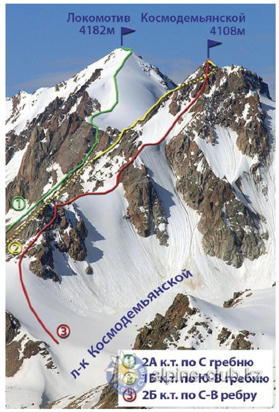
Peak Kosmodemyanskaya is located in the western branch of the Malo-Almatinsky ridge, which is a watershed of the Malaya and Bolshaya Almatinka rivers. Ridges stretch from it to the northeast, northwest, and south. On the northeastern side, a small eponymous glacier descends from its slopes.
The initial bivouac is organized on the platforms among the ancient moraine ramparts of the Molodezhny glacier. Then:
- Go to the left lateral moraine of the Tuyuk-Su glacier and along it — to the Kosmodemyanskaya glacier.
- Ascend to the upper snow plateau.
- Move along the ridge between the first and second gendarmes to the very summit.
From the saddle:
- Ascend along the large talus to the right rib of the second gendarme.
- Enter a narrow couloir.
- After 8–10 m, overcome a rock wall up to 15 m high, which has very few holds.
The ascent is possible:
- Along a winding crack.
- Along a crevice (the first ascenders of the route preferred this option).
The crevice ascends almost vertically; to the right of it, at a distance of half a meter, there is an internal corner.
Then a section of easy rocks begins, along which, from the right side, the second gendarme is bypassed. Behind it is a snow-ice isthmus. Move along it for about 150 m to the third gendarme, which is bypassed on the left along a couloir with talus. After 200 m, the couloir branches into two arms. You need to go along the right one with black talus to the ice isthmus. Then pass almost to the end of the ice couloir, continue moving along a 40-meter internal corner with a steepness of up to 50°.
Go out to a small platform, and behind it, overcome a 15-meter internal corner.
Along a section (about 20 m) of easy rocks, approach a slab (its inclination is up to 45°, length is about 6 m), behind which the ascent begins along a 10-meter wall with several vertical crevices.
Then:
- A small section of easy and medium rocks with a 7-meter wall.
- The fourth gendarme, which is bypassed on the right along rocks of tile-like structure.
The approach to the summit tower is along an isthmus, then along a 6-meter wall with a steepness of up to 55°, traverse a 15–20-meter rock wall and move in the direction of a steep chute. Slabs, walls, and chutes are mostly covered with snow throughout the summer; by the end of the season, flow ice forms. A cairn on the summit tower.
After descending from the tower along the ascent route, go out to the southern ridge, from here descend to the beginning of the couloir along a narrow steep chute up to 10 m long. The couloir and the slabs behind it are traversed in a southeastern direction. Then cross one of the rock ridges separating numerous couloirs on the eastern side of the summit.
Descend along heavily destroyed rocks to the south, into a couloir, cross it in the direction of the next rock ridge. Behind it lies an arm of a large couloir, leading to the left moraine of the Tuyuk-Su glacier. The path then lies to the Tuyuk-Su glacier. On this section:
- loose talus,
- large rock fragments on it.
Therefore, you should move extremely cautiously.
The ascent takes 9–10 hours. The first ascent of the route was made in August 1945 by a group of instructors from the mountain training school led by V. Nearonsky.
Recommendations
- Number of participants — 6–8 people.
- Initial bivouac on the moraine of the Molodezhny glacier.
- Departure from the bivouac at 5:00 AM.
- Equipment for a group of 4 people:
- main rope — 2×30 m
- rock pitons — 8 pcs.
- ice axes — 2–3 pcs.
- hammers — 2 pcs.
- carabiners — 2
pcs.
From the Mountain.kz website