Route Description
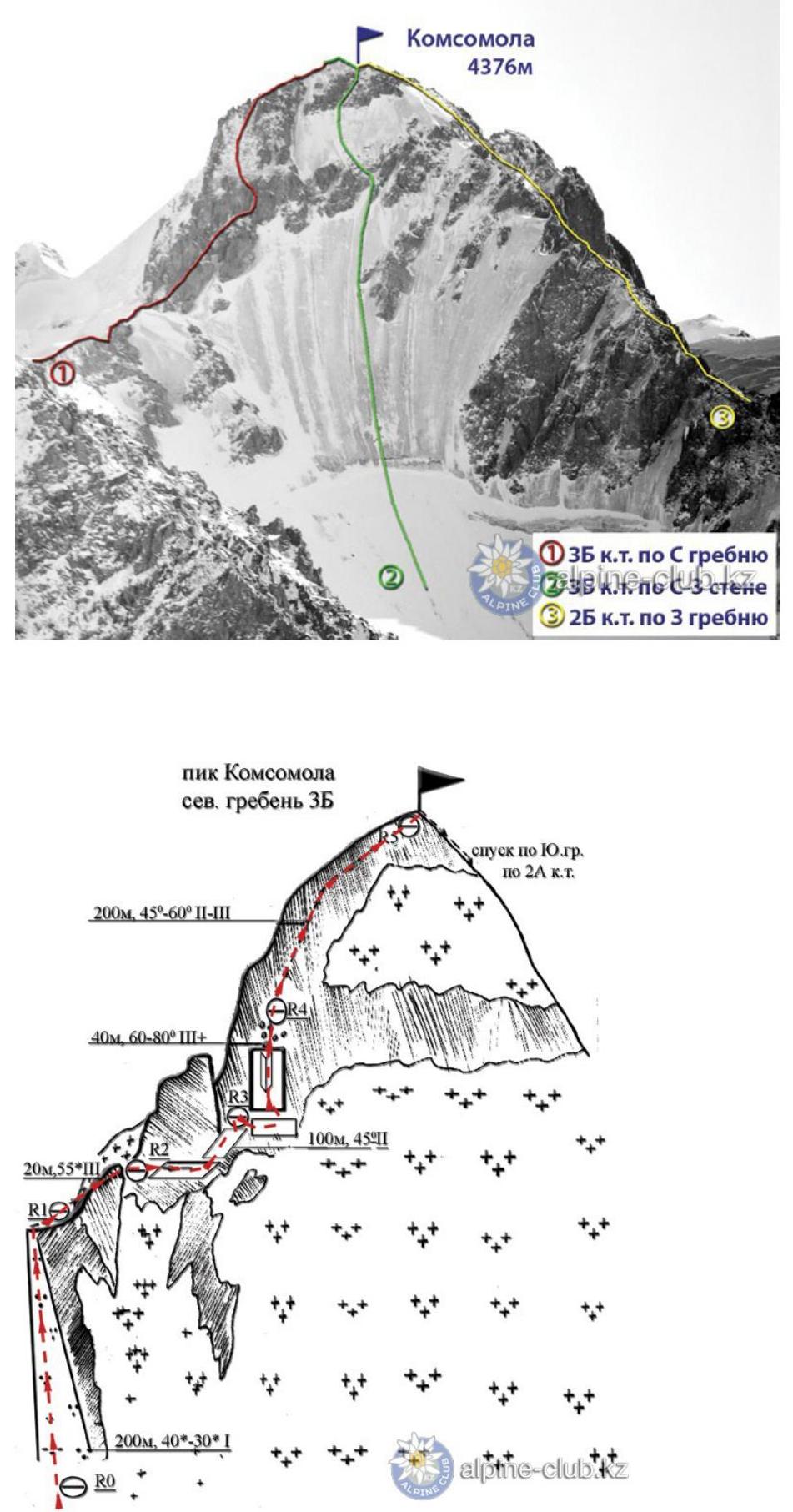
From the initial bivouac on the moraine of the Bogdanovich Glacier, exit onto its right branch, ascend along it to the saddle between Fizkulturnik peak and the Peak of Komsomol. From here, the ascent route begins along a snowy slope with a steepness of up to 50° and a length of 60 m. Approaching the foot of the first gendarme, organize belay through a ledge and traverse an icy couloir for up to 30 m. Further, traverse along slabs to the front rocks of the first gendarme on the right for 120 m. Here, at its foot, near a rocky tooth, is the first control point.
The route continues along a small ledge and a ridge to an icy couloir. Having ascended along it for 80 m alongside a steep rocky wall on the left, exit onto a small shoulder (piton belay), then to the base of a rocky couloir covered with wall ice (piton belay for 30 m).
Beyond the couloir:
- ascend along a steep snowy scree on the left with a height gain over 100–120 m;
- then ascend along a steep icy couloir to the ridge.
Here is the second control point. From here, move along rocks of medium difficulty, bypassing small gendarmes on the right.
The final section before the summit is a snowy-icy slope with a steepness of up to 45° and a length of up to 60 m, followed by an exit to the summit. Descend along route 2A cat. diff. to Komsomolsky Pass.
The ascent takes 9–10 hours. The first ascent of the route was made in July 1936 by a group of Almaty climbers consisting of A. Alekseev, P. Komolov, L. Kibardin, T. Rossova, D. Salanov under the leadership of I. Tyutyunikov.
Recommendations
- Number of participants — 4–6 people.
- Initial bivouac on the moraine of the Bogdanovich Glacier.
- Departure from bivouac at 6:00 AM.
- Equipment for a group of 4 people:
— main rope 2 × 30 m — rock pitons — 7–8 pcs. — hammers — 2 pcs.
From Mountain.kz website