Karlytau 1B cat. via Komosomolsky Pass
Route Description.
The snow-ice dome of Karlytau peak is located in the Maloalmatinsky spur, somewhat south of the majestic pyramid of Peak Komosomola. Its snow-white cap is clearly visible from Almaty.
Karlytau is situated between the passes:
- Komosomolsky (to the north)
- Manshuk Mametova (to the south).
To the west, a snowy ridge connects it to the peak Geroev Panfilovtsev. To the east, towards the Left Talgar gorge, a ridge stretches from the peak, crowned by the slender towers of Peak Aristova.
From the initial bivouac near Talgar Pass:
- head to the Bogdanovich glacier,
- move along the left lateral moraine,
- then along the glacier itself,
- cross its main branch,
- continue on, bypassing the western ridge of Peak Komosomola,
- head towards Komosomolsky Pass (4000 m).
From the pass, the ascent (about 300 m) to the peak begins along the northern ridge.
Initially, the ridge is icy but fairly gentle; closer to the peak, the slope steepens to 35°. Step-cutting is necessary to overcome the bergschrund.
Then follows the summit, which has cornices on the eastern side.
Route conditions at different times of the season:
- At the beginning of the summer season after heavy snowfalls, Karlytau slopes are avalanche-prone, and ascent is only possible in the early hours.
- At the end of the season, when the icy slopes are exposed, the entire route is traversed with crampons.
The ascent takes 5–6 hours. Descent is via the same route.
The first ascent to the peak was made in 1934 by a group of Almaty alpinists led by B. Lobanov.
Recommendations:
-
Number of participants — not limited.
-
Initial bivouac near Talgar Pass.
-
Departure from bivouac at 4:00–5:00.
-
Equipment for a group of 4 people:
- 2 × 40 m main rope
Author: Zhunusov B. Source: Book "Alpinist Routes. Trans-Ili Alatau".
Part
1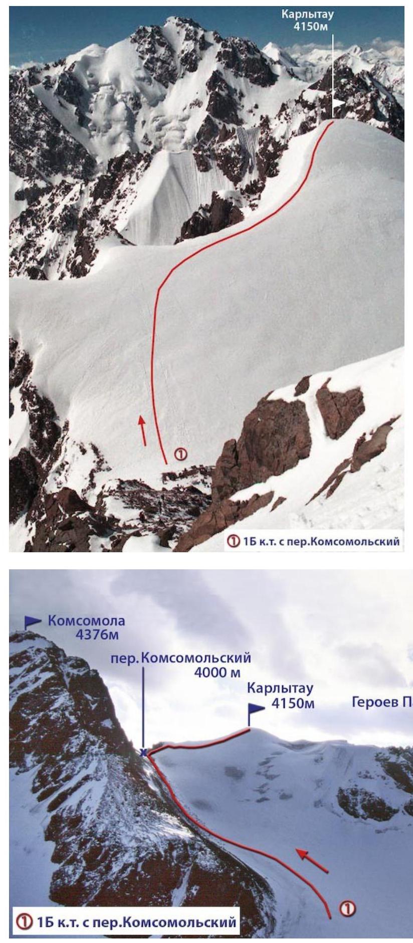 (1)
15 cat. via Kommunarsky Pass
(1)
15 cat. via Kommunarsky Pass
