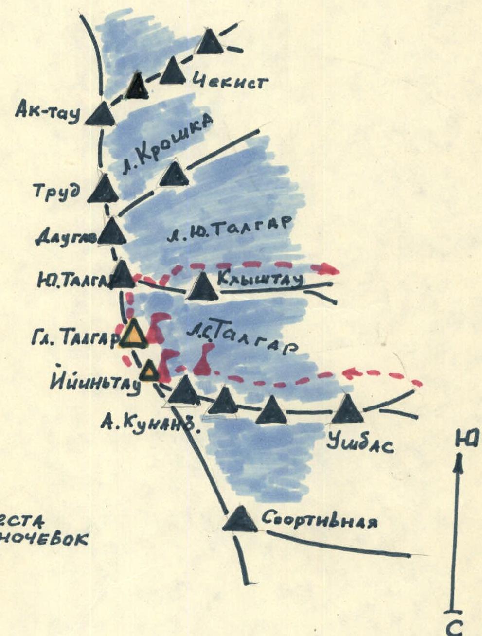
Climbing Area Map
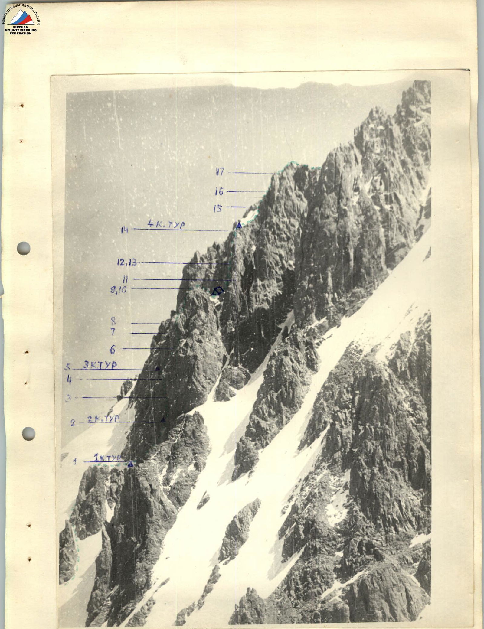
Profile, view from the southwest.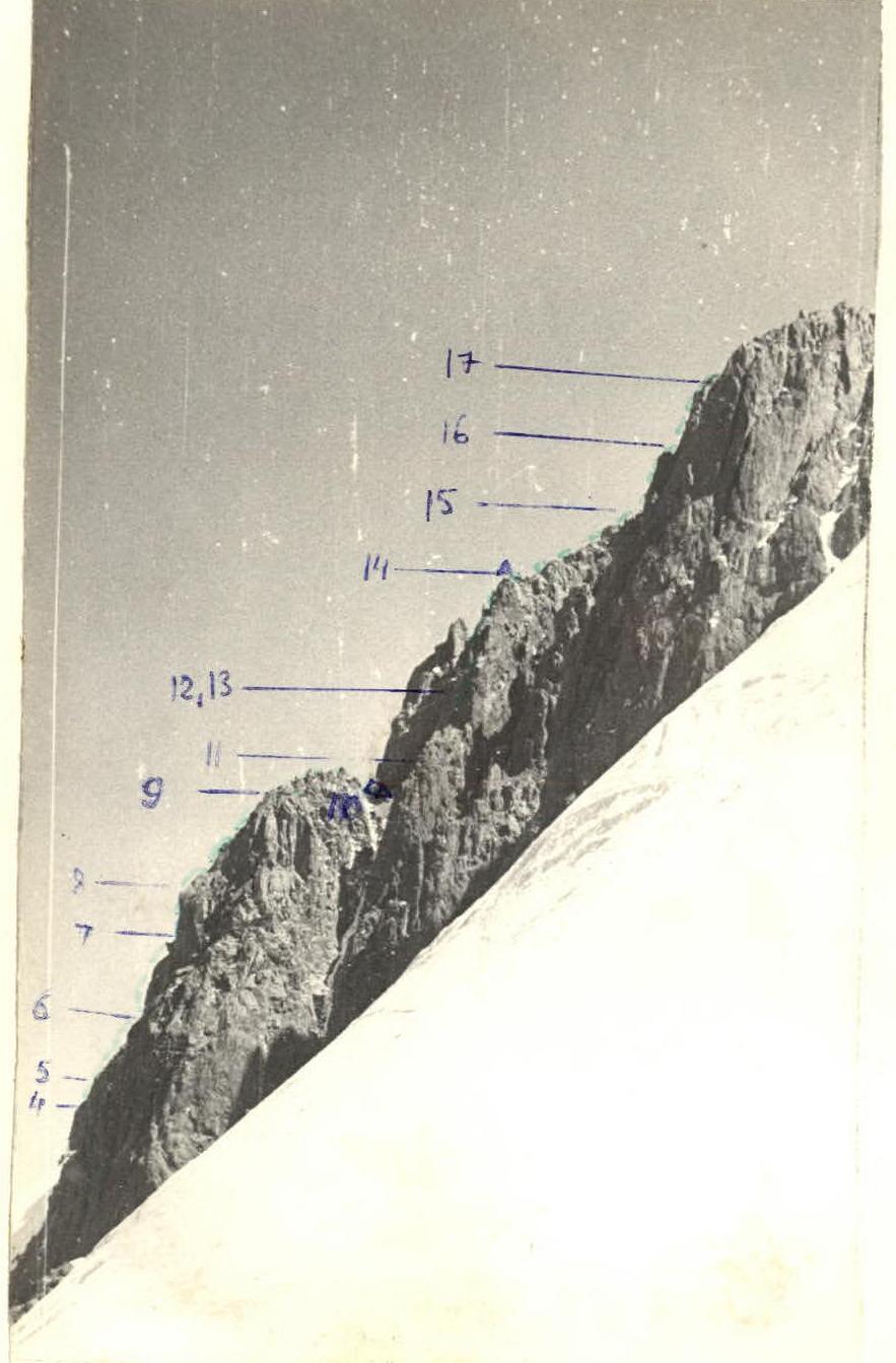
Profile, view from the south.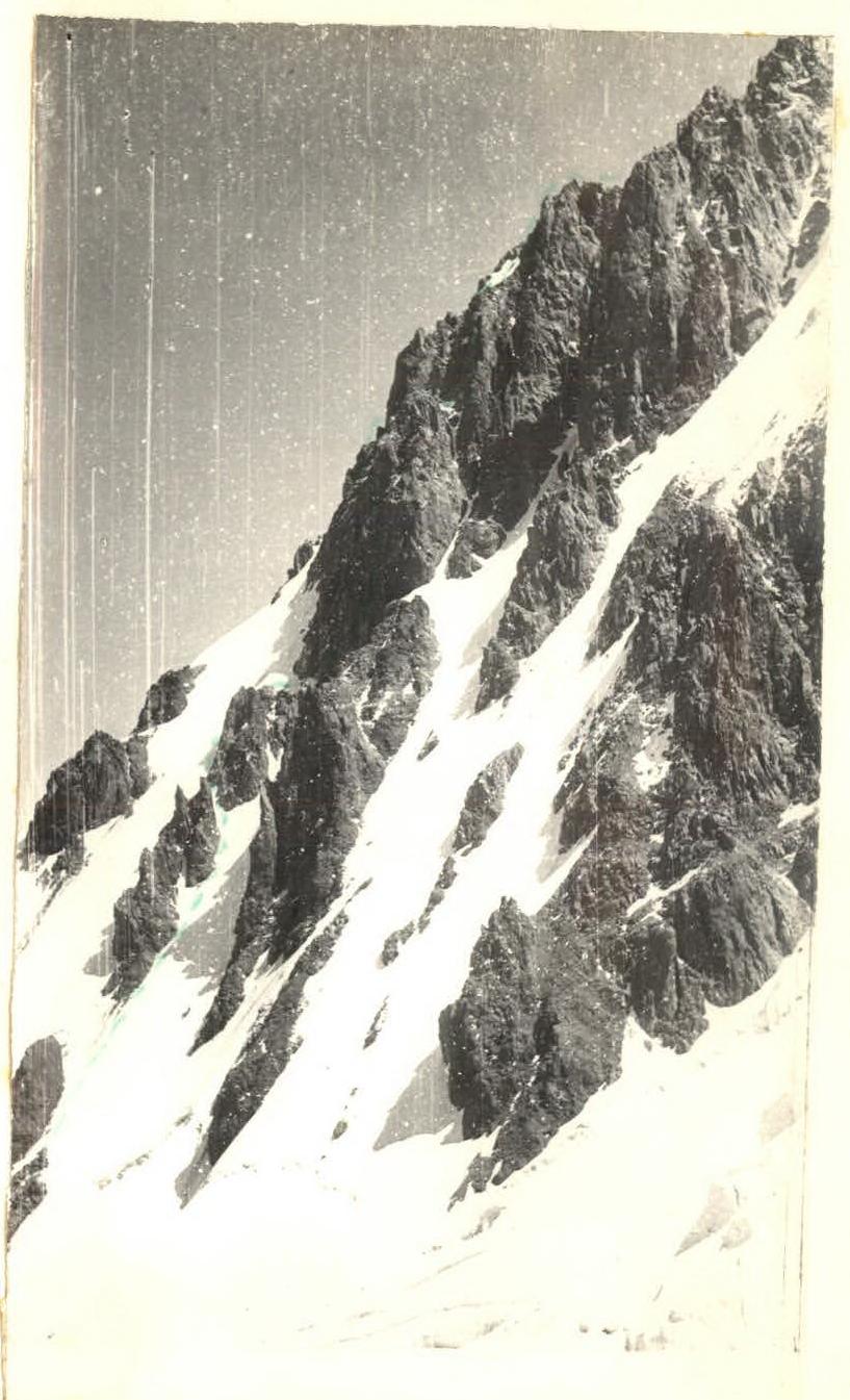
Profile, view from the southwest.
TABLE OF MAIN CHARACTERISTICS OF THE ASCENT ROUTE
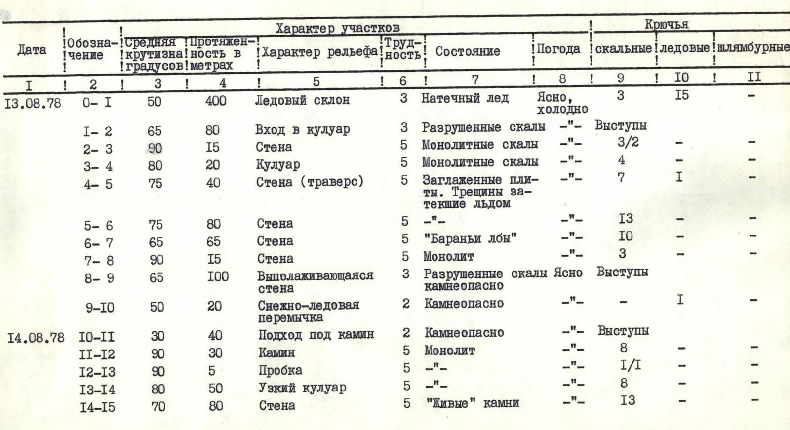
Note: Pitons used to create artificial holds are indicated by a fraction. From the Talgar alp camp, follow the trail up the Sredny Talgar River to the Severny Talgar glacier, then up the Severny Talgar glacier. Overnight at the moraine at the foot of the IyinTau slope.
Brief Explanation for the Table
Section R1. Passed with piton belay. All participants wear crampons. Before entering the couloir, 1st control point.
Section R2. Belay through ledges. Under the wall, left of the rusty spot, 2nd point. From 13:00, when the western slope of IyinTau is lit by the sun, rockfall hazard increases significantly.
Section R3. Move up the inner corner left of the rusty spot. The rock is monolithic sandstone. On the first 15 meters, there are no footholds or good cracks. Two rock pitons were hammered in to create artificial holds. Organization of rappel, pulling up backpacks.
Section R4. The upper part of the inner corner becomes gentler; there are cracks for pitons; at the exit, there is a good ledge. Pulling up backpacks.
Section R5. Bypass the overhanging wall to the left. Piton belay. On the shelf, 3rd point.
Section R6. Move up the wall. Difficult climbing. Piton belay. Pulling up backpacks.
Section R7. Due to rockfall hazard, the ice section is bypassed to the right. Piton belay.
Section R8. There are cracks for various pitons.
Section R9. Move with alternating belay.
Section R10. Belay through ice screws. Overnight on the ridge under the wall. The ice slope to the left is highly prone to rockfall.
Section R11. From the overnight spot, descend from the ridge to the right — 5 meters down and traverse 40 meters to the start of the chimney. Simultaneous movement with rope placement around ledges.
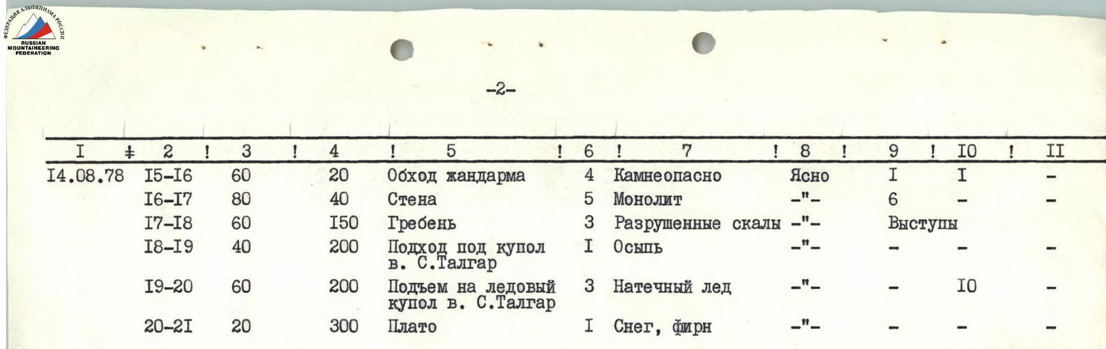
Section R12. Difficult climbing through the chimney. Piton belay, organization of rappel, pulling up backpacks. There are cracks for various pitons.
Section R13. Overcoming the "plug" requires creating an artificial hold using a rock piton and a ladder.
Section R14. Difficult climbing, piton belay, organization of rappel, pulling up backpacks.
Section R15. Moving up the wall requires caution due to "live" rocks. There are cracks for various pitons. 4th control point.
Section R16. The black gendarme with a cleft is bypassed to the left on ice. Belay through rock and ice screws.
Section R17. Piton belay. There are cracks for various pitons.
Section R18. Move with alternating belay through ledges on IyinTau.
Section R19. Simultaneous movement under the dome of S. Talgar.
Section R20. Move with alternating belay through ice screws.
Section R21. Ascent to Gl. Talgar. Overnight in a hollow before Gl. Talgar.
Note:
- Ascent to IyinTau via the cold north face.
- The wall is lit after 13:00.
- Rockfall hazard increases after this time, with rockfall occurring on the ice slopes.
- Rockfall has also been observed at night.
Brief Information about the Descent
Descent is made through Yu. Talgar via its western snow-ice slope to the Yu. Talgar glacier (Baranovsky's path) and further down the glacier to the trail.
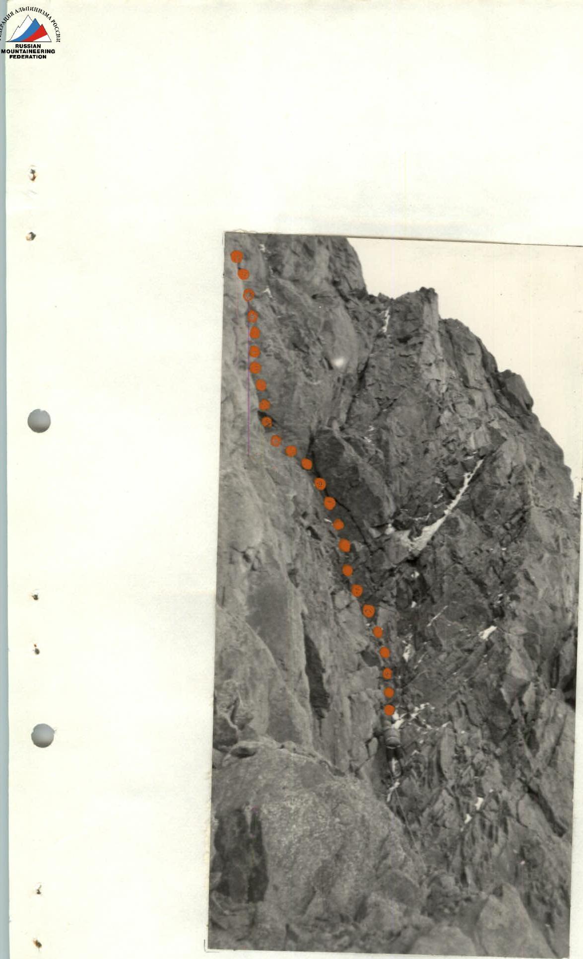
Section № R11, R12.


