Route Description
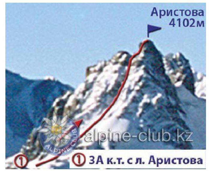
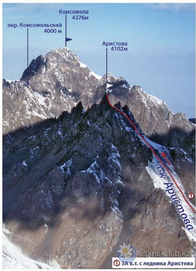
Peak Aristova, named after one of the first Soviet climbers — Oleg Aristov, — is a rocky tooth and towers rising above the lateral ridge, which branches off from the Malo-Almatinsky spur at the location of the Karlytau peak. From there, the ridge stretches east-southeast for about 4 km, dividing the lateral valleys of the glaciers:
- Aristova
- Byrdzhiga.
The initial bivouac is on the Aristova glacier plateau. The exit to the route should be no later than four hours, on a slope with a steepness of 55–60°.
The ascent goes straight, a little south of a small group of rocks descending from the summit ridge. Deep snow cover:
- Creates convenience for ascending on beaten steps with insurance through an ice axe.
- Is avalanche-prone.
At the end of summer, ice patches appear on the slope, numerous crevices open, and then cutting steps and piton insurance are required to overcome it. Having ascended to the ridge, turn left and bypass the rocky jumble from the south side along the scree. After about 30 m, having bypassed another rocky jumble, cross over to a snowfield stretching in a narrow strip from west to east. Move along it to the first pronounced gendarme. Its detour is possible from the north side along the firn slope with a steepness of 65° to the couloir at the main tower (movement on crampons) or from the south, where the detour is longer but technically easier. Here, it is necessary to traverse the scree with a loss of height to the couloir, which leads to the saddle of the first gendarme's rib. Having overcome the rib through the saddle, descend to the scree, and bypass the second gendarme from the south side. Then ascend to the saddle between the second and third gendarmes (the third is bypassed from the north side on rocks without loss of height). Then cross the icy couloir between the third gendarme and the summit tower (at the beginning of the couloir, the snow-ice cover is 5–6 m, requiring step cutting and piton insurance; further on — rocks). When exiting the couloir to the saddle, move carefully (many loose stones).
Above the saddle rises the summit tower (up to 60 m). The ascent to it is from the southwest side.
At first, a monolithic rocky wall 5–6 m high is overcome, then follows:
- an exit to a slab,
- above — a small platform and again a slab,
- behind the slab — an exit to a ledge (25 cm).
Then:
- traverse the tower wall in a northerly direction along the ledge to its end,
- continue movement along a 3-meter wall with a negative angle.
This is the most difficult section of the route.
Behind the wall:
- an exit to rocks of medium difficulty and difficult,
- which lead to the summit area, having a slight tilt to the west (piton insurance).
The descent is via the ascent route. The ascent takes 10–12 hours. The first ascent to the summit via this route was made in 1937 by a group from the Central Asian School of Mountaineering Instructors consisting of:
- A. Alekseev
- M. Leonov
- I. Ezhelev
- S. Denisov under the leadership of V. Orlyankin.
Recommendations
- Number of participants — 4–6 people.
- Initial bivouac — on the Aristova glacier plateau.
- Exit from bivouac at 5:00.
- Equipment for a group of 4 people:
- main rope — 2×40 m
- expendable cordelette — 10 m
- rock pitons — 7–8 pcs
- ice pitons — 5–6 pcs
- hammers — 2 pcs
From Mountain.kz website

