
Ascent to the summit of "Karatau"
The altitude above sea level according to the altimeter is 3800 m. The summit is located in the Dzungarian Alatau, in its Main Northern ridge.
It is situated in the gorge of the Karasai river, a tributary of Aksu, in the left spur of the Main ridge.
To the northeast is a rocky wall 50°–70° with a height of 300–400 m, cut by couloirs, from which a rocky ridge leads to the summit. To the east are rocks with scree, and before the summit, there is a rocky wall 60°–80° with a height of 100–200 m. To the west and south is a large scree representing destroyed rocks. Departure at 6:00 from the base camp at 2650 m on the bank of Aksu. The path is in the gorge of the Kar-Sai river. The exit to the very summit is in the northeastern wall. Through a couloir with scree, the path goes west to the ridge of the spur. At the snowpatch, there is a turn to the south. This bypasses the northeastern wall. Further, the path goes along the snowy scree and exits to a large icy scree representing destroyed rocks. Movement along it is slow and tense. Further, a rocky ridge of about a hundred meters is passed in rope teams. The second group reaches the summit at 13:00. Descent to the south, to the "Enbek" pass. From it, the descent is onto scree in the Kar-Sai gorge onto the glacier. Return to the base camp at 17:00.
The weather during the ascent was sunny, but at times a cold wind blew.
The ascent was made on September 14, 1963, by 12 people led by NAIMAN (1st sports category) and KONDRATYEV (2nd sports category). The remaining participants had the III sports category and the "Alpinist of the USSR" badge.
The presumed degree of difficulty is 1B.
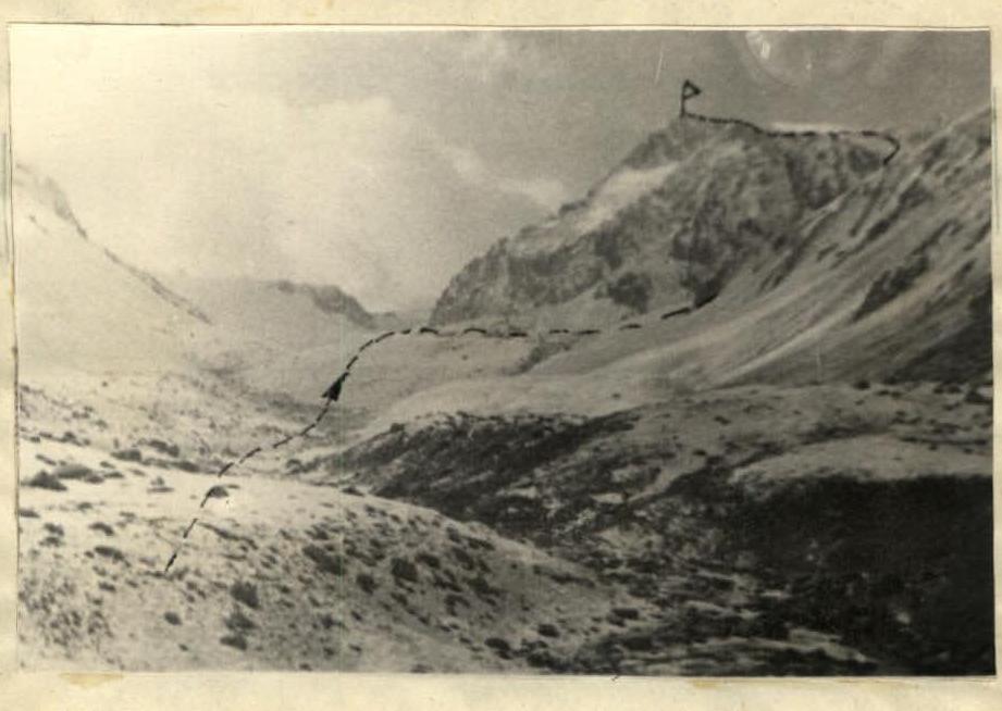
Kara-Tau 3800 — route map
Comments
Sign in to leave a comment