
Ascent to the summit "Karaganda"
The geodetic height is 4014 m. The summit is located in the Dzungarian Alatau, in its Main Northern ridge.
It is situated in the main ridge near the Demekpe pass. A glacier descends from the summit to the north. Its upper part is gentle, but the steepness increases significantly towards the bottom. The north-eastern side is a continuous glacier, which is part of an ice cirque. To the south lies a rocky scree. From the west, there are scree slopes and rocks of moderate difficulty before the summit. Departure at 8:30. At the Demekpe pass by 11:00. From here, the path to the summit begins - eastward along the scree. We reach the ridge. A glacier descends from it to the north, and a snowy-ice cornice to the south. We pass the cornice on the left along the glacier, roped and in crampons.
We reach rocks of moderate difficulty. The rocks are covered with snow and ice. Movement with alternating belay. The rock section is about 100 m high, with a steepness of 50–70°. At the summit by 13:00.
Descent to the north along easy slopes for 100 m. We cross the glacier to the west and join the ascent route. Further descent follows the ascent path. Base camp by 17:30.
The weather during the ascent was very poor. Visibility sometimes disappeared completely. Strong cold wind. Fog.
The ascent was made on September 16, 1963. The group consisted of:
| KONDRATYEV | — leader — Category "P" |
|---|---|
| GATSUTS | — 3rd category |
| SOROKIN | — 1st category |
| ZOTOV | — 3rd category |
The assumed difficulty level is 2A.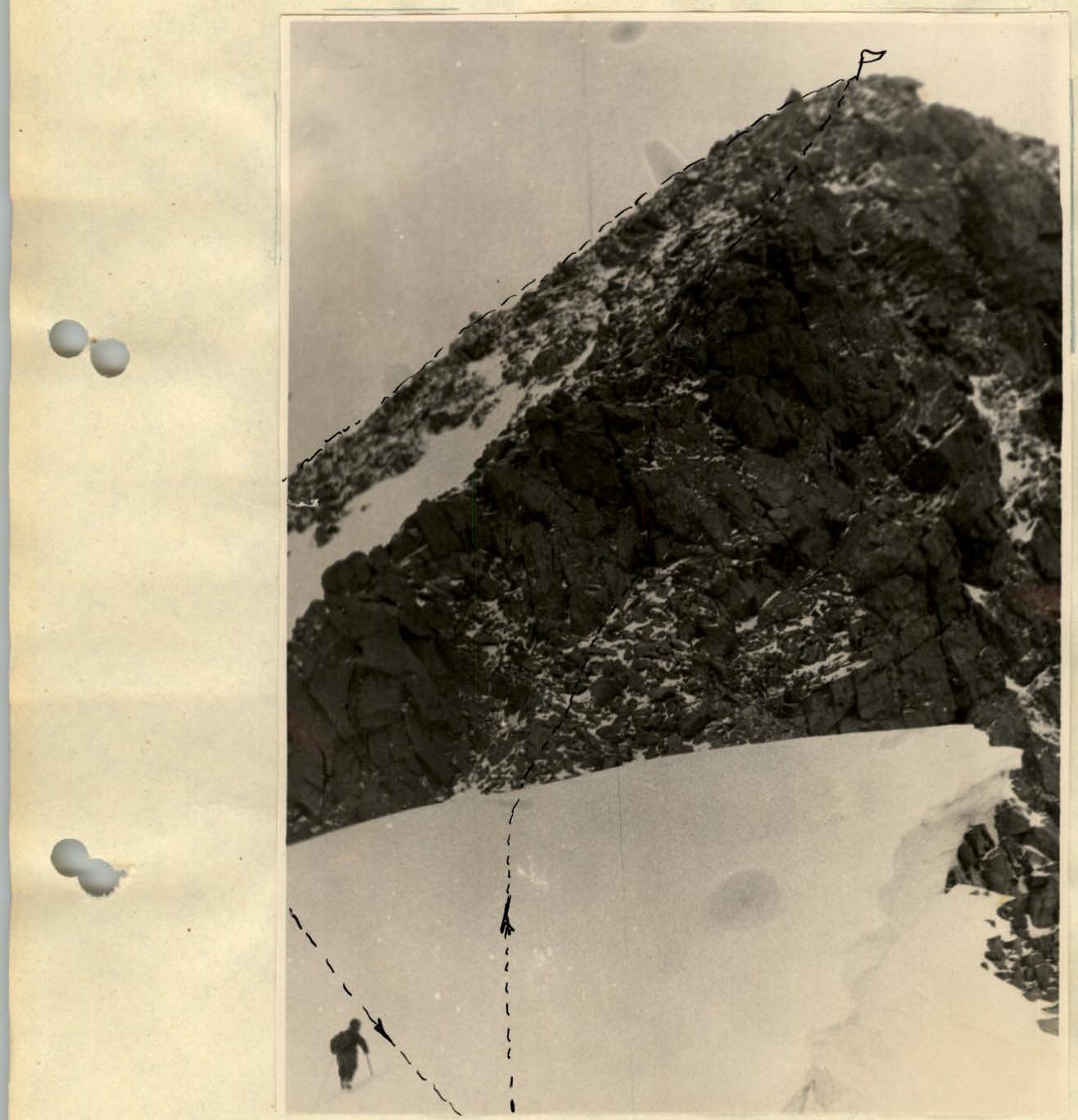
Karaganda 4014 m — Route of movement
Comments
Sign in to leave a comment