
Report
on the ascent to Zvezdny peak, 2265 m. Via the center of the South face, category 5B complexity.
First ascent by the Krasnoyarsk team on July 11, 2022.
I. Ascent Report
| 1. General Information | ||
|---|---|---|
| 1.1 | Full name, sports rank of the leader | Terentyeva G.A. (MS) |
| 1.2 | Full name, sports rank of the participants | Kozlova A.P. (MS) |
| 1.3 | Full name of the coach | Prokofiev D.E. (MS), Zakharov N.N. (MSMK), Balezin V.V. (MSMK) |
| 1.4 | Organization | Krasnoyarsk Regional Federation of Alpinism |
| 2. Characteristics of the Ascent Object | ||
| 2.1 | Region | Western Sayan |
| 2.2 | Valley | Ergaki valley |
| 2.3 | Section number according to the 2013 classification table | 6.6.2 |
| 2.4 | Name and height of the peak | Zvezdny 2265 m |
| 2.5 | Geographical coordinates of the peak (latitude – longitude), GPS coordinates | 35°20′18″ N 76°27′23″ E |
| 3. Characteristics of the Route | ||
| 3.1 | Name of the route | Via the center of the South face |
| 3.2 | Proposed category of complexity | 5B |
| 3.3 | Degree of route exploration | Second ascent |
| 3.4 | Nature of the route terrain | rock |
| 3.5 | Height difference of the route (altimeter or GPS data) | 352 m |
| 3.6 | Length of the route (in meters) | 455 m |
| 3.7 | Technical elements of the route (total length of sections of varying complexity with indication of terrain type (ice-snow, rock)) | II cat. rock — 90 m. III cat. rock — m. IV cat. rock — 35 m. V cat. rock — 70 m. VI cat. rock — 225 m. Rock VI, A3 — 35 m |
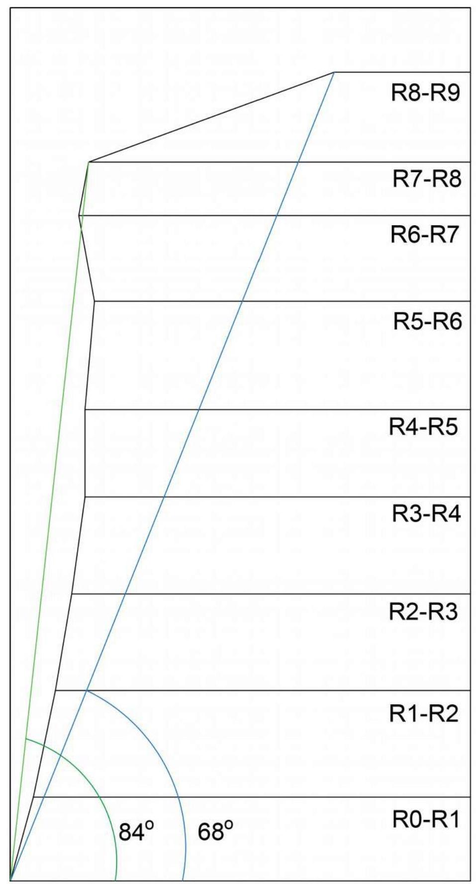
| 3.8 | Average steepness of the route, (°) *(2) | 68° |
| 3.9 | Average steepness of the main part of the route, (°) *(2) | 84° |
| 3.10 | Descent from the peak | Via the SW edge |
| 3.11 | Additional characteristics of the route | The main part of the route is climbed using free climbing, with some aid climbing on skyhooks and friends |
| 4. Characteristics of Team Actions | ||
| 4.1 | Time of movement (team's working hours, in hours and days) | 7 h 10 min, 1 day |
| 4.2 | Overnights | - |
| 4.3 | Time spent on route preparation (3) | 0 h, 0 days |
| 4.4 | Departure from camp | 5:00 July 11, 2022 |
| 4.5 | Start of work on the route | 7:15 July 11, 2022 |
| 4.6 | Reach the peak | 14:25 July 11, 2022 |
| 4.7 | Return to base camp | 17:20 July 11, 2022 |
| 5. Weather Conditions | ||
| 5.1 | Temperature, °C | 15–20 °C |
| 5.2 | Wind speed, m/s | 3 m/s |
| :-- | :-- | :-- |
| 5.3 | Precipitation | none |
| 5.4 | Visibility, m | full |
| 6. Responsible for the Report | Terentyeva G.A. 8twigl@gmail.com | |
| 6.1 | Full name, e-mail | Terentyeva G.A. 8twigl@gmail.com |
II. Description of the Ascent
1. Characteristics of the Ascent Object
1.1. General photo of the peak
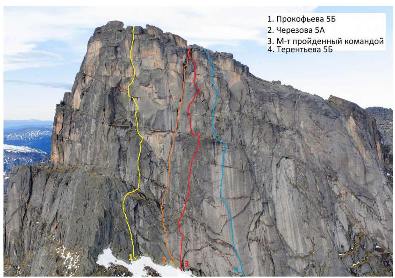
- Prokofiev 5B
- Cheryozov 5A
- Route taken by the team
- Terentyev 5B
1.2. Photo of the route profile
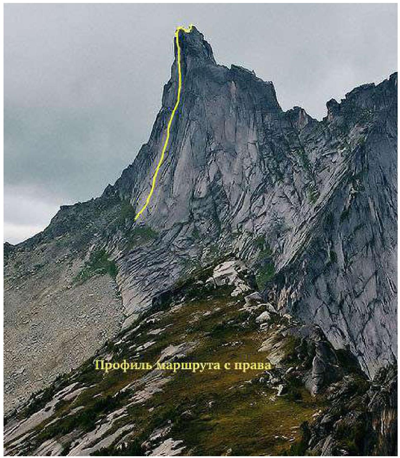 Route profile on the right
1.3. Drawn profile of the route
1.4. Photo panorama of the area, view from the south
 Ptitsa peak 2221 m
Zvezdny peak 2265 m
Ptitsa peak 2221 m
Zvezdny peak 2265 m
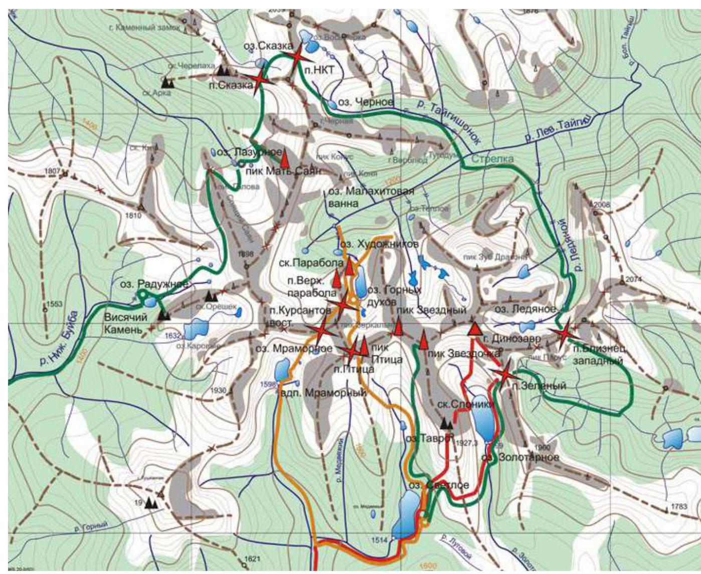
1.5. Map of the area
2. Characteristics of the Route
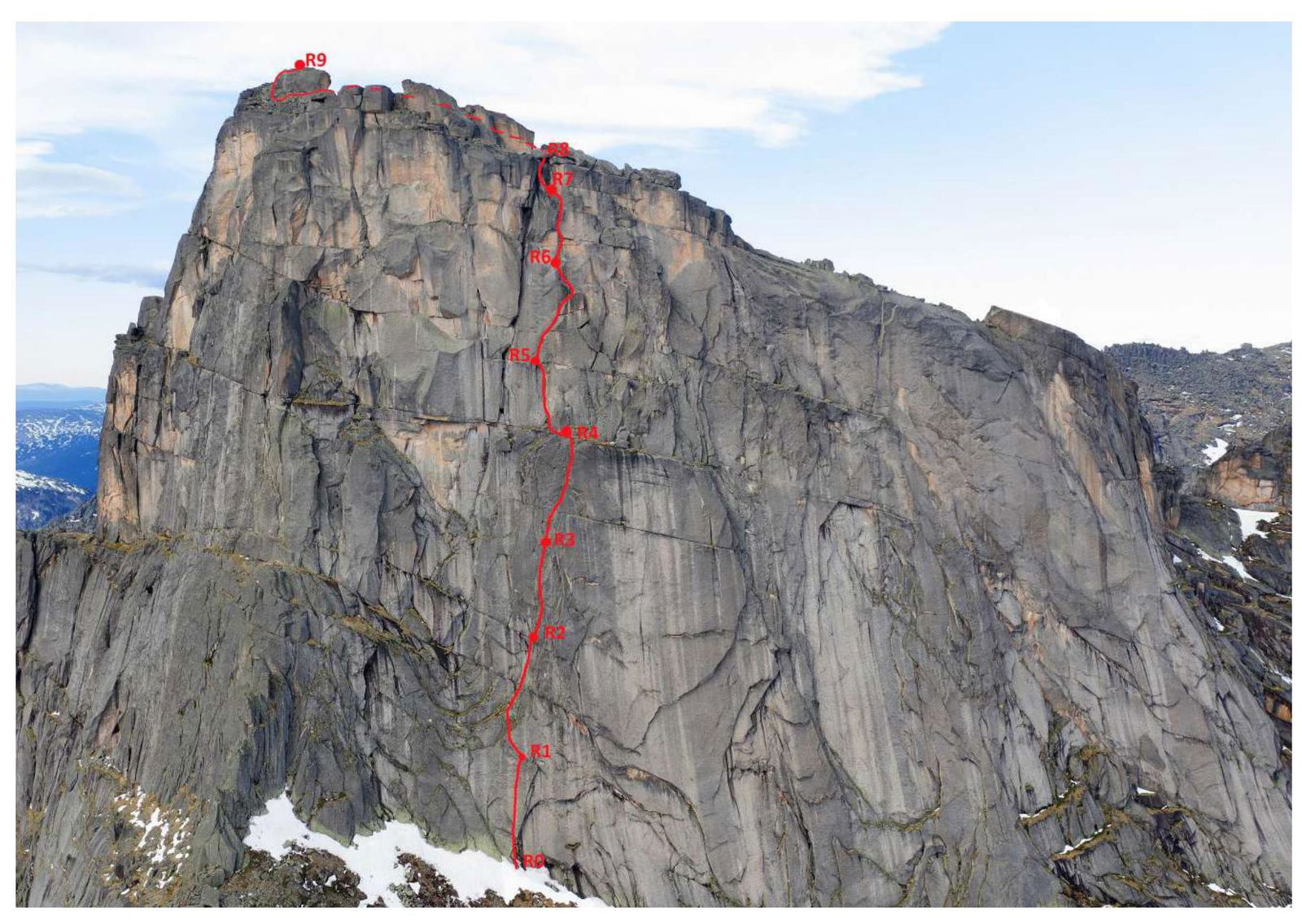
2.1. Technical photo of the route
2.3. Route diagram in UIAA symbols
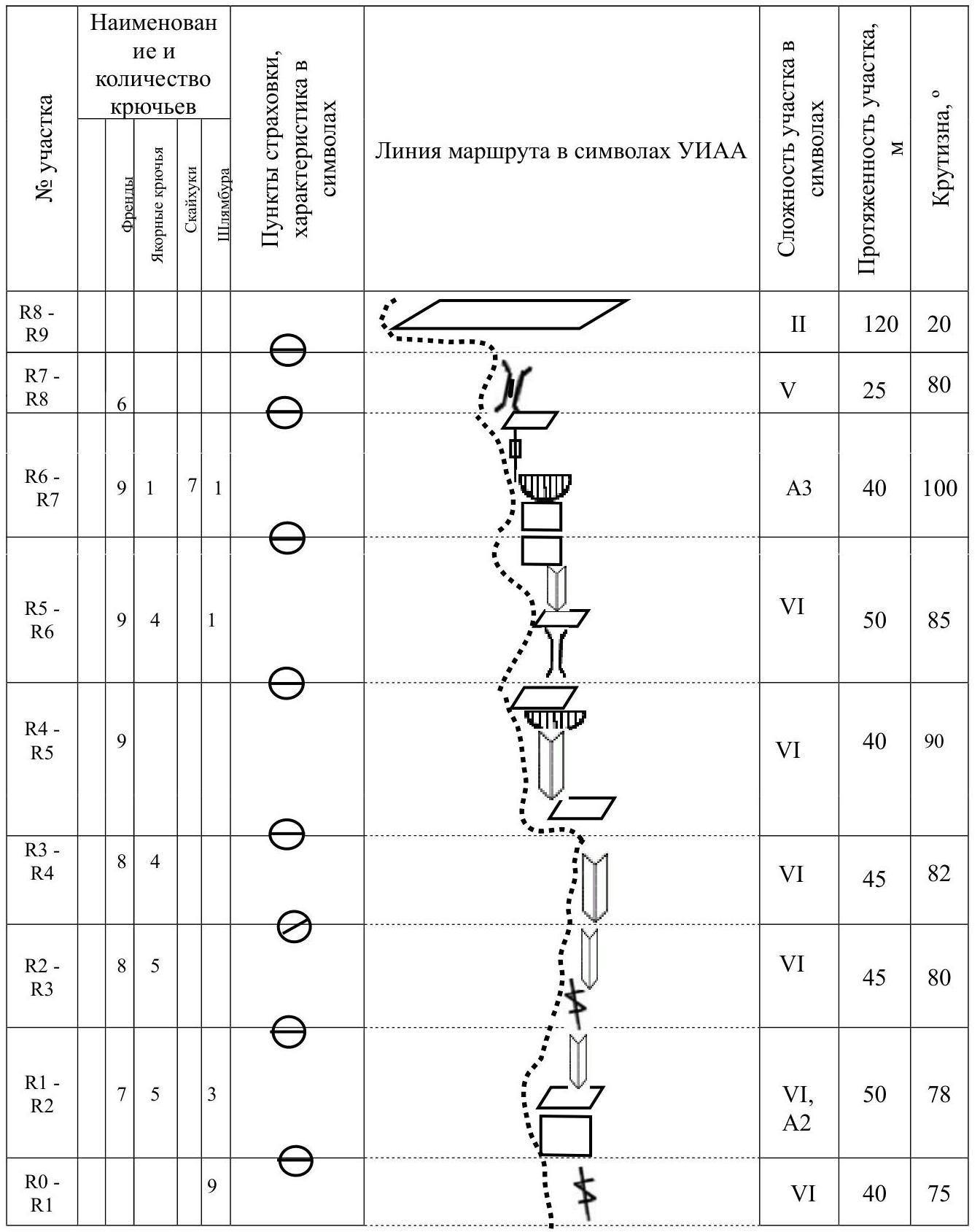
| Section № | Name and number of pitons Friends Anchor pitons Skyhooks Bolts | Insurance points, characteristics in symbols | Route line in UIAA symbols | Complexity of section in symbols | Length of section, m | Steepness, ° |
|---|---|---|---|---|---|---|
| R8–R9 | II | 120 | 20 | |||
| R7–R8 | 6 | V | 25 | 80 | ||
| R6–R7 | 9 1 7 1 | A3 | 40 | 100 | ||
| R5–R6 | 9 4 1 | VI | 50 | 85 | ||
| R4–R5 | 9 | VI | 40 | 90 | ||
| R3–R4 | 8 4 | VI | 45 | 82 | ||
| R2–R3 | 8 5 | VI | 45 | 80 | ||
| R1–R2 | 7 5 3 | VI, A2 | 50 | 78 | ||
| R0–R1 | 9 | VI | 40 | 75 |
3. Characteristics of Team Actions
The South face of Zvezdny has always been attractive for its potential to climb a significant portion of the lines using "free climbing." This route was no exception, so the team waited for a weather window to attempt the route in a pure style. After several sunny days, they were able to climb almost 8 out of 9 ropes via free climbing on dry rock. However, considering:
- the complexity of the sections,
- the high likelihood that after rains, the lower part of the route with grassy ledges would be very wet, and aid climbing would be significantly more than described in this report.
The main part of the route was first ascended during the 2009 Russian Championship by the team of Borisova Yu. and Smelovskaya M., but the participants of this first ascent could not recall any information, and a description of the route was not compiled; accordingly, the route was not classified. Therefore, our team decided to climb this route and add an independent finish to the upper part, making it a fully standalone line. The more direct line made the route more logical. A challenging section with an overhanging crack helped avoid unnecessary traverses. The line we climbed exits to the final pitch of the Cheryozov route, not the Lebedev route (as was the case with Borisova's route). Thus, a significant part of the R6–R7 section represents a first ascent.
The route is extremely varied and technically challenging: it combines climbing through internal corners and cracks, featuring an interesting section with a steep (and overhanging in the upper part) corner in the middle of the route — which will be appreciated by fans of trad climbing and free climbing. It includes:
- a short but interesting off-width,
- a vertical slab requiring confident technique on skyhooks with less-than-reliable protection,
- strenuous aid climbing on an overhanging crack.
The route is comparable in complexity to other category 5B routes in the Ergaki area and is undoubtedly more challenging than all category 5A routes on Zvezdny peak and the neighboring Ptitsa peak. We recommend climbing it during the summer. The route does not have large chimneys or water collection areas, so there is a high probability that it dries well within a couple of days.
3.1. Brief description of the route ascent
R0–R1. 40 m. Start of the route Trial, landmark for approach — a metal plaque. Move up the slab with a thin crack, 9 stationary bolts. Climbing 6B. Station on bolts.
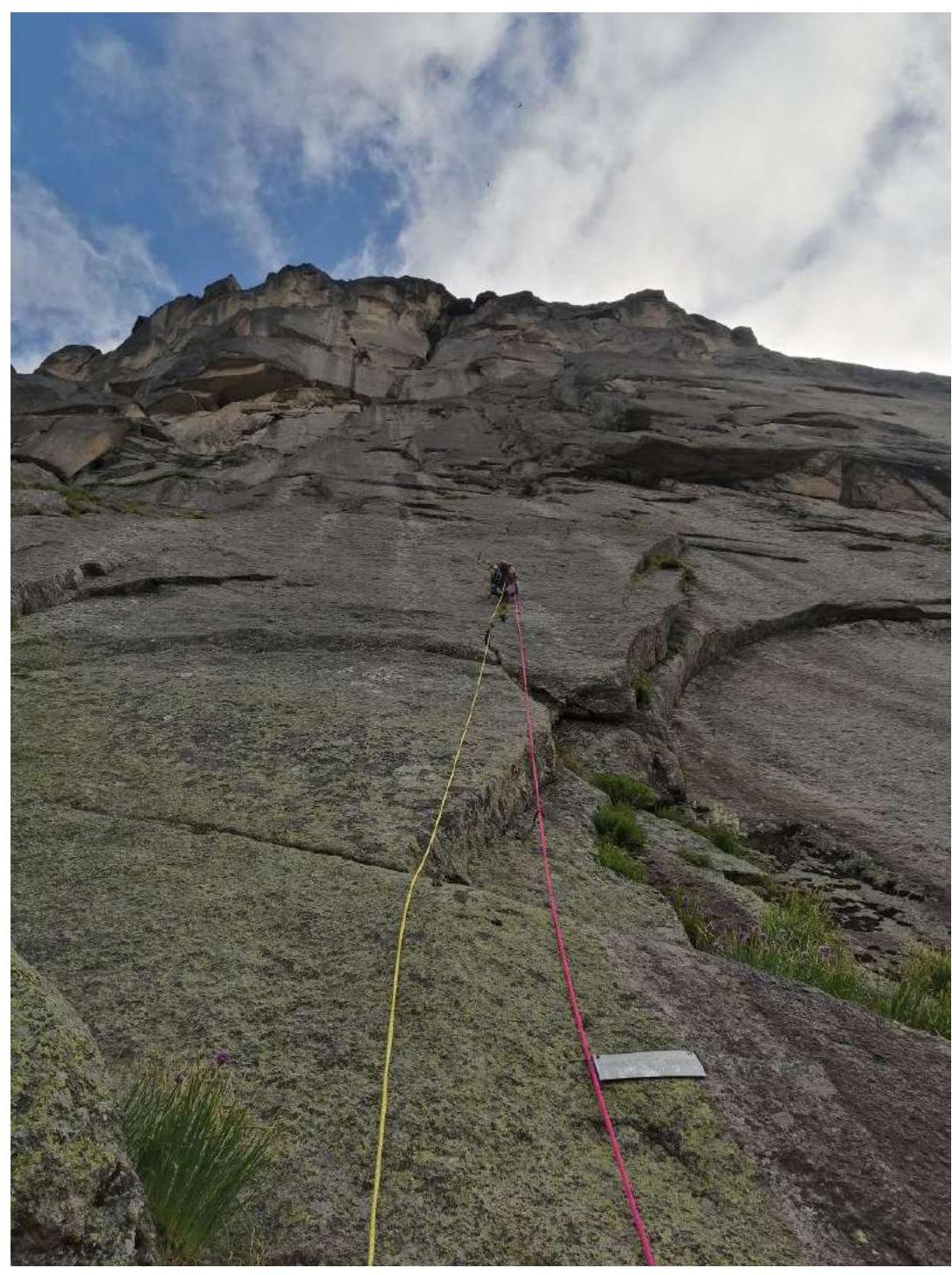
Fig. 1. Start of the route — section R0–R1.
R1–R2. 50 m. Left and up, slab with underclings. First 10 m protection on bolts, climbing is complex. Then, traverse right along a grassy ledge into a system of internal corners. Continue moving up to a small grassy ledge. Climbing 6A/6B. Cracks are overgrown. Can use a wick to clean vegetation; medium and small friends, bent anchors are used. Station on personal points.
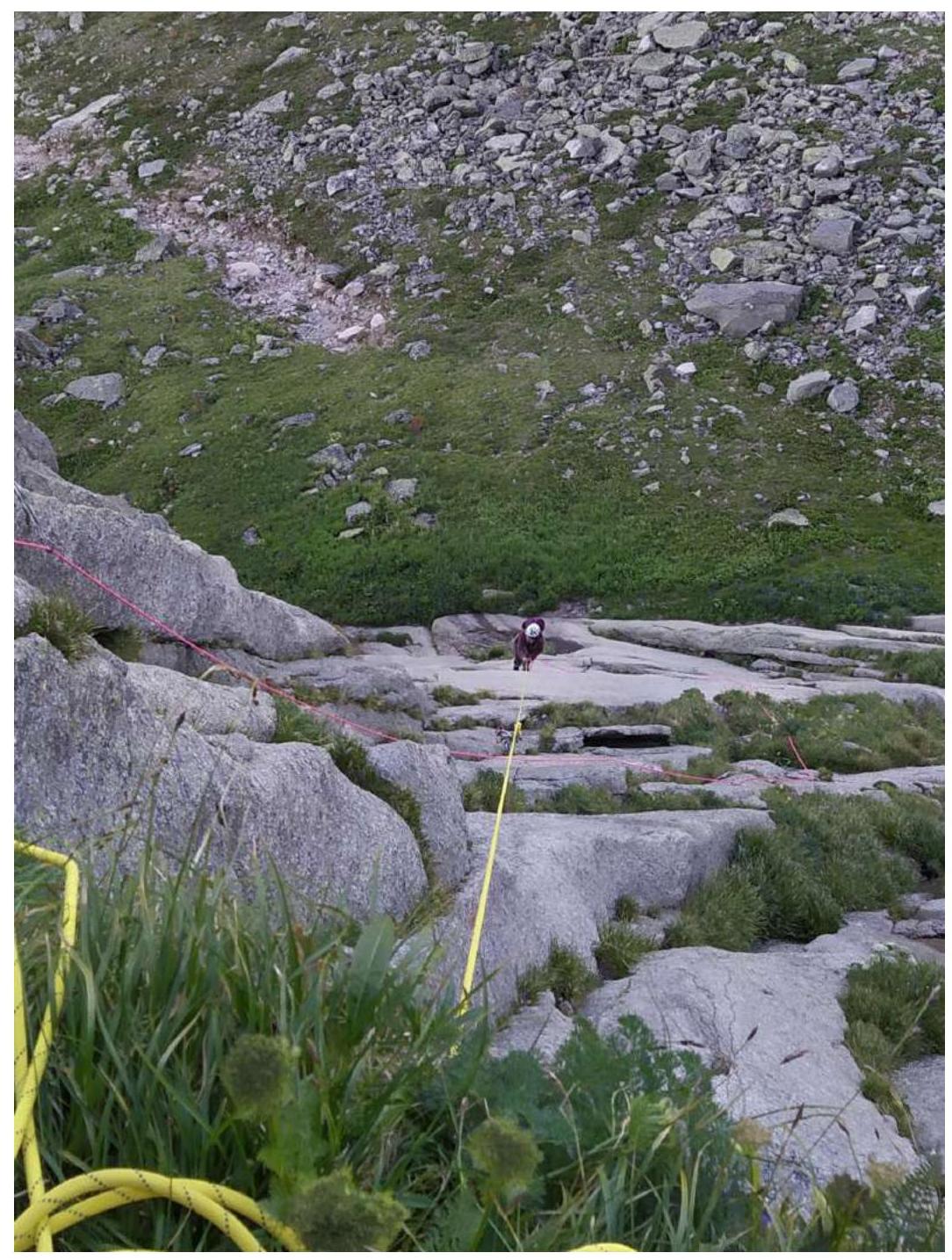
Fig. 2. Internal corners and overgrown cracks — top of section R1–R2.
R2–R3. 45 m. Move up with a slight rightward deviation through an internal corner. Cracks and corners are overgrown. Semi-suspended station on personal points, with small ledges for feet.
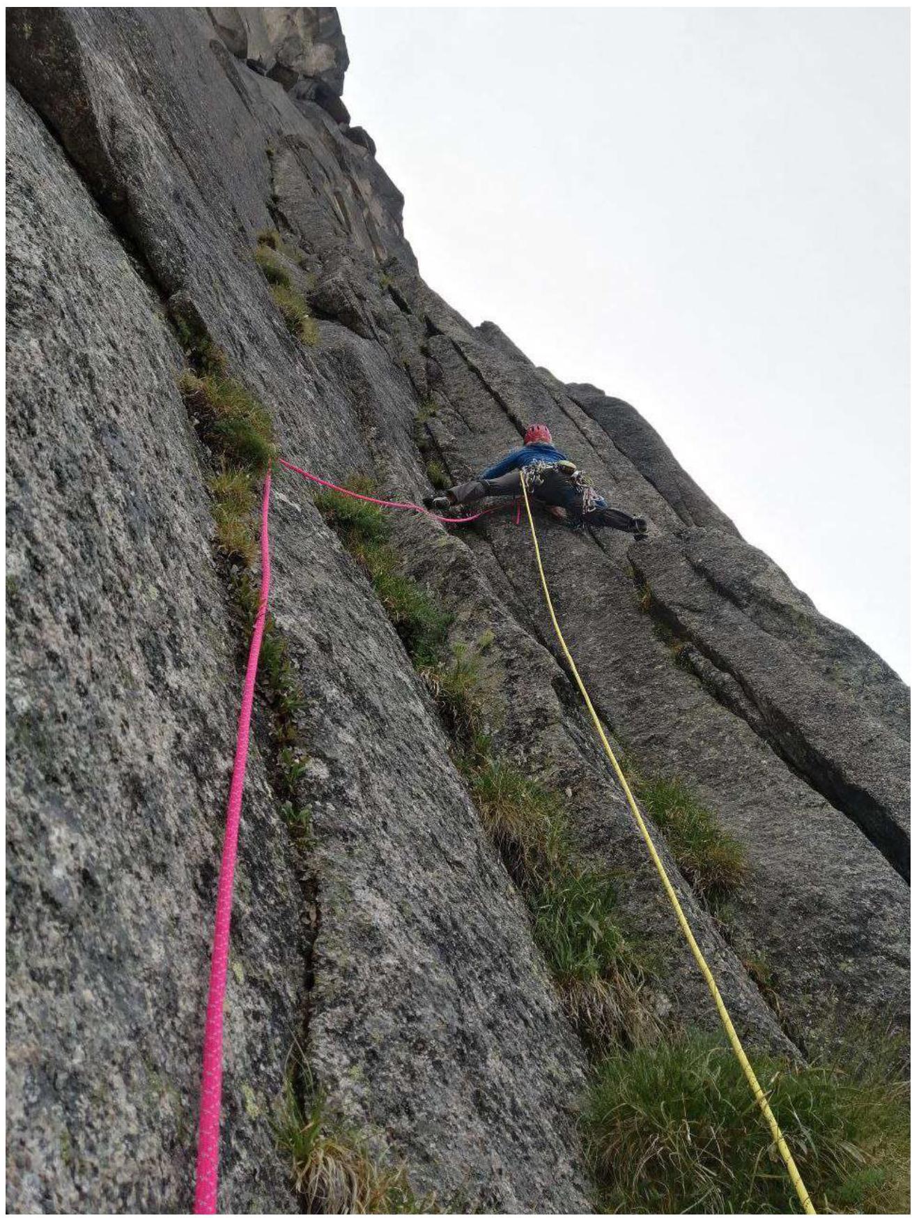
Fig. 3. Internal corner — start of section R2–R3.
R3–R4. 45 m. Continue up the internal corner to a large ledge, using small and medium friends, bent anchors. Station on a comfortable ledge, before a large vertical slab-monolith, on personal points.
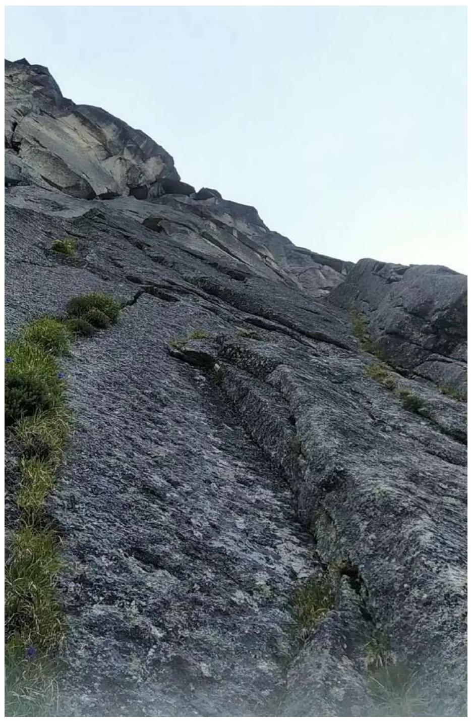
Fig. 4. Internal corners on section R3–R4.
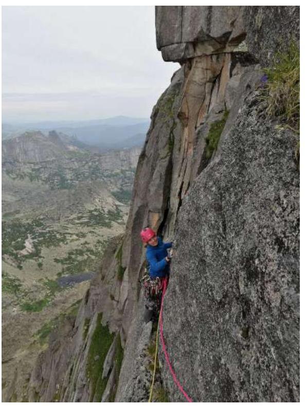
R4–R5. 40 m.
- Traverse left 7 m to bypass the slab.
- Then move up a steep internal corner.
- At the top, the corner becomes overhanging and meets a small ledge.
- Climbing 6C+, using medium and small friends.
- Then exit left onto a ledge.
Comfortable station on personal points (medium, large friends).
Comfortable station on personal points (medium, large friends).
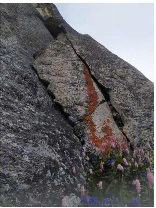
Fig. 6. Steep internal corner on section R4–R5.
R5–R6. 50 m. Interesting vertical off-width requiring large and medium friends. Then move left and up into an internal corner with a narrow crack, climbing is complex. Protection on anchors. Station under a vertical smooth slab on personal points.
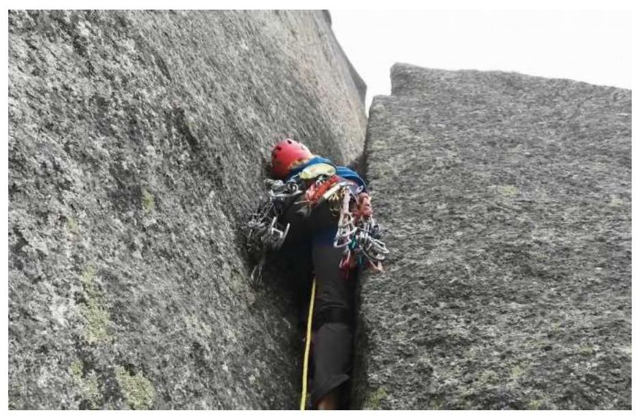
Fig. 7. Off-width — start of R5–R6.
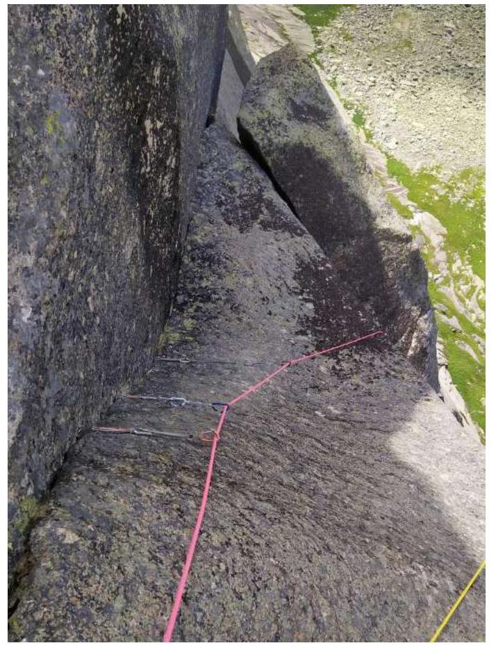
Fig. 8. Internal corner with narrow crack on section R5–R6.
R6–R7. 40 m. Key section: vertical slab 12–15 m with holes for skyhooks, aid climbing A3.
- Two old spits are present.
- Protection is not reliable.
- A fall is highly undesirable.
Then move to a ledge and an overhanging crack (moss, crumbling crust), strenuous aid climbing, using medium and large friends. Exit onto a sloping ledge, to the final pitch of the Cheryozov 5A route. Station on a bolt and personal points.
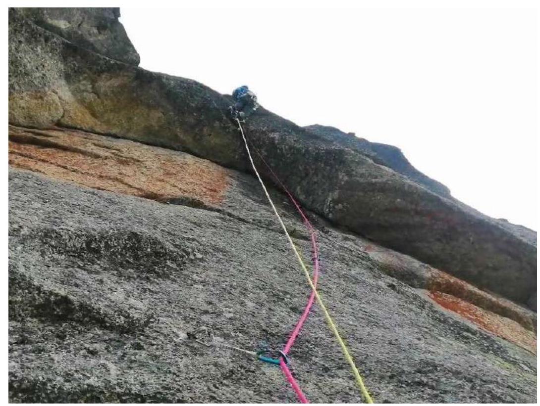
Fig. 9. Smooth slab — start of R6–R7 and exit to the overhanging crack through a ledge.
R7–R8. 25 m. Traverse left a few meters to a chimney with a plug. Moving up in a stem, overcome the narrow part and pass through a grotto to the right onto the summit ridge. This section is almost always wet, climbing is not complex but interesting. Station on personal points or a large stone.

Fig. 10. Chimney with a plug — section R7–R8.
R8–R9. 120 m. Move toward the peak on foot, in a team. Final section, 25 m — easy climbing.
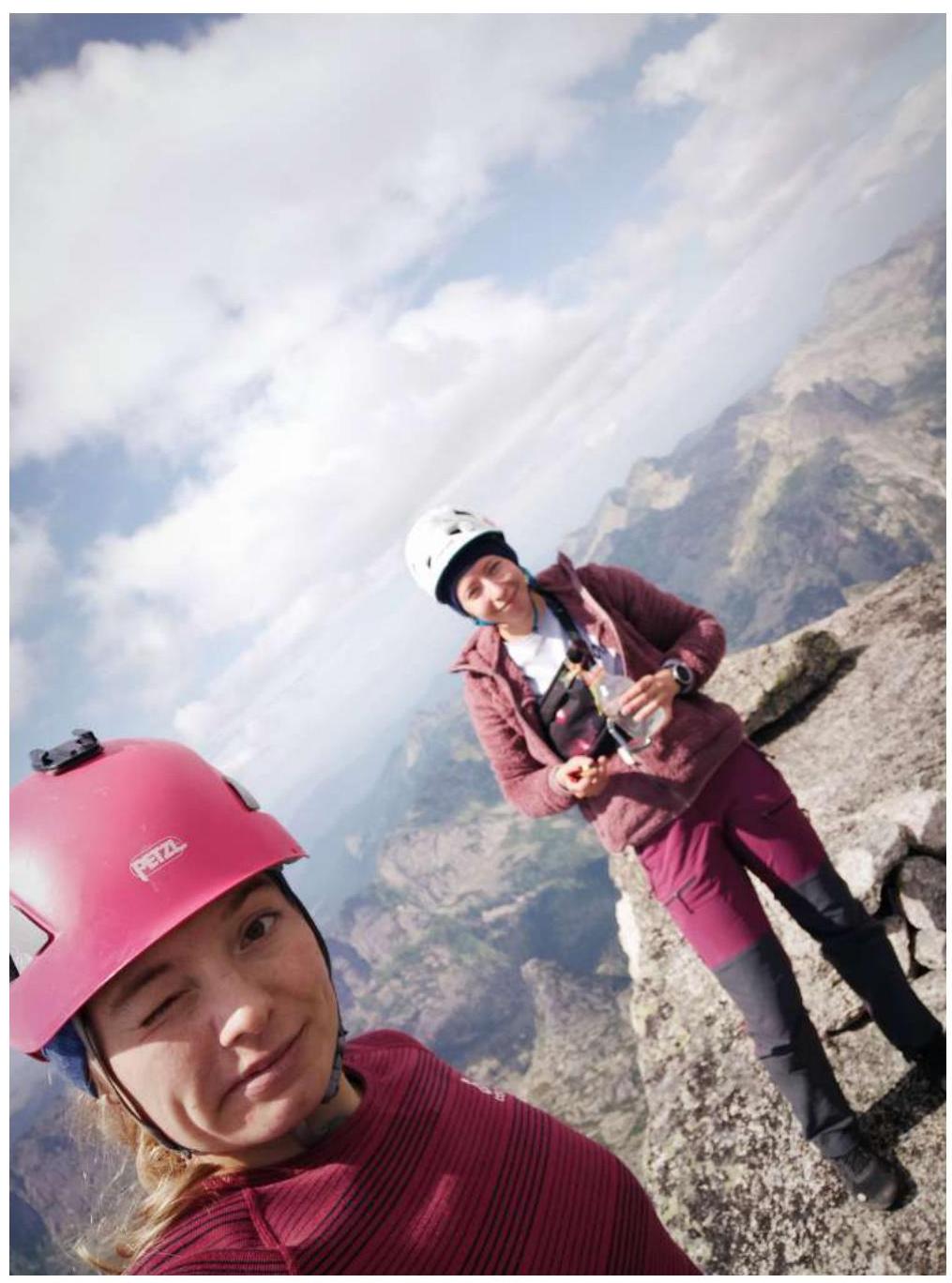
Photo of the participants on the peak.
Comments
Sign in to leave a comment