
REPORT
ON THE FIRST ASCENT TO THE SUMMIT "SPYASHCHIY SAYAN" VIA THE ROUTE "PO Z. STENE CHEREZ RUKI" (WESTERN WALL VIA "RUKI") OF 2B CATEGORY OF COMPLEXITY BY THE TEAM OF THE 5TH TRAINING CENTER FOR MILITARY-SPORTS TRAINING ON OCTOBER 10, 2023.
I. Ascent Passport
| №№ p.p. | 1. General Information | |
|---|---|---|
| 1.1 | Full Name, Sports Rank of the Leader | Shirnin Viktor Vladimirovich, 2nd sports rank |
| 1.2 | Full Name, Sports Rank of the Participants | Kraytor Sergey Grigorievich, Candidate Master of Sports, Popov Danil Anatolievich, 2nd sports rank |
| 1.3 | Full Name of the Coach | Kraytor Sergey Grigorievich |
| 1.4 | Organization | 5th Training Center for Military-Sports Training |
| 2. Characteristics of the Ascent Object | ||
| 2.1 | Region | Western Sayan |
| 2.2 | Valley | Ergaki Ridge |
| 2.3 | Number according to the 2013 Classification Table | 6.2 |
| 2.4 | Name and Height of the Summit | Spyashchiy Sayan, 1998 m |
| 2.5 | Geographical Coordinates of the Summit (latitude/longitude), GPS Coordinates *(1) | --- |
| 3. Characteristics of the Route | ||
| 3.1 | Name of the Route | po Z. stene cherez ruki (via Western wall through "ruki") |
| 3.2 | Proposed Category of Complexity | 2B |
| 3.3 | Degree of Route Exploration | First Ascent |
| 3.4 | Nature of the Route Terrain | Rocky |
| 3.5 | Height Difference of the Route (data from altimeter or GPS) | 232 m (2022–1790) |
| 3.6 | Length of the Route (in meters) | 885 m |
| 3.7 | Technical Elements of the Route (total length of sections of varying complexity with indication of terrain type: ice-snow, rocky) | I cat. sl. rocks – 565 m. II cat. sl. rocks – 275 m. III cat. sl. rocks – 45 m. IV cat. sl. rocks – m. Doulfer descent (on descent) – (1 rope 50 meters) |
| 3.8 | Descent from the Summit | Via 2A category of complexity |
| 3.9 | Additional Characteristics of the Route | Absence of water |
| 4. Characteristics of the Team's Actions | ||
| 4.1 | Time of Movement (in hours) | 7.0 hours |
| of the team, indicated in hours and days) | ||
| 4.2 | Overnight Stays | No |
| 4.3 | Start of the Route | 10:00 October 10, 2023 |
| 4.4 | Reaching the Summit | 15:30 October 10, 2023 |
| 4.5 | Return to the Base Camp | 19:00 October 10, 2023 |
| 5. Person Responsible for the Report | ||
| 5.1 | Full Name, e-mail | Kraytor Sergey Grigorievich, kraitor@bk.ru |
II. Description of the Route.
1. Characteristics of the Ascent Object
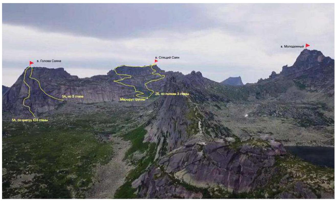
Photo 1. General photo of the summit
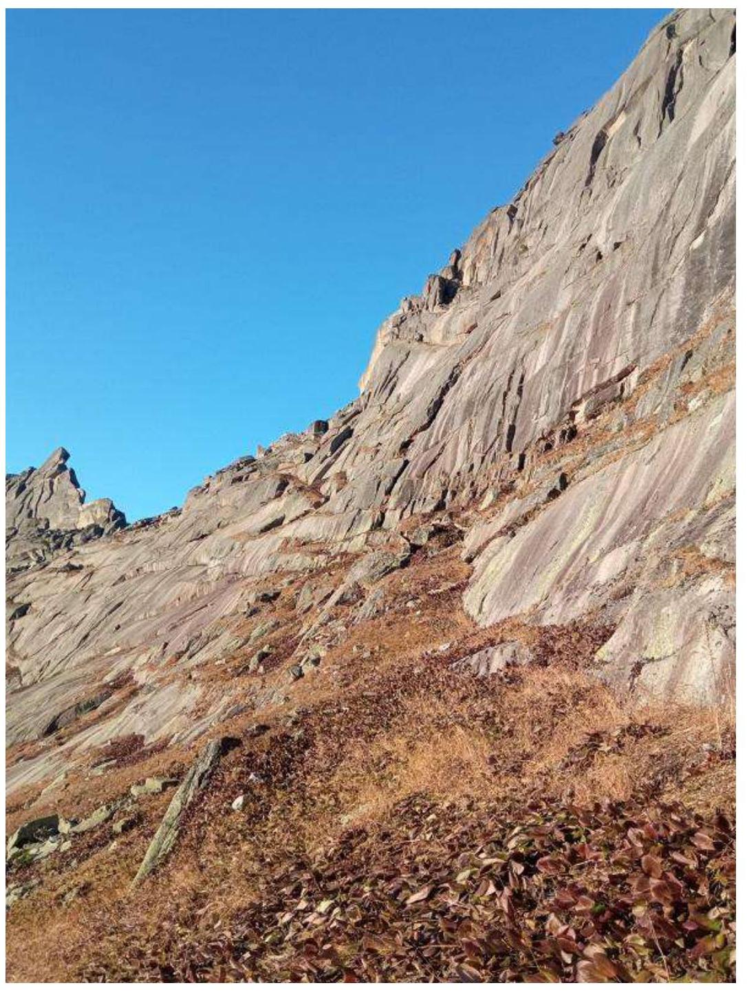
Photo 2. Profile photo of the route
2. Characteristics of the Route.

Photo 3. Scheme of the route
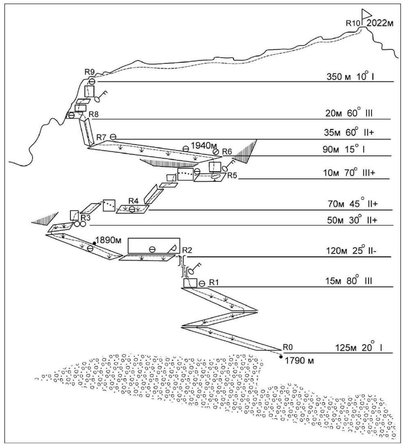
Fig. 1. Scheme of the route in UIAA pitches. Description of the route by sections.
R0–R1 125 m. 20°, 1 cat. sl. The section is traversed zigzagging along inclined grassy ledges to a rocky wall with a protruding rock slab forming a chimney.
R1–R2 15 m. 80°, 3 cat. sl. Key section of the route. The wall has good holds for 4 m, followed by two consecutive chimneys (flakes) of 5–6 m with limited holds and belay points. After the chimneys, exit left to a grassy ledge, above which a hook is hammered into a crack in the rock wall. Belay is from rocks (medium-sized friends).
R2–R3 120 m. 25°, 2 cat. sl. The grassy ledge is traversed with simultaneous belay in good weather, and with alternate belay from rocks and stones lying on the ledge in bad weather. The ledge is traversed to its end, where a simple rocky slab is crossed to a ledge going up to the right.
R3–R4 50 m. 30°, 2 cat. sl. Through a large stone (with a "hourglass" station in the niche beneath it), up to the right along small grassy and rocky ledges to a long stone block lying along the wall, which is traversed on top. Further along a grassy ledge to lying stones, where a station is organized. There are cracks for belay on this section (medium and larger friends).
R4–R5 70 m, 45°, 2 cat. sl. Ascend the inner corner with slots (8 m), then move right along an oblique ledge to a 5 m wall, which is traversed by simple climbing on the right part. Belay is from rocks (medium and small friends). Further through a crevice between the rock and the rock block, exiting onto a rocky ledge turning into a grassy one. There are sufficient belay points.
R5–R6 10 m, 70°, 3 cat. sl. Key section of the route. Along the ledge to a growing cedar, then left up the wall. The wall (5 m) has limited holds and belay points. The wall leads to a ledge, along which we move left (small friends and anchor hooks).
R6–R7 90 m. 15°, 1 cat. sl. A wide grassy ledge is traversed with belay from rocks and rocky outcrops.
R7–R8 35 m. 60°, 2 cat. sl. A wide inner corner (8 m high), cluttered with stones at the top. The corner leads to a rocky ledge on the ridge. Climbing is simple. Medium and large friends are used for belay. The upper station is organized on a rocky outcrop.
R8–R9 20 m. 60°, 3 cat. sl. Key section of the route. Two consecutive walls (4 and 7 m) with limited holds and belay points. A lift is recommended on the upper wall. Exit onto a grassy ledge. The upper station is organized on a large lying stone.
R9–R10 350 m. 10°, 1 cat. sl. A wide grassy ridge with large debris, leading to the summit, is traversed with simultaneous belay.
3. Characteristics of the Team's Actions.
The approach to the route from "Rainbow" lake takes about an hour. On the plateau under the route, there are areas for overnight stays, and water is available in the stream under the wall. There is cellular coverage on the route (Tele2).
In dry weather, the route is traversed without problems. In wet weather, movement along grassy ledges is complicated (crampons can be used).
The ascent was made in good weather. There were small remnants of freshly fallen snow on the route. The height on sections of the route was measured with a Garmin watch altimeter.
4. Photographs of Route Sections.
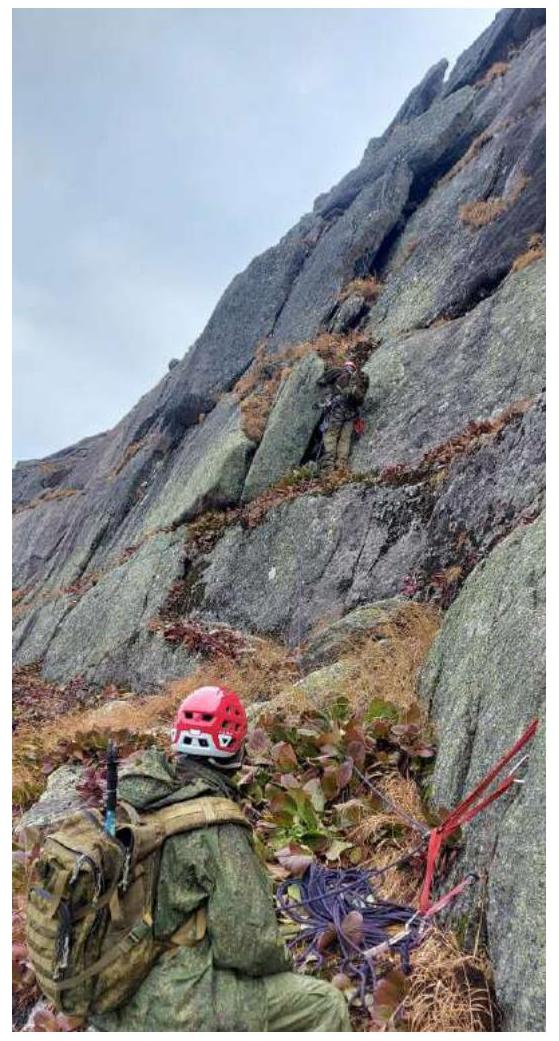
Photo 4. Passage of section R1–R2
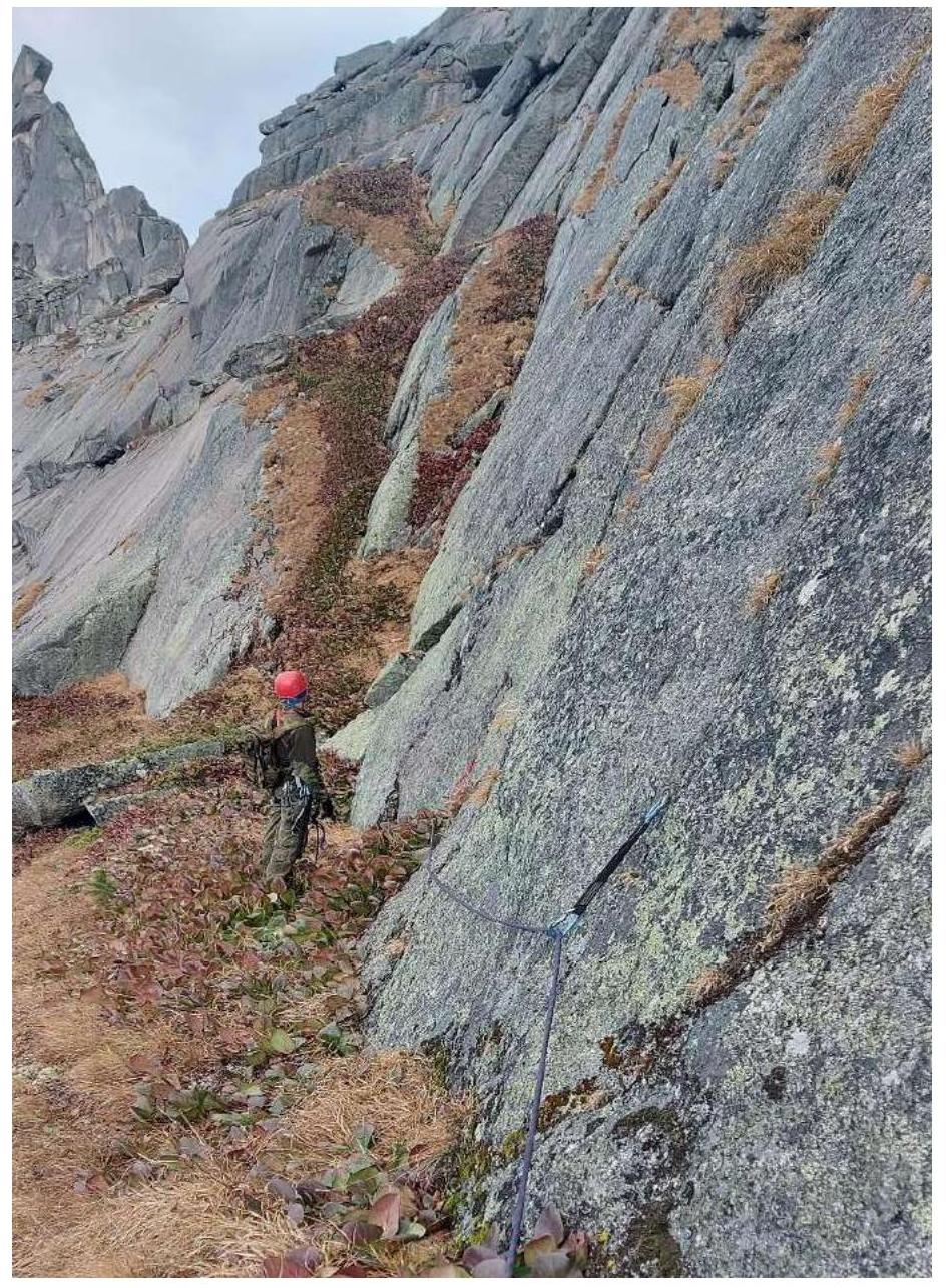
Photo 5. Section R2–R3
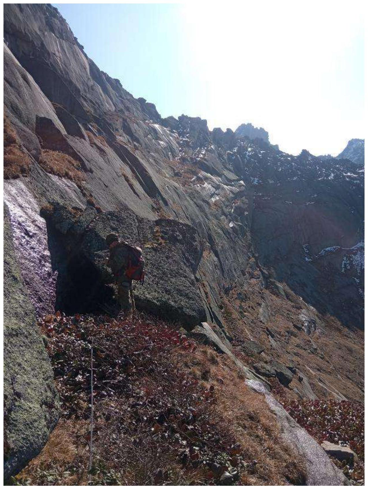
Photo 6. Section R3–R4

Photo 7. Section R4–R5 (Corner)
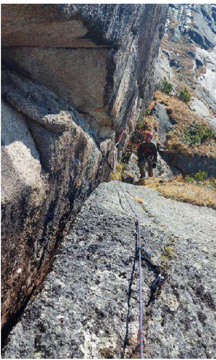
Photo 8. Section R4–R5 (Upper part)
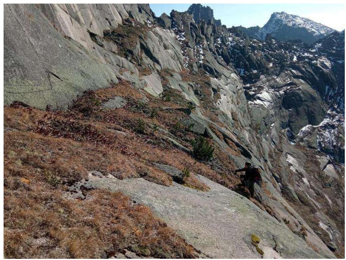
Photo 9. Section R5–R6 (Participant climbing via the top rope over the second crux).
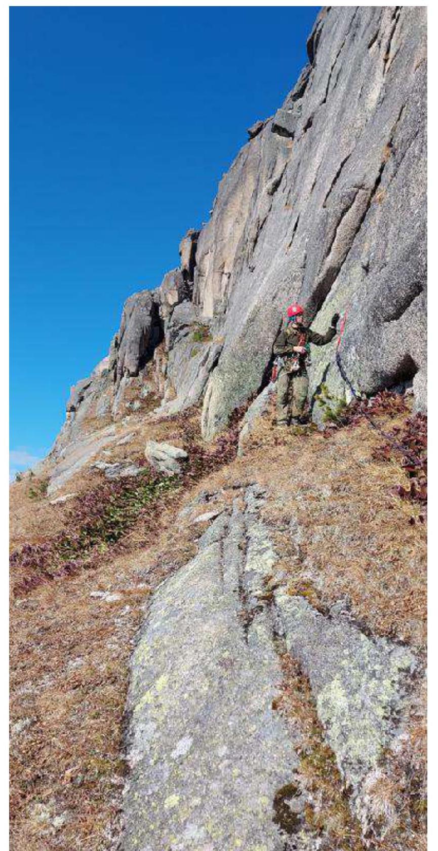
Photo 10. Section R6–R7.
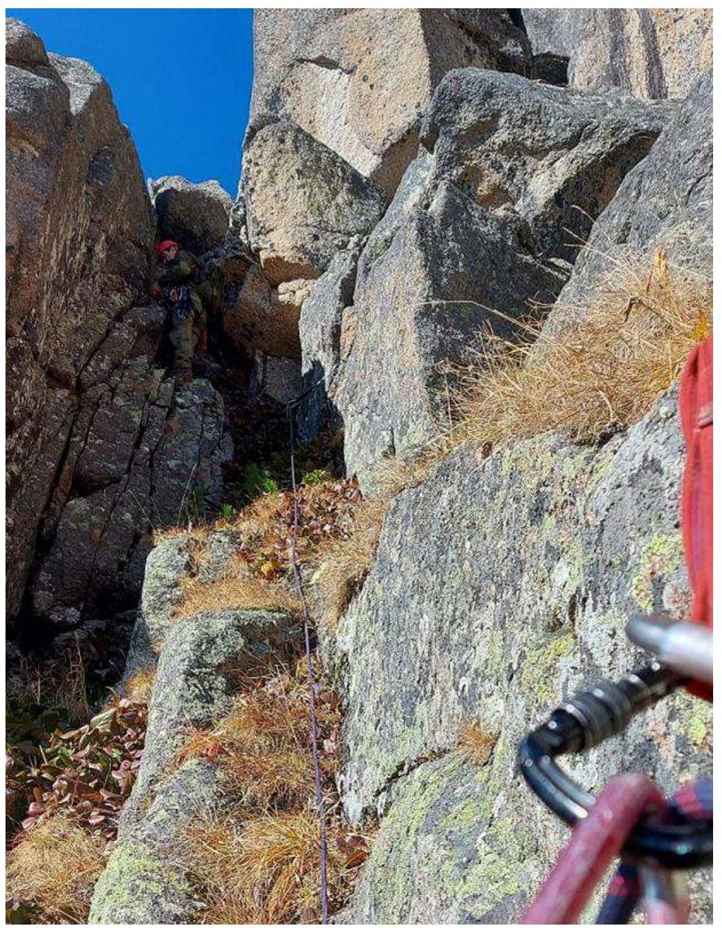
Photo 11. Section R7–R8
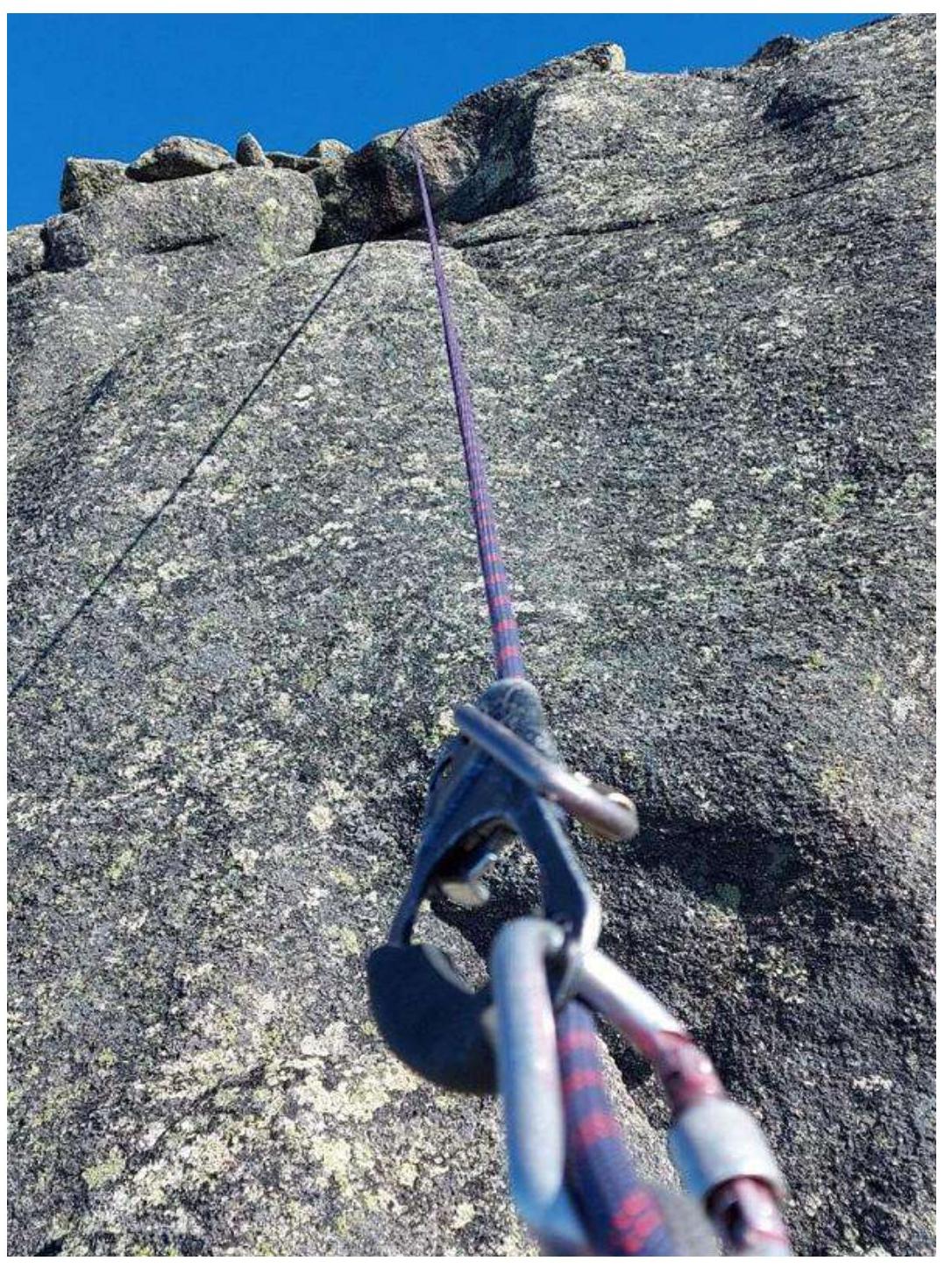
Photo 12. Section R8–R9
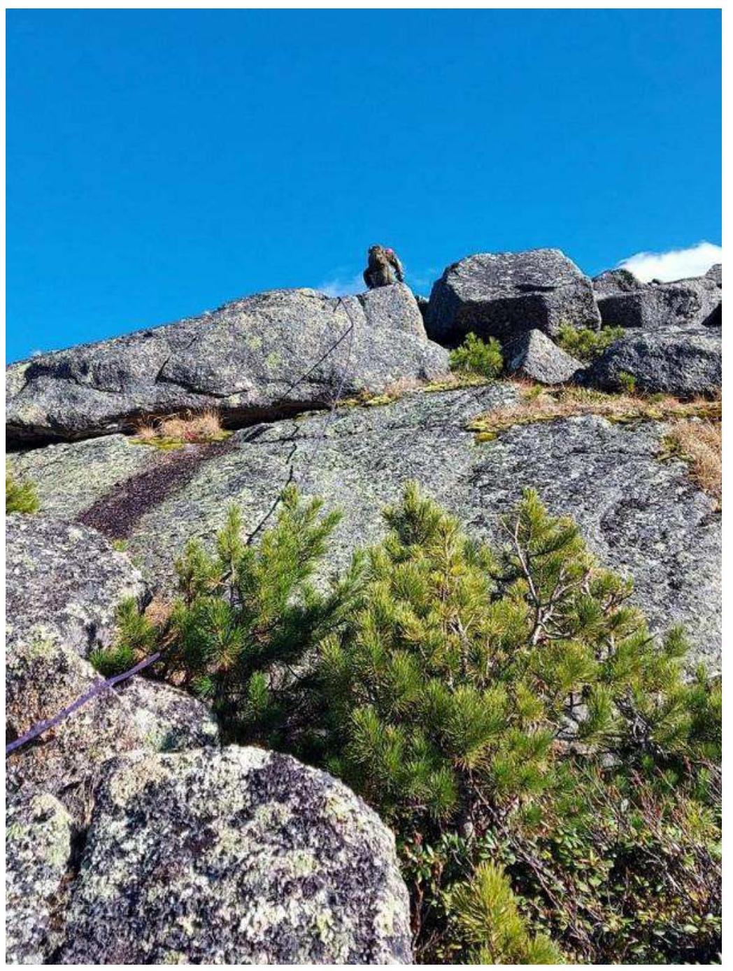
Photo 13. Section R9–R10

Photo 14. Section R9–R10
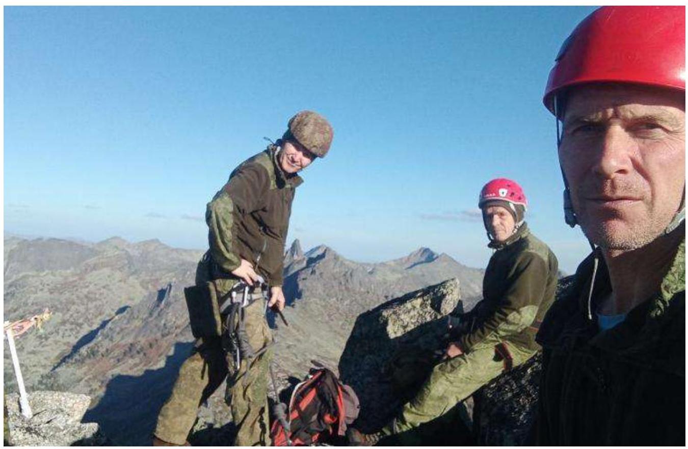
Photo 15. At the summit.
Comments
Sign in to leave a comment