
Siberian Federal District Climbing Championship
High-Altitude Technical Class
2018
Report
on the ascent to Zvezdny peak, 2265 m via the left part of the South wall, 5B category of complexity.
First ascent by a team from Krasnoyarsk on July 19, 2018
I. Ascent Passport
| 1. General Information | ||
|---|---|---|
| 1.1 | Full name, sports rank of the leader | Prokofiev D.E. (MS) |
| 1.2 | Full name, sports rank of participants | Popova M.E. (MS) |
| 1.3 | Full name of coach | Prokofiev D.E. (MS), Zakharov N.N. (MSMK), Balezin V.V. (MSMK) |
| 1.4 | Organization | Krasnoyarsk Regional Climbing Federation |
| 2. Characteristics of the Ascent Object | ||
| 2.1 | Region | Western Sayan |
| 2.2 | Valley | Ergaki valley |
| 2.3 | Section number according to the 2013 classification table | 6.6.2 |
| 2.4 | Name and height of the peak | Zvezdny, 2265 m |
| 2.5 | Geographical coordinates of the peak (latitude/longitude), GPS coordinates | 35°20′18″N 76°27′23″E |
| 3. Route Characteristics | ||
| 3.1 | Route name | Left part of the South wall |
| 3.2 | Proposed category of complexity | 5B |
| 3.3 | Degree of route exploration | First ascent |
| 3.4 | Relief characteristics of the route | Rocky |
| 3.5 | Altitude difference of the route (altimeter or GPS data) | 350 m |
| 3.6 | Route length (in meters) | 425 m |
| 3.7 | Technical elements of the route (total length of sections with different complexity categories, indicating relief characteristics (ice-snow, rocky)) | 2 cat. rocky 50 m 3 cat. rocky – m 4 cat. rocky – 35 m 5 cat. rocky – 80 m 6 cat. rocky – 150 m Rocky 6, A3 – 110 m |
| 3.8 | Average steepness of the route, (°) * (2) | 75° |
| 3.9 | Average steepness of the main part of the route, (°) * (2) | 84° |
| 3.10 | Descent from the peak | Along the SW edge |
| 3.11 | Additional route characteristics | Main part of the route with artificial aids on anchors and small friends |
| 4. Team Actions Characteristics | ||
| 4.1 | Time of movement (team's walking hours, in hours and days) | 9:15 h, 1 day |
| :--: | :--: | :--: |
| 4.2 | Overnights | - |
| 4.3 | Route preparation time *(3) | 0 h, 0 days |
| 4.4 | Start of the route | 7:00 July 19, 2018 |
| 4.5 | Summit | 16:00 July 19, 2018 |
| 4.6 | Return to base camp | 19:00 July 19, 2018 |
| 5. Weather Conditions Characteristics *(4) | ||
| 5.1 | Temperature, °C | 10–18 |
| 5.2 | Wind speed, m/s | 5 m/s |
| 5.3 | Precipitation | None |
| 5.4 | Visibility, m | Full |
| 6. Person Responsible for the Report | ||
| 6.1 | Full name, e-mail | Prokofiev D.E. desprok@gmail.com |
II. Ascent Description
1. Ascent Object Characteristics
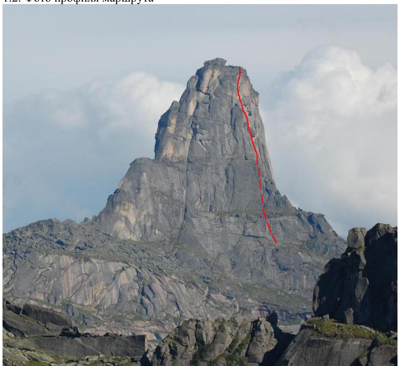
1.1. General photo
of the peak
Route taken by the team
1.2. Route Profile Photo
1.3. Hand-Drawn Route Profile
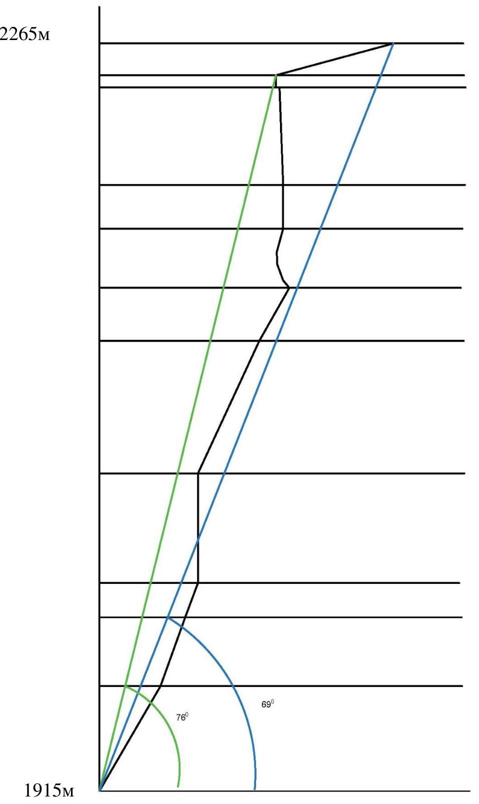
Start of the route 1.4. Photopanorama
of the area 1.5.
Map
of the area
1.5.
Map
of the area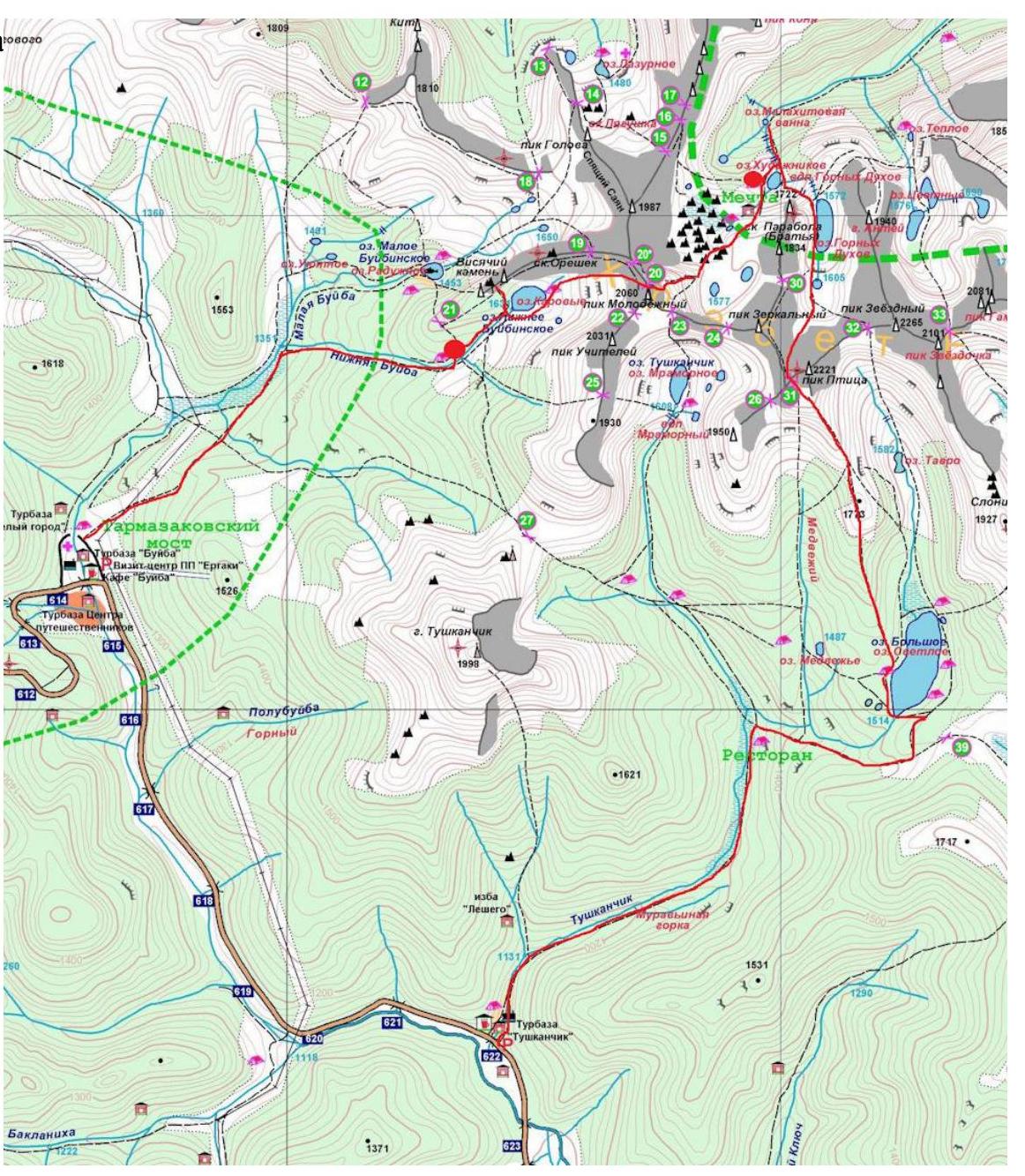
2. Route Characteristics
2.1. Technical photo
of the route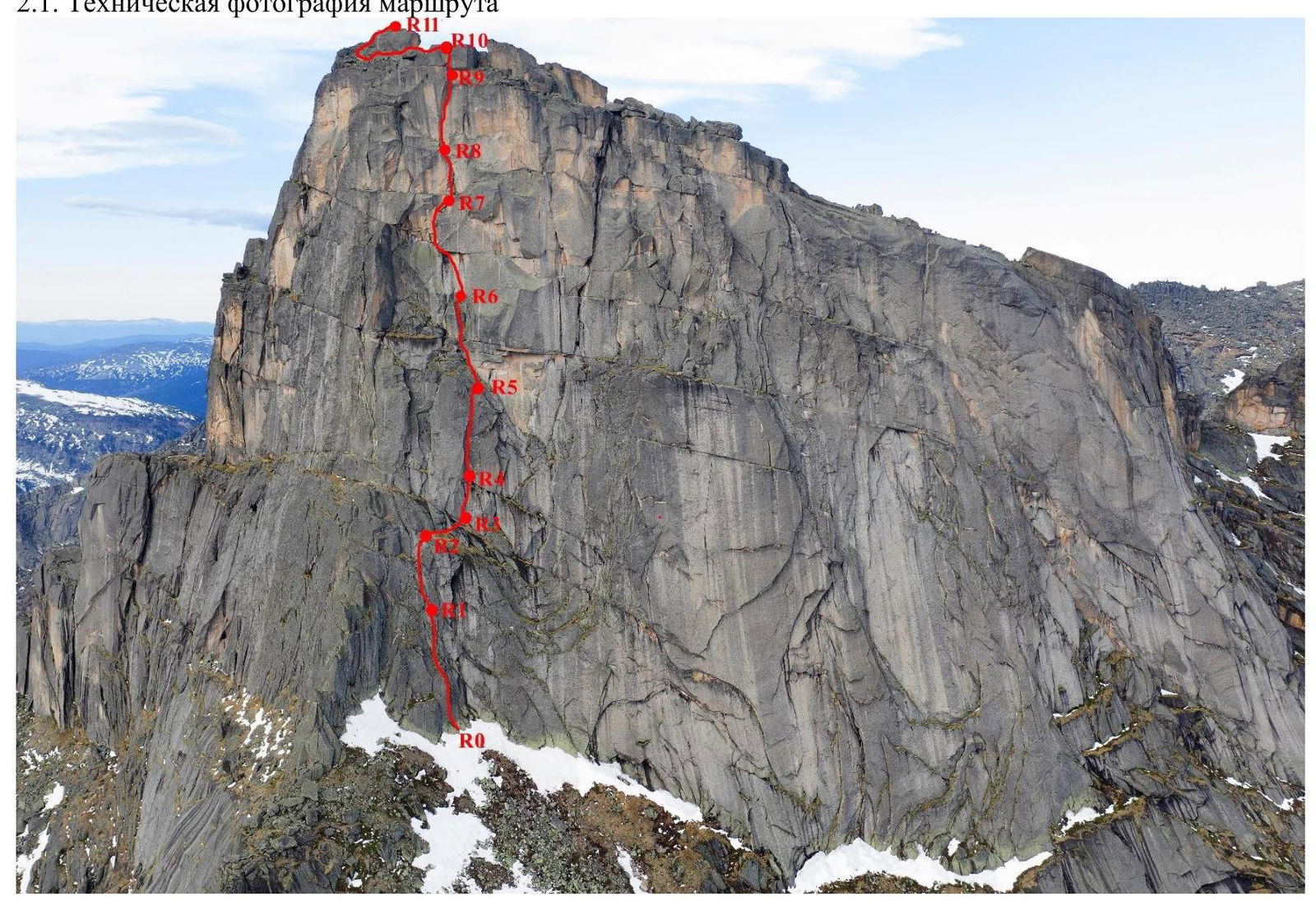
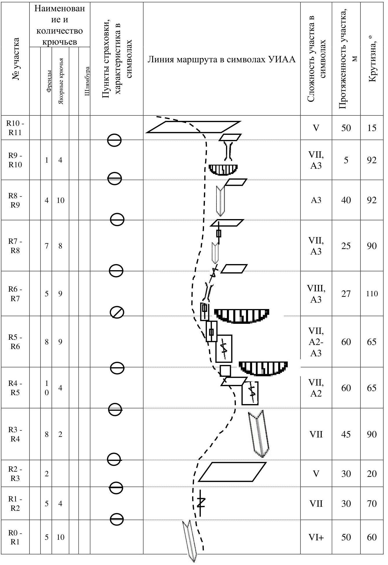
2.3. Route Diagram in UIAA Symbols
3. Team Actions Characteristics
The Ergaki region is a familiar area for our team. The chosen line is logical, runs close to Lebedev's 5A route on the SW wall, but does not intersect with it.
At the same time, the route is completely independent and has a high technical complexity, as it passes through a series of overhangs and cornices in the upper part. The route combines:
- Free climbing (lower part),
- A distinctly labor-intensive second part, requiring the ability to climb on relief,
- Application of artificial aids.
The route is comparable in complexity to other 5B routes in the Ergaki region and is more complex than all 5A routes on Zvezdny peak and the neighboring Ptitsa peak.
3.1 Brief Description of the Route Passage
The start of the route goes through a series of cracks, some of which are overgrown with grass. The start is about 50–60 m to the right of the "Edge".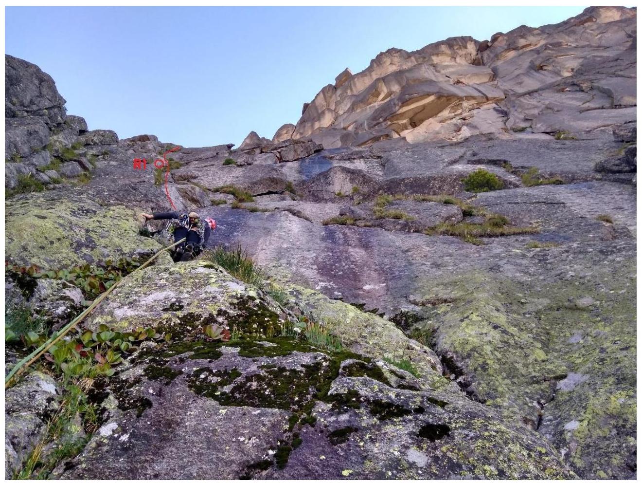
Fig. 1. Start of the route. Movement through a system of cracks to the left of the black streak.
Further, the wall becomes slightly steeper, leading to a sloping ledge with grass.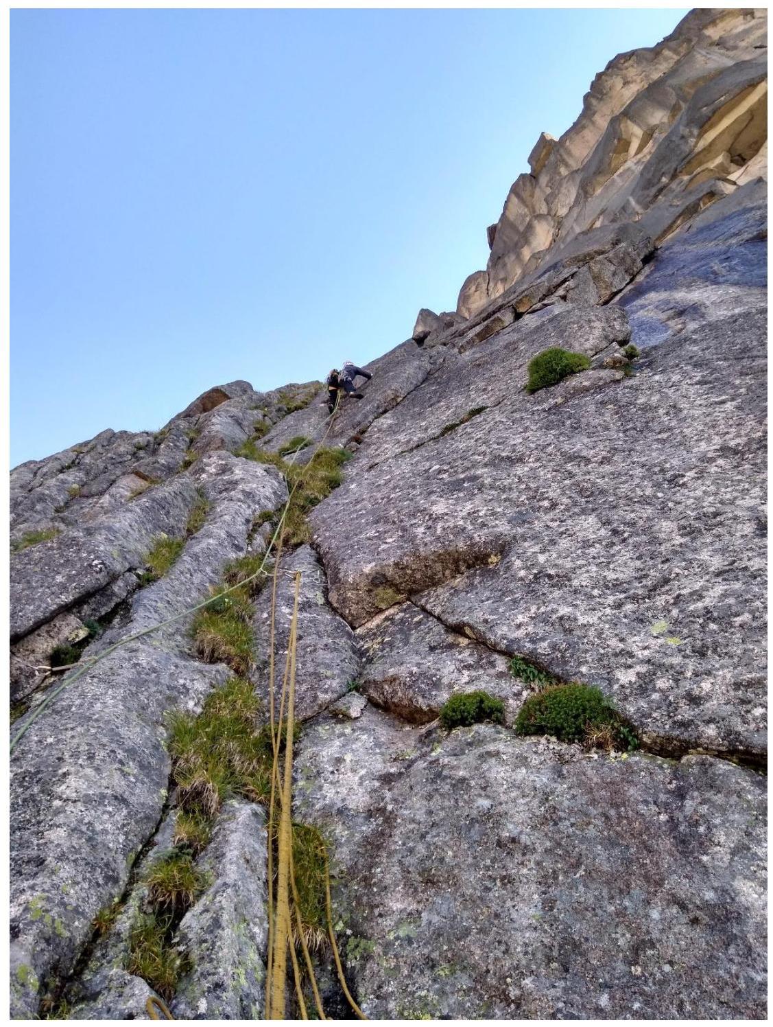
Fig. 2. Second section of the route.
Along the ledge, traverse right for about 30 m, entering a large global S-shaped internal corner.
Initially, the corner is positive, then becomes vertical.
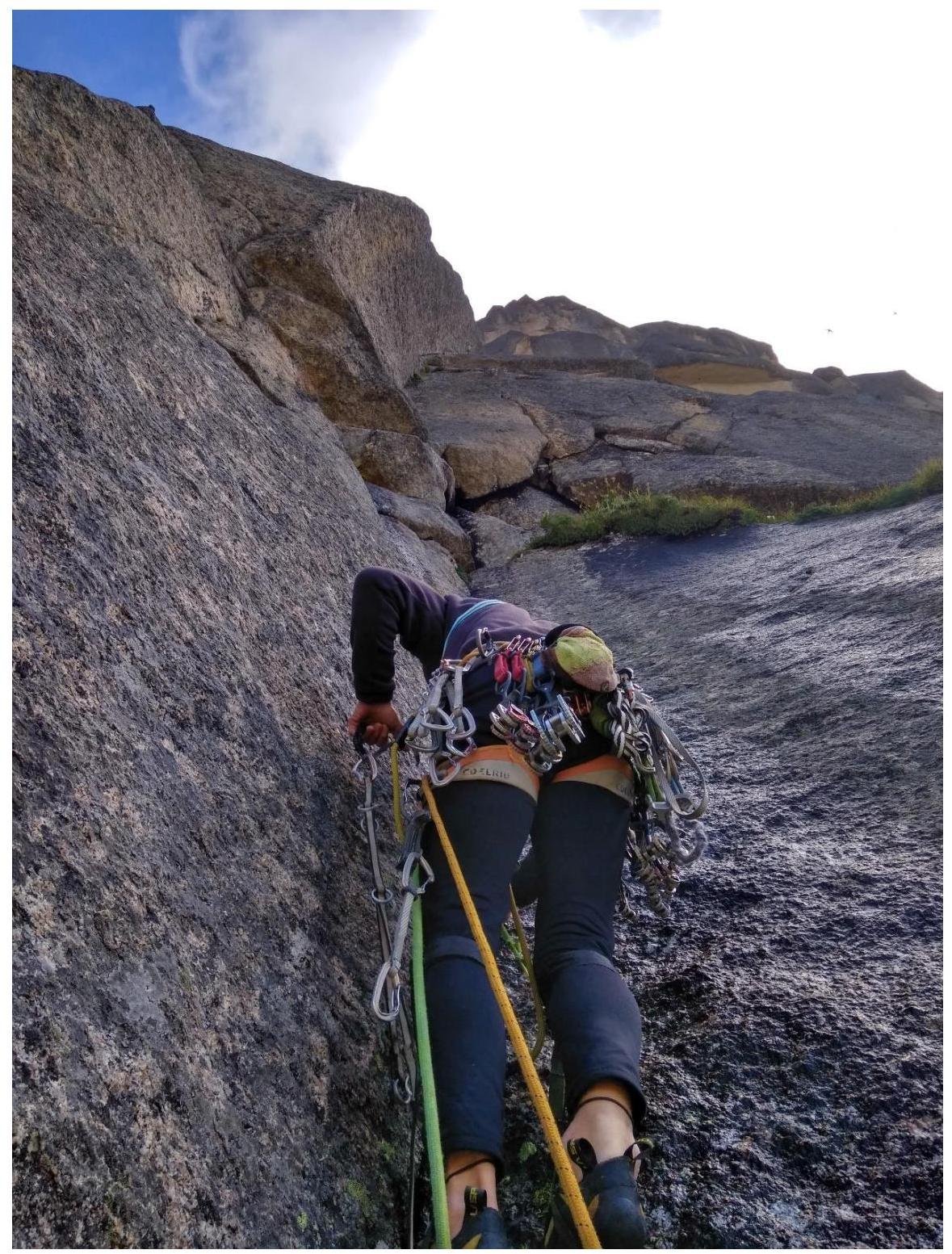
Fig. 3. R3–R5, movement along the corner. Complexity gradually increases.

Fig. 4. R4–R5. Exit from the corner, belay is diagonal and overhanging. Labor-intensive for the second climber.
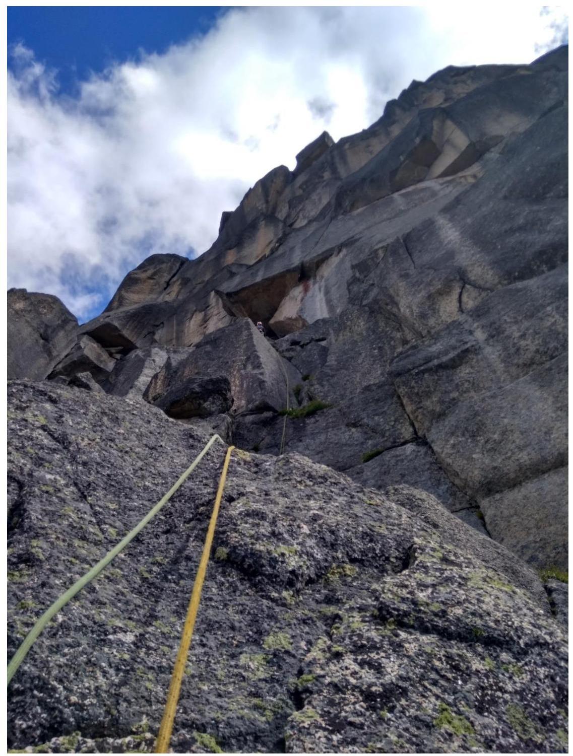
Fig. 5. R5–R6. Movement towards the "wet" cornice (clearly visible from below the route) through a system of walls and corners. Approach under the cornice on artificial aids.
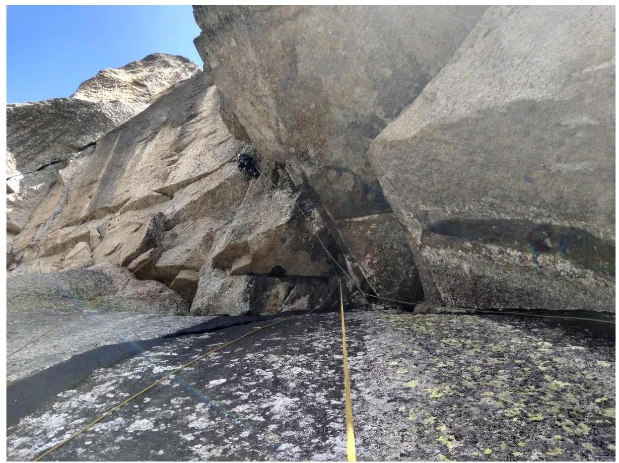
Fig. 6. Passing the cornice and moving along the overhanging crack. Anchors with offset work well. At the base of the cornice, an anchor hook is left to allow the second climber to safely compensate for the pendulum from under the cornice. Further, the overhanging crack turns into a chimney, leading to a rightward exit onto a ledge.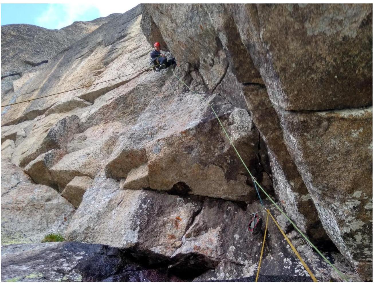
Fig. 7. Passing the cornice and moving along the overhanging crack, sections R6–R7.
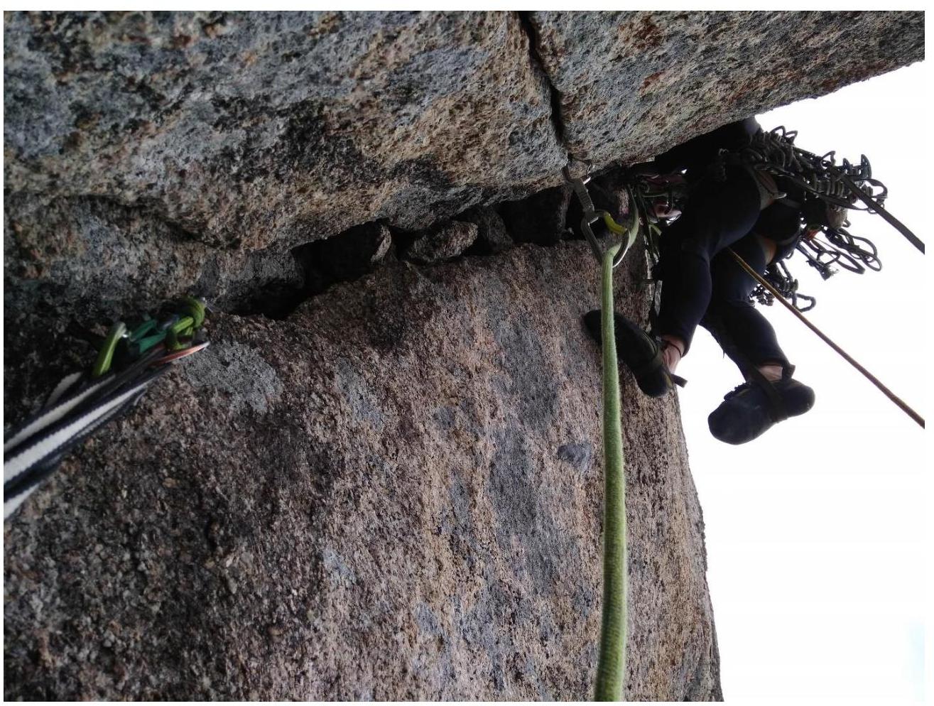
Fig. 8. Start of section R7 along a small overhang from the ledge, then up along the internal corner.

Fig. 9. R7–R9, up along the internal corner, which is vertical. Route description by sections
| Section | Description | Photo Number |
|---|---|---|
| R0–R1 | System of internal corners and cracks 50 m, 60° | 1 |
| R1–R2 | Wall becomes steeper, careful friction climbing 30 m, 70° | 2 |
| R2–R3 | Traverse right to the green ledge 30 m | |
| R3–R4 | Up along the internal corner, complexity increases, corner becomes vertical 30 m, 70°, 20 m, 90° | |
| R4–R5 | Up along the smooth wall to a ledge, then through a series of ledges and walls, movement towards the "wet" black cornice 60 m, 50° | 3 |
| R5–R6 | Leftward up under the cornice along a smooth wall, belay along a crack on the right (wet and slippery) 60 m, 45–60° | 5 |
| R6–R7 | Through the cornice up, movement along the overhanging crack. Anchors with offset, small friends. Then along a chimney 5 m, exit to a ledge, from it along a crack up 10 m 65–70° | 6,7 |
| R7–R8 | Vertical internal corner, then it becomes slightly less steep and up along a crack 10 m, leading to a large internal corner. 30 m, 90° | 8 |
| R8–R9 | Movement along the large internal corner 40 m, 85°, A2. | 9 |
| R9–R10 | Cornice 1.5 m, then chimney 5 m (wide cam) | |
| R10–R11 | To the summit 50 m, easy rocky terrain, simultaneous movement |
Comments
Sign in to leave a comment