Report
on the first ascent of the route to the summit of Ptitsa via the left part of the eastern wall and the southeast buttress, category 4A, by the team of the "Voshozhdenie" Alpine Sports Club (Barnaul) on July 29, 2020
I. Climbing Report
| № p.p. | 1. General Information | |
|---|---|---|
| 1.1 | Full name, sports rank of the team leader | Lezhnev Anton Petrovich, Candidate for Master of Sports |
| 1.2 | Full name, sports rank of the team members | Trufanov Maxim Sergeevich, Candidate for Master of Sports |
| 1.3 | Full name of the coach | Guselnikov Vitaly Mikhailovich, Master of Sports |
| 1.4 | Organization | "Voshozhdenie" Alpine Sports Club |
| 2. Characteristics of the Climbing Object | ||
| 2.1 | Region | Western Sayan, Ergaki ridge |
| 2.2 | Valley | |
| 2.3 | Number according to the 2020 classification table | 6.2 |
| 2.4 | Name and height of the summit | Ptitsa, 2221 m |
| 2.5 | Geographical coordinates of the summit (latitude/longitude), GPS coordinates | |
| 3. Characteristics of the Route | ||
| 3.1 | Name of the route | via the left part of the eastern wall and the southeast buttress |
| 3.2 | Proposed category of difficulty | 4A |
| 3.3 | Degree of route development | first ascent |
| 3.4 | Nature of the route terrain | rock |
| 3.5 | Height difference of the route (altimeter or GPS data) | 420 m |
| 3.6 | Length of the route (in meters) | 507 m |
| 3.7 | Technical elements of the route (total length of sections of varying difficulty with terrain description) | I cat. d., rocks — 30 m. II cat. d., rocks — 40 m. III cat. d., rocks — 191 m. IV cat. d., rocks — 145 m. V cat. d., rocks — 91 m. VI cat. d., rocks — 10 m. |
| 3.10 | Descent from the summit | Via route 2A (SW ridge, from the south) towards Svetloe Lake |
| 3.11 | Additional route characteristics | Lack of water |
| 4. Characteristics of the Team's Actions | ||
| 4.1 | Time of movement (team's walking hours, in hours and days) | 10 h |
| 4.2 | Overnight stays | - |
| 4.3 | Time spent on route development | - |
| 4.4 | Start of the route | 7:00, July 29, 2020 |
| 4.5 | Reaching the summit | 14:30, July 29, 2020 |
| 4.6 | Return to the base camp | 17:00, July 29, 2020 |
| 6. Responsible for the Report | ||
| 6.1 | Full name, e-mail | Lezhnev Anton Petrovich, anton.lezhnev@gmail.com |
II. Climbing Description
1. Characteristics of the Climbing Object
1.1. General Photo of the Summit
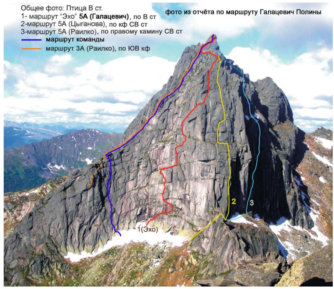
Photo 1. Ptitsa summit, approximate shooting point — from the route via the SW ridge to Zvezdny peak, 2009
1.2. Photo of the Route Profile
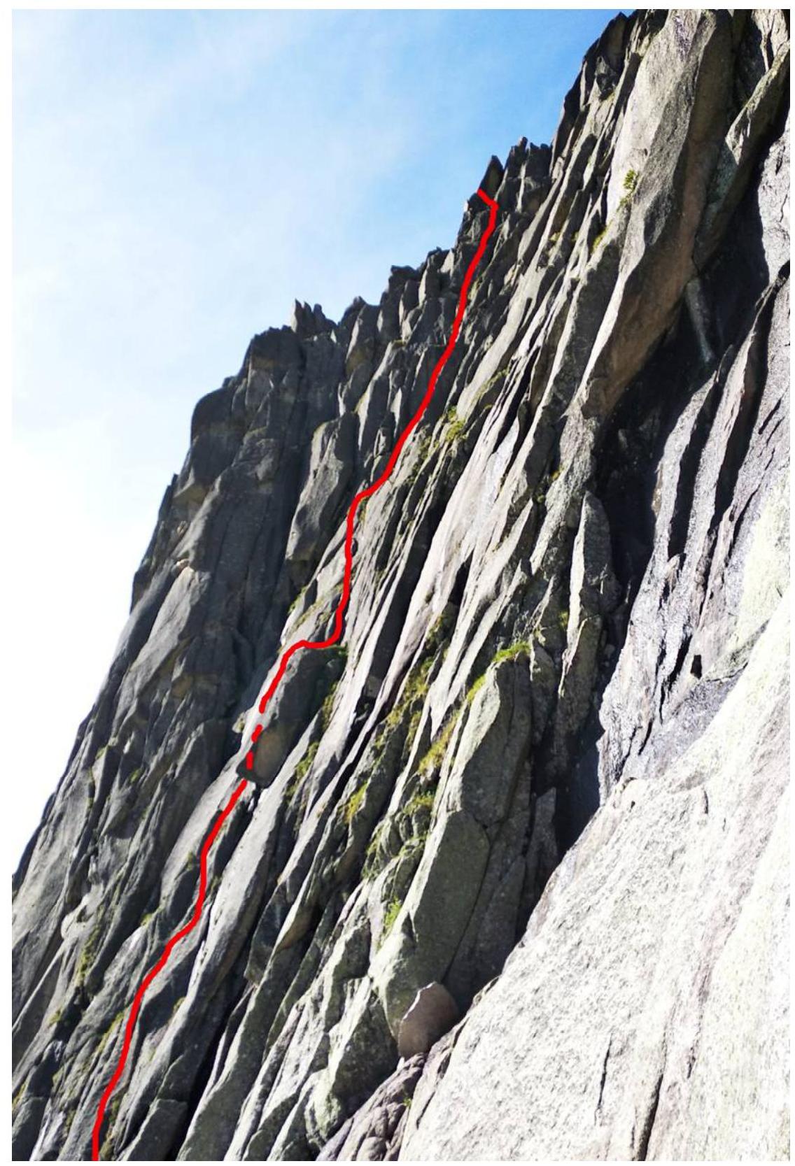
Photo 2. Wall section of the route in profile, shooting point — start of the 5A category route via the E wall (Galacevich), July 29, 2020
1.3. Panorama of the Area
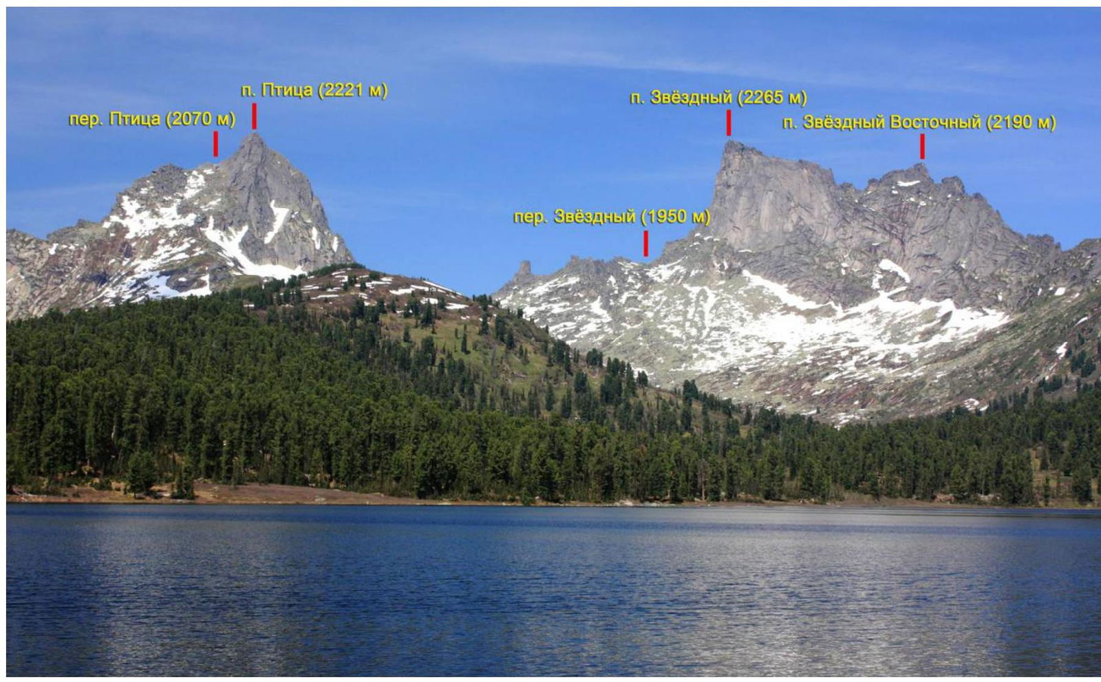
Photo 3. Panorama of the area, shooting point — Svetloe Lake, 2013
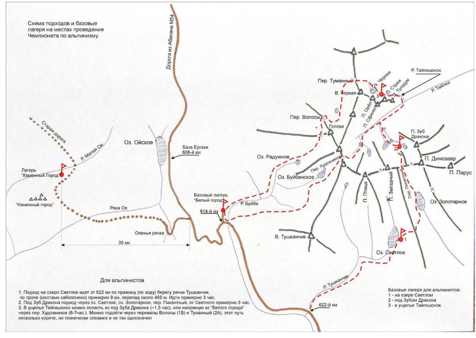
1.4. Map of the Area
2. Characteristics of the Route
2.1. Technical Photos of the Route
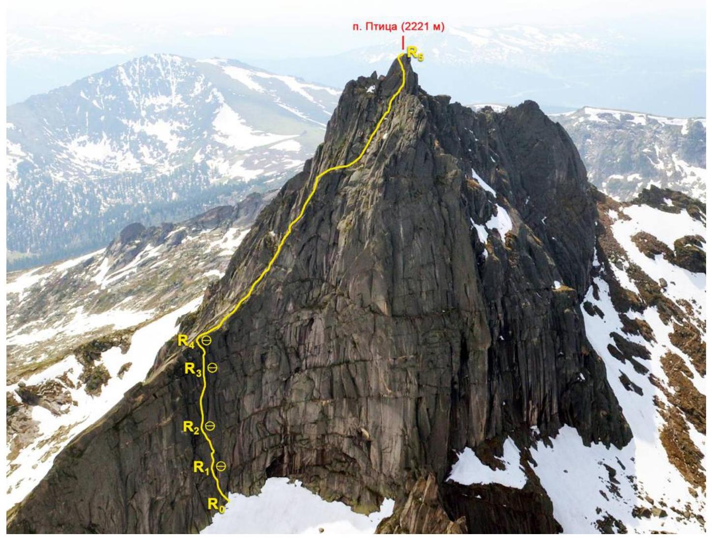
Photo 4. General photo of the route
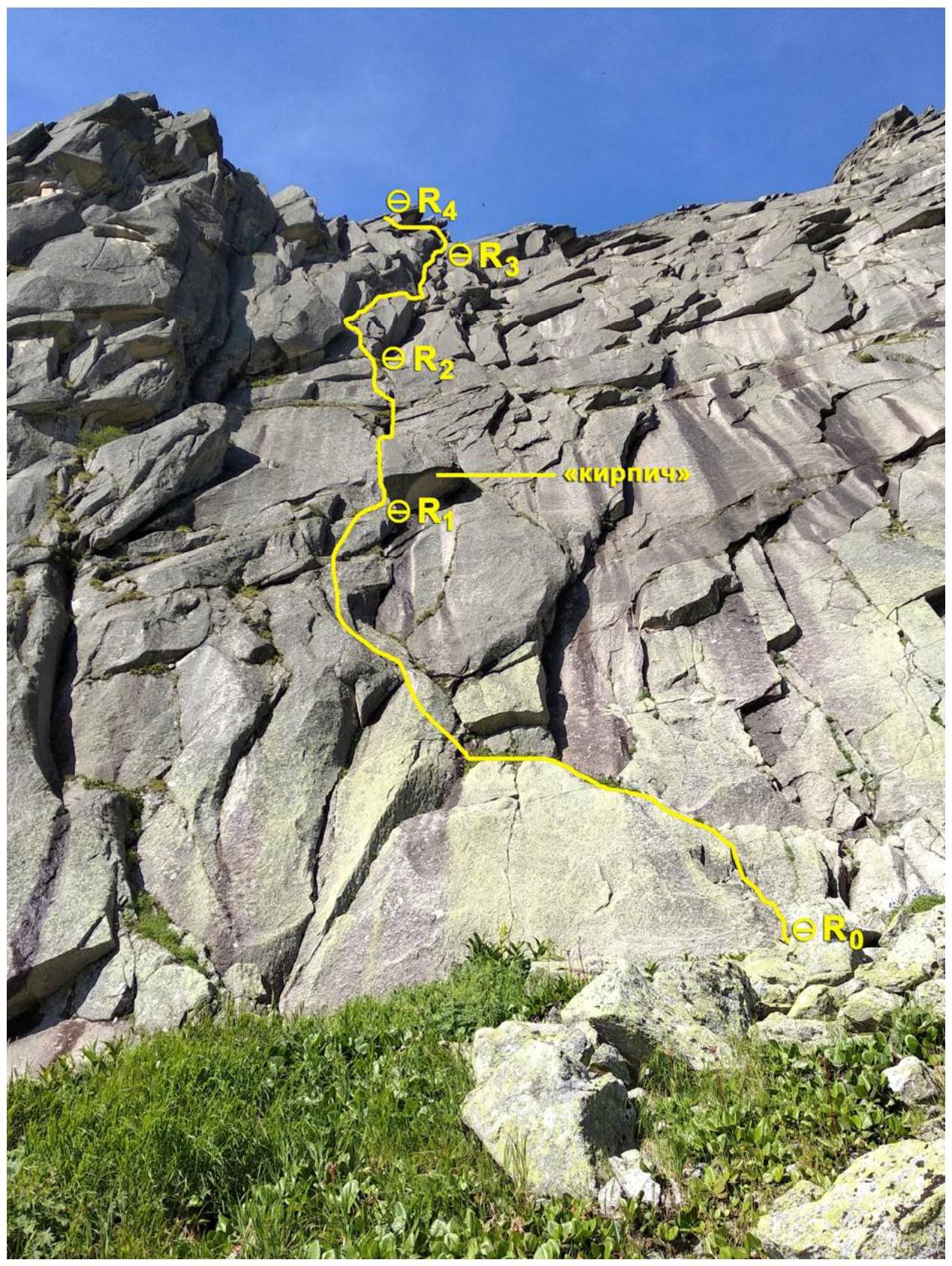
Photo 5. Photo of the wall section of the route. Shooting point — control tour.
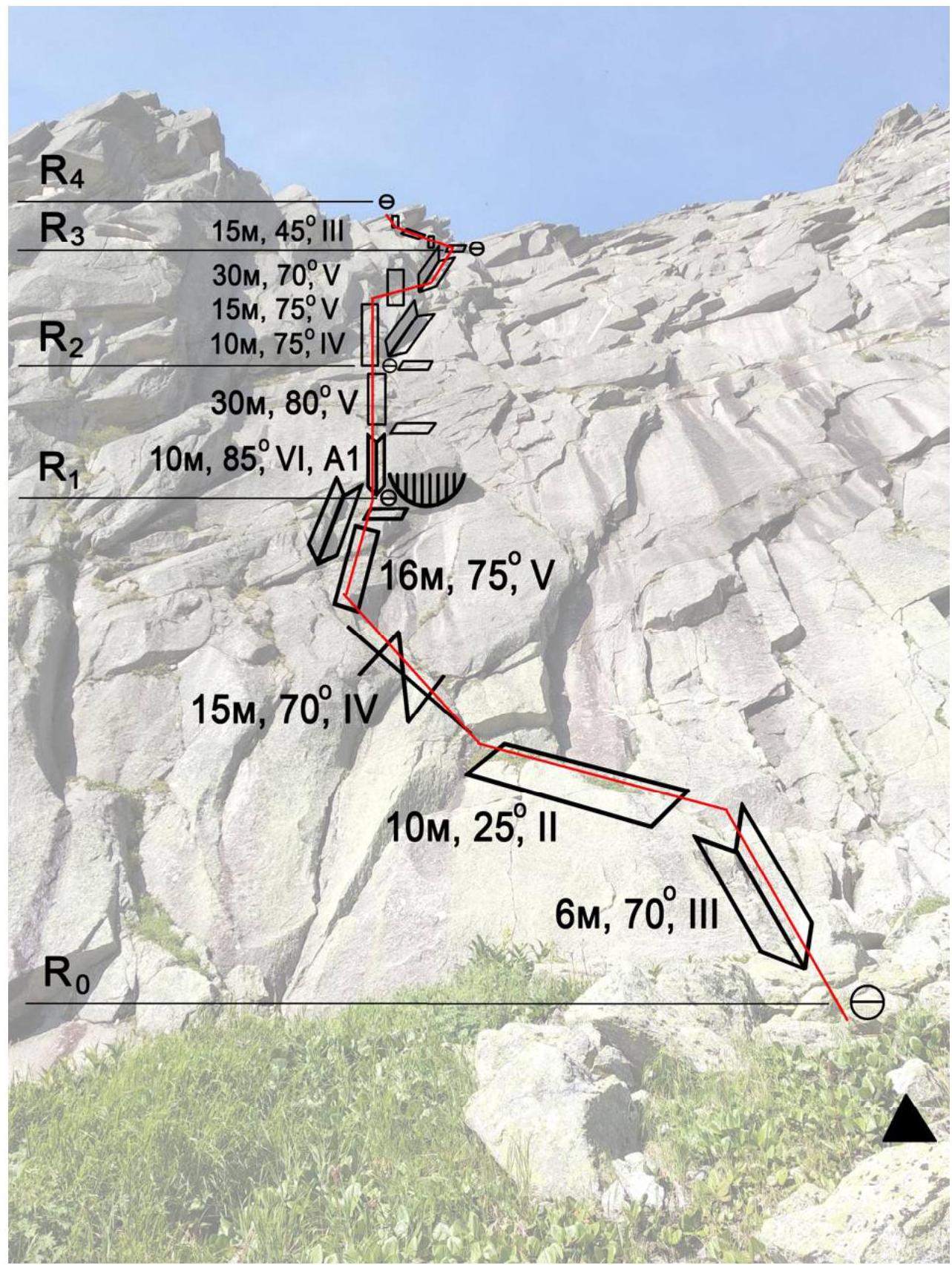
2.2. Route Scheme in UIAA Symbols
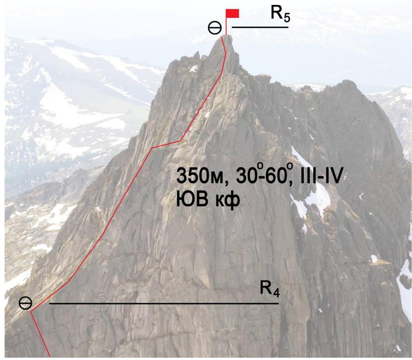
Photo 6. Scheme of the wall section of the route
Photo 7. Part of the route coinciding with the 3A category route via the SE buttress
| Section № | Friends | Pitons (with bend) | Belay points, characteristics in symbols | Route line in UIAA symbols | Section difficulty in symbols | Section length, m | Steepness, ° |
|---|---|---|---|---|---|---|---|
| III–IV | 350 m | 30–60° | |||||
| R4–R5 | 3 | 7 | III–IV | 350 m | 30–60° | ||
| R3–R4 | 0 | 2 | III | 15 m | 45° | ||
| R2–R3 | 4 | 3 | V | 30 m | 70° | ||
| V | 15 m | 75° | |||||
| IV | 10 m | 75° | |||||
| R1–R2 | 6 | 3 | V | 30 m | 80° | ||
| VI, A1 | 10 m | 85° | |||||
| R0–R1 | 3 | 3 | V | 16 m | 75° | ||
| IV | 15 m | 70° | |||||
| II | 10 m | 25° | |||||
| III | 6 m | 70° |
3. Characteristics of the Team's Actions
3.1. Brief Description of the Route Ascent
| Section № | Description | Photo № |
|---|---|---|
| R0–R1 | Under the route, we assembled a control tour. Landmarks on the wall are the "brick" — a characteristic cornice in the lower part, and at the exit to the ridge — three overhanging cornices resembling "feathers". 6 m up a small inner corner to a narrow green ledge. 10 m left along the ledge. Then 15 m up a vertical crack to the start of the "coils". Up the "coils" rightwards towards the "brick" cornice. Station on a ledge under the cornice. | 8,9 |
| R1–R2 | Right of the "brick", the wall is wet; we moved left up a vertical inner corner 10 m. The crack required cleaning from dirt; no other option but to use artificial aids. Good rock climbers can now climb it free. Above the cornice, a large ledge. From it, 25 m up a steep wall. Station on a green ledge under a large inner corner. | 10,11 |
| R2–R3 | Leftwards around the large inner corner, up walls 10 m to an inner corner. Then 15 m rightwards up the wall beyond a relief bend. 30 m up the inner corner. Station on a ledge. | 12,13 |
| R3–R4 | Leftwards up, avoiding cornices-"feathers", beyond a relief bend onto the ridge 15 m. Station on a large stone. | 14 |
| R4–R5 | The route then coincides with the 3A category route via the southeast buttress. Climbing category III, with several short sections of category IV. Simultaneous movement, belaying with pitons and friends. 350 m to the summit. | 15,16 |
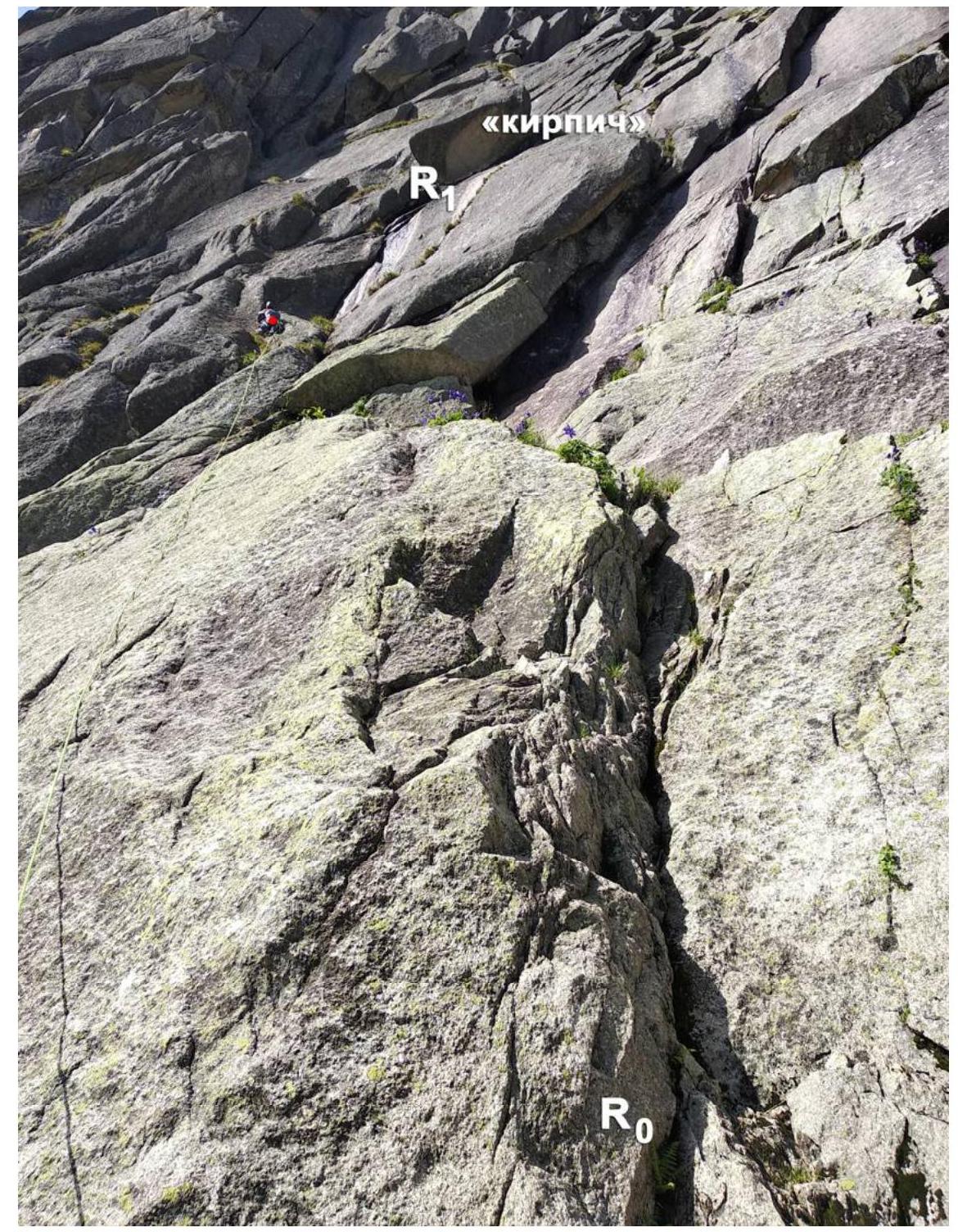
Photo 8. Section R0–R1
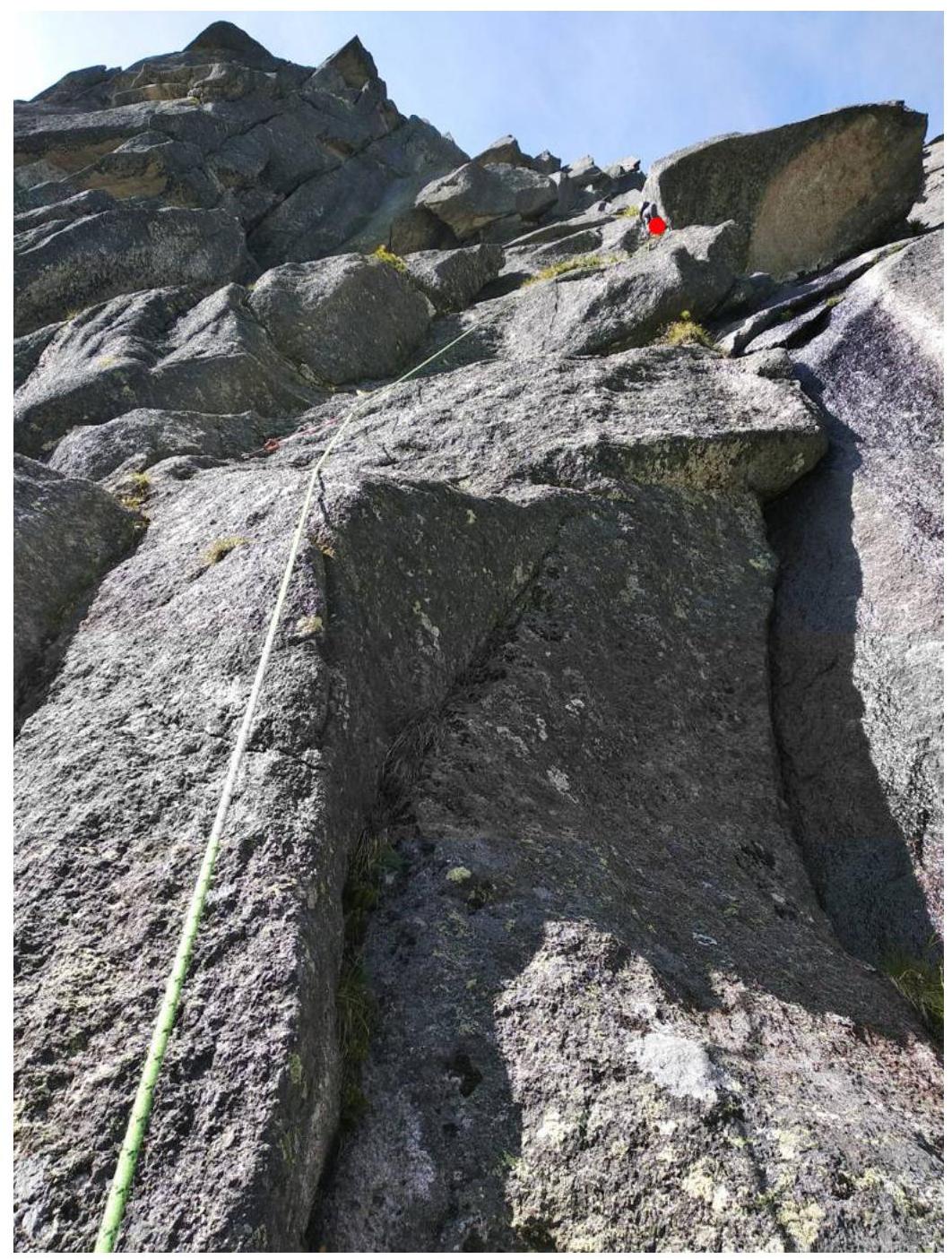
Photo 9. Section R0–R1. Leader at the station under the "brick" (marked with a red dot).
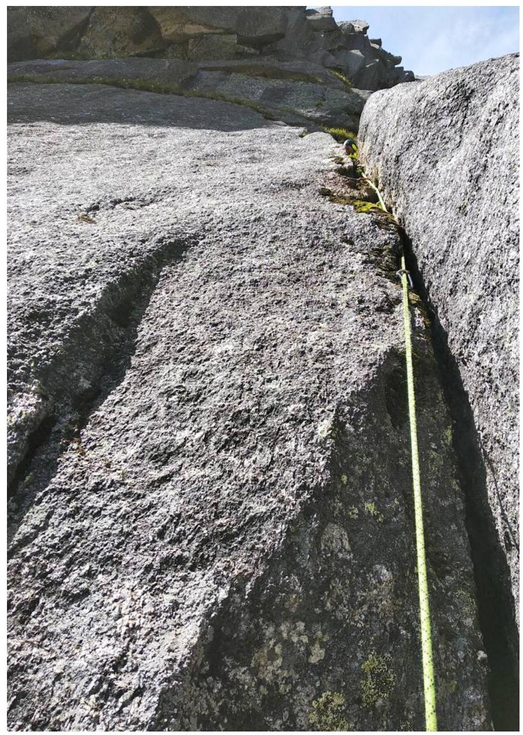
Photo 10. Start of section R1–R2. Vertical inner corner. The crack requires further cleaning.
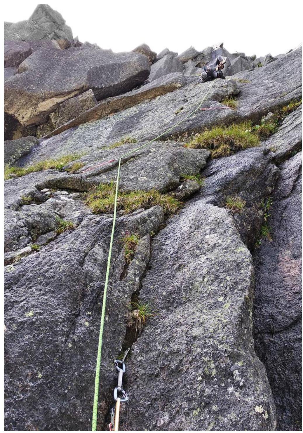
Photo 11. Section R1–R2 from the ledge above the "brick".
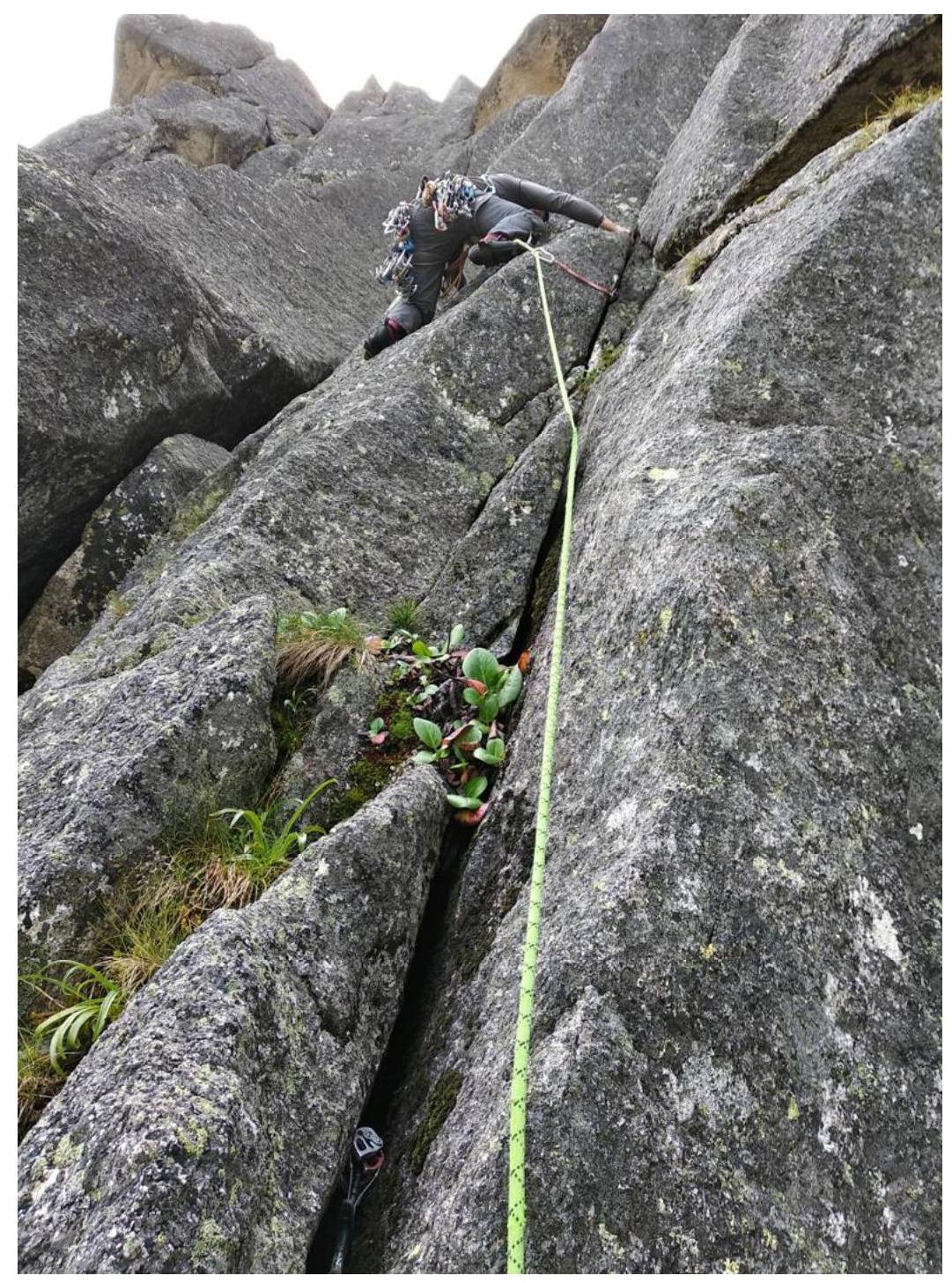
Photo 12. Start of section R2–R3.
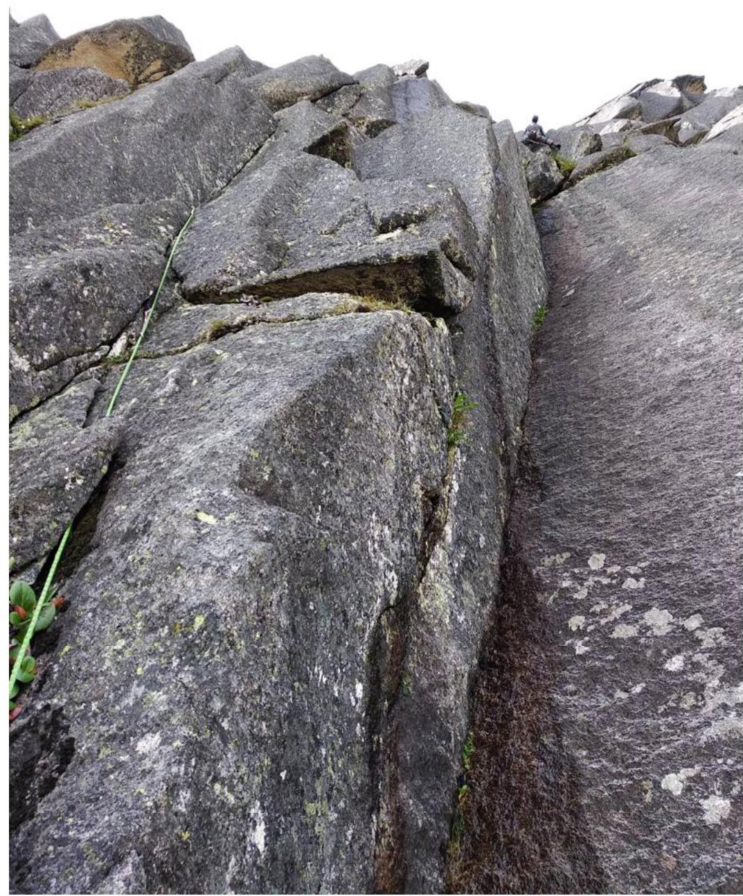
Photo 13. On section R2–R3, leader under the start of the inner corner.
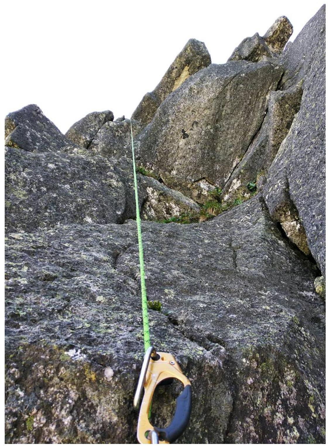
Photo 14. On section R3–R4. Before exiting onto the buttress.
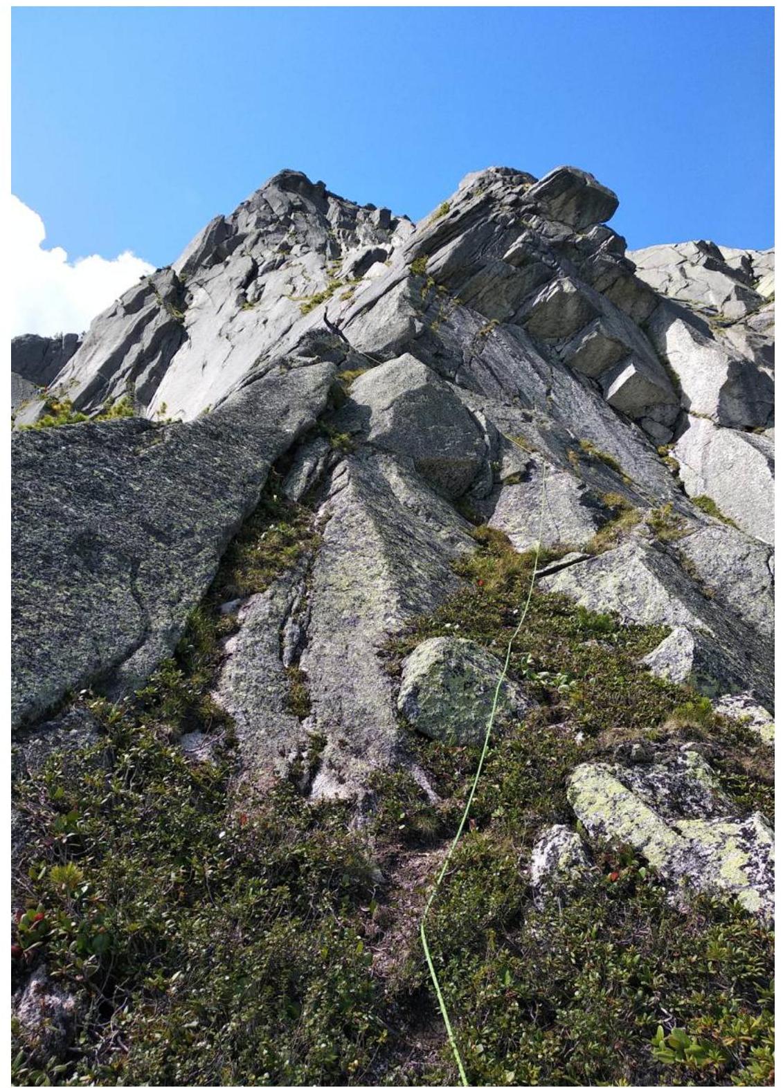
Photo 15. On the southeast buttress (3A category).
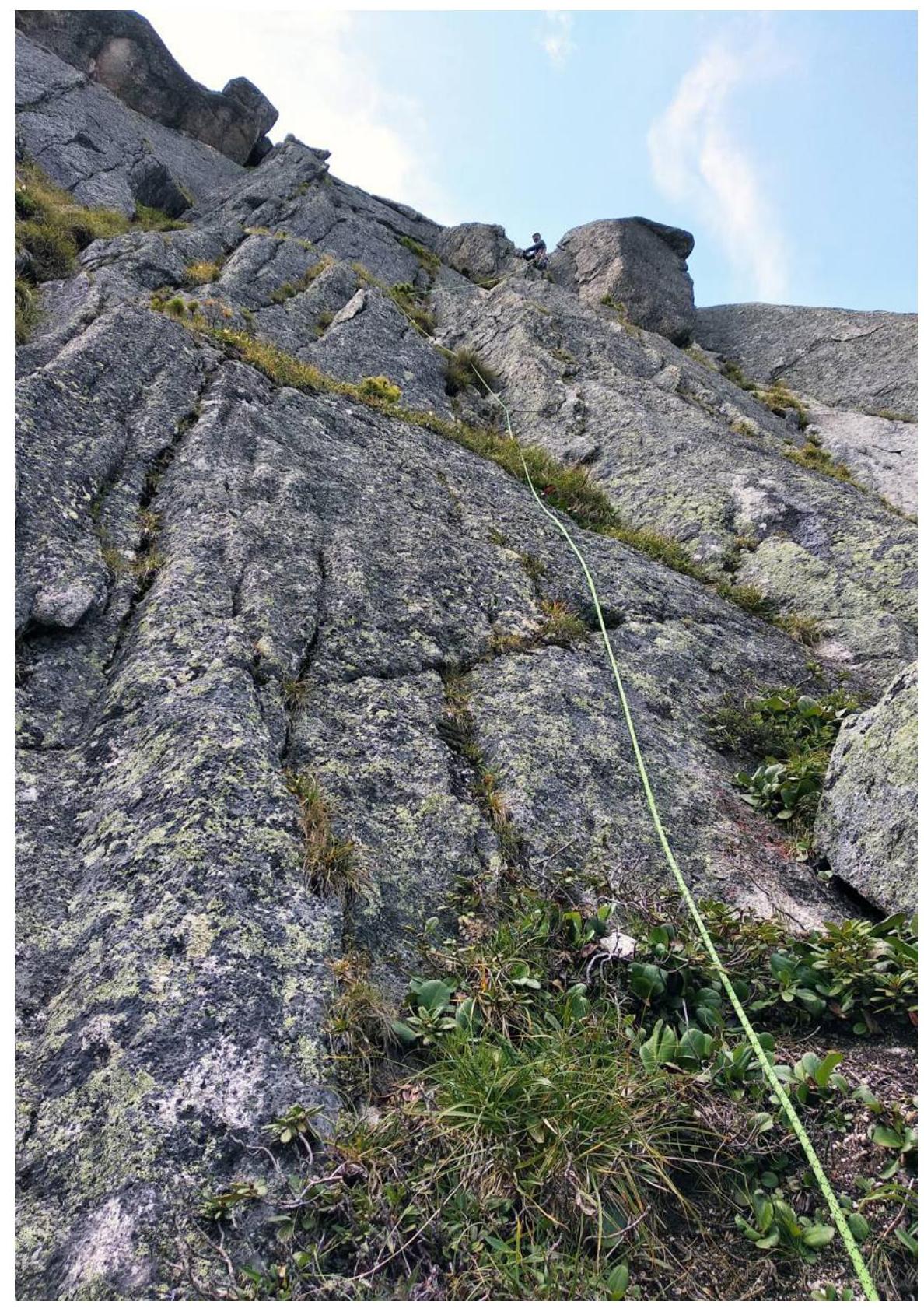
Photo 16. On the southeast buttress (3A category).
3.2. Photo of the Team at the Summit by the Control Tour
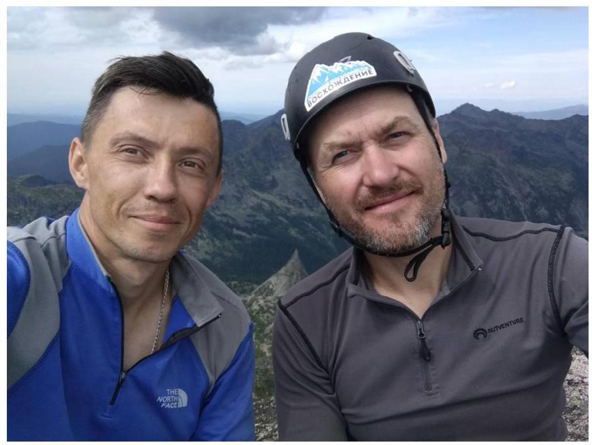
Photo 17. Team at the summit of Ptitsa (2221 m), July 29, 2020
3.3. Route Safety Assessment
On the way to the Tsyganova route, we noticed that on the eastern wall, only one route is classified (Galacevich, 5A category). We looked for possible lines to the left. We chose a goal — to create a route passable by free climbing. The central part of the wall is wet, consisting of walls with overhanging "sickles", and in the left part, there are several logical options, the longest of which we climbed.
The route is safe; there are no "live rocks". The choice of terrain is logical and presents no difficulties. A lot of friction climbing. For passage, it is sufficient to have:
- friends (camalots sizes 4 and 5 will be useful)
- pitons with a bend.
Near the summit, there is a rappel station on bolts, allowing one to bypass the complex sections of the 2A route on descent. Two rappels — and you're on the trail.
The team has experience climbing routes from 2A to 6A in this area. Climbing category V was compared to:
- the first ropes (also category V) of the Tsyganova route on the same summit;
- ropes category V of the neighboring "Ekho" route by Polina Galacevich.
In the team's opinion, the route corresponds to the declared 4A category.