Report
of the "Voshozhdenie" climbers' sports club team (Barnaul) on the ascent to Uchiteley peak via the center of the eastern wall
first ascent, estimated at 4A
Participants: Ozerov I.M. Ivanov V.L. 2016
Ascent Data Sheet
- Western Sayan, Ergaki ridge, section 6.2 of the mountain route classifier.
- Uchiteley, 2031 m, via the center of the eastern wall.
- Proposed category: 4A, first ascent.
- Route type: rock climbing.
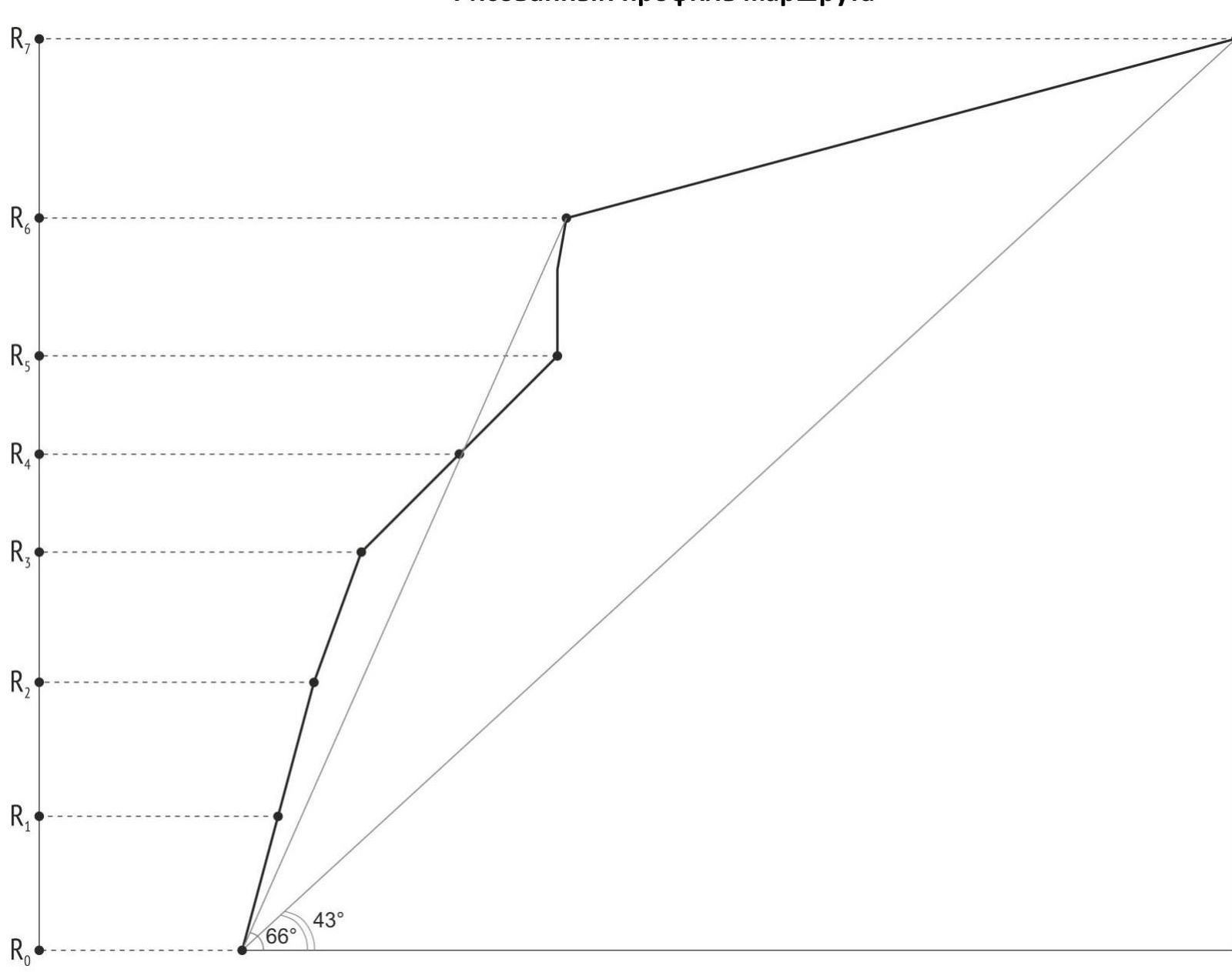
- Height difference: 331 m (GPS).
Route length: 440 m. Length of sections (wall part of the route):
- V category – 45 m
- IV category – 105 m. Average slope: 43°. Average slope of the wall section: 66°.
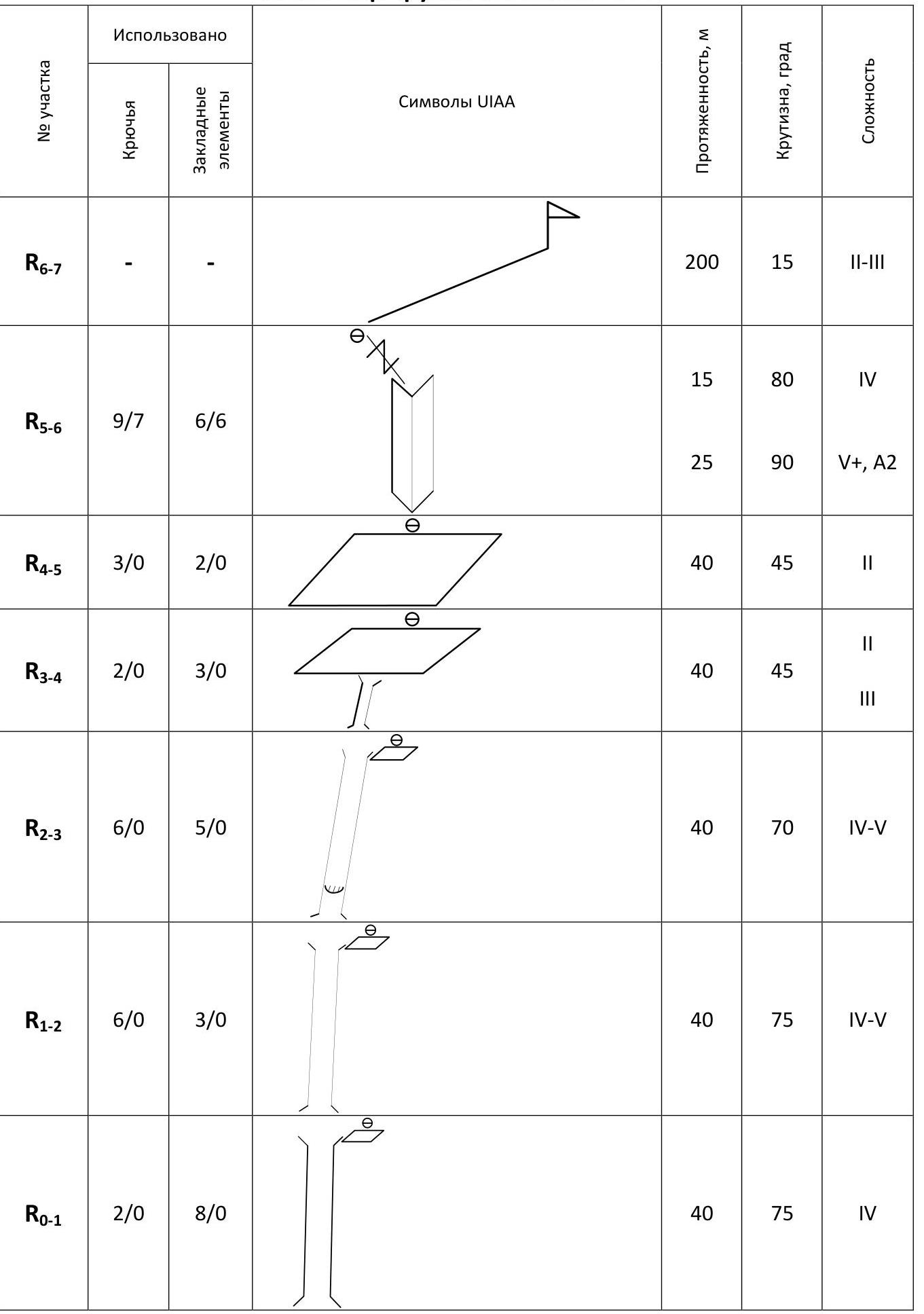
- Equipment used (including for setting up belay stations):
- Rock anchors – 28 pcs., including 7 for artificial aids.
- Chocks – 27 pcs., including 6 for artificial aids.
Hooks left on the route: 0 total; including bolt hangers: 0.
- Team's climbing time: 8 hours, 1 day.
- Team leader: Ozerov Ivan Mikhaylovich, 1st sports category.
Participants: Ivanov Viktor Leonidovich, 2nd sports category.
- Coach: Endelin Oleg Vladimirovich, Master of Sports.
- Departure from base camp to Svetloe lake: 5:00, August 1, 2016.
Start of work on the route: 7:50, August 1, 2016. Reaching the summit: 15:50, August 1, 2016. Return to base camp: 20:00, August 1, 2016. Descent via route 1B towards Molodezhny pass.
- Organization: "Voshozhdenie" Climbers' Sports Club (Barnaul). http://climb-club.ru↗
- Responsible for the report: Ozerov I.M. E-mail: iozerov@mail.ru
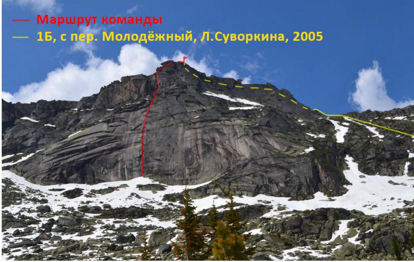
Photograph of the peak's general view (taken on June 17, 2014 from Mramornoe lake)
– Team's route
– 1B, from Molodezhny pass, L.Suvorkina, 2005
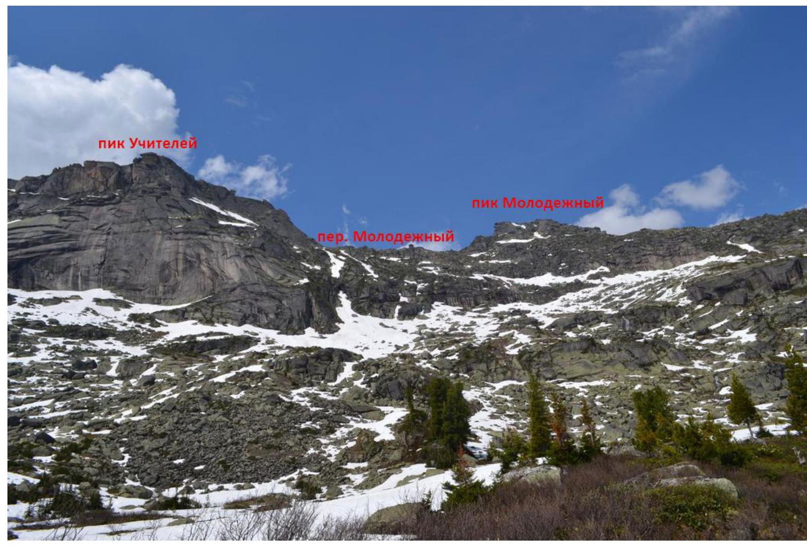
 Photopanorama of the area (taken on June 17, 2014 from Mramornoe lake)
Uchiteley peak
Molodezhny peak
Molodezhny pass
Photopanorama of the area (taken on June 17, 2014 from Mramornoe lake)
Uchiteley peak
Molodezhny peak
Molodezhny pass
 Hand-drawn profile of the route
 Route diagram in UIAA symbols
 Technical photograph of the route
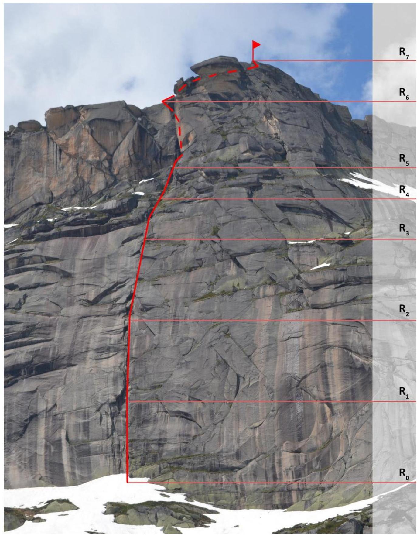
Route Description by Sections
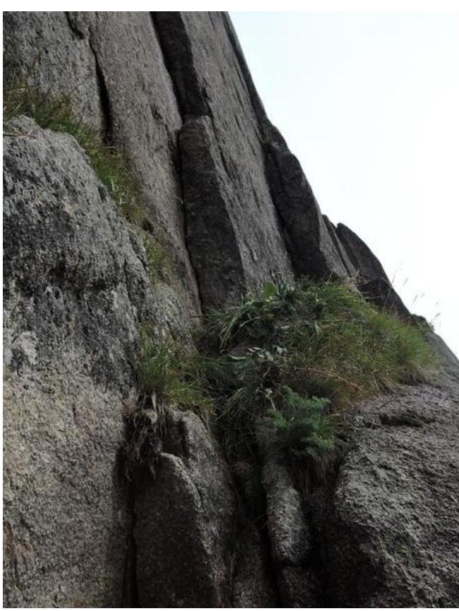
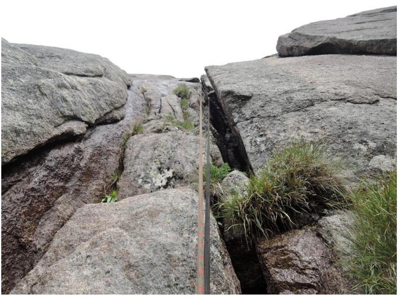
R0–R1 — Start via a chimney (40 m, 75°, IV). Varied climbing (cam-outs, mizera, laybacks). Chimney walls are wet. Station on a convenient green ledge. R1–R2 — Continuation of the chimney (40 m, 75°, IV–V). Climbing becomes more difficult. Station on a green ledge 7 m below the cornice. R2–R3 — At the start of the rope, the first "crux" is a small cornice in the chimney. Climbed using free climbing. Then the chimney narrows to 20–30 cm and begins to ease (40 m, 70°, IV–V). Station on a green ledge. R3–R4 — At the end of the chimney, we exit onto an inclined green ledge and then move up towards the black internal corner. Climbing is not difficult (40 m, 45°, II–III). R4–R5 — Continue moving along the green ledge (40 m, 45°, II). R5–R6 — Second "crux" — a black internal corner (25 m, 90°, V+, A2). Climbed using artificial aids. Rocks are fragile. At the top of the corner, we move left-upwards via a crack onto the ridge using free climbing (15 m, 80°, IV). Station on a good rock ledge. R6–R7 — Easy climbing to the summit (200 m, 15°, II–III). Simultaneous movement.
Descent towards Molodezhny pass via route 1B and then to Mramornoe lake.
Tactical and Technical Actions of the Team
The chosen line was scouted during an alpine event in 2014. Then, for reconnaissance, we ascended Uchiteley peak via route 1B, but the departure date did not allow us to climb the new route.
In 2016, we returned to Ergaki. To prepare, we climbed classified routes:
- 4A (Ivanov–Ozerov team)
- 4B (Ivanov–Lezhnev–Ozerov team)
Overall, the participants have experience on routes up to 5B category in the area.
Weather in July–August in the area is unstable. Assuming that the lower part can only be climbed via free climbing on dry rocks, we waited for a clear day.
On August 1, we departed from base camp to Svetloe lake at 5:00. The scenic approach through Medvezhye lake, Mramorny waterfall, and Mramornoe lake took 2 hours 30 minutes.
We started the ascent at 7:50. Weather is excellent. Movement is in alternating lead. The leader goes on a single dynamic rope, dragging the rope behind. The second climber ascends on the rope with belay. We reached the second crux (R5–R6) at 13:30. Weather worsened — rain, fog. By 15:30, we reached the ridge and then the summit at 15:50.
From the summit, we descended via rocks and a trail along the ridge to Molodezhny pass. Then we walked from the pass, gradually moving under the slopes of Molodezhny peak, as it's possible to slip into gullies on the right.
In clear weather, the eastern wall is visible from the camp at Svetloe lake. The route follows a distinct relief, making it hard to get lost.
We were unable to get good photographs of the route's side profile due to the terrain (the route is obscured by the continuation of the eastern wall).
After rain, water flows through sections R0–R3 (chimney), significantly complicating climbing. For the terrain, the following are suitable:
- anchors
- medium to large-sized cams
Chocks were rarely used.
According to the team, the route matches the claimed category of difficulty.
Photographs of Route Sections
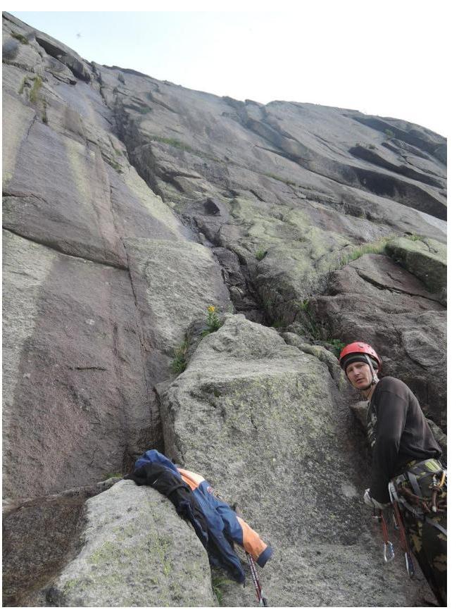
Start of the route
Ledge for the station at the end of R0–R1
Section R1–R2 (taken from station R1)

First "crux" — a cornice. Section R2–R3 (taken from station R2)

Continuation of section R2–R3 after the cornice
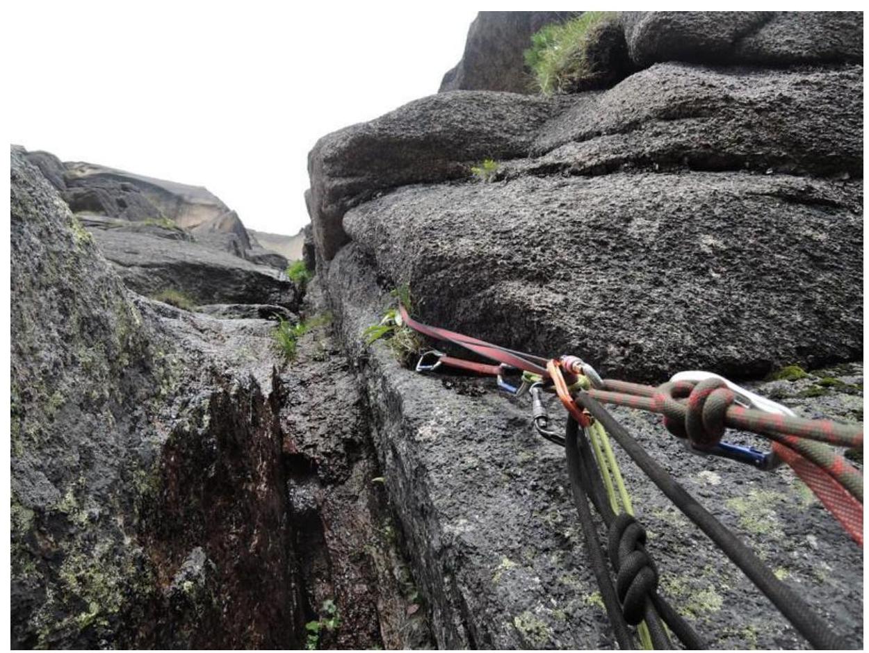
Station R3
Visible:
- end of the chimney
- exit onto the green ledge
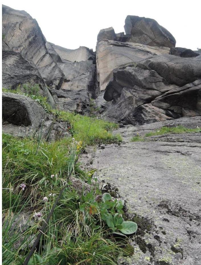
Section R4–R5. Approach along the green ledge to the black internal corner
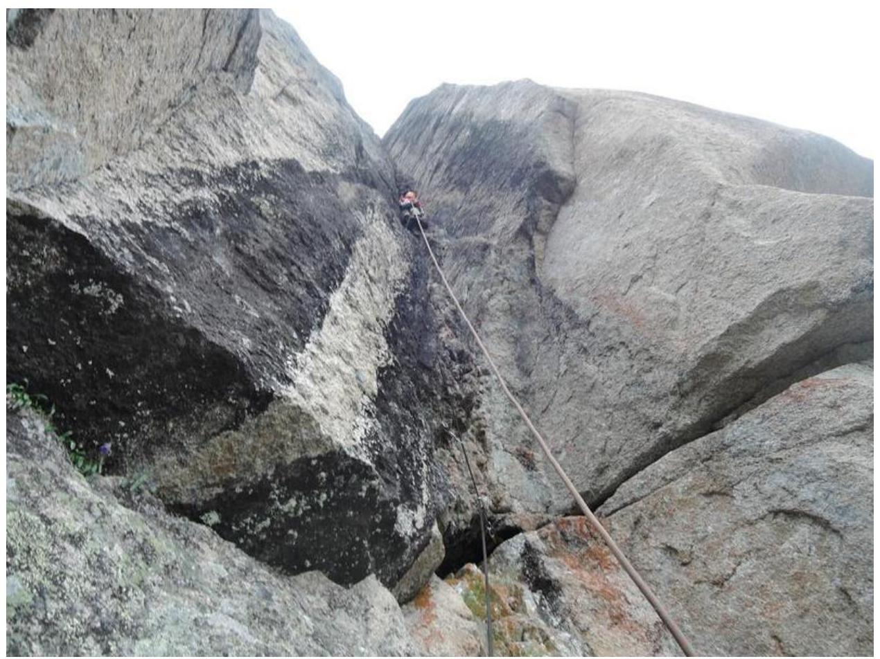
Second "crux" — internal corner on artificial aids. Section R5–R6 (taken from station R5)
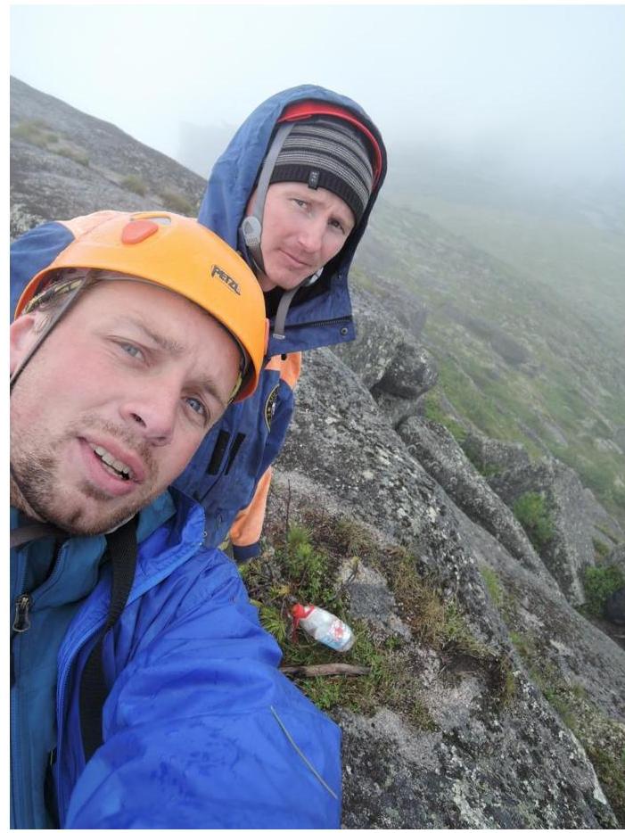
Summit