Passport
Protocol No. 12 dated 23.01.1996, item 8. 45th SK.
- Rock class.
- Western Sayan, Ergaki ridge.
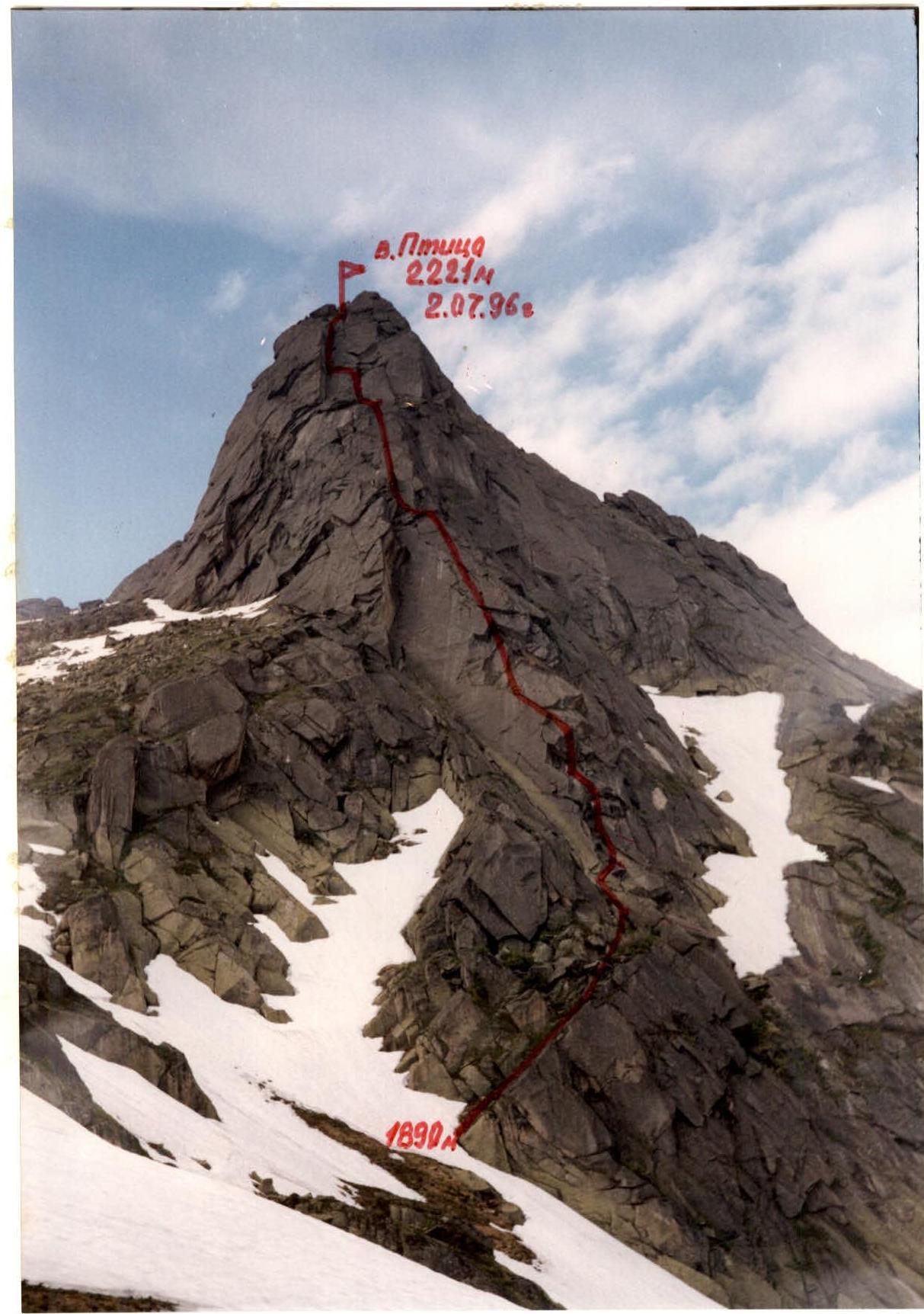
- Ptitsa Peak, 2220 m, S ridge.
- Proposed category 4B, first ascent.
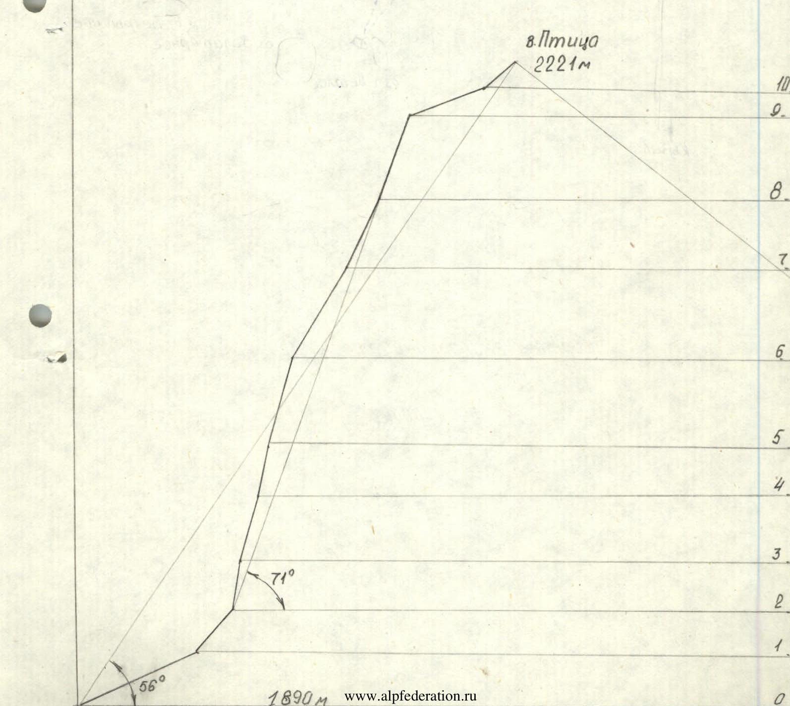
- Elevation difference: 330 meters; length 430 meters; length of category 5 section 85 meters. Average steepness of the route 56°.
- Pitons hammered:
- rock: 18 (3 left)
- chocks: 44 (6 left)
- Climbing hours 12, days 1.
- Overnights on the route: none.
- Leader: Balyezin Valeriy Viktorovich, MSМК
Participants:
- Volkov Vladimir, 2nd sports category
- Zakrepa Andrey Yevgenyevich, 2nd sports category
- Maximov Andrey Vladimirovich, 2nd sports category
- Team coach: Lebedev Vladimir Aleksandrovich, MS
- Approach to the route: July 2, 1996. Summit: July 2, 1996. Return: July 2, 1996.
- Organization: Krasnoyarsk Kraysportkomitet.

General photo of the summit. Taken on June 30, 1996. Time of shooting 14:20. Shooting height 1600 m, distance 500 m, lens F=85 mm.
Route Profile
M1:2000
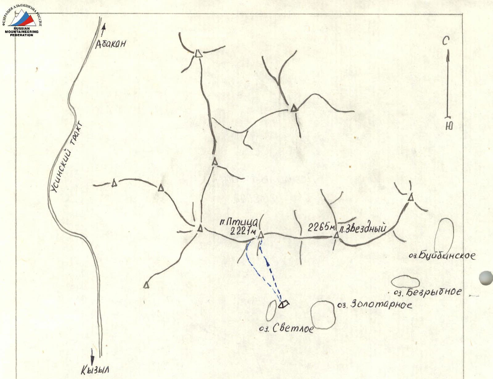
Map of the Ascent Area
M1:100000
Brief Overview of the Ascent Area
The Ergaki massif is located in the central part of the Western Sayan, approximately 600 km drive along the Krasnoyarsk-Abakan highway, then along the Usinskiy tract towards Kyzyl to Olenya Rechka, from where it's about 10 km on foot to the base camp located on the shore of Svetloe Lake. The approach to the route from the base camp takes 1.5 hours.
The Ergaki massif stretches about 80 km from west to east. It consists of several mountain ridges: Ergaki, Metugul-taiga, Baldyr-taiga, Shepshir-taiga. This territory is characterized by an East Siberian type of climate with a long and harsh winter and a cold summer, prevailing temperatures in July during the day +10°–+16°, at night +2°–+6°. Frequent rains and snowfalls.
The Ergaki massif area has excellent prospects for development in terms of alpinism, with several sheer walls up to 500–600 m in height difference planned to be explored in the future.
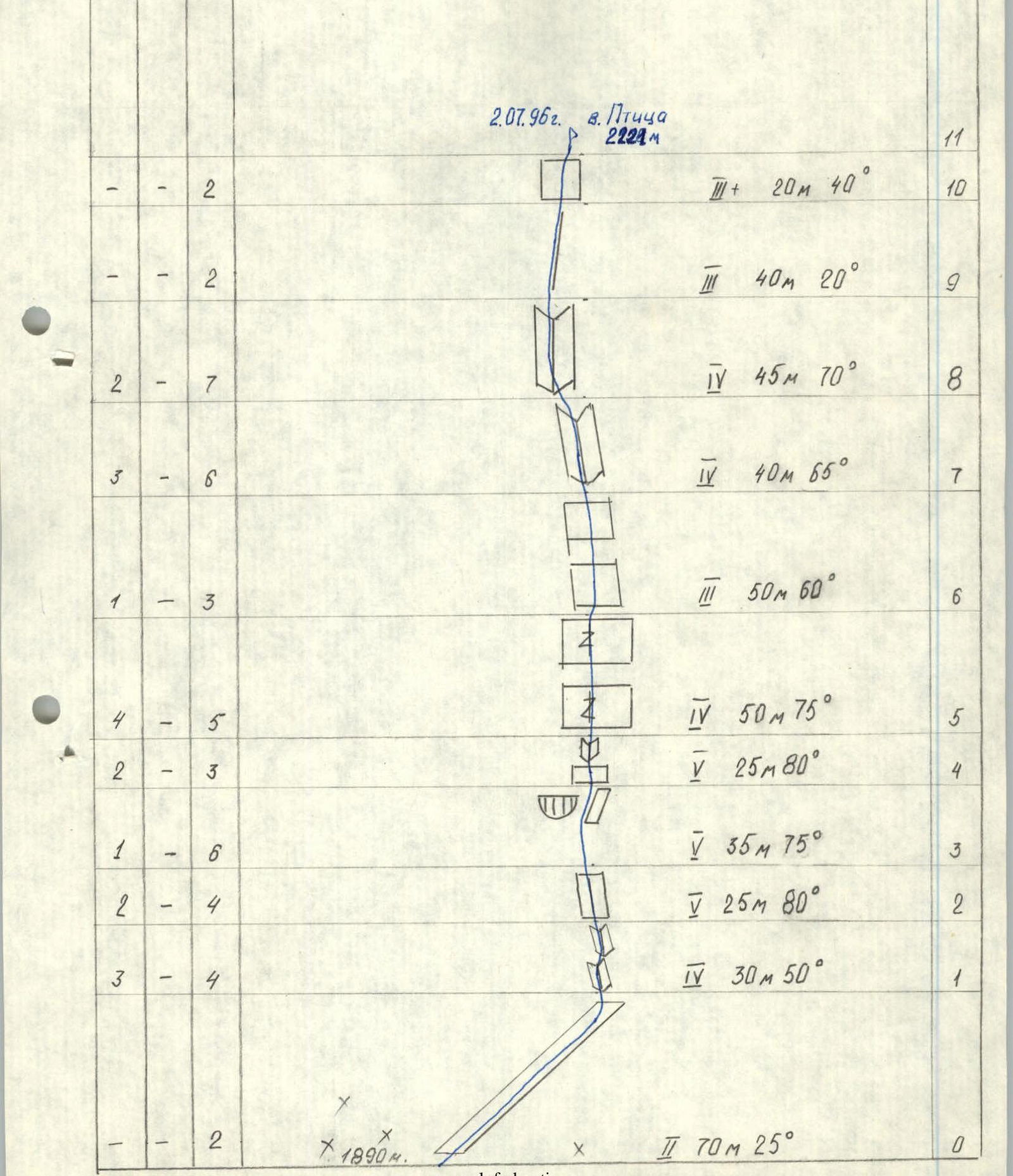
Route Diagram in Symbols
Total climbing hours 12
Route Description by Sections
Sec. R0–R1: Simple gentle ledge. Sec. R1–R2: Wide internal corner. Many small cracks. Sec. R2–R3: Wide slab with vertical cracks. ITO used. Sec. R3–R4: Section with overhangs, ITO. Sec. R4–R5: Lower part is a slab, upper part is a steep internal corner. Sec. R5–R7: Steep slabs. Convenient ledge at the top. Sec. R8–R9: Internal corner with a wide vertical gap. Sec. R9–R10: Ridge section, traverse, protection on ledges. Sec. R10–R11: Several inclined ledges and a 10-meter ledge.