Ascent Passport
-
Ascent class — rock climbing
-
Region — Western Sayan, Ergaki ridge
-
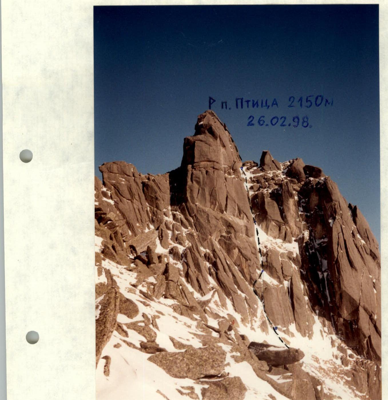
Peak — Ptitsa 2150 m, via the southern slope, rock climbing
-
Proposed category — 2B first ascent
-
Route characteristics:
height difference — 130 m, total length — 160 m, average slope: entire route — 50°
-
Equipment used on the route — 12 stoppers
-
Number of climbing hours — 4
-
Overnights — none
-
Team composition:
Borisova Yulia Valentinovna 2nd sports category, Balezin Valery Viktorovich MSMK, Zakharov Nikolai Nikolaevich MSMK, Antipin Sergey Mikhailovich MS
-
Team coaches:
Zakharov Nikolai Nikolaevich MSMK, Balezin Valery Viktorovich MSMK
-
Dates:
summit — February 26, 1998, return — February 26, 1998
-
Organization: Krasnoyarsk Committee for Physical Culture and Sports
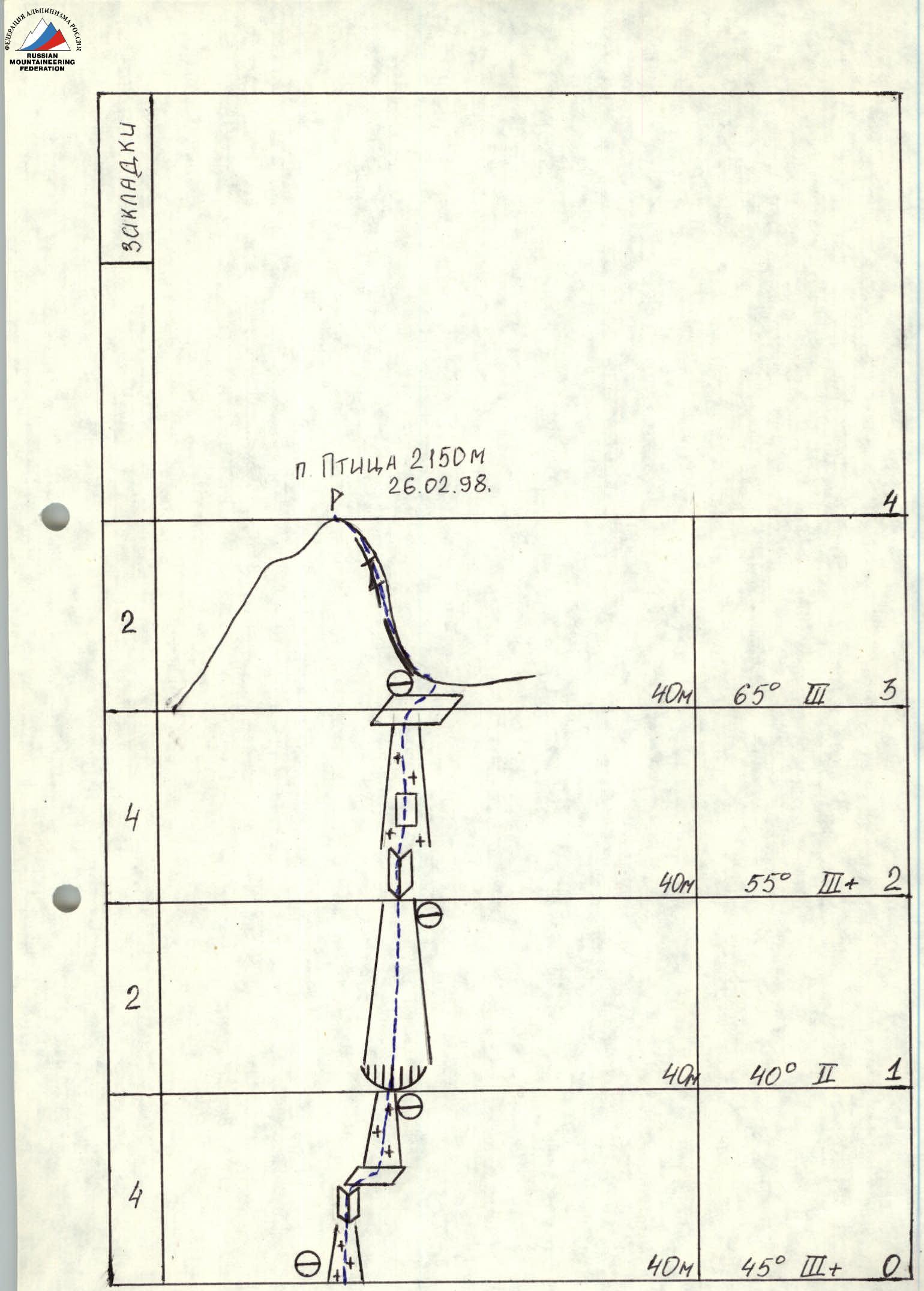
Brief route description
Section R0–R1. The start of the route is through a snowy narrow couloir. Then, via an inside corner, exit right onto a ledge and up into a snowy couloir to a small cornice. Under it, an intermediate camp (п.п.).
Section R1–R2. After the cornice — a wide couloir that abuts an inside corner. Here, an intermediate camp (п.п.).
Section R2–R3. A steep inside corner gradually transitions into a snowy couloir with a rock wall in the middle, leading to a good ledge under the summit ridge. Here, an intermediate camp (п.п.).
Section R3–R4. From the ledge, exit right onto the pre-summit ridge, then along a narrow ledge on the northern side of the summit tower, the route approaches a wide crevice that leads to the summit.