Title Page
Western Sayan, Ergaki ridge, Orehek peak 1850 m, via the South Face, cat. 2B diff. 6.2.
Irkutsk.
Climbing Passport for Orehek peak 1850 m, via the South Face, cat. 2B diff.
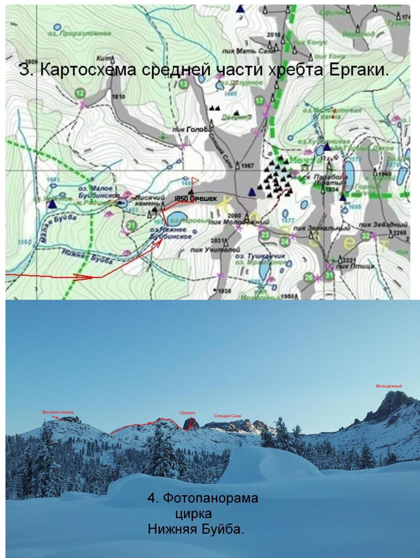
- Western Sayan, Ergaki ridge, Nizhnee Buibinskoe gorge, section 6.2. 2. Orehek peak (1850) via the South Face. 3. Proposed cat. 2B diff., winter, first ascent. 4. Route type — rock climbing. 5. Elevation gain — 100 m, length — 400 m, average slope — 10°; wall section — 85°. 6. Pitons hammered: wired — 15 pcs, natural features used for belay — 4 times. 7. Team's total climbing time — 7 hours. 8. No bivouacs on the route. 9. Team members:
Afanasyev A.E. MS
Vlasov V.E. badge
Idrisov R.I. badge
Lazarenko A.V. badge
Nesterov V.N. badge
Nugmanov M.E. badge
Tulepbergenov G.T. badge
-
Coach Afanasyev A.E. MS
-
Summit and return on October 20, 2014.
Orehek peak, 1850 m, via the South Face, cat. 2B diff., winter.
From the campsite at Nizhnee Buibinskoe lake to the saddle in the ridge between Visyachiy kamen and Orehek, to the right of Visyachiy kamen, via the southern slope on crampons — 30 minutes.
Sect. R0–R1 200 m, 10°, I diff. Snow slope to the crest before Orehek, on crampons. Downhill slopes on both sides.
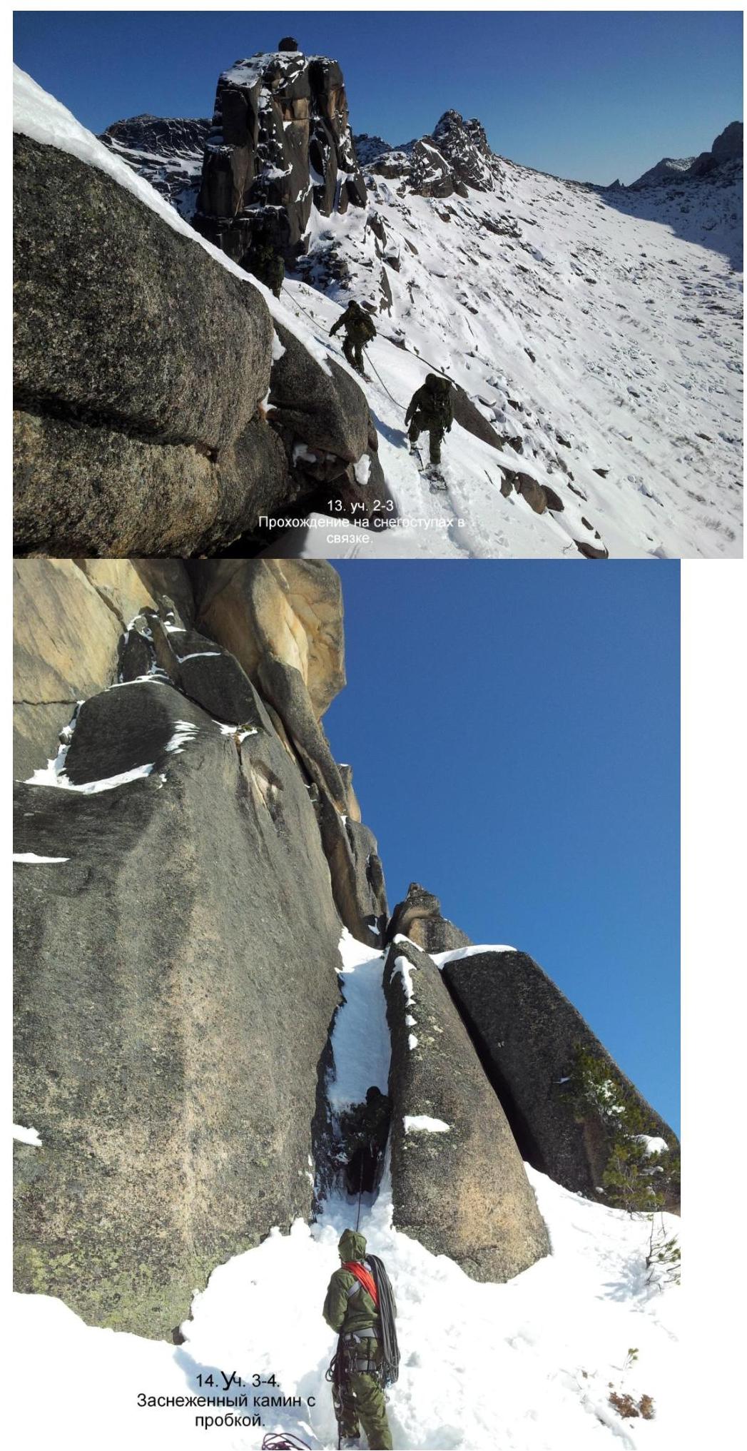
Sect. 1–2 100 m, 20°, I+ diff. Descent along the ridge on crampons and on foot to the saddle before Orehek.
Sect. 2–3 40 m, 20°, I– diff. Through deep snow under the wall of a large rock outcrop, where Orehek peak is located. On the left side of the wall, there is an inner corner transitioning into a crack at the top. A bolted route for rock climbing goes through this corner all the way to the top. The length of the corner is 50 meters.
Climbing route:
- Starts to the right of the rock climbing route
- Goes right onto the wall with southern exposure
- Approach to the wall section in winter takes 2 hours
Sect. 3–4 12 m, 50°, III diff. Snowy chimney with a plug at the bottom.
Sect. 4–5 5 m, 90°, V diff. Crack between the rock and a boulder.
Sect. 5–6 5 m, 80°, IV+ diff. Wall with cracks and ledges.
Sect. 6–7 7 m, II diff. Traverse right along a snowy ledge with cedar trees:
- 3 trees, 1.5–2 m high
- suitable for belay at the root.
Sect. 7–8 7 m, 85°, — diff. Right monolithic flake.
Sect. 8–9 5 m, 70°, III diff. Climb onto a deep ledge.
Sect. 9–10 12 m, 95°, V+ diff. Reddish overhang in the inner corner, transitioning into a wide, flat crack. Various cracks in the inner corner:
- vertical
- horizontal
The section is climbed with a combination of aid climbing and free climbing. Exit onto a large snowy ledge on the ridge.
Sect. 10–11 7 m, 85°, IV– diff. Wall to the left, exit to Orehek peak. The peak is small, about 2 meters high on the right side. A rope can be thrown over it for ascent. The logbook is located under the peak at the bottom of Orehek.
Descent from the summit:
- Rappelling on two fixed bolted pitons via the rock climbing route.
- Then, from under the rock, descend directly into the gorge and to the campsite at Nizhnee Buibinskoe lake — 1.5 hours, if the snow is not avalanche-prone.
- Otherwise, descend in reverse order via the ascent route, through the ridge.
Route specifics:
- For training groups, the route is recommended only with a team size of no more than 6 people and only in winter.
- In summer, it's an easy walk with pleasant climbing in "galoshes".
- The first ascent team spent 7 hours on the wall section.
- 15 wired pitons were placed.
- Natural features and trees were used for belay 4 times.
-
Photopanorama of Nizhnyaya Buiba cirque.
-
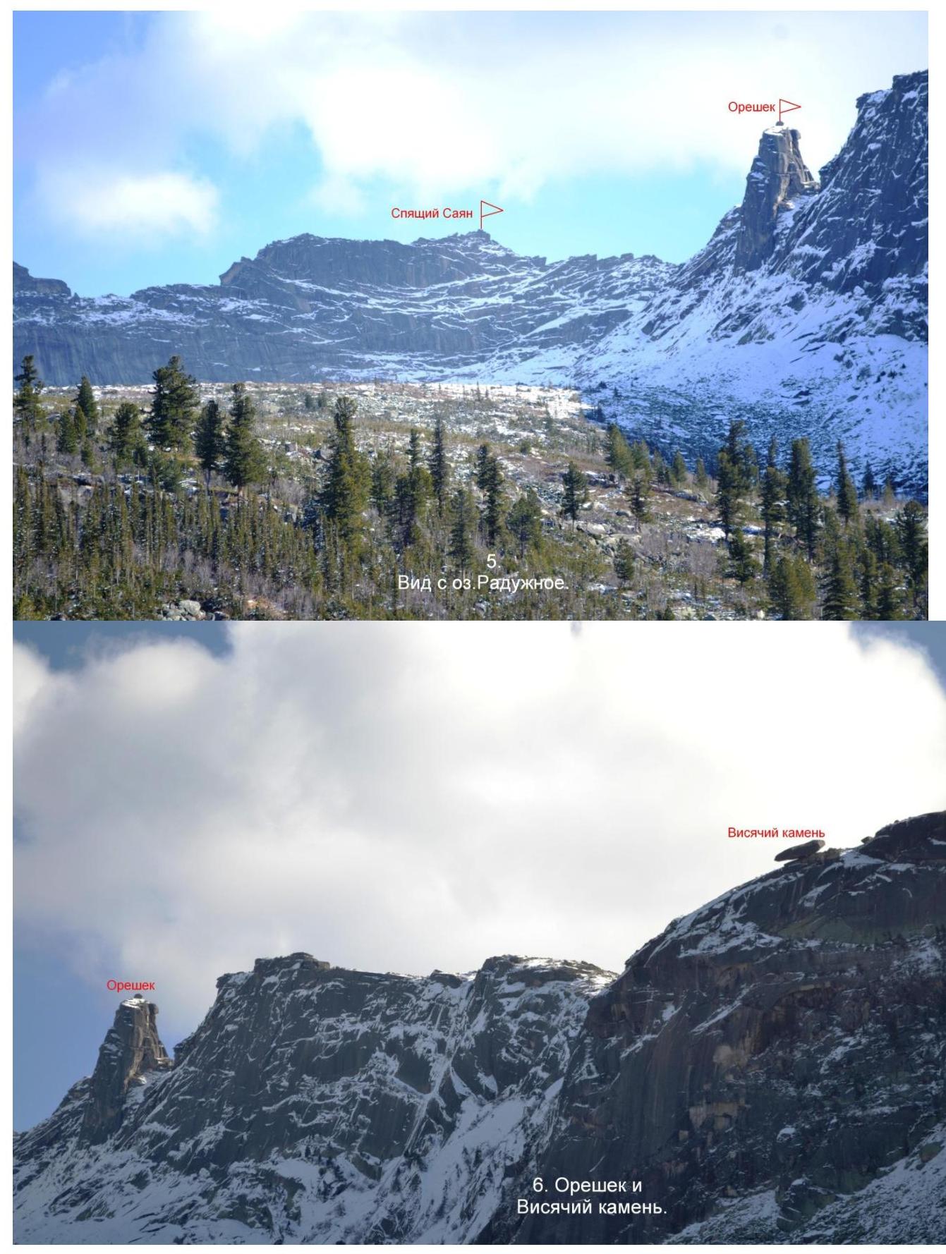
Sreshek and Visochiy kamen.
-
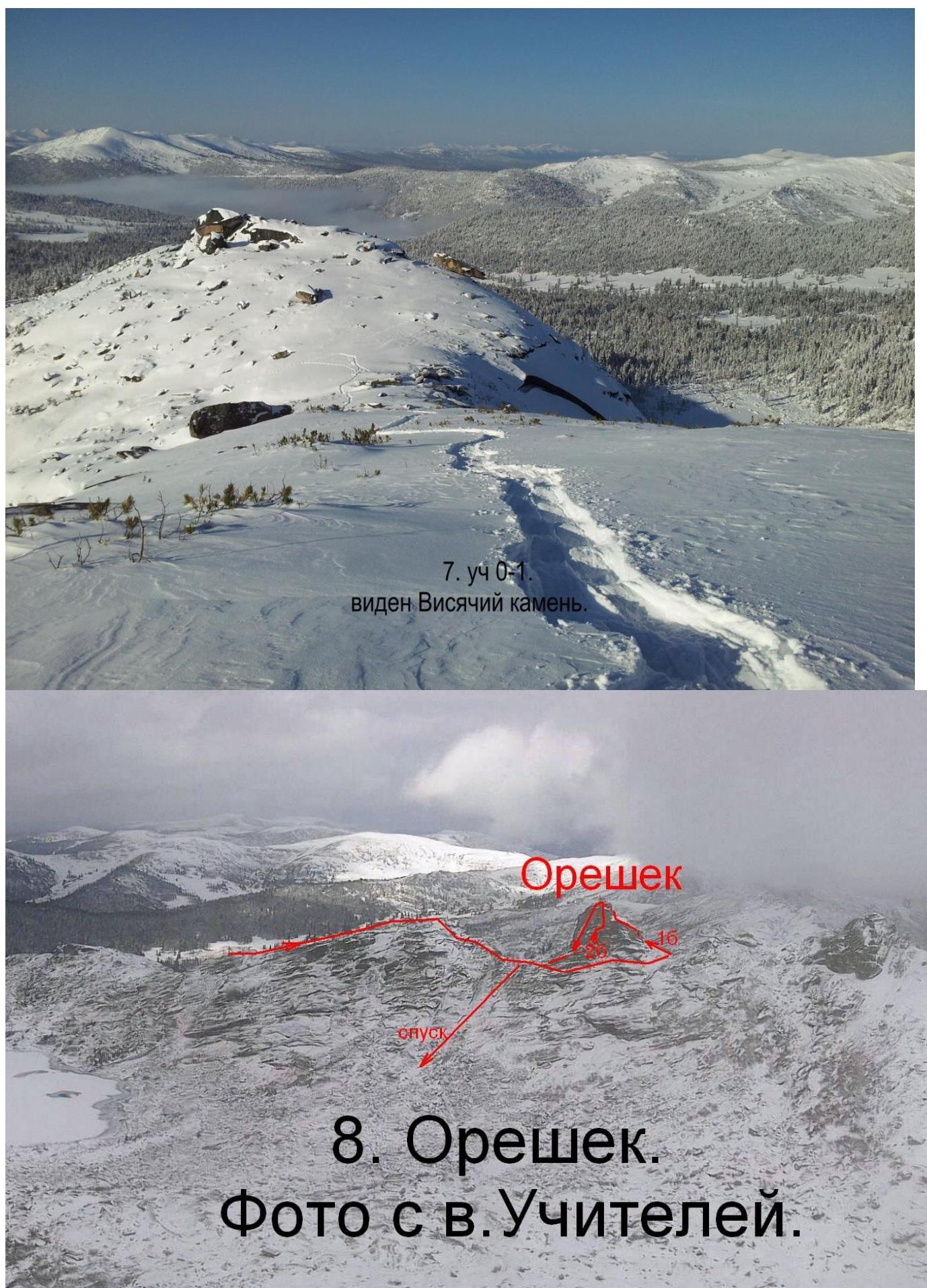
Orehek.
Photo from Uchiteley peak.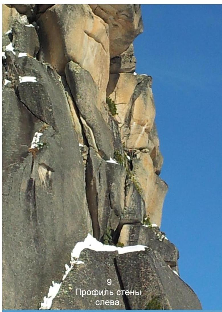
Orehek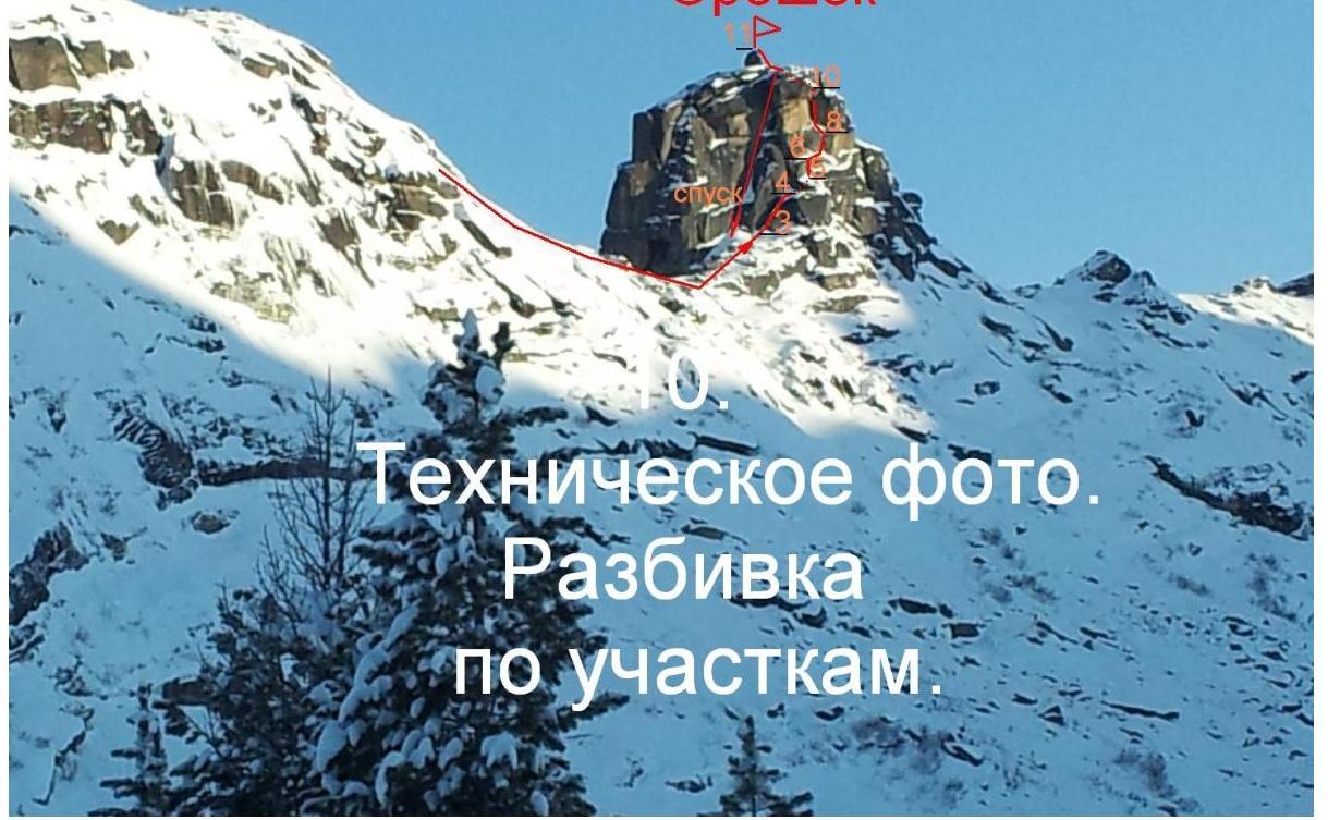
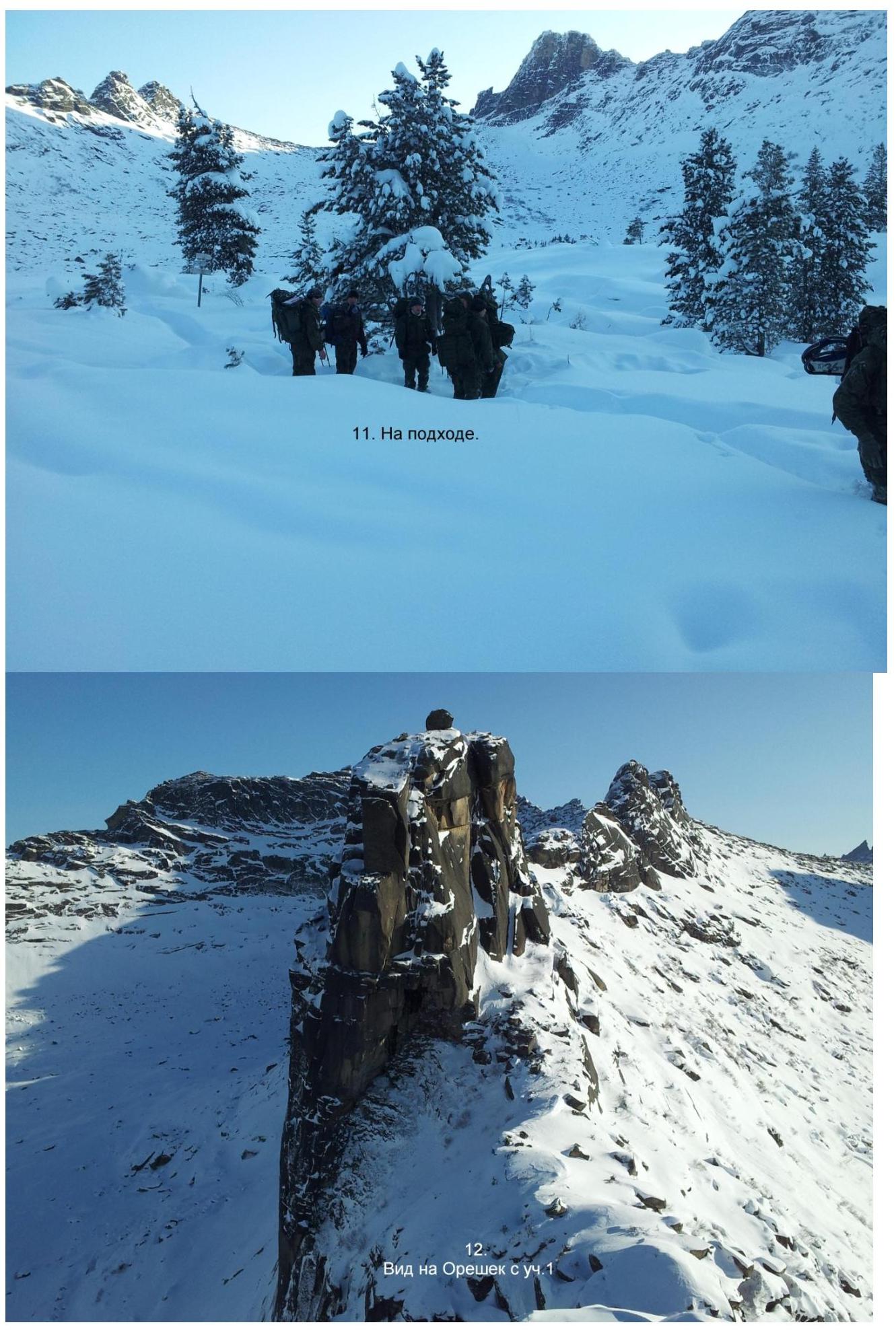
- On approach.
 14
Sect. 3–4. Snowy chimney with a plug.
14
Sect. 3–4. Snowy chimney with a plug.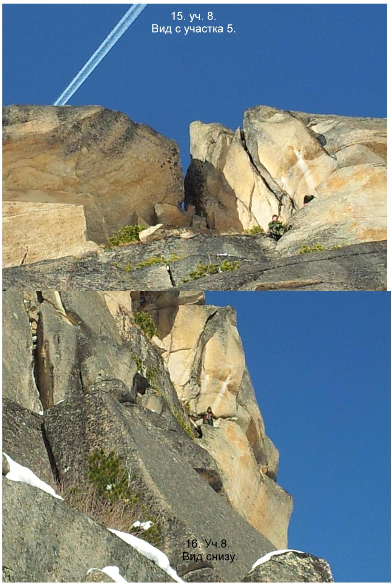 16°
Sect. 4–5. View from below.
16°
Sect. 4–5. View from below.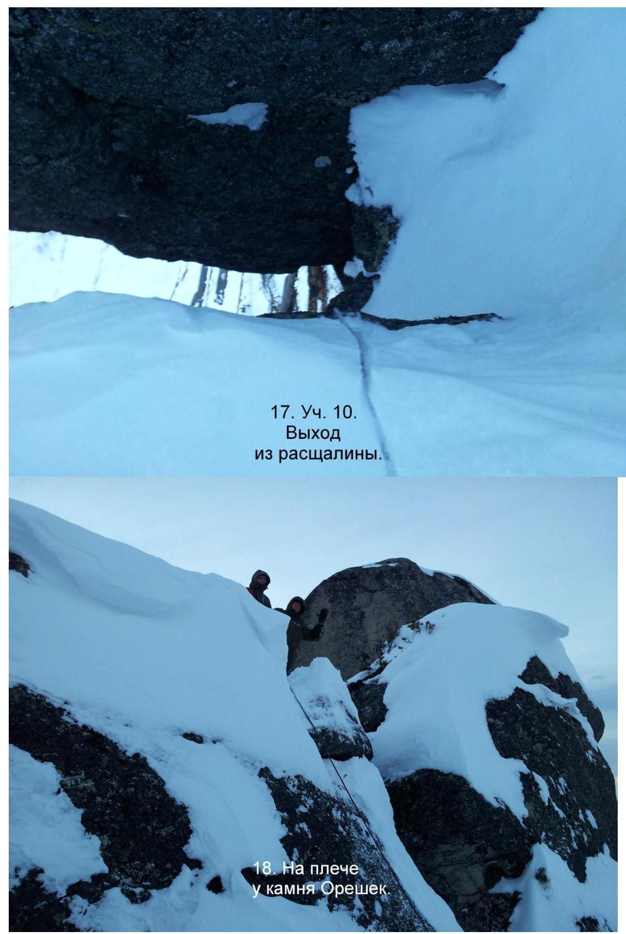
- Sect. 10.
Exit from the crack.
19. Summit.
