Climbing Passport
- Climbing type: rock climbing.
- Climbing area: Western Sayan, Bорус ridge.
- Peak Koshurnikova (2010 m), via the center of the eastern slope.
- Proposed category: 3A difficulty level.
- Route characteristics: elevation gain — 400 m distance — 600 m average slope — 45°
- Equipment used on the route: 7 stoppers 5 rock pitons
- No overnight stays. Total climbing time 8 hours.
- Team members: Full Name, sports rank Senashov Sergey Ivanovich — Candidate for Master of Sports Burmak Ulyana Viktorovna — 2nd sports category
- Team coach: Lebedev V.A., Master of Sports
- Departure for climb — 9:00, February 3, 1999 reaching the summit — 14:30, February 3, 1999 return — 17:00, February 3, 1999
- Organization: Youth Center for Travelers, Krasnoyarsk.
Approach route diagram to the 3A category route on Peak Koshurnikova
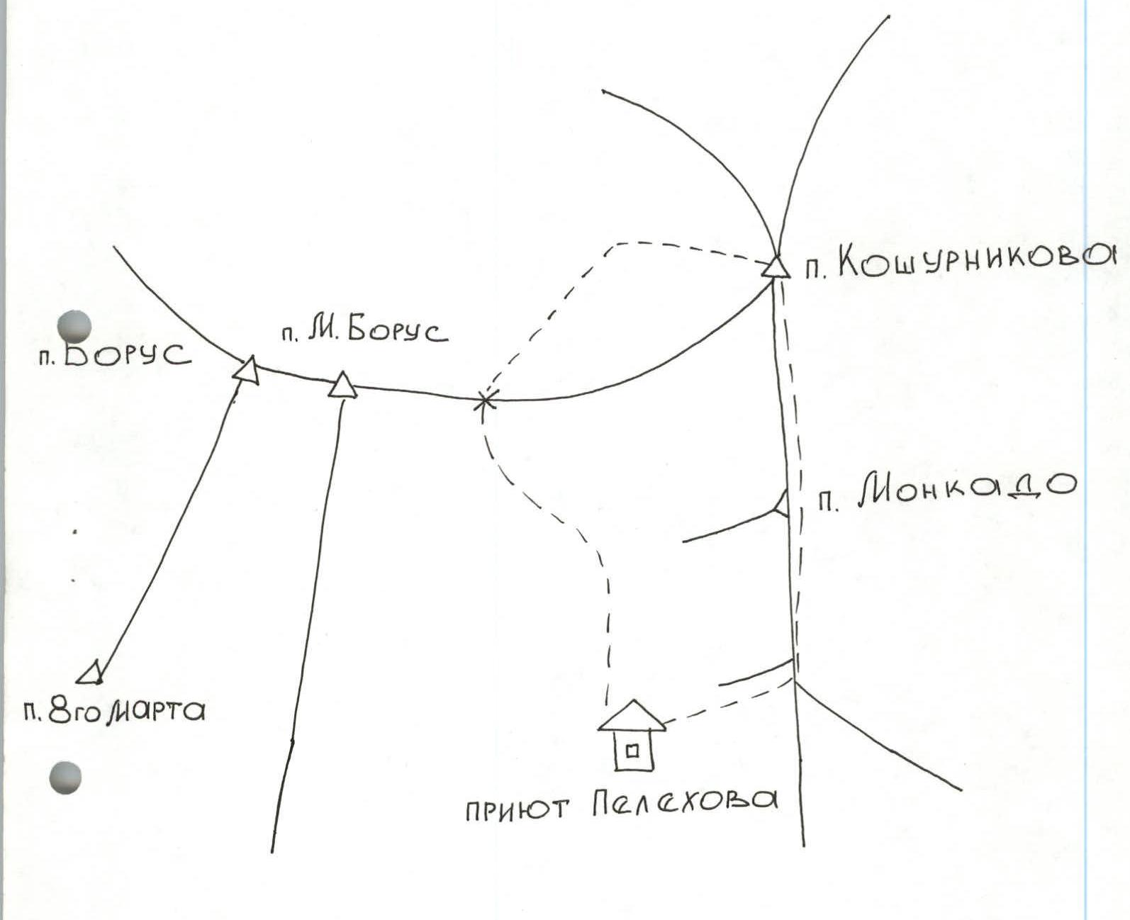 Koshurnikova pass
M. Borus pass
Borus pass
8 Marta pass
Pelekhov shelter
S — N
Koshurnikova pass
M. Borus pass
Borus pass
8 Marta pass
Pelekhov shelter
S — N Monkado pass
Yenisei River
Hydroelectric Power Station
Monkado pass
Yenisei River
Hydroelectric Power Station
Route description to Peak Koshurnikova, 3A category, by sections:
Section R0–R1 — snowy slope with 40° steepness, 100 m long. Section R1–R2 — rock wall 5 m high, 90° steepness. Section R2–R3 — snowy ledge 20 m long, 50° steepness. Section R3–R4 — rock wall 7 m high, 75° steepness. Section R4–R5 — inner corner 15 m long, 45° steepness. Section R5–R6 — snowy slope 30 m long, 45° steepness, leads to the base of a rock wall on the ridge. Section R6–R7 — rock wall 20 m high, 75° steepness, leads to the ridge. Section R7–R8 — snowy ridge 120 m long, 60° steepness. Section R8–R9 — ridge with a series of steep rock walls 3–5 meters high. Section R9–R10 — ascent via a steep snowy rock ridge to the summit.
Descent via a 1–6 category route to Pelekhov shelter.
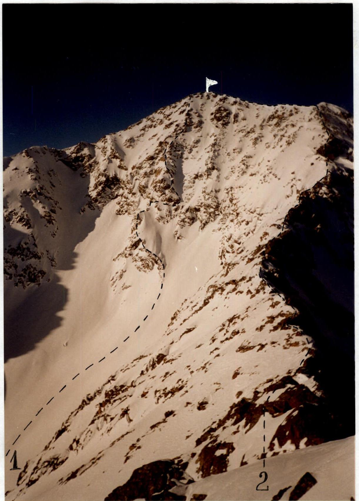
General photo of the summit
1 — route taken by the team 2 — route via the upper ridge, 2B category.