Ascent Log
- Area – Western Sayan, Borus Ridge, p. 6.2
- Peak – Koschurnikova, 2300 m, via the Central North-Eastern slope through "Monkado"
- Category – 3A cat. diff. – first ascent
- Route Type – Rock climbing
- Route Description:
elevation gain – 650 m,
total route length – 1195 m,
wall section length before reaching the counterfort – 365 m,
section lengths:
- 6B cat. diff. – 10 m
- 5B cat. diff. – 20 m
- 4B cat. diff. – 30 m
- 3B cat. diff. – 115 m, average steepness of the entire route – 52°, average steepness of the wall section before reaching the counterfort – 59°.
- Equipment Used: anchor pitons – 26/6 (on belay stations), camalots – 23/0.
- Climbing Time – 5 hours, 1 day. Descent – 2.5 hours via the North ridge, 1B, classic route. Overnight Stays – none.
- Team Leader: Zhigalov Alexander Vladimirovich, Master of Sports. Team Members: Yarnykh Margarita Yuryevna, 3rd sports category. Ivanov Nikita Alexandrovich, 3rd sports category.
- Team Coaches: Balezin Valery Viktorovich, International Master of Sports, Honored Coach of Russia. Zakharov Nikolai Nikolaevich, International Master of Sports, Honored Coach of Russia.
- Departure Date: Started ascent – 12:00, July 24, 2016. Reached summit – 17:00, July 24, 2016. Returned to Pelekhovo camp – 19:30, July 24, 2016.
- Report Responsible: Zhigalov Alexander Vladimirovich, phone: 8-983-574-84-88. Email: 0jog@bk.ru.
- Ascent Organized by – Ministry of Sports of Krasnoyarsk Krai.
 Overall photo of the peak
1 – 2B, via East ridge, Kurmachev Yu., 1976. 2 – 3B, via North wall through "gendarmes", Zhigalov A., 2013. 3 – 3B, via North-East wall, Katanaev S., 2009. 4 – 2A, counterfort of East ridge, Pelekhov E., 1976. 5 – first ascent 3A via Central North-East slope through "Monkado", 2016. 6 – 1B, via North ridge, Zhigalov A., 2013.
 Koschurnikova Peak, 2300 m
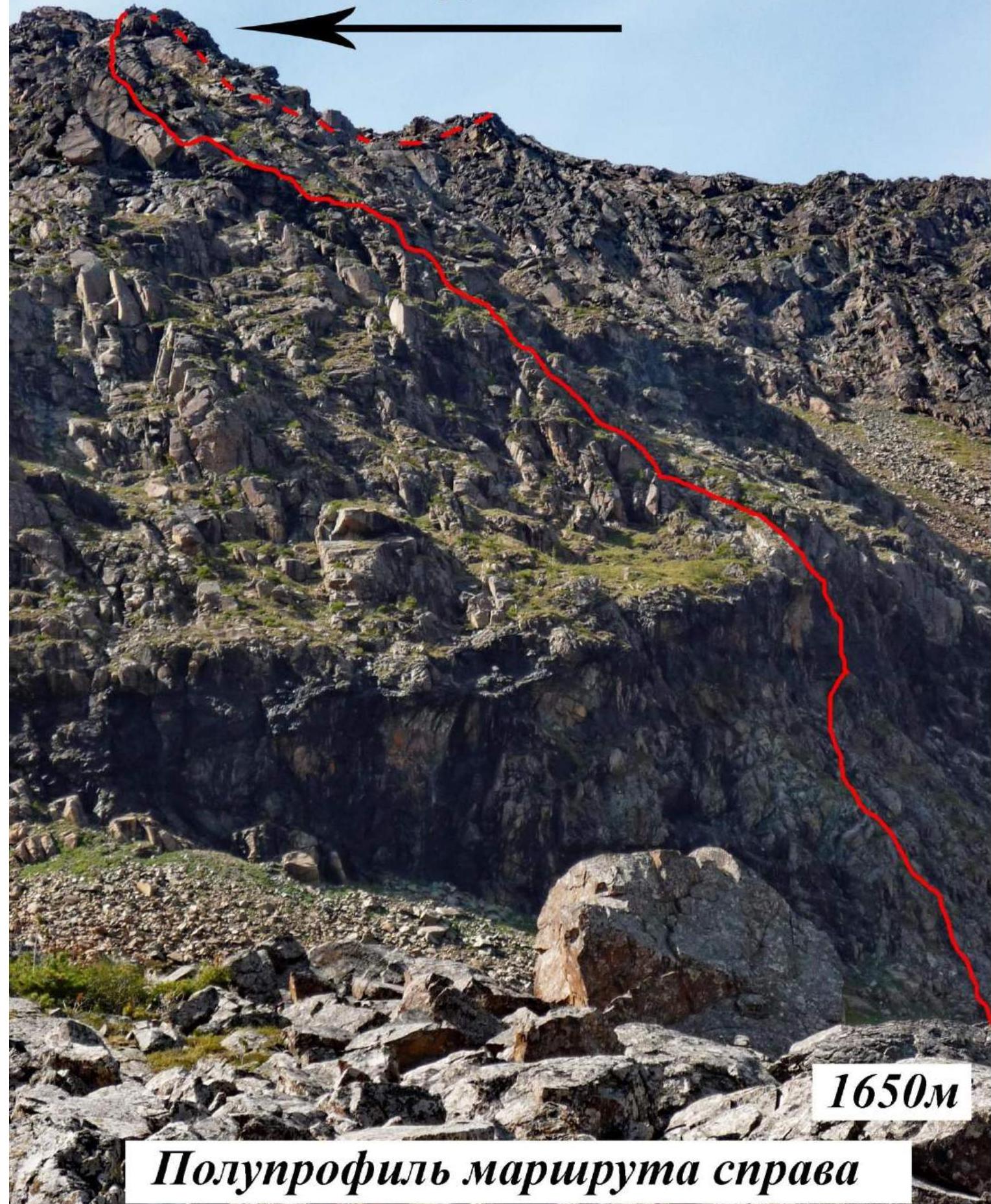
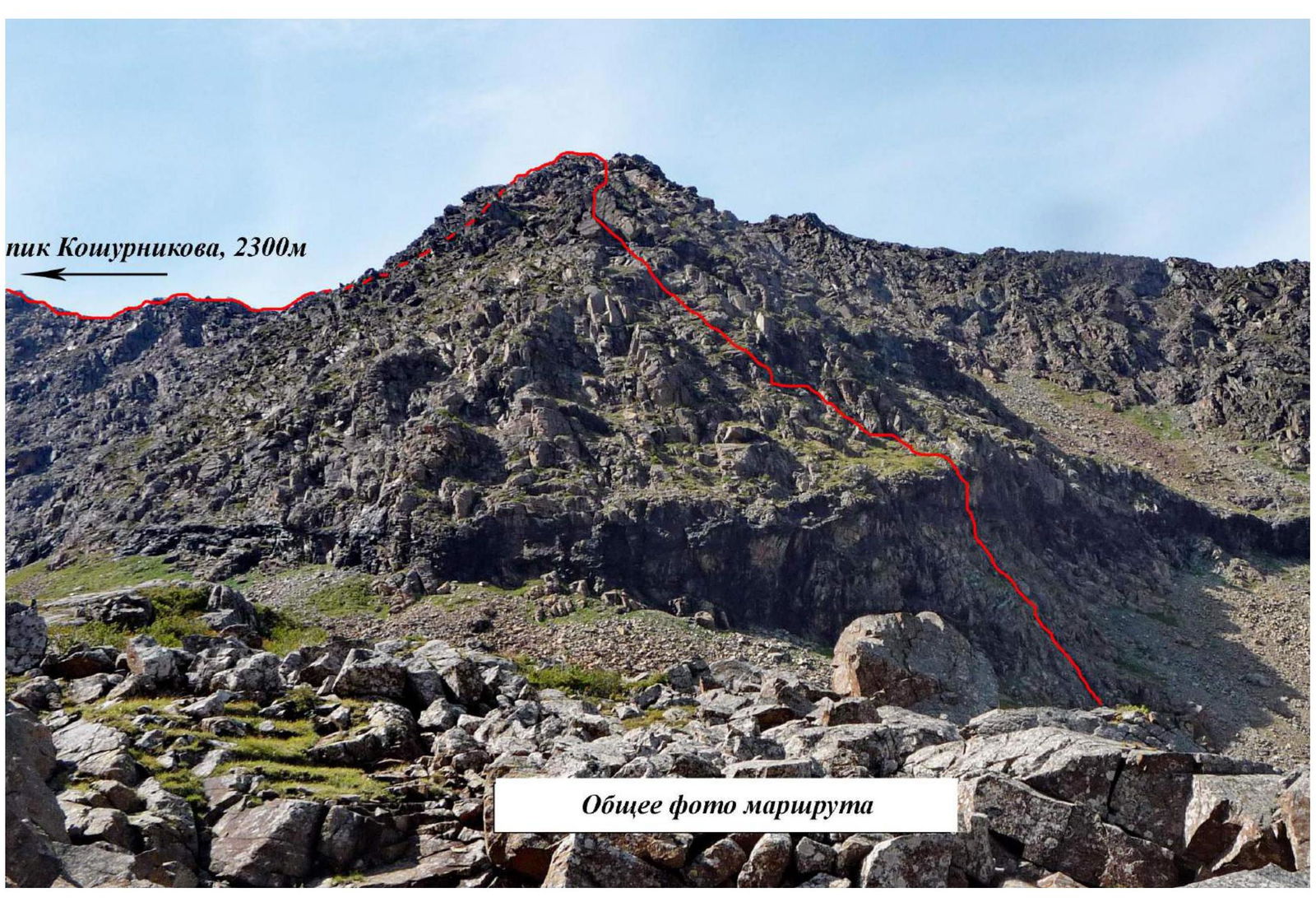 Overall photo of the route
Koschurnikova Peak, 2300 m
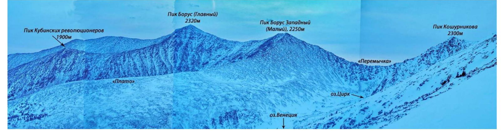 Photopanorama of the area
Tactical Actions of the Team
The team consisting of Zhigalov Alexander – Master of Sports, Yarnykh Margarita – 3rd sports category, and Ivanov Nikita – 3rd sports category, completed a first ascent of a new route on Koschurnikova Peak via the center of the North-East slope through Monkado Peak as part of the training camp of the Krasnoyarsk Alpine Federation.
Zhigalov A. and Yarnykh M. left Cheremushki settlement at 6:30 on July 12, 2016. Around 10:00, the duo arrived at the campsites in the Pelekhova River valley, where Ivanov N. was already waiting in the Base Camp.
The team then took the necessary equipment and gear and moved to the start of the planned route.
The team began working on the route at 12:00. By 14:00, they had passed the key section of the route and reached the counterfort of the East ridge, to the right of Pelekhov E.'s 1976 route, 2A. At the same time, the weather deteriorated significantly: a heavy downpour with wind, hail, and lightning began. From this point on until the end of the day, the team continued the ascent in very poor weather conditions.
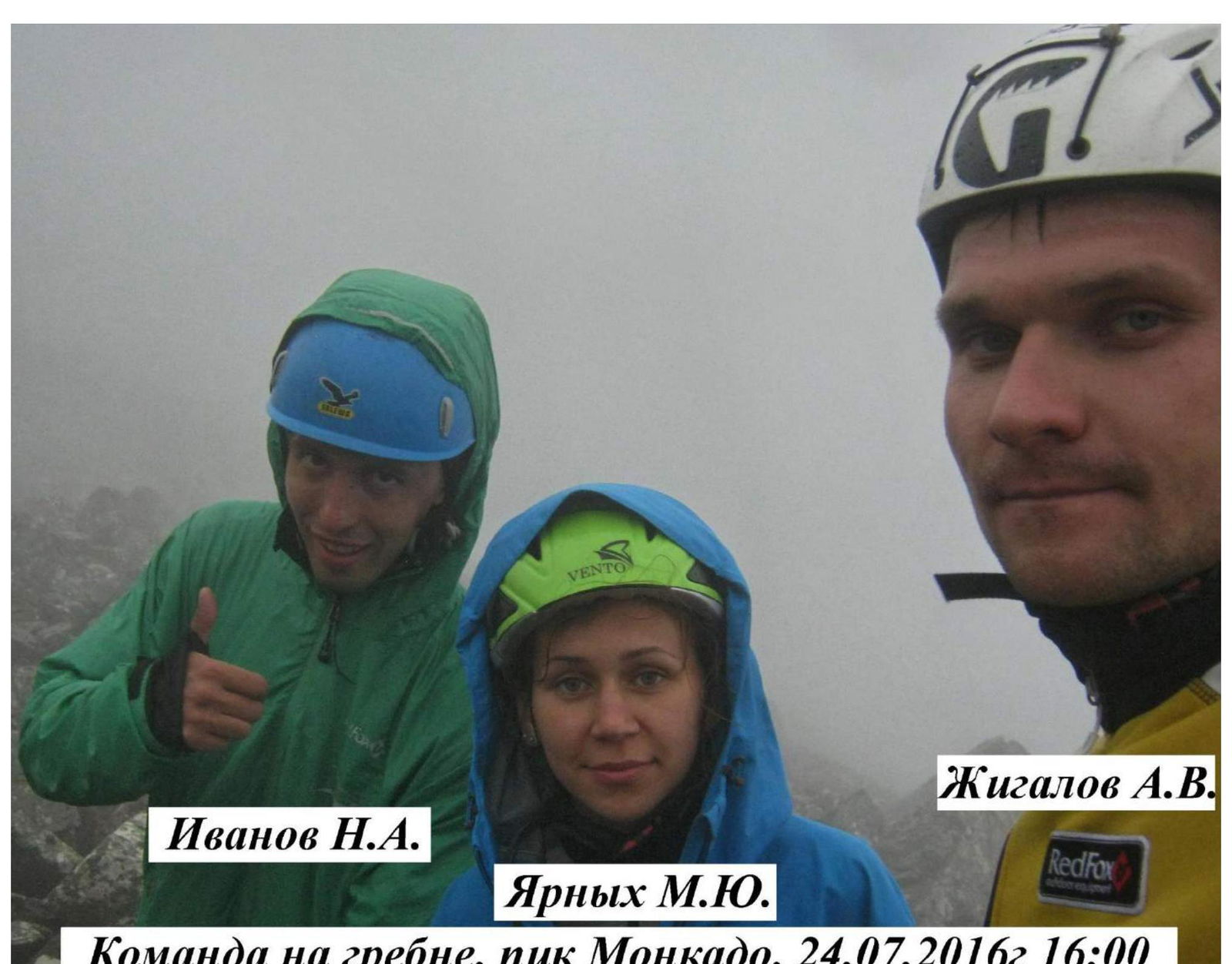
At 16:00, all team members reached the North ridge, on top of Monkado Peak.
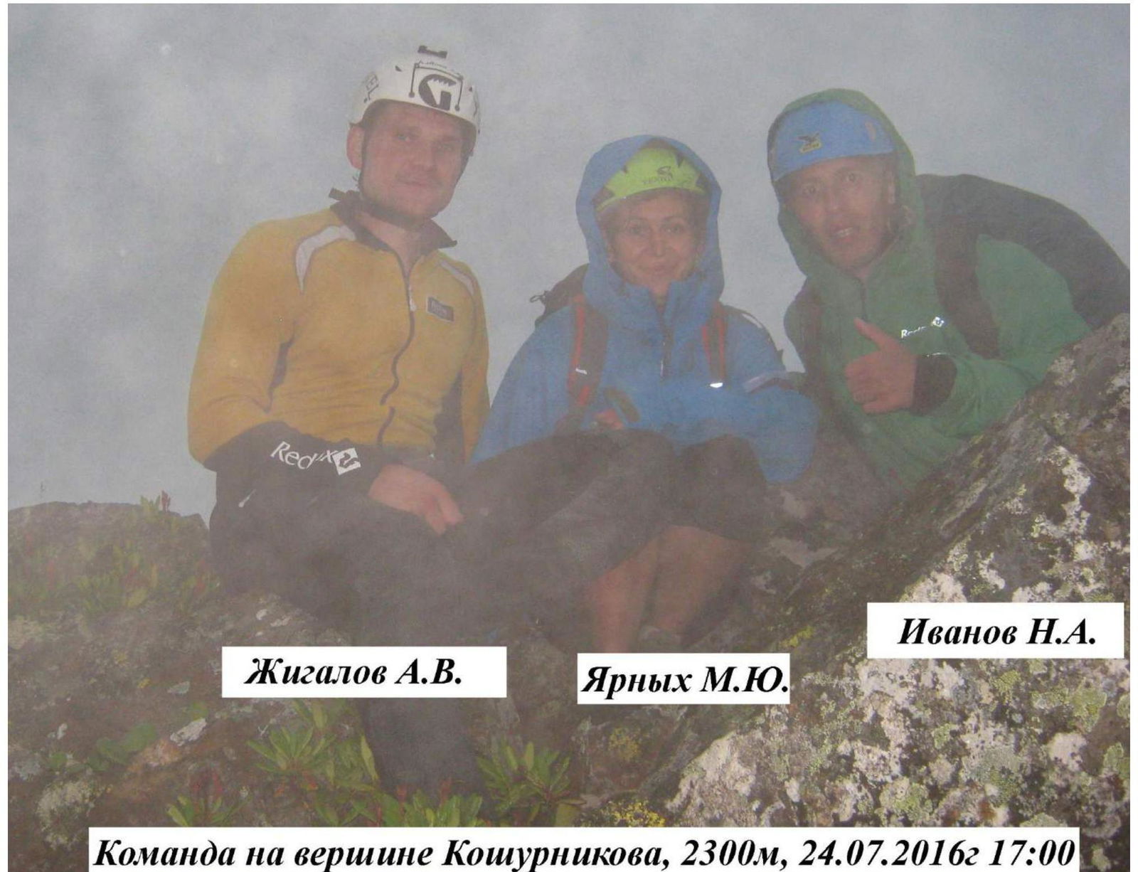
At 17:00, the team reached the summit of Koschurnikova Peak, took a few photos, and left a note in the control cairn.
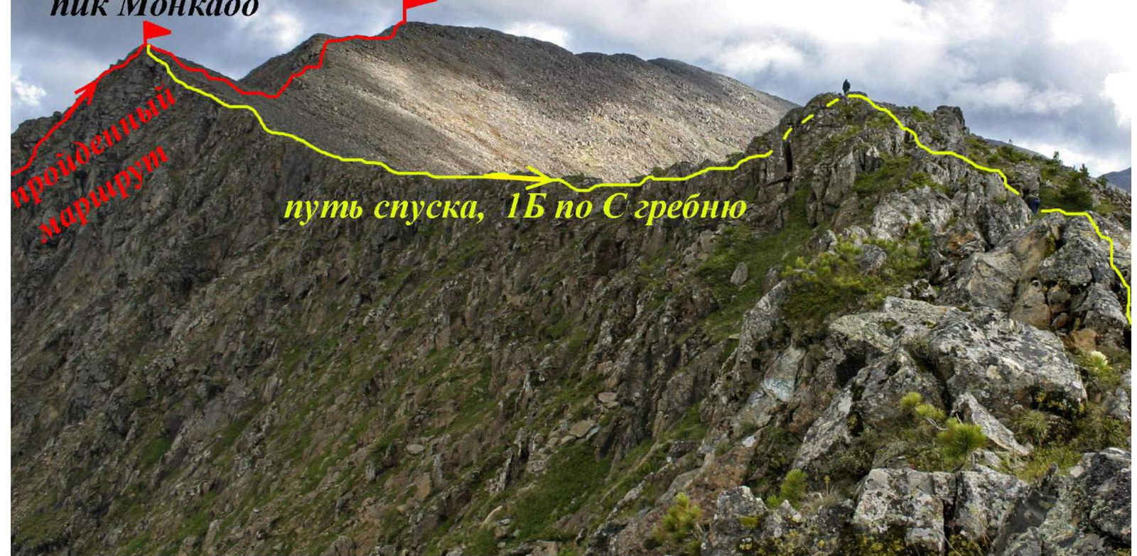
The descent to the Base Camp was via the North ridge and through a couloir, following the 1B route.
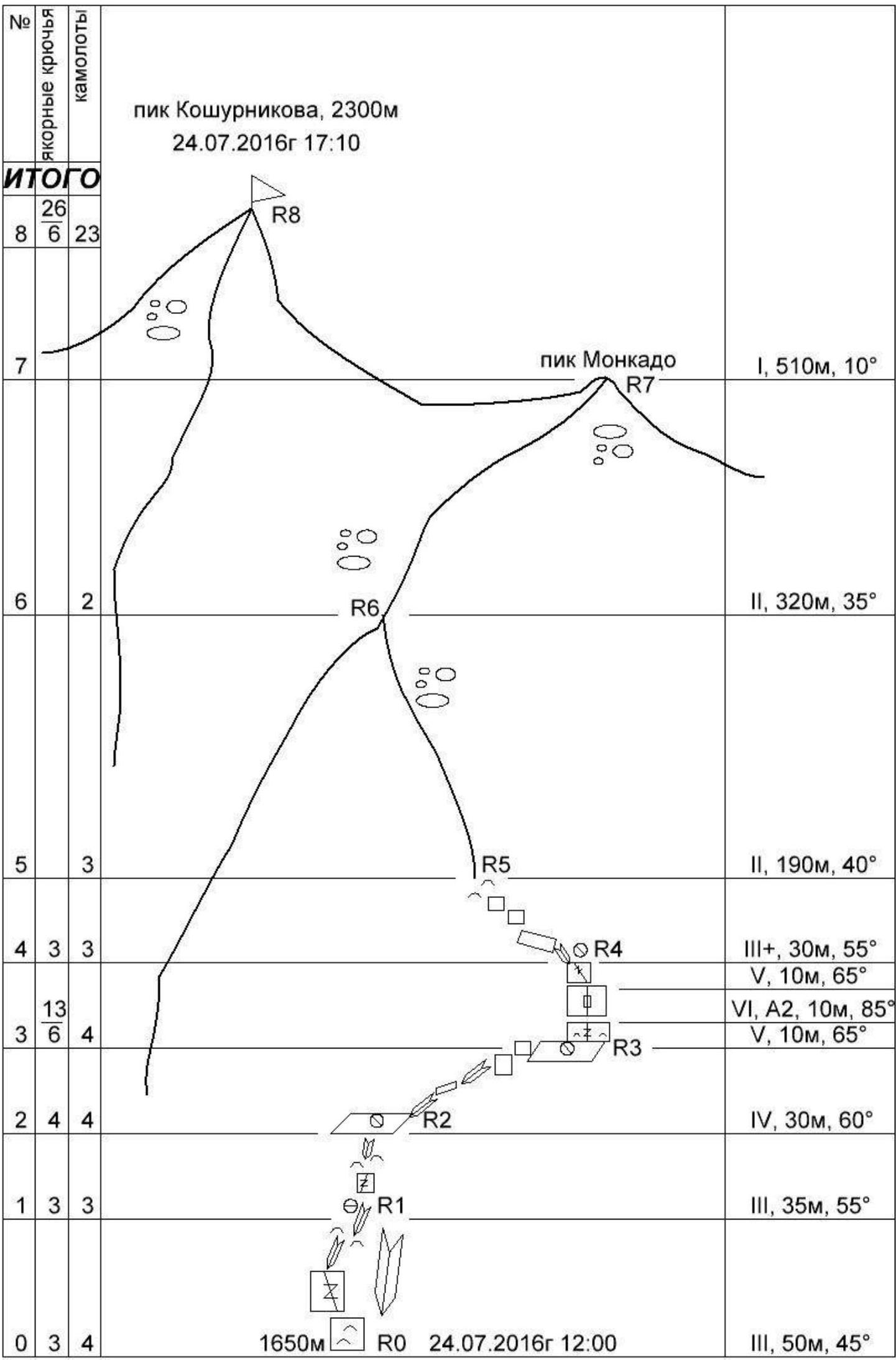
Route Data:
- Koschurnikova Peak, 2300 m
- Ascent Date: July 24, 2016, 17:10 (summit)
- Start of Ascent: July 24, 2016, 12:00
- Equipment Used:
- Anchor pitons: 26
- On belay stations: 6
- Camalots: 23
- Total Section Length (by scheme): 1650 m
Section Description:
- R0: III, 50 m, 45°
- R1: III, 35 m, 55°
- R2: IV, 30 m, 60°
- R3: III, 35 m, 55°
- R4:
- V, 10 m, 65°
- VI, A2, 10 m, 85°
- V, 10 m, 65°
- R5: III+, 30 m, 55°
- R6: II, 190 m, 40°
- R7: II, 320 m, 35°
- R8 (Monkado Peak): I, 510 m, 10°
Section-by-Section Description
Approach to the start of the route from the campsites and Lake Venice along the left bank of the stream. After passing a small waterfall, veer right. Climb up a large-block talus slope towards a steep wall, accessing a grassy ledge from the right via scree.
Section R0–R1, 50 m, 40°, III – start of the route to the left of a large internal corner – a water collector. Climb up a smooth, inclined wall with "sheep's foreheads," then move right through cracks – entering a not very pronounced internal corner, and exit onto grassy ledges through "sheep's foreheads." Convenient belay station on anchors and camalots.
Section R1–R2, 35 m, 55°, III – climb up a crack with simple climbing, through an internal corner, then alternate between walls and ledges with a slight gain to the right towards an inclined grassy ledge that veers right. Belay station on anchors and camalots.
Section R2–R3, 30 m, 60°, IV – follow a narrow ledge, partly formed by clods of earth and grass wedged in internal corners, about 20 meters to the right, then through gently sloping walls and ledges – exit below a black, overhanging wall. Not very convenient belay station on anchors.
Section R3–R4, 20 m, 65°, V; 10 m, 85°, VI – key section of the route.
- From the belay station, climb straight up the black wall, slightly veering right, via smooth rock with very poor relief.
- Along a thin crack.
- Then up the crack that cuts through a cornice, slightly left onto a belay station about 10 meters.
- Insurance – only anchor pitons; presence of rock features will facilitate passage of this section.
- On the overhang, a control cairn hangs – a plastic bottle on a cord with a note.
- Traverse through the overhang, then via cracks and fissures – enter a not very pronounced internal corner.
- Climb up the corner slightly left – exit onto an inclined ledge.
- Semi-hanging belay station on camalots and anchors.
Section R4–R5, 30 m, 55°, III+ – from the belay station, move left, bypassing the overhang via the corner. Then alternate between walls and ledges. Reach a large boulder. View opens up to the counterfort with Pelekhov E.'s route – 2A cat. diff. Belay station on the boulder.
Section R5–R6, 190 m, 40°, II – from the boulder, climb up, veering left towards the counterfort. Bypass large blocks and talus slopes. Plenty of varied relief for insurance. Alternating movement, sometimes can move simultaneously, with frequent insurance. About 4 ropes. Exit onto the counterfort leading to Monkado Peak.
Section R6–R7, 320 m, 35°, II – move up the counterfort towards the ridge. Occasional walls with chimneys and cracks. All passable with ease. In bad weather, like during the first ascent, pay special attention to insurance. Additionally, the counterfort is in shade, making all relief – grassy clods and earth – very wet. Alternating movement, plenty of relief for any insurance points. On horizontal sharp ridges – insurance on relief features. High risk of swinging off the ridge with a large pendulum. Through a steep talus couloir – exit onto Monkado Peak. There's a cairn here.
Section R7–R8, 510 m, 10°, I – from Monkado Peak, follow the ridge, up a large-block talus slope, towards the summit.
Descent in the opposite direction – via the North ridge, following the classic 1B cat. diff. route.
Koschurnikova Peak, 2300 m
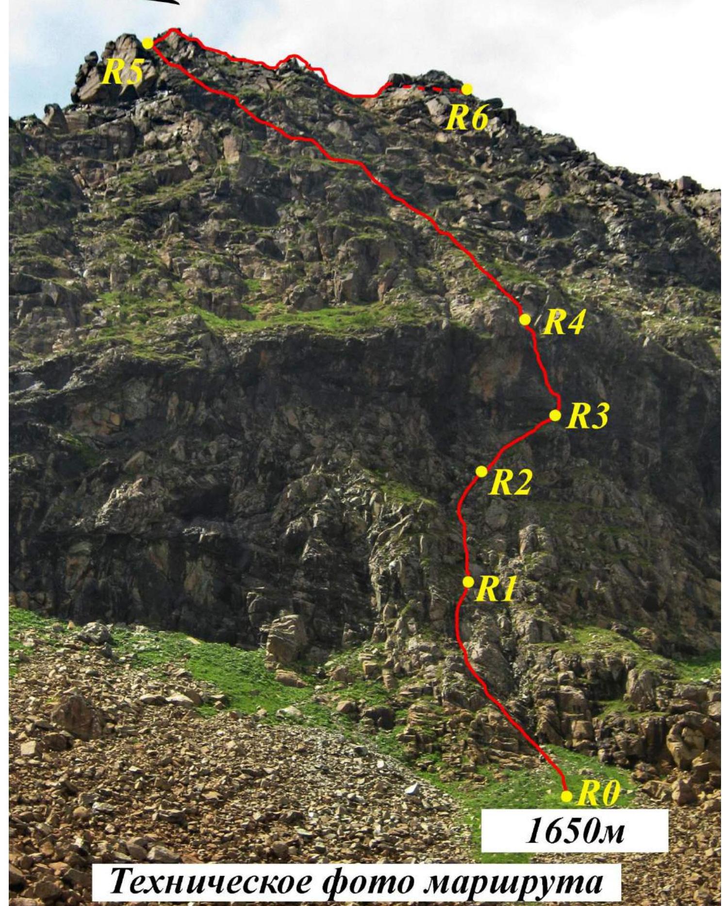 Technical photo of the route
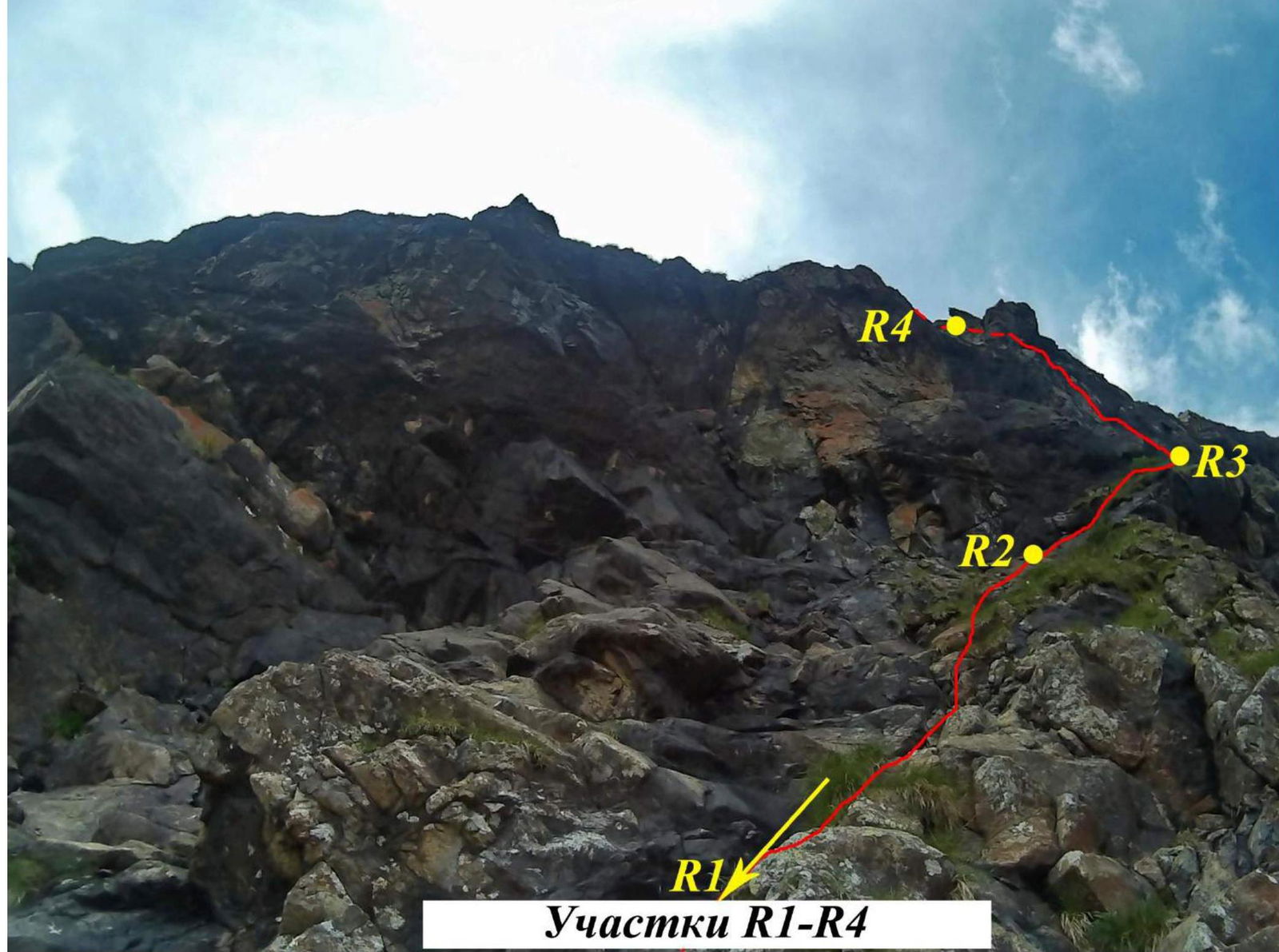
Sections R1–R4
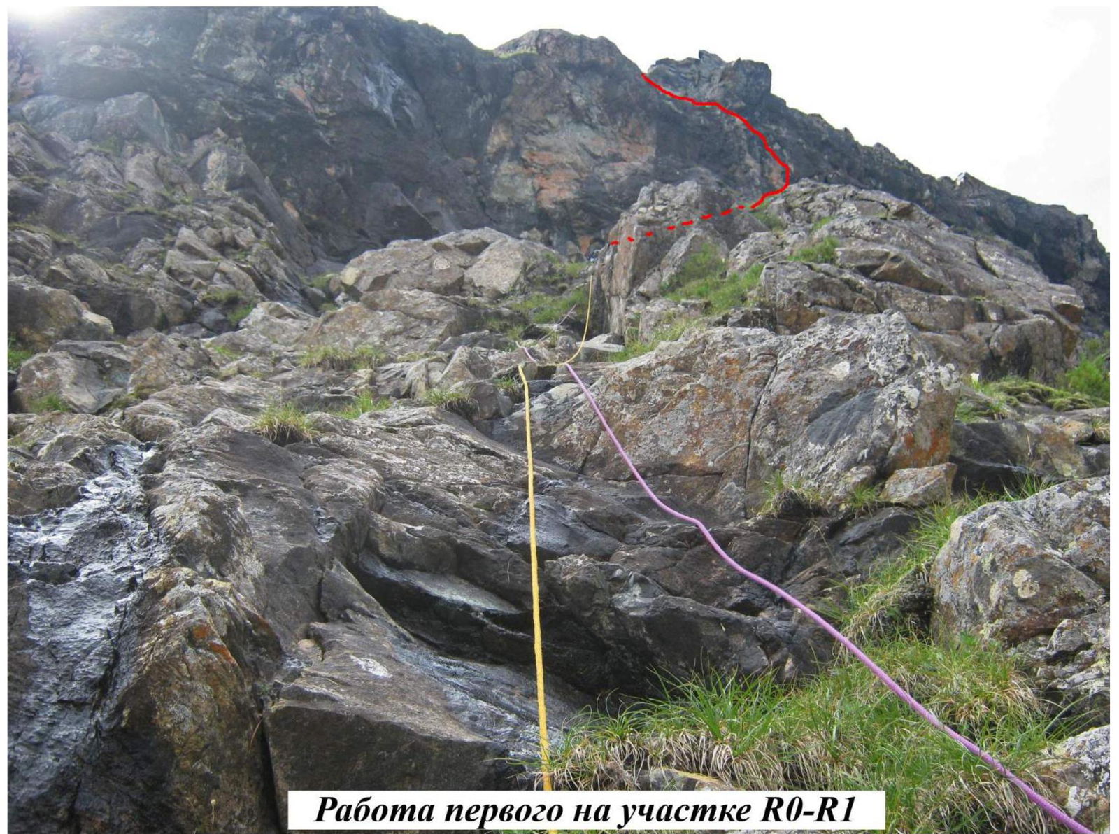 First climber on section R0–R1
 Third climber on section R0–R1 on fixed ropes
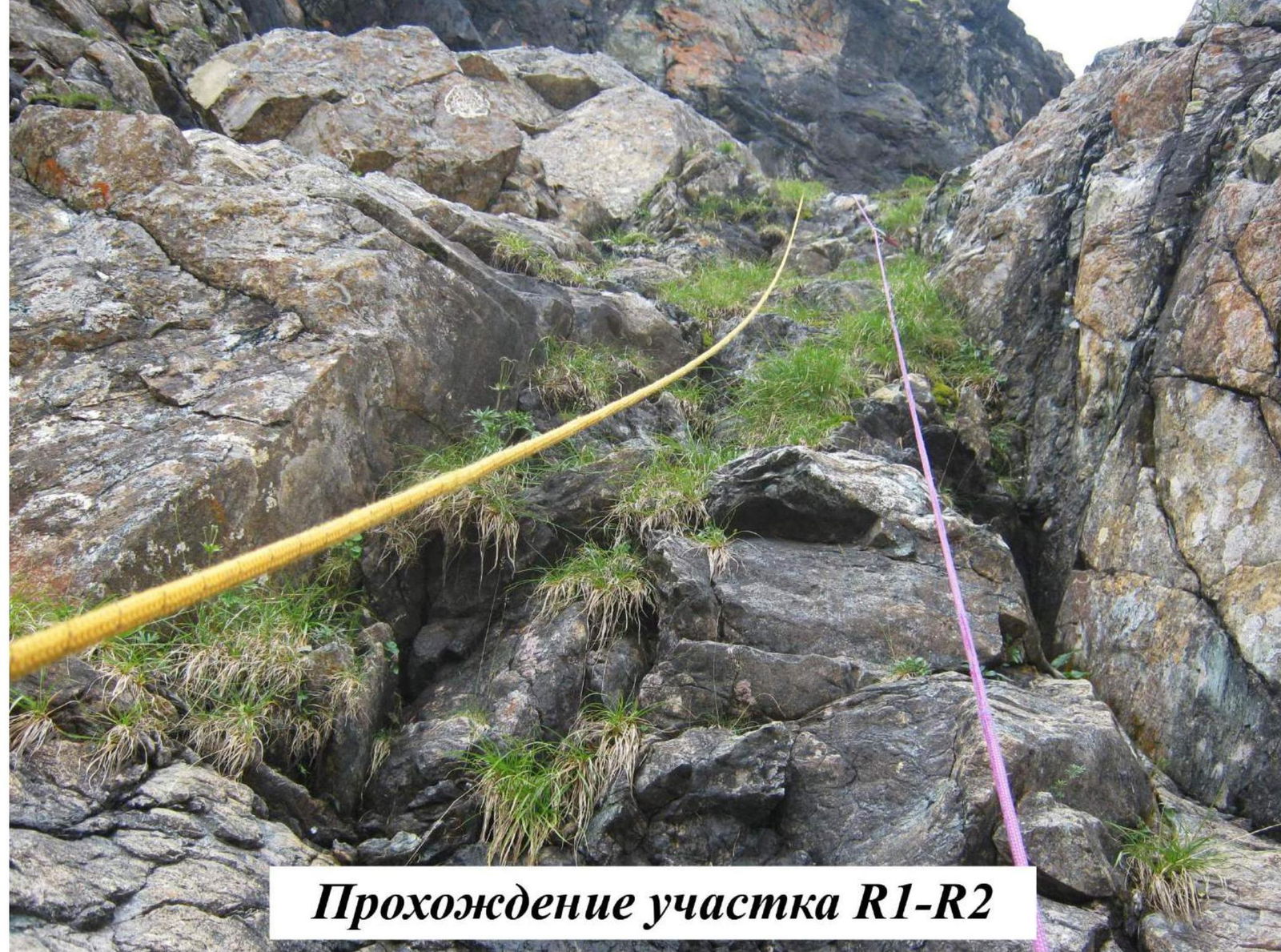 Climbing section R1–R2
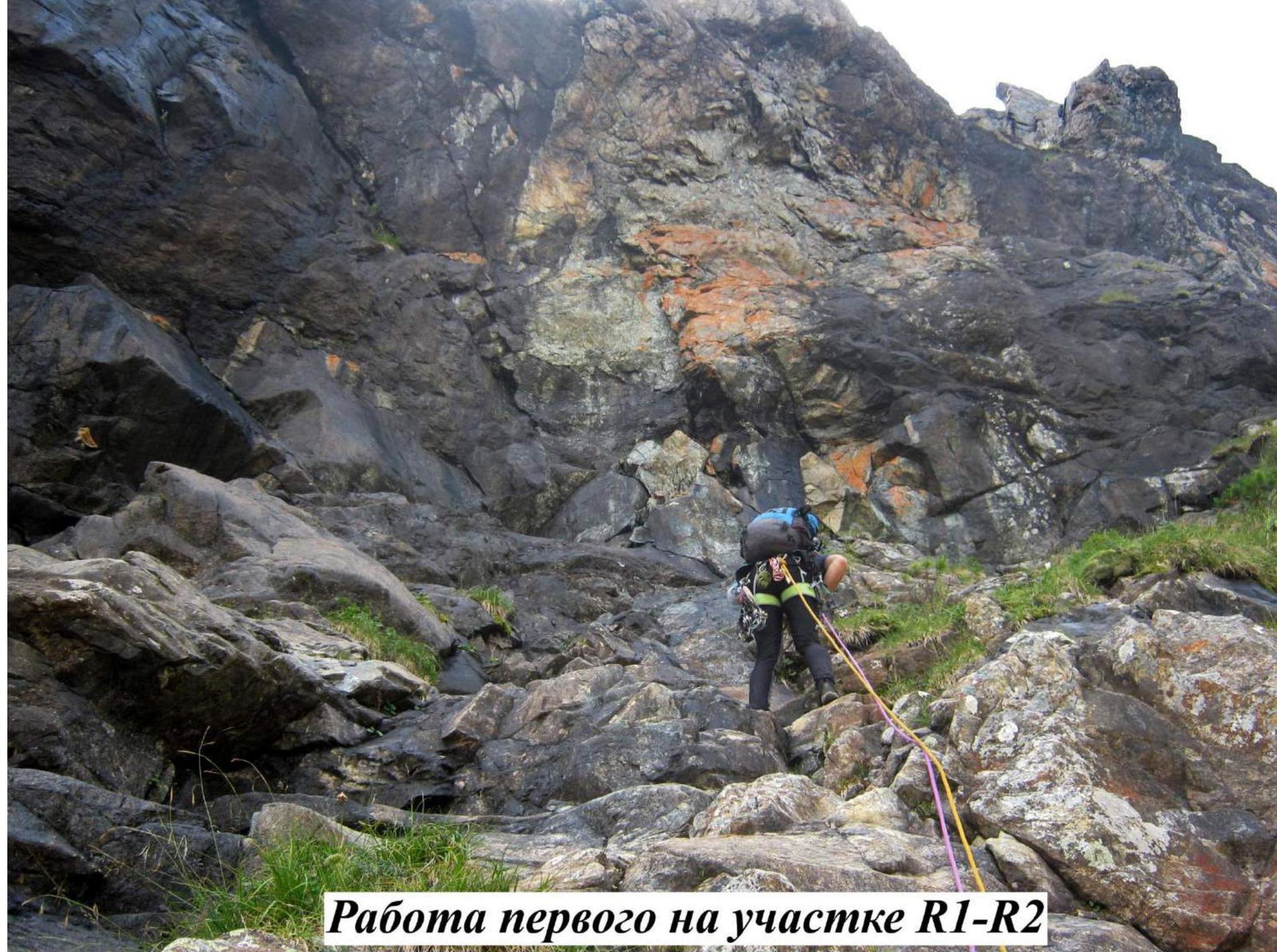 First climber on section R1–R2
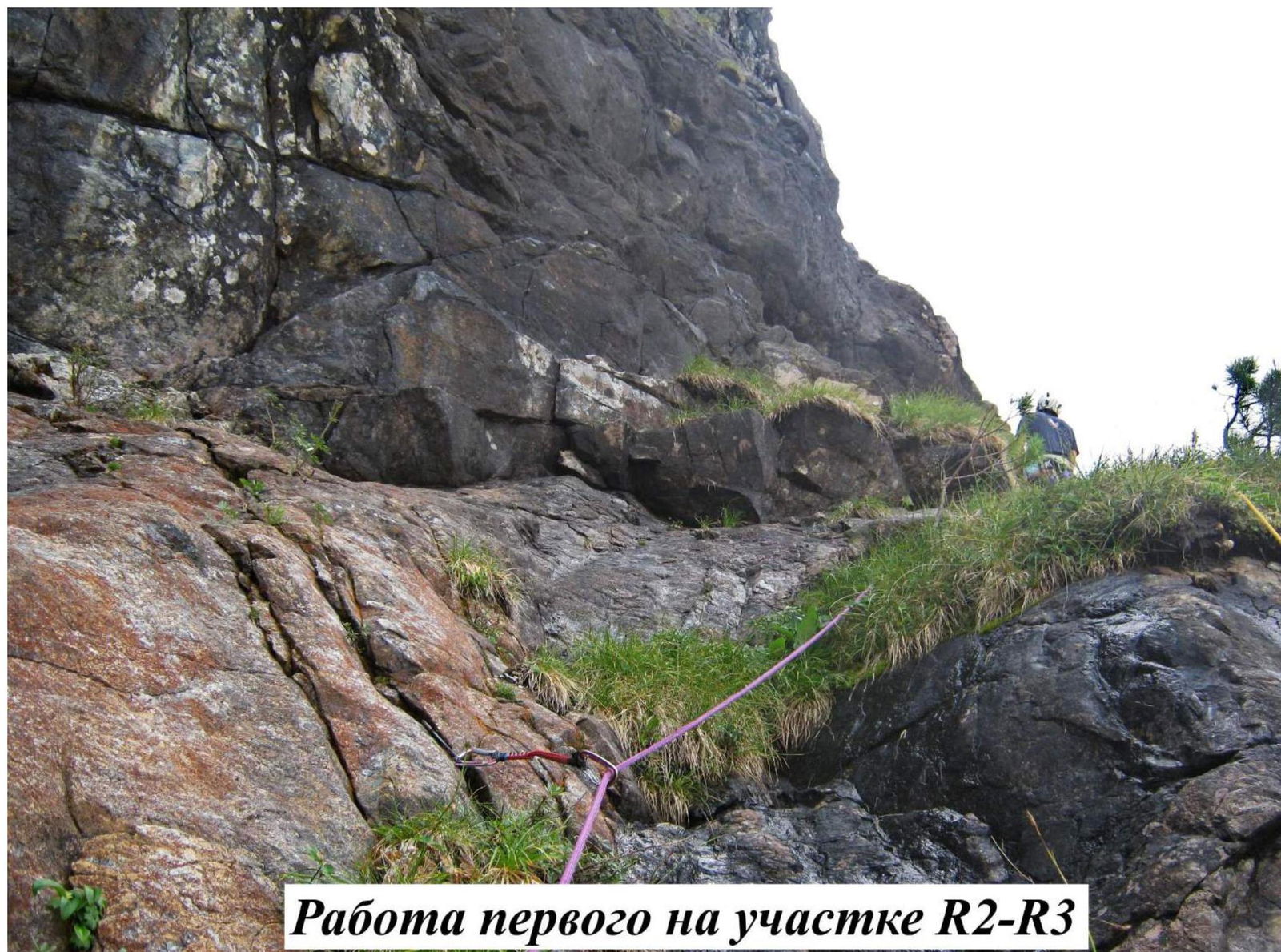 First climber on section R2–R3
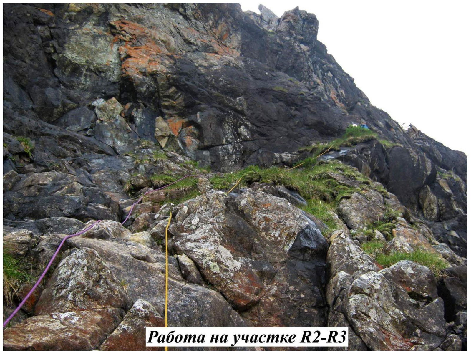 Climbing on section R2–R3
 Lower part of section R3–R4
Climbing the Key Section R3–R4 on Belay Stations
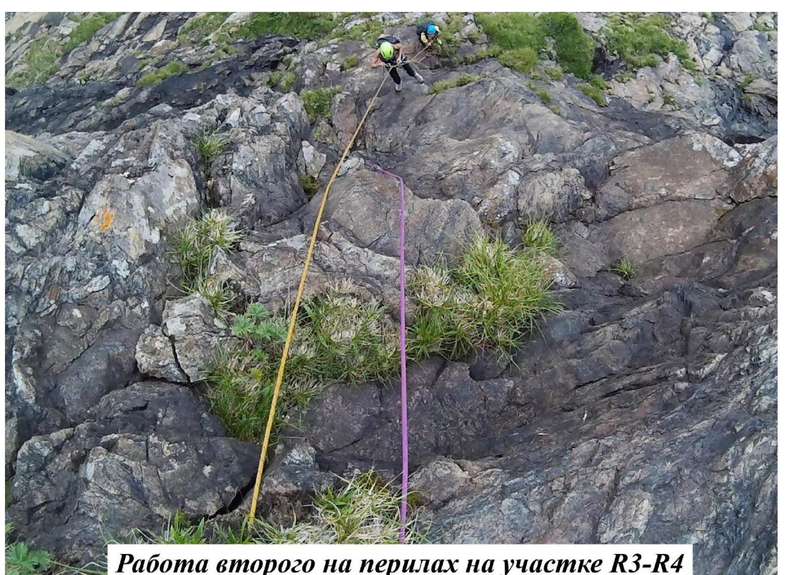 Second climber on fixed ropes on section R3–R4
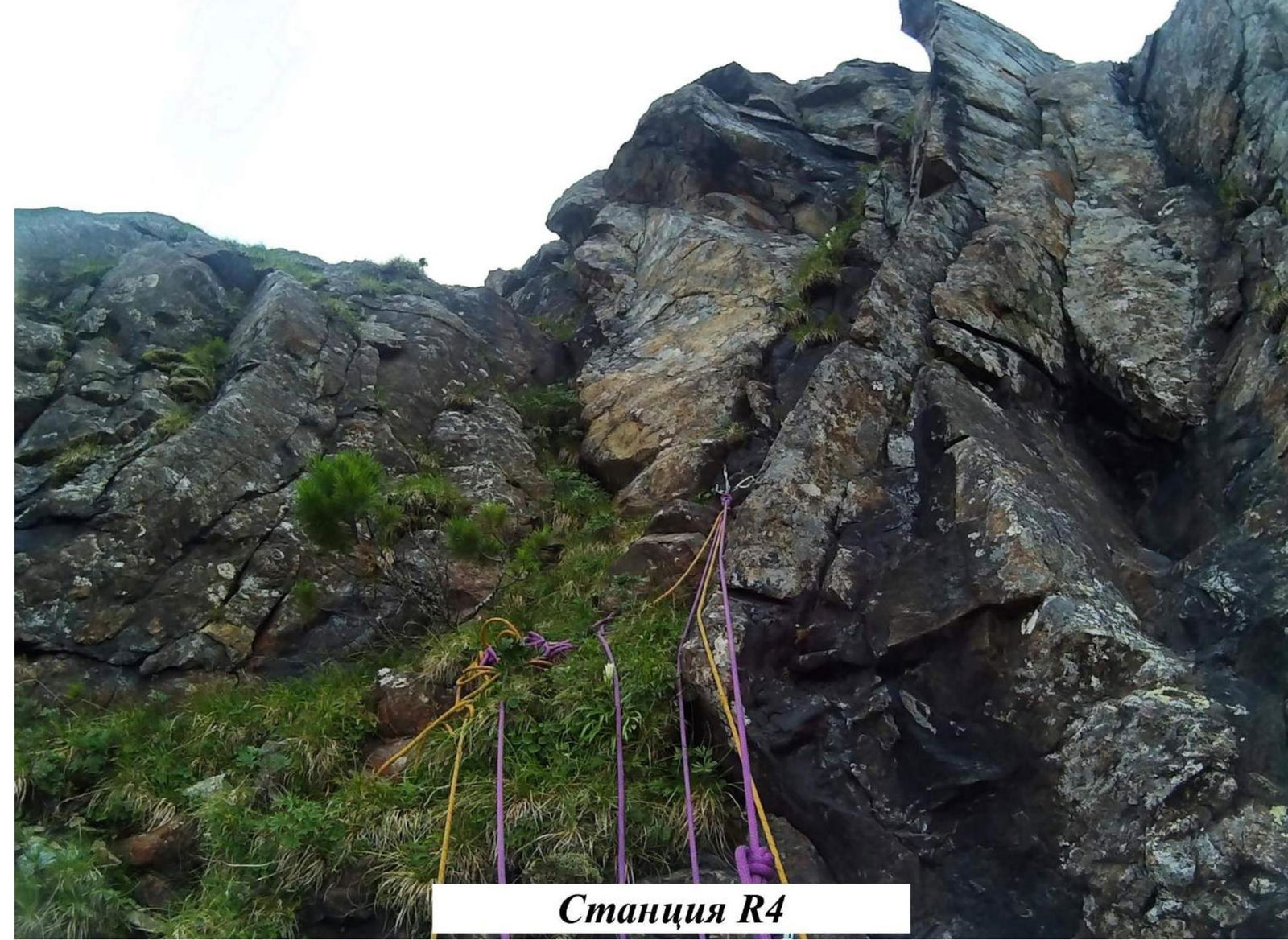 Belay station R4
 Belay station R4 from above
 Climbing on section R5–R6
 Section R5–R6 before exiting onto the counterfort
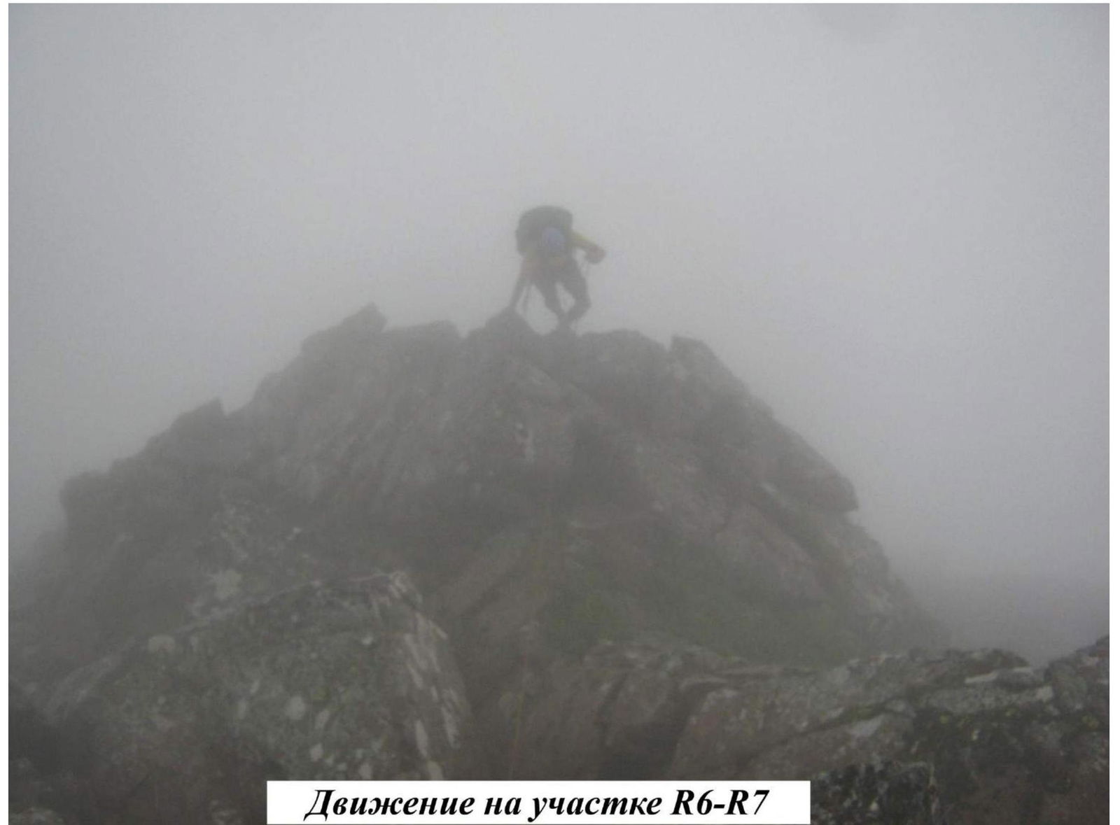
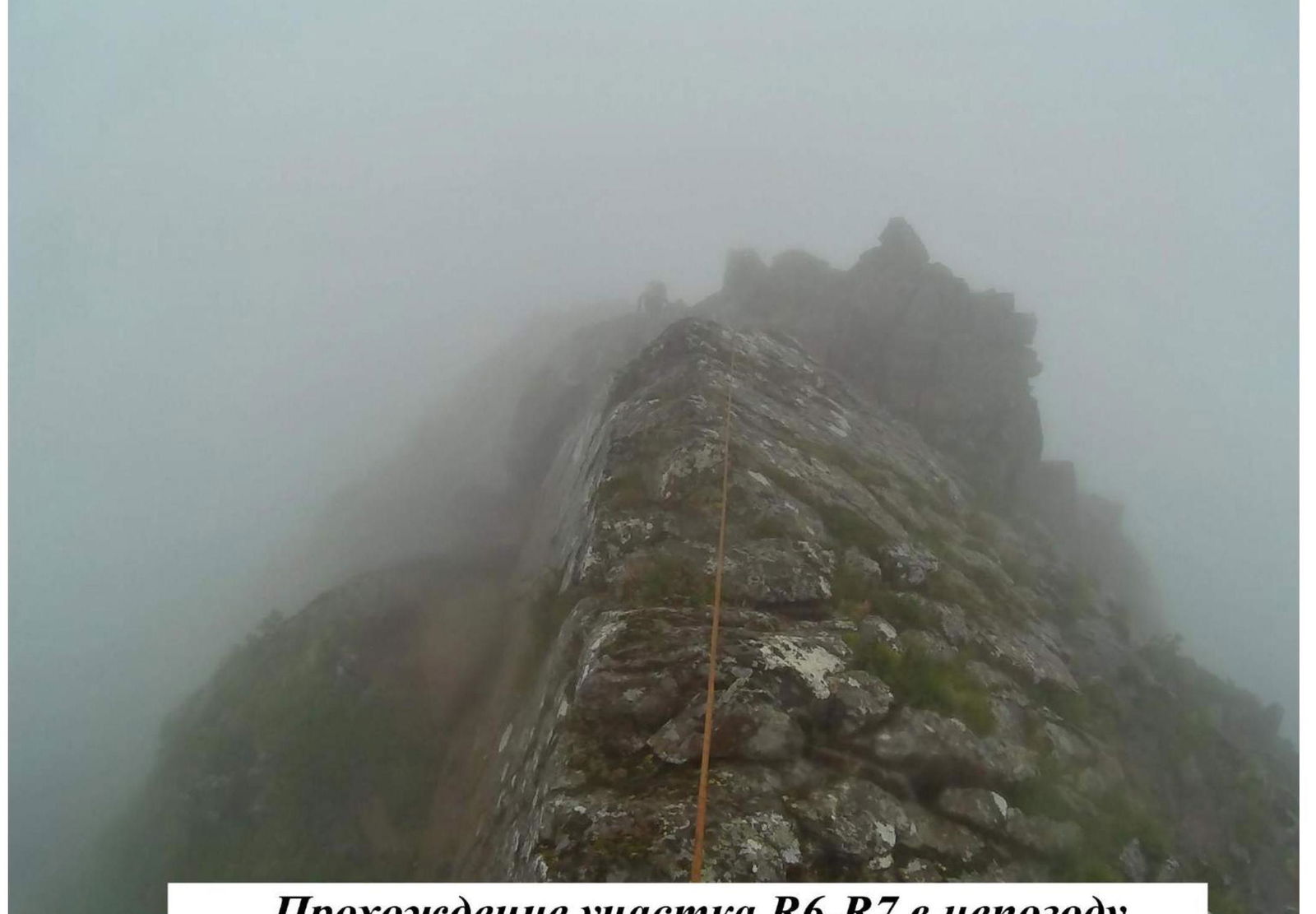 Climbing section R6–R7 in bad weather
 Climbing on section R6–R7
Team Photos
Zhigalov A.V.
Ivanov N.A.
Yarnykh M.Yu.
Team on the ridge, Monkado Peak, July 24, 2016, 16:00.
Monkado Peak
Koschurnikova Peak, 2300 m
 Descent route, 1B via North ridge.
Team on the summit of Koschurnikova, 2300 m
Ivanov N.A., Zhigalov A.V., Yarnykh M.Yu. July 24, 2016, 17:00.