Report
On the ascent to the summit of Pik Zvezdny 2265 m via the western wall, Balezin's route, 5B category of complexity, by the team of the Krasnoyarsk Alpine Club on July 25, 2024.
I. Ascent Passport
| 1. General Information | ||
|---|---|---|
| 1.1 | Full Name, Sports Rank of the Leader | Fedosenko Alexey Sergeevich — CMS |
| 1.2 | Full Name, Sports Rank of Participants | Taskin Andrey Sergeevich — 1st sports rank |
| 1.3 | Full Name of Coach | Gunko Vladimir Sergeevich |
| 1.4 | Organization | Krasnoyarsk Alpine Club |
| 2. Characteristics of the Ascent Object | ||
| 2.1 | Region | Sayans |
| 2.2 | Valley | Western Sayan, Ergaki Ridge |
| 2.3 | Number of Section according to the 2013 Classification Table | 6.2 |
| 2.4 | Name and Height of the Summit | Pik Zvezdny – 2265 m |
| 2.5 | Geographical Coordinates of the Summit | 52.83080° N, 93.41412° E |
| 3. Characteristics of the Route | ||
| 3.1 | Name of the Route | Via the western wall |
| 3.2 | Proposed Category of Complexity | 5B |
| 3.3 | Degree of Route Development | Developed |
| 3.4 | Nature of the Route Terrain | Rock |
| 3.5 | Height Difference of the Route | 400 m |
| 3.6 | Length of the Route | 505 m |
| 3.7 | Technical Elements of the Route (total length of sections of varying complexity with indication of terrain character (ice-snow, rock)) | V cat. sl. Rock – 180 m. VI cat. sl. Rock – 250 m. |
| 3.8 | Average Steepness of the Route, (°) | 67° |
| 3.9 | Average Steepness of the Main Part of the Route, (°) | 82° |
| 3.10 | Descent from the Summit | Descent via the "SW Kantu" route, 5A cat. sl. |
| 3.11 | Additional Characteristics of the Route | Initially, the route is overgrown, dirty, and wet after rains |
| 4. Characteristics of the Team's Actions | ||
| :--: | :--: | :--: |
| 4.1 | Time of Movement (team's working hours, indicated in hours and days) | 11 h, 1 day |
| 4.2 | Overnight Stays | No |
| 4.3 | Time of Route Preparation | No |
| 4.4 | Start on the Route — Beginning of Work on the Route | 6:00 July 25, 2024, 7:30 July 25, 2024 |
| 4.5 | Arrival at the Summit | 18:40 July 25, 2024 |
| 4.6 | Return to the Base Camp | 20:30 July 25, 2024 |
| 5. Characteristics of Weather Conditions | ||
| 5.1 | Temperature, °C | +15–25 |
| 5.2 | Wind Speed, m/s | 0–5 m/s |
| 5.3 | Precipitation | No |
| 5.4 | Visibility, m | Full |
| 6. Responsible for the Report | ||
| 6.1 | Full Name, e-mail | Taskin Andrey Sergeevich, and0000@inbox.ru |
1. Characteristics of the Ascent Object
1.1. General Photo of the Summit
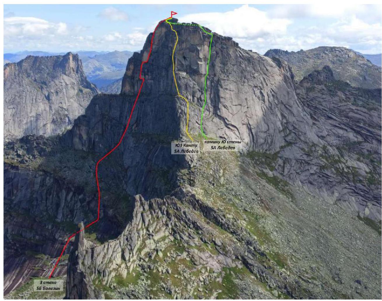
Taken from Pik Ptitsa on July 24, 2022.
1.2. Photo of the Route Profile
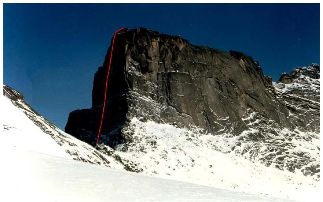
Profile of the right wall section of the route. Photo from the route passport.
1.3. Drawn Profile of the Route

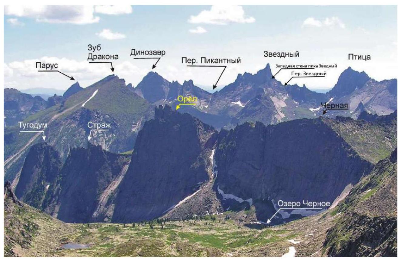
1.4. Photopanorama of the Area
1.5. Map of the Area, Schematic Diagram of the Ascent Object.

2. Characteristics of the Route
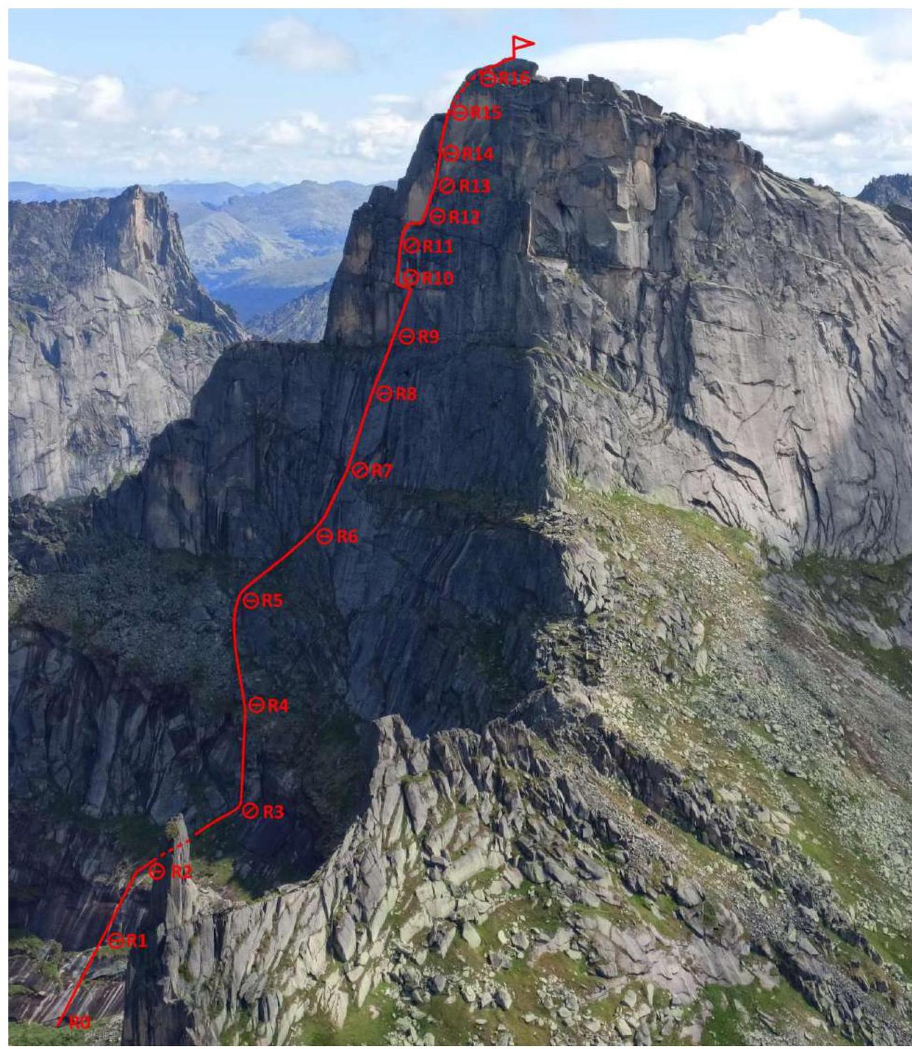
2.1. Technical Photograph of the Route
2.2. Scheme of the Route in UIAA Symbols
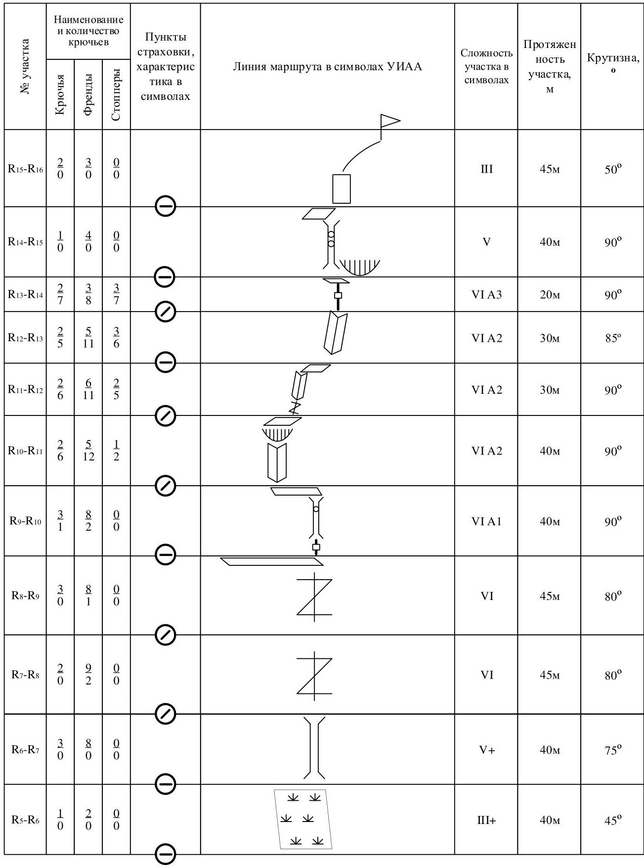

| Section No. | Pitons | Friends | Stoppers | Belay Stations, Characteristics in Symbols | Route Line in UIAA Symbols | Complexity of Section in Symbols | Length of Section, m | Steepness, ° |
|---|---|---|---|---|---|---|---|---|
| R15–R16 | 0 | 0 | 0 | III | 45 m | 50° | ||
| R14–R15 | 14 | 0 | 0 | V | 40 m | 90° | ||
| R13–R14 | 2 | 7 | 3 | VI A3 | 20 m | 90° | ||
| R12–R13 | 2 | 5 | 3 | VI A2 | 30 m | 85° | ||
| R11–R12 | 2 | 6 | 5 | VI A2 | 30 m | 90° | ||
| R10–R11 | 2 | 6 | 3 | VI A2 | 40 m | 90° | ||
| R9–R10 | 1 | 8 | 2 | VI A1 | 40 m | 90° | ||
| R8–R9 | 3 | 8 | 0 | VI | 45 m | 80° | ||
| R7–R8 | 2 | 2 | 0 | VI | 45 m | 80° | ||
| R6–R7 | 9 | 2 | 0 | V+ | 40 m | 75° | ||
| R5–R6 | 1 | 2 | 0 | III+ | 40 m | 45° | ||
| R4–R5 | 0 | 2 | 0 | III+ | 40 m | 45° | ||
| R3–R4 | 6 | 2 | 0 | V- | 40 m | 60° | ||
| R2–R3 | 4 | 3 | 0 | V | 50 m | 65° | ||
| R1–R2 | 5 | 1 | 0 | III+ | 50 m | 45° | ||
| R0–R1 | 4 | 0 | 0 | IV | 50 m | 45° |
3. Characteristics of the Team's Actions
We departed from the base camp at Lake Svetloe on July 24, 2024, at 16:00. At 18:00, we set up a storm camp in the valley between Pik Ptitsa and Pik Zvezdny. This location is convenient for setting up a camp, with water (streams) and flat areas available.
We left the storm camp at 6:00, and it took 30 minutes to ascend to the Zvezdny Pass, and another 50 minutes to approach the start of the route.
For the ascent, we used two 60-meter ropes: a dynamic and a static one, two sets of friends, 12 anchor pitons, a set of stoppers, and equipment for climbing with ITO.
We used alternating belays. Mostly free climbing was used up to station R10 and after R14, while ITO was used on sections R10–R14. The leader climbed with two ropes — a dynamic one for belaying and a static one for organizing fixed ropes. On long sections, the fixed ropes were divided. At station R10, there was a change of leader.
We reached station R10 at 12:30 and the summit at 18:30. We began our descent from the summit at 19:20 via the 5A "SW Kantu" route. We returned to the storm camp at 21:00, packed up the camp, and departed for the base camp at 23:00, arriving at 00:30.
3.1. Brief Description of the Route Passage.
| Section No. | Description | Photo No. |
|---|---|---|
| R0–R2 | Section traversed by free climbing. Belay points mainly friends. | |
| R2–R3 | Internal corner with smoothed rocks like "sheep's foreheads." Belay — anchors, anchors with bends, friends. Section traversed by free climbing. | |
| R3–R4 | Smoothed monolithic "sheep's foreheads." Belay points mainly friends. Section traversed by free climbing. | |
| R4–R5–R6 | Series of grassy ledges and gentle rocks with a steepness of 45–50°. We traversed the right part. Climbing is easy, simultaneous belay. | Photo 1 |
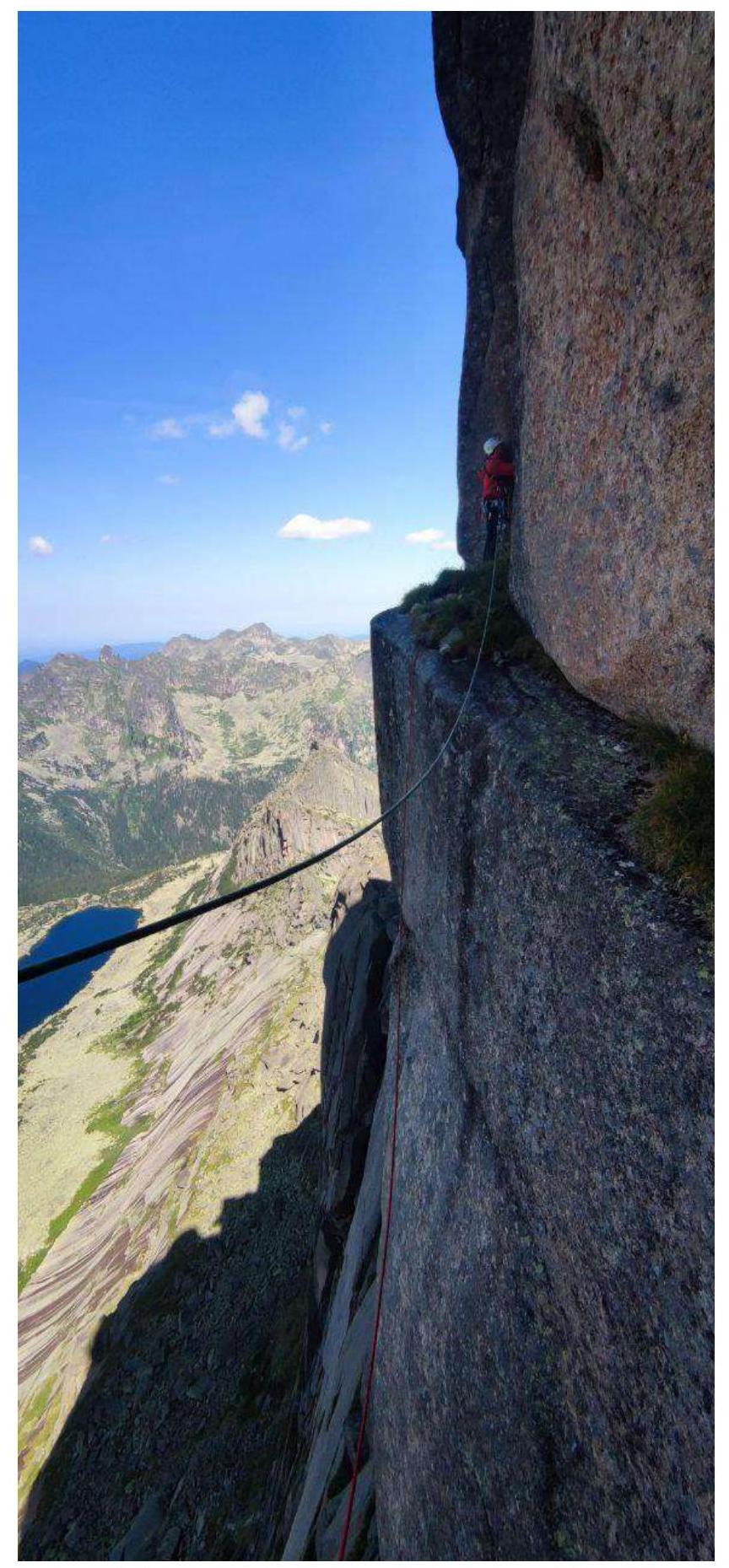
| R6–R7 | Large internal corner. Inside which there is a chimney that gradually turns into a crack about 10–15 cm wide. Climbing is difficult. For belaying, we mainly used friends. | Photo 2 |
| R7–R8 | Vertical crack 10–20 cm wide, poor relief. Climbing is difficult. | Photo 3 |
| R8–R9 | Continuation of the wide crack, climbing is difficult, exit to a ledge. | Photo 4 |
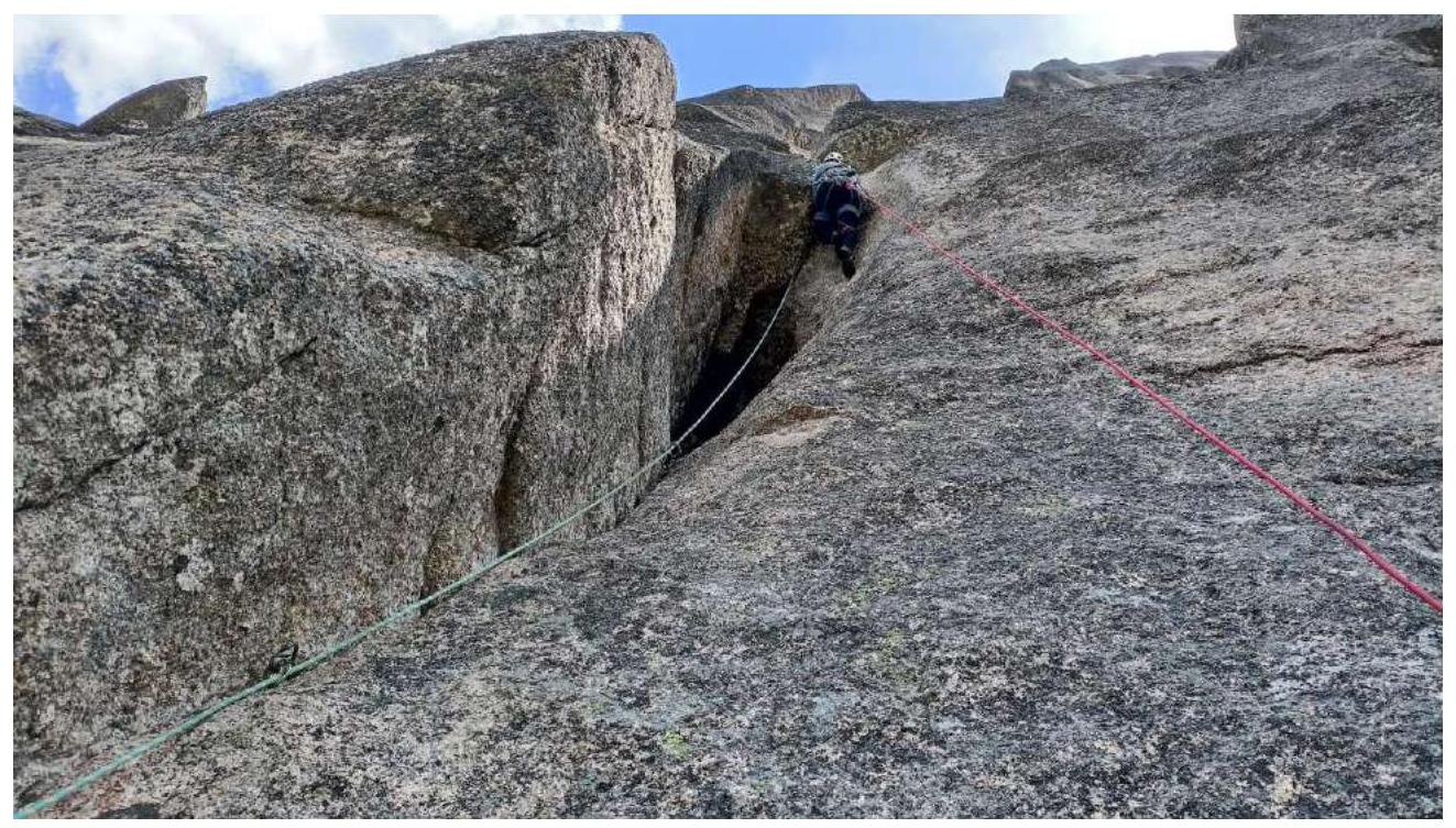
| R9–R10 | Overhanging crack about 8 m, turning into a chimney in the upper part, followed by a small 2-meter cornice, then a traverse to the right and up, exit to a ledge. Very difficult climbing. | Photo 5 |
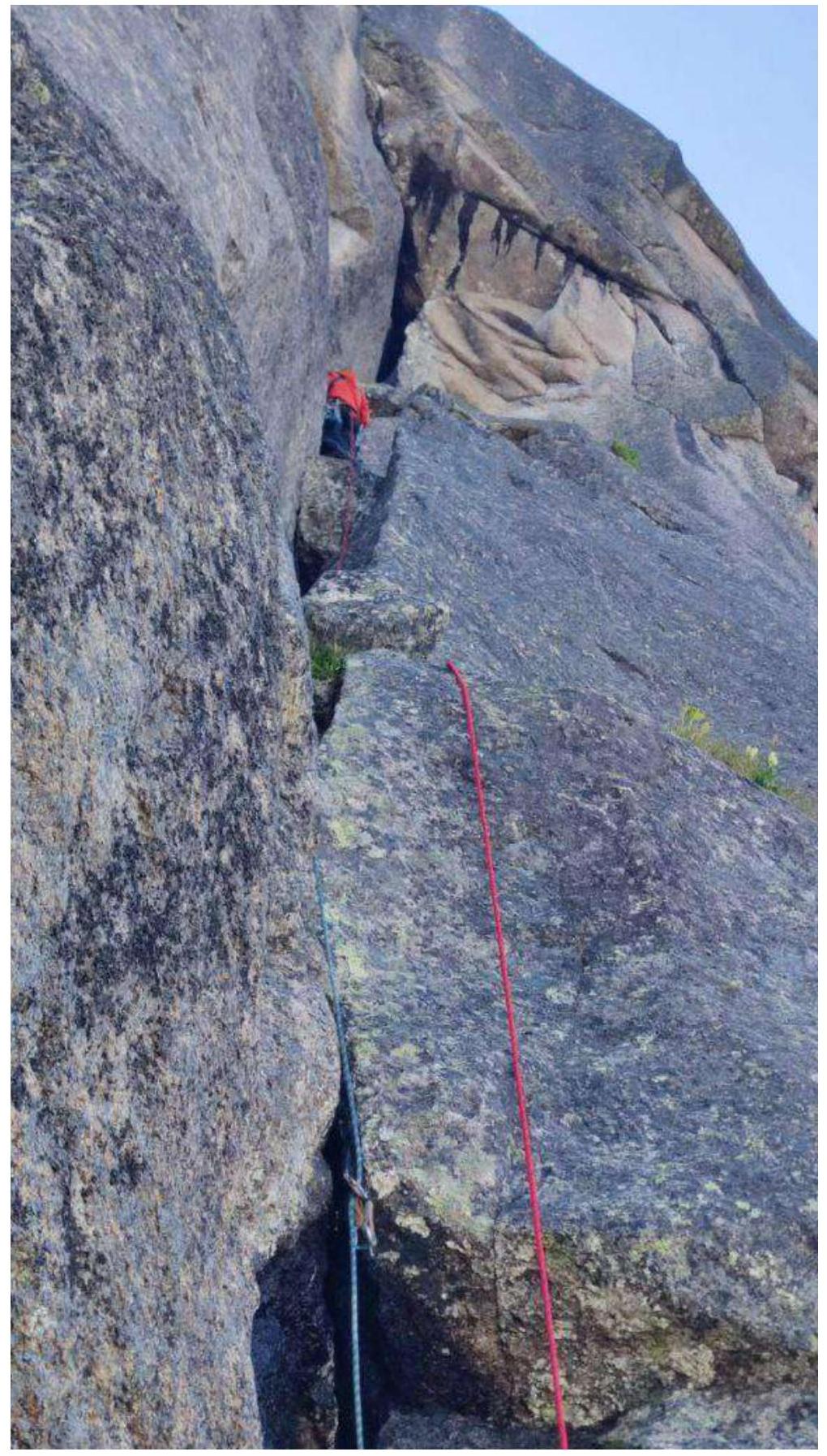
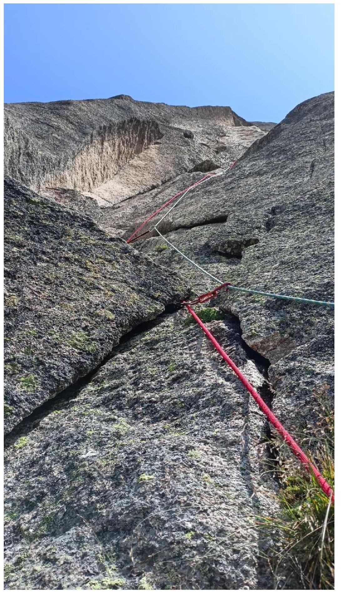
| R10–R11 | Along the ledge, traverse left about 10 m, then along an overhanging internal corner under a two-meter cornice, then along a crack to a small ledge. The upper part of the section is traversed using ITO. | Photo 6, 7 |
| R11–R12 | Series of inclined corners and cracks from left to right. Exit to a ledge under a large internal corner. | Photo 8 |
| R12–R13 | Large monolithic internal corner with a crack, at the beginning of the corner — a cornice. Part of the section is traversed using ITO. | Photo 9 |
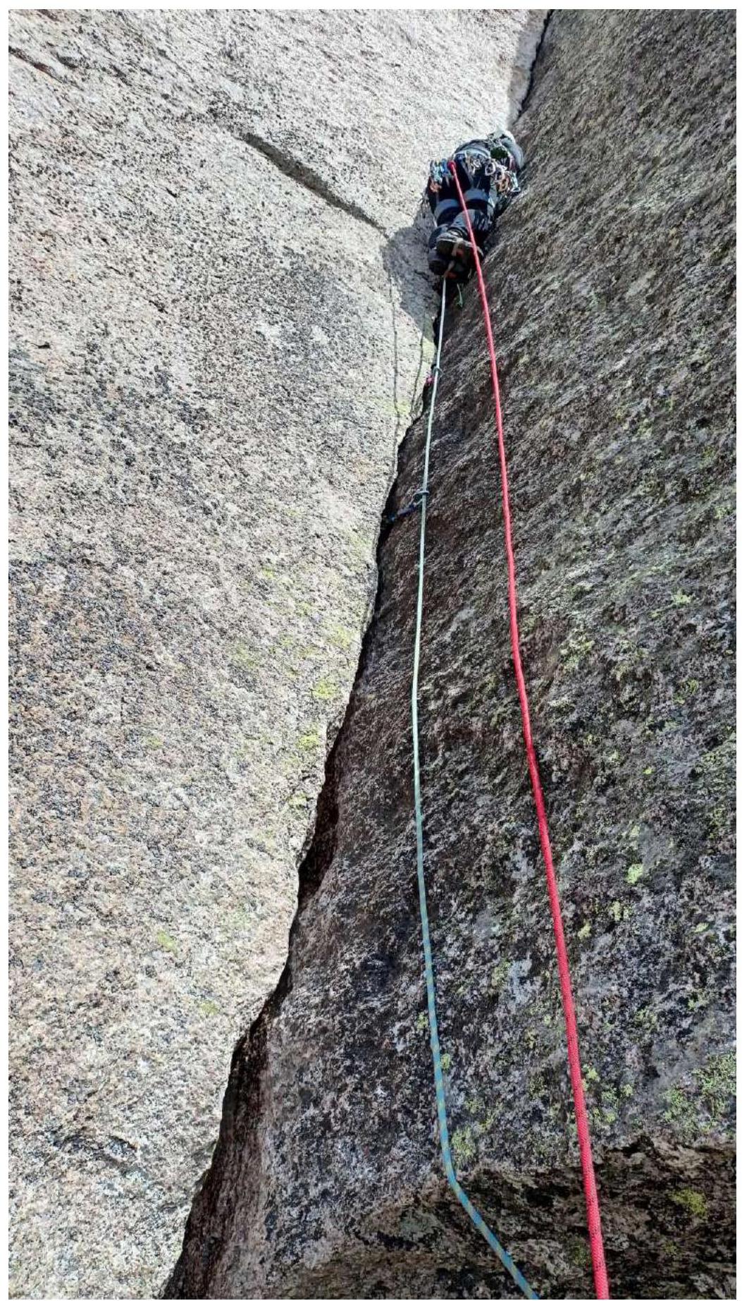
| R13–R14 | Vertical crack leading under the left part of a huge cornice. The cornice is bypassed on the left. Section traversed using ITO. Exit to a ledge before a chimney. | Photo 10 |
| R14–R15 | Wide, comfortable vertical chimney. There are plugs at the bottom of the chimney. Exit to a ledge. | |
| R15–R16 | Small wall with a crack, leading to the pre-summit ridge. Along the ridge, about 30 m to the summit. |
Photo 1. Section R5–R6

Simultaneous belay on an easy section.
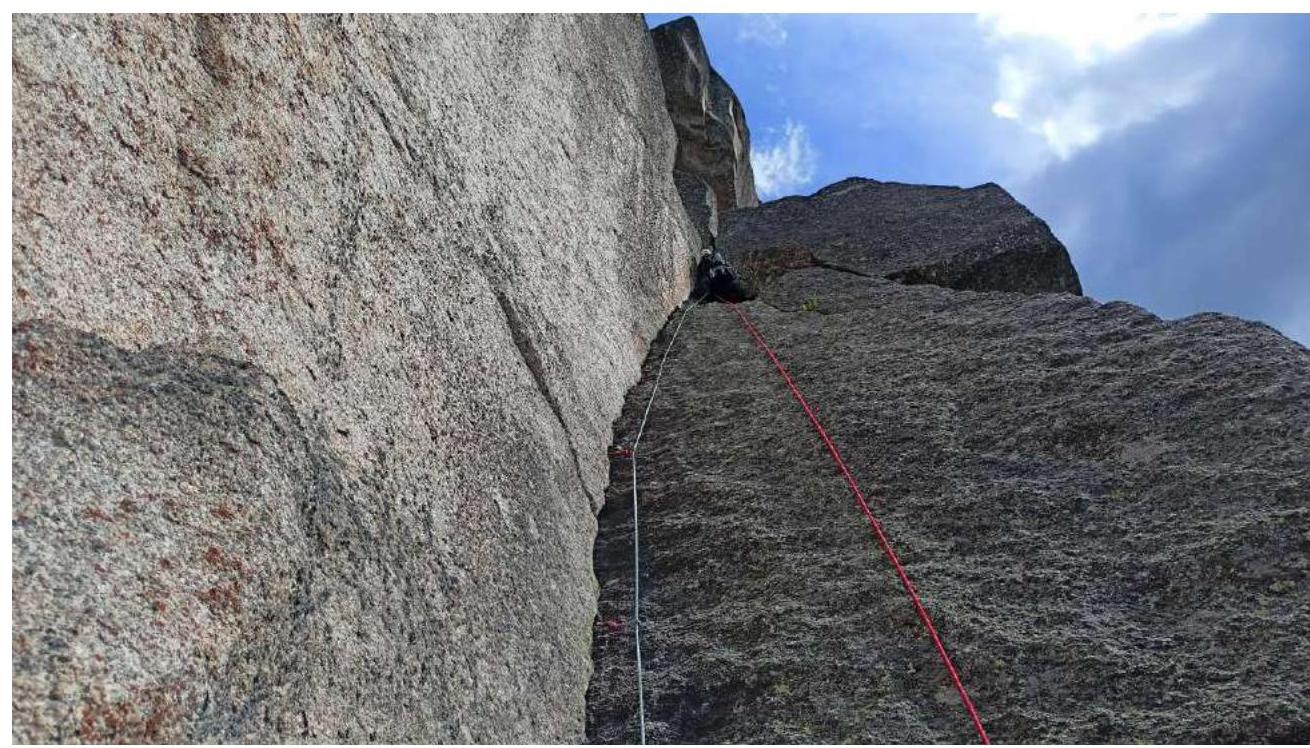
Photo 2. Section R6–R7
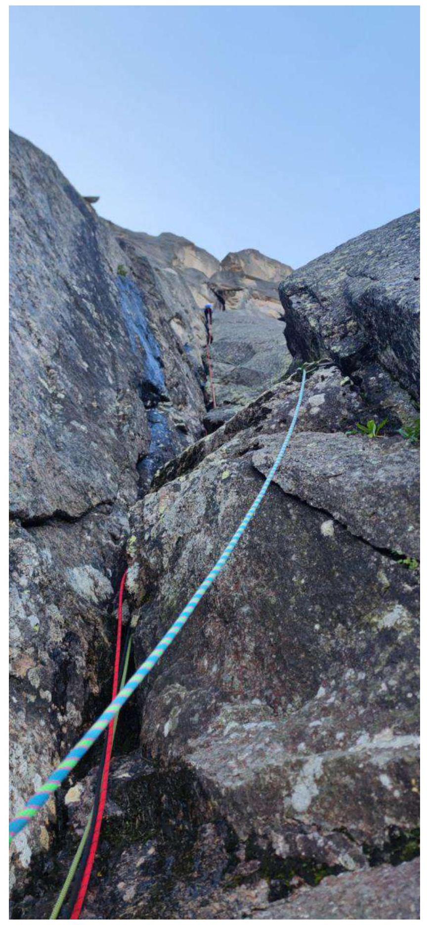
Large internal corner with a wide crack. Black and green ropes remained from rescue work in 2023.
Photo 3. Section R7–R8
Leader traversing a vertical crack.
Photo 4. Section R8–R9
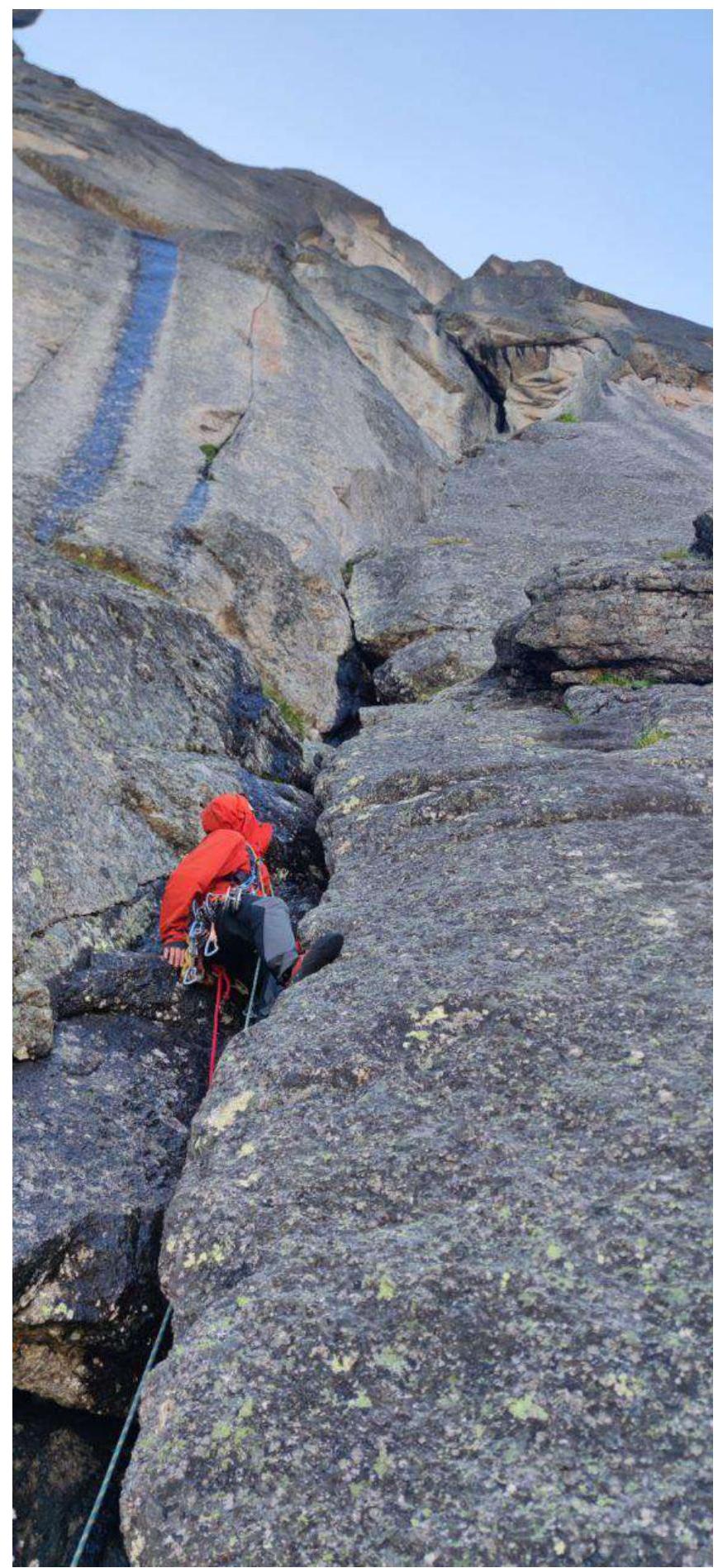
Photo 5. Section R9–R10
Chimney with a plug, exit to a ledge.
Photo 6. Section R10–R11
Along the ledge, traverse left about 10 m.
Photo 7. Section R10–R11
Leader traverses a cornice using ITO.
Photo 8. Section R11–R12
Series of corners and cracks.
Photo 9. Section R12–R13
Steep monolithic internal corner, at the beginning of the corner — a cornice.
Photo 10. Section R13–R14
Crack before a huge cornice.