Siberian Federal District and Far Eastern Federal District Championship in Alpinism
Technical and Altitude Class, 2024
REPORT
on the ascent to the summit of Pik Zvezdny 2265 m via the 3rd wall, category 5B, by a team from Krasnoyarsk Krai on July 29, 2024
2024
I. ASCENT PASSPORT
| 1. General Information | ||
|---|---|---|
| 1.1 | Full Name, sports rank of the leader | Timofeev V. M. (MS) |
| 1.2 | Full Name, sports rank of participants | Balezine V. V. (MSMK), Savelyev V. A. (MS) |
| 1.3 | Full Name of coach | Balezine V. V. (MSMK), Zakharov N. N. (MSMK) |
| 1.4 | Organization | Krasnoyarsk Krai Alpinism Federation |
| 2. Characteristics of the Ascent Object | ||
| 2.1 | Region | Western Sayan, Ergaki Ridge |
| 2.2 | Valley | |
| 2.3 | Number according to the 2013 Classification Table | |
| 2.4 | Name and height of the summit | Pik Zvezdny 2265 m |
| 2.5 | Geographic coordinates of the summit (latitude/longitude), GPS coordinates | |
| 3. Characteristics of the Route | ||
| 3.1 | Route Name | Via the 3rd wall |
| 3.2 | Category | 5B |
| 3.3 | Degree of route development | high |
| 3.4 | Relief characteristics of the route | rocky |
| 3.5 | Altitude difference of the route (data from altimeter or GPS) | 350 m |
| 3.6 | Route length (in meters) | 400 m |
| 3.7 | Technical elements of the route (total length of sections with different complexity categories, indicating relief type (ice-snow, rocky)) | II–III — 30 m, IV — 40 m, V — 130 m, VI — 200 m. |
| 3.8 | Average steepness of the route, (°) * (2) | 75° |
| 3.9 | Average steepness of the main part of the route, (°) * (2) | 83° |
| 3.10 | Descent from the summit | Via the SW edge 5A |
| 3.11 | Additional route characteristics | |
| 4. Characteristics of Team Actions | ||
| 4.1 | Time of movement (team's walking hours, in hours and days) | 7 h 40 min, 1 day |
| 4.2 | Overnight stays | 0 |
| 4.3 | Time spent on route preparation *(3) | 0 h, 0 days |
| 4.4 | Start of the route | 6:15 July 29, 2024 |
| 4.5 | Summit attainment | 13:45 July 29, 2024 |
| 4.6 | Return to base camp | 18:00 July 29, 2024 |
| 5. Characteristics of Weather Conditions *(4) | ||
| 5.1 | Temperature, °C | +5 – +20 °C |
| 5.2 | Wind speed, m/s | 1–4 |
| 5.3 | Precipitation | Light rain and fog on descent |
| 5.4 | Visibility, m | clear |
| 6. Person responsible for the report | ||
| 6.1 | Full Name, e-mail | Balezine V. V., balezinvv@mail.ru |
II. ASCENT DESCRIPTION
1. Characteristics of the Ascent Object
1.1. General photo of the summit
Pik Zvezdny 2265 m 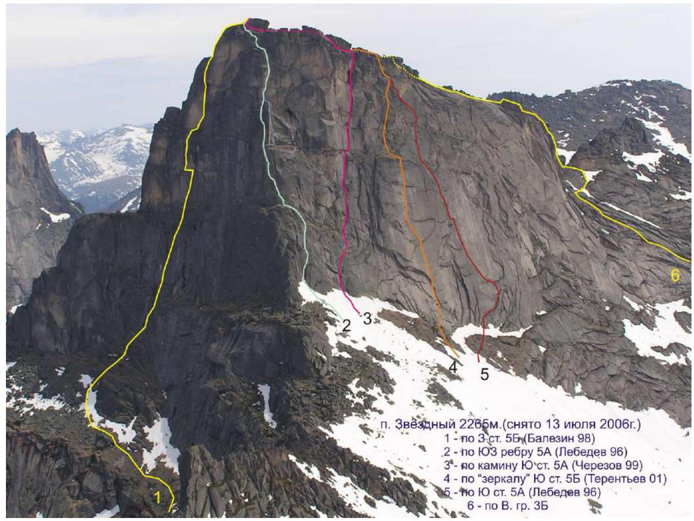 Pik Zvezdny 2265 m (taken on July 13, 2006)
1 — via the 3rd wall, category 5B (Balezine, 1998)
2 — via the SW edge, category 5A (Lebedev, 1996)
3 — via the chimney of the S-wall, category 5A (Cherezov, 1999)
4 — via the "mirror" of the S-wall, category 5B (Terentyev, 2001)
5 — via the S-wall, category 5A (Lebedev, 1996)
6 — via the E. ridge, category 3B
Pik Zvezdny 2265 m (taken on July 13, 2006)
1 — via the 3rd wall, category 5B (Balezine, 1998)
2 — via the SW edge, category 5A (Lebedev, 1996)
3 — via the chimney of the S-wall, category 5A (Cherezov, 1999)
4 — via the "mirror" of the S-wall, category 5B (Terentyev, 2001)
5 — via the S-wall, category 5A (Lebedev, 1996)
6 — via the E. ridge, category 3B
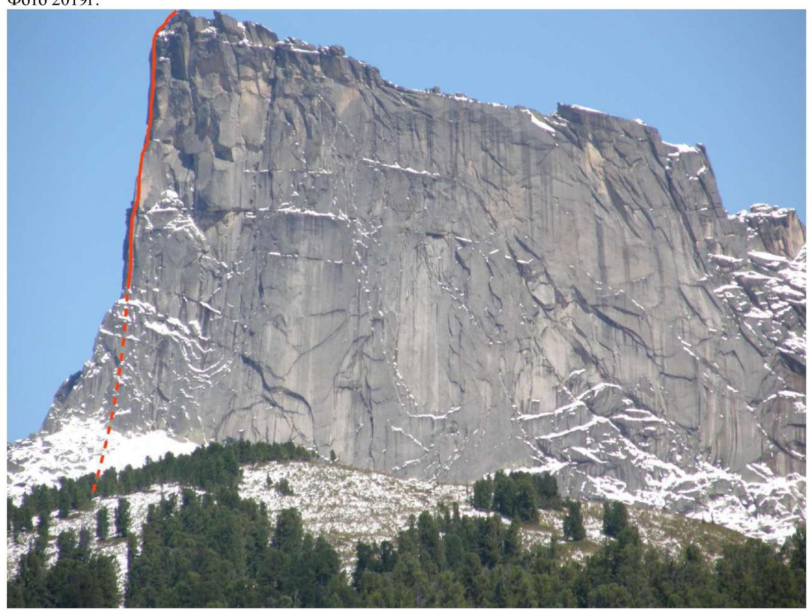
1.2. Profile of the upper part of the route from the right
Photo from 2019
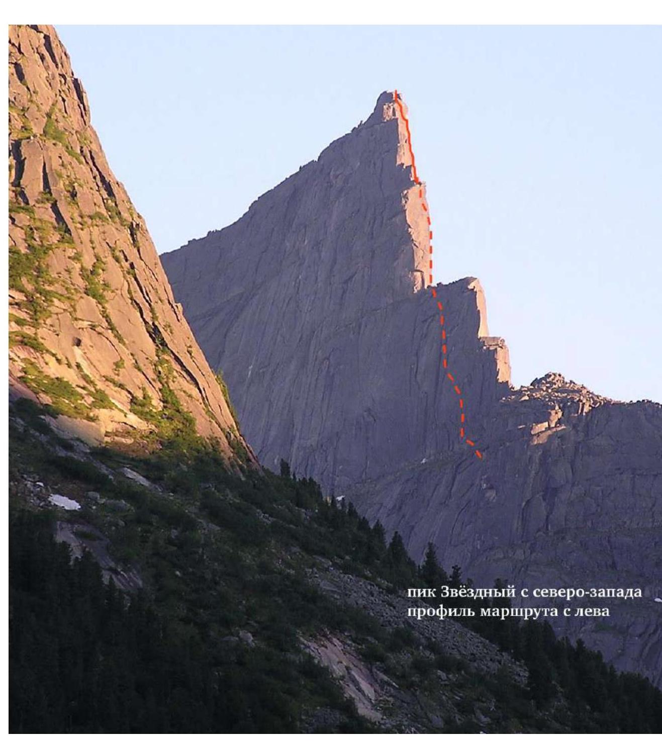
Pik Zvezdny from the northwest, route profile on the left
Tactical Actions of the Team
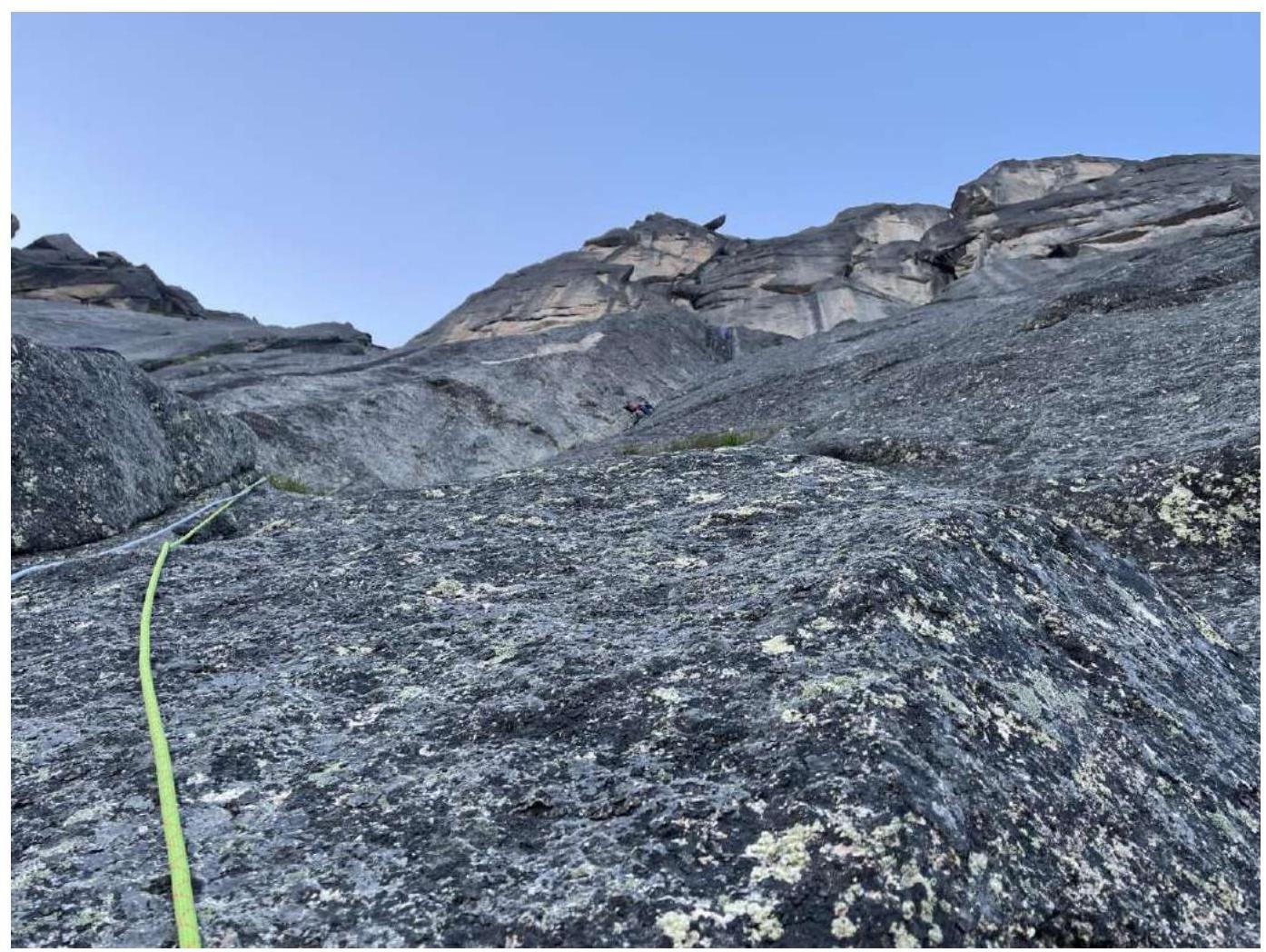
The western wall of Pik Zvezdny drops steeply to the west, forming a narrow, sheer wall between two steep ridges. The route is logical and follows a clearly defined relief. The first part of the route is damp (section R0–R4). The route is monolithic, with little vegetation.
On July 28, 2024, the team carried out a supply run from Svetloe Lake to an overnight stay on Zvezdny Pass.
On July 29, 2024, the team proceeded from their overnight location to their route. At 6:15, they began their ascent. The team's pace was steady, with a slight slowdown on section R8–R9. Sections R0–R8 were led by Timofeev, and sections R8–R10 were led by Balezine. At 13:45, the team reached the summit in full. The ascent took 7 hours and 40 minutes. The weather during the ascent was good, but on descent, rain and thick fog rolled in. They descended via the "Kant" 5A route. By 18:00, the team returned to their base camp at Svetloe Lake.
Map of the area 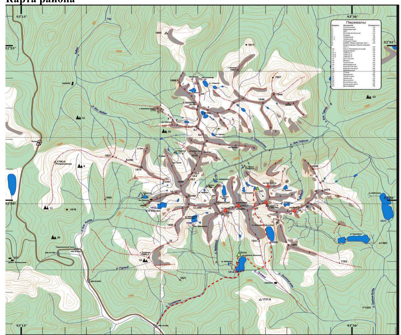
2. Characteristics of the Route
2.1. Technical photograph of the route 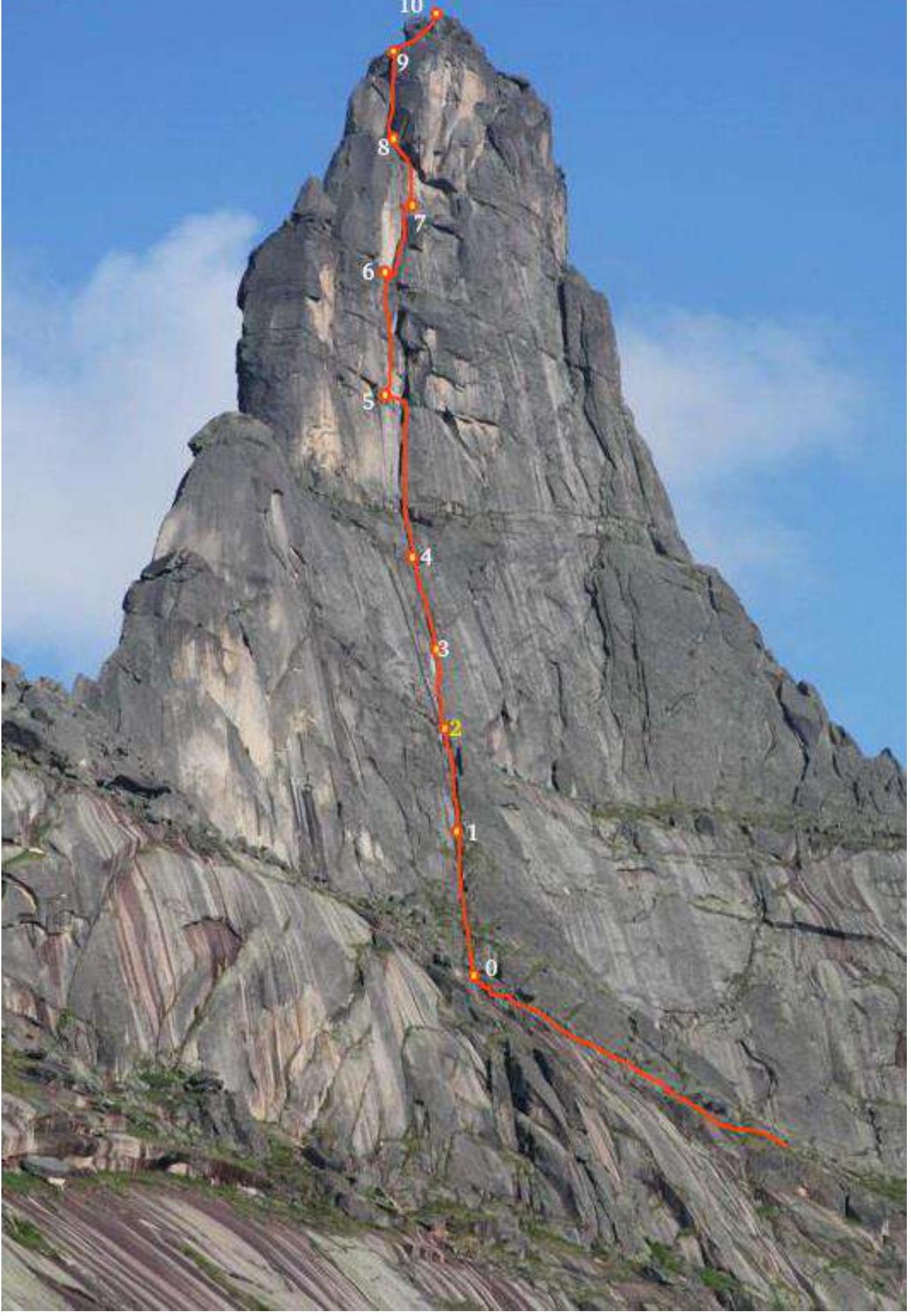
2.3. UIAA Symbol Route Diagram
UIAA diagram 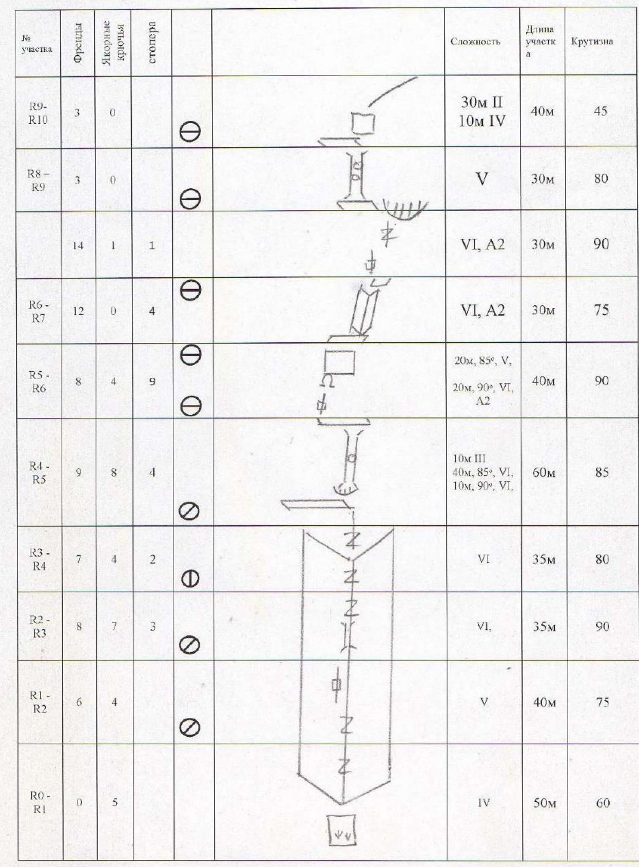
3. Characteristics of Team Actions
3.1. Brief description of route passage
| Section | Description | Photo Number |
|---|---|---|
| R0–R1 | Overgrown walls turning into a large corner chimney. 50 m, 65°, IV. | |
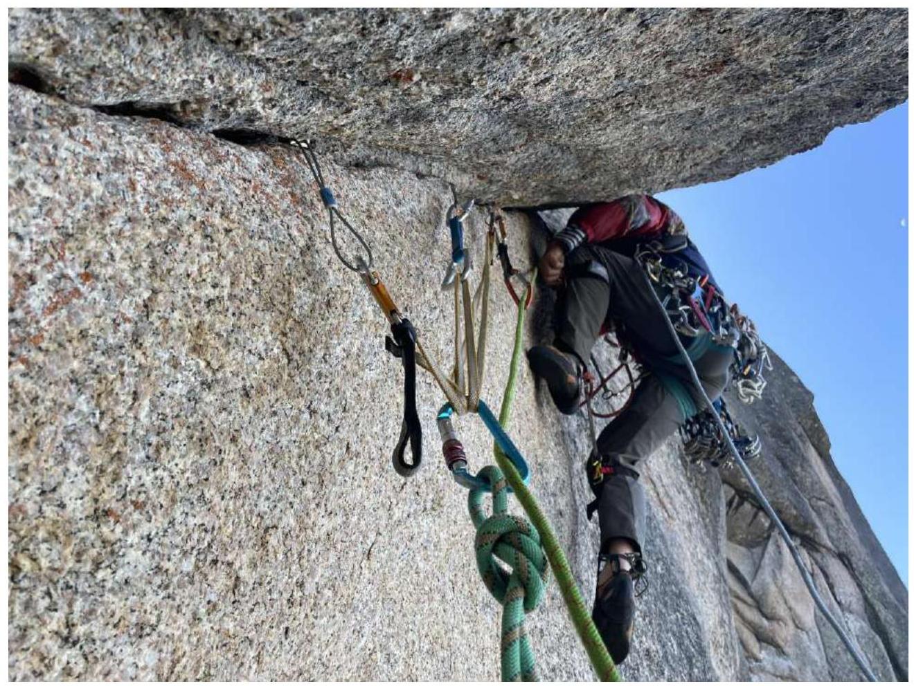
| R1–R2 | Large internal corner with a chimney 40 m, 75°, category V 6A; | 1 |
| R2–R3 | Continuation of the large internal corner with a chimney that gradually turns into a 15 cm wide crevice. Passed on the left part using aid climbing, followed by a series of complex narrow chimneys. Station under a wet overhang. 35 m, 90°, VI, A2+ | |
| R3–R4 | Vertical, occasionally damp crevice 10–20 cm wide. Due to the lack of features, it's challenging to set up reliable protection. Station on a large ledge. 35 m, 80°, VI. | 2 |
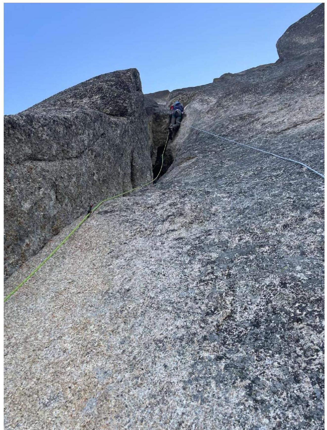
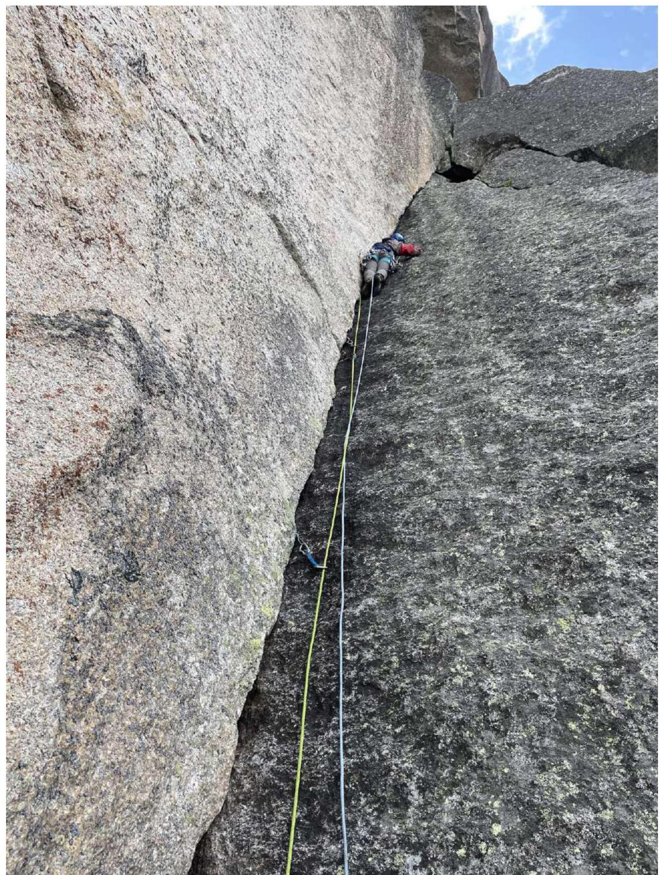
| R4–R5 | Continuation of the wide crevice. Exit to a ledge separating the first and second rock belts. Then a нависающая damp crevice about 8 m. is passed using aid climbing, followed by a chimney with two corks and an overhang at the top. Exit to a ledge, then traverse 10 m to the left. Station on stoppers. 10 m, 70°, V, 40 m, 90°, VI, 10 m traverse 3 | 3,4 |
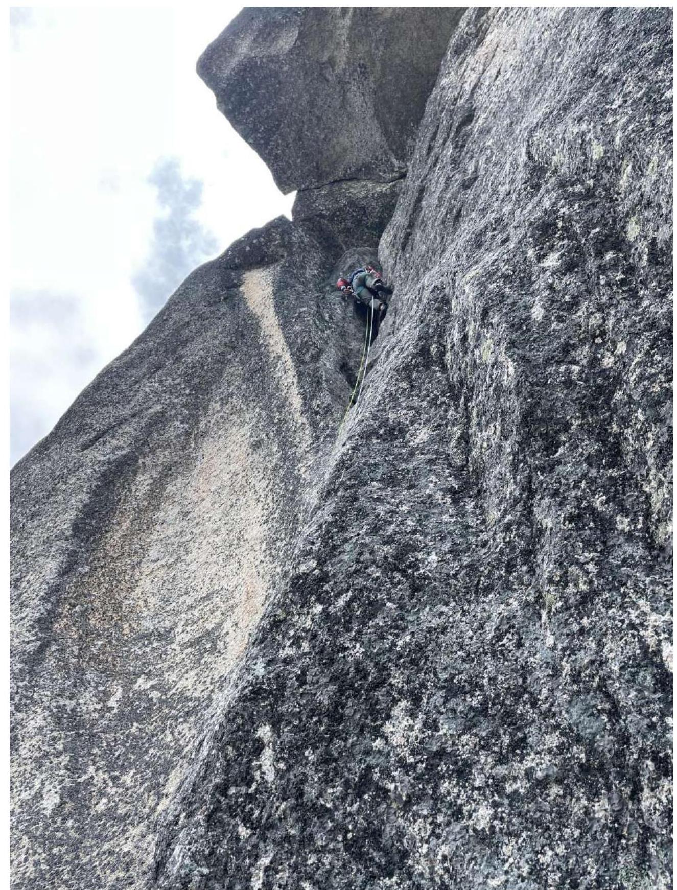
| R5–R6 | Then via a нависающему internal corner into a grotto under a two-meter overhang, aid climbing, followed by a crevice to a ledge. Then a series of inclined monolithic crevices from left to right. Exit to a small ledge under a large internal corner. 20 m, 90°, VI, A3–20 m, 85°, V+ | 5,6 |
| R6–R7 | Large monolithic, occasionally damp internal corner with a single thin crevice, starting with an overhang. Station on a bolt. 30 m, 75°, VI, A2 | 7 |
| R7–R8 | Vertical, uncomfortable crevice leading under the left part of a large overhang. Under the overhang, traverse left to a ledge under the start of a chimney using aid climbing. 30 m, 90°, VI, A2 | 8 |
| R8–R9 | Via a narrow, steep chimney with corks, exit to a bastion. 30 m, 80°, V | |
| R9–R10 | Wall with a crevice leading to the pre-summit ridge. Then along the ridge of moderate complexity to the summit. 10 m, 80°, V, 30 m. 45 II–III |
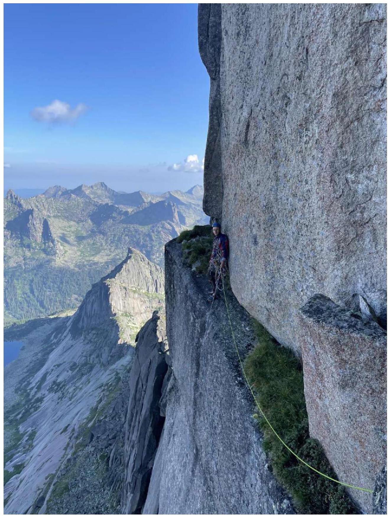
Photographs from route sections
-
Photo 1, section 1–2
-
Photo 2, section 3–4


-
Photo 3, section 4–5
-
Photo 4, Traverse at the end of section 5–4
-
Photo 5, Start of section 5–6, taken from station 5
-
Photo 6, Exit from the grotto through the overhang, section 5–6.
-
Photo 7, Large internal corner, section 6–7
-
Photo 8, Section 7–8