Ascent Passport
- Area — Western Sayan, Ergaki Ridge, p.6.2
- Peak — Zvezdny, 2265 m, via the right part of the 3rd wall, "Tred" route
- Claimed — 5A cat. diff. — first ascent
- Route type — rock climbing
5. Route Characteristics:
elevation gain — 315 m, total route length — 328 m, length of 6th cat. diff. sections — 170 m, 5th cat. diff. — 75 m, average steepness of the entire route — 65.4°
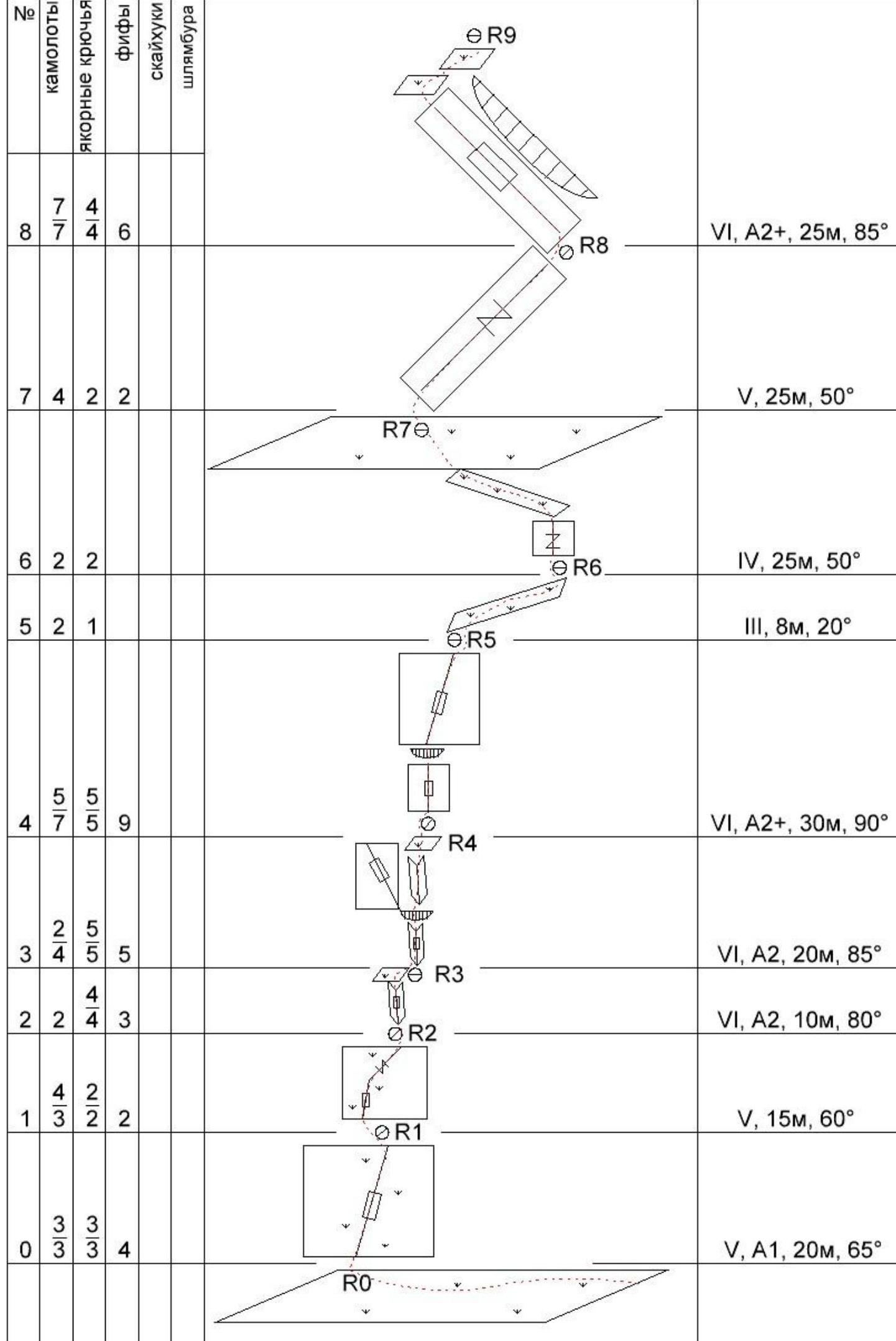
- Equipment used on the route: anchor pitons — 41/35, 1 left behind, broken, on the mid-shelf, camalots — 51/32, about 35 IT0 on "fifas", about 9 IT0 on skyhooks, 1 IT0 on a bolt.
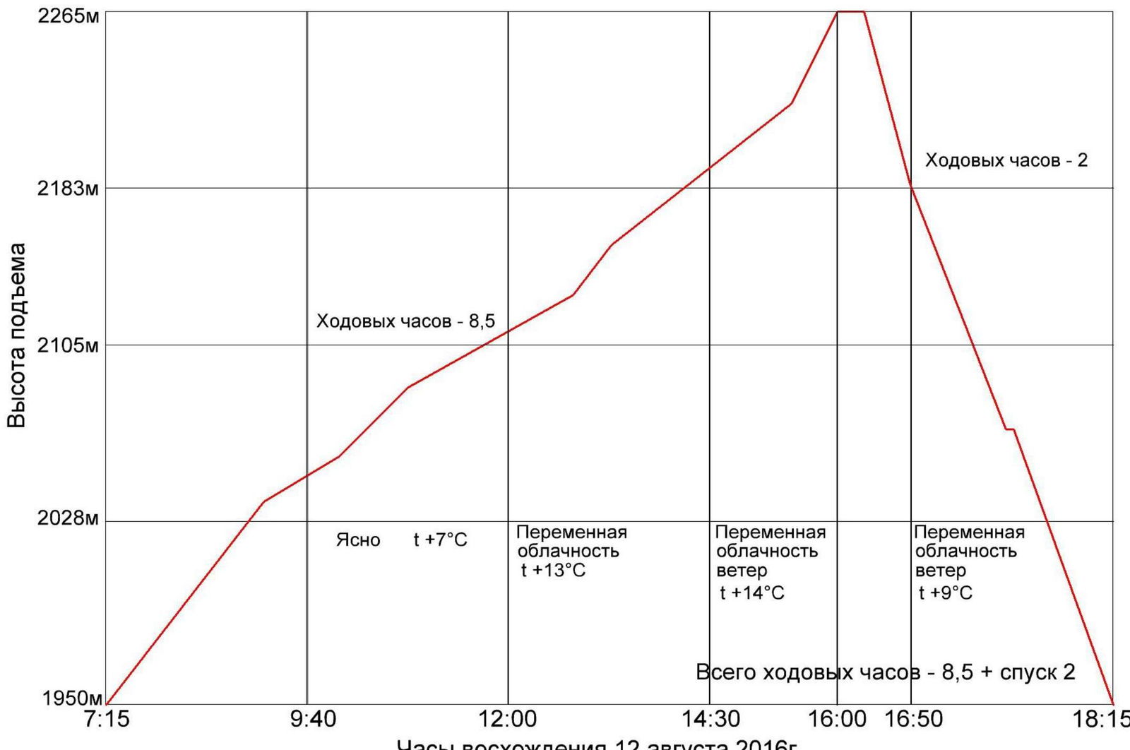
- Total climbing hours — 8 h 45 min, days — 1. Descent 2 h via Lebedev's route, "Kant", 5A cat. diff.
No overnight stays
-
Leader: Zhigalov Alexander Vladimirovich MS
Participant: Pachuev Ilya Nikolaevich 2nd sports category
-
Team Coaches:
Balezin Valery Viktorovich MSMK, ZTR; Zakharov Nikolai Nikolaevich MSMK, ZTR
-
Departure Date:
On the route — at 7:15 on August 12, 2016, on the summit — at 16:00 on August 12, 2016, return to B.L. at Lake Svetloe — at 19:20 on August 12, 2016.
-
Ascent organized by — Ministry of Sports of Krasnoyarsk Krai, Krasnoyarsk City Alpine Federation, "Youth Center of Travelers".
Peak Zvezdny, 2265 m
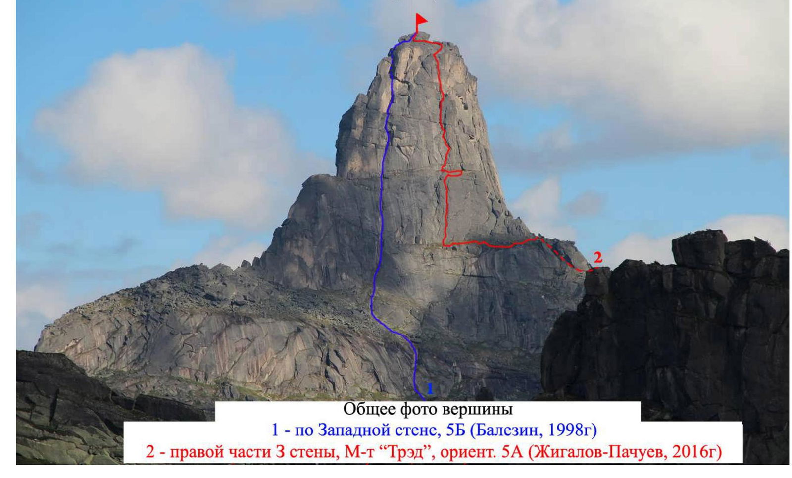
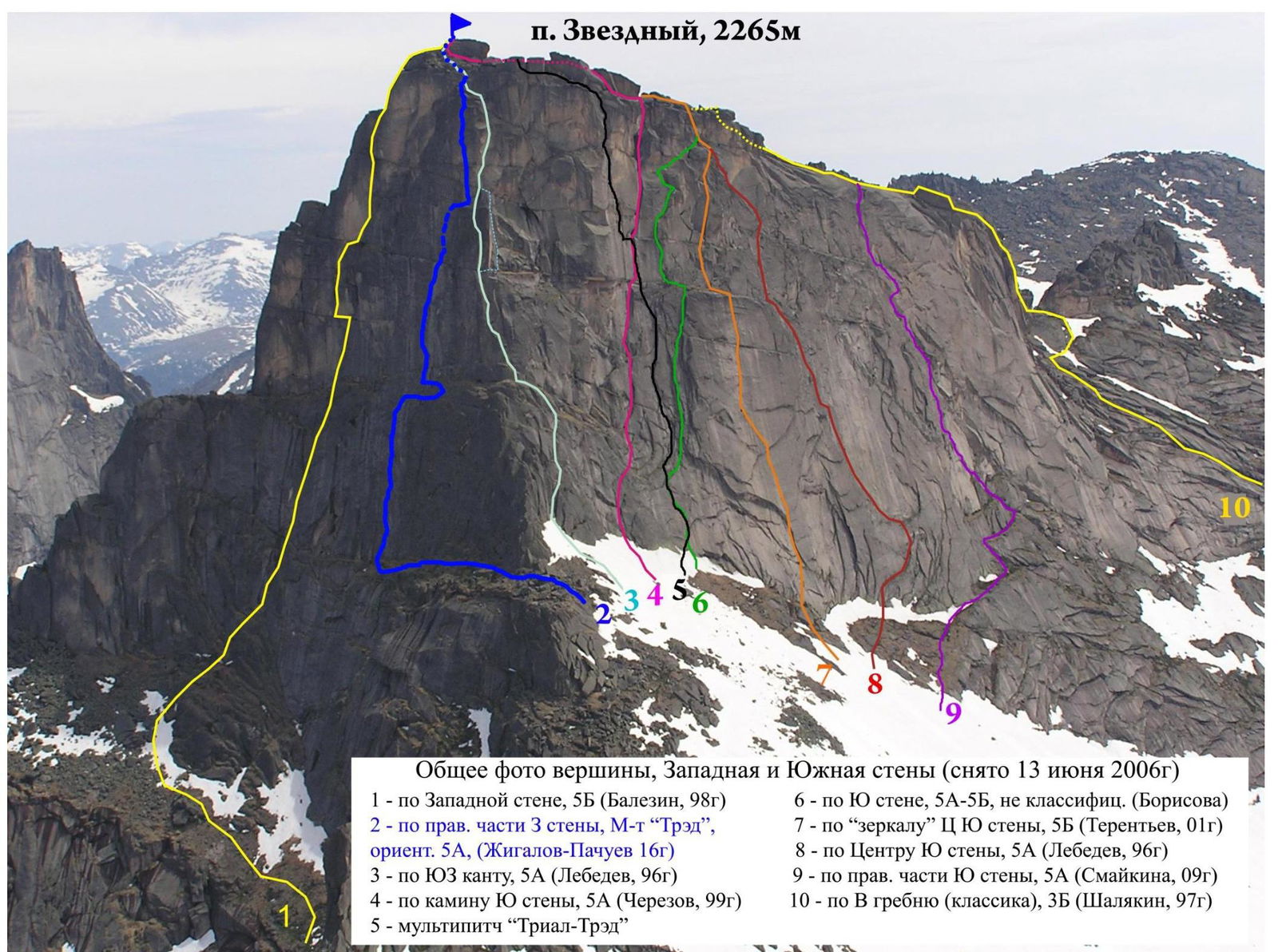
General photo of the peak, West and South walls (taken on June 13, 2006)
1 — via the West wall, 5B (Balezin, 1998) 2 — via the right part of the 3rd wall, "Tred" route, approx. 5A (Zhigalov–Pachuev, 2016) 3 — via the SW edge, 5A (Lebedev, 1996) 4 — via the chimney of the South wall, 5A (Cherezov, 1999) 5 — multipitch "Trial-Tred"
6 — via the South wall, 5A–5B, unclassified (Borisova) 7 — via the "Mirror" of the Central South wall, 5B (Terentyev, 2001) 8 — via the center of the South wall, 5A (Lebedev, 1996) 9 — via the right part of the South wall, 5A (Smaikina, 2009) 10 — via the East ridge (classic), 3B (Shalyakin, 1997)
Peak Zvezdny, 2265 m, August 12, 2016
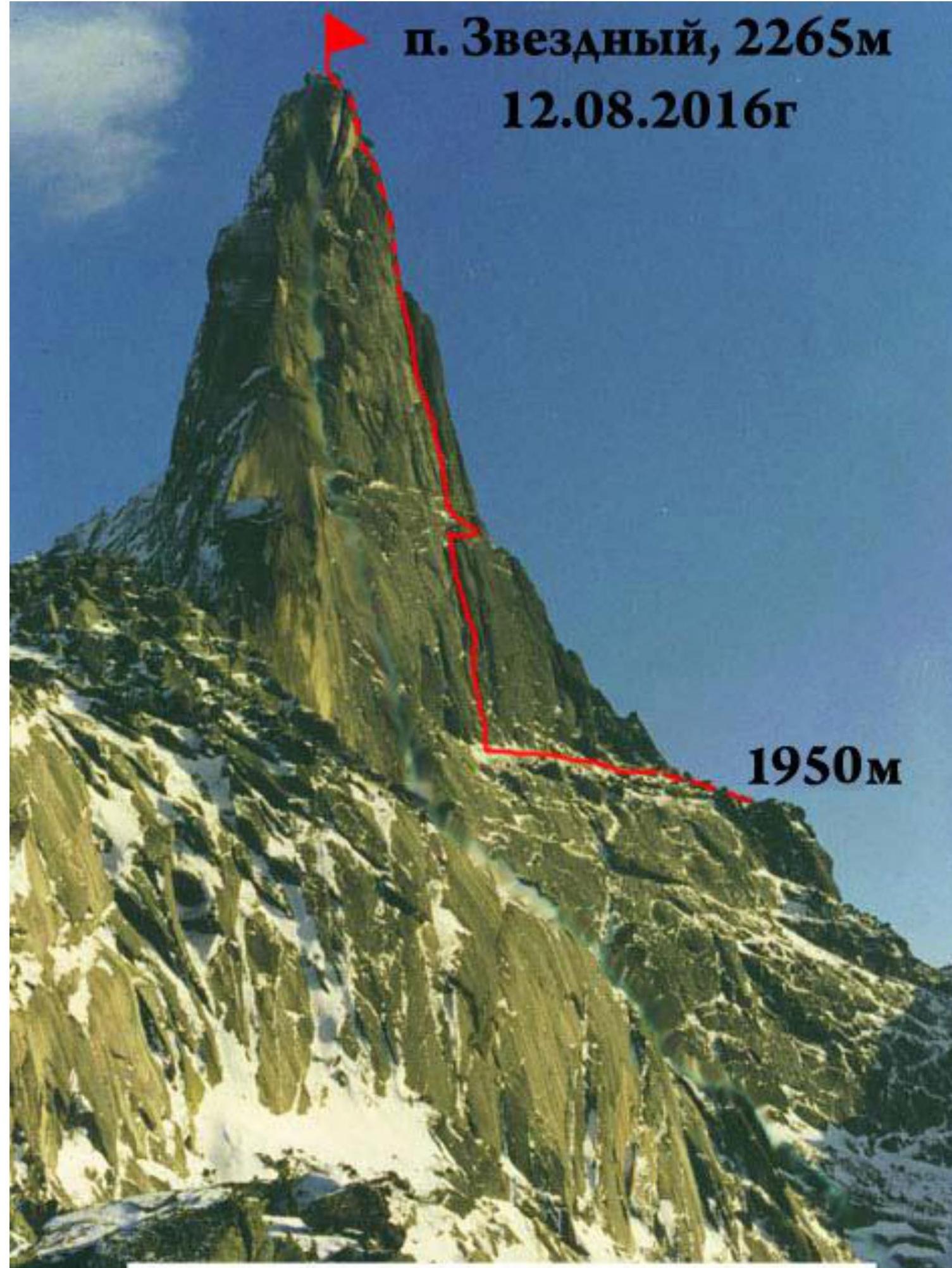
Route profile from the left
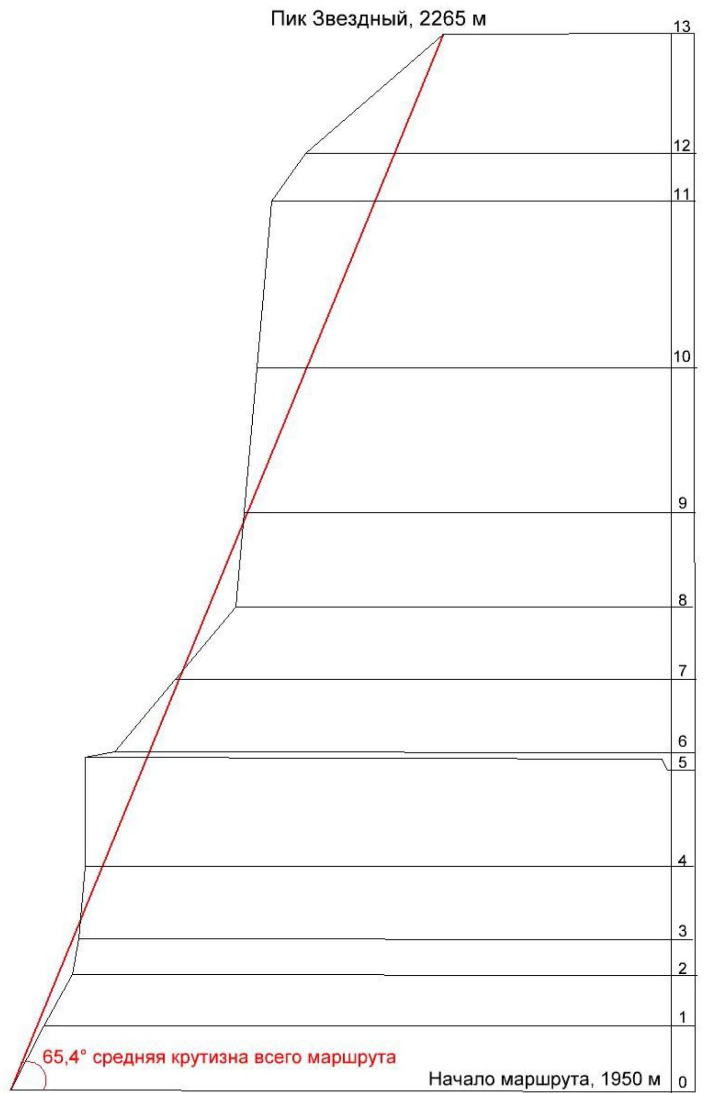
Drawn route profile
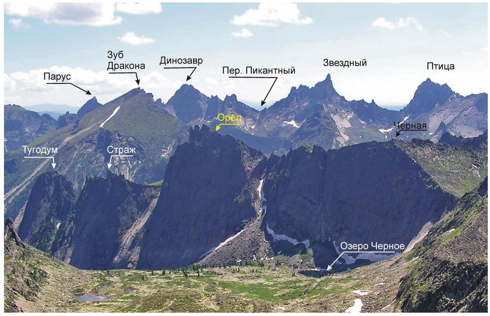
Photopanorama of the area
Team Tactics
During the "Sayan Vertical — 2016–2" training camp, Zhigalov Alexander and Ilya Pachuev formed a team and planned to climb a new route on Peak Zvezdny via the West wall.
On August 12, 2016, at 4:00, they left the base camp at Lake Svetloe. They approached the South wall of Peak Zvezdny, then went under the "Kant" route — 5A cat. diff., bypassed it on the left via a large shelf, went around the edge, and found themselves on the West side of Zvezdny.
About 100 m up to the right of Balezin's route (1998), large cracks and chimneys, heavily overgrown with grass tufts, lead up. This is where the route begins. Judging by the photos, this relief continues upwards, not ending until about two-thirds of the wall. The only unclear part was the upper section. But they had a bolt kit for that case.
They quickly put on all their gear, left one backpack with some unnecessary items on the wall, and started climbing. They started working on the route at 7:15.
In the lower part, the relief is heavily clogged with grass tufts, and climbing is easy if the weather is dry and warm. However, they faced cold and damp conditions, so they had to use protection points and occasionally use aid climbing for several meters. Then the wall starts to steepen. On the fourth and fifth pitches, there is a section with large, resonant slabs. They are quite reliable, but their thickness and hollow sound raise doubts.
They reached the mid-shelf. It's large enough to spend the night if the ascent is not swift. During the ascent, they accidentally broke one anchor piton, hammered it on the belay station on the mid-shelf, and hung a capsule with a note on it as a control tour.
Next, there is a section of climbing, followed by a large, inclined, scimitar-shaped chimney-brow, passing from right to left with various cracks and fissures. Transition into a vertical inner corner and a vertical chimney with a double wall. You can climb in a wide stem, or in a narrow one. Inside, there are cracks and crevices for camalots of any size — from 0.25 to 5 — and you can also use anchor pitons for protection.
They exited the chimney onto a large, convenient shelf, where they built a cairn so that subsequent groups could more easily navigate the route. From the shelf, they could see the key section of the "Kant" route — 5A. If you climb 8 m to the right and up, you end up under the bolts of the "Kant" key. This is just in case: if someone doesn't want to complete the route, they can exit onto "Kant", making a combination of the two routes, or descend via the prepared rappel stations of "Kant".
Their route continues from the control cairn straight up. Upwards through the crevices for about 30 m. Exit onto a small shelf. On it, they found two old titanium channels with a rotten, mossy loop made of rope. Apparently, someone's rappel. Maybe the first ascensionists of "Kant", or maybe groups that went the wrong way.
Next, there is an overhanging wall with a thin crack, followed by crevices with wedged slabs and resonant thin slabs. They approached the base of a large, overhanging half-chimney-half-crevice, OFF-style. At the bottom, another titanium channel is hammered, and on the right wall, an old, rusty, wedge-shaped bolt is hammered. Again, it looks like a rappel.
Due to their inexperience with climbing such terrain without protection points, they had to drill a few holes in the right wall of the crevice. About 9 holes, 6 mm, for skyhooks, along the overhang, and then, protecting themselves with two skyhooks, made small steps into a horizontal crack, and exited onto a small ledge to the right, then to the left onto a large shelf where the penultimate rope of "Kant" ends.
From here, it's a simple climb up and to the right, about 15 m, to the pre-summit shelf of Zvezdny. To the right, they could see the first rappel station of "Kant".
Another 50 m of easy climbing to the summit.
After taking a few photos, they changed the note in the control tour, recorded the time on the summit at 16:00, and contacted the base camp. After that, they descended a bit from the summit to a larger area, organized lunch, and then rappelled down to the bottom via "Kant" and returned to the start of their new route, retrieved their left-behind gear, and built a large cairn at the base of the wall, at the start of the first crack, so that subsequent groups could easily find the new route.
The entire route was pioneered by Zhigalov A., with Pachuev I. as the second. They used simultaneous movement. The route was completed without prior reconnaissance, without overnight stays, in alpine style.
Ascent graph for Peak Zvezdny, 2265 m via the right part of the 3rd wall, "Tred" route
 №
№
| № |  | Camalots | Anchor Pitons | Fifas | Skyhooks | Bolts |
|---|---|---|---|---|---|---|
| 0 | R0 | |||||
| V, A1, 20 m, 65° | 3 | 3 | 3 | 4 | ||
| 1 | R1 | |||||
| V, 15 m, 60° | 4 | 2 | 1 | 3 | 2 | |
| 2 | R2 | |||||
| VI, A2, 10 m, 80° | 2 | 2 | 4 | 3 | ||
| 3 | R3 | |||||
| VI, A2, 20 m, 85° | 2 | 5 | 3 | 4 | 5 | |
| 4 | R4 | |||||
| VI, A2+, 30 m, 90° | 4 | 7 | 5 | 9 | ||
| 5 | R5 | |||||
| III, 8 m, 20° | 5 | 2 | 1 | |||
| 6 | R6 | |||||
| IV, 25 m, 50° | 6 | 2 | 2 | |||
| 7 | R7 | |||||
| V, 25 m, 50° | 7 | 4 | 2 | 2 | ||
| 8 | R8 | |||||
| VI, A2+, 25 m, 85° | 8 | 7 | 4 | 6 | ||
| 9 | R9 | |||||
| VI, 40 m, 85° | 8 | 3 | 9 | 2 | 3 | |
| 10 | R10 | |||||
| VI, A3, 45 m, 85° | 10 | 6 | 9 | 8 | 9 | |
| 11 | R11 | |||||
| V, 15 m, 55° | 11 | 2 | 1 | |||
| 12 | R12 | |||||
| III, 50 m, 40° | 12 | |||||
| 13 | R13 | |||||
| TOTAL | 51 | 41 | 35 | 9 | 1 | |
| 32 | 40 |
Section-by-Section Description
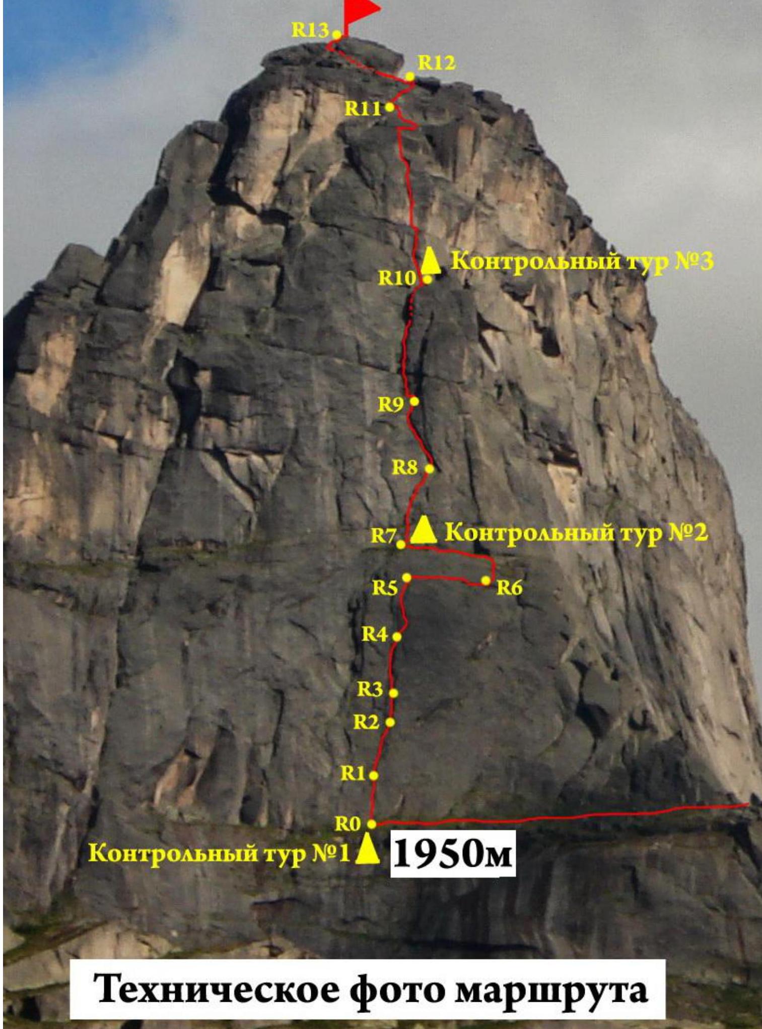
It's easy to review the beginning of the route from the South side. Bypassing the South wall of Zvezdny on the left, from the start of the "Kant" route — via the SW edge, 5A (Lebedev, 1996), go left around the edge. Then along a wide shelf, overhanging the wall above Lake Gornykh dukhov, move under the West wall for about 150–200 m. At the start of the route, a cairn is built. The start of the route is exactly through the crack at the base of which the control cairn №1 is located.
Section R0–R1 — a wall with various cracks for all types of protection elements and pitons. Cracks, heavily overgrown with grass, are clogged with earthy tufts. In bad weather, climbing will be complicated. Aid climbing is applicable in some places.
Section R1–R2 — up the crack, then to the right, along inclined crevices, free climbing, occasionally aid climbing. To the base of a vertical inner corner.
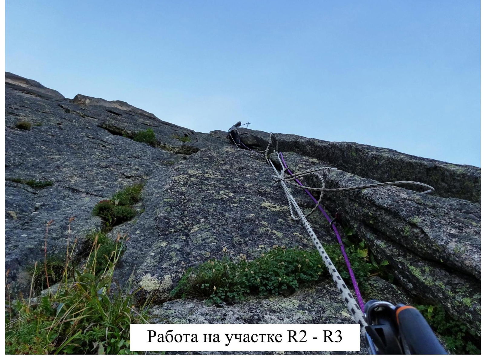
Section R2–R3 — a wide vertical inner corner. Up the inner crack about 10 m. Exit onto a small grassy ledge.
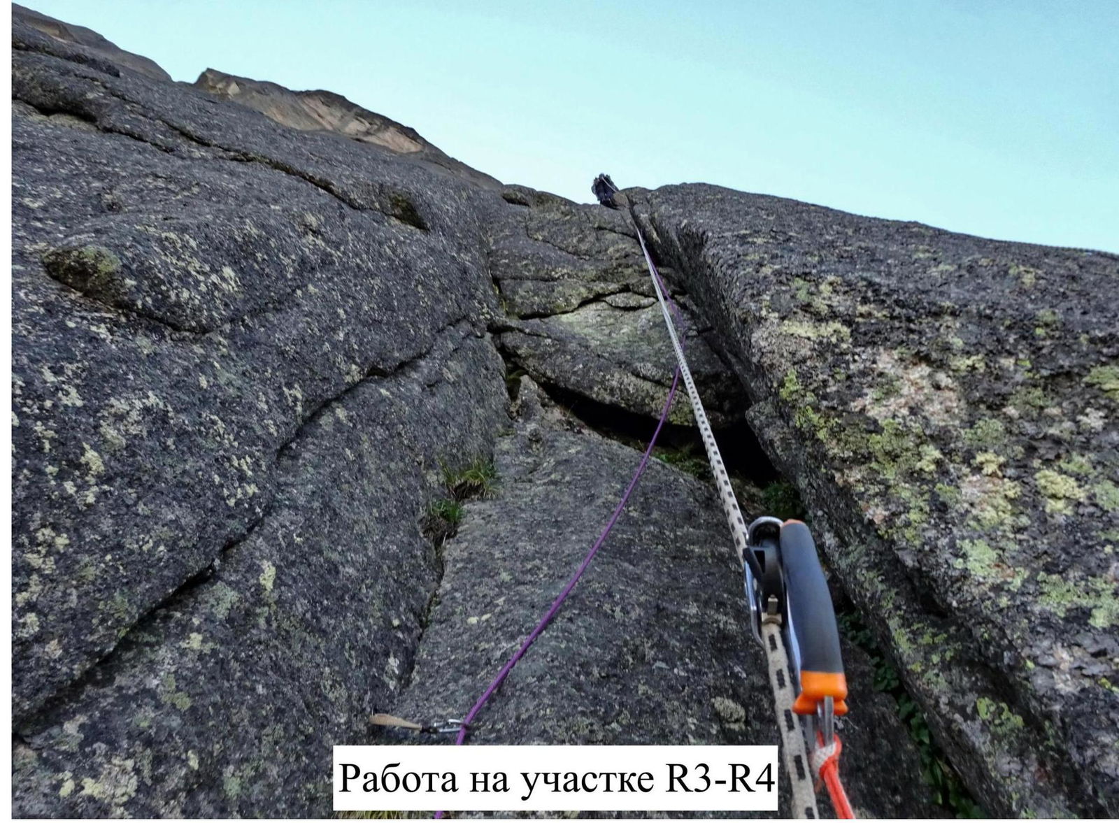
Section R3–R4 — then an inclined inner corner. Up along it, through a small overhang. At this point, a good crack goes left along the wall, but it's not the correct direction. Up the corner, leaning slightly to the right. Exit onto an earthy ledge.
Section R4–R5 — a steep, vertical wall. Cracks are formed by thin, resonant slabs. Strenuous aid climbing. Then through a ledge — exit onto the next wall. Along it, in the direction left and up, exit to the mid-shelf onto a narrow "balcony".
Section R5–R6 — along the ledge, a simple traverse to the right, about 8 m.
Section R6–R7 — in the right part of the ledge, up a simple crack to the left, about 2 m, exit onto the mid-shelf. Along it to the left about 20 m. Belay station left of large overhanging blocks. Control cairn №2, capsule with a note on a broken anchor piton.
Section R7–R8 — from the station up and left along a series of good cracks, occasionally overgrown with grass, to the base of a scimitar-shaped ledge.
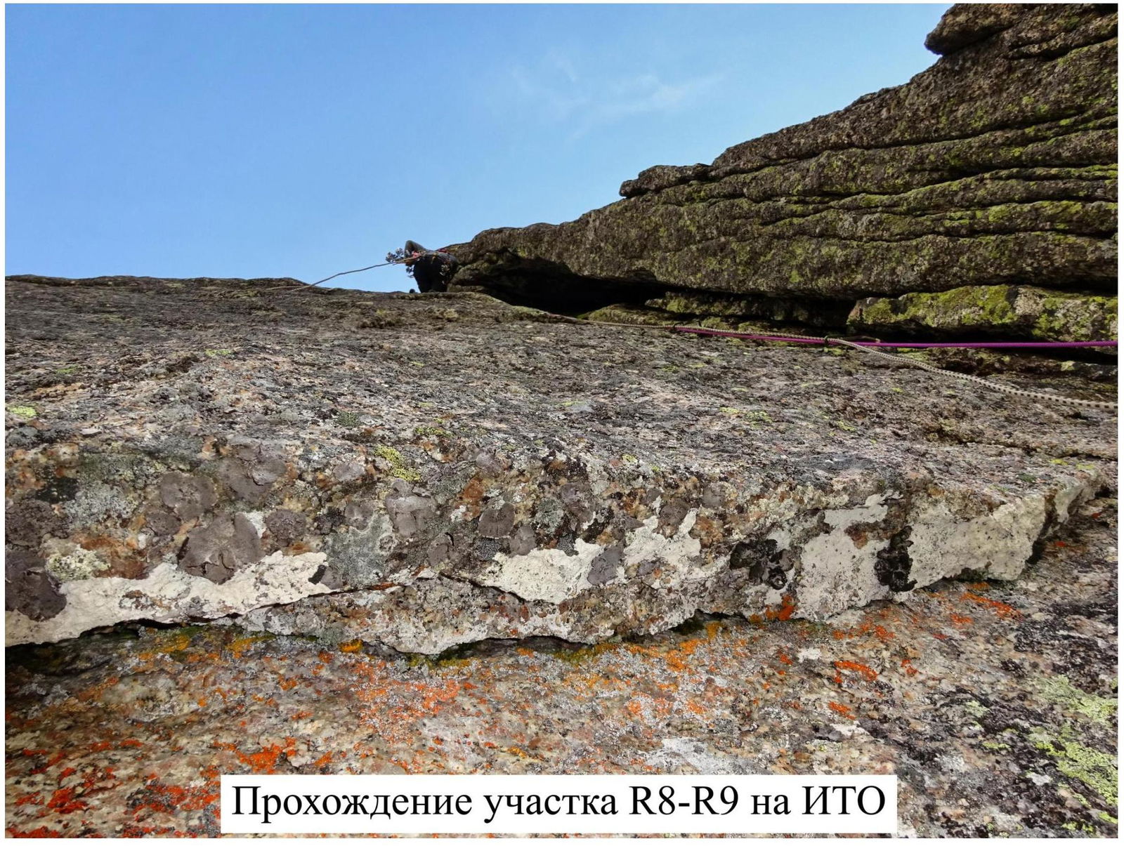
Section R8–R9 — under the scimitar-shaped ledge, along a series of cracks and crevices to the left and up. Strenuous aid climbing, swinging to the side. Exit onto a grassy ledge. Along it about 3 m to the right.
Section R9–R10 — through a short, wet, overgrown wall, enter a wide inner corner. Inside the corner is a large chimney. Climb the chimney first along the inner part, along the bottom, then in any convenient stem upwards. Inside the chimney, there is a double wall, so you can climb this section in either a wide or narrow stem. At the top, the chimney narrows. Exit onto a large shelf. Here, at the base of the next section of the route, control cairn №3 is built. To the right and above, about 7 m, is the ledge of the key section of the "Kant" route.
Section R10–R11 — from the control cairn, a clear crack up and to the right, then to the left. Exit onto a small ledge. Occasionally, there are steel and titanium pitons. On the ledge, they were possibly used to set up one of the rappels from the summit. Then along a good crack upwards, slightly to the left. Exit under an overhanging half-chimney-half-crevice, OFF-style. Here, on the right wall, an old bolt is hammered, sticking out of the wall. Most likely, another rappel. Up the crevice. Camalots №6 will be needed. Or aid climbing on holey skyhooks, about 10 steps, without protection points (that's how they did it). Exit onto a narrow ledge, traverse to the right, then simple climbing along the wall about 2 m. Exit onto a common shelf with "Kant".
Section R11–R12 — from the shelf up to the right, free climbing, towards the protruding slab where the first rappel station of "Kant" is set up. Exit onto a wide pre-summit shelf.
Section R12–R13 — along the shelf: left under a small wall, simple climbing up, then to the right, through "cat coils" — exit onto the summit, straight to the control cairn.
The fastest descent is via "Kant". Straight down about 5–7 rappels (25–50 m each).

Photos of the Route Ascent and Summit
Technical Photo of the Route
Photos of Sections
Passage of section R0–R1
Work on section R2–R3
Work on section R3–R4
Passage of section R8–R9 on aid climbing. Start of work on section R10–R11. Work in the upper part of section R10–R11.
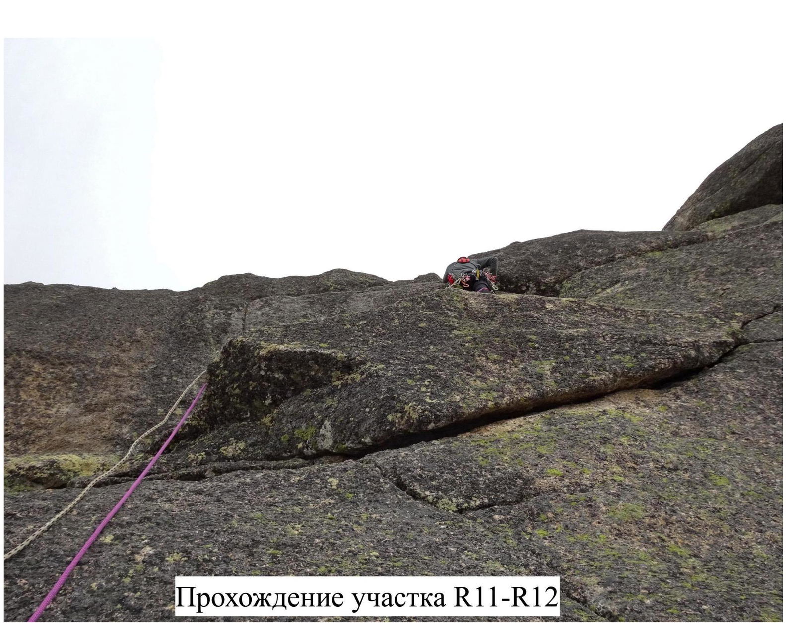
Passage of section R11–R12
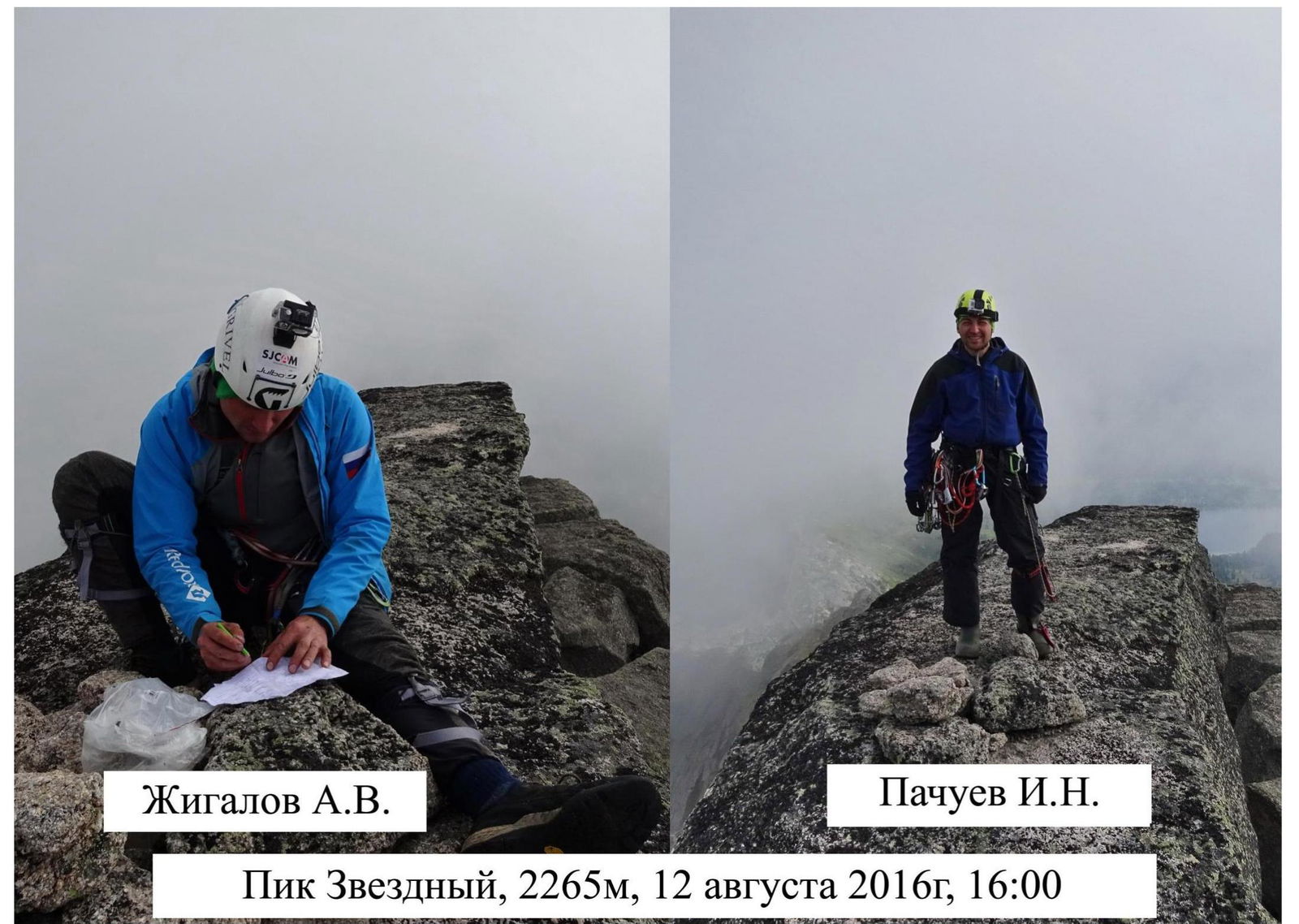
Summit Photos
Zhigalov A.V. Pachuev I.N.
Peak Zvezdny, 2265 m, August 12, 2016, 16:00