Ascent record for p. 3177–Zhelaniy 3199 m via the South slope, traverse 3A cat. diff.
-
Eastern Sayan, Kitoy Golets ridge, Ilchir gorge, section 6.1.3.
-
P. 3177–Zhelaniy 3199 m via the South slope, traverse.
-
Categorized as 3A cat. diff., first ascent.
-
Route type — rocky.
-
Height difference 100 m, length 482 m, average slope 20°.
-
Pitons driven: rock and wired 12 pcs.
-
Team's walking hours – 6 h.
-
No overnight stays on the route.
-
Group:
Afanasyev A.E. — MS Budim V.V. — 3rd sports category Vasilyev M.Yu. — 3rd sports category Vinogradov N.N. — 3rd sports category Yeremenko Yu.A. — 3rd sports category Zaikin A.S. — 3rd sports category Marchukov K.F. — 3rd sports category Prokhnitsky D.A. — 3rd sports category Senatorov A.V. — 3rd sports category
-
Coach — Afanasyev A.E., MS
-
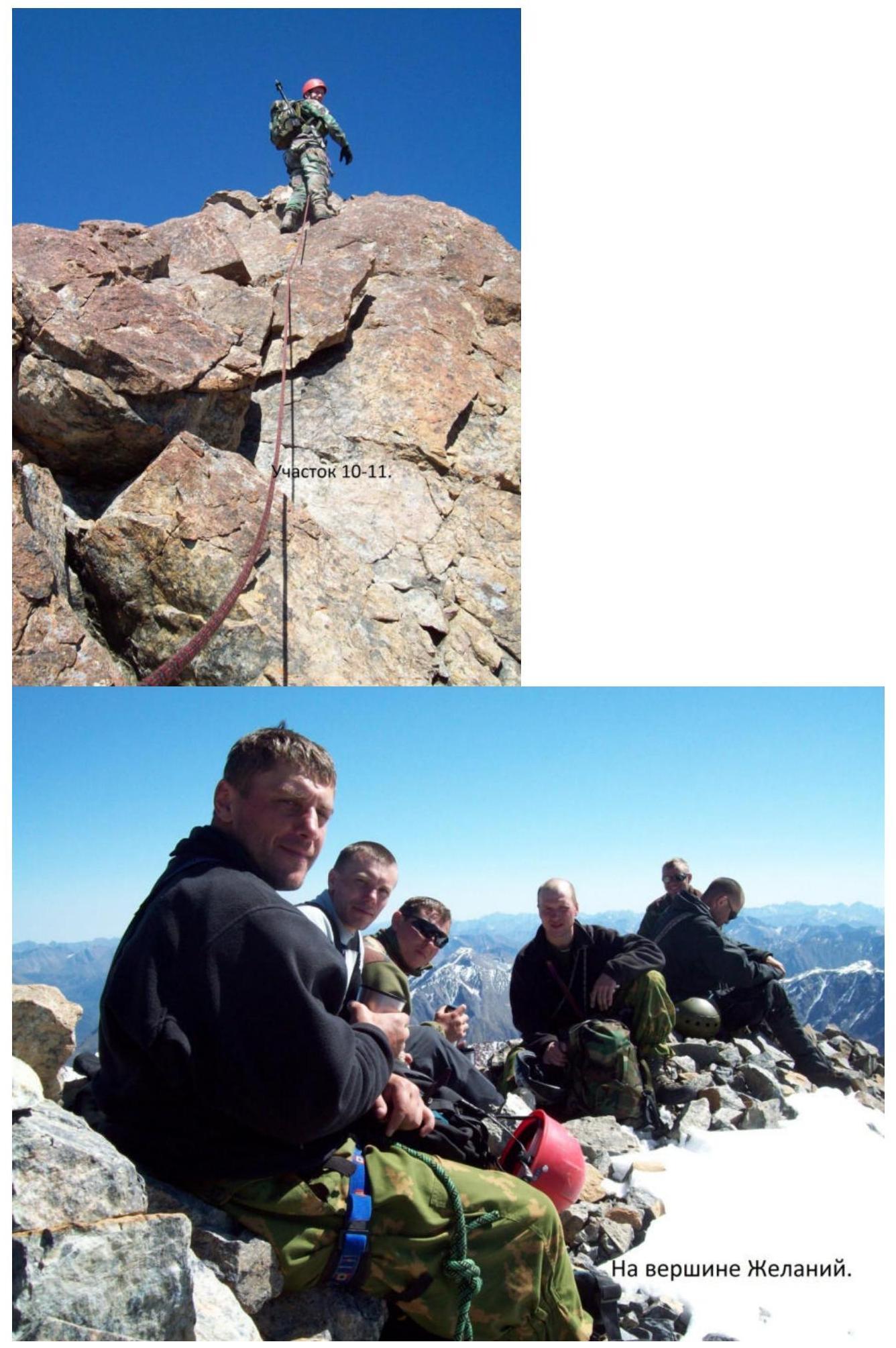
Summit ascent and return on August 22, 2010
Route description for p. 3177–Zhelaniy 3199 m via the South slope, traverse 3A cat. diff.
Zhelaniy mountain is located in the Ospinsky ridge. The Ospinsky ridge is a northern spur of the Kitoy Golets ridge, consisting of only a few independent peaks with a height of more than 3000 m and a large height difference, located in the watershed between the Onot and Ilchir rivers (right tributary of Onot). The upper Ilchir gorge is a large circus, uniting 3 sources:
- The right (orographic) one comes from the northern slopes of the Kitoy Golets and has Lake Bolshoye.
- The left (orographic) one flows from the southern slopes of the Ospinsky ridge, where Lake Skalnoye and a small lakelet are located at the very head of the source.
- The middle source originates from the eastern slope, above which, under the pass between the Kitoy and Ospinsky ridges, there is a closed basin not filled with a lake.
Approach from the base camp to the gorge:
- First to the pass between the Kitoy and Ospinsky ridges.
- Further north along the slope of mountain 3177 to the summit.
At the summit, there are wooden fragments of a triangulation point.
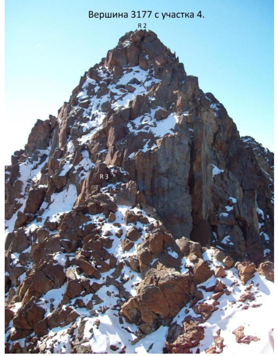
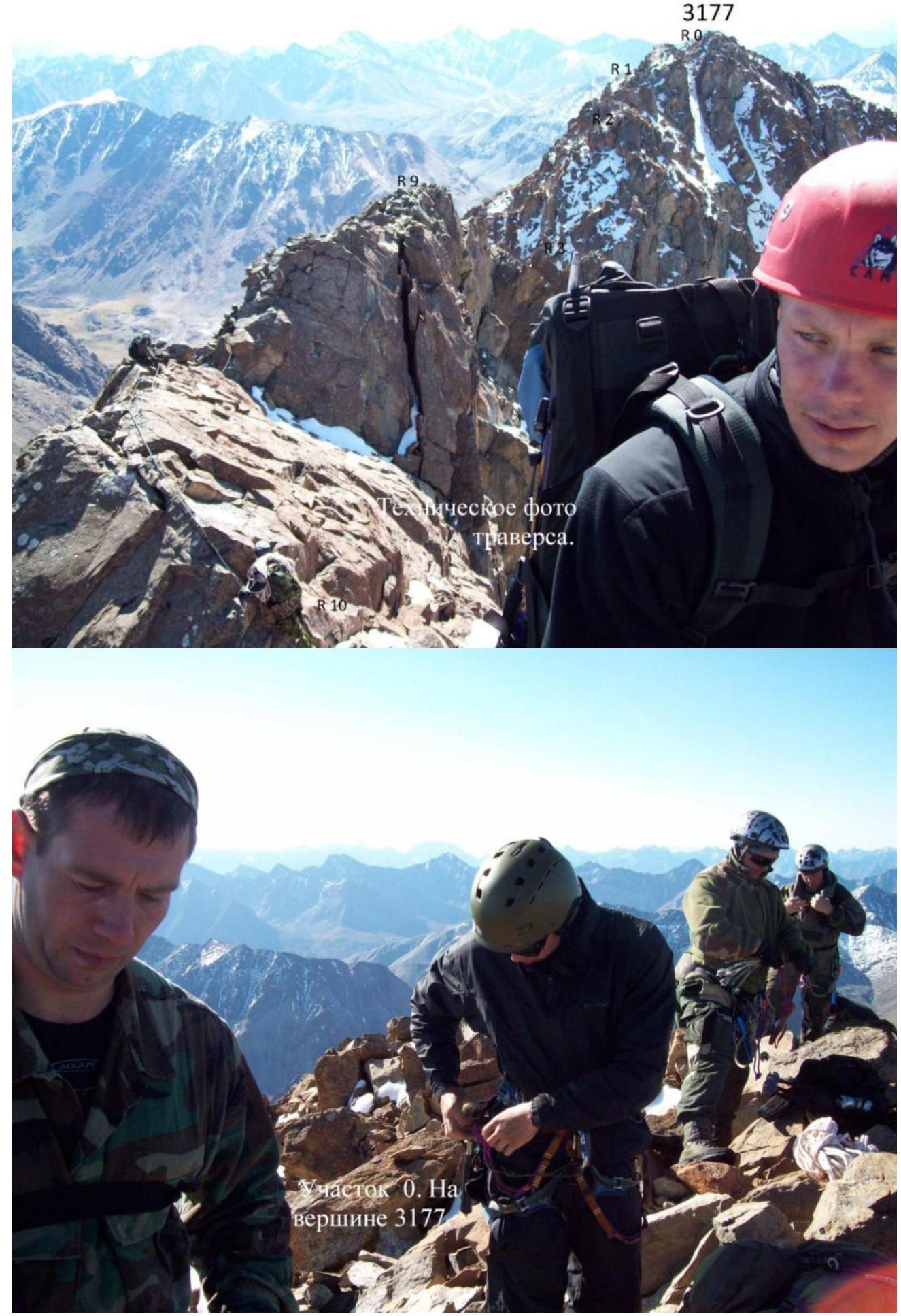
The route begins at the summit 3177.
- R0–R1 40 m 35° 1. Descent from the summit to the north.
- R1–R2 120 m 2. Slightly down along the ridge, bypassing rock outcrops on the right and left.
- R2–R3 50 m 50° 3. Rappelling.
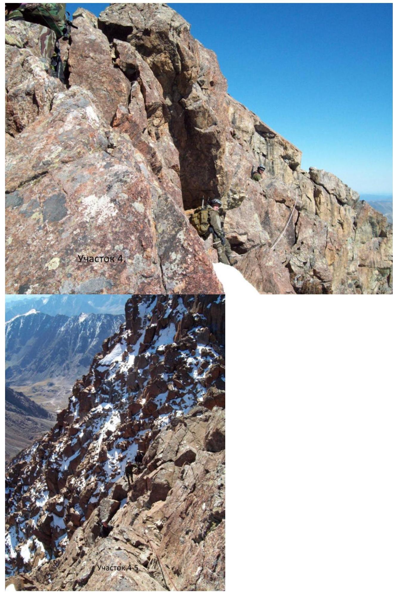
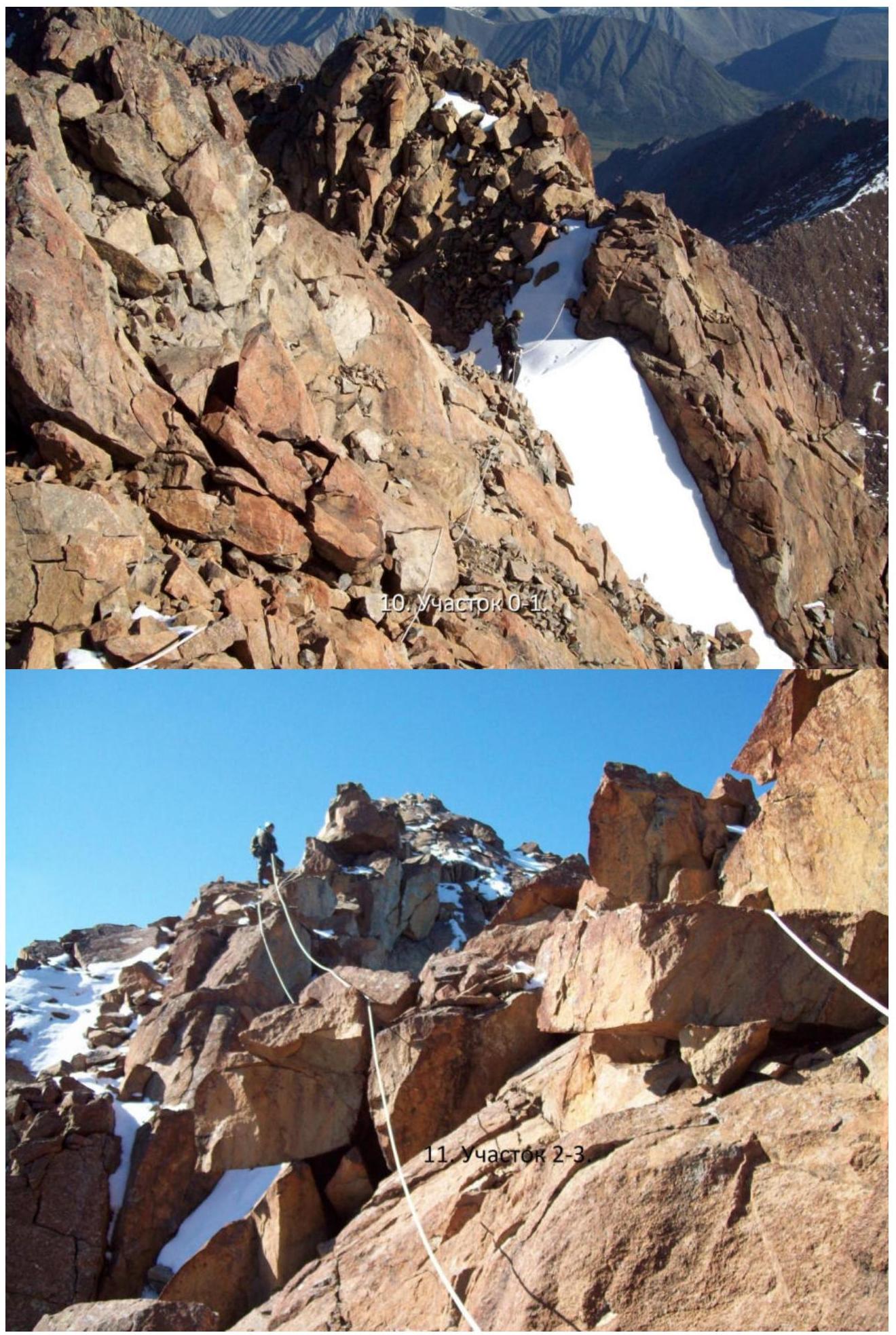
- R3–R4 20 m 1. Slightly down along the ridge to the saddle.
- R4–R5 60 m 2. Slope to the right 50°. From the saddle to the right and up along the ridge.
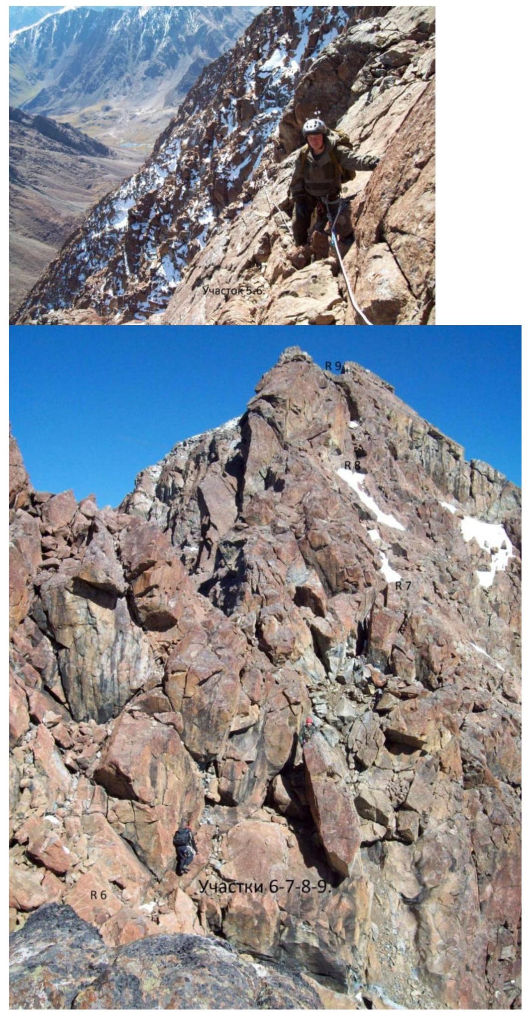
- R5–R6 20 m 2. Slope to the right 40°. Inner corner. Exit to the ridge on the right.
- R6–R7 10 m 3. Slope to the right 45°. To the right of the ridge along horizontal fractures.
- R7–R8 20 m 50° 3. Rocky slab with snow.
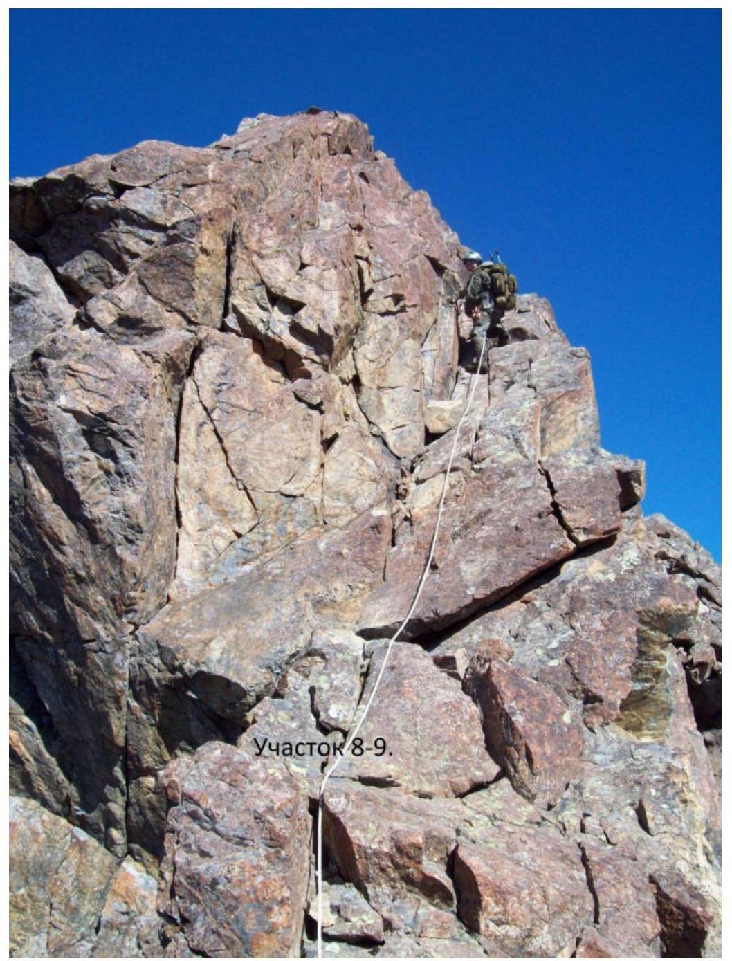
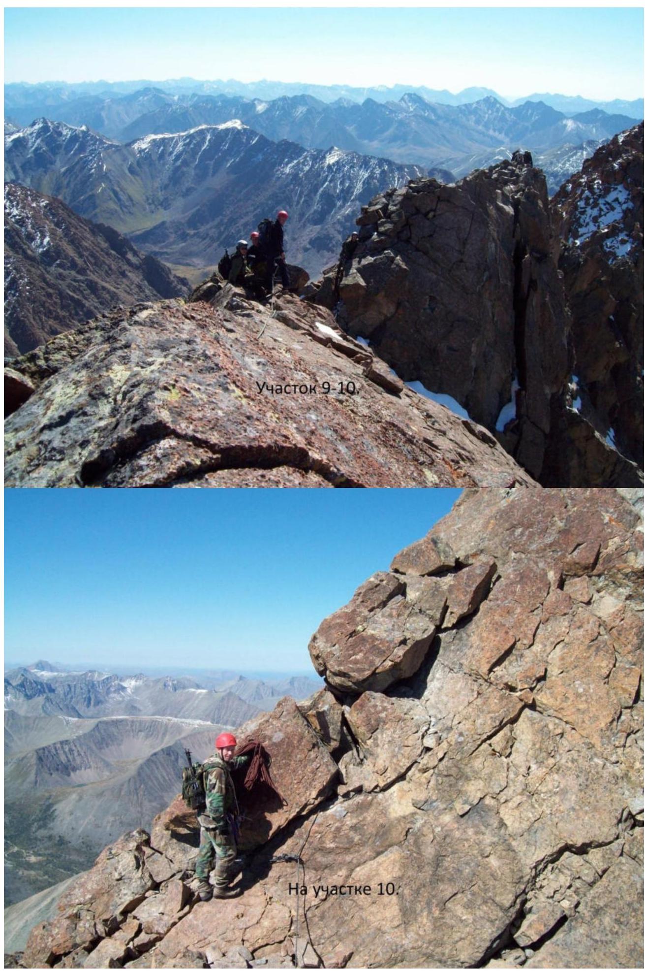
- R8–R9 15 m 90° 4. Inner corner. Exit to the ridge of a gendarme.
- R9–R10 70 m 10° 2. Along the ridge to a 4 m gap.
- R10–R11 12 m 70° 3. Rocky wall on the ridge.
- R11–R12 25 m 5° 1. Along the ridge to the summit of Zhelaniy 3199.
Descent via the ascent route, i.e., back traverse.
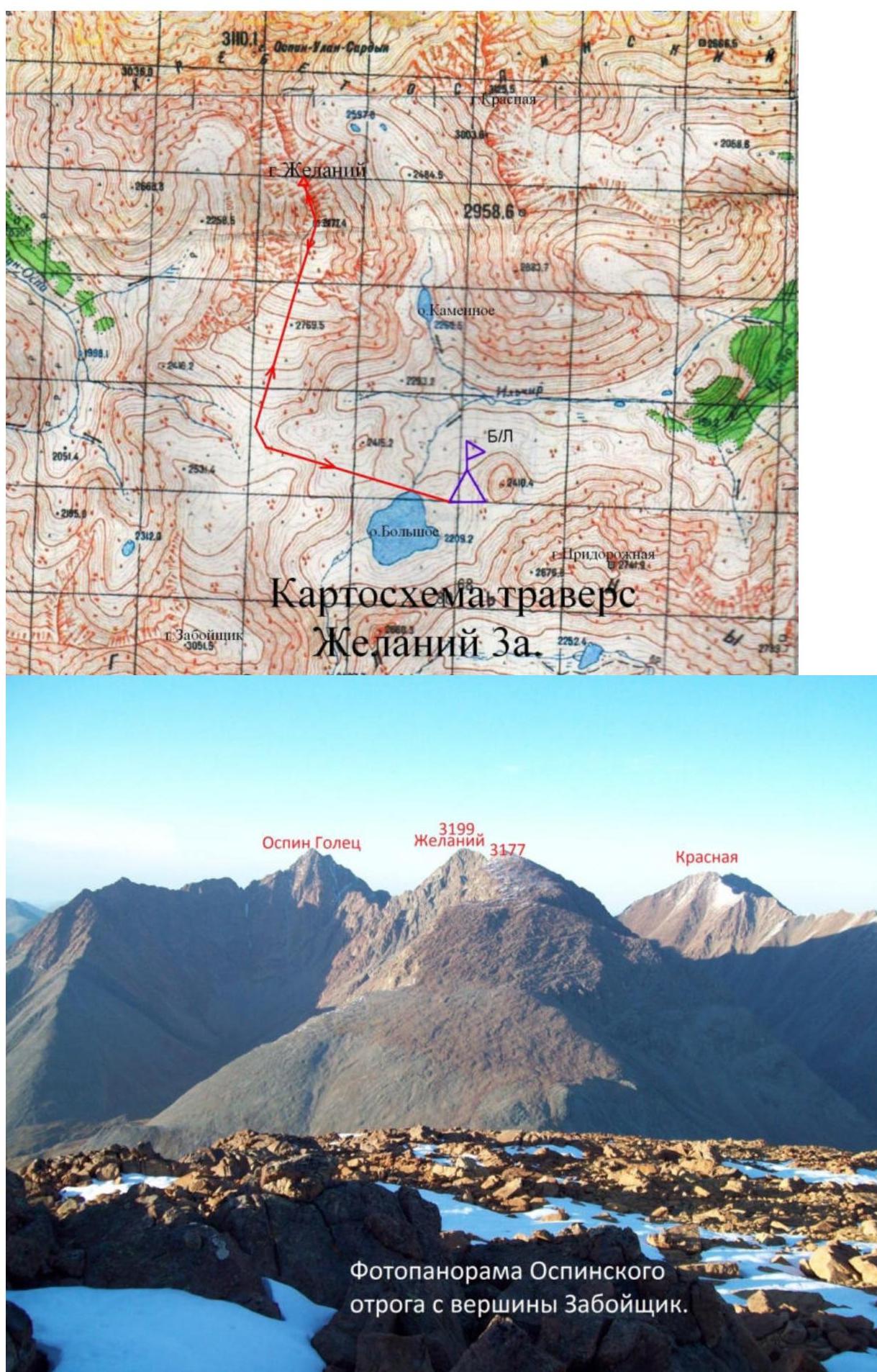 Photopanorama of the Ospinsky spur from the Zaboyshchik summit.
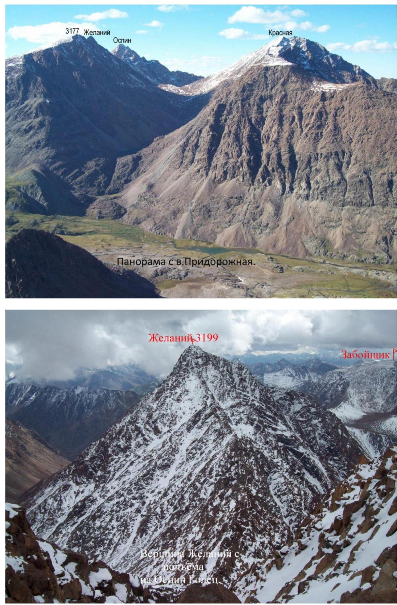
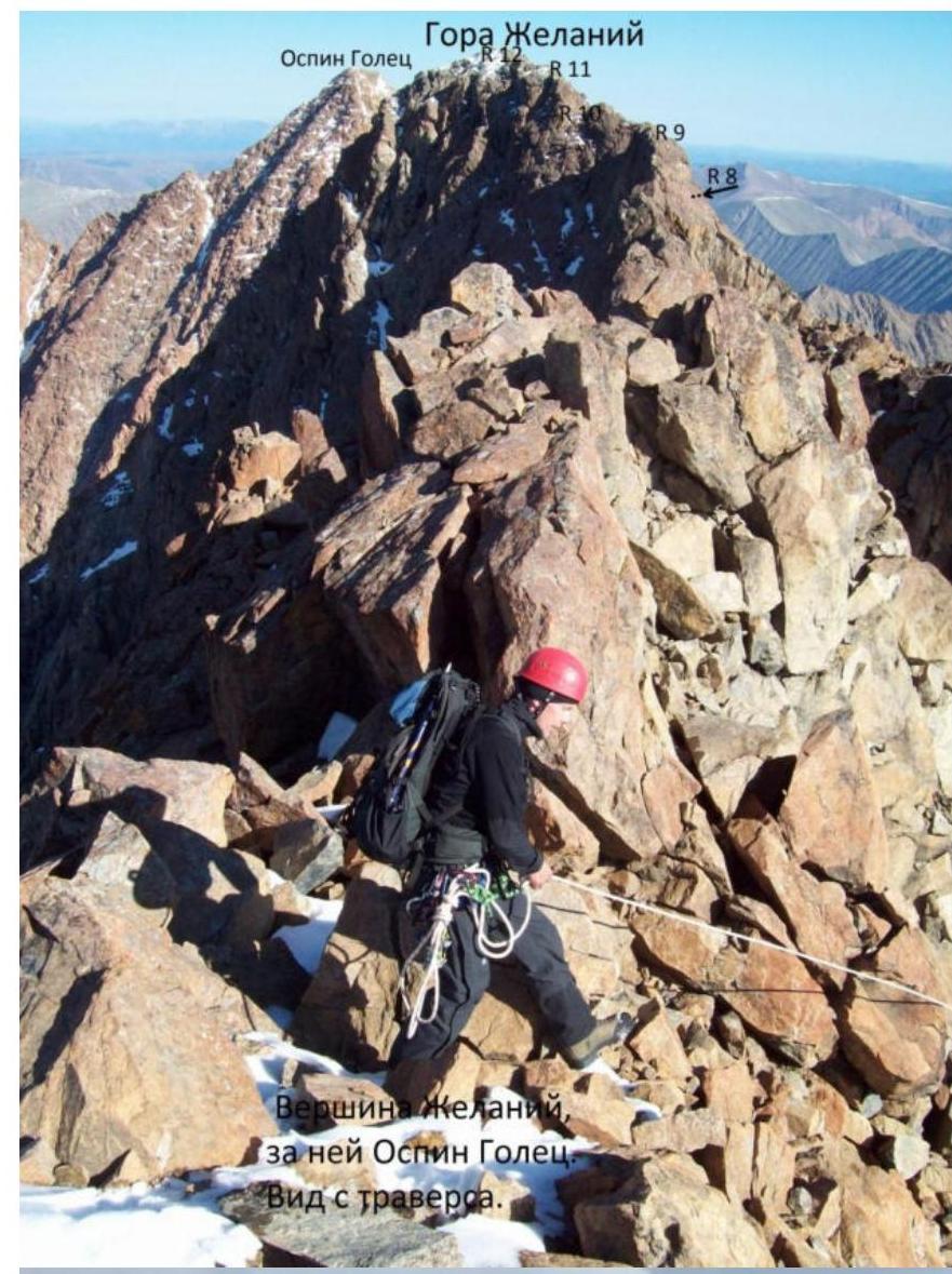 Zhelaniy mountain

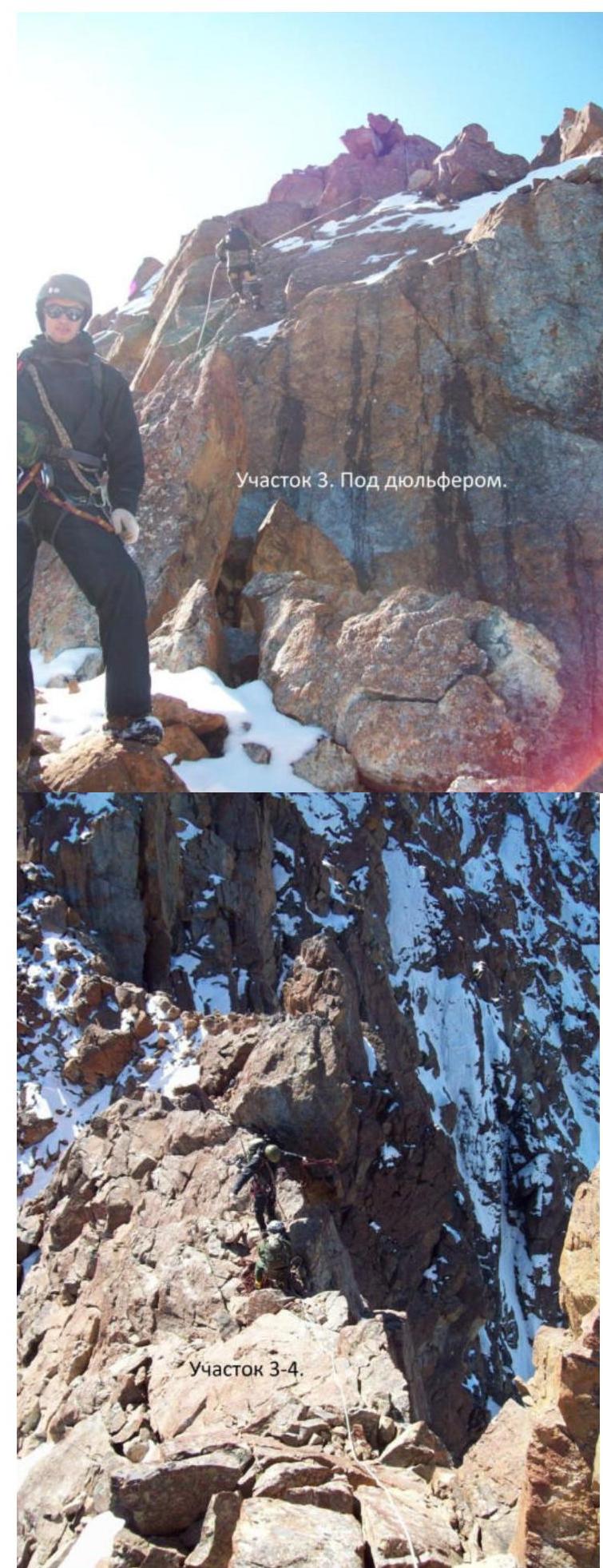
R3 section. Under the rappel.
Summit 3177 from R4 section.