
Ascent record for Zaboyshchik peak 3051 m via Central buttress of the Eastern edge, cat. 4A.
- East Sayan, Kitoi Goltsy ridge, Ilchir gorge, section 6.1.3.
- Zaboyshchik peak 3051 m, via Central buttress of the Eastern edge.
- Claimed category 4A, first ascent.
- Route type — rock climbing.
- Height difference — 600 m, length — 1150 m, average steepness of the wall section — 60°.
- Pitons hammered: rock and wired — 30 pcs.
- Team's travel time — 10 hours.
- No overnight stays on the route.
- Group: Afanasiev A.E. MS Budim V.V. 3rd sp. grade Vasiliev M.Yu. 3rd sp. grade Marchukov K.F. 3rd sp. grade Prokhnitskiy D.A. 3rd sp. grade
- Coach Afanasiev A.E. MS
- Summit and return on August 23, 2010.
Route description for Zaboyshchik peak 3051 m via Central buttress of the Eastern edge, cat. 4A.
Zaboyshchik mountain is located in the Kitoi Goltsy ridge and rises directly above the Big Lake in the Ilchir gorge.
The approach from the base camp in the gorge follows the left (in the direction of travel) side of the Big Lake and takes one and a half hours. The Central buttress of the eastern exposure is obviously noticeable in the center of the triangular rock wall, turning into the eastern edge and rising above the lake.
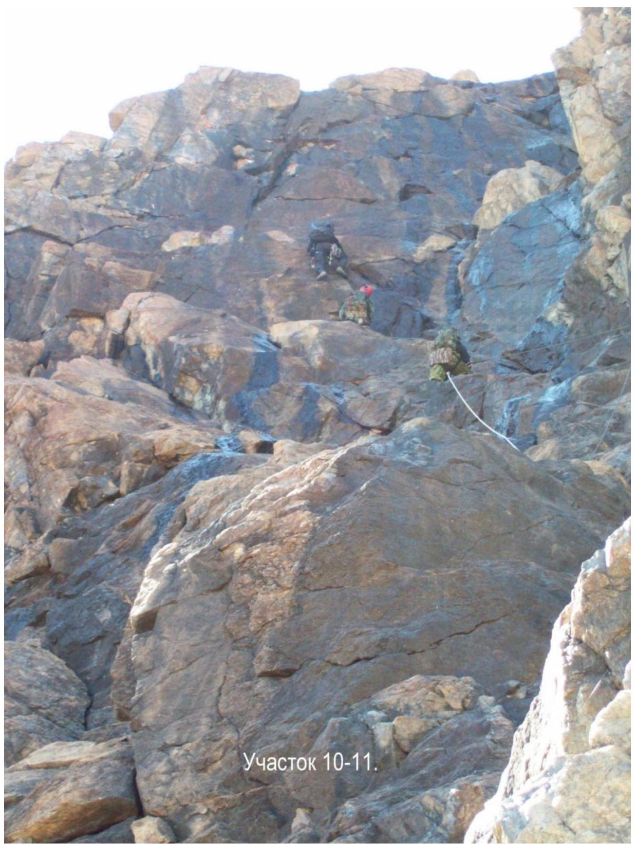
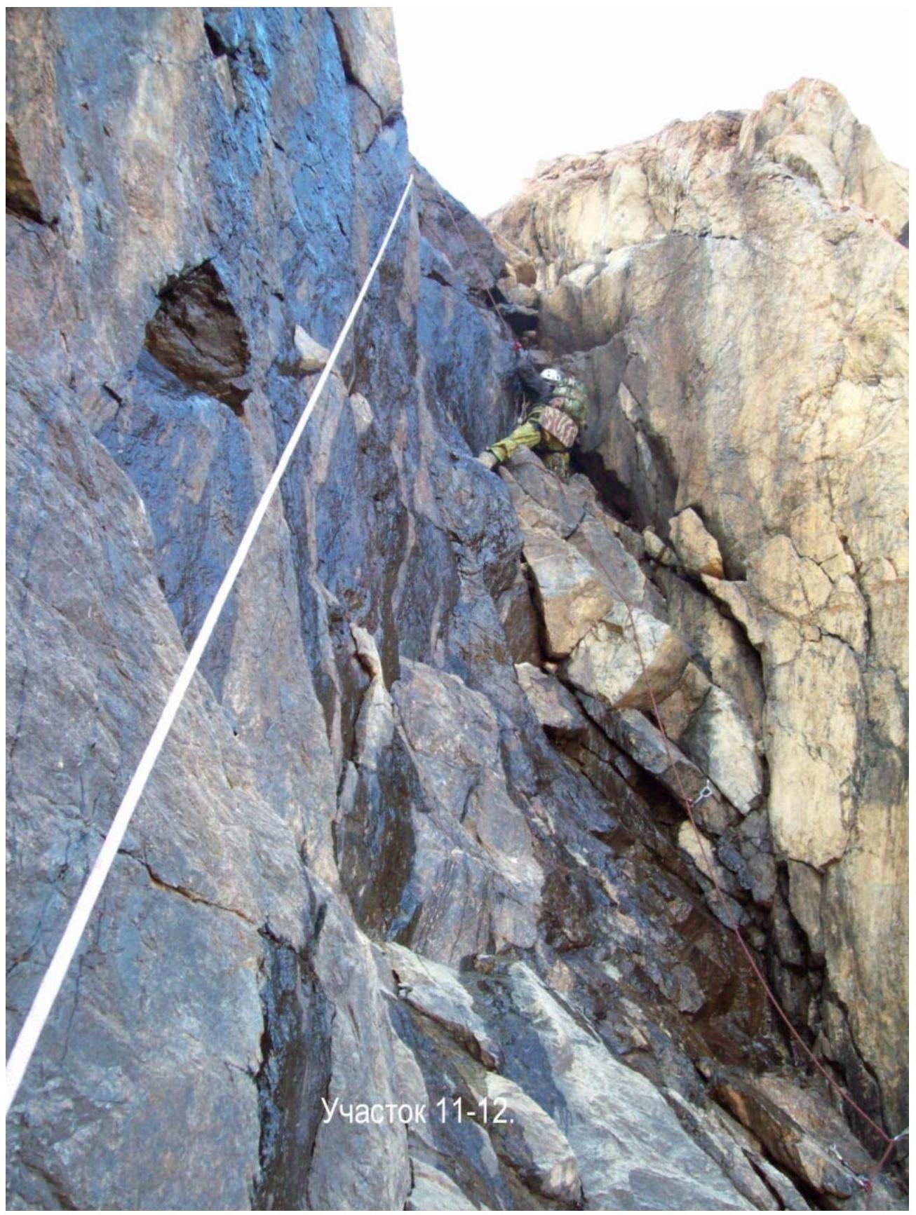
The route starts at an altitude of 2450 m. Access to the buttress is on the right via a ledge. R0–R1 — 20 m, 60°, III–. A small chimney in the slab to the right of the buttress. Exit to the buttress crest. R1–R2 — 5 m, I–. Ledge to the left. R2–R3 — 35 m, 60°, III–. Rock slab to the left of the buttress crest. Exit to the buttress. R3–R4 — 20 m, 90°, V–. Inner corner. Climbed using the "elephant" method. R4–R5 — 10 m, 92°, V+. Crack in the inner corner. R5–R6 — 5 m, 30°, II–. Ledge to the right. R6–R7 — 20 m, 60°, II+. Rock with loose stones on the ledges. Exit to a large ledge. Control cairn. R7–R8 — 40 m, 70°, III+. Rock wavy slab. R8–R9 — 25 m, 55°, II+. Series of wall ledges. Exit to the buttress crest on the right. R9–R10 — 20 m, 60°, III–. Along the buttress crest, transition to the left into the inner corner using a pendulum. R10–R11 — 50 m, 70°, III+. Black inner corner. Left side has a positive slope, right side is vertical. Move along the left stepped side with water seepage. R11–R12 — 50 m, 85°, V–. Wet inner corner. Exit to the wall roof with small loose scree. Altitude 2700 m. R12–R13 — 350 m, 40°, I+. Large-block rocks. R13–R14 — 600 m, 10°, I–. Movement to the west along the flat mountain roof with a slight ascent. No note found at the summit, although surveyors likely reached the summit, and possibly climbers as well.
Descent to the north via a cat. 1B route down short separate rock sections using a rope to a gentle fine scree, almost sandy, hill — 2 hours. Along the fine scree of the hill to the east towards the lake — 15 minutes, and then back to the base camp along the lake.
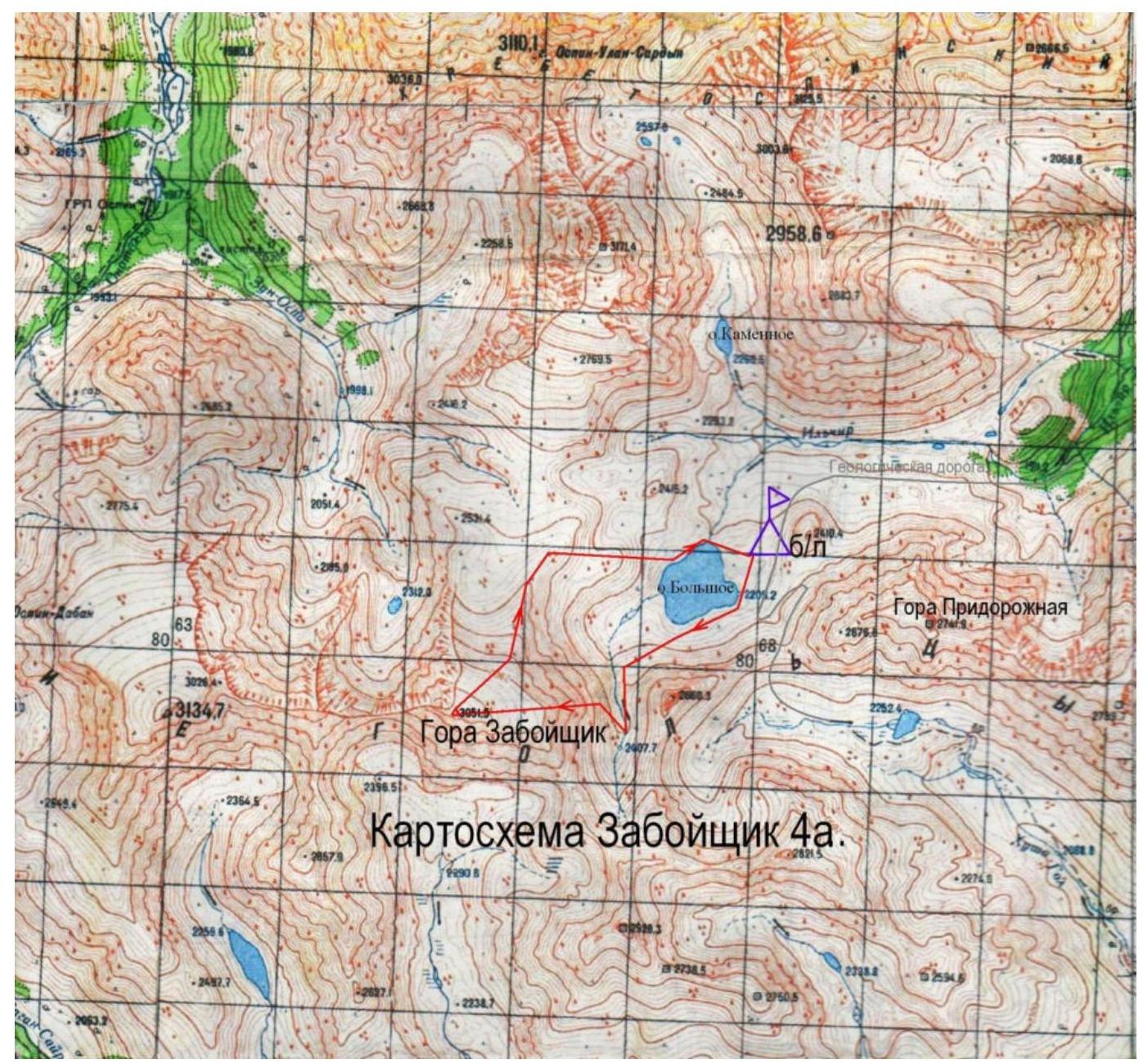
Map of Zaboyshchik 4A.
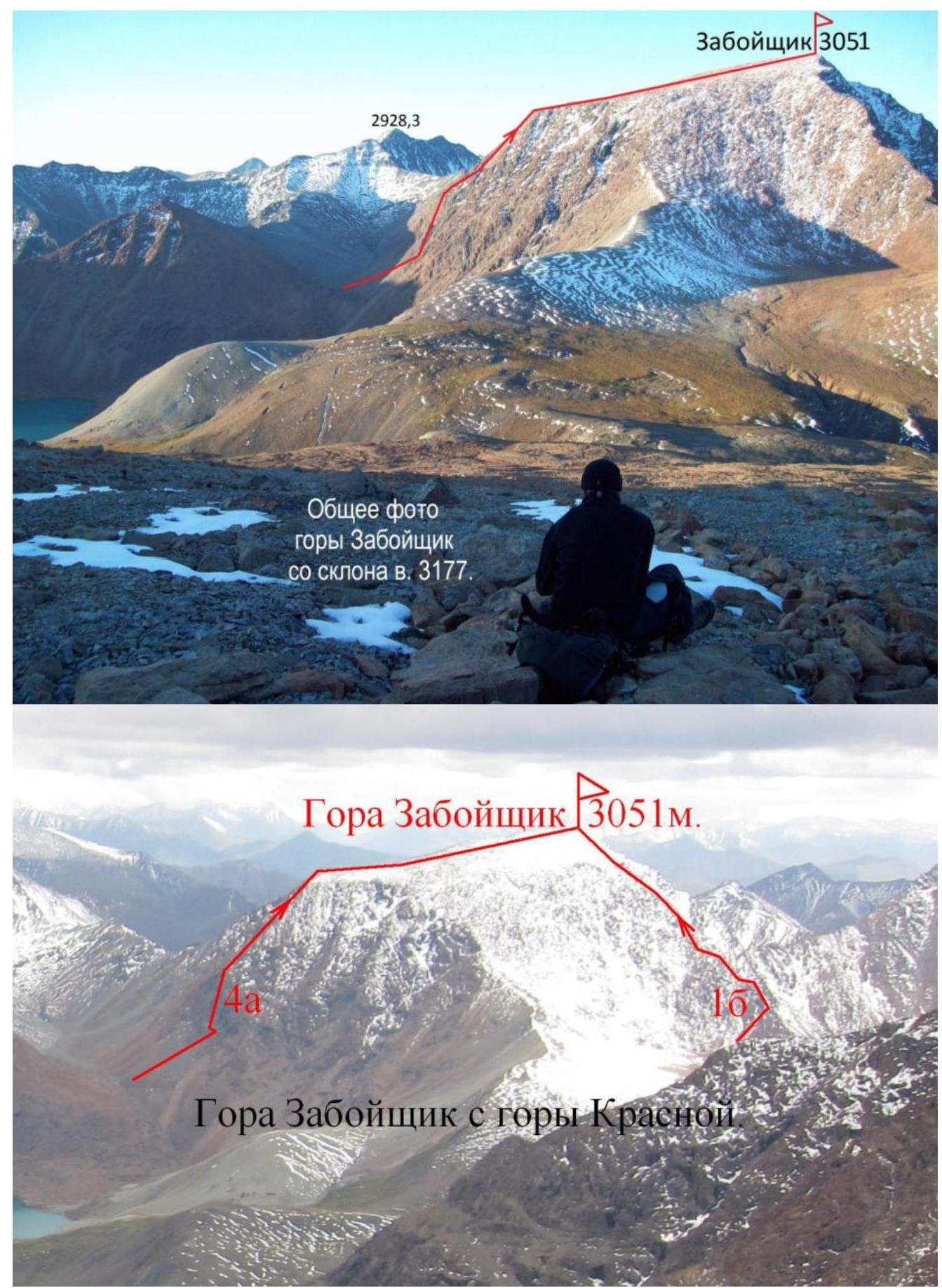
Zaboyshchik mountain 3051 m.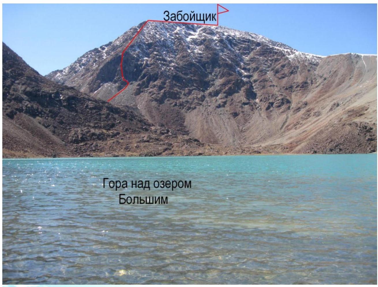 Zaboyshchik peak
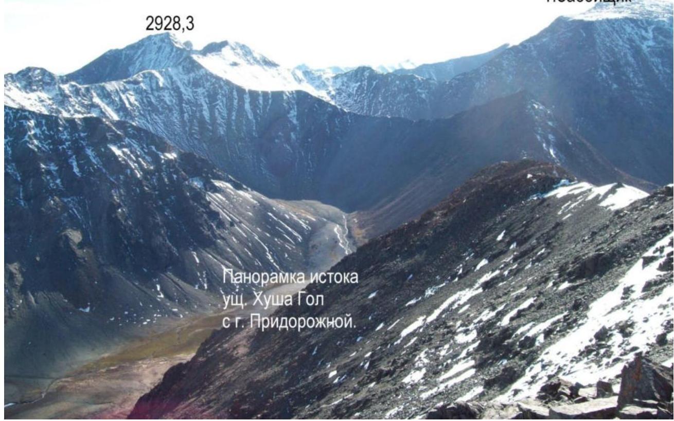
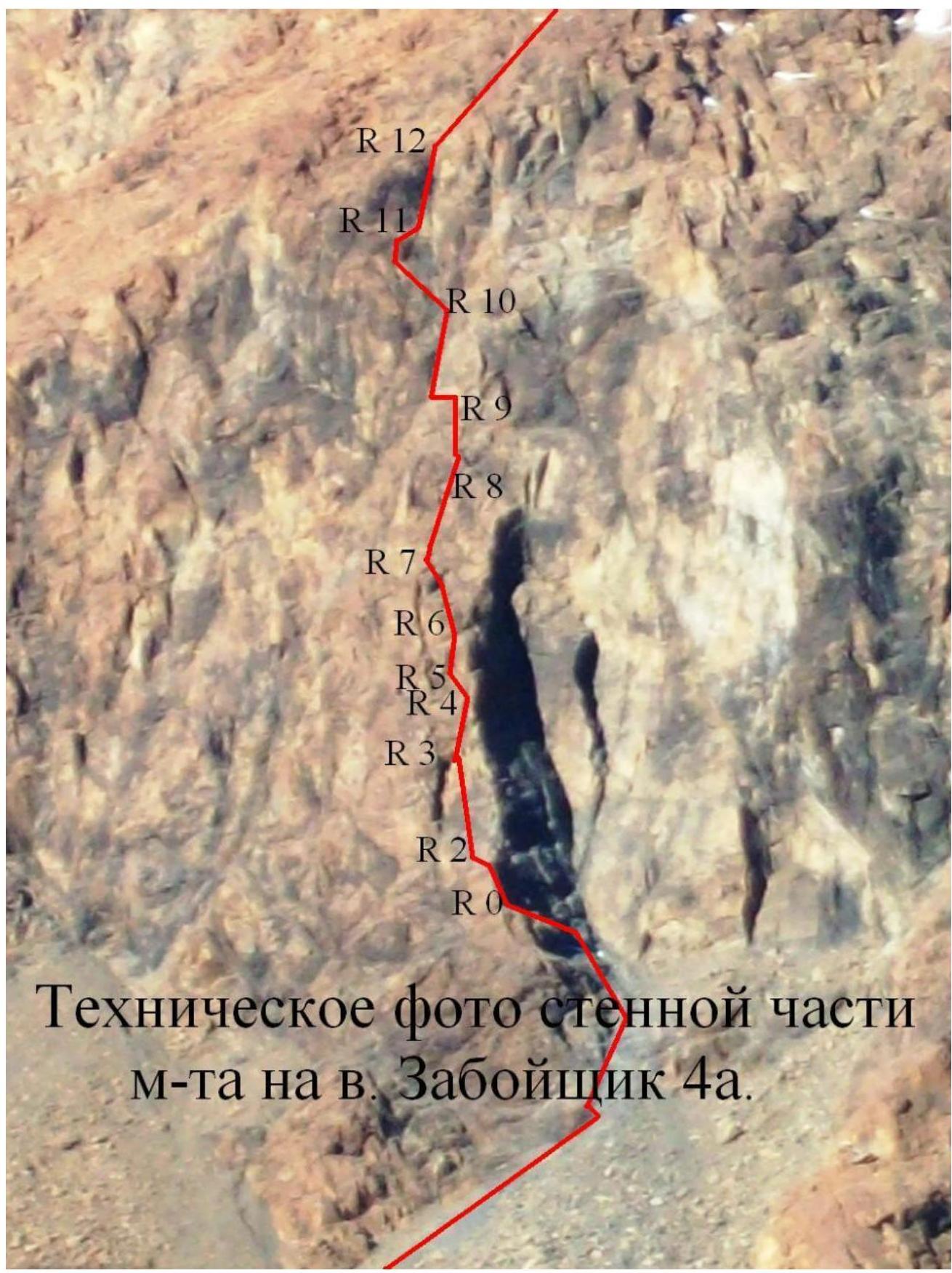
Technical photo of the wall section of the route on Zaboyshchik peak 4A.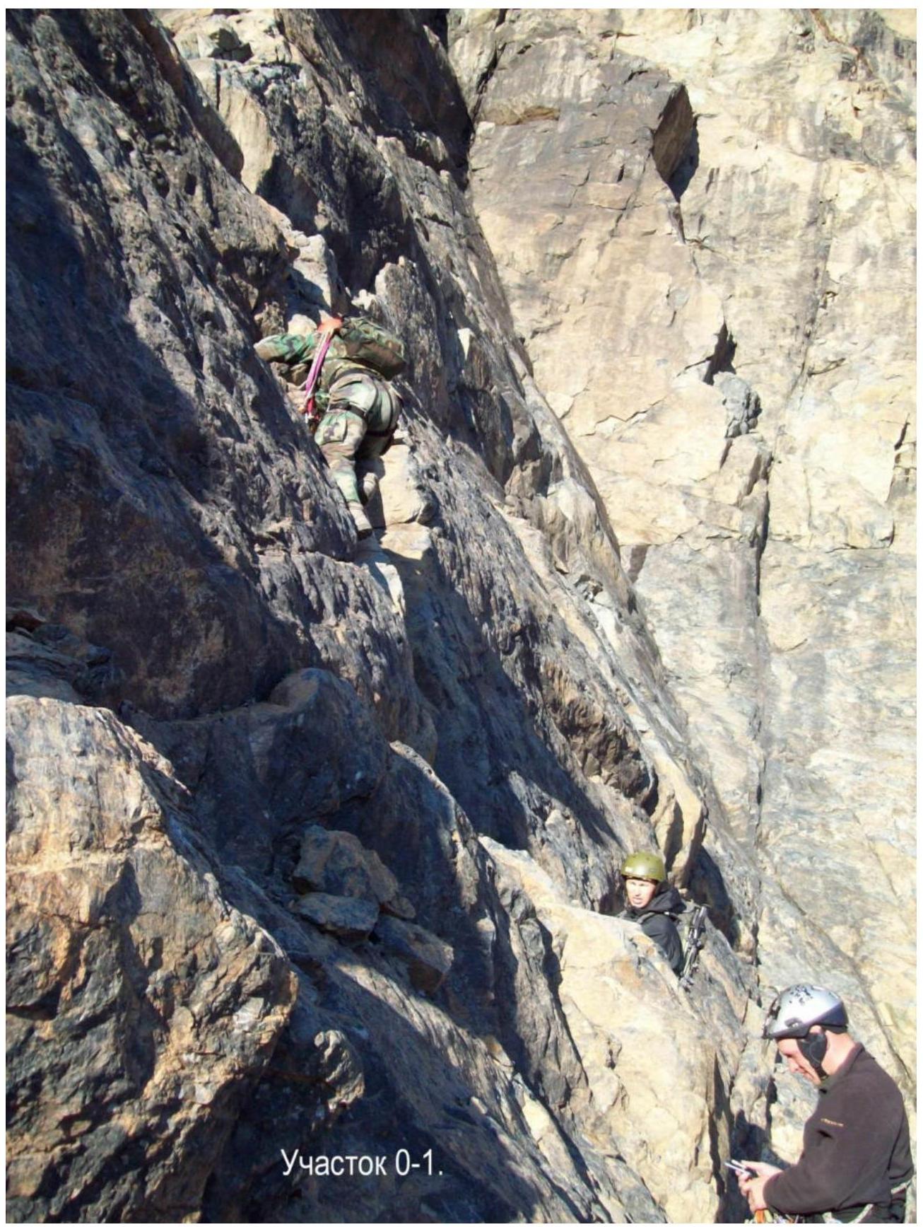
R0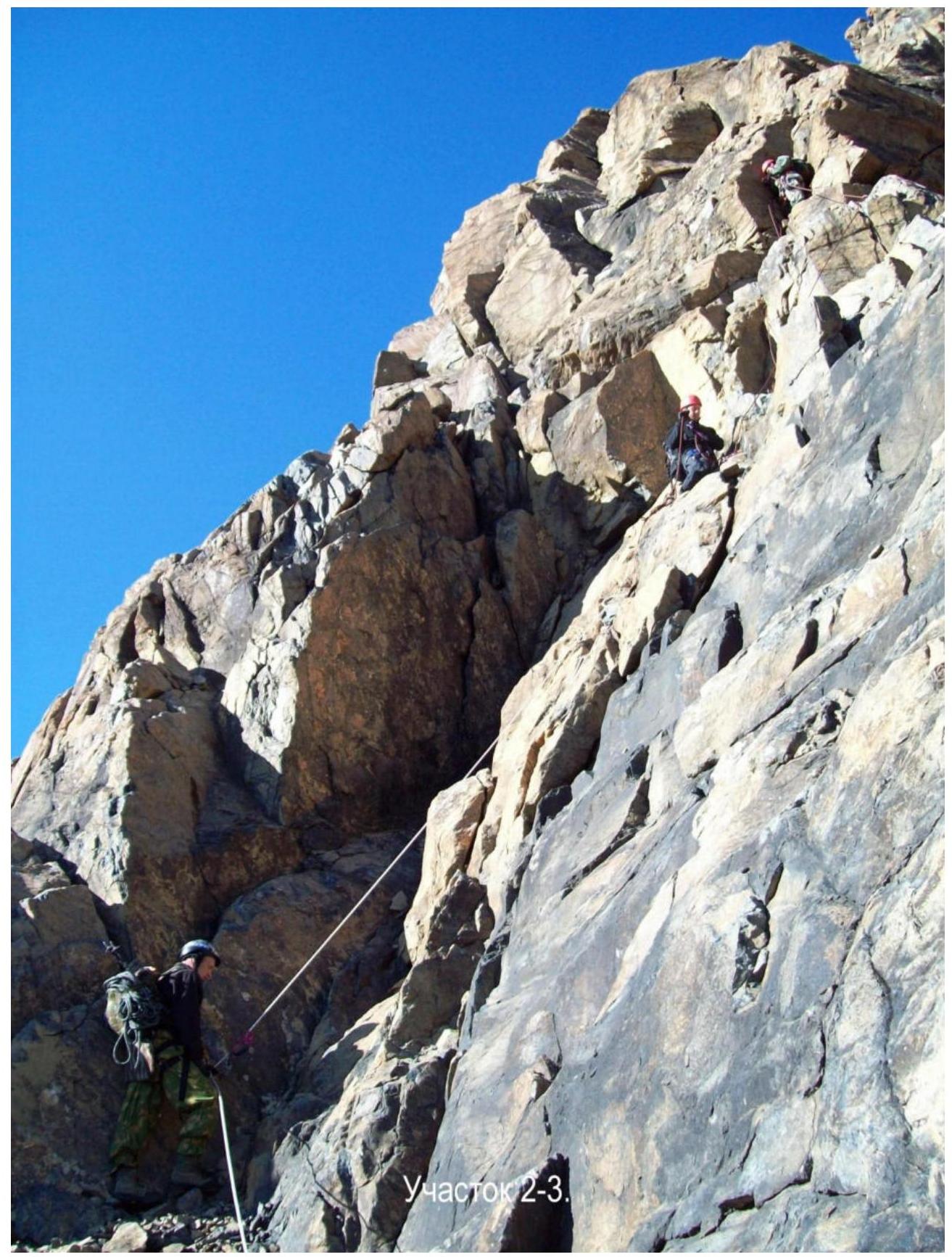
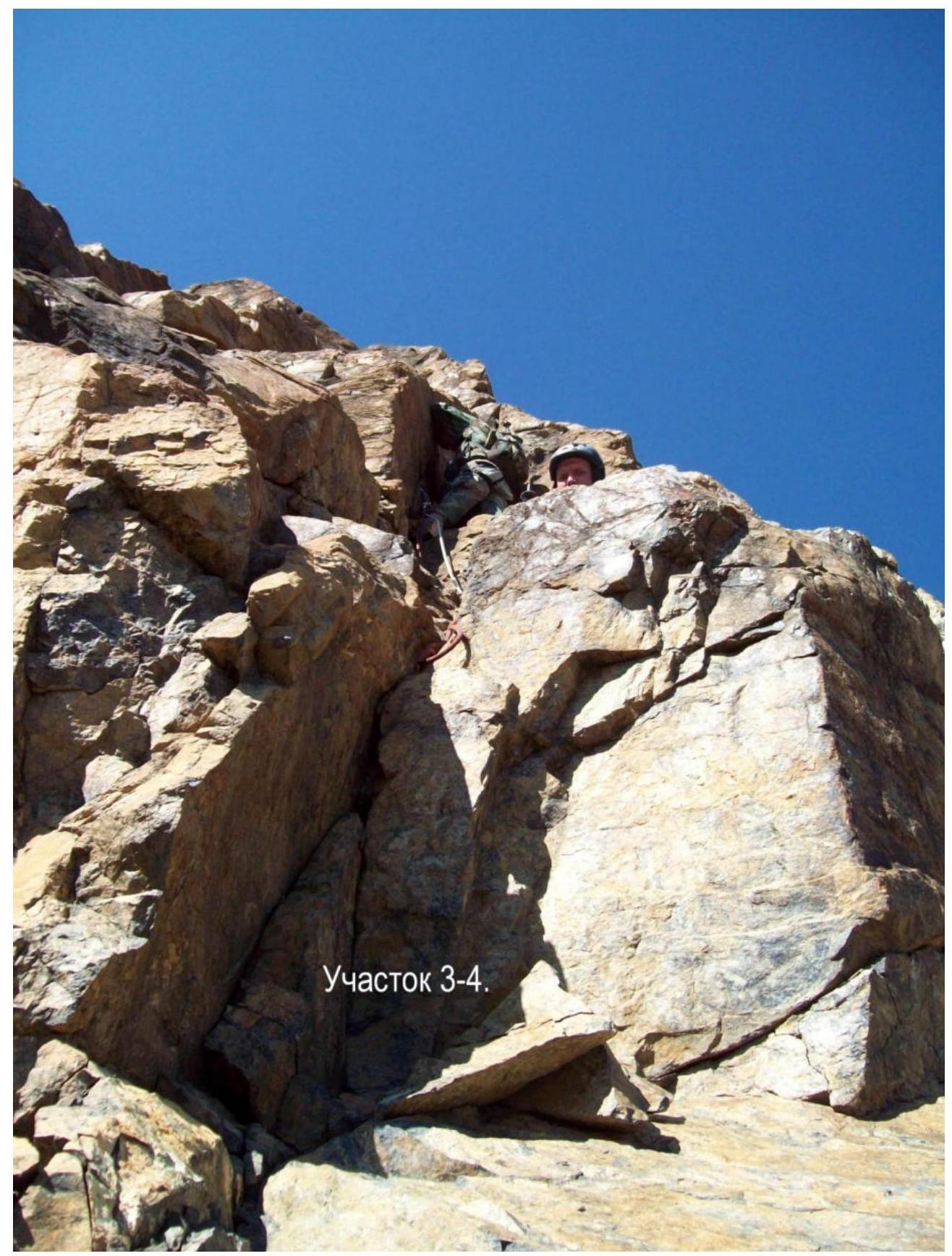
R3–R4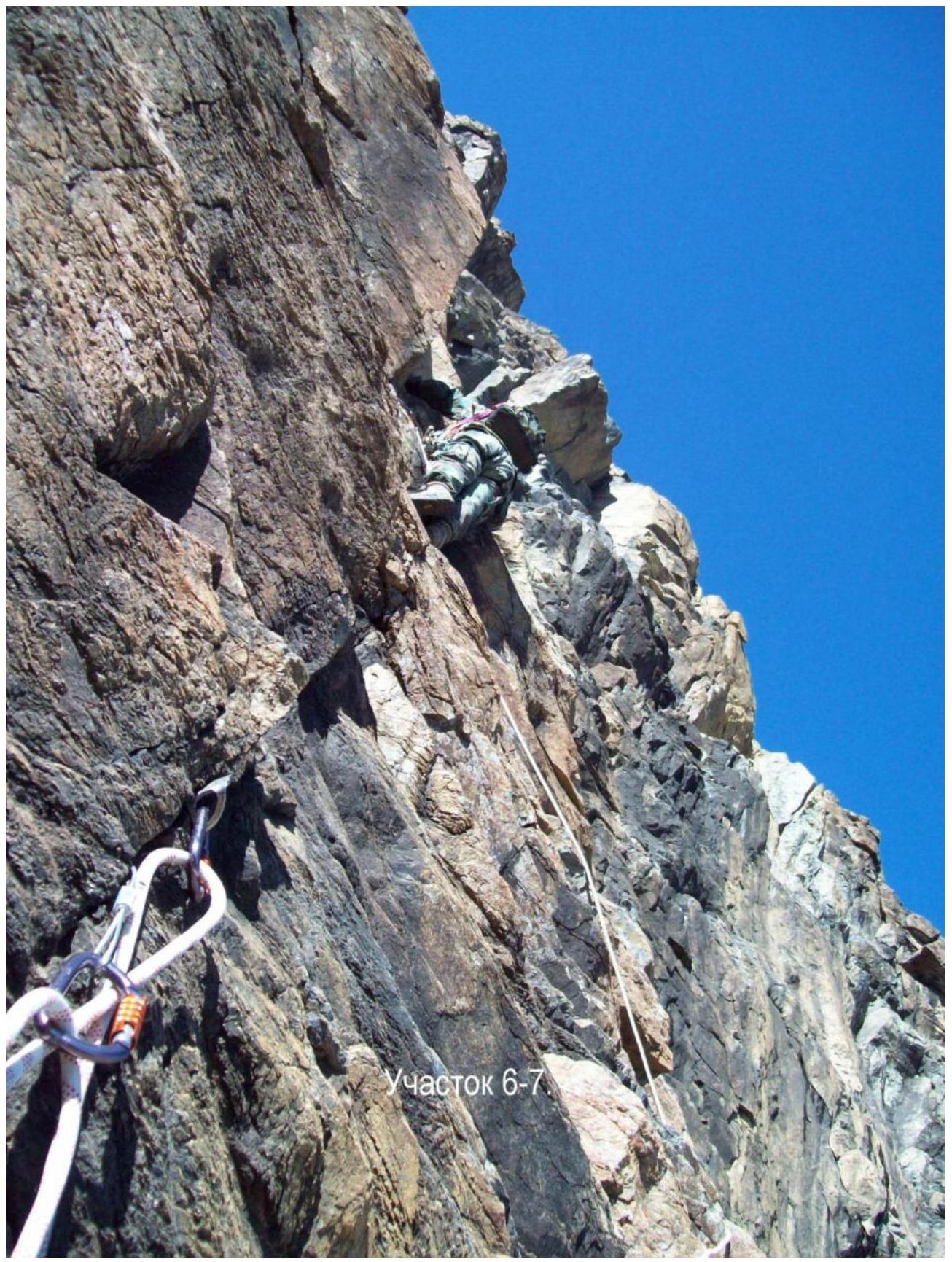
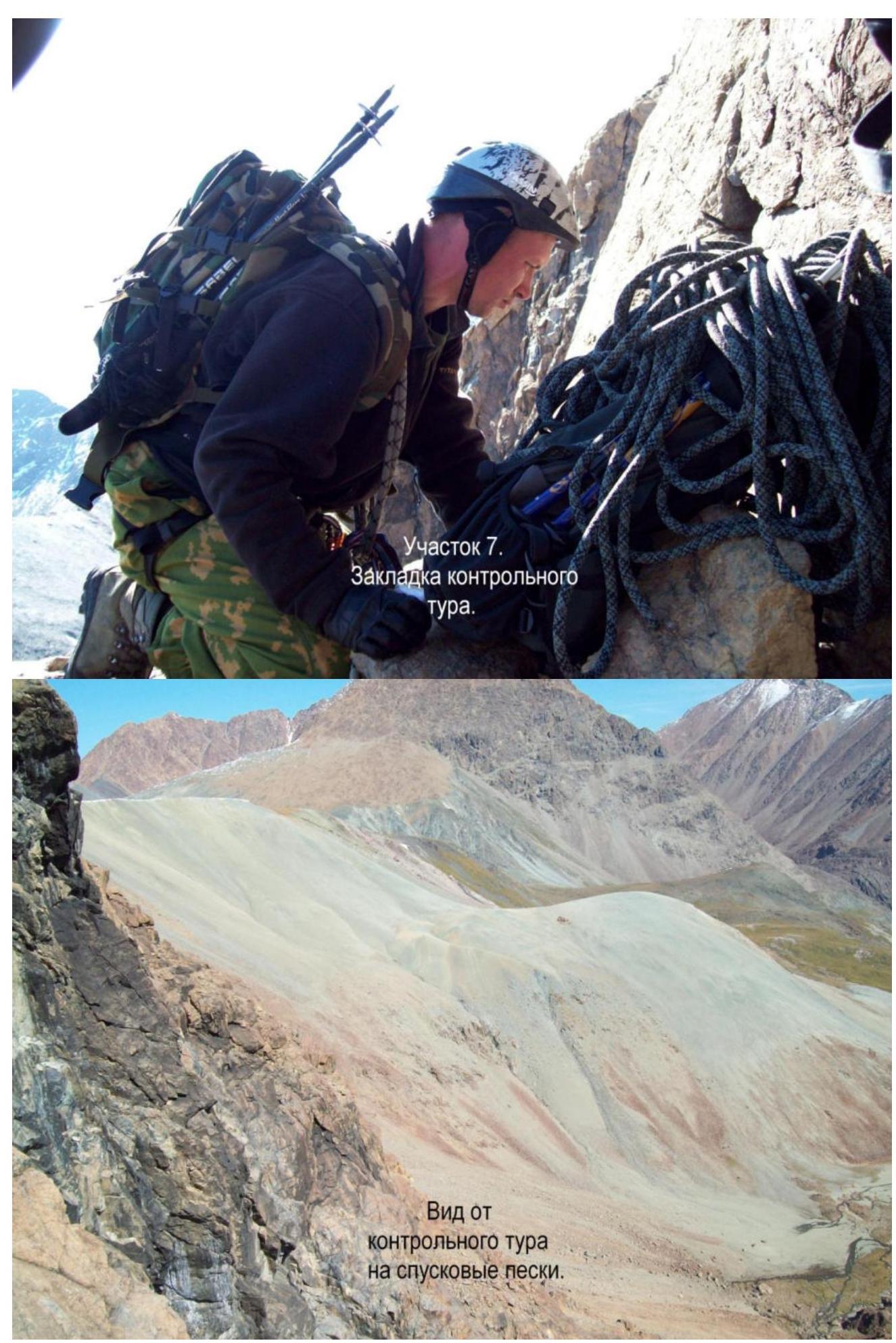
View from the control cairn towards the mica sands.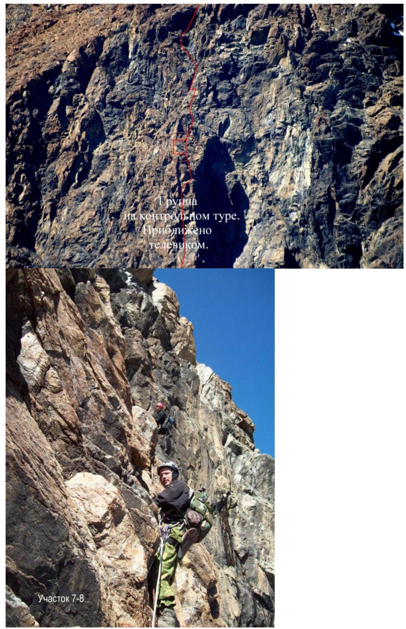
Section 7–8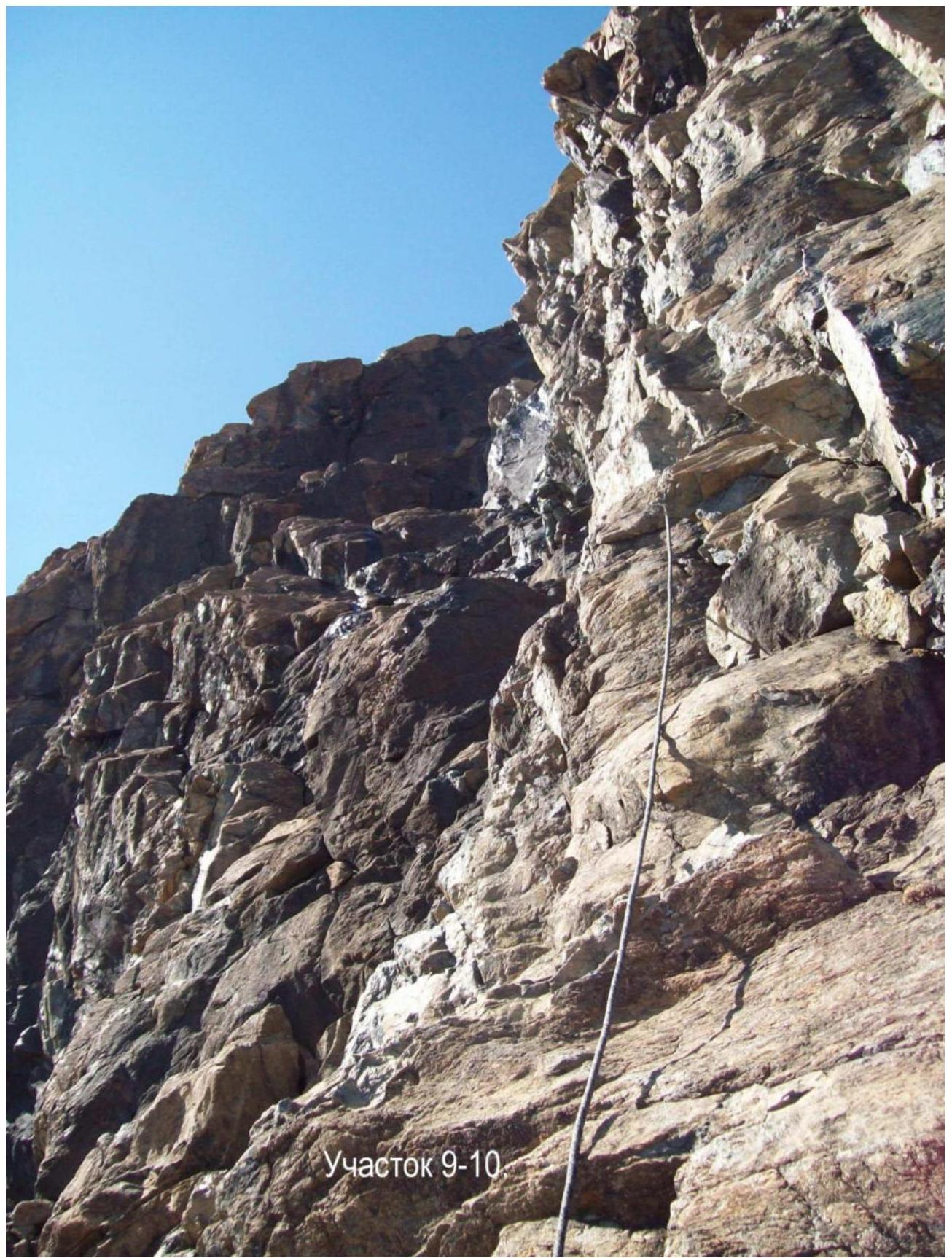
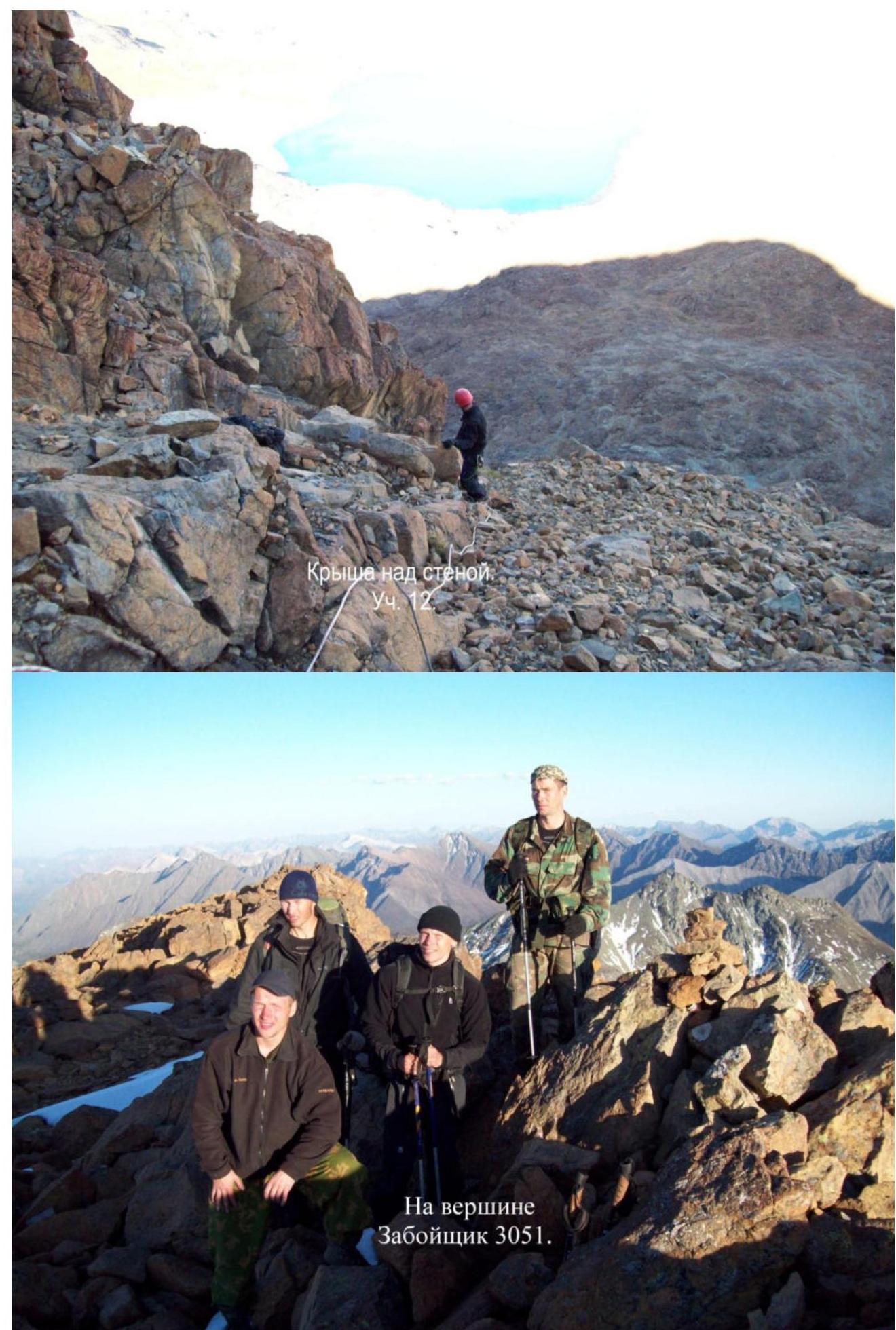
At the summit of Zaboyshchik 3051.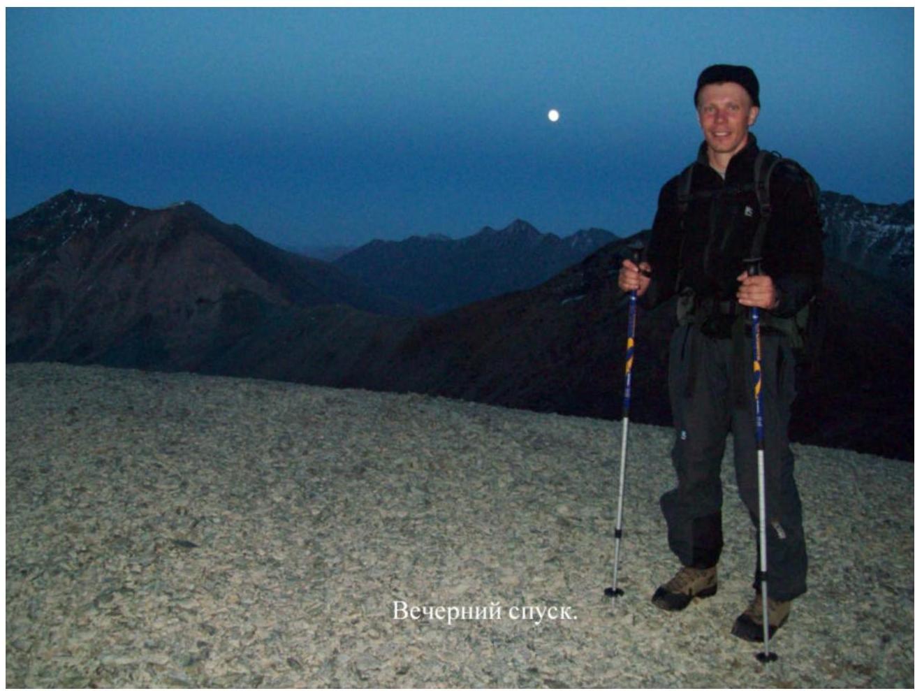
Comments
Sign in to leave a comment