
Report
On the first ascent
Peak Yanichar (2520 m) — Southeast ridge — Route 3B cat. diff. (proposed), first ascent — Eastern Sayan, Tunkinskie Goltsy ridge, Kharimta gorge, 6.1.2
Leader: Klepikov A.A. Participants:
- Drulis A.M.
- Lipchenko A.V.
- Oseev D.N.
- Pechenin K.V.
- Buinevich A.A.
- Matveychuk E.O.
The ascent was made on November 4, 2022.
I. Ascent Passport
| №№ p.p. | 1. General Information | |
|---|---|---|
| 1.1 | Full name, sports rank of the leader | Klepikov Alexander Alexandrovich, Master of Sports, 3rd category |
| 1.2 | Full name, sports rank of participants | Drulis Alexey Maximovich (2nd sports rank) Lipchenko Anastasia Vyacheslavovna (3rd sports rank) Oseev Dmitry Nikolaevich (3rd sports rank) Pechenin Kirill Vadimovich (3rd sports rank) Buinevich Alexey Andreevich (3rd sports rank) Matveychuk Elizaveta Andreevna (3rd sports rank) |
| 1.3 | Full name of the coach | Afanasiev Andrey Evgenievich, Master of Sports, 1st category |
| 1.4 | Organization | FASIО |
| 2. Characteristics of the ascent object | ||
| 2.1 | Region | Eastern Sayan, Tunkinskie Goltsy ridge |
| 2.2 | Gorge | Kharimta gorge |
| 2.3 | Section number according to the 2020 classification table | 6.1.2 |
| 2.4 | Name and height of the peak | Yanichar (2520 m) |
| 2.5 | Geographical coordinates of the peak (latitude/longitude) | 51°57′02.81″N, 102°34′16.11″E |
| 3. Characteristics of the route | ||
| 3.1 | Route name | SE ridge |
| 3.2 | Proposed category of difficulty | 3B |
| 3.3 | Degree of route development | First ascent |
| 3.4 | Nature of the route relief | Rocky |
| 3.5 | Height difference of the route and main part | 220 m |
| 3.6 | Length of the route and main part | 505 m |
| 3.7 | Technical elements of the route (total length of sections of various difficulty categories is indicated, indicating the nature of the relief (ice-snow, rocky)) | II cat. diff. rocks — 315 m. III cat. diff. rocks — 105 m. IV cat. diff. rocks — 85 m. Descent by rappel (on descent) — (1 rope 30 m) |
| 3.8 | Descent from the peak | Along the Western couloir into the Kharimta gorge. |
| 3.9 | Additional route characteristics | In summer, there is usually no water on the route. |
| 4. Characteristics of the team's actions | ||
| 4.1 | Time of movement (team's walking hours, indicated in hours and days) | 7 h 20 min walking hours to the peak, 1 day |
| 4.2 | Overnights | No |
| 4.3 | Exit to the route | 8:40 November 4, 2022 |
| 4.4 | Exit to the peak | 16:00 November 4, 2022 |
| 4.5 | Return to the base camp | 19:00 November 4, 2022 |
| 5. Responsible for the report | ||
| 5.1 | Full name, e-mail | Klepikov A.A., Baikalteam@gmail.com |
Photo of the general view of Yanichar peak (2520 m). (The photo was taken from the ridge between the peaks Strazh and Grenader, approximately 2400 m above sea level, distance from the object 1500–2000 m).
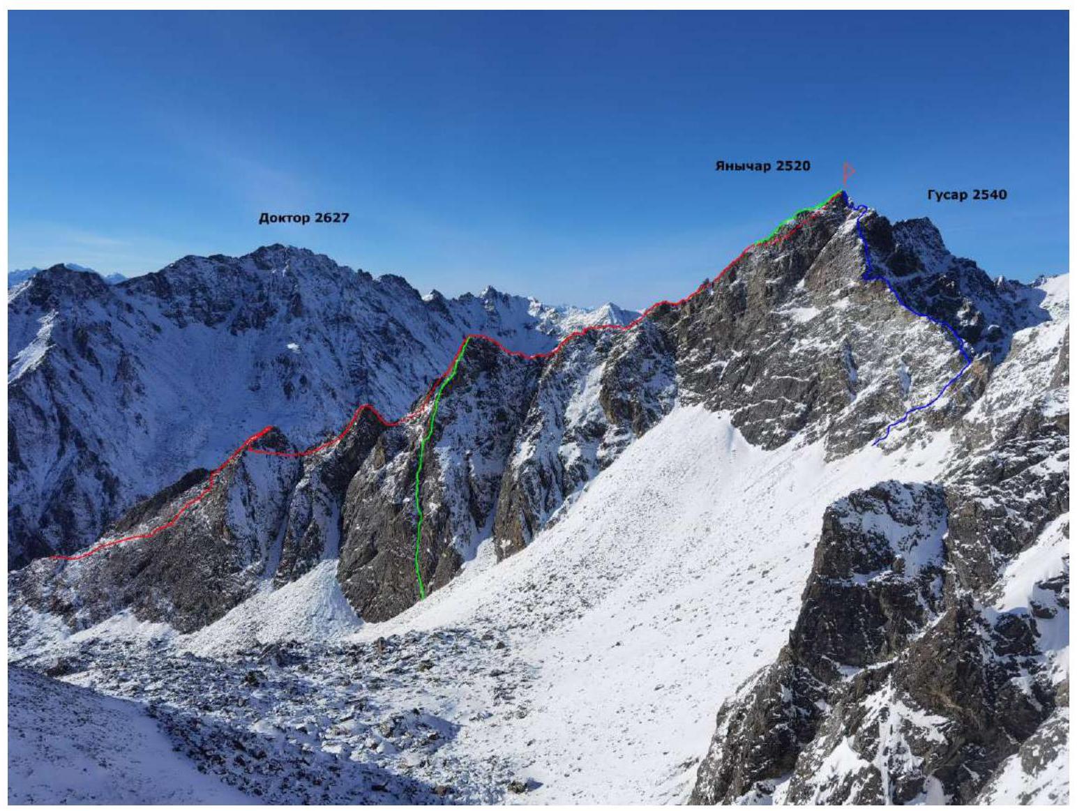
BLUE — team's route SE ridge 3B cat. diff. RED — route SW ridge 3A cat. diff., n/k (Klepikov A.A., 2022). GREEN — route S side SW ridge 4A cat. diff., n/k (Klepikov A.A., 2022).
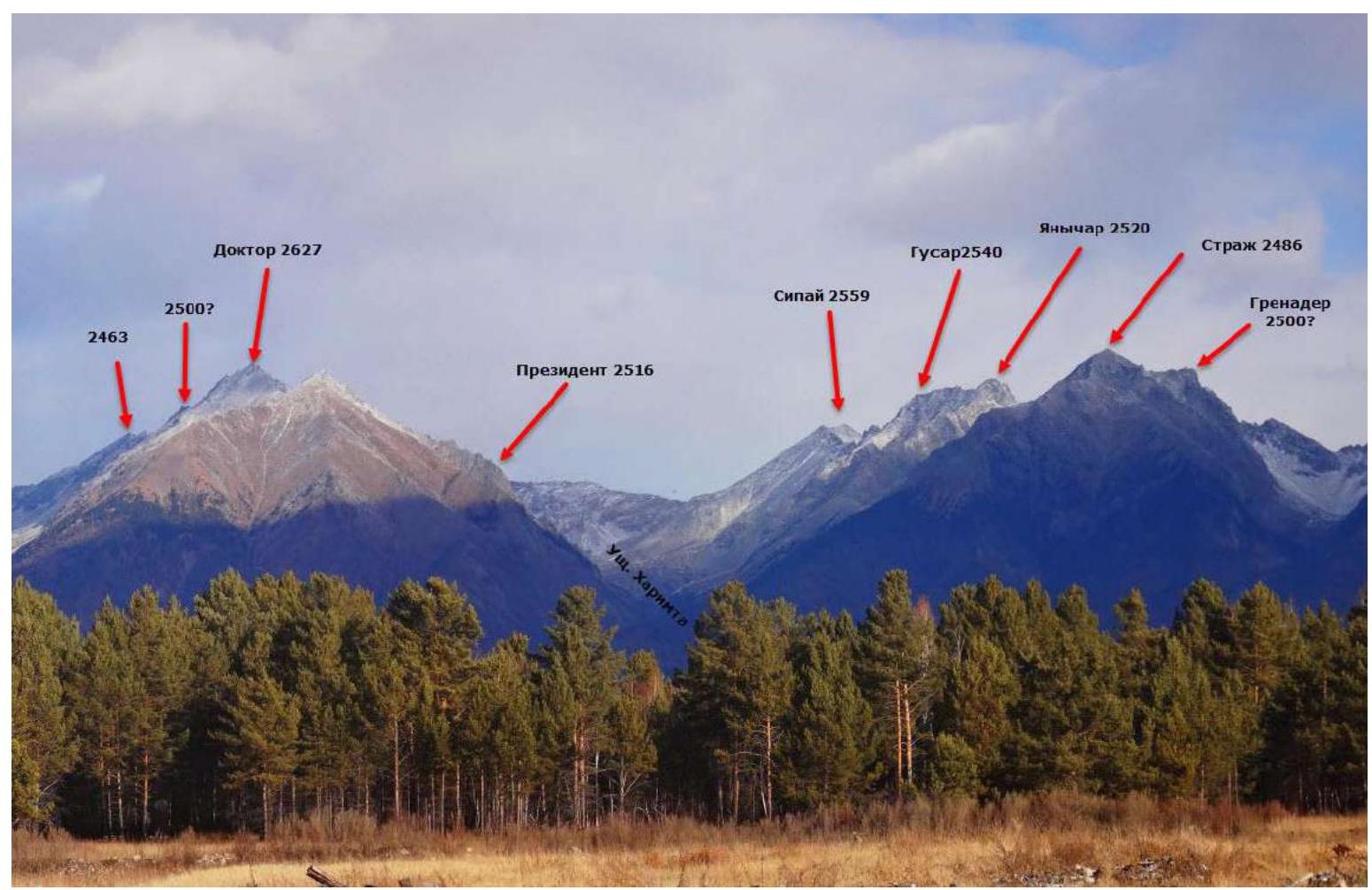
Panorama of the peaks of the Tunkinskie Goltsy ridge in the area of the Kharimta gorge. (The photo was taken from the Tunkinskaya valley, distance approximately 10 km).
Map-scheme of the approach to the Kharimta gorge
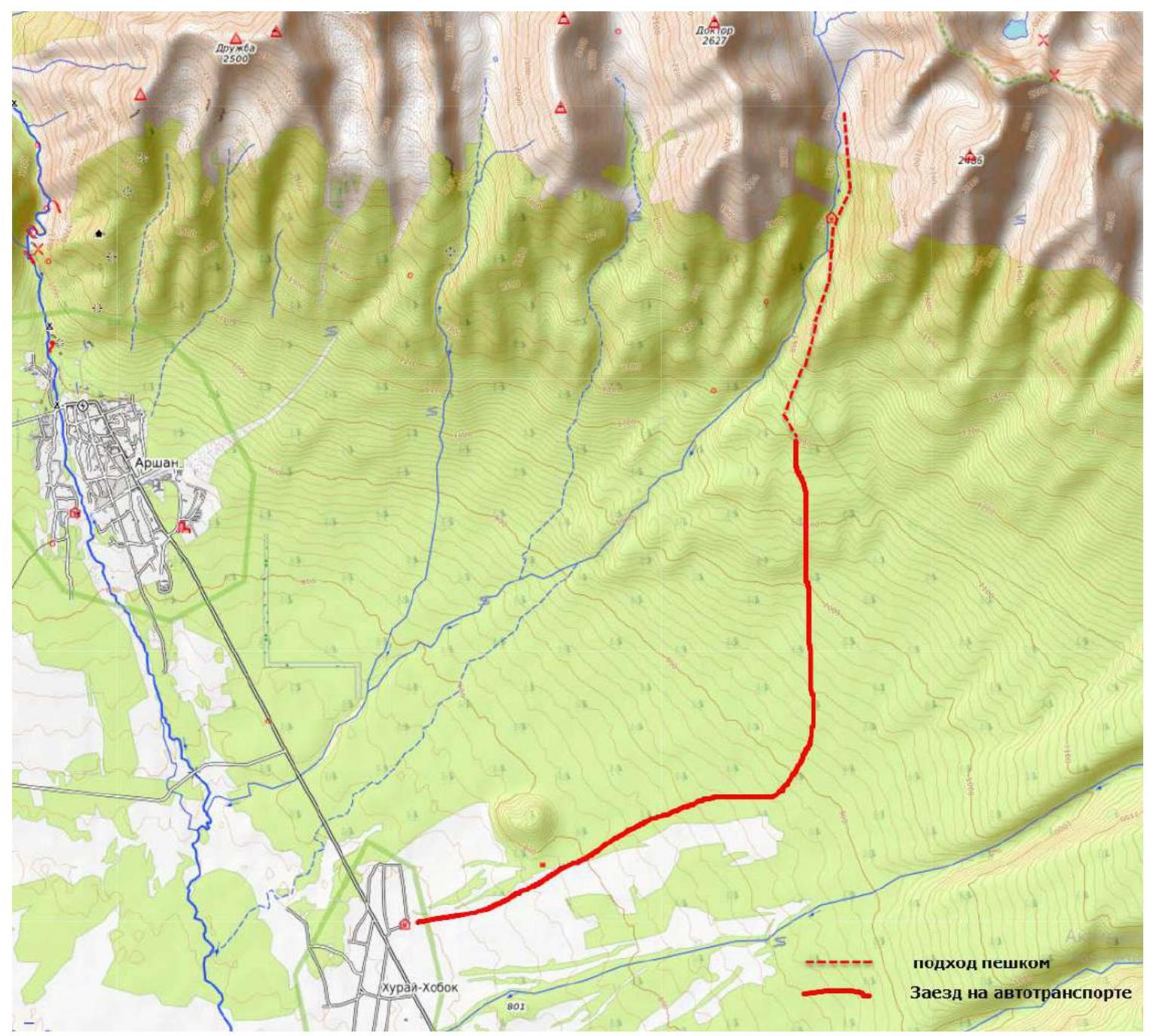
Map-scheme of the Kharimta gorge

The Kharimta gorge is located in the Tunkinskie Goltsy ridge near the Arshan settlement and faces the Tunkinskaya valley. The gorge is a rather interesting training ground for alpine development, due to its rich relief, size, and height differences of about 1000 m, as well as transport accessibility. The Kharimta gorge is the only true gorge in the Tunkinskie Goltsy ridge to the right of the Arshan settlement and mountain; the other gorges are actually hanging valleys — cirques, breaking off into the Tunkinskaya valley. Kharimta has a deeply incised valley with a branched system of cirques in the upper reaches and on the left side in the middle part.
The nearest large settlement is the Arshan settlement. The approach is made by driving to the entrance of the gorge. A car can deliver to an elevation of 1200 m above sea level. The time for the approach from the Arshan settlement to the trail is no more than 1 hour. The time for the approach along the trail to the base camp near the forest boundary is about 2–3 hours. The average time to approach the described route can be broken down as follows: Arshan settlement — trail 1 h, trail — hunter's shack BC1 — 2 h, hunter's shack BC1 — start of the technical part of the route — 1.5 h. The gorge has potential for ascents and classification of routes up to 4B/5A cat. diff. As of the end of 2022, more than 10 routes from 1B to 4A cat. diff. have been laid out in the gorge.
Technical photo of the route
The photo was taken from the slope of the Grenader peak, distance 1000 m, shooting height 2350 m.

Description and characteristics of the relief
The start of the route is the slope under the saddle of the ridge connecting the peaks Yanichar and Grenader. The start of the route is at an altitude of 2300 m.
- R0–R1: 50 m, 55°, 3, snow-covered grassy rocks
- R1–R2: 50 m, 45°, 2, along the couloir towards the saddle
- R2–R3: 40 m, 45°, 2, to the right of the ridge, bypassing its steep part along the inner form, crossing it to the right, we come out onto a shoulder extending from the ridge
- R3–R4: 40 m, 35°, 2, to the right of the ridge, coming out onto the ridge itself
- R4–R5: 40 m, 15°, 2, along the ridge under the gendarme — the first key section
- R5–R6: 15 m, 65°, 3, gendarme wall
- R6–R7: 5 m, 0°, 2, exit to a shoulder to the right of the ridge
- R7–R8: 20 m, 70°, 4, exit to the gendarme, station
- R8–R9: 40 m, 50°, 2, through the gendarme, exit to the saddle (saddle in the ridge)
- R9–R10: 20 m, 50°, 2, несложная каменистая сыпуха под более крутую часть бастиона, станция
- R10–R11: 25 m, 65°, 3, beginning of the key rope, wall ledges
- R11–R12: 15 m, 60°, 3, approach under the vertical inner corner
- R12–R13: 10 m, 90°, 4, complex inner corner. It is possible that it will be easier to pass the section to the left
- R13–R14: 5 m, 50°, 2, to the station on the ledge
- R14–R15: 25 m, 65°, 4, wall upwards between the spalled "beak" and the main wall
- R15–R16: 15 m, 45°, 2, upwards under the ridge, station below the ridge
- R16–R17: 10 m, 45°, 2, along the gully onto the ridge
- R17–R18: 20 m, 10°, 2, along the ridge with a slight descent
- R18–R19: 30 m, 70°, 4, bypassing the gendarme to the right with an exit to the sub-peak
- R19–R20: 30 m, 45°, 2, along the ridge to the peak
Characteristics of the route and the team's actions.
The route taken by the team is a logical line along the SE ridge of Yanichar peak. From this side of the mountain, this is the most straightforward path to the peak; any other options will be technically more complex.
The SE ridge has steep walls on both sides of the ridge, and the simplest path goes along the knife-edge of the ridge. The route is quite safe in terms of rockfall: the line goes along the outer forms of the relief, the relief is quite strong and relatively monolithic. Special attention should be paid to rockfall danger during descent in snow-free time; for this, the team used a tactic on the descent where the rope was lowered in such a way that the rope did not hang directly above the team members on hazardous sections. In winter, rockfall danger is extremely minimal in the entire area. Avalanche danger on the route is an objective factor only at the very beginning of the route when climbing to the saddle between Yanichar and Grenader peaks. Also, in winter, pay attention to the descent couloir, having previously "cleared" it.
The route has two key sections: in the middle of the route and in the upper part. There is a possibility of needing to use artificial climbing aids (ICA) on the key sections. The route is quite challenging for 3B; it falls short of being 4A due to a lack of length of technically complex sections and a slightly more complex key.
The descent from the peak is made to the west towards the Kharimta gorge along the Western couloir. The descent is made on foot along the ledges, insurance is necessary, there is a safe area to fall, and there are also places to organize insurance even in winter. In the lower part of the descent, there is a 25 m rappel, after which the descent continues relatively safely on foot without insurance.
The author's experience with 3B routes: 11 ascents on 8 routes in the Sayan Mountains and the Caucasus. In terms of technical complexity, this route ranks among the most challenging, standing out for its complexity, decent length, and variety of sections of different characters and difficulties.
Cellular network coverage ("Tele2") is available along almost the entire route.
-
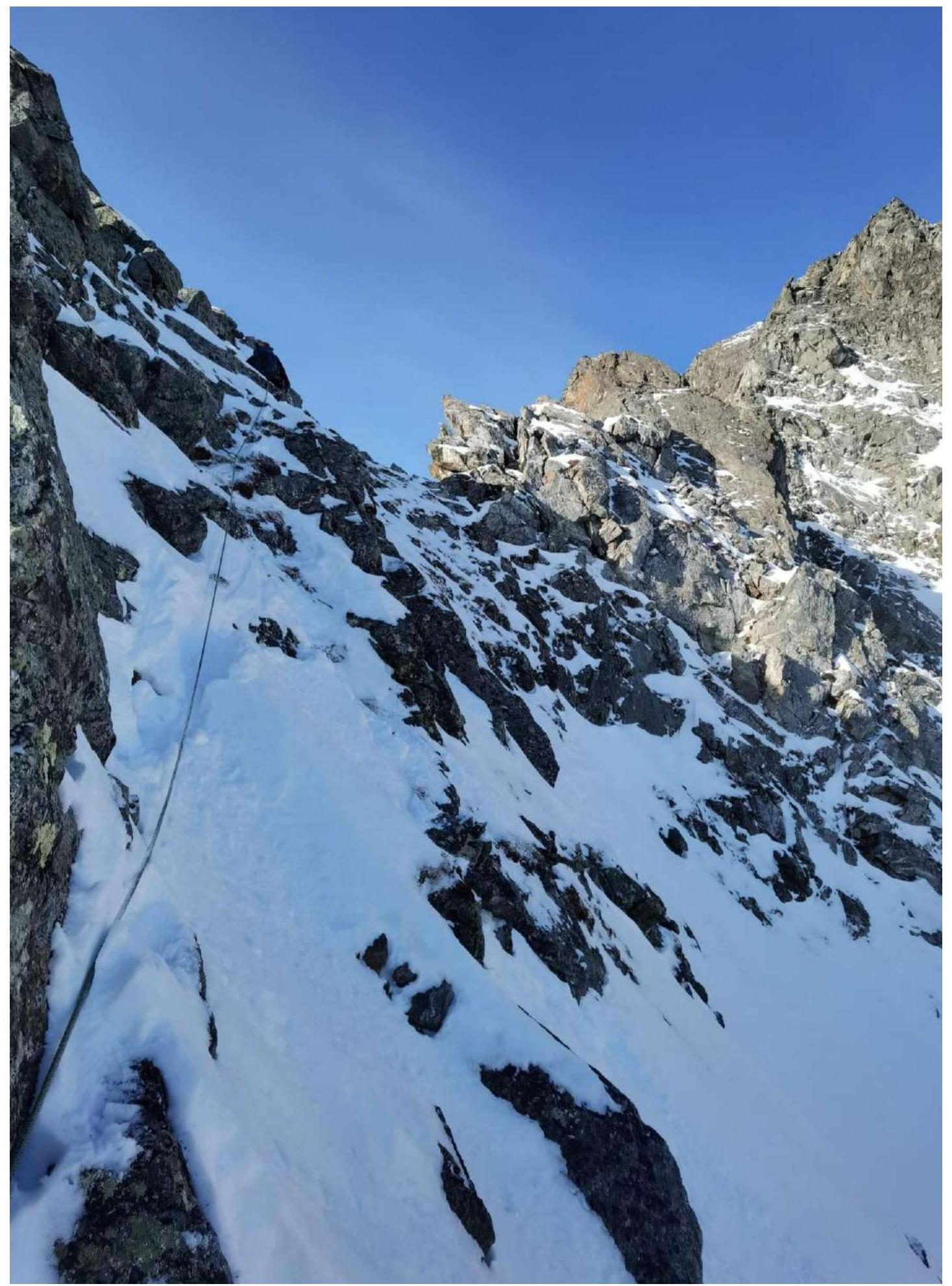
Section R0–R1: Snow-covered rocks with grass, complex climbing on smoothed-out relief.
-
Section R3–R4: Bypass to the right.
-
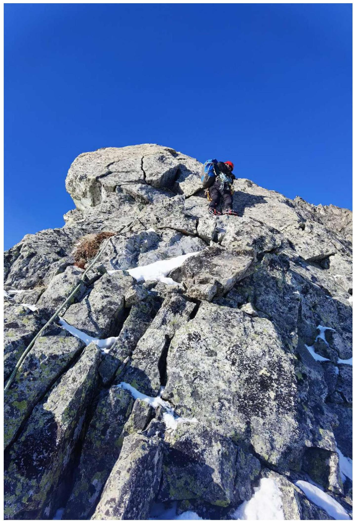
Section R5–R6: Beginning of the first key — gendarme wall.
-
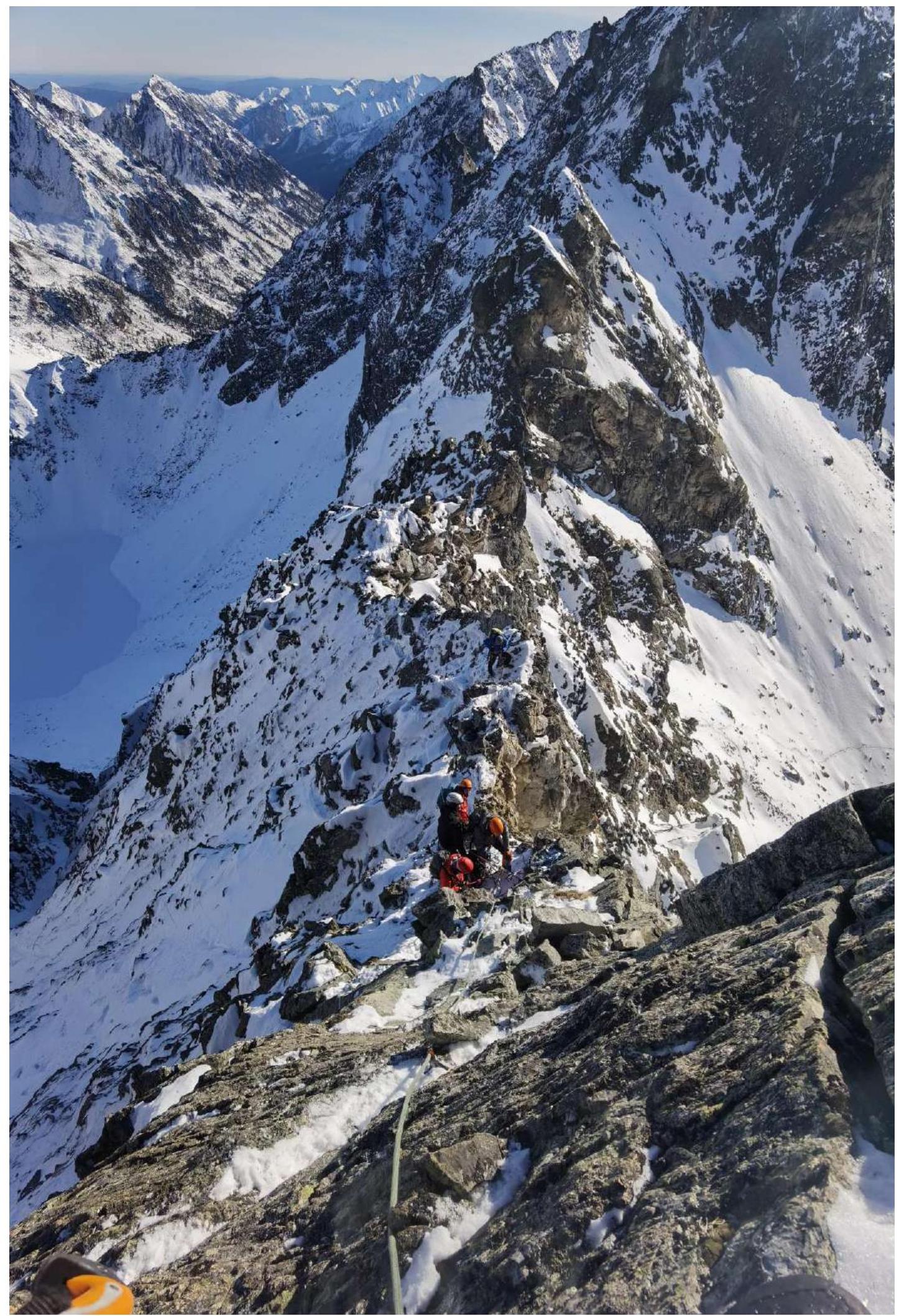
View downwards from section R5–R6.
-
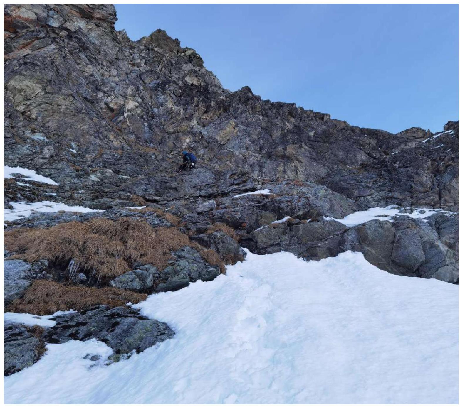
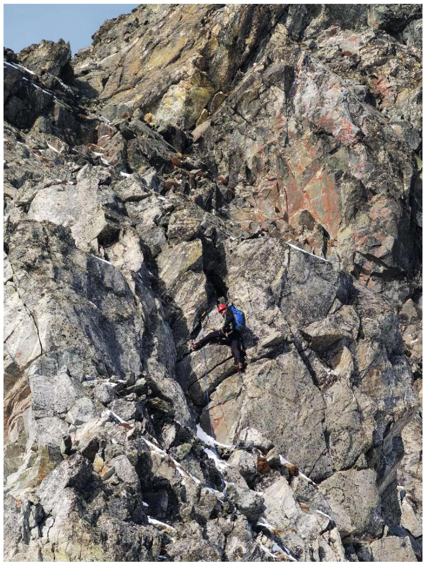
Leader on section R10–R11: Second key, lower part.
-
Section R12–R13: Vertical inner corner.
-
Section R14–R15: Wall between the spalled "beak" (left) and the main wall (right).
-
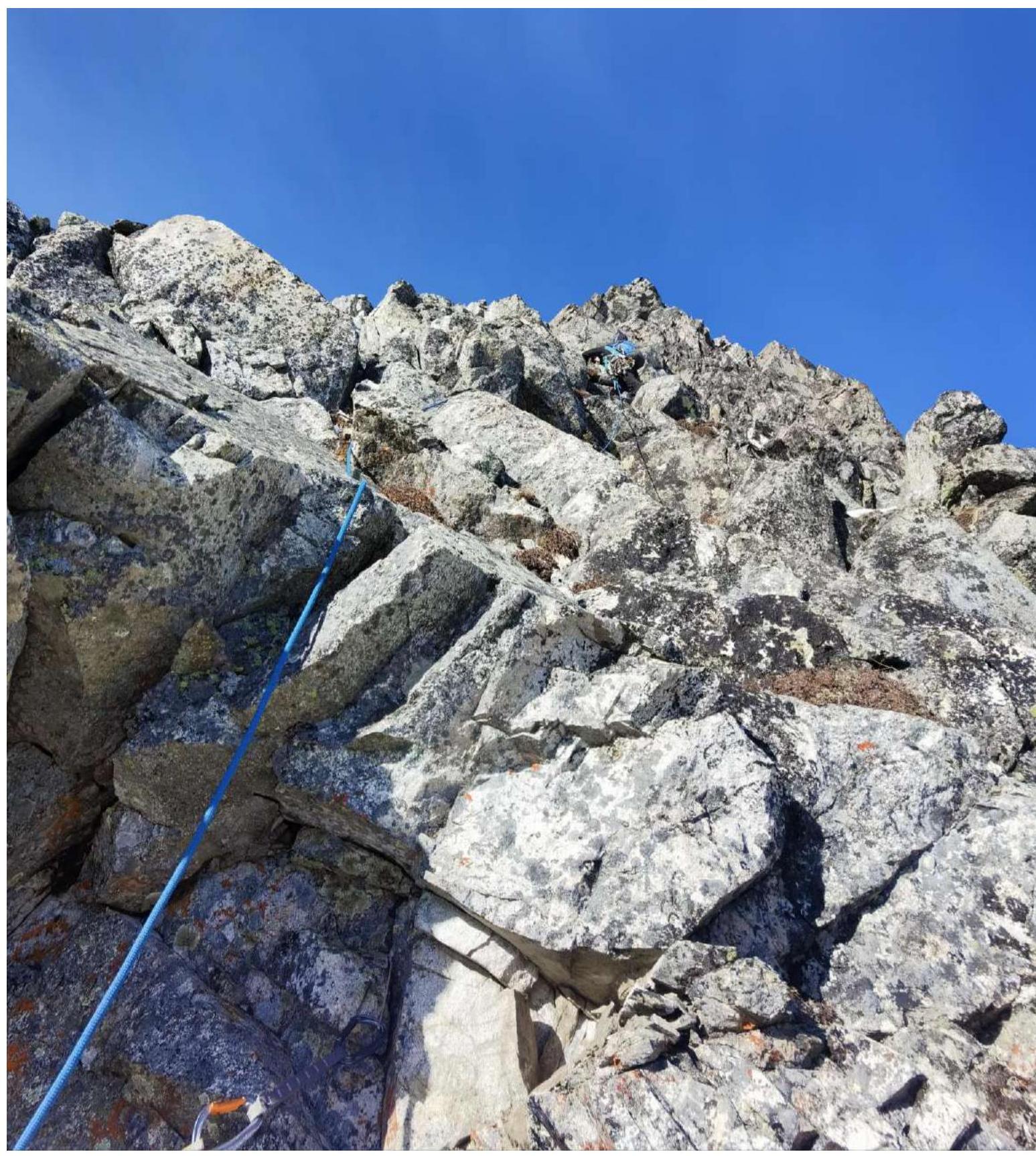
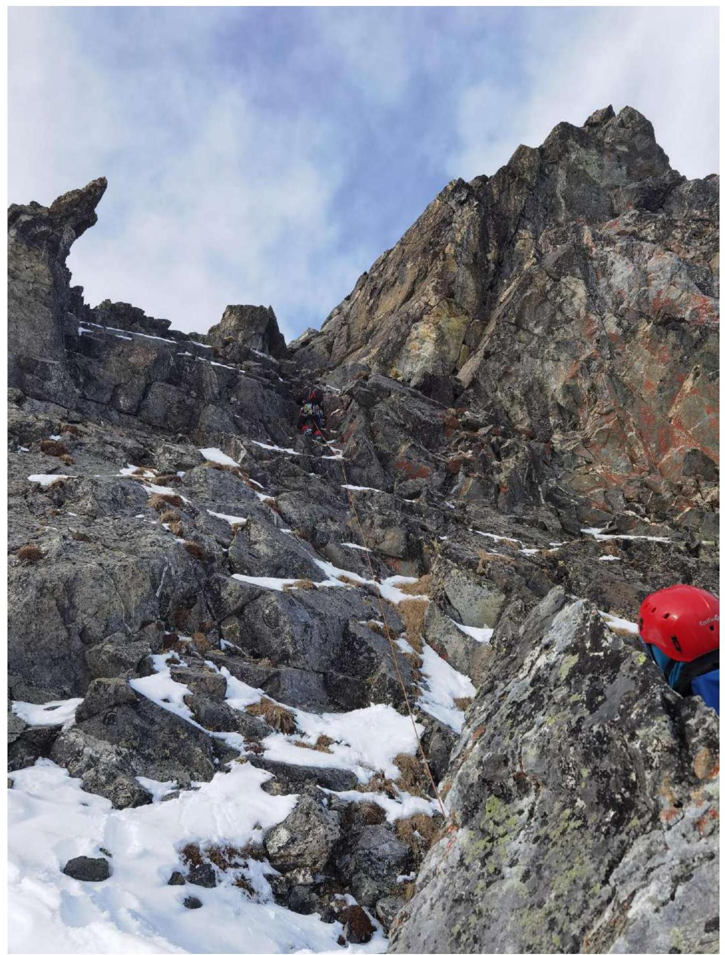
Section R18–12: Middle of the section.
-
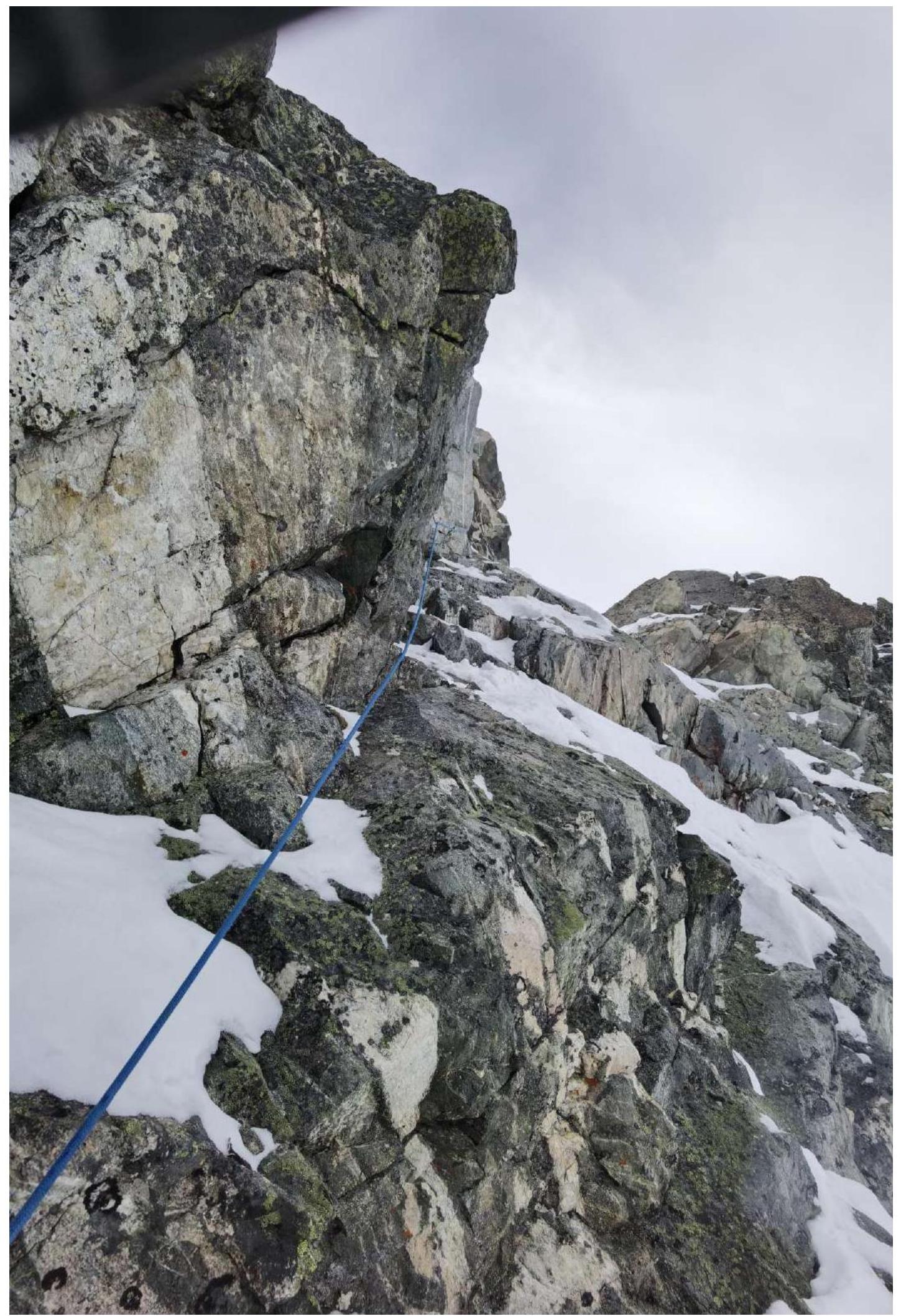
Section R18–R19: Closer to point 19 — complex climbing on dissected relief of great steepness.

-
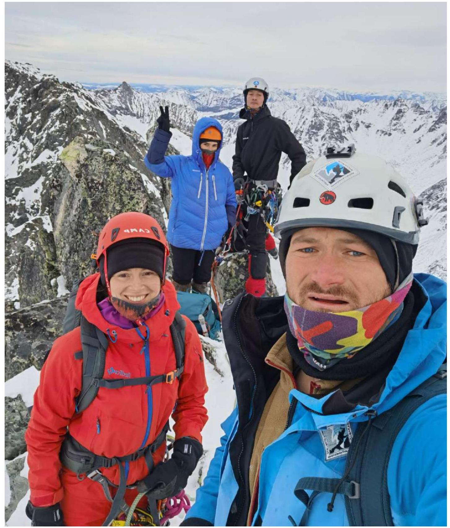
Photo on Yanichar peak: participants of the ascent (front to back): Klepikov A.A., Lipchenko A.V., Matveychuk E.O., Oseev D.N. Buinevich, Drulis, and Pechenin are not in the photo as they were sent down before the group photo. There is photoconfirmation of their presence on the ascent if needed.
Comments
Sign in to leave a comment