Report
On the First Ascent
The peaks Gussar 2540 m — Yanichar (2520 m). Traverse. Route 3A cat. diff. (proposed), first ascent. Eastern Sayan, Tunkinskiye Goltsy ridge, Kharimta valley, 6.1.2.
Leader: Klepikov A.A. Participants:
- Drulis A.M.
- Lipchenko A.V.
- Oseyev D.N.
- Pechenin K.V.
- Buynovich A.A.
- Matveychuk E.O.
The ascent was made on November 2, 2022.
I. Ascent Passport
| № | 1. General Information | |
|---|---|---|
| 1.1 | Full name, sports rank of the leader | Klepikov Alexander Alexandrovich, Master of Sports, 3rd category |
| 1.2 | Full name, sports rank of participants | Drulis Alexey Maximovich (2nd sports rank) Lipchenko Anastasia Vyacheslavovna (3rd sports rank) Oseyev Dmitry Nikolaevich (3rd sports rank) Pechenin Kirill Vadimovich (3rd sports rank) Buynovich Alexey Andreevich (3rd sports rank) Matveychuk Elizaveta Andreevna (3rd sports rank) |
| 1.3 | Full name of the coach | Afanasyev Andrey Evgenievich, Master of Sports, 1st category |
| 1.4 | Organization | FASIО |
| 2. Characteristics of the Ascent Object | ||
| 2.1 | Region | Eastern Sayan, Tunkinskiye Goltsy ridge |
| 2.2 | Valley | Kharimta valley |
| 2.3 | Section number according to the 2020 classification table | 6.1.2 |
| 2.4 | Name and height of the peak | Gussar (2540 m) Yanichar (2520 m) |
| 2.5 | Geographical coordinates of the peak (latitude/longitude), GPS coordinates | Gussar 51°57′13.12″N 102°34′10.51″E Yanichar 51°57′02.81″N 102°34′16.11″E |
| 3. Characteristics of the Route | ||
| 3.1 | Route name | South ridge, traverse |
| 3.2 | Proposed category of difficulty | 3A |
| 3.3 | Degree of route development | First ascent |
| 3.4 | Nature of the route terrain | Rocky |
| 3.5 | Height difference of the route and main part | 426 m |
| 3.6 | Length of the route and main part | 1460 m |
| 3.7 | Technical elements of the route (total length of sections of various difficulty categories with indication of terrain type (ice-snow, rocky)) | Category I rocky terrain — 470 m. Category II rocky terrain — 615 m. Category III rocky terrain — 360 m. Dülfer 15 m on R11–R12. Rappel descent (on descent) — (1 rope 30 m) |
| 3.8 | Descent from the peak | Down the Western couloir into the Kharimta valley. |
| 3.9 | Additional route characteristics | In summer, there is usually no water on the route |
| 4. Characteristics of the Team's Actions | ||
| 4.1 | Time of movement (team's walking hours, indicated in hours and days) | 7 hours 45 minutes walking hours to the peak, 1 day |
| 4.2 | Overnights | None |
| 4.3 | Start of the route | 7:20 November 2, 2022 |
| 4.4 | Reaching the peak Gussar | 10:30 November 2, 2022 |
| 4.4.1 | Reaching the peak Yanichar | 15:05 November 2, 2022 |
| 4.5 | Return to the base camp | 18:10 November 2, 2022 |
| 5. Responsible for the Report | ||
| 5.1 | Full name, e-mail | Klepikov A.A., Baikalteam@gmail.com |
Photo of the general view of the peaks Gussar 2540 m and Yanichar 2520 m. (Photo taken from the South ridge of Mt. Doktor, height approximately 2450 m above sea level, distance from the object 2000–2500 m)
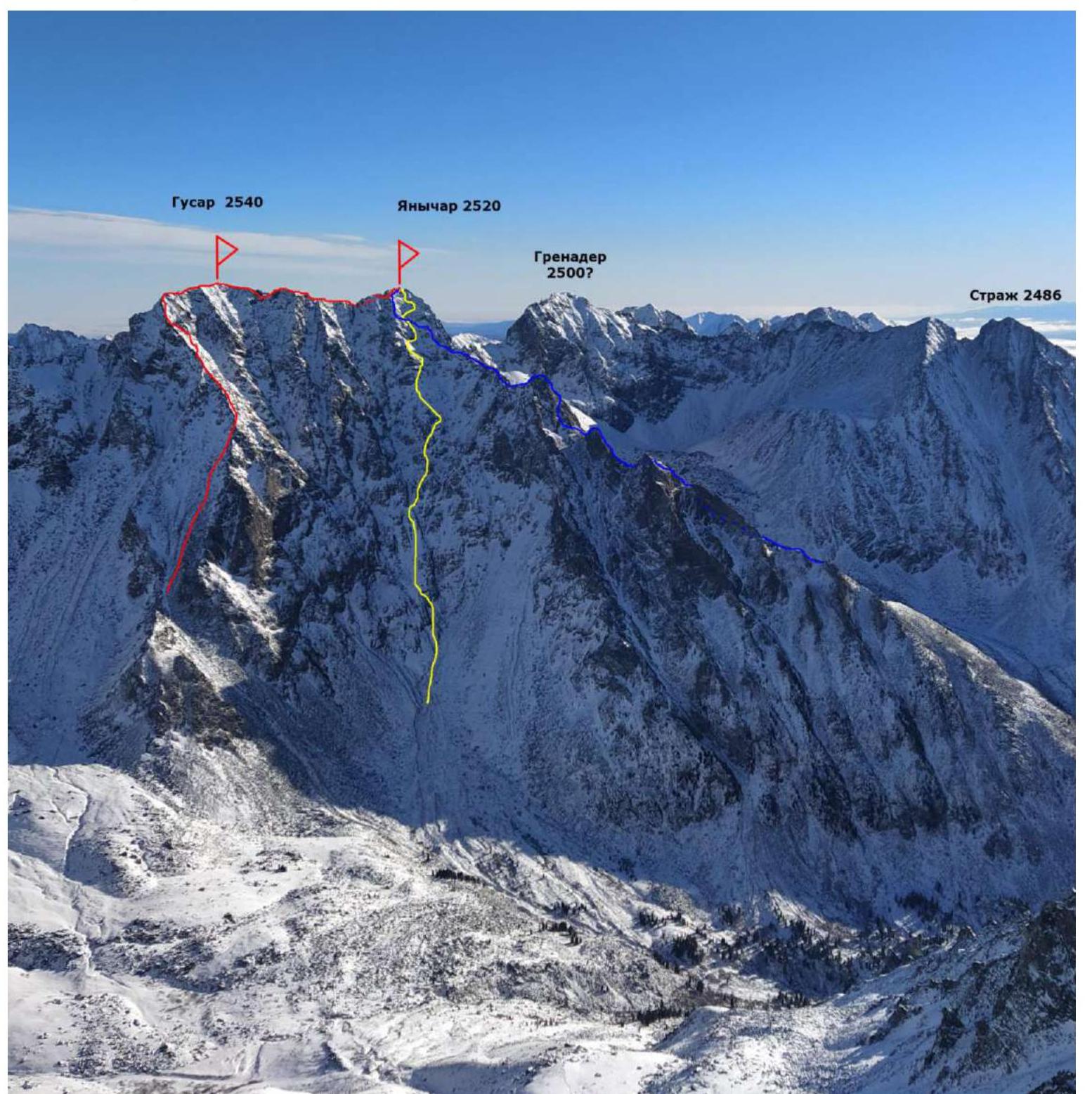
RED — team's route 3A BLUE — route SW ridge 3A cat. diff., nk (Klepikov A.A., 2022) YELLOW — descent path 3 couloir
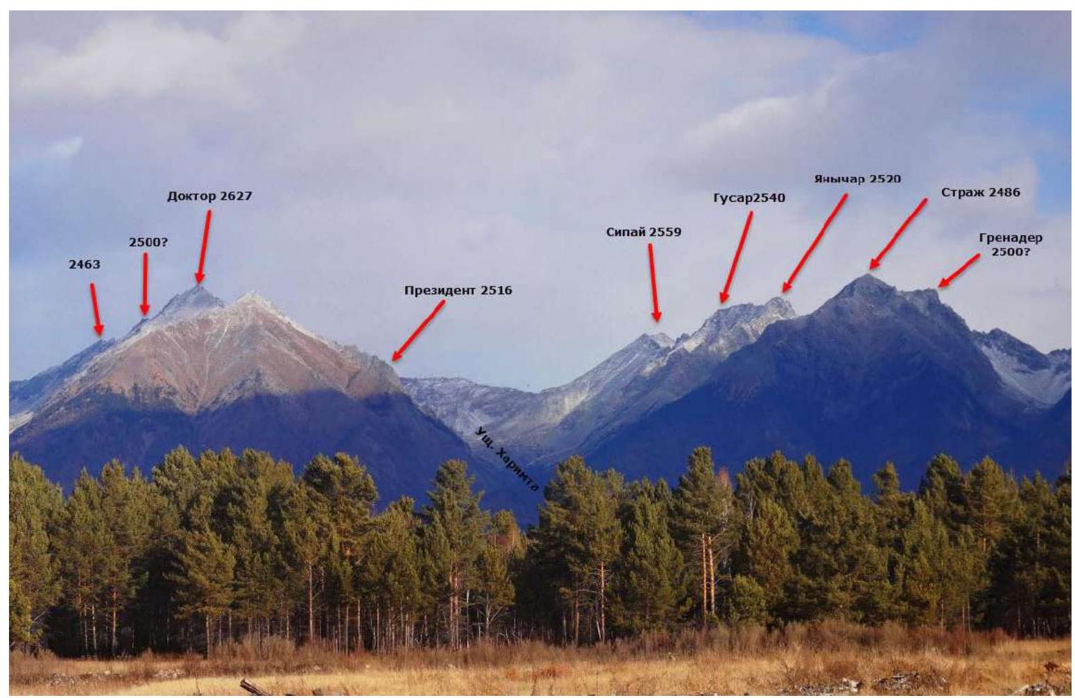
Panorama of the peaks of the Tunkinskiye Goltsy ridge in the area of the Kharimta valley. (Photo taken from the Tunkinskaya valley, distance approximately 10 km)
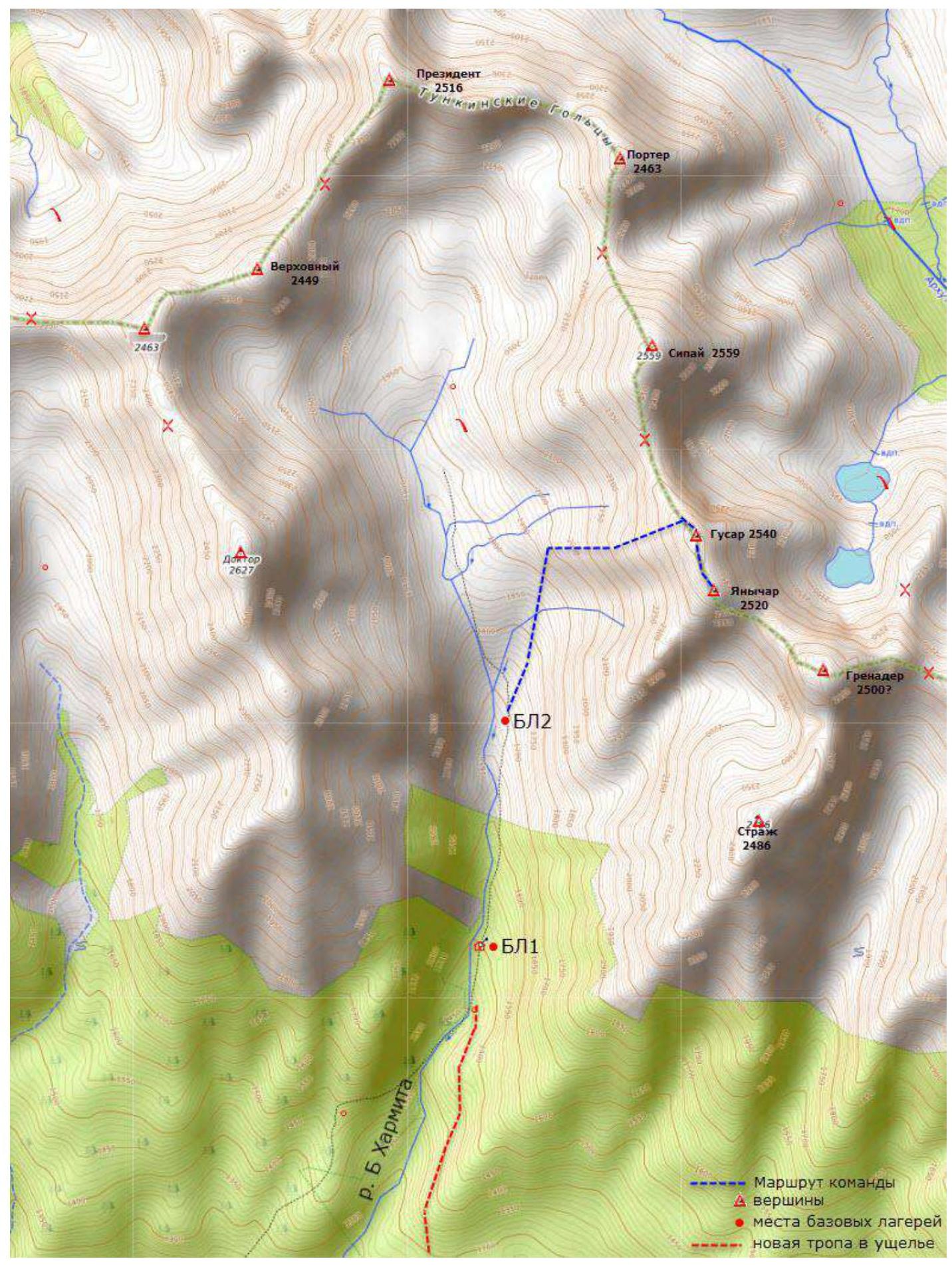
 Map of the approach to the Kharimta valley
 Map of the Kharimta valley
 The Kharimta valley is located in the Tunkinskiye Goltsy ridge near the settlement of Arshan and is open towards the Tunkinskaya valley. The valley is a rather interesting training ground for mountaineering due to its rich terrain, size, and height differences of about 1000 m, as well as its accessibility. The Kharimta valley is the only true valley in the Tunkinskiye Goltsy ridge to the right of the settlement and Mt. Arshan; the other valleys are actually hanging valleys — cirques, dropping into the Tunkinskaya valley. Kharimta has a deeply incised valley with a branched system of cirques in its upper reaches and on the left side in its middle part.
The nearest major settlement is Arshan. The approach is made by driving to the entrance of the valley. A car can reach an elevation of 1200 m above sea level. The time taken to drive from Arshan to the trail is no more than 1 hour. The time taken to hike from the trail to the base camp near the forest boundary is about 2–3 hours. The average time to approach the described route can be broken down as follows: Arshan settlement — trail: 1 hour; trail — hunter's hut BC1 — 2 hours; hunter's hut BC1 — start of the technical part of the route: 1 hour 30 minutes. The valley has potential for ascents and classification of routes up to 4B/5A category of difficulty. As of the end of 2022, more than 10 routes from 1B to 4A category of difficulty have been laid out in the valley.
The Kharimta valley is located in the Tunkinskiye Goltsy ridge near the settlement of Arshan and is open towards the Tunkinskaya valley. The valley is a rather interesting training ground for mountaineering due to its rich terrain, size, and height differences of about 1000 m, as well as its accessibility. The Kharimta valley is the only true valley in the Tunkinskiye Goltsy ridge to the right of the settlement and Mt. Arshan; the other valleys are actually hanging valleys — cirques, dropping into the Tunkinskaya valley. Kharimta has a deeply incised valley with a branched system of cirques in its upper reaches and on the left side in its middle part.
The nearest major settlement is Arshan. The approach is made by driving to the entrance of the valley. A car can reach an elevation of 1200 m above sea level. The time taken to drive from Arshan to the trail is no more than 1 hour. The time taken to hike from the trail to the base camp near the forest boundary is about 2–3 hours. The average time to approach the described route can be broken down as follows: Arshan settlement — trail: 1 hour; trail — hunter's hut BC1 — 2 hours; hunter's hut BC1 — start of the technical part of the route: 1 hour 30 minutes. The valley has potential for ascents and classification of routes up to 4B/5A category of difficulty. As of the end of 2022, more than 10 routes from 1B to 4A category of difficulty have been laid out in the valley.
Technical Photo of the Route
The photo was taken from the Eastern slope of Mt. Doktor 2627 m, height approximately 2100 m, distance 1000–1500 m.
Description and Characteristics of the Terrain
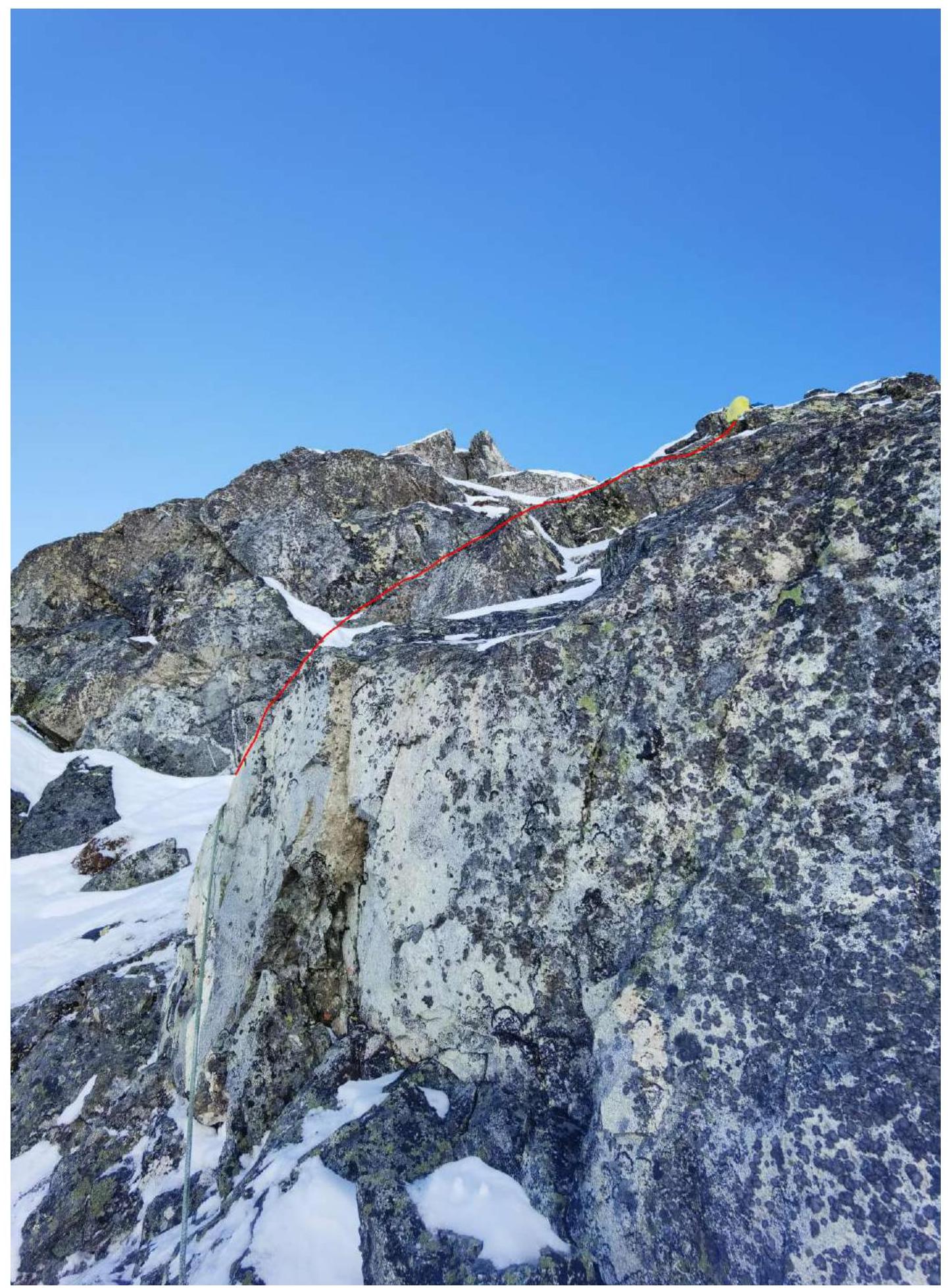
The start of the route is the Western ridge, which has a simple approach both from the bottom of the valley and from the top. Further, directly from the first saddle, the ridge branches out and widens; the ascent is made along the couloir between these ridges with a further entry onto the larger right-hand ridge. The start of the route is at an altitude of 2050 m. R0–R1 400 m, 40°, 1. Along the couloir of the bifurcated ridge, exiting onto the right-hand ridge. R1–R2 150 m, 45°, 2. Along the ridge. R2–R3 50 m, 45°, 2. Bypassing the gendarme on the right. R3–R4 40 m, 45°, 1. To the right of the ridge, entering a large hollow. R4–R5 40 m, 60°, 3. Wall from the hollow to the left onto the ridge. R5–R6 60 m, 40°, 2. Up along the ridge. R6–R7 20 m, 30°, 2. Crossing along large-block terrain, over the ridge, even a small overhanging block, but not difficult, exiting onto a horizontal ridge. R7–R8 30 m, 0°, 2. Horizontal ridge. R8–R9 100 m, 25°, 2. To peak Gussar along the ridge. R9–R10 150 m, 10°, 60° slopes, 3. Down along the gentle ridge to the South, towards peak Yanichar. The ridge is a sharp knife-edge. Descent onto a saddle. R10–R11 20 m, 40°, 2. Exiting onto a ledge to a rappel before a complex, dissected gendarme. R11–R12 15 m, 55° down. Rappel. R12–R13 50 m, 45°, 2. To the right of the ridge, bypassing the gendarme. Deep snow. Exiting back onto the ridge. R13–R14 20 m, 0°, 60° slopes, 2. Along the horizontal ridge. R14–R15 15 m, 50°, 3. Descent from the gendarme. R15–R16 30 m, 0°, 3. Onto a small gendarme and along the ridge. R16–R17 70 m, 10°, 3. Along the ridge, along the knife-edge or bypassing to the right. R17–R18 25 m, 40°, 2. Descent onto a saddle. R18–R19 50 m, 55°, 2. To the left of the ridge from the saddle under the overhanging part of the ridge, steep snow, rocks. R19–R20 20 m, 65°, 3. Exiting onto the ridge to the right, the key part of the route. R20–R21 30 m, 45°, 1. Traversing to the right of the ridge. R21–R22 5 m, 70°, 3. Exiting onto a step to the right through a rocky belt. R22–R23 40 m, 55°, 2. Traversing in an arc, exiting onto the ridge. R23–R24 30 m, 10°, 3. Along the ridge to the peak.
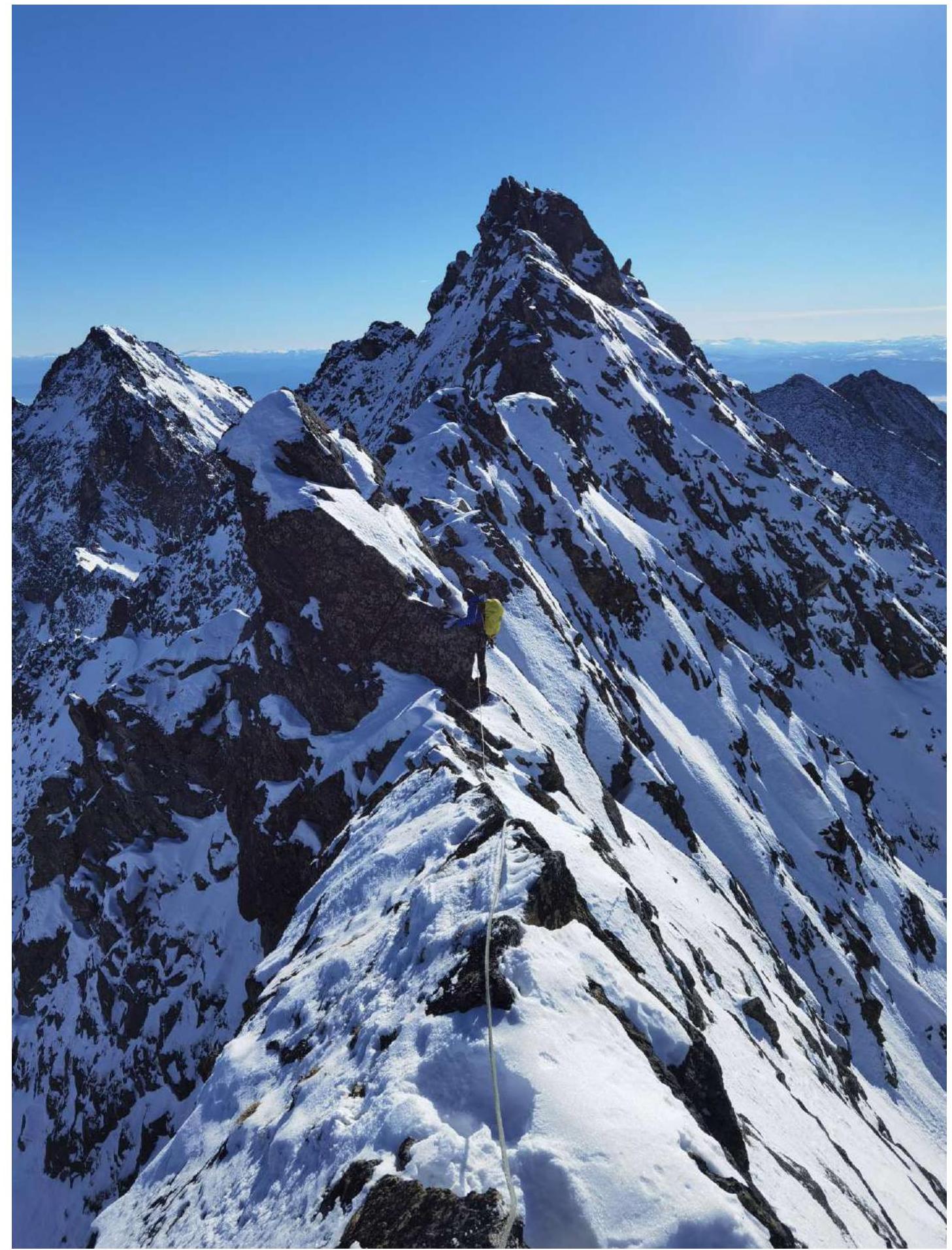
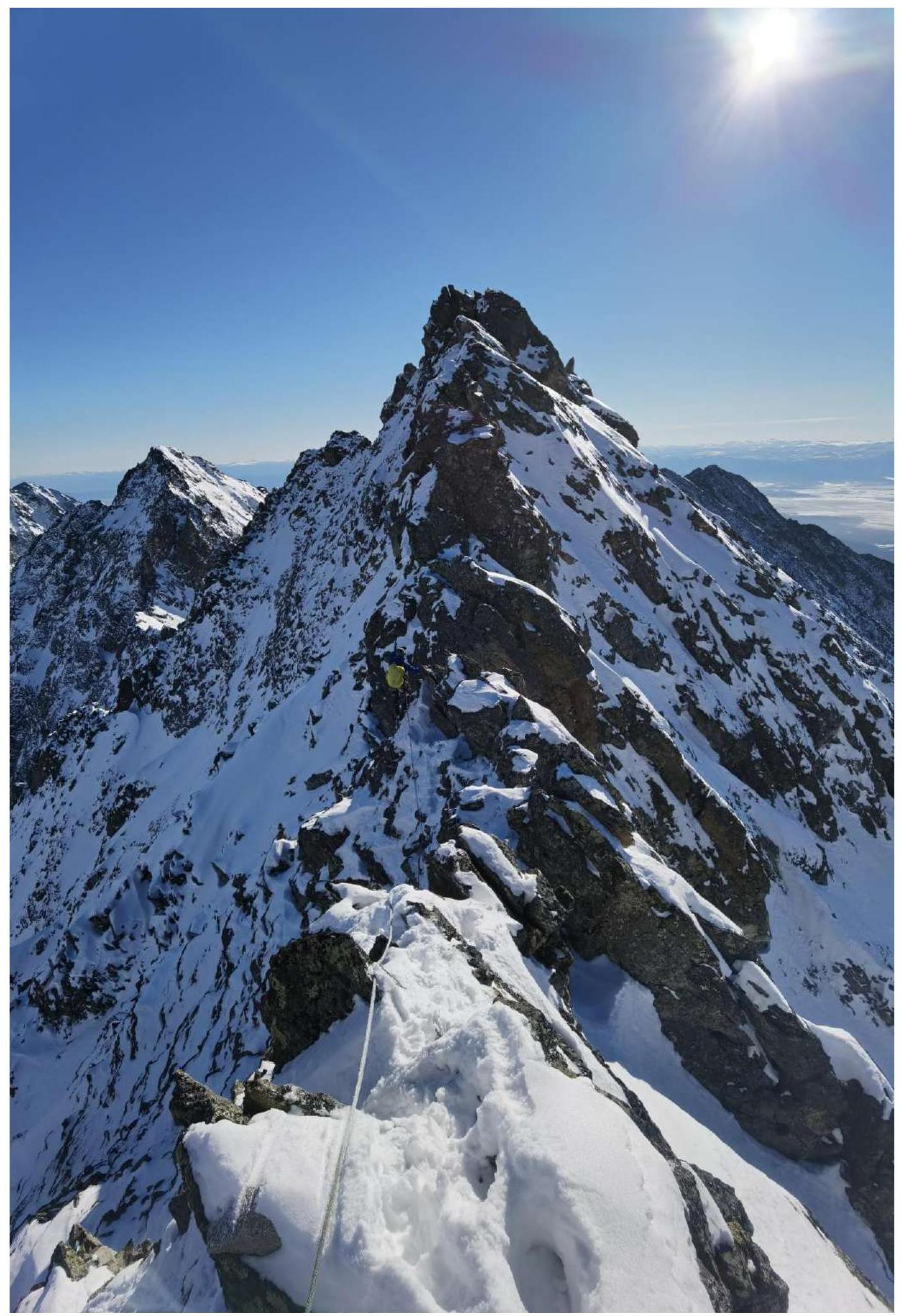
The length of the traverse between peaks Gussar and Yanichar is 570 m.
Characteristics of the Route and Team Actions
The route taken by the team is the first route to be made to the peak Gussar. The most logical and simple line was chosen for the ascent, as a traverse to Yanichar along the connecting ridge was planned. During previous ascents to Yanichar, the ridge connecting it to Gussar was examined and preliminarily assessed to have a category of difficulty not lower than 3A.
The ridge to peak Gussar is technically quite simple, except for a key section of 40 m in the middle of the ridge. On its own, the ridge confidently has a category of difficulty 2A. The route is quite safe in terms of rockfall; the line follows the external forms of the terrain, which is quite solid and relatively monolithic. Special attention should be paid to rockfall danger on the descent during snow-free times; to mitigate this, the team descended in a way that avoided being directly below each other on hazardous sections. In winter, rockfall danger is minimal in the entire area. Avalanche danger on the route is an objective factor only at the very start of the route when approaching the ridge and in the area of the key section in the hollow. In winter, attention should also be paid to the descent couloir by "shooting" it beforehand.
The traverse has a key section in the last third, shortly before reaching peak Yanichar. The traverse is significant in length and complexity; the nature of the ridge does not allow for safe belaying, requiring simultaneous or alternate movement by climbing, for which all team members must possess the necessary skills.
The length of the traverse between peaks Gussar and Yanichar is 570 m.
The descent from the peak is made to the West towards the Kharimta valley along the Western couloir; the descent is made on foot along ledges, requiring belaying, with places to fall and options for organizing belays even in winter. At the lower part of the descent, there is a 25 m rappel, after which the descent is relatively safe and can be made on foot without belaying.
The author has experience with 3A category routes: 32 ascents on 28 routes in the Sayan Mountains, Caucasus, and Transbaikal. In terms of technical difficulty, this route is average among them, standing out for its length; it lacks only a characteristic key section of the complexity typical for such routes to be classified as 3B.
There is cellular network coverage ("Tele2") along almost the entire route.
Section R4–R5: exit from the hollow to the left onto the ridge.
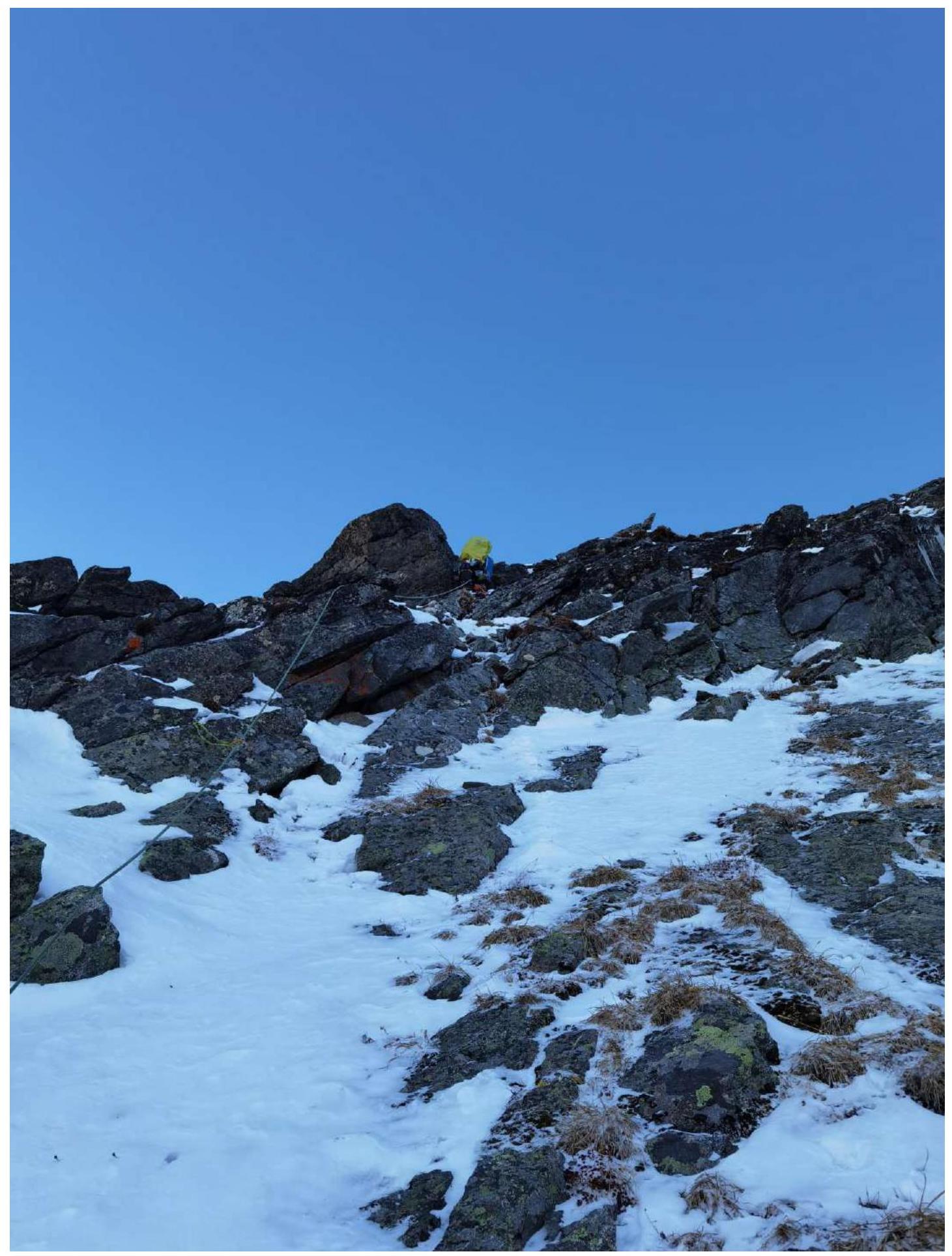
Section R6–R7: ridge with large-block terrain.
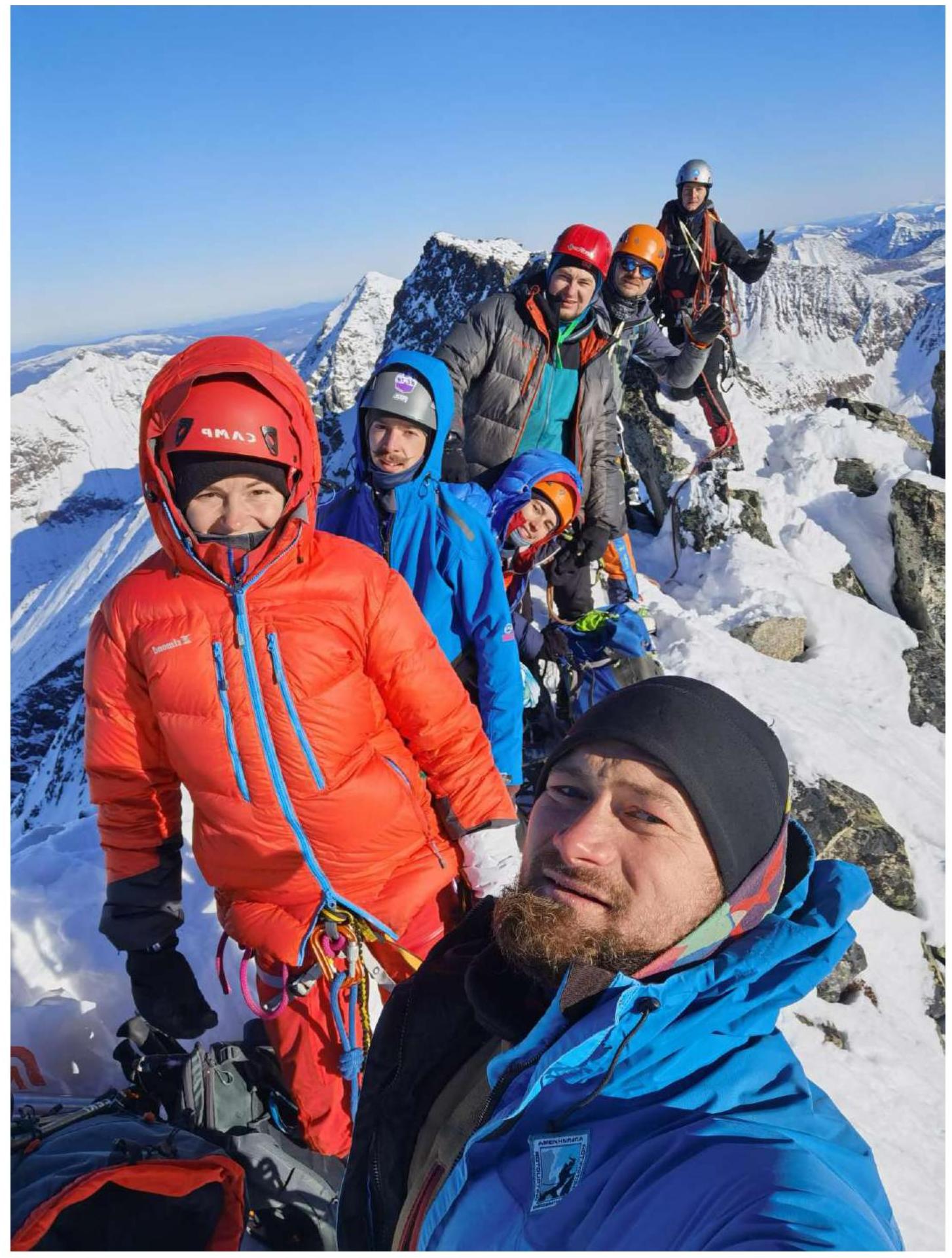
On peak Gussar 2540 m. From left to right: Pechenin K.V., Lipchenko A.V., Matveychuk E.O., Oseyev D.N. (behind), Buynovich A.A., Drulis A.M., Klepikov A.A.
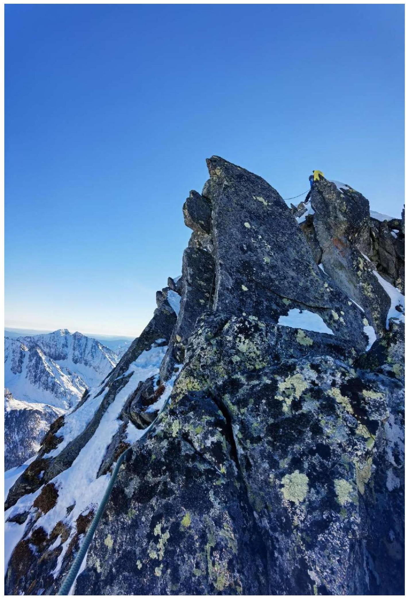
Section R9–R10: along the ridge, quite complex in terms of orientation and unraveling the ridge by climbing, with precipices almost everywhere in both directions.
End of section R9–R10.
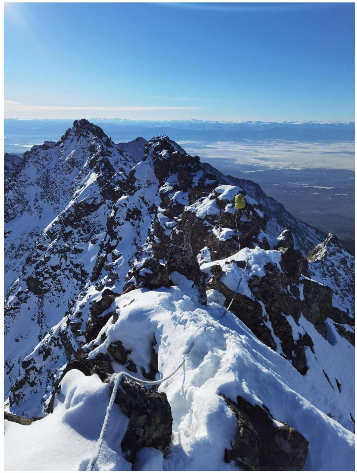
Ridge on section R15–R16.
Section R18–R19: to the left of the ridge under its overhanging part.
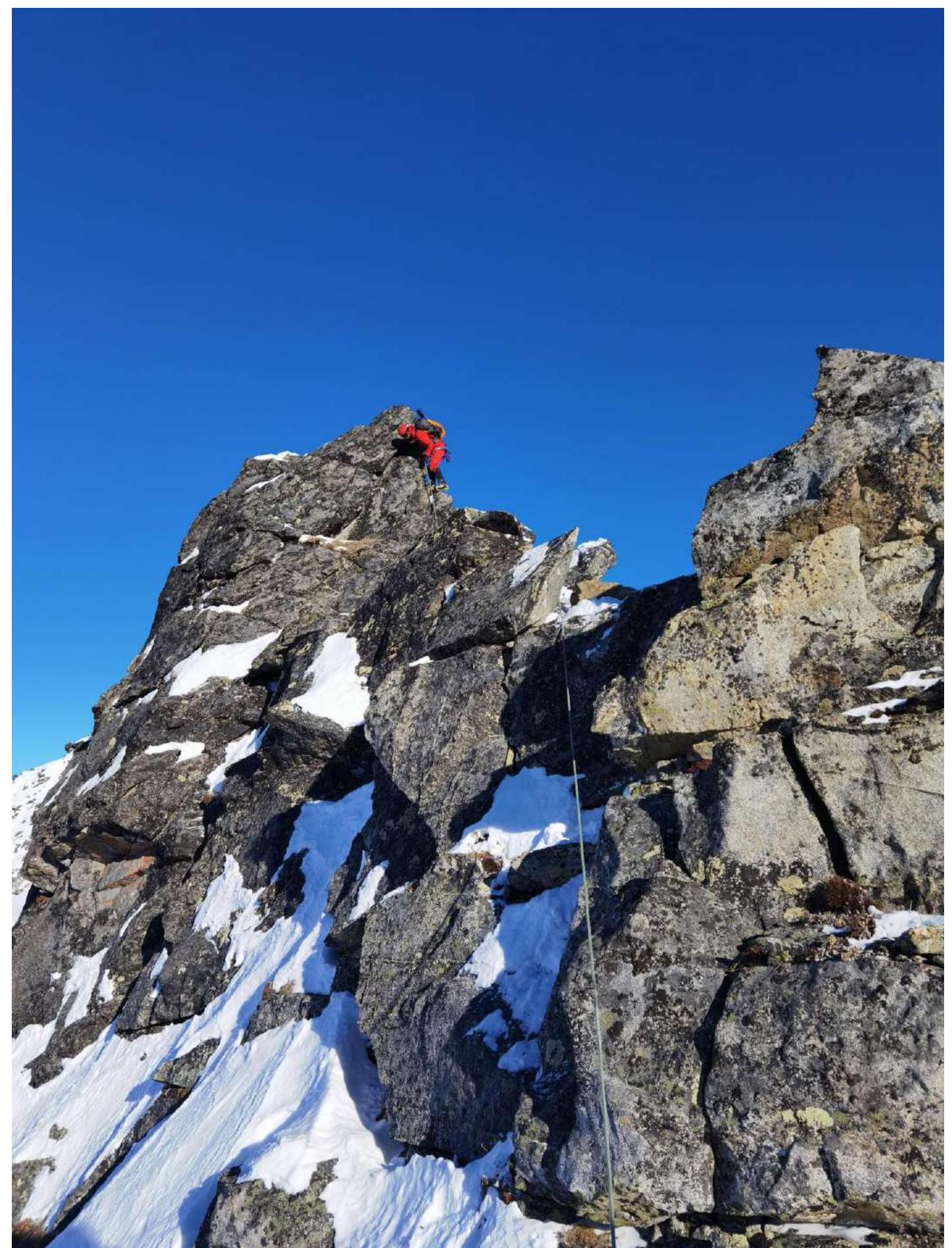
Section R19–R20: exit to the right onto the ridge, a steep little wall, the key part of the route.
Section R21–R22: exit to the right, bypassing a steep gendarme. The section where the leader is located slightly overhangs a ledge, complicating the passage despite a small ledge underfoot.
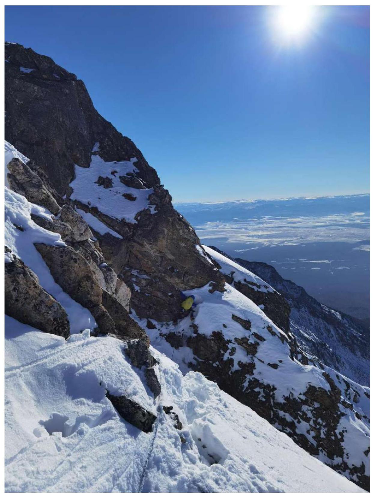
Photo on peak Yanichar. Ascenders from front to back: Klepikov A.A., Lipchenko A.V., Pechenin K.V., Matveychuk E.O., Drulis A.M., Buynovich A.A., Oseyev D.N.