Report
on the first ascent
The peak Strazh (2486 m), Western ridge, Route 2A cat. diff. (proposed), first ascent, Eastern Sayan, Tunkin Range, Kharimta valley, 6.1.2
Leader: Klepikov A. A. Participants:
- Kuzmenko I. M.
- Drulis A. M.
The ascent was made on February 13, 2022.
I. Ascent Passport
| № | 1. General Information | |
|---|---|---|
| 1.1 | Full name, sports rank of the leader | Klepikov Alexander Alexandrovich, Master of Sports, 3rd category |
| 1.2 | Full name, sports rank of the participants | Kuzmenko Ivan Mikhailovich (Candidate for Master of Sports), Drulis Alexey Maksimovich (2nd sports rank) |
| 1.3 | Full name of the coach | Afanasiev Andrey Evgenievich, Master of Sports, 1st category |
| 1.4 | Organization | Baikal Alpine School |
| 2. Characteristics of the ascent object | ||
| 2.1 | Region | Eastern Sayan, Tunkin Range |
| 2.2 | Valley | Kharimta valley |
| 2.3 | Section number according to the 2020 classification table | 6.1.2 |
| 2.4 | Name and height of the peak | Strazh (2486 m) |
| 2.5 | Geographical coordinates of the peak (latitude/longitude), GPS coordinates № 1 | 51,56,16.93 N 102,34,25.01 E |
| 3. Characteristics of the route | ||
| 3.1 | Name of the route | 3 group |
| 3.2 | Proposed category of difficulty | 2A |
| 3.3 | Degree of route development | first ascent |
| 3.4 | Character of the route relief | Rocky |
| 3.5 | Height difference of the route and main part | 386 m |
| 3.6 | Length of the route and main part | 530 m |
| 3.7 | Technical elements of the route (total length of sections of various difficulty categories with indication of relief character (ice-snow, rocky)) | I cat. diff. rocks — 280 m. II cat. diff. rocks — 250 m. |
| 3.8 | Descent from the peak | Along the northern ridge to the saddle with the next peak and then west along a simple couloir |
| 3.9 | Additional characteristics of the route | In summer, there is usually no water on the route |
| 4. Characteristics of the team's actions | ||
| 4.1 | Time of movement (team's walking hours, indicated in hours and days) | 5 walking hours to the peak, 1 day |
| 4.2 | Overnights | No |
| 4.3 | Exit to the route | 09:00 February 13, 2022 |
| 4.4 | Exit to the peak | 14:00 February 13, 2022 |
| 4.5 | Return to the base camp | 16:00 February 13, 2022 |
| 5. Responsible for the report | ||
| 5.1 | Full name, e-mail | Klepikov A. A., Baikalteam@gmail.com |
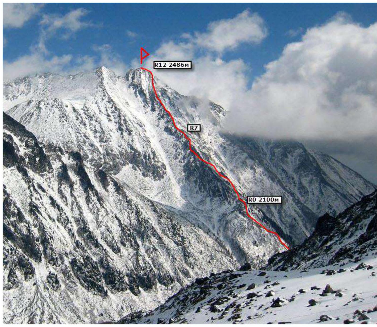
Photo of the general view of Mount Strazh 2486. (Photo taken from the Tunka valley, shooting height approximately 800 m above sea level, distance from the object ± 10,000 m)
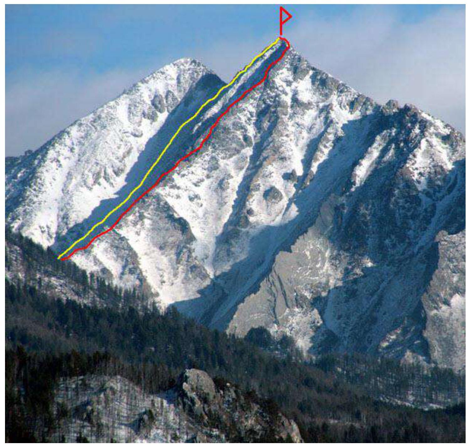
RED — team's 2A route, 3 group. Yellow — descent route, 3 couloir.
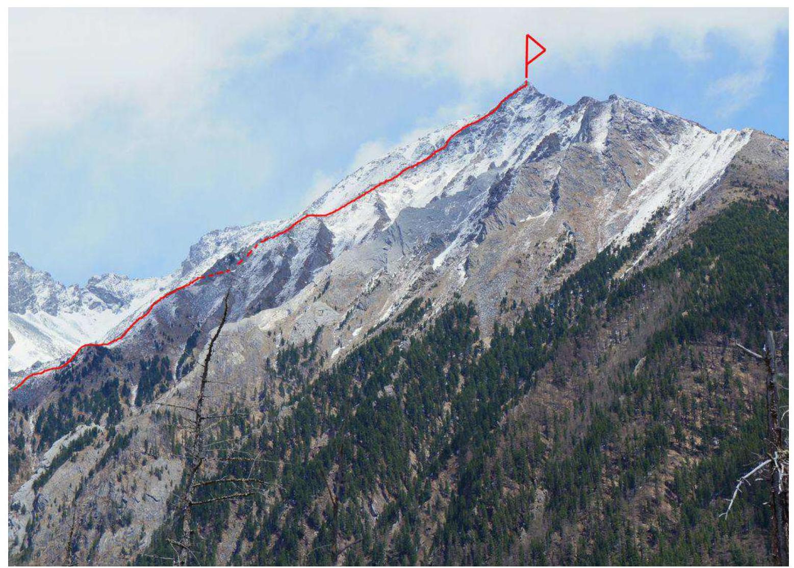
Photo of the route profile on the right. (Photo taken from the Tunka valley)
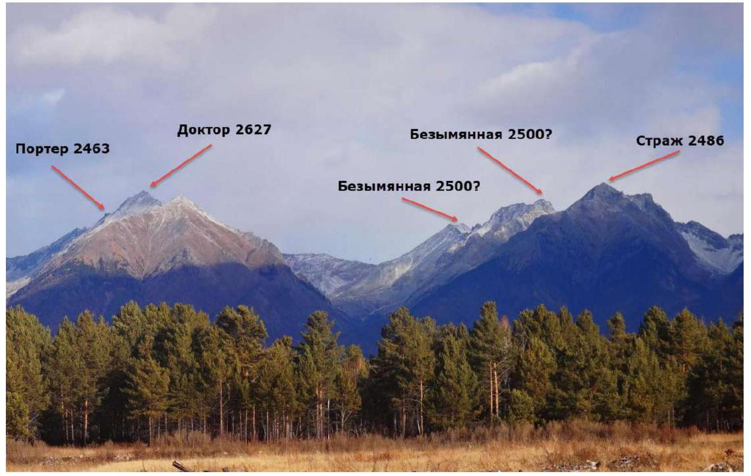
Panorama of the peaks of the Tunkin Range in the area of the Kharimta valley. (Photo taken from the Tunka valley, distance approximately 10 km)
Map-scheme of the Kharimta valley.
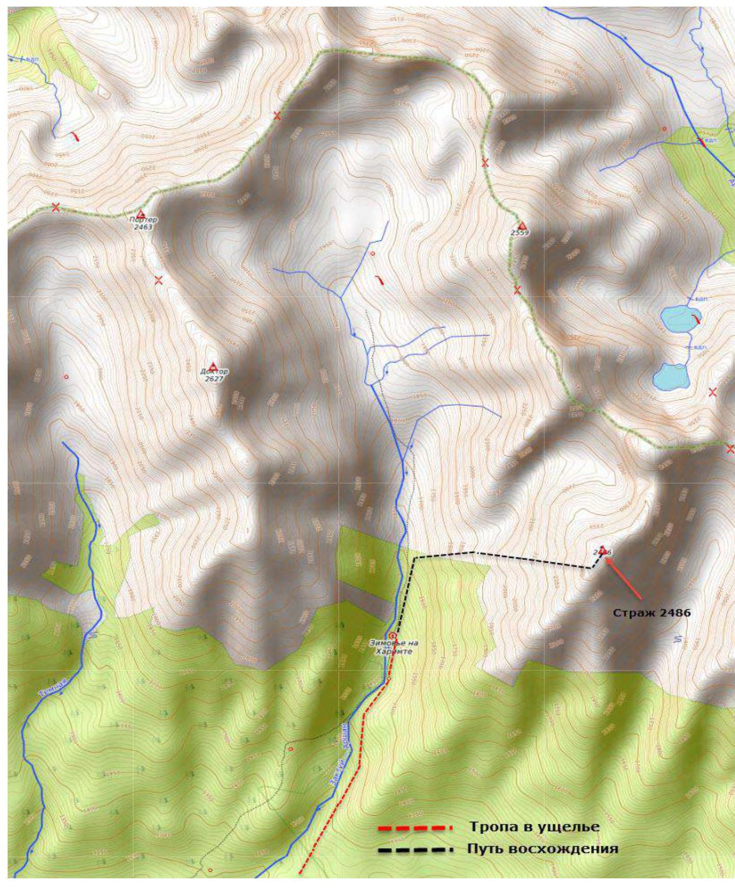
The Kharimta valley is located in the Tunkin Range near the settlement of Arshan and is facing the Tunka valley. The valley is a rather interesting polygon for alpine development due to its rich relief, size, and height differences of about 1000 m, as well as its transport accessibility. The Kharimta valley is the only true valley in the Tunkin Range to the right of the settlement and Mount Arshan; the other valleys are actually hanging valleys — cirques, breaking off into the Tunka valley. Kharimta has a deeply incised valley with a branched system of cirques in its upper reaches and on the left side in the middle part.
The nearest large settlement is the village of Arshan.
The approach is made by driving to the entrance of the valley. A car can deliver to an elevation of 1100 m above sea level.
Time of delivery:
- From the village of Arshan to the trail — no more than 1 hour.
- Along the trail to the base camp near the forest boundary — about two to three hours.
The average time to approach the described route can be estimated as follows: Arshan village — trail: 1 hour; trail — hunting lodge: 3 hours; hunting lodge — start of the technical part of the route: 1 hour.
The valley has potential for ascents and classification of routes up to 4B/5A category of difficulty.
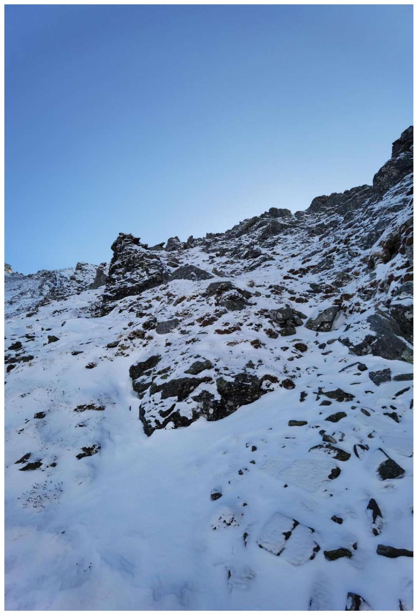
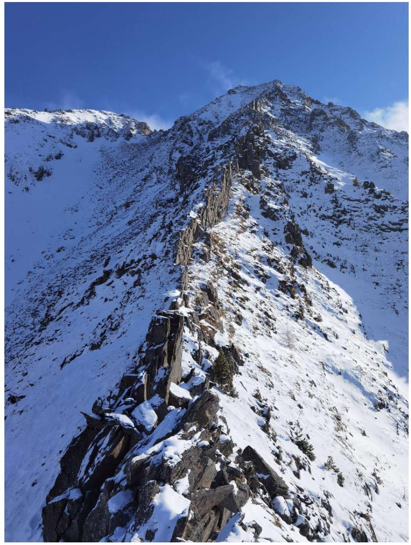
Technical photo of the route
Photo taken from the Eastern slope of the peak Doktor, shooting height approximately 2300 m.
Description and characteristics of the relief
The starting point of the route is a characteristic diagonal couloir from left to right, cutting through the base of the wall in its middle part and being the only one of its kind on the entire wall.
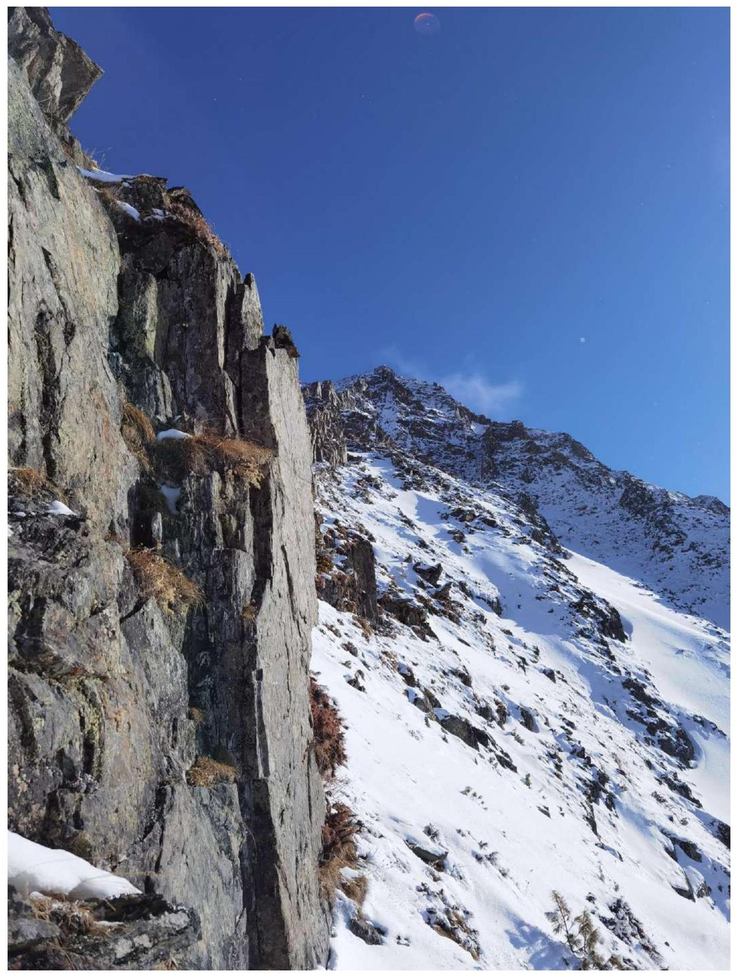
- R0–R1 50 m, 50°, 1–2. Bypassing a gendarme along ledges.
- R1–R2 20 m, 55°, 1–2. Exit to the ridge.
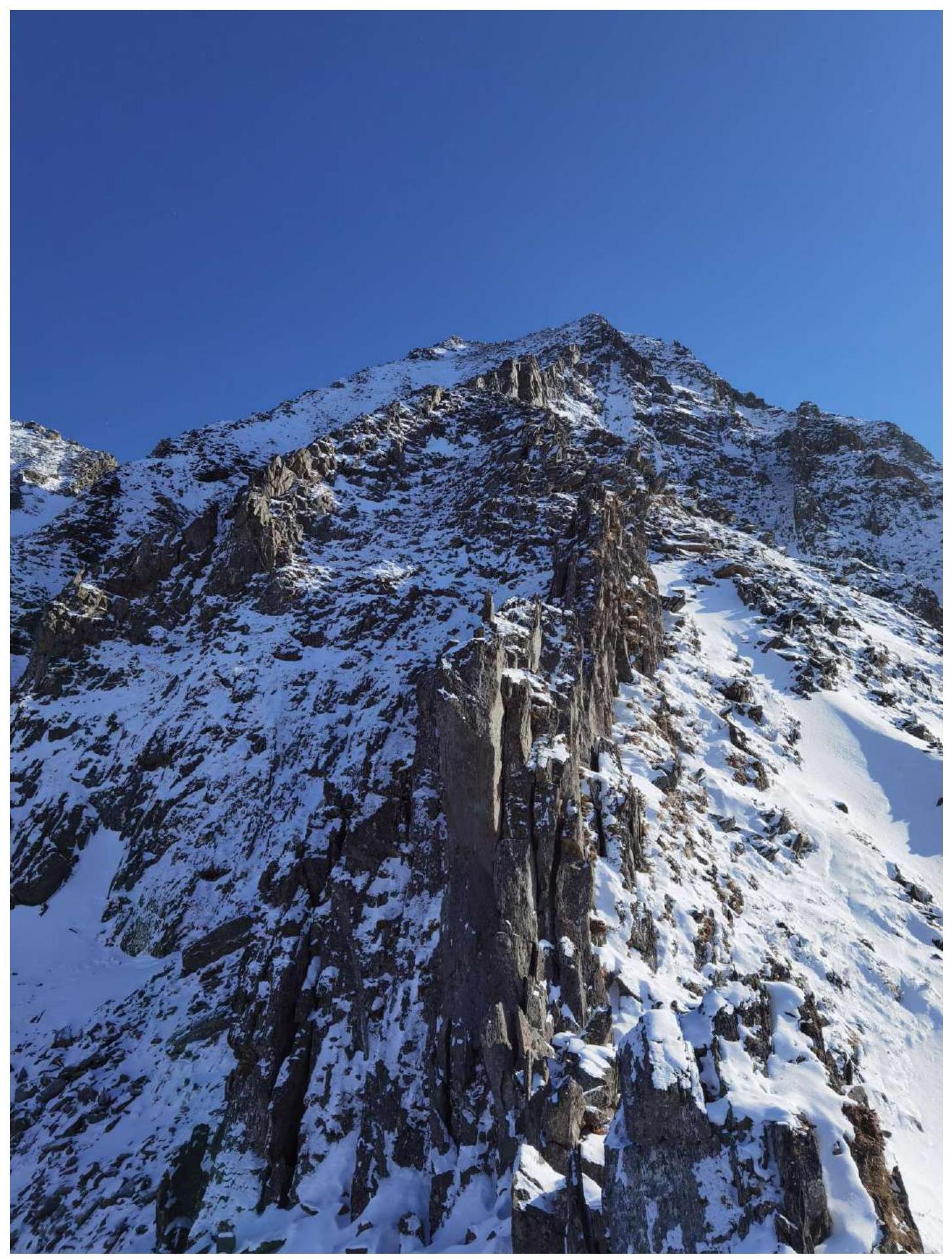
- R2–R3 100 m, 30°, 1–2. Rocky ridge.
- R3–R4 30 m, 50°/25°, 2. Bypassing a group of gendarmes on the left.
- R4–R5 50 m, 50°/25°, 1–2. Crossing the ridge and bypassing gendarmes on the right.
- R5–R6 20 m, 50°/25°, 1–2. Transition to the left side of the ridge.
- R6–R7 10 m, 0°, 2. Along the ridge.
- R7–R8 30 m, 45°, 1. Bypassing a gendarme on the right along grass and rocks.
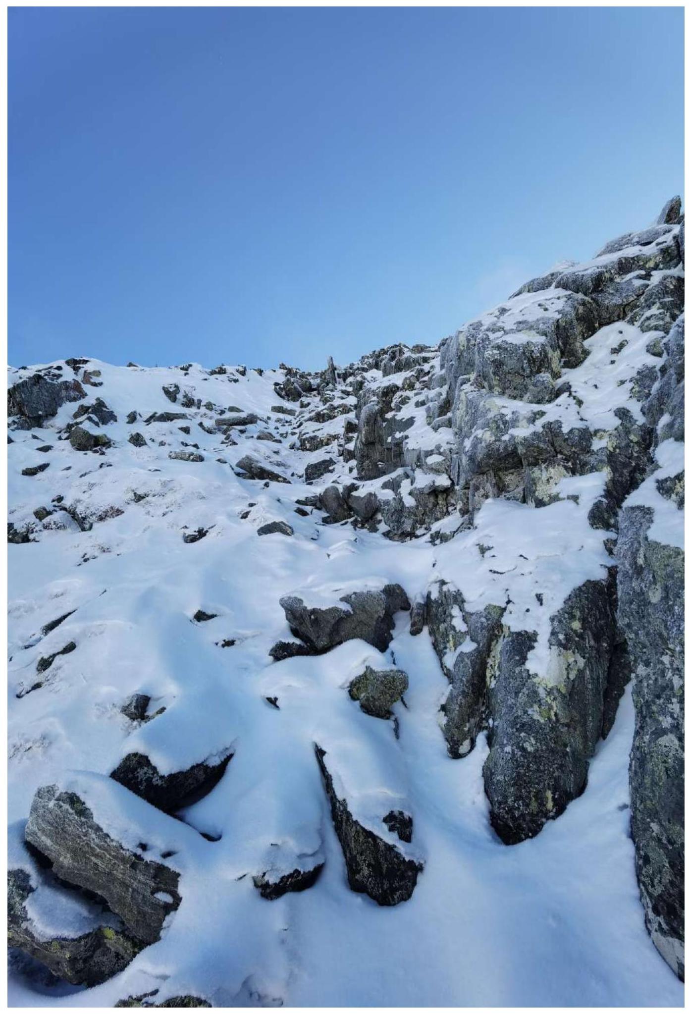
- R8–R9 50 m, 50°, 1–2. Directly along the crumbling ridge, rocks interspersed with scree.
- R9–R10 30 m, 40°, 1–2. Along the ridge, beveled ridge, wall on the right, gentle slope on the left, broken rocks.
- R10–R11 60 m, 40°, 1. To the right of the ridge along broken rocks and scree.
- R11–R12 50 m, 45°, 2. Couloir next to the ridge, small depth, movement along it. Exit to the Southern ridge.
- R11–R12 30 m, 30°, 1. Along the ridge to the peak.
Characteristics of the route and the team's actions
The route taken by the team is an obvious and evident line of ascent to the peak Strazh according to the external relief; the ridge to the right seems less logical at first glance due to:
- greater complexity of its ruggedness;
- presence of a simpler path along the couloir nearby.
The couloirs bounding the external form of the route on the right and left may be avalanche-prone in winter.
The route was initially planned for a quick passage; the participants have extensive experience and a high level of climbing. The route was climbed for the purpose of exploring and surveying the area. The pace was conditioned by:
- short daylight hours;
- unstable weather in February.
The route does not have obvious key sections and is uniform throughout its length. The descent from the peak is made in a westerly direction along a couloir next to the ascent route. It may be avalanche-prone.
The author has experience with routes of 2B category of difficulty: more than 25 ascents in the Sayan Mountains, in the Caucasus, and in Transbaikalia. In terms of technical complexity, the route occupies a middle position among them.
- Section R0–R2: bypassing a gendarme on the left, middle of the section, view down.
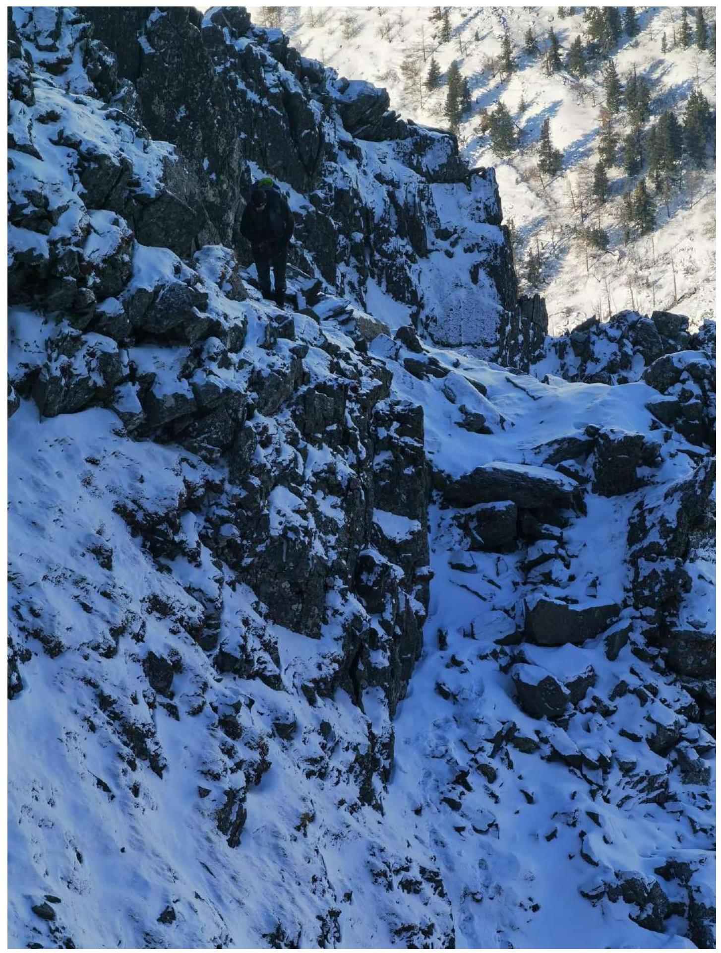
- Section R0–R2: bypassing a gendarme on the left, middle of the section, view up.
- Section R2–R3: ridge.
- Section R4–R5: bypassing a gendarme on the right.
- Section R7–R9: bypassing a gendarme on the right and a sprawling ridge.
- Section R11–R12: small couloir on the ridge.
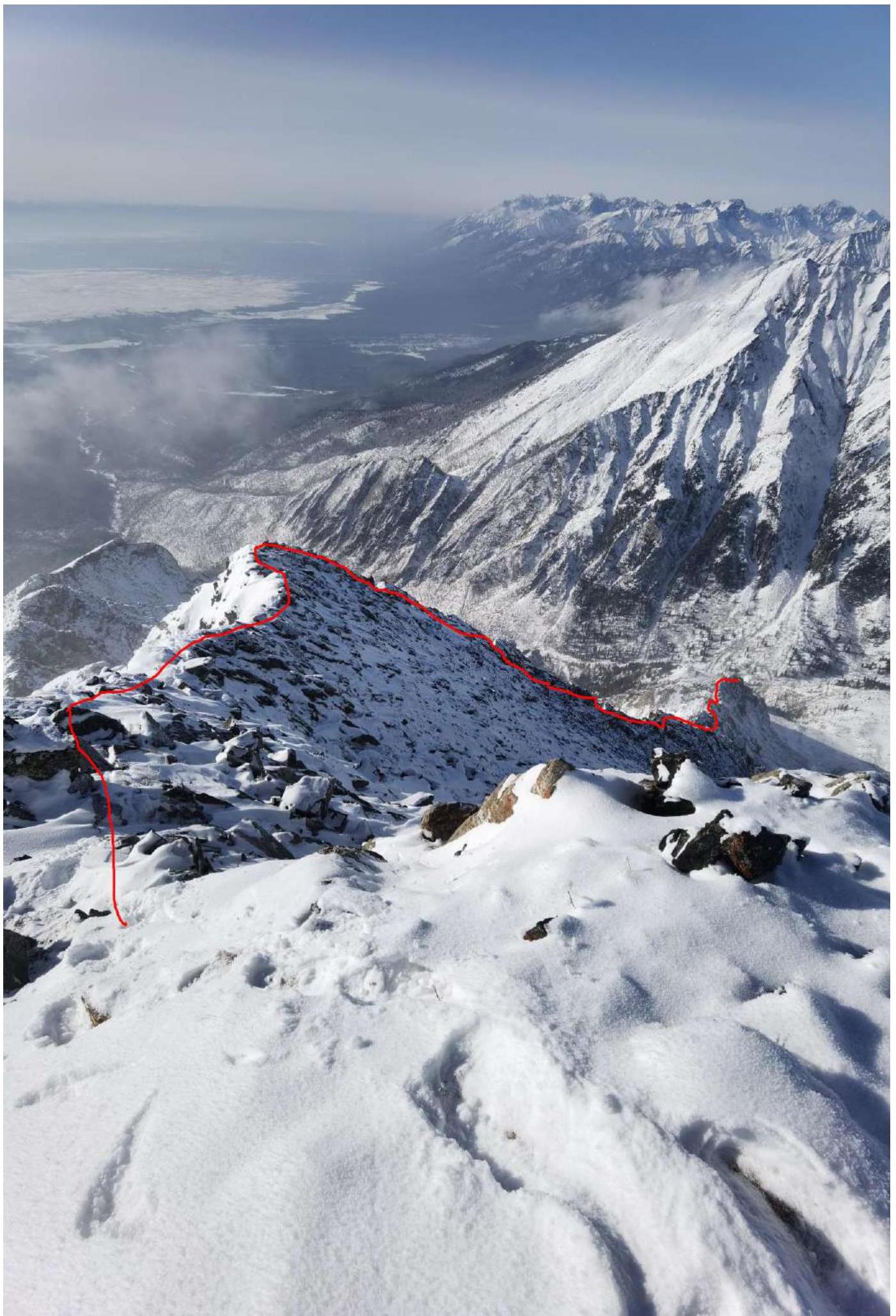
- View of the route from the peak.
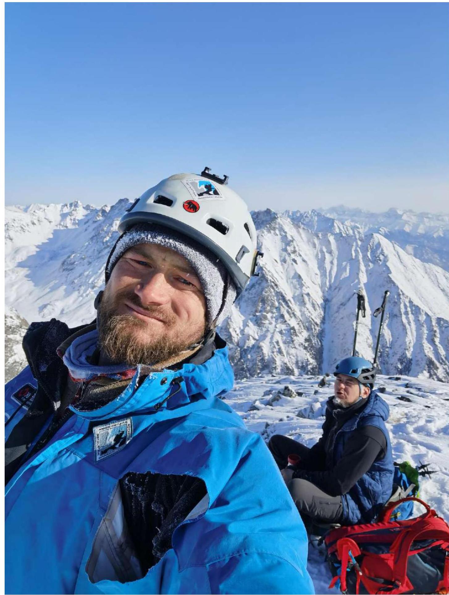
- Photo at the peak: Klepikov A. A., Drulis A. M. Unfortunately, we forgot to take a group photo with Kuzmenko I. M.