I. ASCENT DOCUMENTATION
| № | 1. General Information | |
|---|---|---|
| 1.1 | Full Name, sports rank of the leader | Vasilenko Olga Igorevna, 2nd sports rank |
| 1.2 | Full Name, sports rank of the participants | Stuchilina Anna Anatolyevna, "Alpinist Rossii" badge |
| 1.3 | Full Name of the coach | Nadtochiy Sergey Valentinovich |
| 1.4 | Organization | "Kerch Alpine Club" |
| 2. Characteristics of the Ascent Object | ||
| 2.1 | Region | Crimea |
| 2.2 | Valley | |
| 2.3 | Section number according to the 2013 classification table | |
| 2.4 | Name and height of the summit | Sokol, 473 m |
| 2.5 | Geographical coordinates of the summit (latitude/longitude), GPS coordinates *(1) | |
| 3. Characteristics of the Route | ||
| 3.1 | Route name | Zagadka |
| 3.2 | Proposed category of difficulty | 2B |
| 3.3 | Degree of route exploration | First ascent |
| 3.4 | Character of the route terrain | Rock |
| 3.5 | Route elevation gain (altimeter or GPS data) | 250 m |
| 3.6 | Route length (in meters) | 367 m |
| 3.7 | Technical elements of the route (total length of sections of varying difficulty with terrain type) | Category I rocks – 20 m Category II rocks – 97 m Category III rocks – 90 m Category IV rocks – 75 m |
| 3.8 | Descent from the summit | Descent on foot via trail towards Novy Svet settlement or Sudak city |
| 3.9 | Additional route characteristics | Lack of water |
| 4. Characteristics of the Team's Actions | ||
| 4.1 | Time in motion (team's walking hours, in hours and days) | 7 hours |
| 4.2 | Overnights | None |
| 4.3 | Start of the route | 11:00, June 5, 2021 |
| 4.4 | Reach the summit | 18:00, June 5, 2021 |
| 4.5 | Return to base camp | 19:00, June 5, 2021 |
| 5. Responsible for the Report | ||
| 5.1 | Full Name, e-mail | Vasilenko Olga Igorevna, dev2000@mail.ru |
II. ASCENT DESCRIPTION
1. Characteristics of the Ascent Object
1.1. General photo of the summit — see Photo 1 — taken on July 1, 2020. Shooting location — Galitsyn trail, Novy Svet.
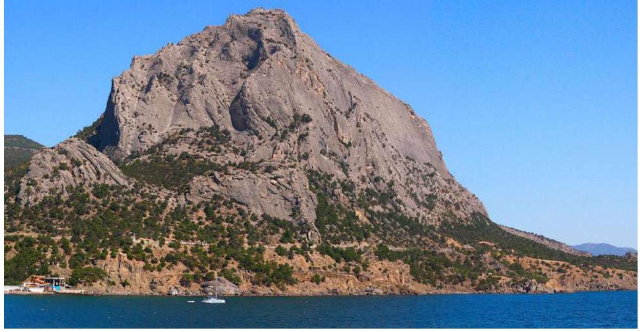
Photo 1. Sokol Mountain
1.2.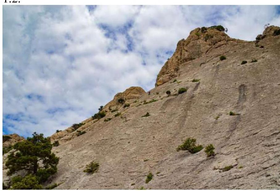 Photo 2. Route profile. The photo was taken during the passage from station R0 of the "Gammii" route. The participant is at the location of the bolt.
2. Characteristics of the Route
2.1. Technical photograph of the route, taken from a rocky ledge, 400 m to the right of the beginning of the Western wall of Sokol — see Photo 2
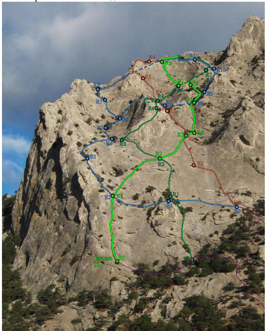
Photo 3. Technical photograph of the route. 2.3. Technical characteristics of the route sections *(5)
| Section № | Terrain character | Difficulty category | Length, m | Type and number of anchors |
|---|---|---|---|---|
| R0–R1 | Internal angle | 60 m | Chocks – 3 pcs., Friends – 6 pcs. | |
| R1–R2 | Initially not steep terrain, at the end of the section a steep "mirror" | 60 m | Friend – 3, Bolt – 1, Anchor hook – 1 | |
| R2–R3 | Traverse of the "mirror" | 45 m | Anchor hooks – 6, Friend – 1, Bolt – 1 | |
| R3–R4 | Simple | 30 m | Friend – 1 pcs. | |
| R4–R5 | Rocky "gutter" | 50 m | Friends – 4 pcs., Chocks – 3 pcs., Anchor hook – 1 pcs. | |
| R5–R6 | Wall with a watercourse | 60 m | Chock – 2 pcs. | |
| R6–R7 | Simple transition beyond the inflection into the "circus" | 10 m 2 | Not used | |
| R7–R8 | System of cracks leading out of the stone "circus" | 60 m | Friends – 3 pcs., Chocks – 2 pcs., Anchor hook – 2 |
3. Characteristics of the Team's Actions
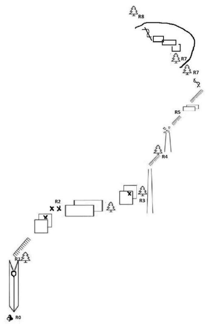
3.1. All sections were climbed with free climbing; on the second rope before section 5, a category 5 difficulty, 8 m, a 10 mm bolt was hammered. As station R2, the station of the "Po nozhu" route was used; also on section 3 (R2–R3), a bolt from the "Kosyк" route was used.
| Section № | Description | Photo № |
|---|---|---|
| R0–R1 | 55 m. From the large juniper upwards through the crack to the intersection with the "Gammii Wall" route. Sometimes rockfall hazard – a large lying stone above the crack can be bypassed on the right. Station on a juniper bush. 15 m 2, 40 m 3. | 4 |
| R1–R2 | First upwards 25 m, then to the right at 2 o'clock in the direction of R2 station of the "Po nozhu" route. It is also R2 of "Zagadka". 7–8 m before the station, a bolt was hammered. 30 m 2, 22 m 3, 8 m 5. | 5 |
| R2–R3 | 45 m. Traverse to the right at 3 o'clock to a bush (pine). Protection is problematic. Bypass the bush from above, then to the right upwards at 1 o'clock to the bolt of the "Kosyк" route, after the bolt to the right to a hollow, then slightly descended to a large juniper. 45 m 4+. | 6 |
| R3–R4 | 30 m. Simple transition under the base of the gutter between two summits. Station on a tree – yew berry. 15 m no protection, 15 m 2. | 7 |
| R4–R5 | Climb the gutter. Then a simple transition 10 m under a small wall with a watercourse. Station on a tree. At the exit from the gutter lie stones that can be dislodged by a rope on the second climber, who is recommended to move away from the line of fall; it is possible to climb to the right. In rain, the section is rockfall hazardous. 10 m 2, 30 m 3, 10 m 1. | 8 |
| R5–R6 | R6–R7. 57 m. Upwards along the watercourse on its right part, then along simple terrain slightly to the left in the direction of the stone "circus". Station before the inflection on a pine. 15 m 2+, 35 m no protection, 10 m 1. | |
| R6–R7 | 10 m. Transition through the inflection into the stone "circus". Station on a pine 5 m from the inflection. 10 m 2. | |
| R7–R8 | 60 m. Upwards from the pine 10 m in the direction of the right part of the "circus", then traverse to the left along the system of cracks at 10 o'clock, bypassing a broken juniper from below, upwards at 11 o'clock along cracks to a large pine and further upwards along the crack to the exit from the "circus". In the cracks, there are loose stones! Station beyond the inflection on a juniper. 10 m 2, 20 m 3, 30 m 4. | 9 |
3.2. Photo of the team on the summit near the remains of the triangulator — see Photo 10 and Photo 11
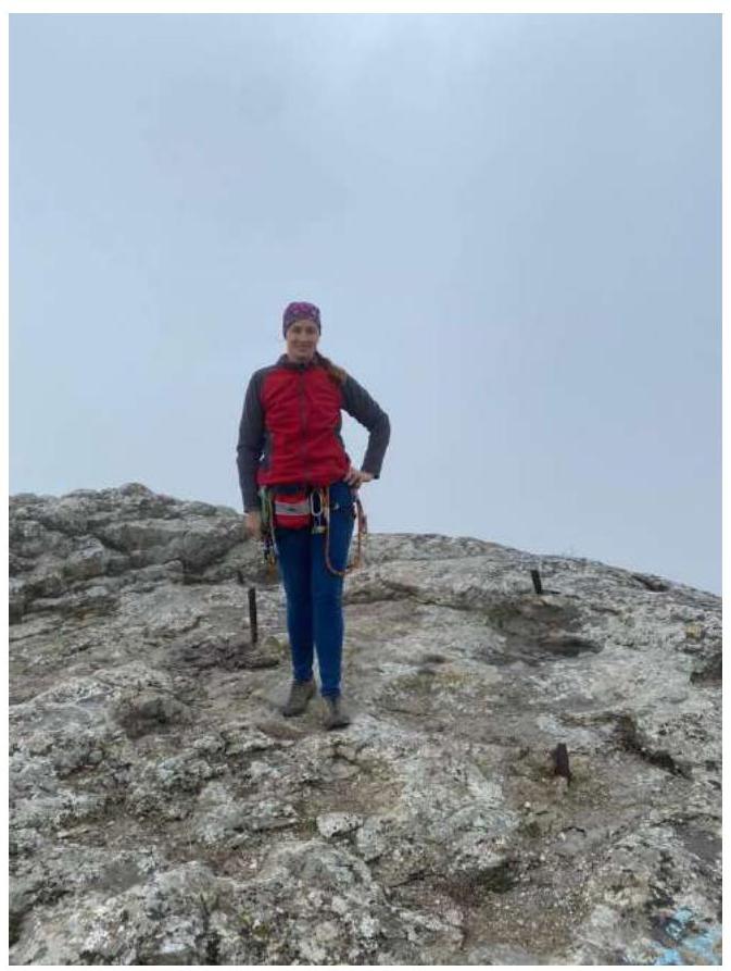
Photo 10. Vasilenko O.I. on the summit
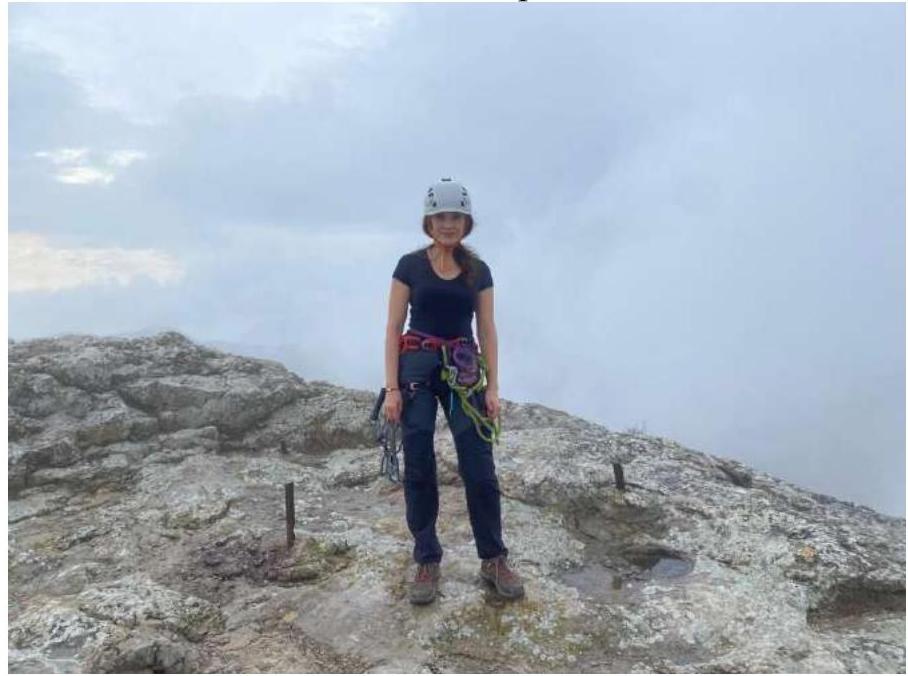
Photo 11. Stuchilina A.A. on the summit. 3.3. The route is recommended for prepared participants with experience of at least 2B. Protection is almost always easily organized; the terrain is reliable, although there are many separate lying stones. Cellular communication is available. Descent via trail towards Novy Svet settlement or Sudak city.
Route features:
- Protection is almost always easily organized
- The terrain is reliable, although there are many separate lying stones
- Cellular communication is available
- Descent via trail towards Novy Svet settlement or Sudak city
We propose to classify it as 2B.
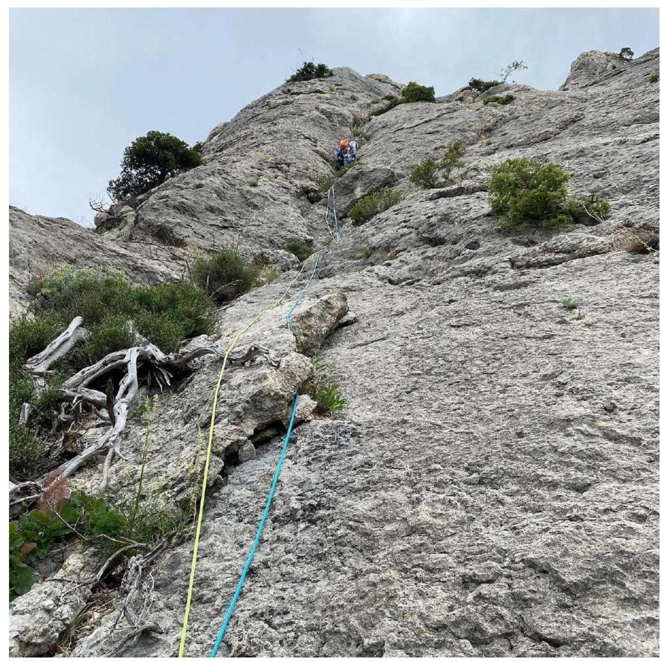
Photo 4. Section R0–R1
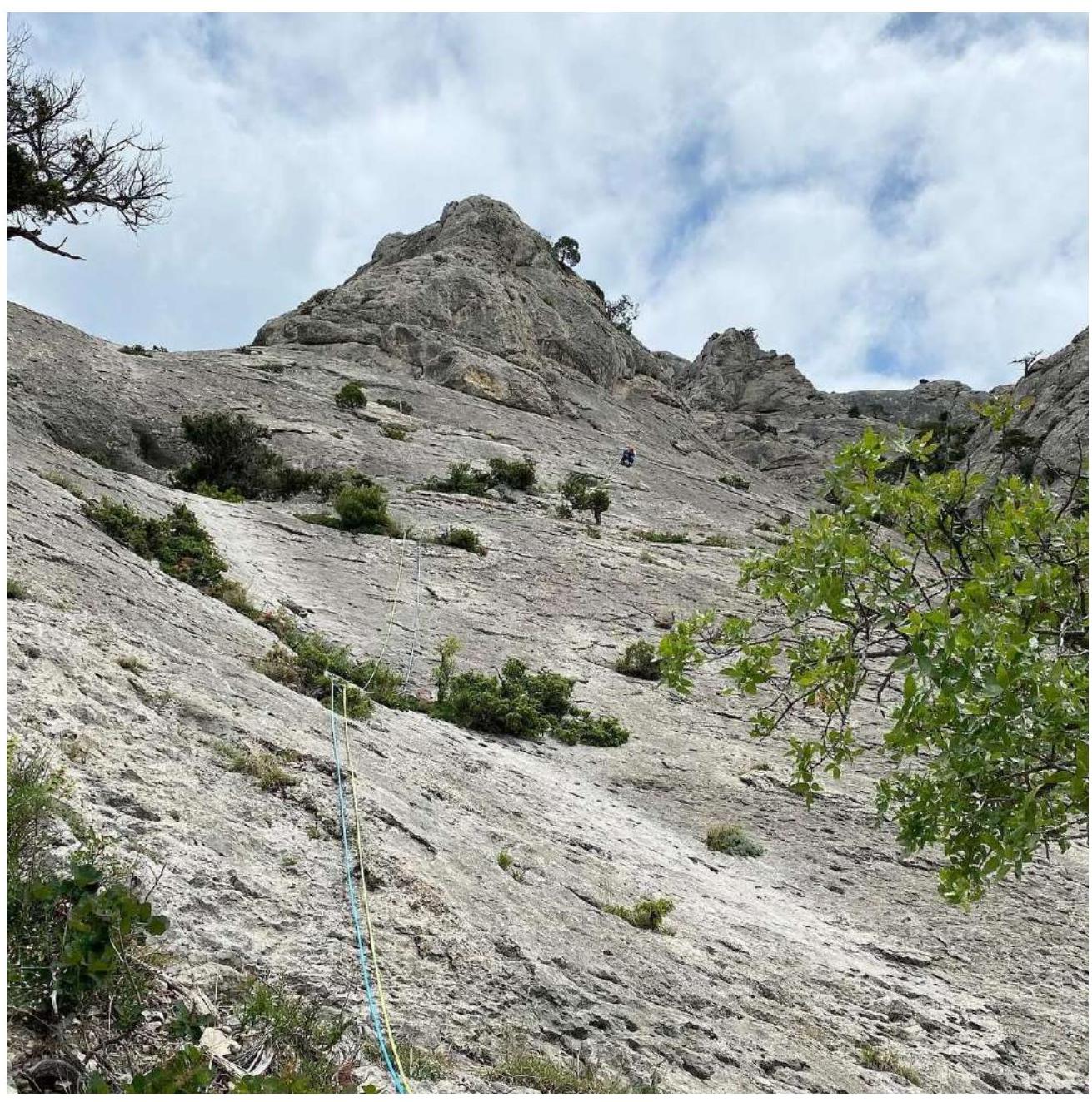
Photo 5. Section R1–R2
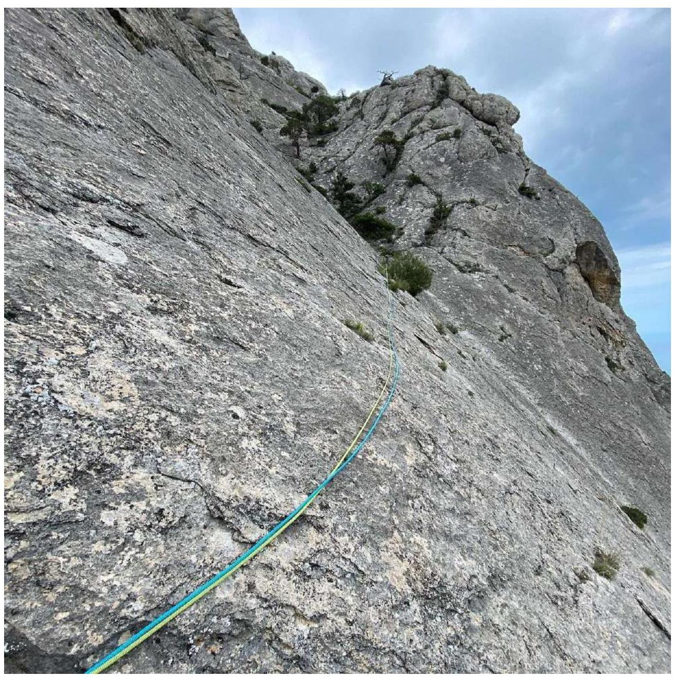
Photo 6. Section R2–R3
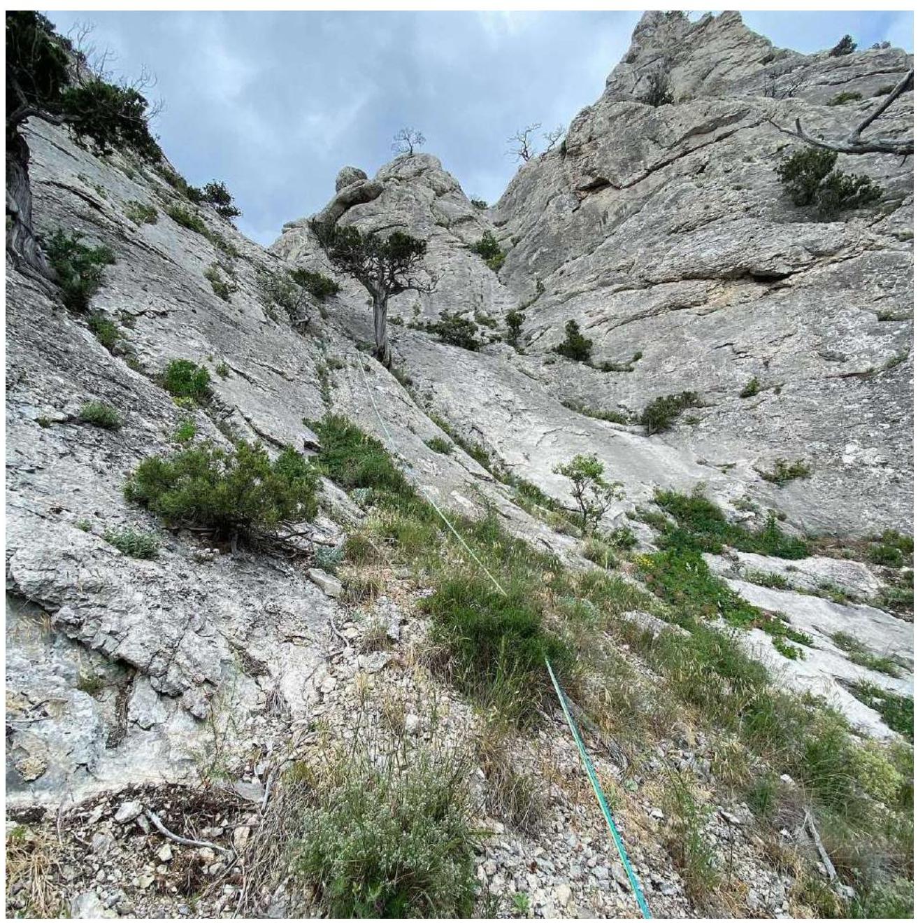
Photo 7. Section R3–R4
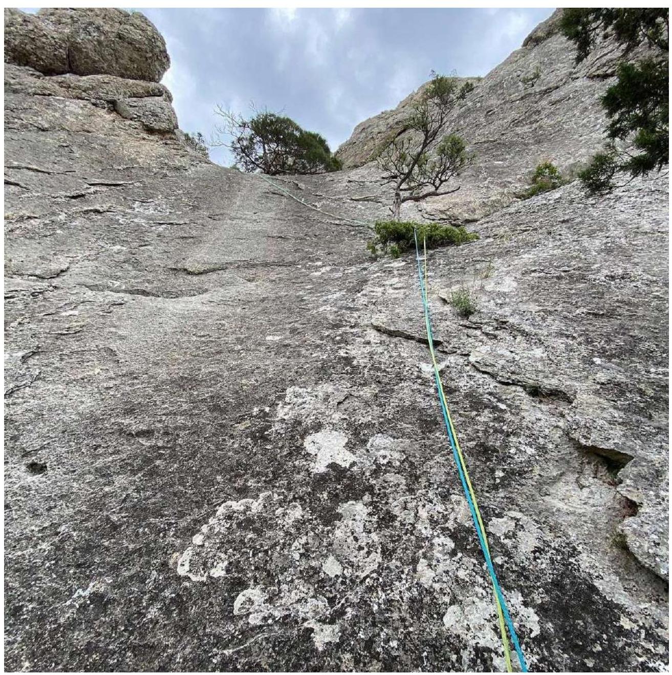
Photo 8. Section R4–R5
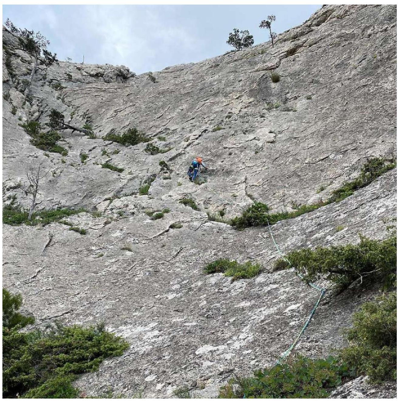
Photo 9. Section R7–R8


