Report
On the First Ascent
Peak Bratchanaka (2501 m) Right Southeast Buttress of the South Ridge. Route 3A cat. diff. (proposed), first ascent. Eastern Sayan, Tunkinskiye Goltsy ridge, Kyngarga gorge, 6.1.2.
Leader: Klepikov A. A. Participants:
- Ilyinskiy V. A.
- Tokmachev A. A.
Ascent completed on January 26, 2019.
I. Ascent Passport
| № | 1. General Information | |
|---|---|---|
| 1.1 | Full name, sports rank of the leader | Klepikov Alexander Alexandrovich, Master of Sports, 3rd sports rank |
| 1.2 | Full name, sports rank of participants | Ilyinskiy Vasily Andreevich (Candidate for Master of Sports); Tokmachev Andrey Andreevich (3rd sports rank) |
| 1.3 | Full name of coach | Afanasiev Andrey Evgenievich, Master of Sports, 1st sports rank |
| 1.4 | Organization | Baikal Alpine School |
| 2. Characteristics of the Ascent Object | ||
| 2.1 | Region | Eastern Sayan, Tunkinskiye Goltsy ridge |
| 2.2 | Gorge | Kyngarga gorge |
| 2.3 | Section number according to the 2020 classification table | 6.1.2 |
| 2.4 | Name and height of the peak | Bratchanaka (2501 m) |
| 2.5 | Geographical coordinates of the peak (latitude/longitude), GPS coordinates (1) | |
| 3. Route Characteristics | ||
| 3.1 | Route name | Right SE buttress of the S ridge |
| 3.2 | Proposed category of difficulty | 3A |
| 3.3 | Degree of route development | First ascent |
| 3.4 | Relief characteristics of the route | Rocky |
| 3.5 | Height difference of the route and main part | 450 (304) m |
| 3.6 | Length of the route and main part | 760 (410) m |
| 3.7 | Technical elements of the route (total length of sections of various difficulty categories with indication of relief character (ice-snow, rocky)) | cat. diff. 1 — 320 m. cat. diff. 2 — 270 m. cat. diff. 3 — 110 m. cat. diff. 4 — 60 m. rappel descent (on descent) — (1 rope 50 meters) |
| 3.8 | Descent from the peak | Along the South Ridge to the pass between peaks Brig and Bratchanaka and rappel into Kyngarga |
| 3.9 | Additional route characteristics | In summer, there is usually no water on the route |
| 4. Characteristics of Team Actions | ||
| 4.1 | Time of movement (team's walking hours, indicated in hours and days) | 5 h 20 min walking hours to the peak, 1 day |
| 4.2 | Overnights | No |
| 4.3 | Exit to the route | 9:00 January 26, 2019 |
| 4.4 | Reach the peak | 14:20 January 26, 2019 |
| 4.5 | Return to base camp | 17:30 January 26, 2019 |
| 5. Responsible for the Report | ||
| 5.1 | Full name, e-mail | Klepikov A. A., Baikalteam@gmail.com |
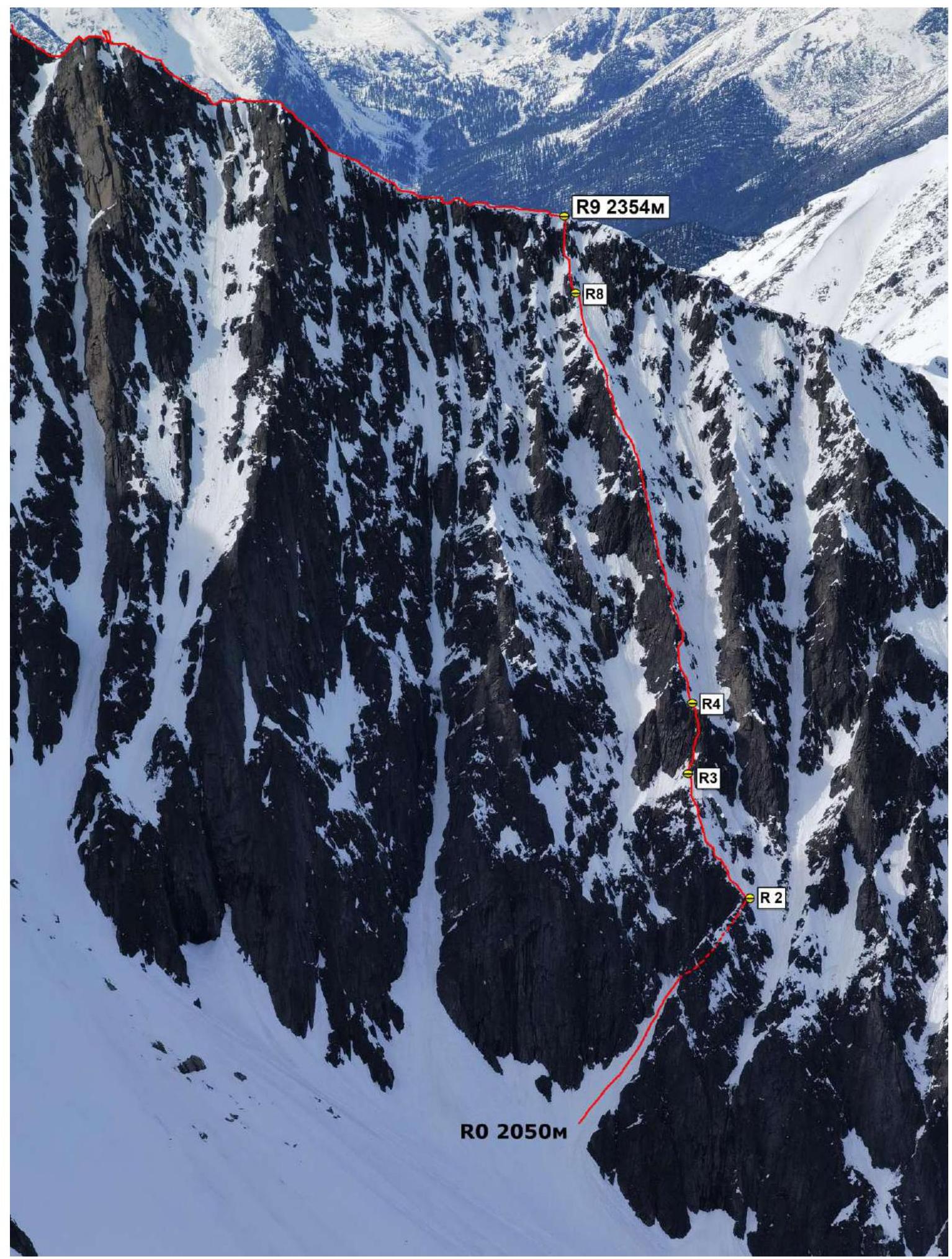
Photo of the general view of Mount Bratchanaka 2501. (Photo taken from the ridge of peak Trekhglavaya, shooting height approximately 2400 m above sea level, distance from object 2000 meters)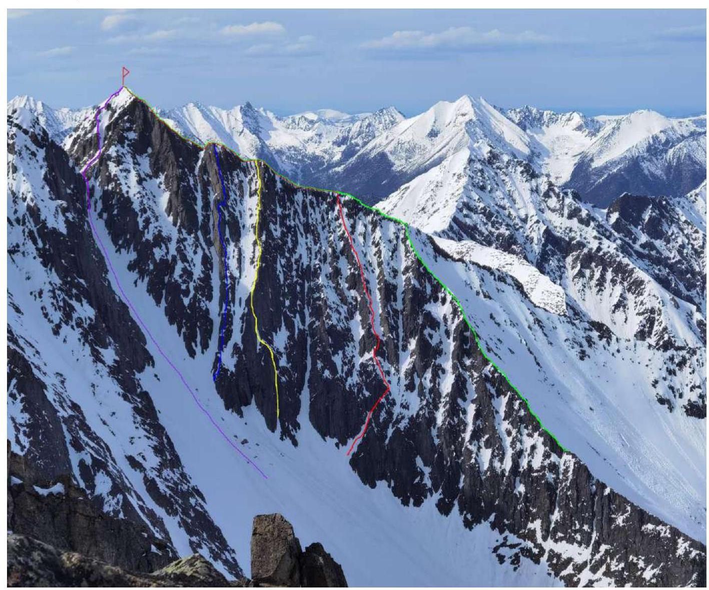
PURPLE — Afanasiev Yu. route, grade 2A, descent BLUE — Krasnukhin Yu. route, Right W buttress, 3A cat. diff. YELLOW — Perepechin Yu. route, 4A cat. diff. RED — team route 3A GREEN — Trubnikov V. route, grade 1B cat. diff.
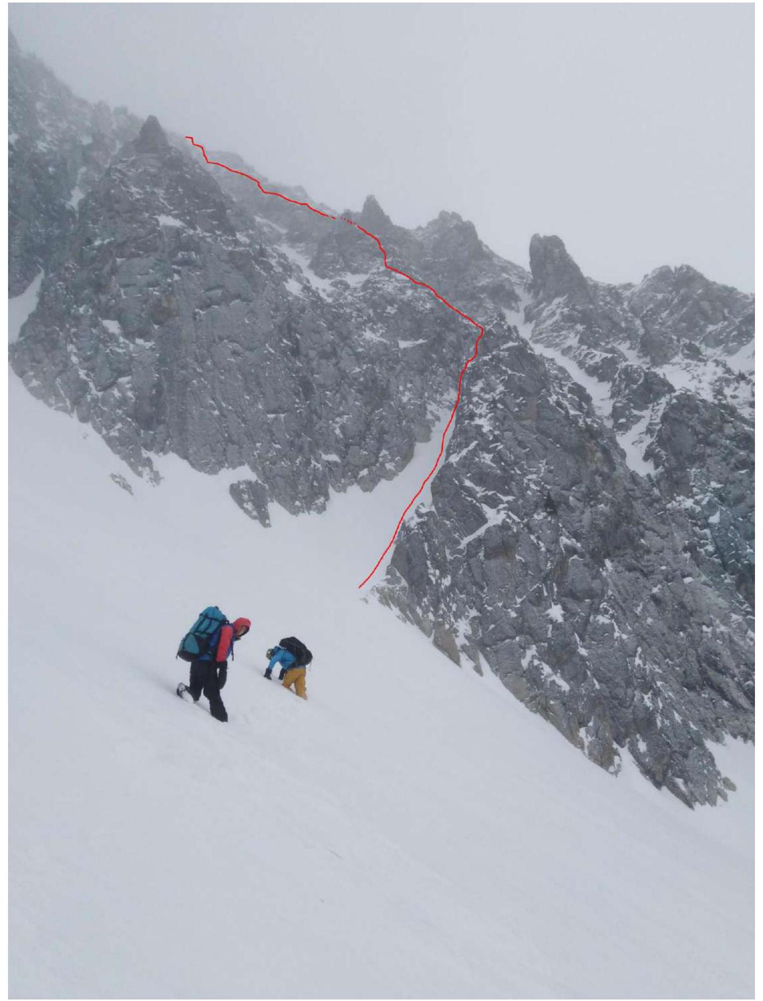
Photo of the route profile from the left. (Photo taken from the descent couloir to the left of the route)
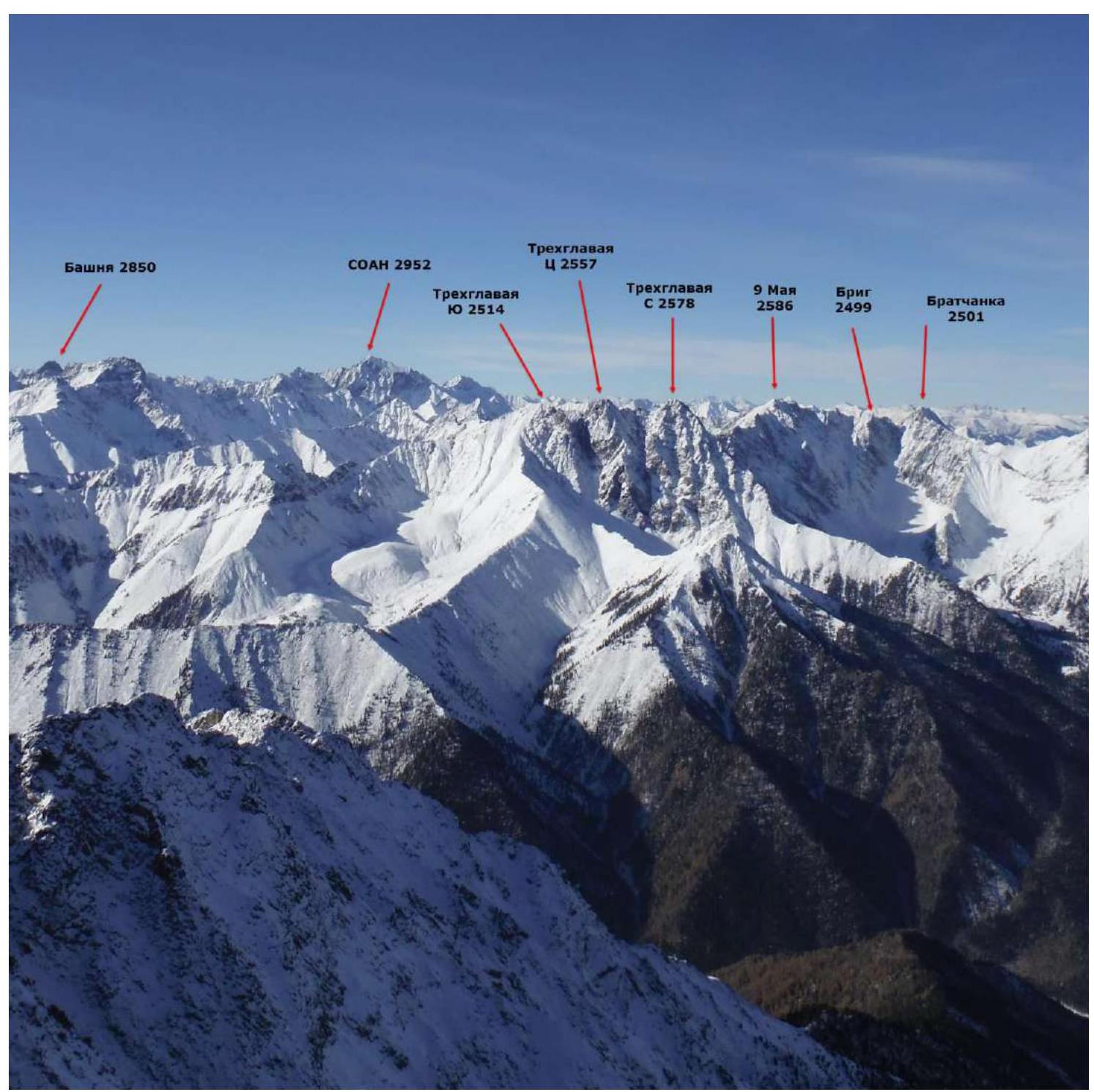
Panorama of the peaks of the Tunskinskiye Goltsy ridge in the area of Kyngarga gorge and adjacent gorges of the ridge. (Photo taken from peak Arshan 2546 m above sea level.)
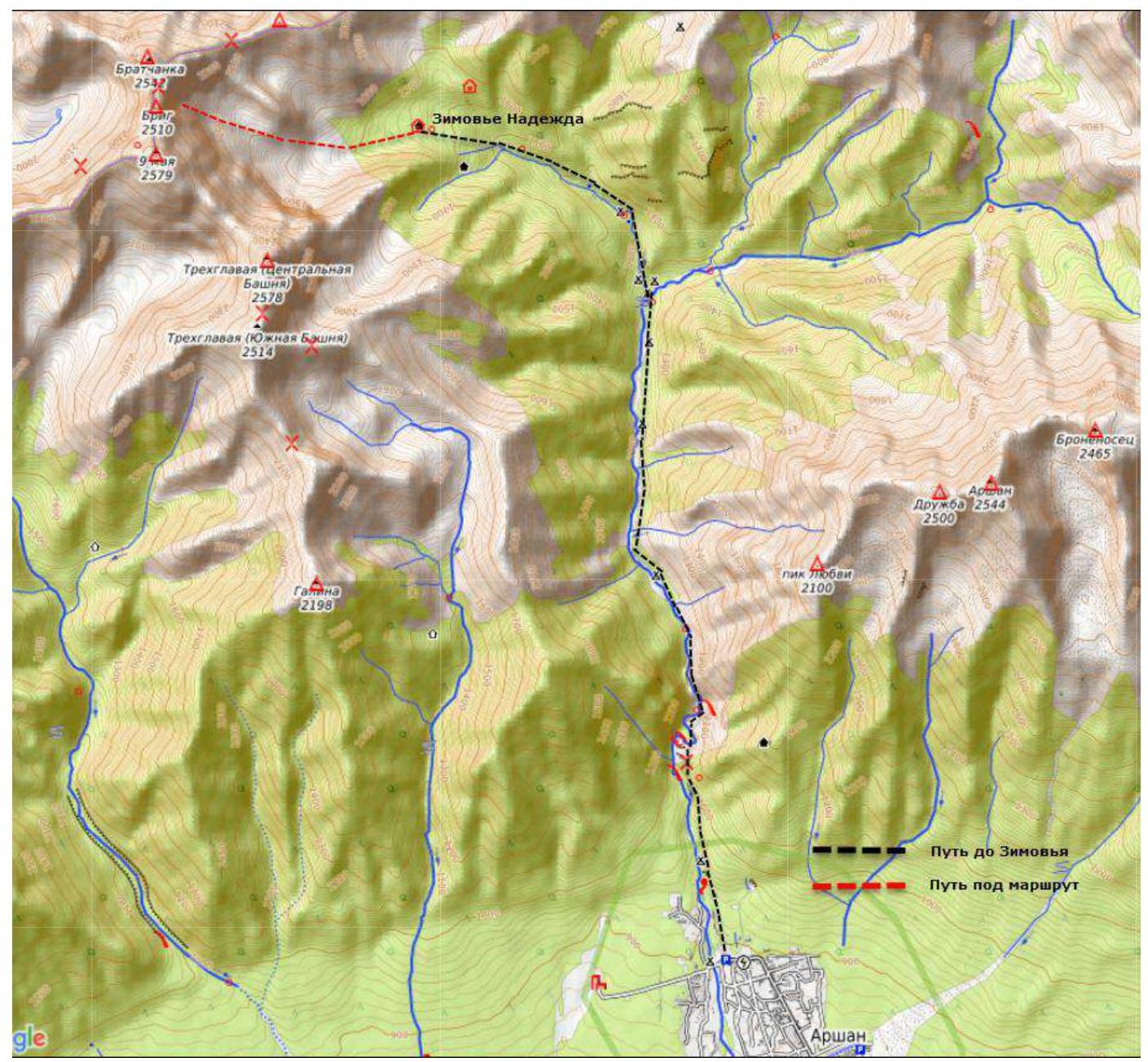
Kyngarga gorge is located in the Tunskinskiye Goltsy ridge near the settlement of Arshan and is oriented towards the Tunka valley. The gorge is the most accessible in terms of logistics and is the most popular among tourists and climbers in the region.
The nearest major settlement is the village of Arshan. The approach to the gorge starts directly from the village. The time taken to reach the base camp in the gorge on the "arrow" is 2-3 hours, and to one of the winter huts is 4-5 hours. The average time to approach the described route can be estimated as follows:
- Arshan settlement — Nadezhda winter hut — 5 hours;
- Nadezhda winter hut — start of the route in summer — 1 hour, in winter — 2-3 hours.
There are many classified routes in the gorge ranging from 1B to 4B cat. diff.
Technical Photo of the Route
Photo taken from the North Ridge of peak Trekhglavaya Northern, shooting height approximately 2450 m.
Description and Relief Characteristics
The beginning of the route is a characteristic diagonal couloir from left to right, cutting through the base of the wall in its middle part and being the only one of its kind on the entire wall.
R0–R1 70 m, 40°, 1. Asymmetric couloir, may be avalanche-prone. R1–R2 20 m, 65°, 3. Couloir-chimney up to the shoulder of the buttress. R2–R3 60 m, 45°, 2+. From the shoulder along the wide, sprawling external form under the wall on the buttress. R3–R4 20 m, 70°, 4. Edge-wall on the ridge, exit to simpler relief. R4–R5 60 m, 50°, 3. Movement to the right of the ridge along the boundary of snow and rocks. Simultaneous movement up to R8. R5–R6 80 m, 45°, 2+. Along the couloir to the right of the ridge, couloir may be avalanche-prone. R6–R7 30 m, 55°, 3. Along the ridge. R7–R8 30 m, 40°, 2. Along the more gentle ridge under the rocky wall before exiting onto the ridge. R8–R9 40 m, 65°, 4, A0. Inner corner on the wall, snowy rocks, exit to the ridge. R9–R10 350 m, 25°, 2. Along the ridge to the peak, simple climbing with relief protection.
Route Characteristics and Team Actions
The route taken by the team is one of the logical buttresses of the South wall of peak Bratchanaka. The thread of the route is easily determinable and logical.
The route was initially planned for a quick ascent; participants have extensive experience and a high level of climbing. The pace is due to: – short daylight hours; – unstable weather in January.
The route has two key sections: – in the first third; – when exiting onto the ridge in winter.
In the upper part of the route, the leader may need IT skills. The leader on the route, Klepikov A. A., was unable to climb everything cleanly and had to hang on to a point.
Descent from the peak is carried out in the direction of peak Brig along route 2A to the pass of Pedestrian Tourists. Further — rappel into the large couloir between peaks Brig and Bratchanaka towards Kyngarga. Caution — may be avalanche-prone.
The author's experience with 3A routes: more than 30 ascents on 24 routes in the Sayan, Caucasus, and Transbaikalia. In terms of technical difficulty, the route occupies a middle position among them, not standing out with special parameters; the relatively short length is compensated by the technical difficulty of the keys.
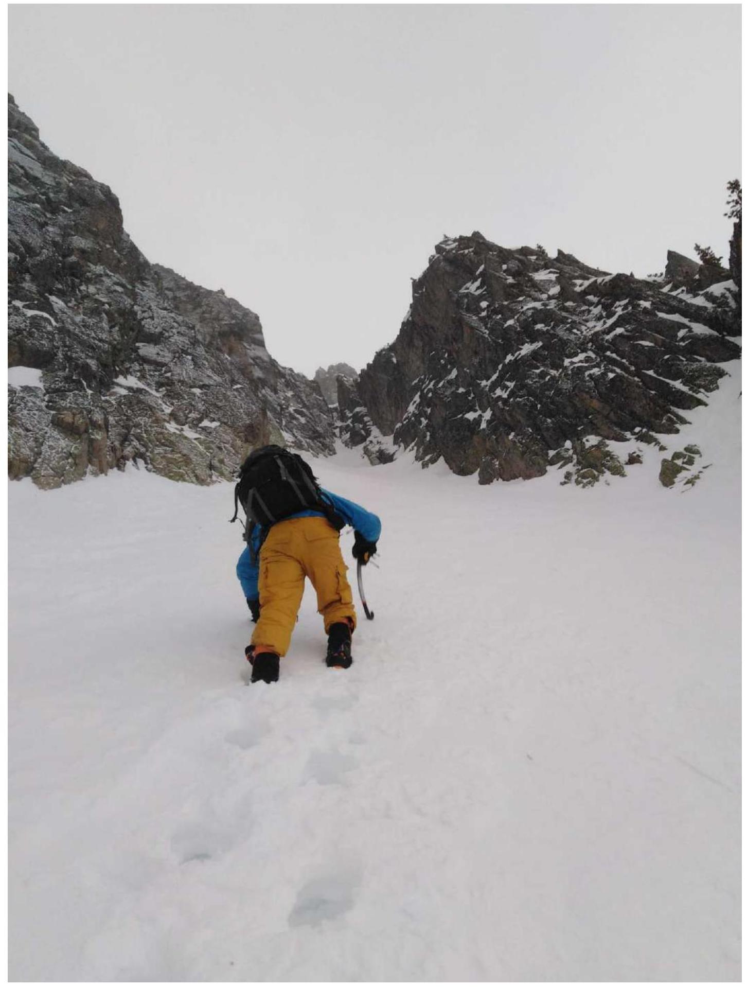
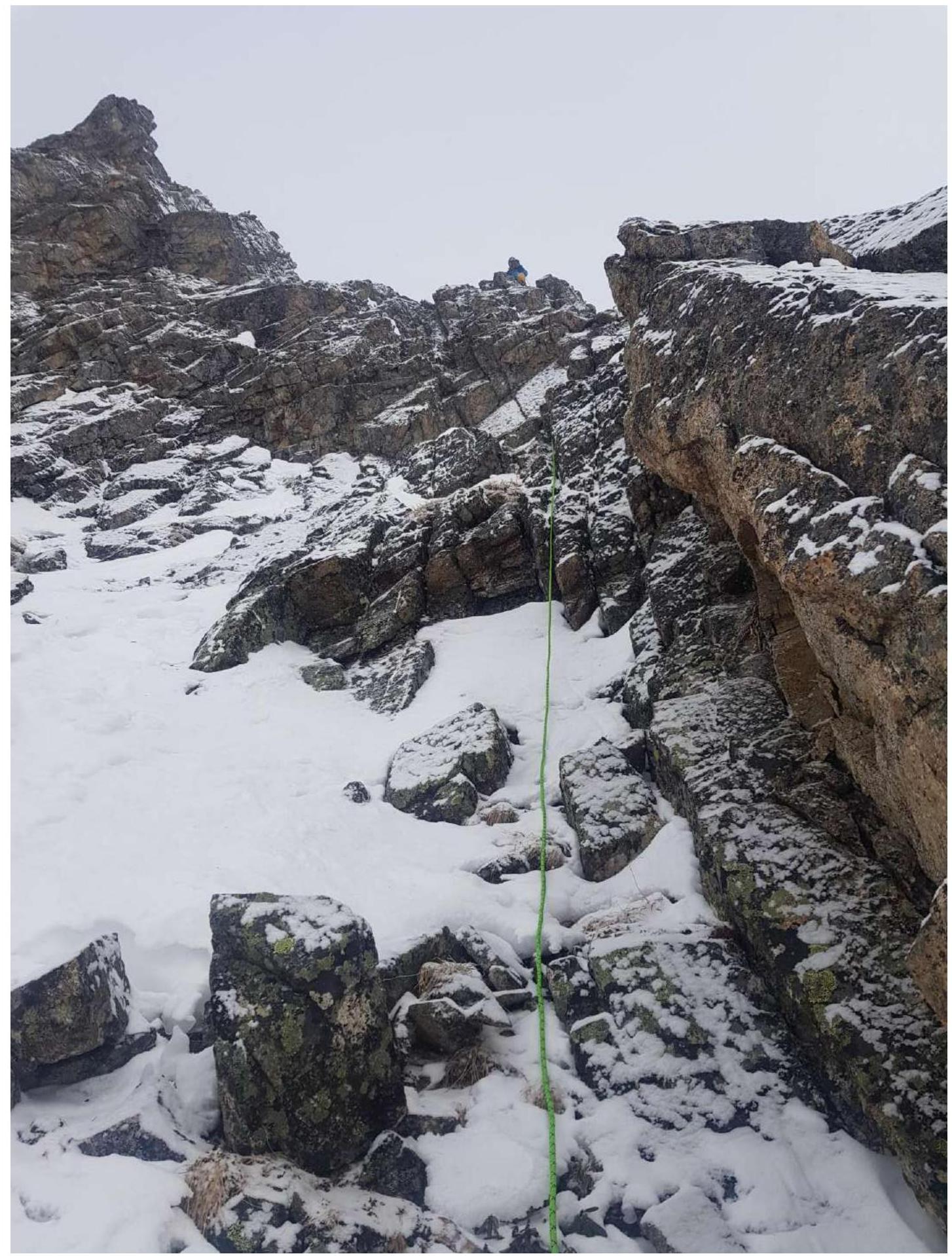
Start of the route. The section R0–R1 — snowy couloir — is visible ahead. The section R1–R2 — couloir-chimney — is also visible.
First key, view down, section R3–R4. Rocky wall, diverse relief, convenient cracks for protection.
First key, view up, section R3–R4. Rocky wall, diverse relief, convenient cracks for protection.
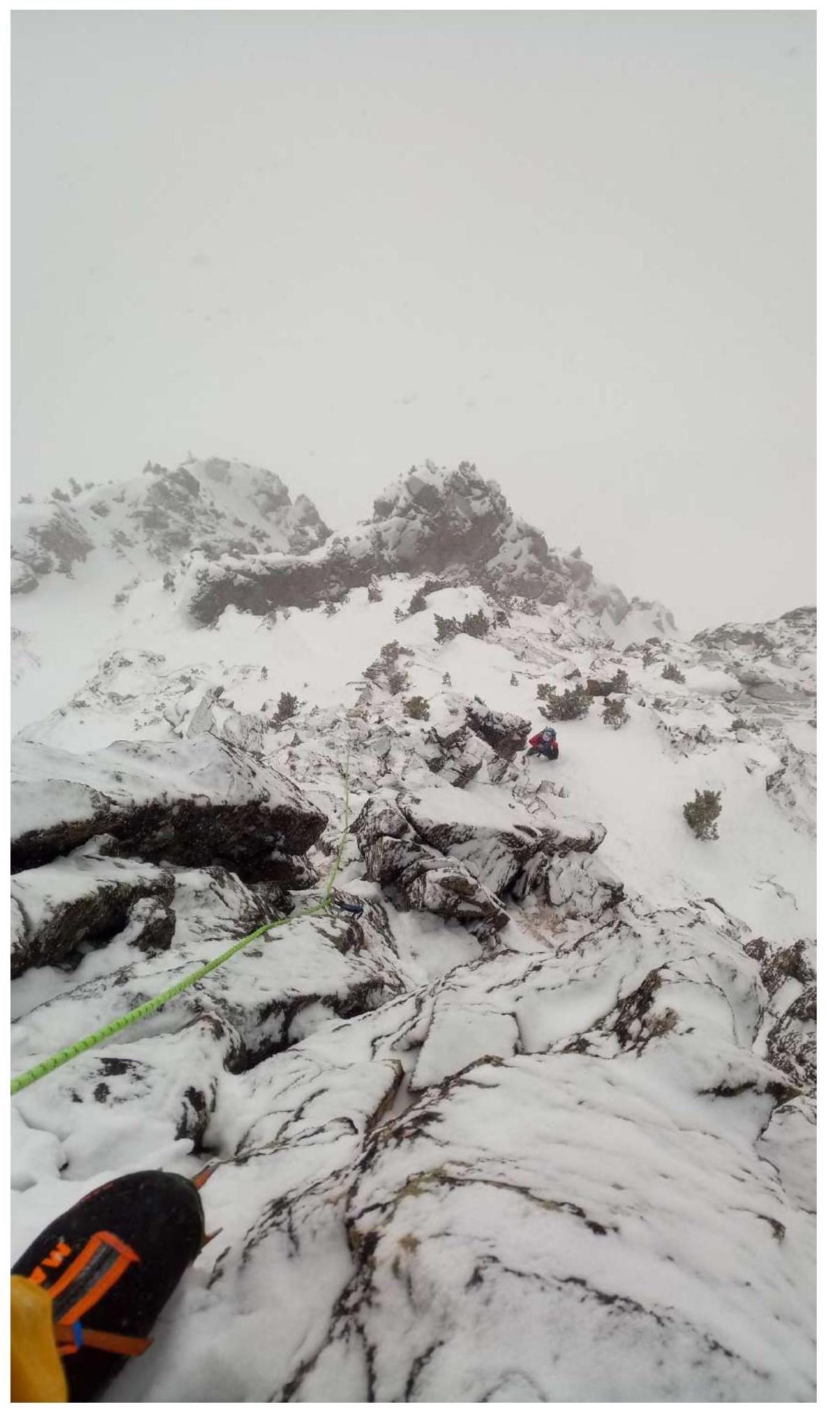
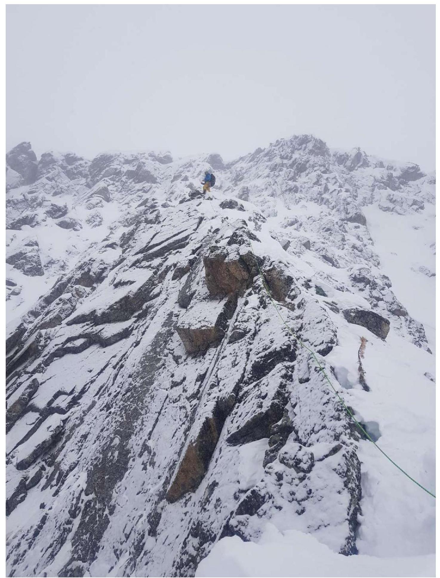
Section R6–R7. Ridge
Section R8–R9. Wall, exit along the inner corner to the ridge.
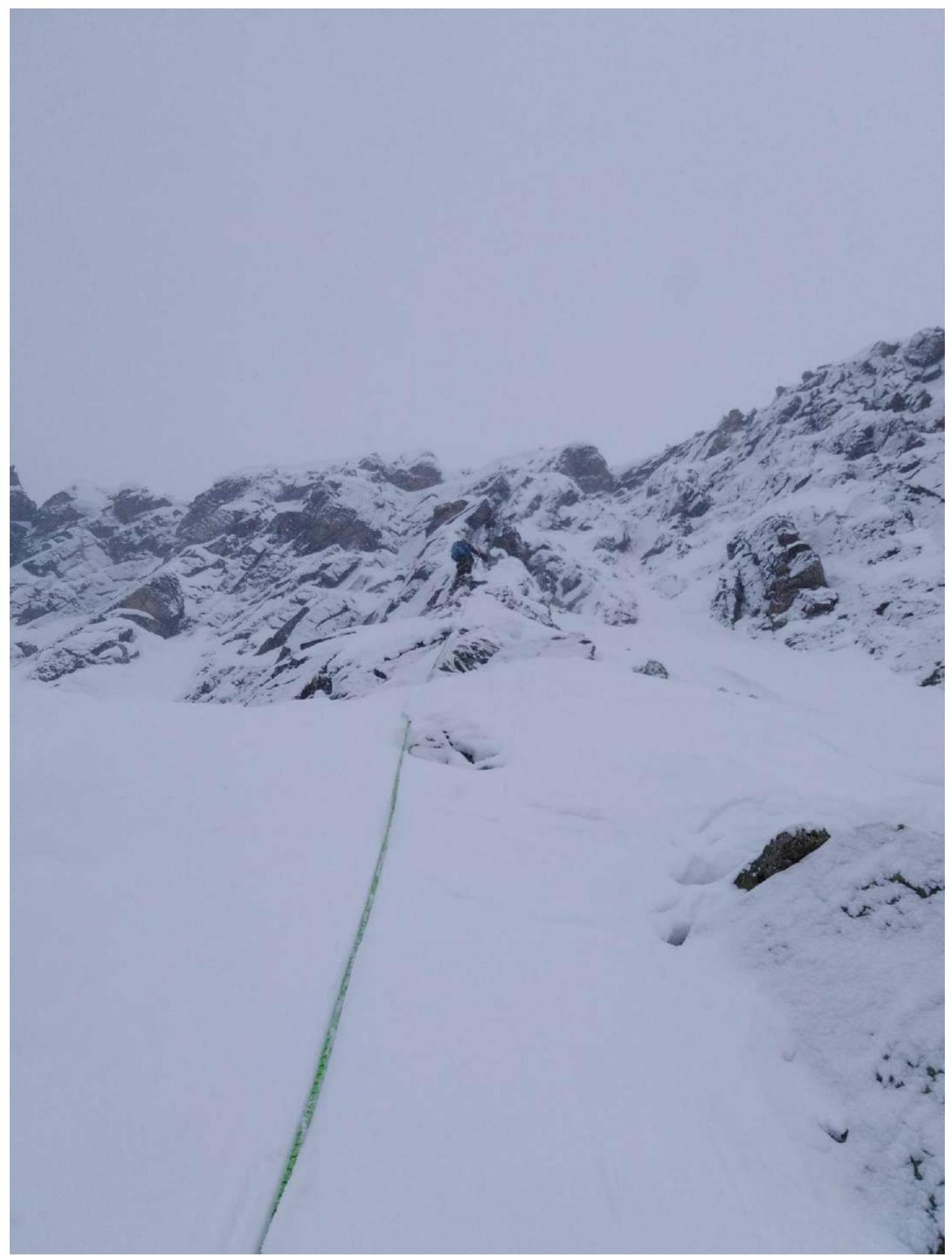
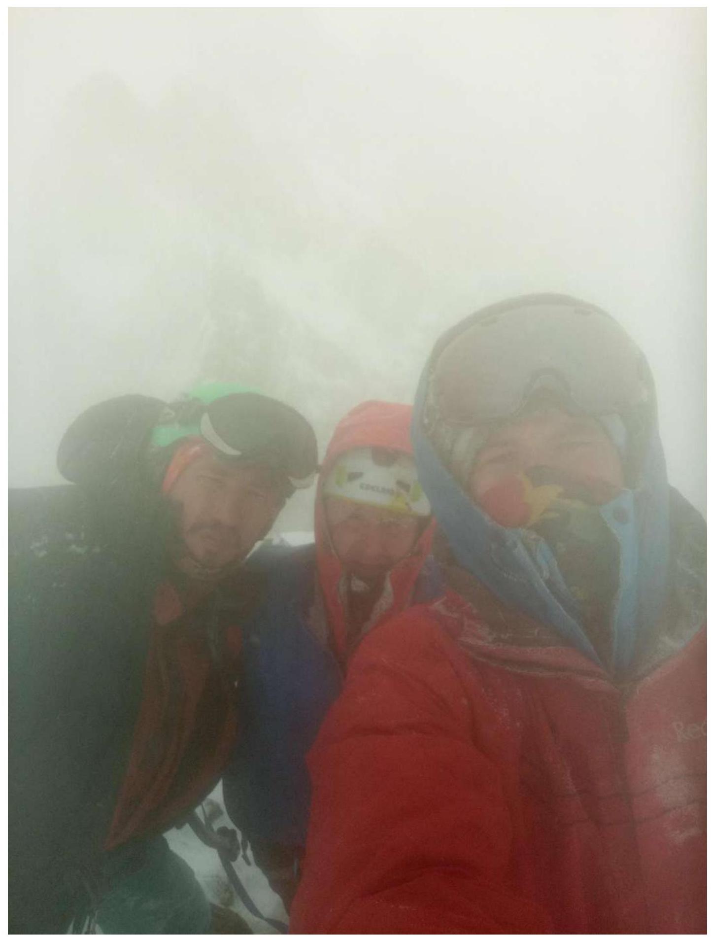
Photo on the peak, peak Brig is visible behind in the cloud. From left to right: Tokmachev A. A., Ilyinskiy V. A., Klepikov A. A.