Report
ON THE FIRST ASCENT TO THE SUMMIT OF RADISHCHEV VIA THE 2ND WESTERN BUTTRESS OF THE SOUTHERN RIDGE, CATEGORY 2A, BY THE TEAM OF THE "GORI BAYKALA" CLUB WITHIN THE FRAMEWORK OF THE PROJECT "NEVOZMOZHNO ETO NE NAVSEGDA" FROM MARCH 27, 2020, TO MARCH 27, 2020.
I. Ascent Passport
| №№ | 1. General Information | |
|---|---|---|
| 1.1 | Full name, sports rank of the leader | Panova Alena Mikhailovna, Candidate for Master of Sports |
| 1.2 | Full name, sports rank of the participants | Kuzmina Maria Anatolyevna, Zolotareva Ekaterina Vitalyevna, Salimov Roman Arturovich, Bobko Nadezhda Alekseyevna, Makarova Anna Igorevna, 3rd sports rank, Penkina Polina Vadimovna, 2nd sports rank, Popov Viktor Valeryevich, Badryzlova Ksenia Sergeyevna, Pochinchik Yuri Nikolayevich |
| 1.3 | Full name of the coach | Panova Alena Mikhailovna |
| 1.4 | Organization | Gori Baykala |
| 2. Characteristics of the Ascent Object | ||
| 2.1 | Region | Eastern Sayan, Tunka Goltsy |
| 2.2 | Valley | Ula-Gol |
| 2.3 | Section number according to the 2013 classification table | 6.1.2 |
| 2.4 | Name and height of the summit | Radishchev 2920 m |
| 2.5 | Geographic coordinates of the summit (latitude/longitude), GPS coordinates | 51°48′19.60″ N 101°28′0.33″ E |
| 3. Characteristics of the Route | ||
| 3.1 | Name of the route | via the 2nd western buttress of the southern ridge |
| 3.2 | Proposed category of difficulty | 2A |
| 3.3 | Degree of route exploration | First ascent |
| 3.4 | Character of the route terrain | Rocky |
| 3.5 | Elevation gain of the route | 700 |
| 3.6 | Length of the route (in meters) | 1200 |
| 3.7 | Technical elements of the route (total length of sections of varying difficulty with indication of terrain character) | 1st cat. diff. rocks — 570 m. 2nd cat. diff. rocks — 615 m. 3rd cat. diff. rocks — 15 m. |
| 3.8 | Descent from the summit | Via non-cat. diff. terrain into the Ula-Gol valley |
| 3.9 | Additional characteristics of the route | Lack of water |
| 4. Characteristics of the Team's Actions | ||
| 4.1 | Time of movement (team's walking hours, in hours and days) | 7 h 15 min |
| 4.2 | Overnights | No |
| 4.3 | Start of the route | 5:00 March 27, 2020 |
| 4.4 | Reach the summit | 13:35 March 27, 2020 |
| 4.5 | Return to the base camp | 20:00 March 27, 2020 |
| 5. Person responsible for the report | ||
| 5.1 | Full name, e-mail | Penkina Polina Vadimovna, polinapenkina4055@gmail.com, 89021558617 |
II. Description of the Ascent
1. Characteristics of the Ascent Object
1.1. General photo of the summit
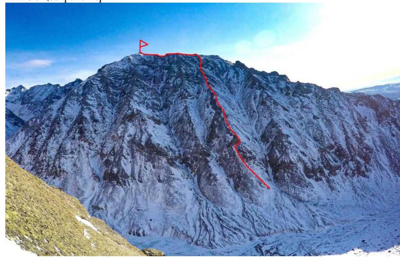
Photo 1. Date taken: March 27, 2020, from the summit of Ula-Gol
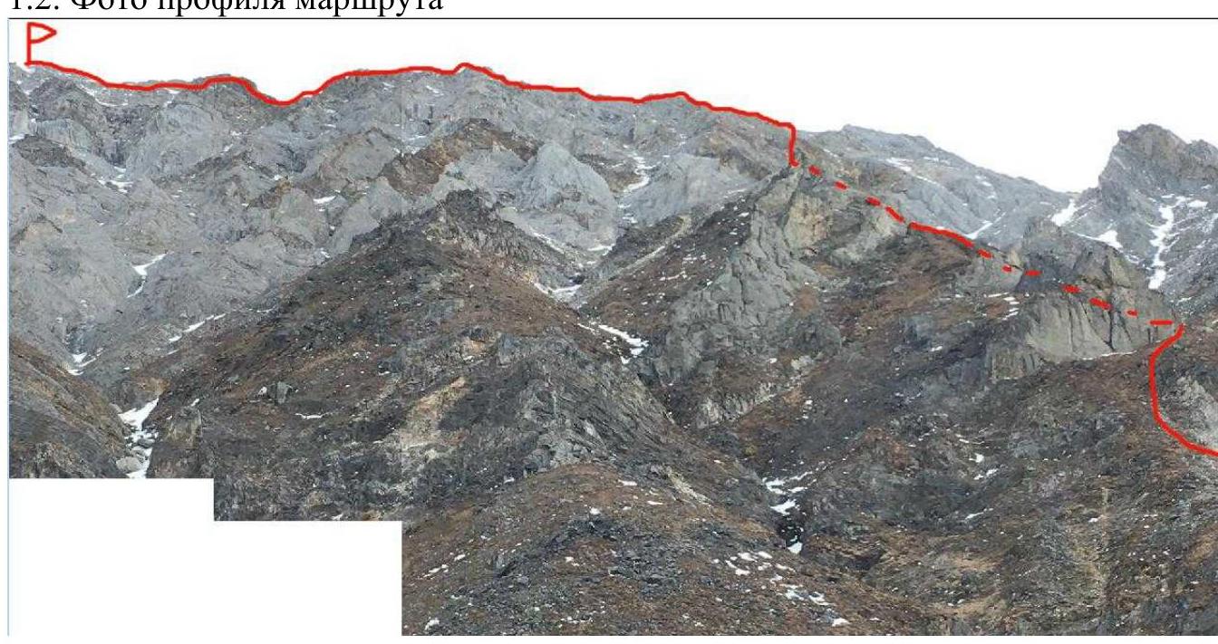
Photo 2. Profile of the route 1.3. Photopanorama of the area

Photo 3. Photopanorama 1.4. Map of the area
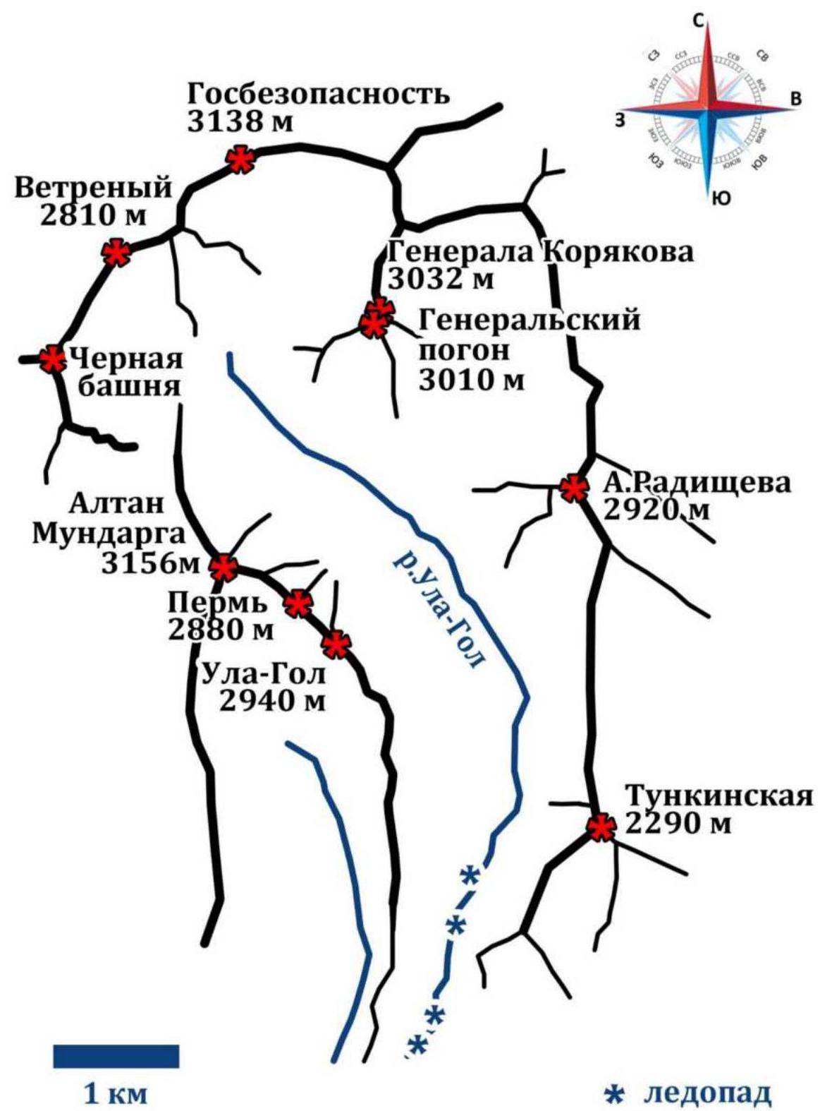
Photo 4. Scheme of the valley
The area is located in the Eastern Sayan Mountains. The nearest settlement is the village of Khoyto-Gol. The approach from Irkutsk was made:
- By personal vehicles to the village of Kyren (218 km, 3 hours)
- From Kyren to the Ula-Gol river by GAZ-66 (60 km, 2 hours)
- To the base camp on foot along the frozen Ula-Gol river (12 km, 6 hours)
There is an icefall on the river, which is bypassed on the right orographic bank of the river. The left bank has a more difficult ascent. The base camp was located in the forest zone on the right bank of the river, with coordinates 51°46′42″ N; 101°27′24″ E. The approach to the route from the base camp was along the river:
- The first icefall is bypassed on the right bank
- The second — on the left The start of the route is at an altitude of 2220 m, and the approach from the base camp took 1 hour 20 minutes along a trodden snow path.
2. Characteristics of the Route
2.1. Technical photograph of the route
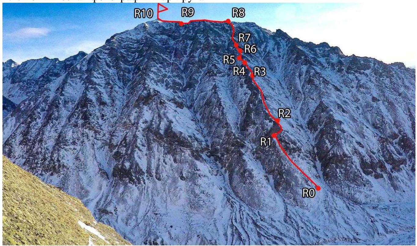
Photo 5. Taken on March 27, 2020, from the ascent to the summit of Ula-Gol.
2.3. Technical characteristics of the route sections
| Section | Character of the terrain | Category of difficulty | Length, angle | Type and number of hooks |
|---|---|---|---|---|
| R0–R1 | Grassy slope. | 1 | 70 m, 60° | - |
| R1–R2 | Scree. | 2 | 60 m, 55° | - |
| R2–R3 | Grassy slope, then scree. | 1 | 500 m, 40° | - |
| R3–R4 | Alternating sheep's backs and slopes with live scree. | 2–2+ | 200 m, 45–50° | - |
| R4–R5 | Scree, sheep's backs. | 3– | 15 m, 45° | - |
| R5–R6 | Destroyed angle with live stones. | 2 | 15 m, 50° | - |
| R6–R7 | Sheep's backs. | 2 | 10 m, 20° | - |
| R7–R8 | Wide ridge turning into a destroyed ridge. | 2 | 100 m, 30° | - |
| R8–R9 | Ridge with scree. | 2 | 200 m, 10° | - |
| R9–R10 | Sheep's backs. | 2 | 30 m, 35° | - |
No hooks or placements were used; belay was done using the terrain.
3. Characteristics of the Team's Actions
| Section | Description | Photo number |
|---|---|---|
| R0–R1 | Approach along a grassy slope under a grey gendarme, which is bypassed on the right. | 6 |
| R1–R2 | Traverse to the right for 30 m, then move upwards along the slope with scree, belay using the terrain. | |
| R2–R3 | Movement along a grassy slope to the right of the ridge, all gendarmes are bypassed on the right. Approach under grey rocks, bypassing them on the right. The grass ends with thorny plants, and live stones begin. | 7 |
| R3–R4 | Movement along the ridge, mainly on the left. | 8 |
| R4–R5 | Bypass a rusty rock on the left, climbing along small holds on the ridge made of sheep's backs. Movement on the sheep's backs is alternating. | 9 |
| R5–R6 | Destroyed angle. Alternating movement. | |
| R6–R7 | Sheep's backs. Simultaneous movement. | 10 |
| R7–R8 | Wide ridge turning into a destroyed ridge. Many live stones, alternating movement. There is a possibility to deviate to the left onto sheep's backs, but it is significantly more difficult and lacks belay. Exit onto the southern ridge. | 11 |
| R8–R9 | Ridge with scree. Simultaneous movement. | |
| R9–R10 | Sheep's backs. Simultaneous movement. Reach the summit. |
Photos from the ascent
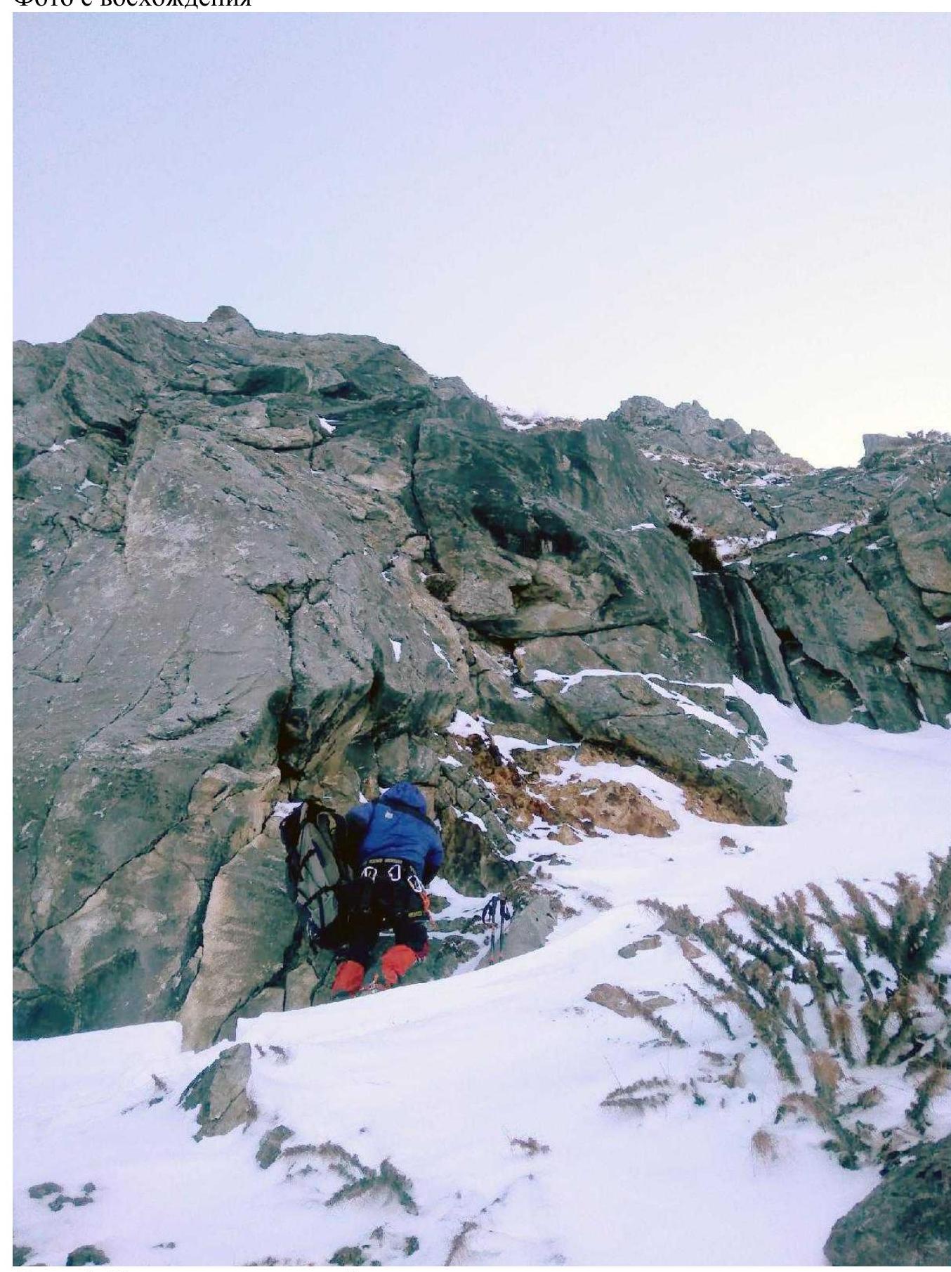
Photo 6. Start of the route, bypassing the gendarme on the right
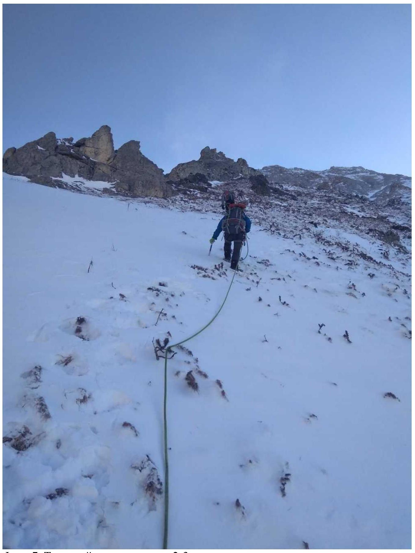
Photo 7. Grassy slope, section R2–R3
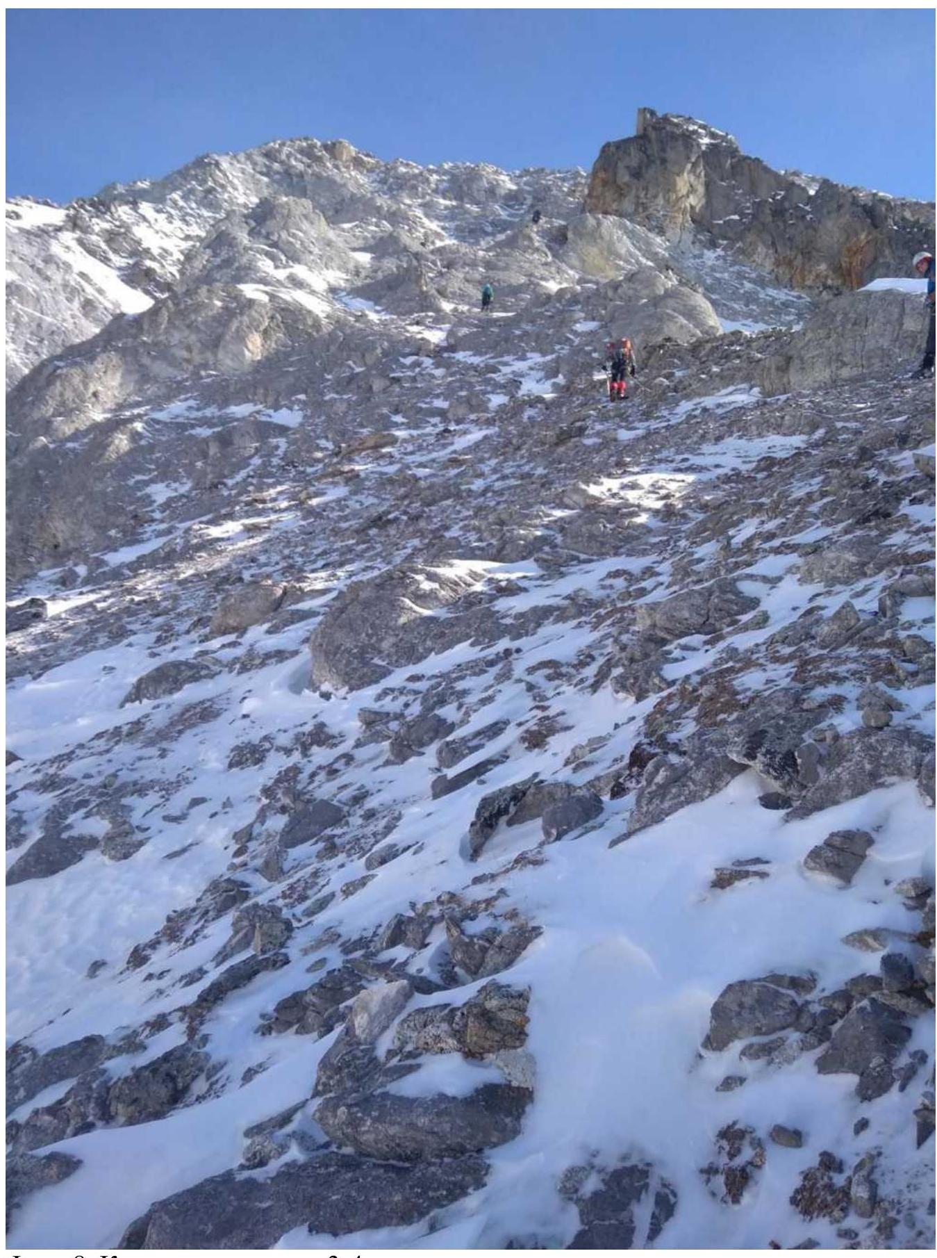
Photo 8. Scree, section R3–R4
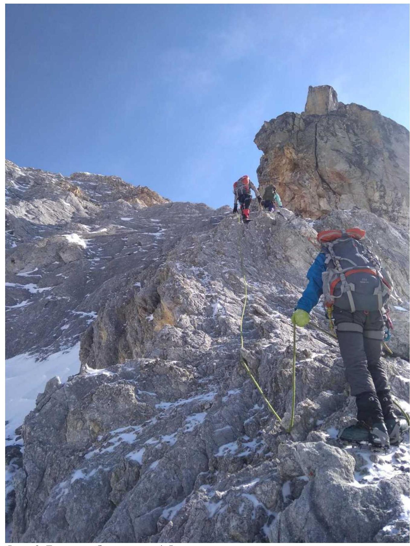
Photo 9. Sheep's backs, section R4–R5
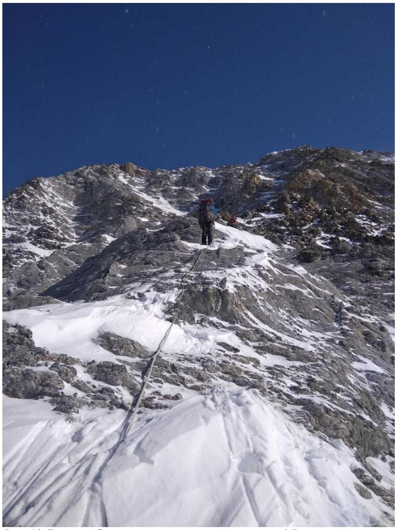
Photo 10. Sheep's backs after the destroyed angle, section R6–R7
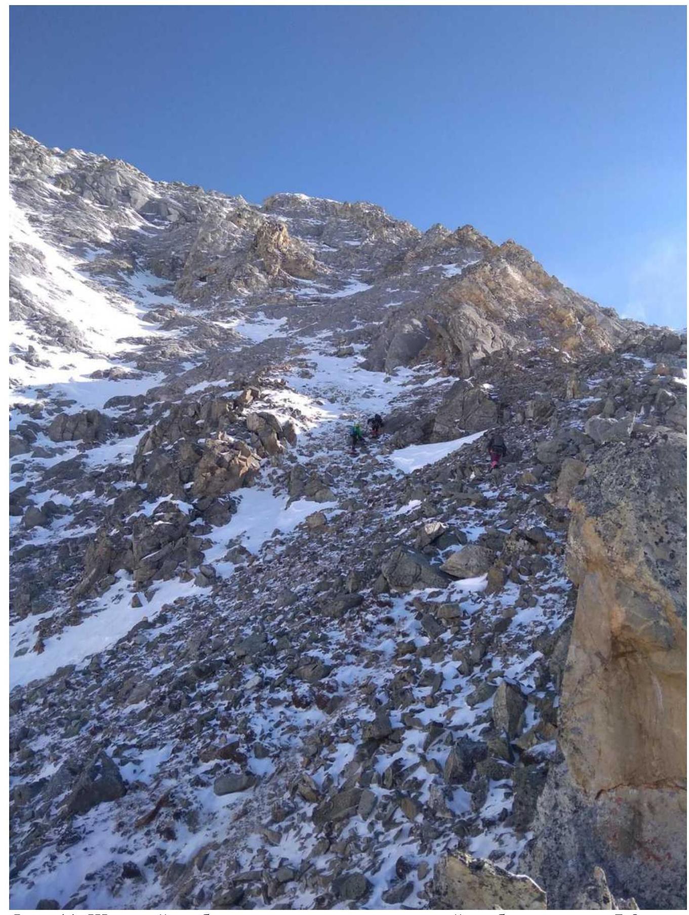
Photo 11. Wide ridge turning into a destroyed ridge, section R7–R8
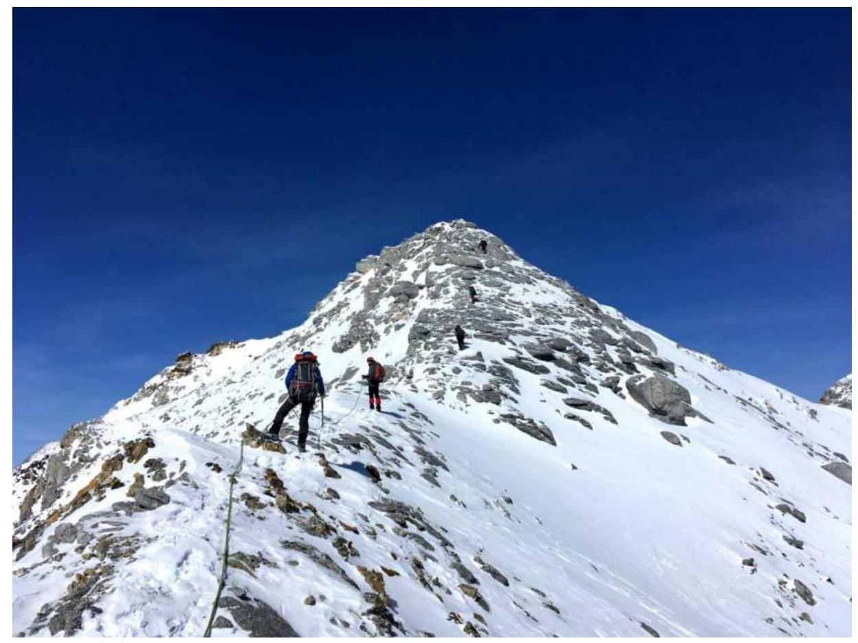
Photo 12. Ridge, sheep's backs lead to the summit.
3.2. Photo of the team on the summit with the control tour.
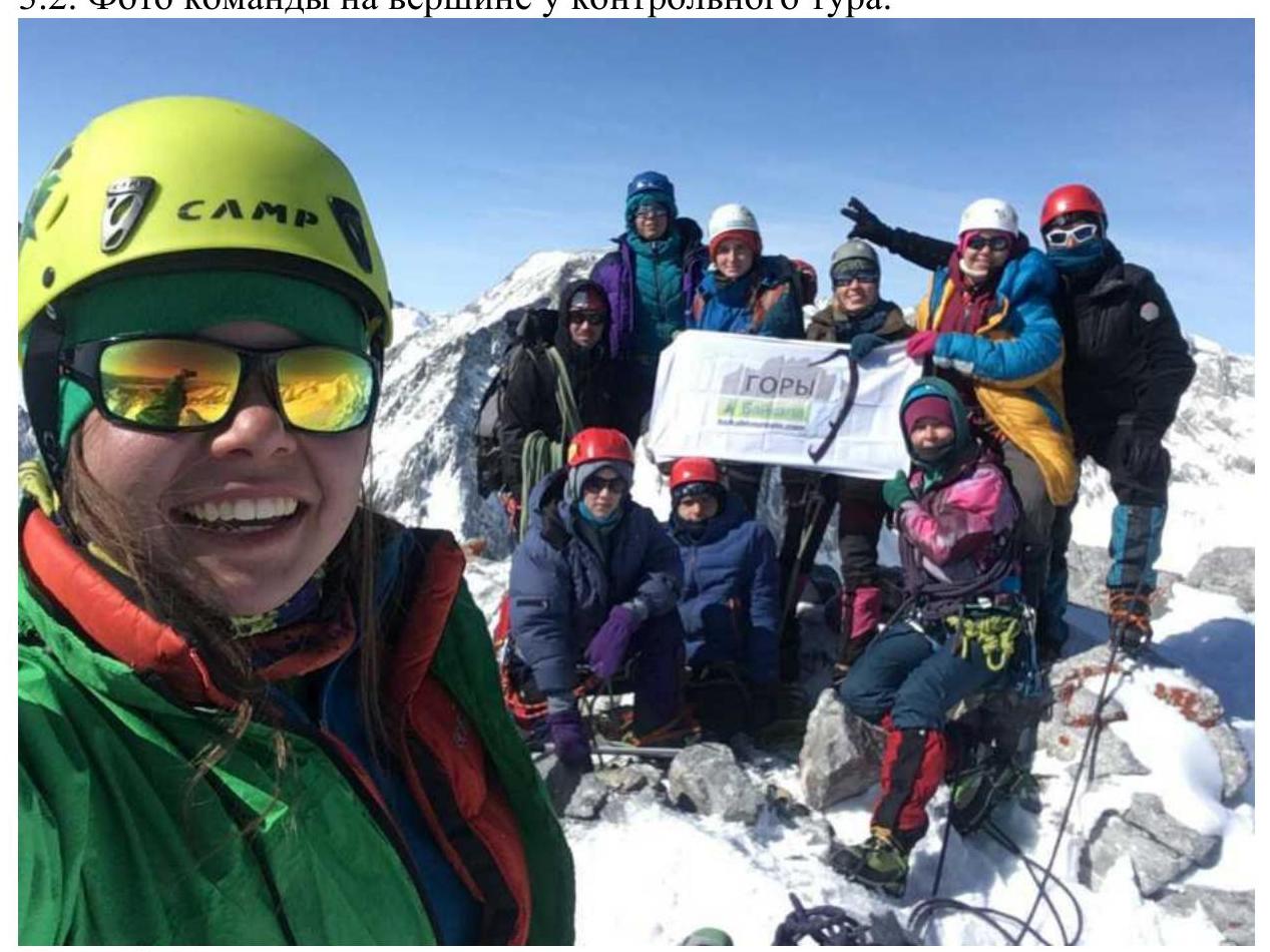
Photo 13. Summit 3.3. The route is relatively safe due to its ridge nature. Communication with the base camp was maintained using a radio station, and there is cellular coverage at the summit. The descent was along the ridge towards a neighboring unnamed summit to the north, to a saddle, then down a couloir to the left (towards the summit of General Koryakov).
Movement:
- To the saddle with simultaneous belay.
- On the saddle, the rope can be removed.
- The couloir is rockfall-prone; movement in a tight group.
- As you descend, you need to veer left and transition into a neighboring couloir because the lower part of this couloir has rockfall.
- In winter, it can be avalanche-prone.
The presumed category of difficulty of the route is 2A, comparable in complexity and length to routes of this category.