
Report
ON THE FIRST ASCENT OF MT. ARSHAN VIA THE EASTERN SLOPE, APPROXIMATELY 2A DIFFICULTY CATEGORY BY THE TEAM FROM BAIKAL ALPINISM SCHOOL ON OCTOBER 8, 2020.
I. Climbing Report
| No. | 1. General Information | |
|---|---|---|
| 1.1 | Full name, sports rank of the team leader | Afanasiev A.E. — Master of Sports |
| 1.2 | Full names, sports ranks of the team members | Vasiliev V.P., Gordov A.V., Nikonov A.A., Plotnikov D.A., Ryazantsev M.S., Tkachev V.Yu. |
| 1.3 | Full name of the coach | Afanasiev A.E. — Master of Sports |
| 1.4 | Organization | Baikal Alpine School |
| 2. Characteristics of the Climb Object | ||
| 2.1 | Region | Eastern Sayan, Tunkinskie Goltsy ridge |
| 2.2 | Valley | Dождевое (Dozhdyevoe) |
| 2.3 | Section number according to the 2013 classification table | 6.1.2. |
| 2.4 | Name and height of the peak | Arshan, 2546 m |
| 2.5 | Geographical coordinates of the peak (latitude/longitude), GPS coordinates | |
| 3. Route Characteristics | ||
| 3.1 | Route name | В скл. (V skl.) |
| 3.2 | Proposed difficulty category | 2A |
| 3.3 | Degree of route development | First ascent |
| 3.4 | Terrain type of the route | Rocky |
| 3.5 | Elevation gain of the route (data from altimeter or GPS) | 250 |
| 3.6 | Route length (in meters) | 380 |
| 3.7 | Technical elements of the route (total length of sections with different difficulty categories, specifying terrain type (ice-snow, rocky)) | 1st cat. diff. rocks — 140 m. 2nd cat. diff. rocks — 205 m. 3rd cat. diff. rocks — 35 m. Rappelling on descent — no |
| 3.8 | Descent from the summit | Along the southern ridge and into Dozhdyevoe valley |
| 3.9 | Additional route characteristics, water availability | Tea in thermoses |
| 4. Team Actions Characteristics | ||
| 4.1 | Time in motion (team's walking hours, in hours and days) | 3 h 30 min; 1 day |
| 4.2 | Overnight stays | No |
| 4.3 | Departure to the route | 7:30, September 8, 2020 |
| 4.4 | Summit ascent | 11:00, September 8, 2020 |
| 4.5 | Return to base camp | 13:00, September 8, 2020 |
| 5. Person Responsible for the Report | ||
| 5.1 | Full name, e-mail | Afanasiev A.E. anevg09@mail.ru |
II. Climbing Description
1. Climb Object Characteristics
1.1. General photo of the peak.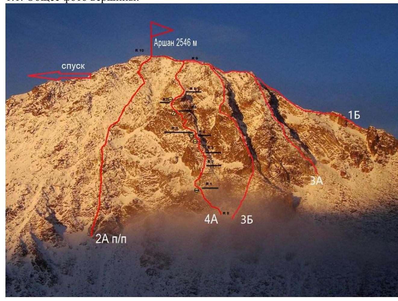
Photo 1. Taken from the foot of Mt. Broneonosets to the west.
1.3. Photopanorama of the area.
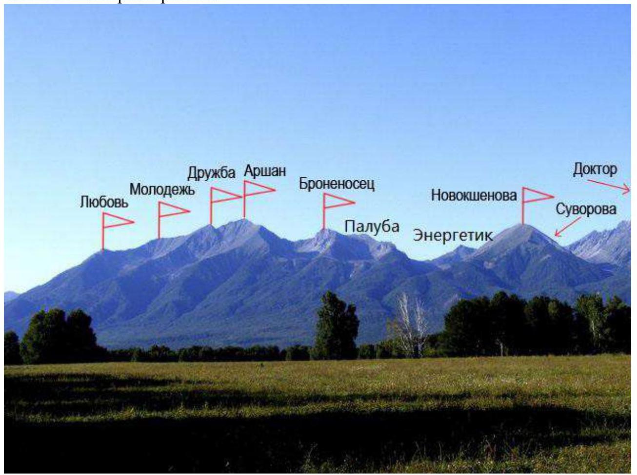
Photo 2. Taken from the Tunkinskaya valley.
1.4. Area map.
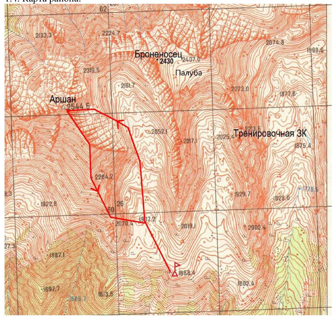
Photo 3. Route map.
2. Route Characteristics
2.1. Technical photograph of the route.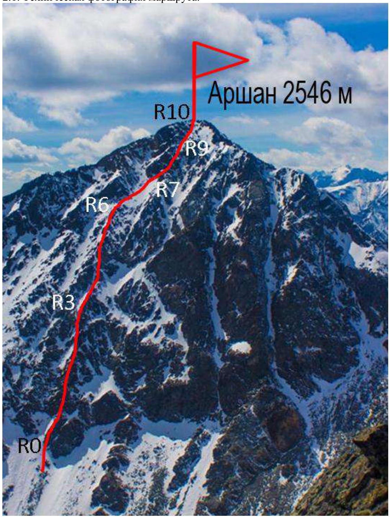
Photo 4.
2.3. Technical characteristics of route sections.
| Section No. | Terrain type | Diff. Cat. | Length m, steepness | No. of pitons |
|---|---|---|---|---|
| R0–R1 | Outer corner | 2 | 20, 55° | 1 |
| R1–R2 | Rock with grassy ledges | 2 | 40, 60° | 2 |
| R2–R3 | Rocky nose. To the right | 3 | 35, 50° | 3 |
| R3–R4 | Ridge, loose rocks | 2 | 25, 45° | |
| R4–R5 | Slab | 2 | 40, 50° | 2 |
| R5–R6 | Outer corner | 2 | 35, 45° | 1 |
| R6–R7 | Large scree and slabs | 1 | 80, 40° | |
| R7–R8 | Ledge up to the right | 2 | 45, 40° | |
| R8–R9 | Outer corner to the right of the beak | 1 | 40, 35° | |
| R9–R10 | Scree slope. Direct ascent to the summit | 1 | 20, 30° |
3. Team Actions Characteristics
3.1. Brief description of the route passage.
The approach from the base camp takes 1.5 hours. The route starts to the left of the three buttresses with routes 3A, 3B, 4A on the steep eastern slope directly under the summit. The route follows the center of the eastern slope and is a direct and logical line.
| Section | Description | Photo No. |
|---|---|---|
| R0–R1 | Outer corner | 5 |
| R1–R2 | Rock with grassy ledges | |
| R2–R3 | Rocky nose. To the right | 6 |
| R3–R4 | Ridge, loose rocks | 7, 8 |
| R4–R5 | Slab to the right to the left | 9 |
| R5–R6 | Outer corner | 10 |
| R6–R7 | Large scree and slabs | |
| R7–R8 | Ledge up to the right | |
| R8–R9 | Outer corner to the right of the beak | 11, 12 |
| R9–R10 | Scree slope. Direct ascent to the summit | 13 |
Photo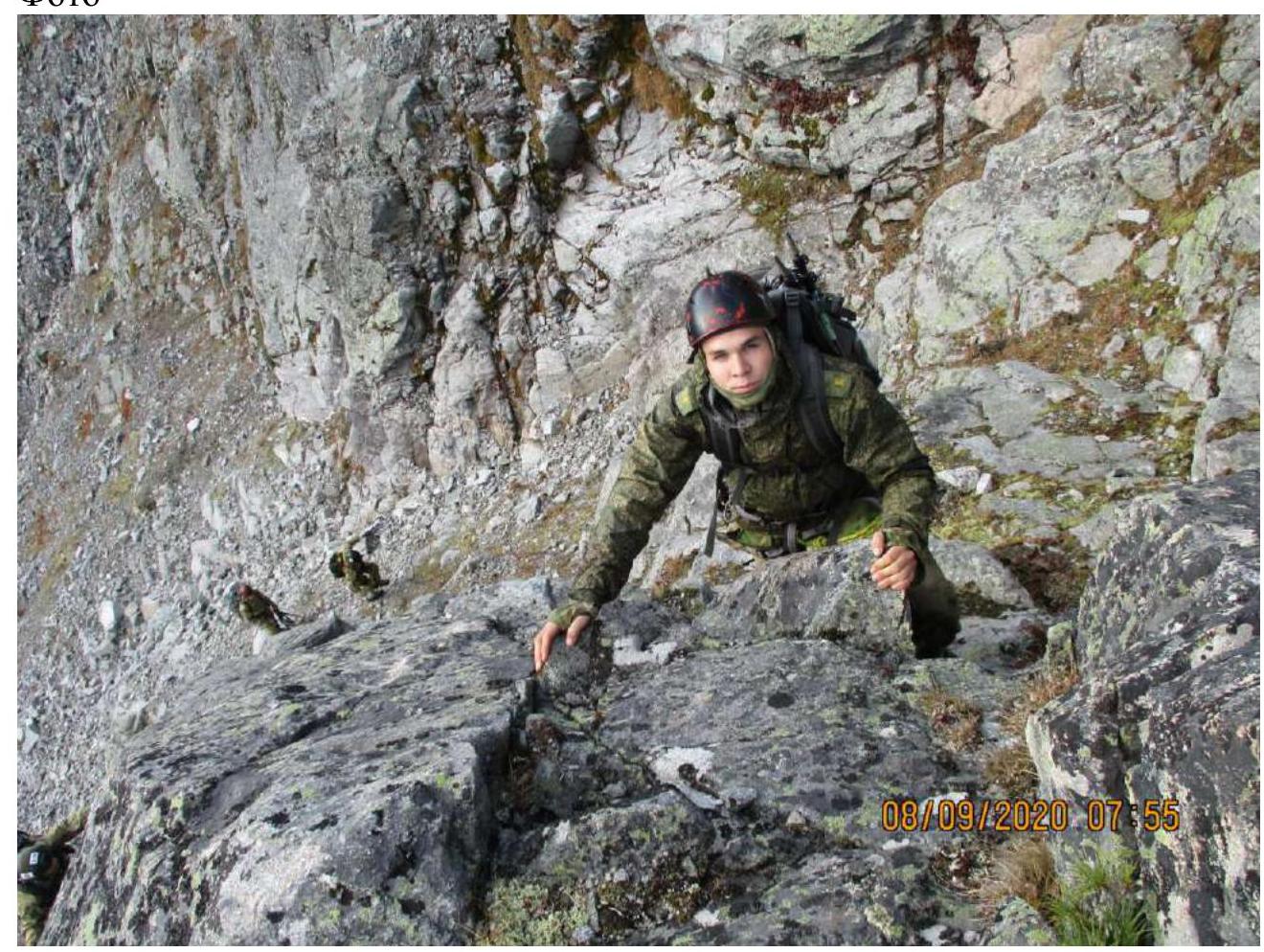
Photo 5. Section R0–R1.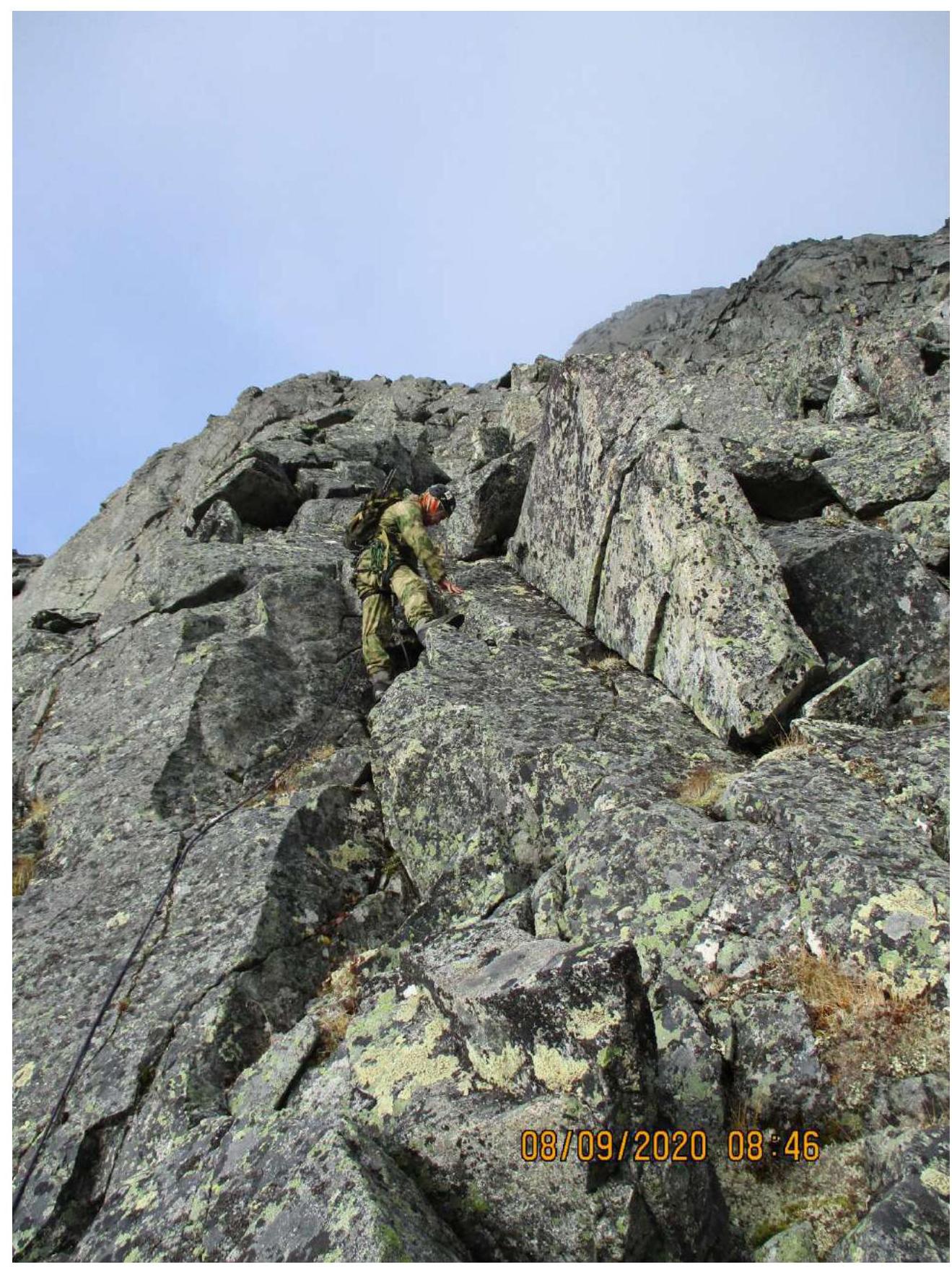
Photo 6. Section R2–R3.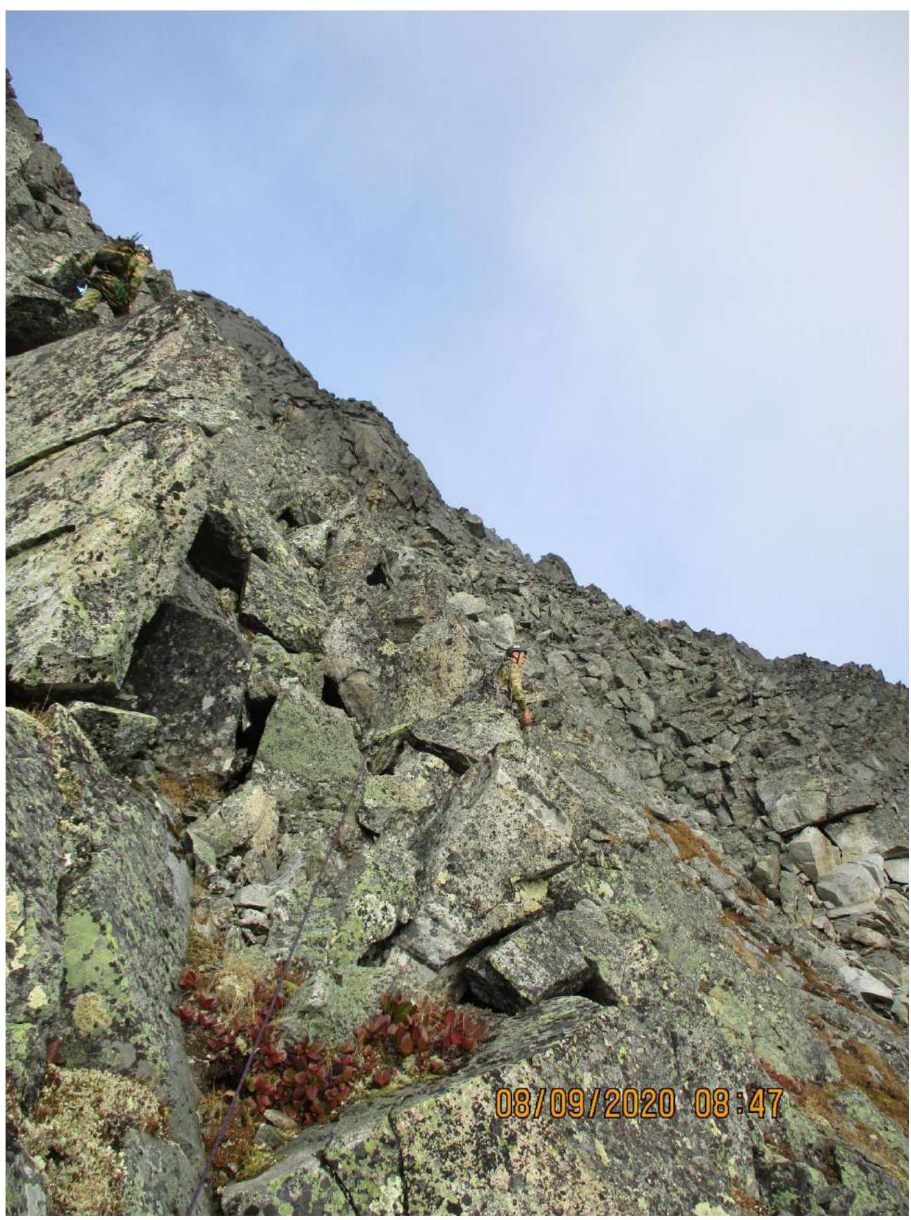
Photo 7. Section R3–R4.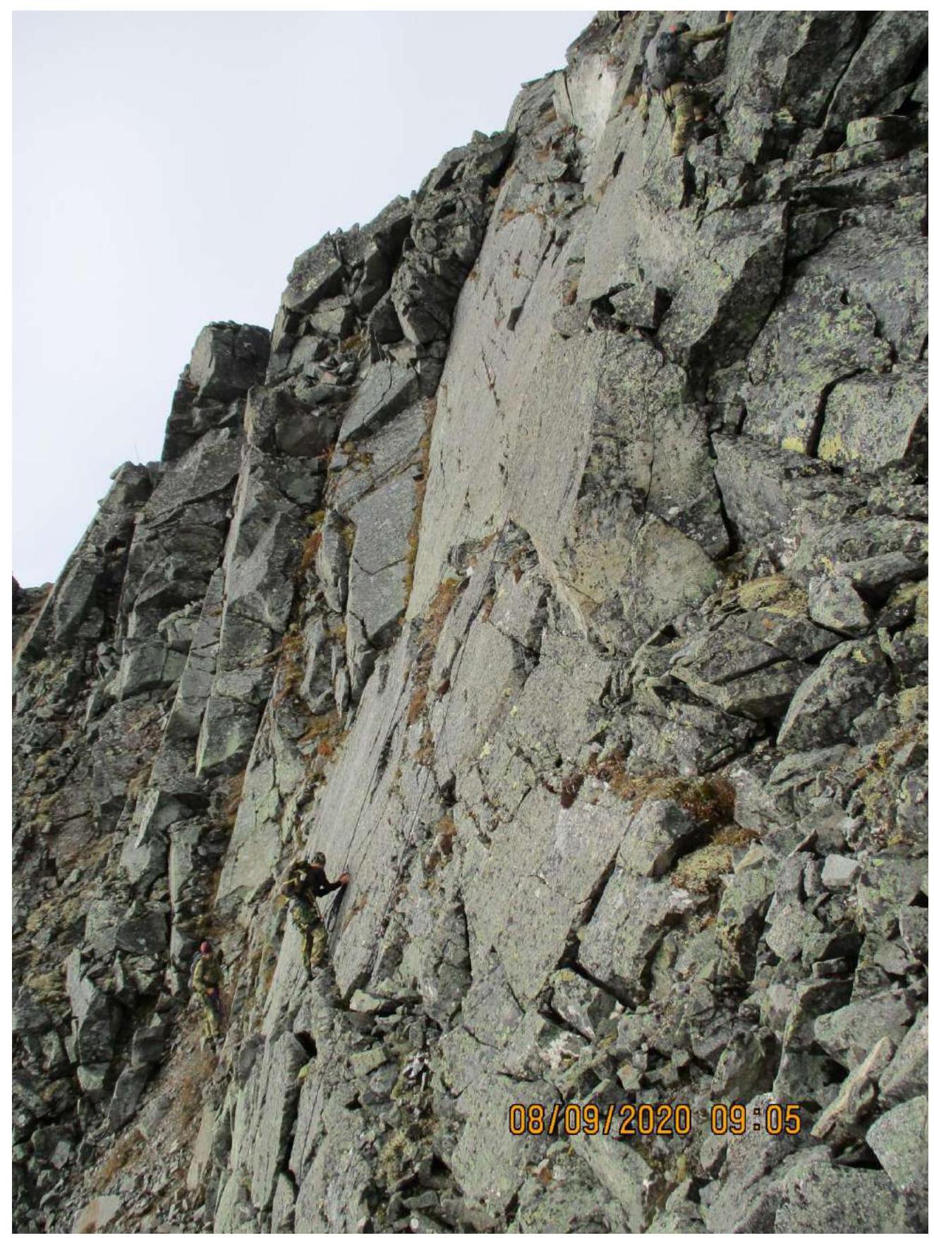
Photo 8. Section R4.
Photo 9. Section R4–R5.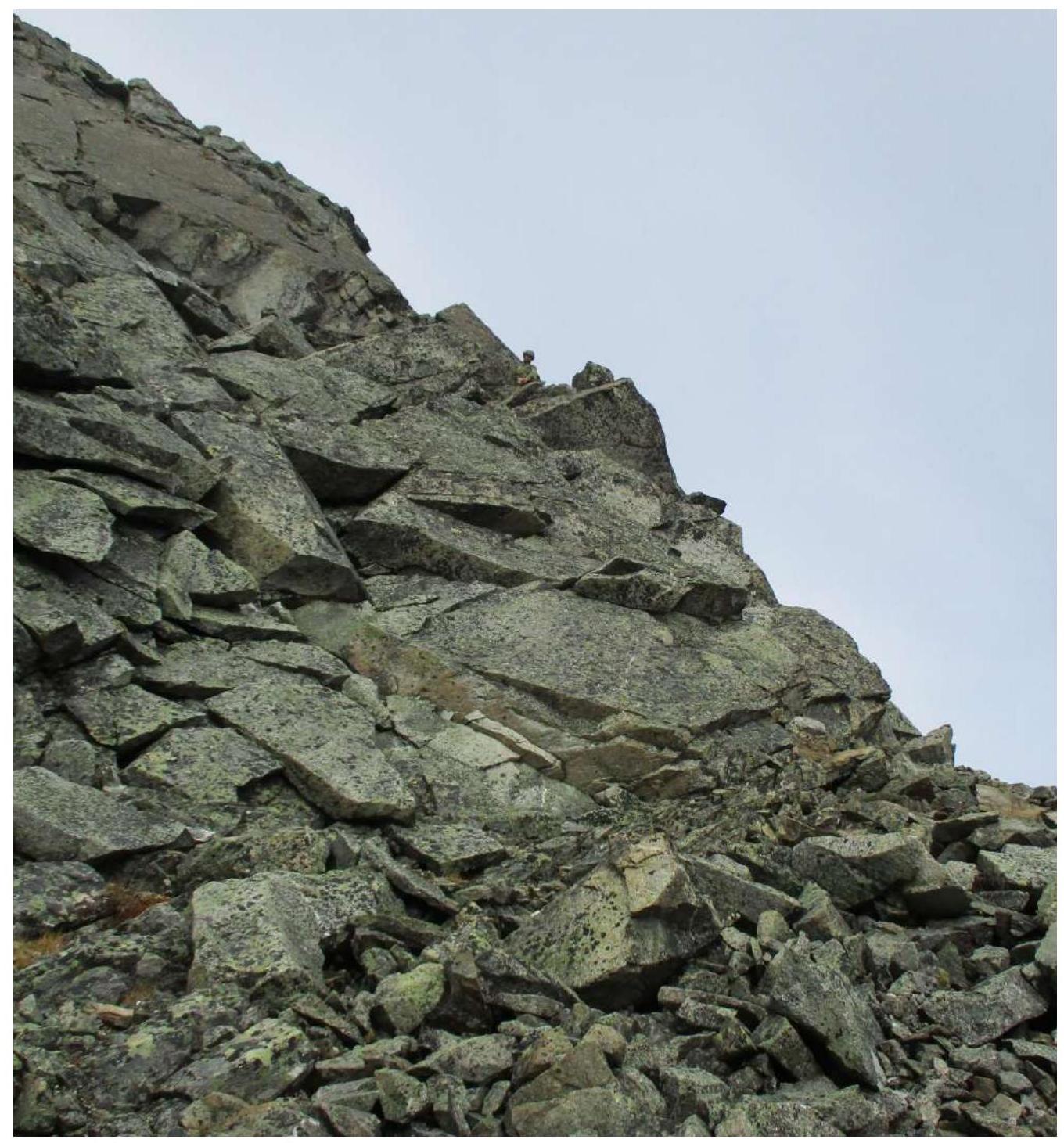
Photo 10. Section R5–R6.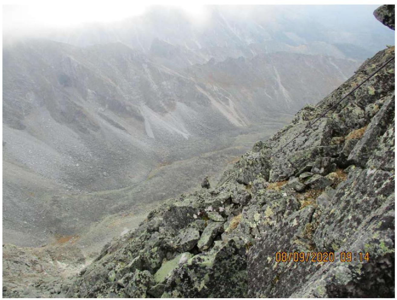
Photo 11. Section R8–R9.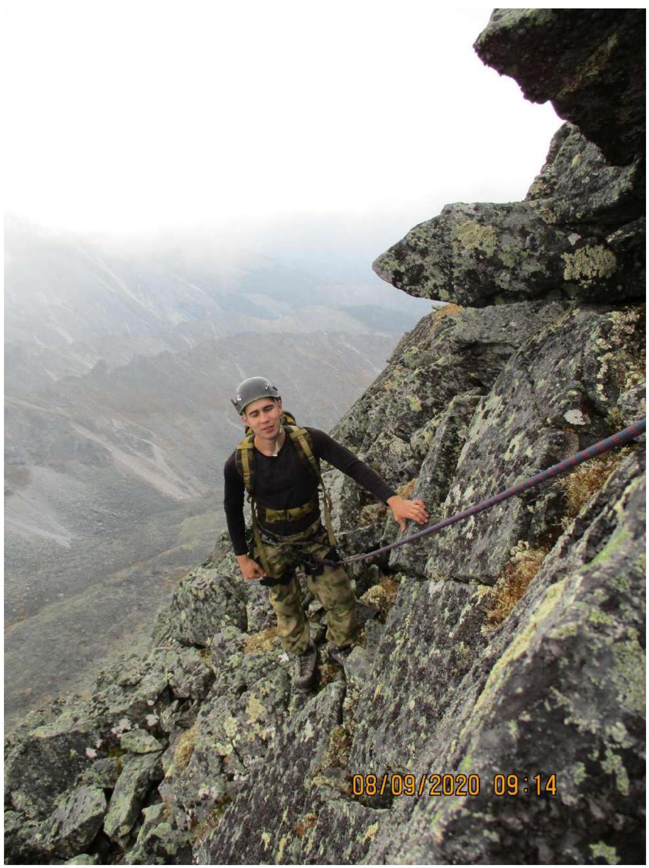
Photo 12. Section R9.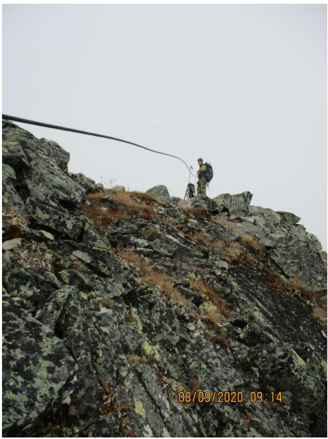
Photo 13. Section R9–R10.
3.2. Team photo at the summit.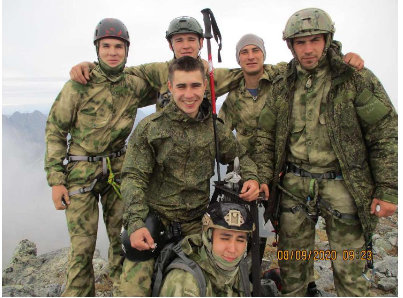
Photo 14.
3.3. The route is safe. There is cellular coverage throughout. Descent from the summit is via the southern ridge — a non-categorized route. In winter, there is a potential avalanche risk on the route's internal terrain features. It is recommended to:
- Move only along the external terrain features
- Pass ledges under the rocks
Comments
Sign in to leave a comment