Report
ON THE FIRST ASCENT TO THE SUMMIT NOSOROG VIA THE ROUTE ON THE WESTERN COUNTERFORT OF THE NORTHERN RIDGE, CATEGORY 3B DIFFICULTY, BY THE TEAM OF THE "GORY BAIKALA" CLUB UNDER THE PROJECT "NEVOZMOZHNO ETO NE NAVSEGDA" FOR THE PERIOD FROM 15.10.2018 TO 15.10.2018
I. Ascent Report Form
| № | 1. General Information | |
|---|---|---|
| 1.1 | Full name, sports rank of the leader | Boyko Aleksey Andreevich, CMS |
| 1.2 | Full name, sports rank of the participants | Bayarsaikhan Luvsangorj Mongol, badge; Pyankovskaya Svetlana Petrovna, 3rd sports rank; Shelikov Aleksey Ivanovich, 3rd sports rank |
| 1.3 | Full name of the coach | Glazunov Evgeny Vladimirovich |
| 1.4 | Organization | Alpinism and Active Recreation Club "Gory Baikala" |
| 2. Characteristics of the Ascent Object | ||
| 2.1 | Region | Eastern Sayan, Tunkinskie Goltsy ridge |
| 2.2 | Valley | Cherthlym-Gorkhon |
| 2.3 | Number according to the 2013 classification table | 6.1.2 |
| 2.4 | Name and height of the summit | Nosorog 2995 m |
| 2.5 | Geographic coordinates of the summit (latitude/longitude), GPS coordinates | 51°51′11.2″ N 101°37′53.9″ E |
| 3. Characteristics of the Route | ||
| 3.1 | Name of the route | Via the western counterfort of the northern ridge |
| 3.2 | Proposed category of difficulty | 3B |
| 3.3 | Degree of route development | First ascent |
| 3.4 | Terrain characteristics of the route | Rocky |
| 3.5 | Elevation gain of the route (according to altimeter or GPS data) | 395 m |
| 3.6 | Length of the route (in meters) | 580 |
| 3.7 | Technical elements of the route (total length of sections of various difficulty categories with terrain type indication) | I cat. rocky – 250 m. II cat. rocky – 0 m. III cat. rocky – 225 m. IV cat. rocky – 105 m. Rappelling descent towards the valley, slightly descending from the summit, 25 m. |
| 3.8 | Descent from the summit | 100 m along the SE ridge, rappelling to a saddle 25 m, descent into the Gorkhon river valley along a scree slope |
| 3.9 | Additional route characteristics | Lack of water |
| 4. Characteristics of the Team's Actions | ||
| 4.1 | Time of movement (team's walking hours, in hours and days) | 7 h 30 min |
| 4.2 | Overnights | None |
| 4.3 | Departure to the route | 5:00 15.10.2018 |
| 4.4 | Reaching the summit | 15:00 15.10.2018 |
| 4.5 | Return to the base camp | 17:30 15.10.2018 |
| 5. Responsible for the Report | ||
| 5.1 | Full name, e-mail | Boyko Aleksey Andreevich alexeiboiko1@gmail.com |
II. Ascent Description
1. Characteristics of the Ascent Object
1.1. General photo of the summit
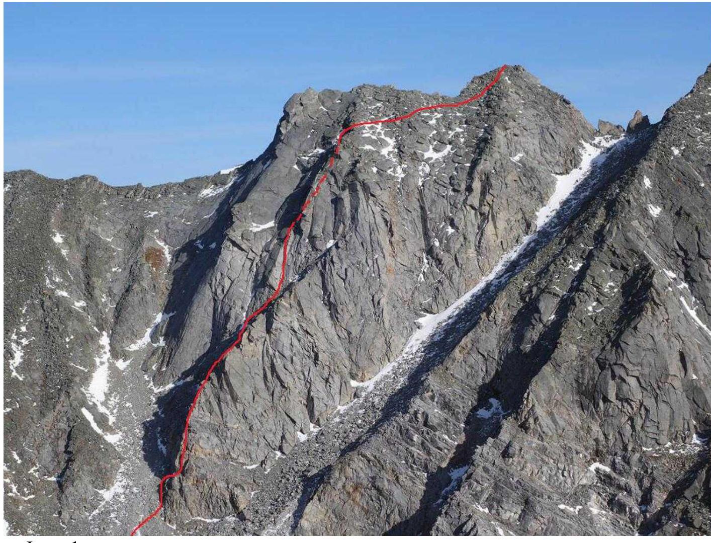
Photo 1.
1.2. Photo of the route profile
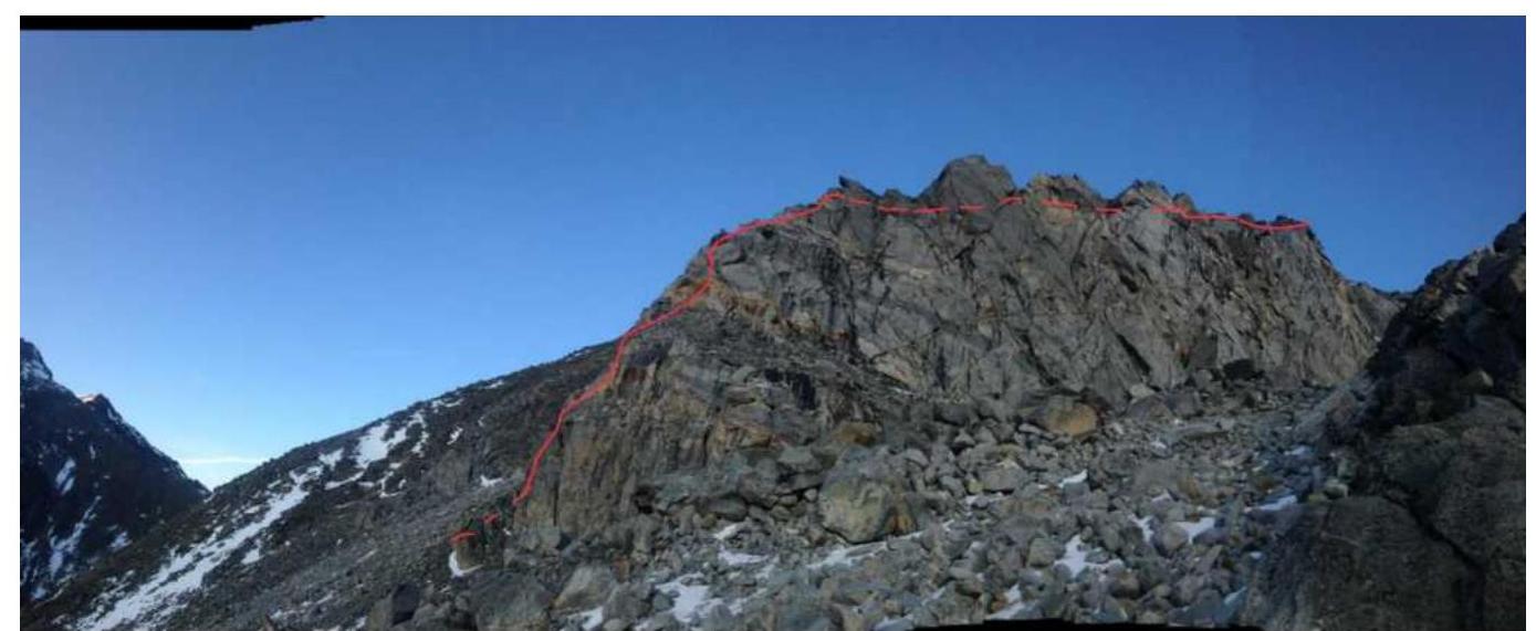
Photo 2.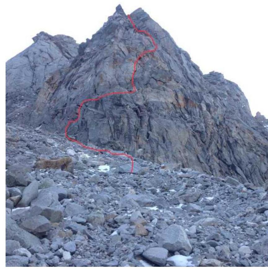
Photo 3.
1.3. Photopanorama of the area, size not less than 13 × 18 cm, with indication of summit names, heights, and passes
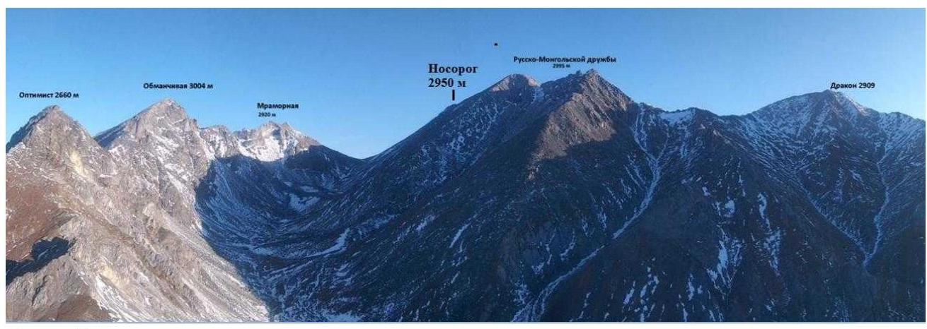
Photo 4.
1.4. Map of the area
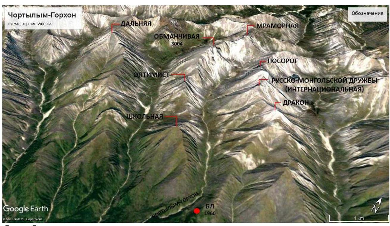
Photo 5.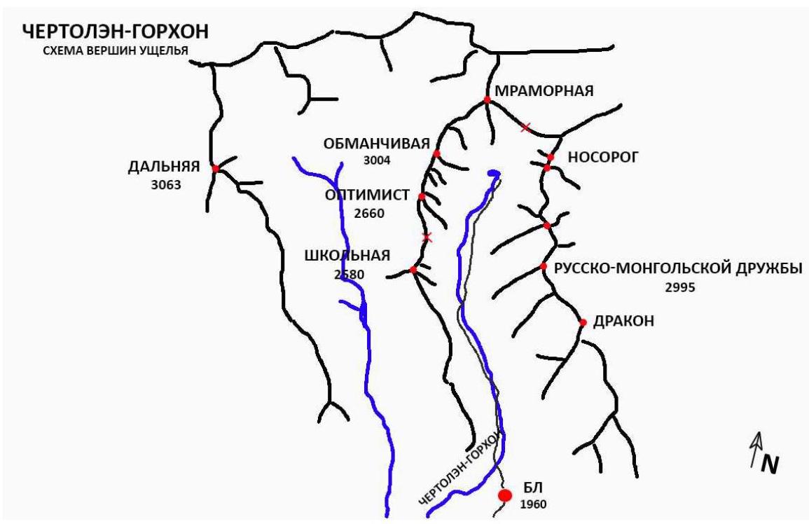
Photo 6. The Nosorog summit is located in the upper reaches of the Cherthlym-Gorkhon valley, Tunkinsky ridge of the Eastern Sayan, west of the Khubuta river valley, along which a trail leads to the Shumak mineral springs, a popular tourist route in our region.
Nearest settlements:
- Nilova Pustyn settlement
- Khoyto-Gol village
Tunkinsky district of the Republic of Buryatia (district center - Kyren settlement). From there, move along the old road to the "Sukhoy Ruchey" tourist base 5 km, further:
- by high-clearance vehicle along the road 3 km
- or on foot to the Cherthlym-Gorkhon river
From there, a good trail leads to the base camp 6 km.
The valley is a dead end, regularly visited by local herb collectors and wild food gatherers, with a very straightforward approach. Horseback transportation to the base camp is possible along the trail.
2. Characteristics of the Route
2.1. Technical photograph of the route.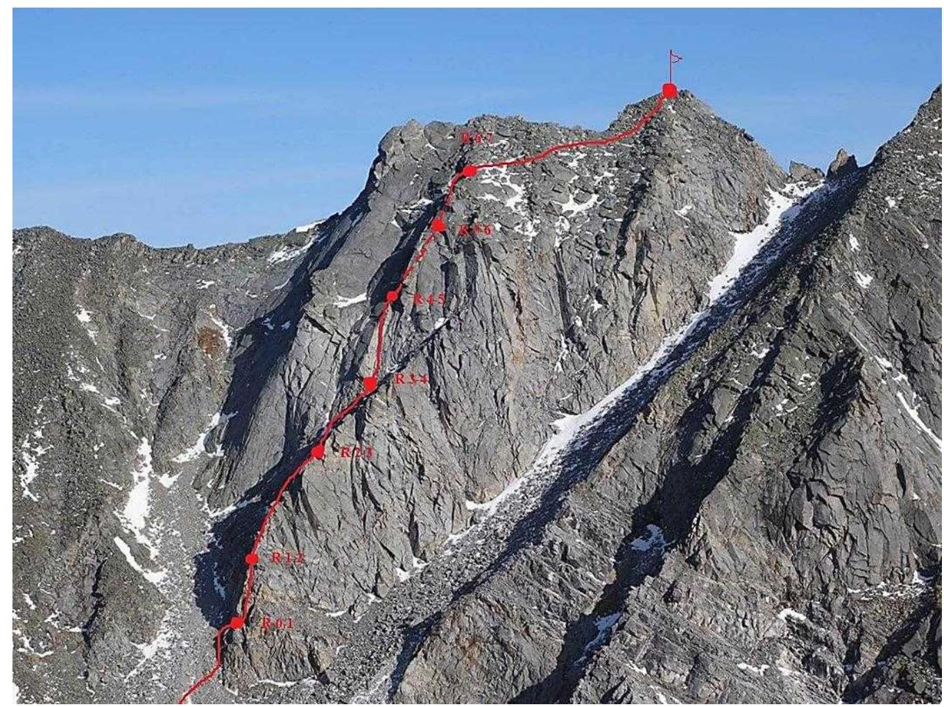
Photo 7.
3. Characteristics of the Team's Actions
3.1. Brief description of the route passage.
Approach to the route: The route begins with a characteristic rocky counterfort, left of the northern counterfort of the Nosorog summit. Ascend a small scree slope to a "threshold" directly under a large hanging boulder, left of a series of rusty, smoothed walls, starting at a clearly visible, pronounced crack that leads to the right.
| Section № | Description | Photo № |
|---|---|---|
| R0–R1 | Move up and to the right through the crack, preferably with a #4 cam, then approach a small vertical wall via a series of internal corners, bypass the wall on the right, then move up and left to a small overhanging fracture, climb over it, station on a ledge before the wall (40 m, 4+, 80°) | |
| R1–R2 | Move up the wall with cracks, then reach a ledge, continue moving through large-block terrain to a small gendarme, bypass the gendarme on the left via sloping slabs, then untwist blocks to reach a comfortable one, station on a beam. (50 m, 3+, 65°) | Photo 9. |
| R2–R3 | From the station, move left and along the main counterfort on the shaded side, traverse easily along a scree slope, reach a scree slope, then move right up a relatively steep scree to a characteristic, pronounced internal corner with large "steps" in it, station on a boulder (90 m; 3; 50°) | |
| R3–R4 | From the station, move up the corner, climb over it, and reach large-block terrain. Caution: many loose, ringing blocks, station on a boulder (40 m; 3+; 75°) | Photo 10 |
| R4–R5 | From the station, move left into a fracture with a characteristic cork at the beginning, then through a series of internal corners to a flattening — station on hooks before sloping slabs. (45 m; 3+; 75°) | Photo 11 |
| R5–R6 | From the station — move up the slabs, gradually moving left, then bypass a small overhang on the left, reach a scree slope, then sharply move right and through a series of large and medium blocks reach the ridge. (65 m; 4; 65°) | Photo 12 |
| R6–R7 | Along the ridge, moving right, ascend to the summit via scree (250 m; 1; 20–25°) | Photo 13 |
Photo Illustration of the Route

Photo 8. The wall left of the route start serves as a good landmark.
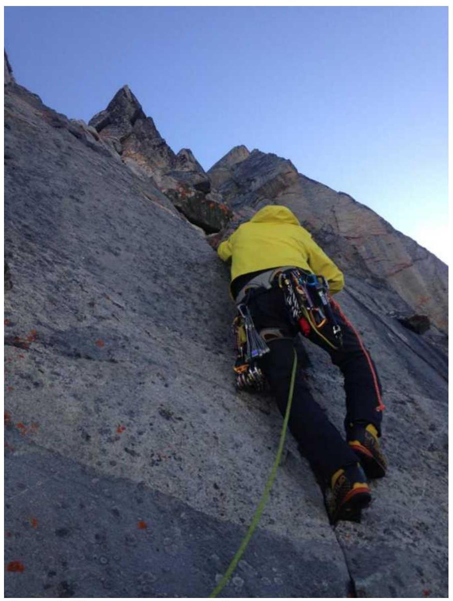
Photo 9. Start of section R1–R2.
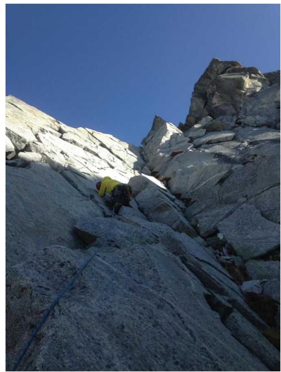
Photo 10. Start of section R3–R4, characteristic internal corner.
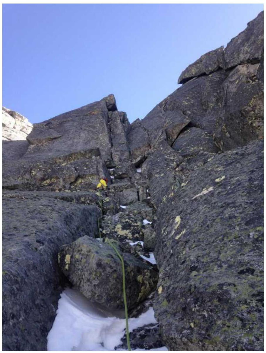
Photo 11. Section R4–R5, fracture with a cork.
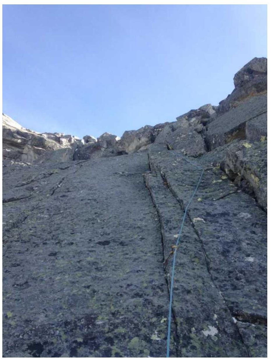
Photo 12. Section R5–R6, movement along slabs.
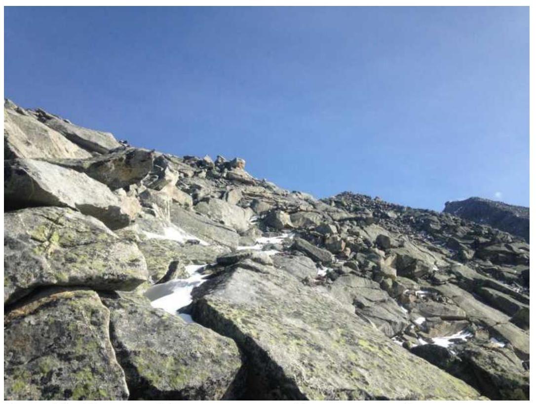
Photo 13. Section R6–R7, reaching the ridge, scree slope.
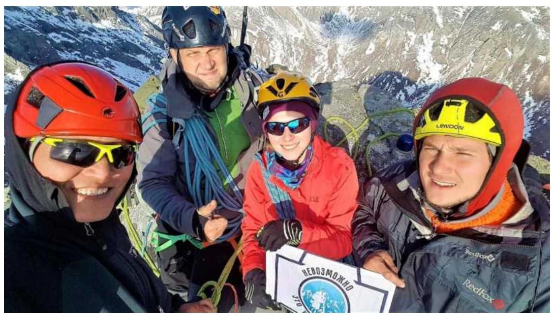
3.2. Photo of the team on the summit with the control landmark.
3.3. The route is practically safe, in some places cautious movement is required, insurance is easily organized, mostly medium friends and hooks are used, the terrain is monolithic. Communication on the route is available at any point. Recommendations for subsequent ascenders:
- Descent from the summit along the SE ridge to a pass.
- 50 m along the scree ridge to rocky outcrops.
- 10 m before the outcrops, bypass rocky spires in the ridge on the left (NE) side.
- A spare loop is left hanging.
- Rappelling 25 m.
- Walking descent along a medium-block scree to a lake in the Cherthlym-Gorkhon river valley.
The route corresponds in complexity to similar routes in the Eastern Sayan of the same difficulty, a good 3B category, with good terrain, recommended for training ascents.