Report
ON THE FIRST ASCENT TO ULA-GOL PEAK 2911 m, VIA THE SECOND BUTTRESS OF THE EASTERN WALL, CATEGORY 4B DIFFICULTY, BY THE TEAM OF THE "GORy BaikalA" CLUB FROM 27.03.2020 TO 27.03.2020
I. Ascent Report
| 1. General Information | ||
|---|---|---|
| 1.1 | Full Name, Sports Rank of the Team Leader | Boyko Alexey Andreevich, CMS |
| 1.2 | Full Name, Sports Rank of the Participants | Tkachenko Pavel Valentinovich, 1st sports rank |
| 1.3 | Full Name of the Coach | Glazunov Evgeny Vladimirovich |
| 1.4 | Organization | Alpinism Club "Gory Baikala" |
| 2. Characteristics of the Ascent Object | ||
| 2.1 | Region | Eastern Sayan, Tunka Goltsy mountain range |
| 2.2 | Valley | Ula-Gol river |
| 2.3 | Section Number according to the 2013 Classification Table | Section 6.1 |
| 2.4 | Name and Height of the Peak | Mt. Ula-Gol 2911 m |
| 2.5 | Geographic Coordinates of the Peak (latitude/longitude), GPS Coordinates | 51°47′34.71″ N 101°26′29.42″ E |
| 3. Route Characteristics | ||
| 3.1 | Route Name | Via the second buttress of the Eastern wall |
| 3.2 | Proposed Difficulty Category | 4B |
| 3.3 | Degree of Route Exploration | First ascent |
| 3.4 | Terrain Type | Rocky |
| 3.5 | Altitude Difference (data from altimeter or GPS) | 701 m |
| 3.6 | Route Length (in meters) | 855 m |
| 3.7 | Technical Elements of the Route (total length of sections with different difficulty categories, indicating terrain type (ice-snow, rocky)) | Category I rocky — 100 m. Category II rocky — 230 m. Category III rocky — 200 m. Category IV rocky — 175 m. Category V rocky — 100 m. Category VI rocky — 50 m. |
| 3.9 | Descent from the Peak | From the saddle between Ula-Gol and Perm peaks via a couloir towards the valley |
| 3.10 | Additional Route Characteristics | – |
| 4. Characteristics of the Team's Actions | ||
| :-- | :-- | :--: |
| 4.0 | Time of Movement (team's walking hours, in hours and days) | 12 hours |
| 4.1 | Overnight Stays | no |
| 4.2 | Route Processing Time | – |
| 4.3 | Start of the Route | 05:00 on March 27, 2020 |
| 4.4 | Reach the Summit | 19:00 on March 27, 2020 |
| 4.5 | Return to Base Camp | 21:30 on March 27, 2020 |
| 6. Person Responsible for the Report | ||
| 4.6 | Full Name, e-mail | Boyko Alexey Andreevich alexeiboiko1@gmail.com |
II. Ascent Description
1. Characteristics of the Ascent Object
1.1. General photos of the peak and descent. Taken on March 27, 2020.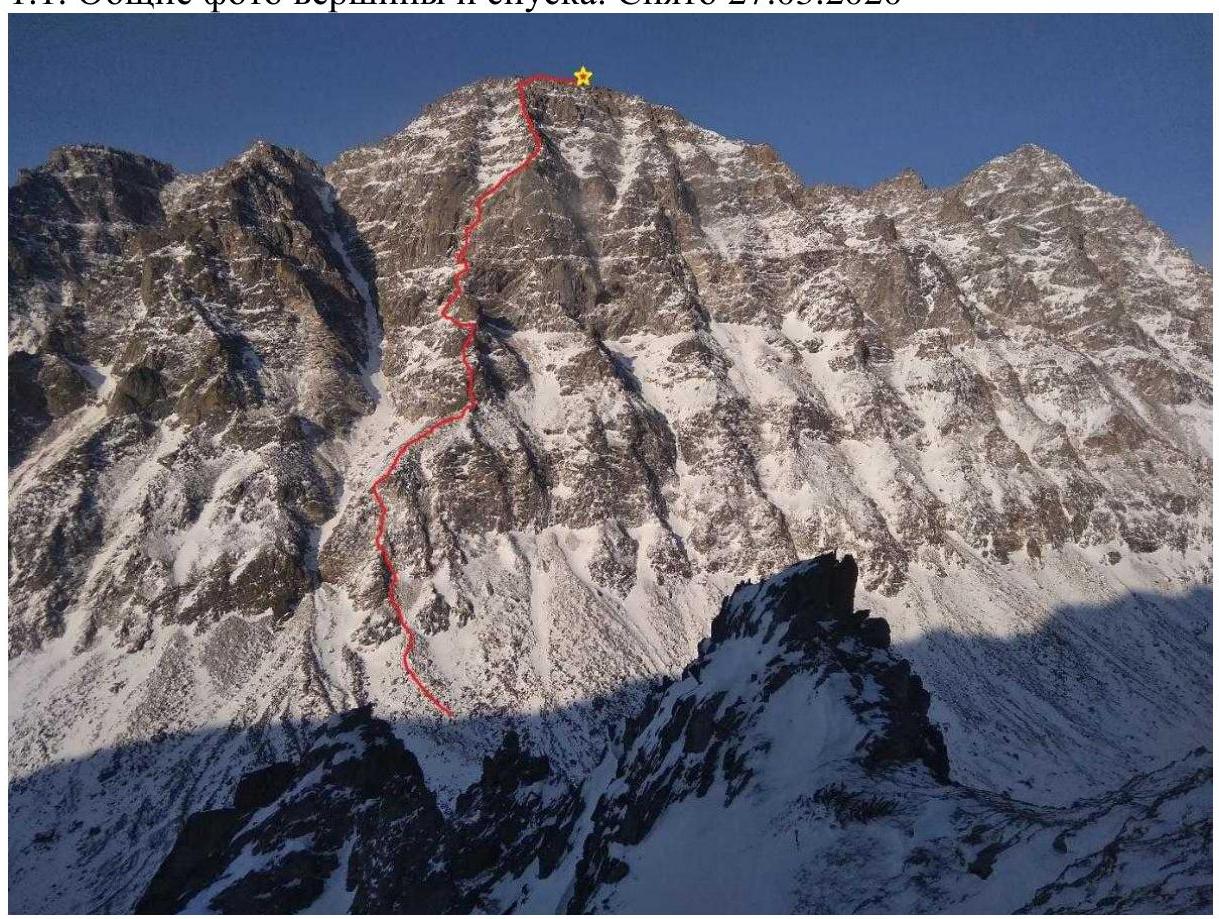
Photo 1
Descent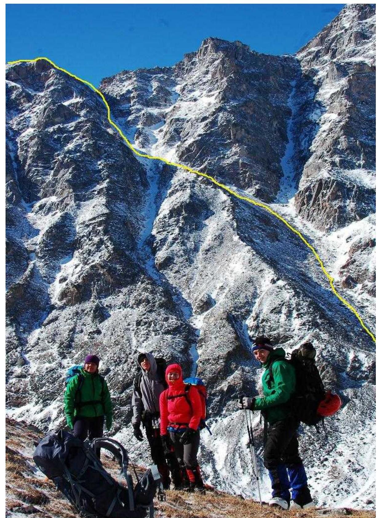
Photo 2, taken from the summit opposite. Directly on course is Mt. Perm.
1.2. Photo of the Route Profile
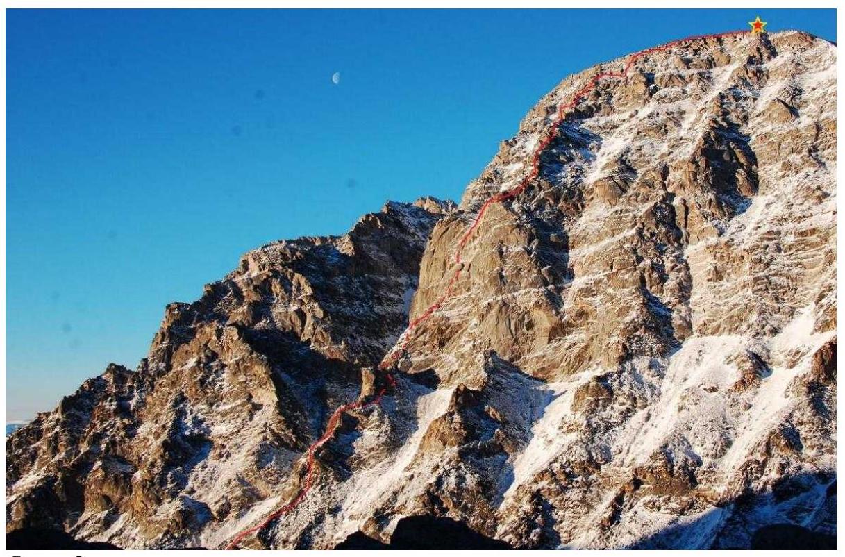
Photo 3
1.3. Panoramic Photos of the Area
Photo 4 № 2
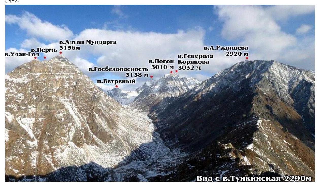
Photo 5
1.4. Map of the Area
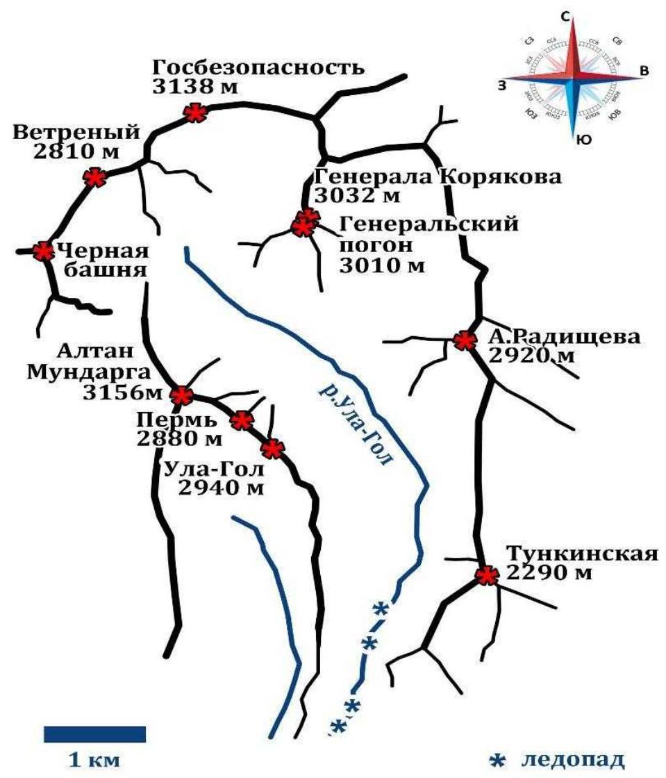
Photo 6
The approach is made from the settlement of Nilova Pustyn (Tunka district, Republic of Buryatia) to the village of Khoyto-Gol, then along a forest road:
- transportation by car (preferably high-clearance) or on foot to a point with a direct view of Mt. Altan-Mundarga,
- from where a horse trail is visible in the direction of the valley.
Movement on foot to the Ula-Gol river. Then upstream along the river. In winter, the approach is more comfortable along the frozen river, the icefall is bypassed to the left towards the valley.
The approximate time for the hiking part of the approach from unloading the car to Base Camp is 7–10 hours. Distance — about 10 km.
It is also possible to try to arrange transportation by horse with local residents.
From Base Camp, follow the horse trail towards the valley to the starting point of the route, approximately 3 hours.
The mountain is located in the first position on the left side, the approach is made along a talus slope directly to a pronounced rocky bastion with a black stain on the right side.
2. Route Characteristics
2.1. Technical photo of the route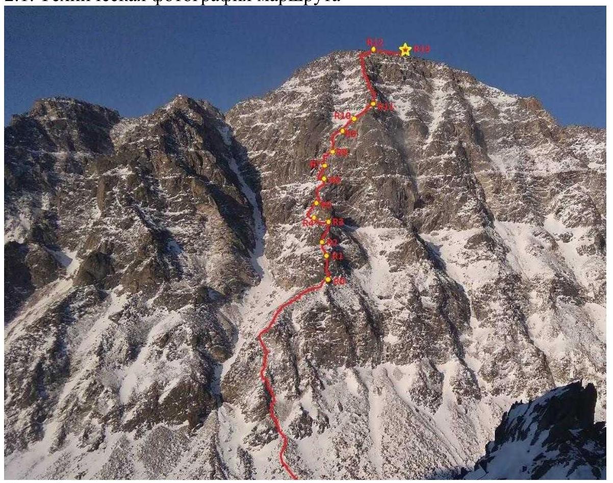
Photo 7
2.2. Route Diagram in UIAA Symbols
| Section № | Hooks | Anchor Elements | Insurance Points, Characteristics in Symbols | Route Line in UIAA Symbols | Section Difficulty in Symbols | Section Length, m | Steepness, ° |
|---|---|---|---|---|---|---|---|
| R0–R1 | 0 | 3 | IV | 35 | 70 | ||
| R1–R2 | 0 | 0 | II | 60 | 45 | ||
| R2–R3 | 4 | 4 | IV+ | 40 | 75 | ||
| R3–R4 | 2 | 1 | II | 60 | 40 | ||
| R4–R5 | 2 | 0 | II | 60 | 40 | ||
| R5–R6 | 4 | 4 | V | 50 | 75 | ||
| R6–R7 | 1 | 2 | IV | 50 | 75 | ||
| R7–R8 | 1 | 4 | V | 50 | 60 | ||
| R8–R9 | 4 | 4 | VI | 50 | 85 | ||
| R9–R10 | 3 | 2 | IV+ | 50 | 75 | ||
| R10–R11 | 0 | 0 | II+ | 50 | 60 | ||
| R11–R12 | 0 | 6 | III | 200 | 60 | ||
| R12–R13 | 0 | 0 | I | 100 | 60 |
3. Characteristics of the Team's Actions
3.1 Brief Description of the Route Passage.
Approach the start of the buttress along the talus slope, ascend, then gradually move right towards a pronounced ridge, approach the internal angle with blocks.
| Section № | Description | Photo № |
|---|---|---|
| R0–R1 | Move upwards along the angle directly to the parallel chimney, climb up to a shelf in a chamber, station on friends. | Photo 8 |
| R1–R2 | From the station, descend slightly to the left, then move right upwards along a sloping slope and shelves with stones. Approach large glazed slabs with a small internal angle at the end. Station on a stone "finger" on a loop. | Photo 9 |
| R2–R3 | Then move upwards along the slabs to the internal angle, cross the internal angle and exit onto pedestrian terrain. The buttress then turns into a narrow ridge with a large rocky gendarme at the end. Station on hooks and friends on a large stone. | Photo 10, 11 |
| R3–R4 | From the station, move right 10–12 m and dive down to the left onto the slope (WHEN SNOW — AVALANCHE-HAZARDOUS, MOVEMENT ACROSS FIELDS ONLY WITH RELIEF PROTECTION!). Move along sloping shelves, station on a pronounced base of the gendarme on a knob. | Photo 12 |
| R4–R5 | From the station, move left, cross a small couloir, exit onto "ram's foreheads" along a series of grassy shelves, approach a non-pronounced angle with grass, station on small friends. | Photo 13 |
| R5–R6 | From the station, move slightly along the angle, then along the slabs directly upwards, then, after taking in the partner, continue movement upwards along large-block terrain and exit onto a large oblique snow shelf. To the left will be the base of a large rocky bastion. Station on friends. | Photo 14 |
| R6–R7 | From the station, move upwards along large-block terrain, choosing the most logical path, exit onto a small flattening, then along blocks approach a small wall with a thin oblique crack, station on friends. | Photo 15 |
| R7–R8 | Then move from the station first along a small angle towards the crack, moving left, along the crack several steps on ITO, exit onto a flattening, move onto the entire rope, take in the partner on relief. | Photo 16 |
| R8–R9 | Crucial section. From the station, descend slightly to the left behind a bend and move upwards along the internal angle to the base of a large internal angle with a blind crack and knolls, tense climbing with poor protection, cross the angle and through a small cornice climb onto a flattening, move slightly upwards along a snowfield to the base of a small internal angle. Station on friends and a hook (cracks for friends in winter may be in ice, attention is required during installation). | Photo 17, 18 |
| R9–R10 | Then move along the angle, then onto a flattening and transition onto snow fields, move with protection to the left of rocks, upwards. Station on a rocky out(stand) on a rocky outcrop on hooks. | Photo 19 |
| R10–R11 | From the station, move right, simultaneous movement along a slope with stones and knolls towards a pronounced ridge of the buttress, take in the partner at the start of large-block terrain. | – |
| R11–R12 | Then move along the ridge among large blocks, choosing the most logical path, bypass a large gendarme to the right along "corridors" of blocks, exit onto the southern ridge. | Photo 20, 21, 22 |
| R12–R13 | Move along the ridge on foot towards the summit. | Photo 23 |
3.2 Photos of Sections
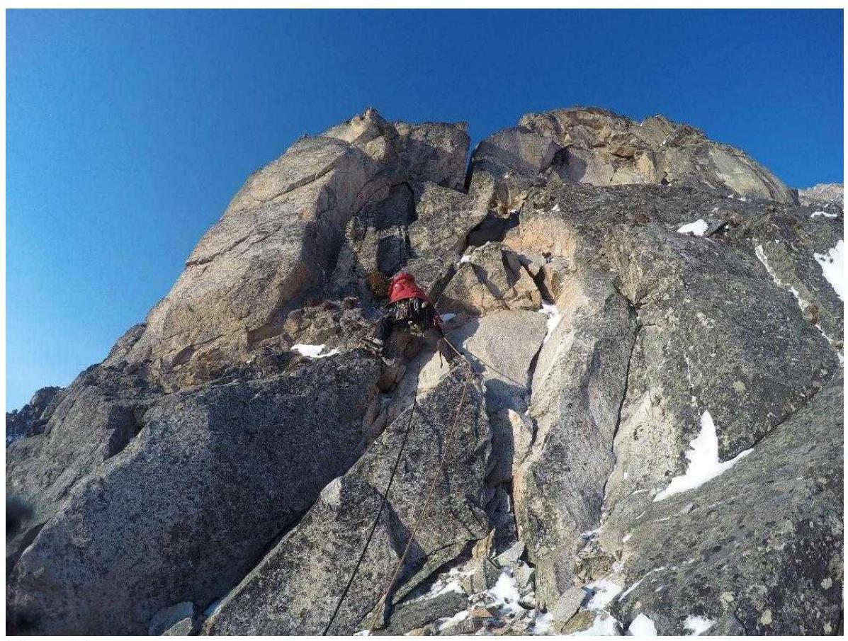
Photo 8
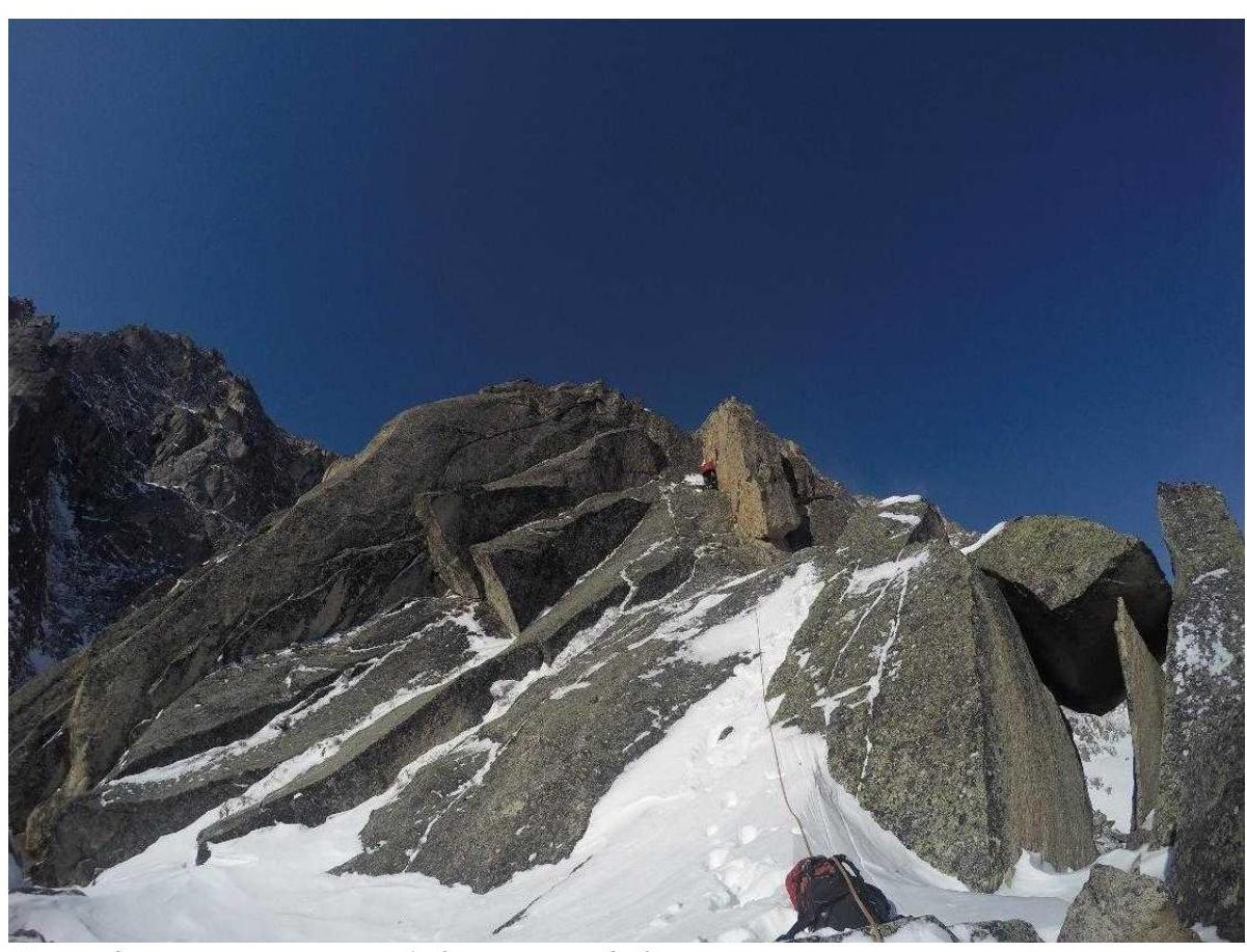
Photo 9, end of section R1–R2, start of R2–R3

Photo 10
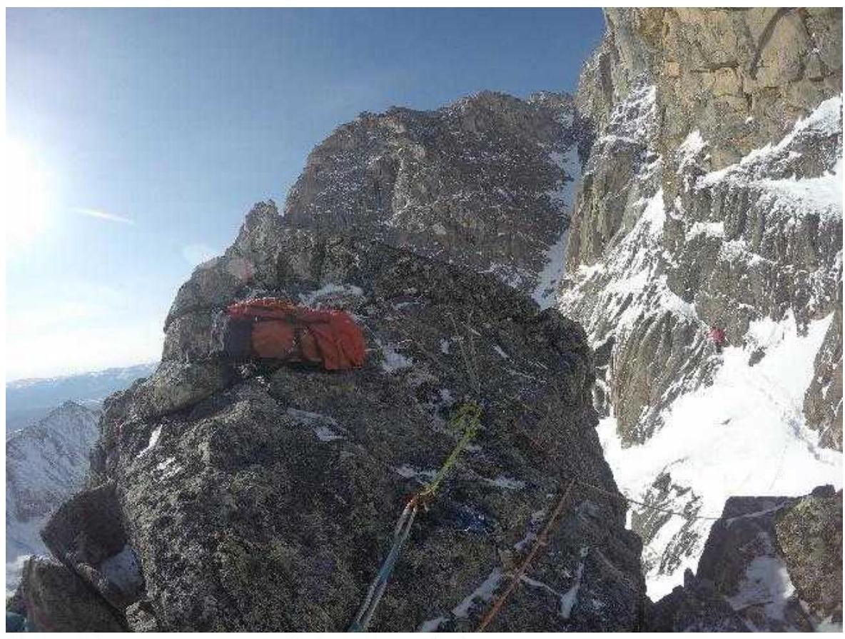
Photo 11, end of section R2–R3, start of R3–R4
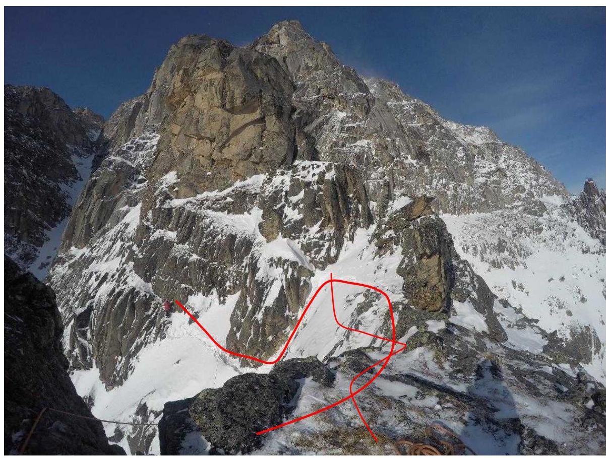
Photo 12, section R3–R4 with movement line
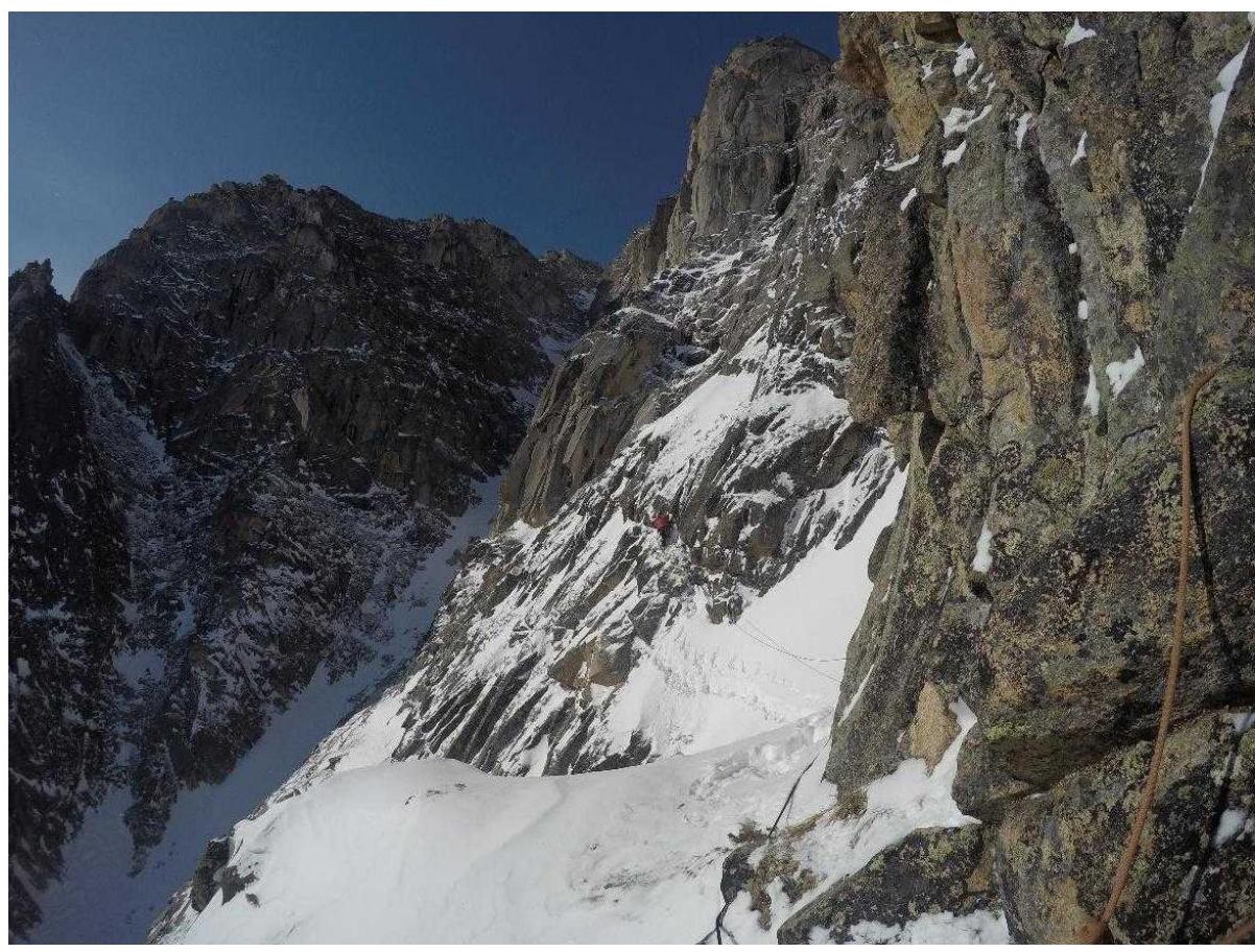
Photo 13, section R4–R5 with movement line
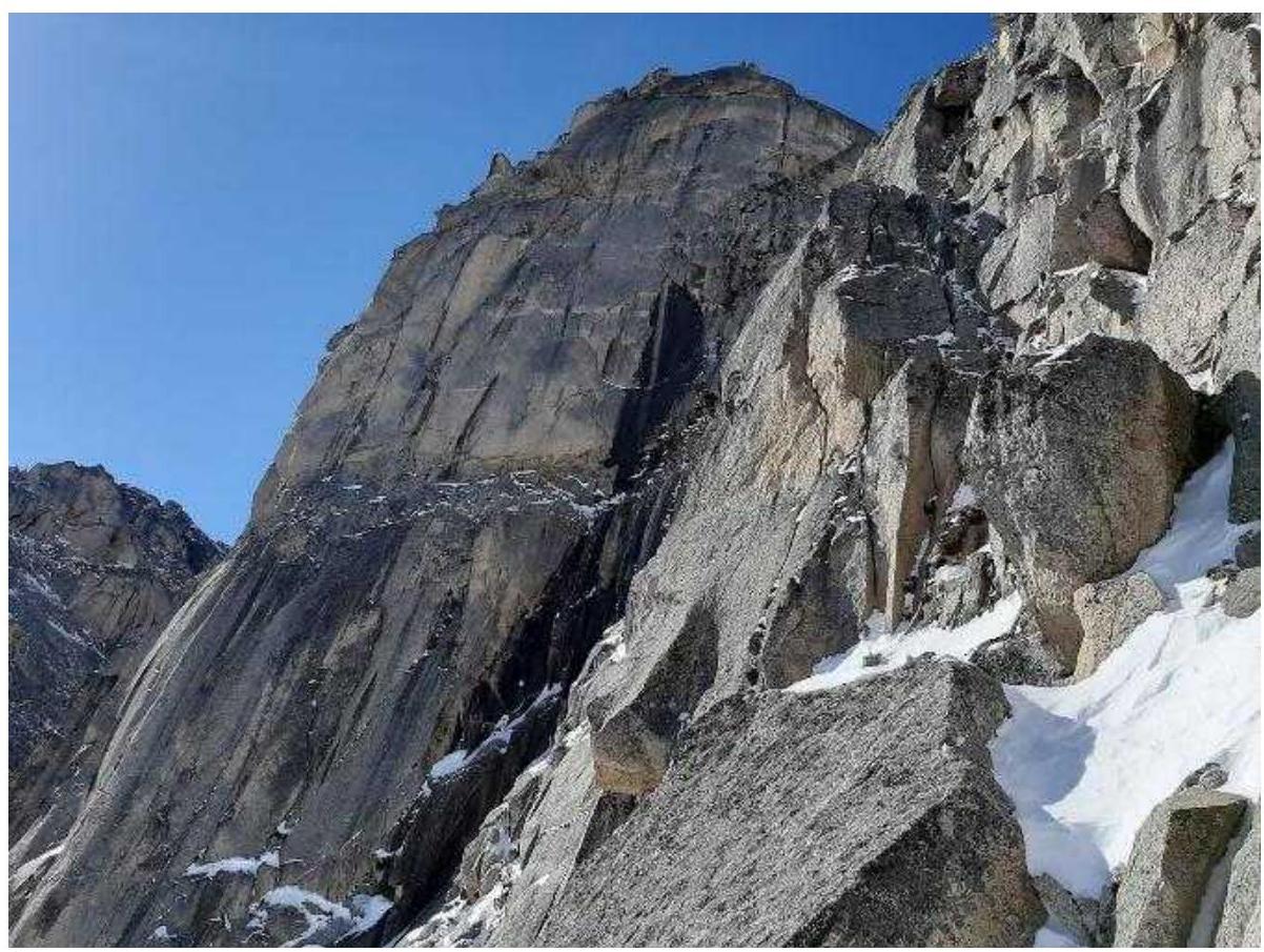
Photo 14
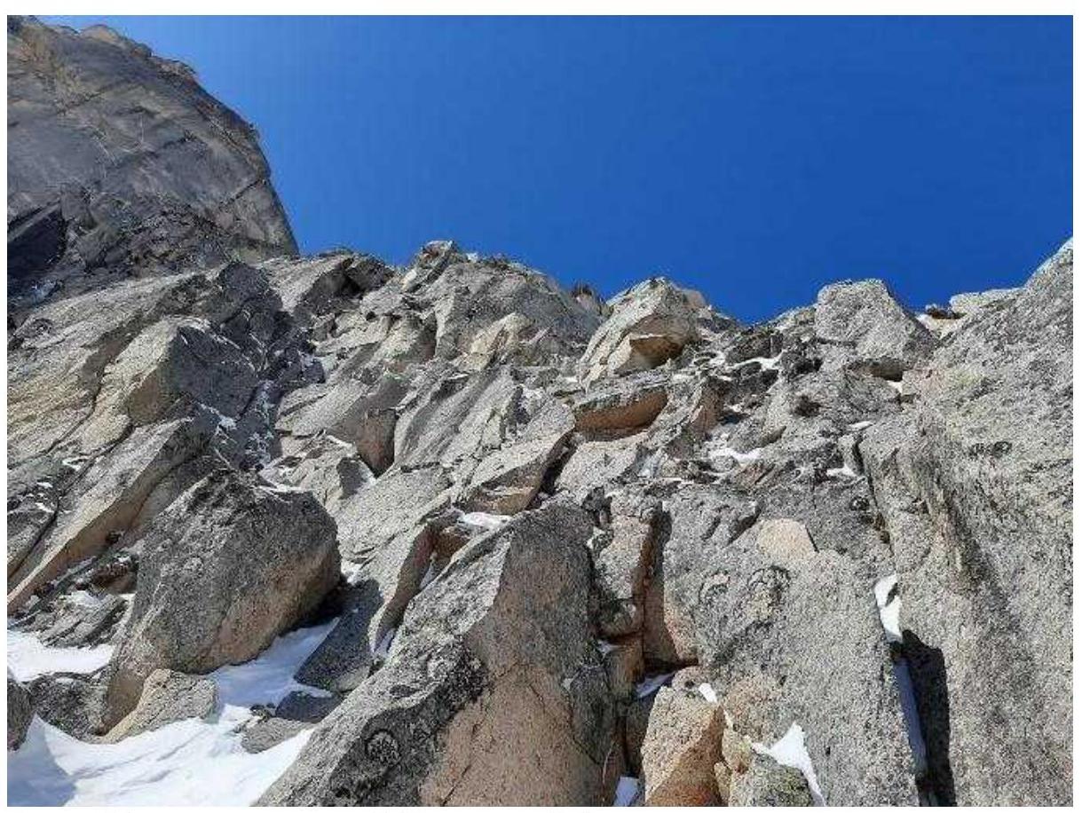
Photo 15, view of section R6–R7 from the end of R5–R6
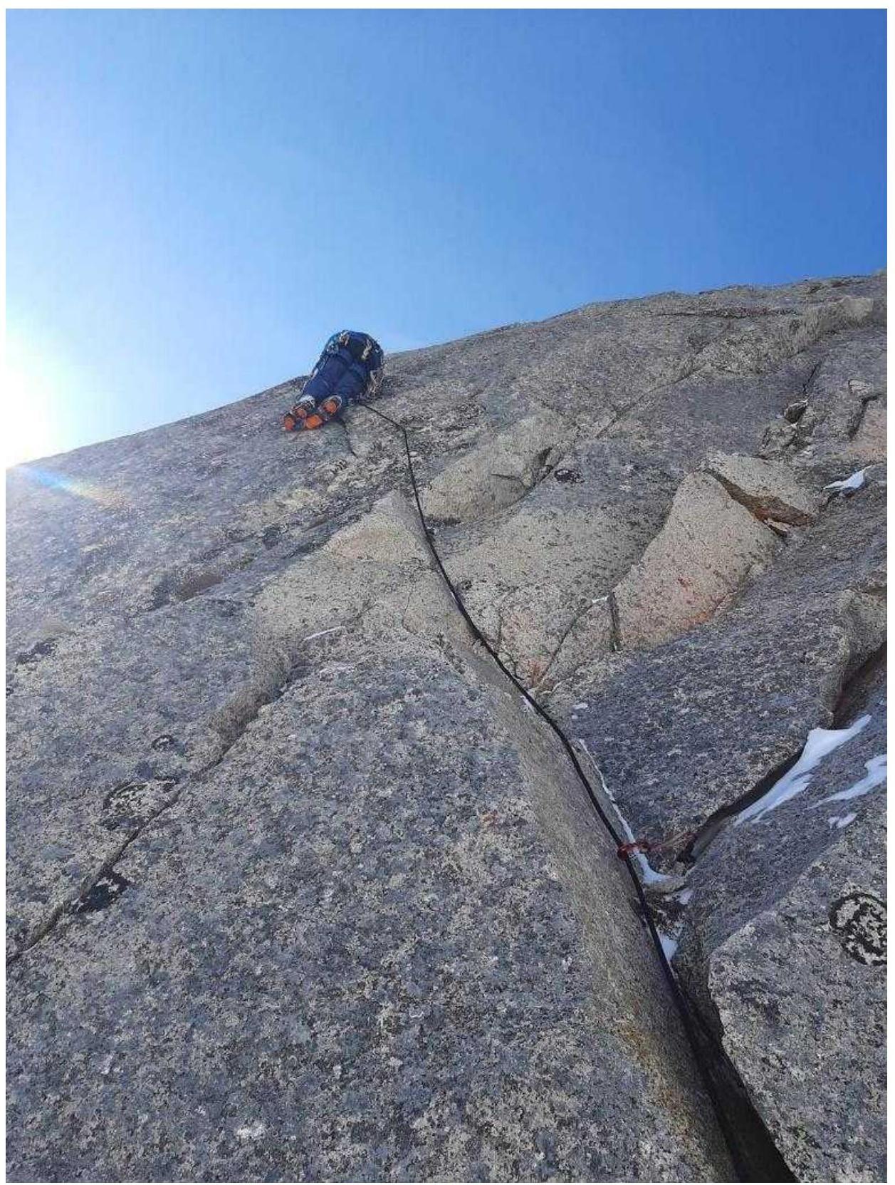
Photo 16
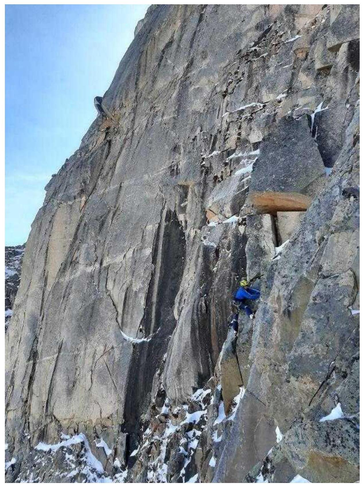
Photo 17
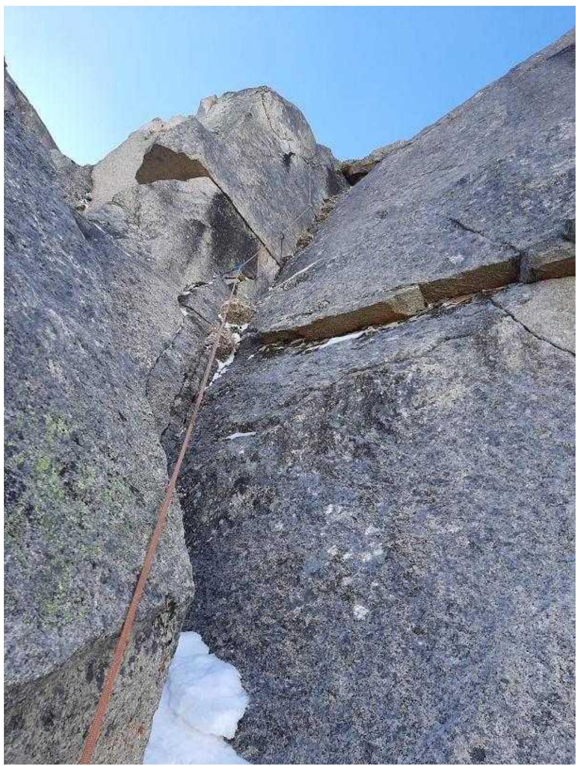
Photo 18
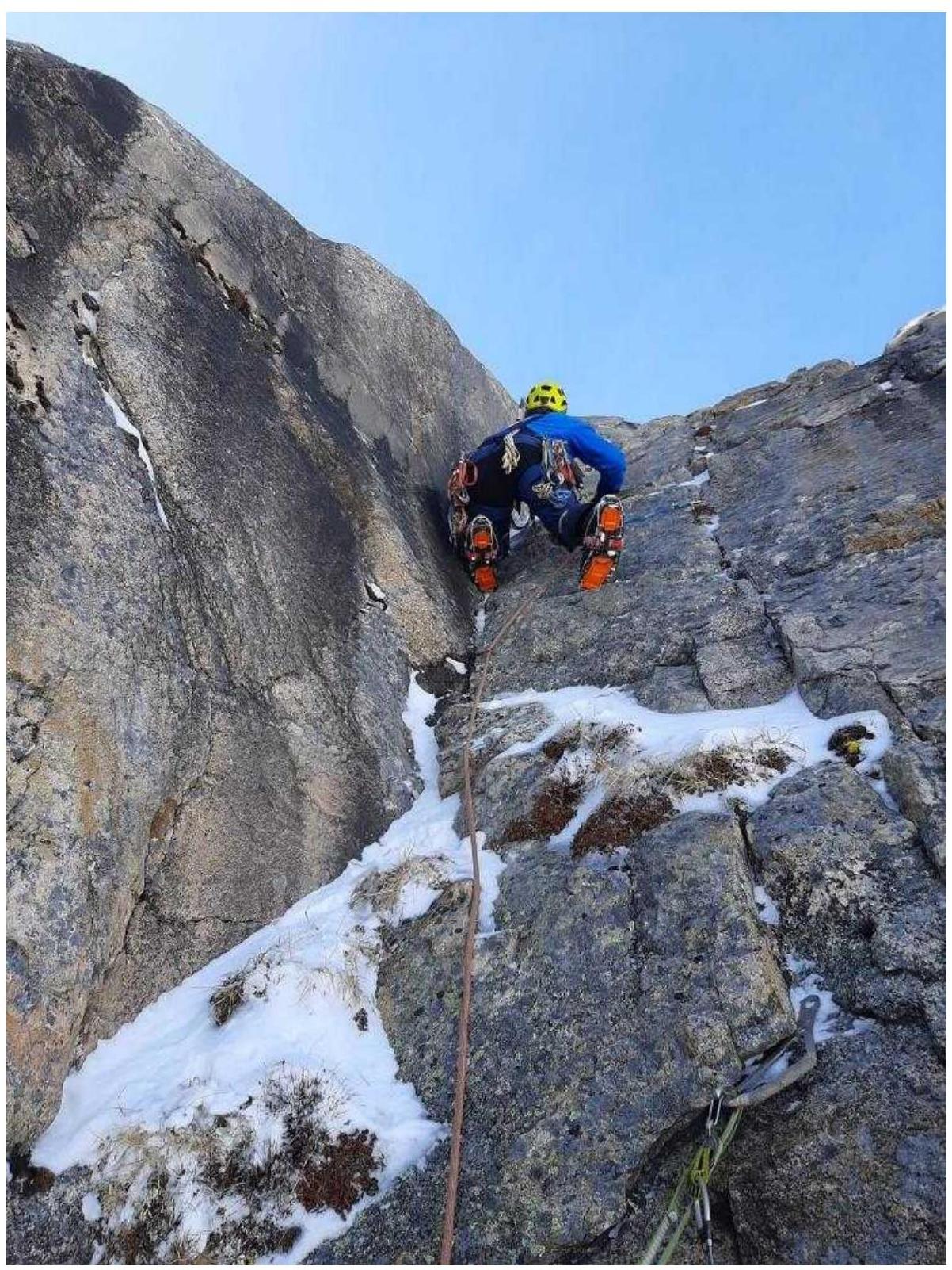
Photo 19, start of section R9–R10
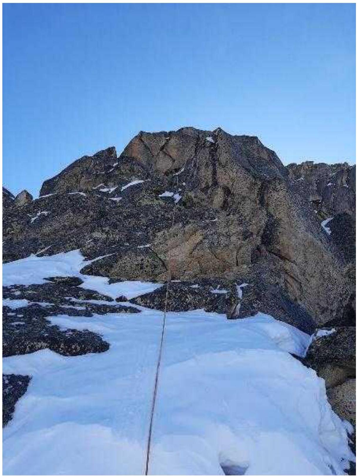
Photo 20
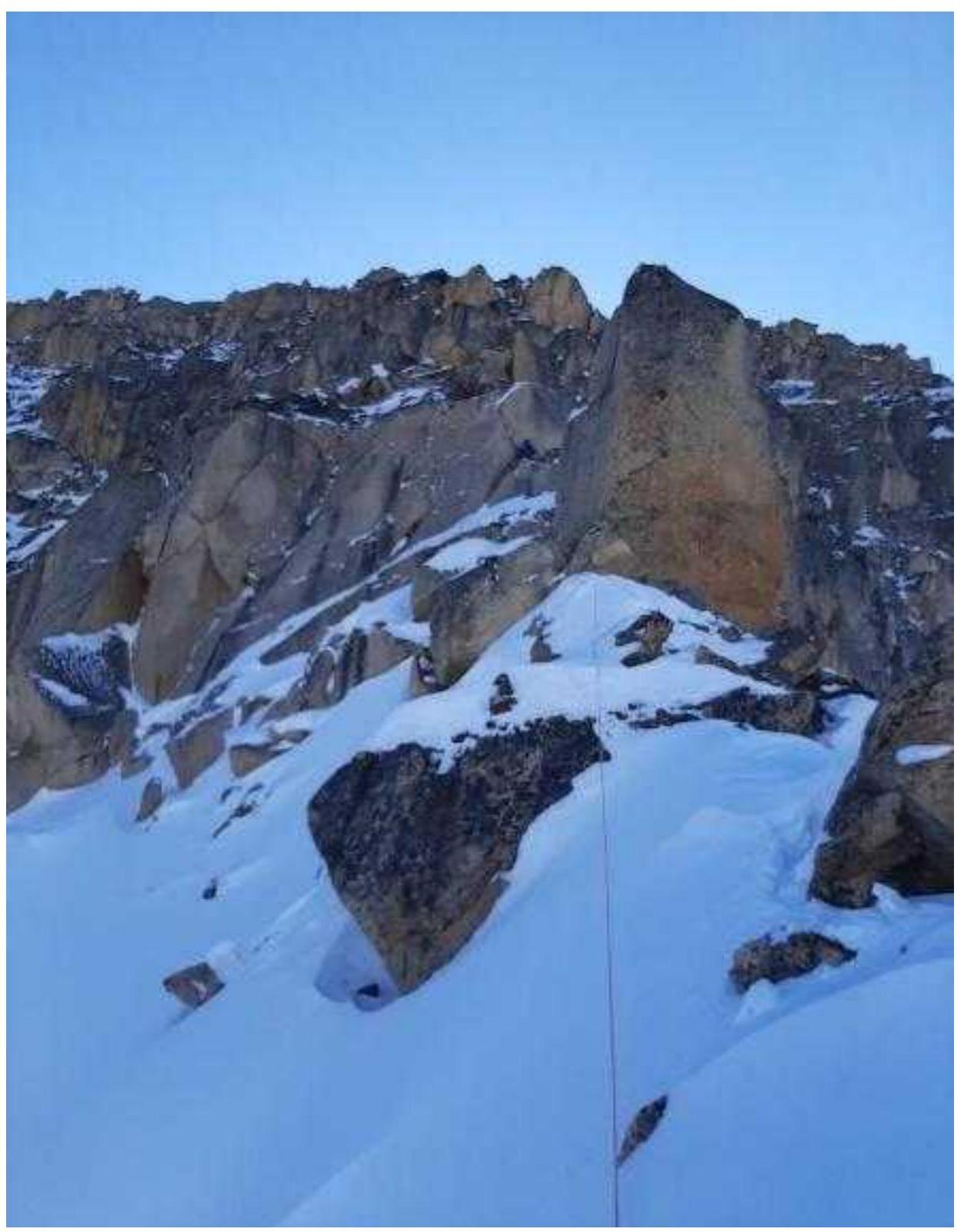
Photo 21
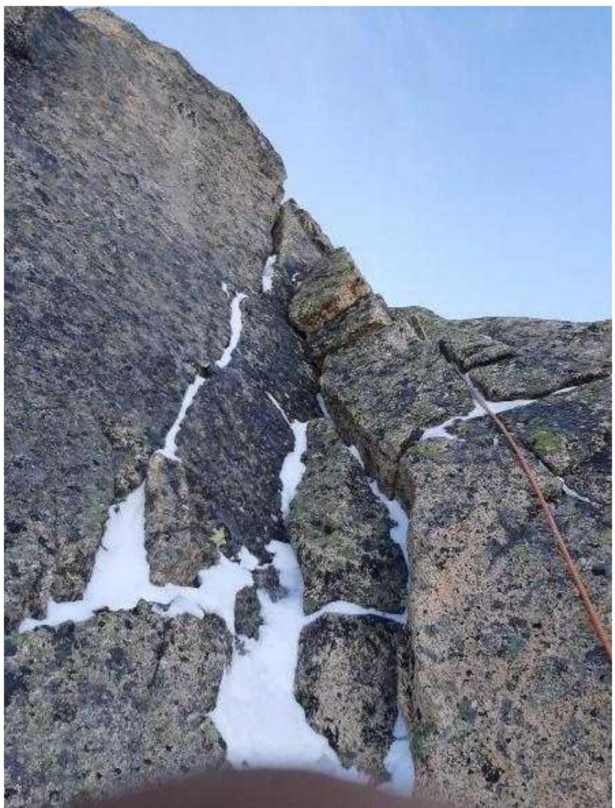
Photo 22, section R11–R12, upper part of the buttress
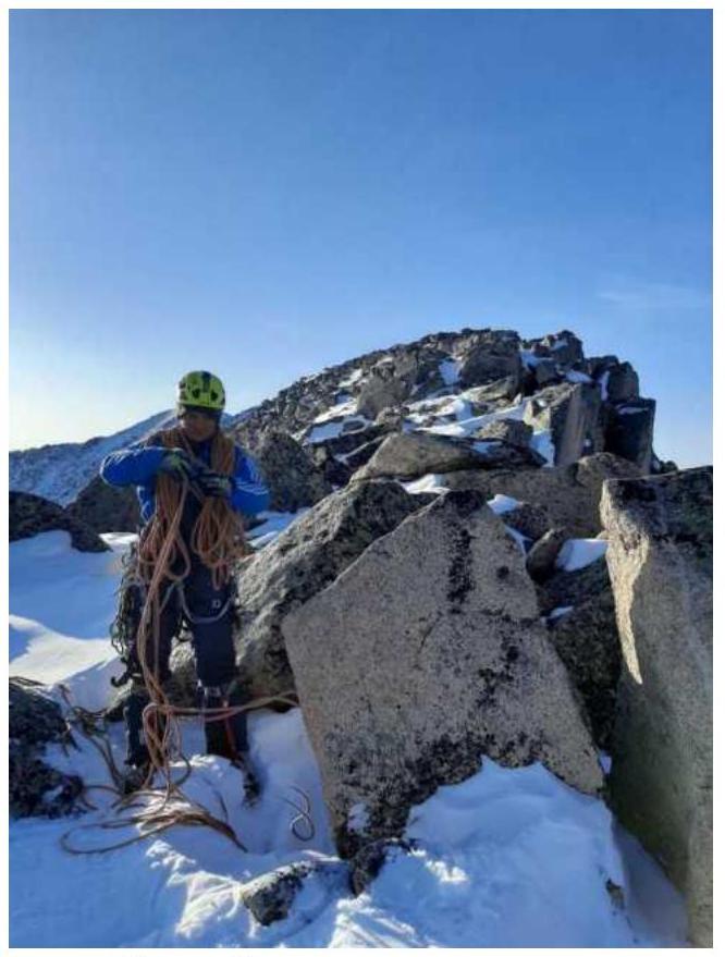
Photo 23, ridge
3.3. Photo of the Team on the Summit with the Control Tour
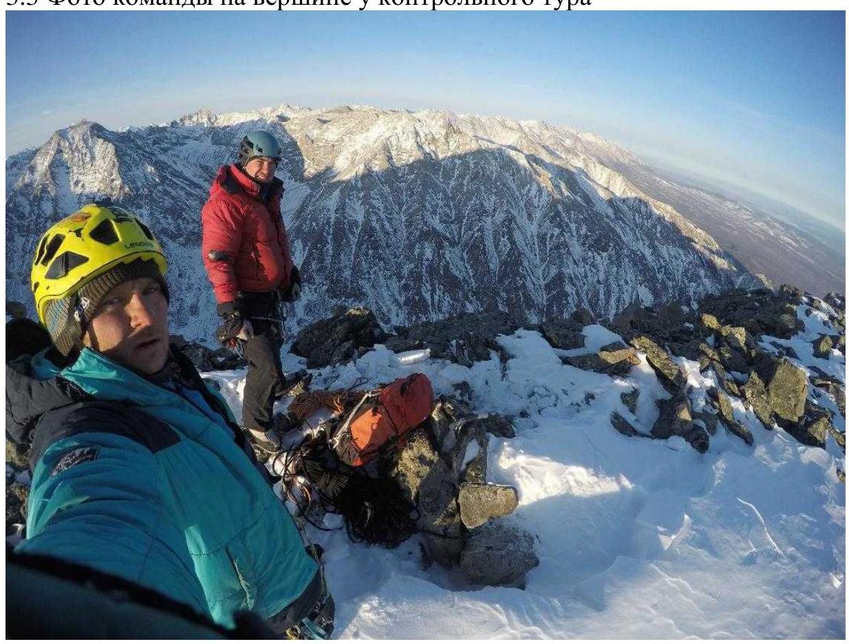
Photo 24 3.3. This route corresponds by difficulty category to similar routes in the Eastern Sayan. The route is safe, the terrain is monolithic, and the insurance is reliable. In winter and especially in spring, it is necessary to organize reliable insurance on relief when moving across snow fields and couloirs. Communication on the route is stable. In winter, ice tools and crampons for two will be very useful, as there are many places where you can work simultaneously. Tools and Fifi work great in frozen knolls.
The descent is made from the saddle between the Ula-Gol and Perm peaks, turning into a couloir towards the valley. At first, the couloir goes left, then it will abruptly turn right. Most likely, this part will be filled with snow — do not go there, there are rockfalls. You need to slightly ascend to the left part of the couloir along the direction of movement — this will be a small isthmus, and from it, move into the main wide descent couloir with stones.
Descent
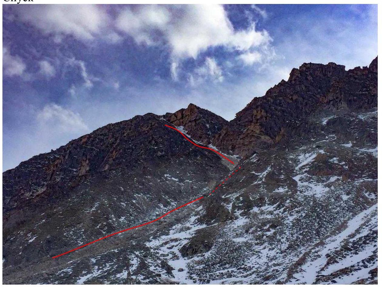
Photo 25, taken during a walk during reconnaissance, to the right is Mt. Perm.