Ascent passport for Starkova peak, 3187 m, via South-Eastern couloir, cat. 2A diff.
-
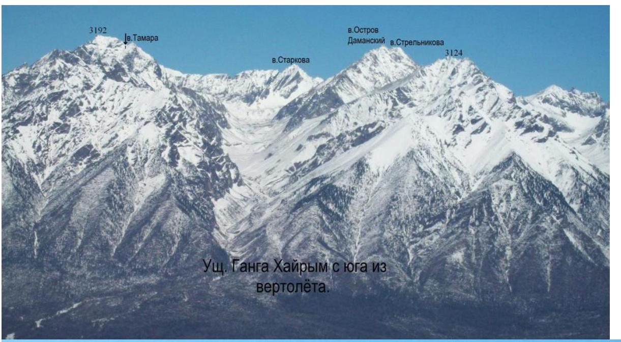
Eastern Sayan, Tunkin Goltsy mountain range, Ganga Khairyim valley, section 6.1.2.
-
Starkova peak 3187 m, via South-Eastern couloir.
-
Proposed cat. 2A diff., first ascent description.
-
Route type — rock climbing.
-
Height difference — 400 m, length — 700 m, average steepness — 40°.
-
Pitons hammered: rock and chock stones — 9 pcs.
-
Team's walking hours — 11 h.
-
No overnight stays on the route.
-
First ascender and first traverser of the route — Starkov, 1963.
-
Group of second ascenders:
- Afanasieva A.A. CMS
- Zhambalov Ts.B. badge
- Kuchumov S.N. badge
- Nomokonov D. 3rd sports category
- Potapov R.A. badge
- Sirotenko R.O. badge
- Titorenko M.A. badge
- Tyutrin G.N. badge
- Khromenkov O.A. badge
-
Coach — Afanasiev A.E. MS
-
Departure and return — September 3, 2014.
Description compiled by Afanasieva Alisa.
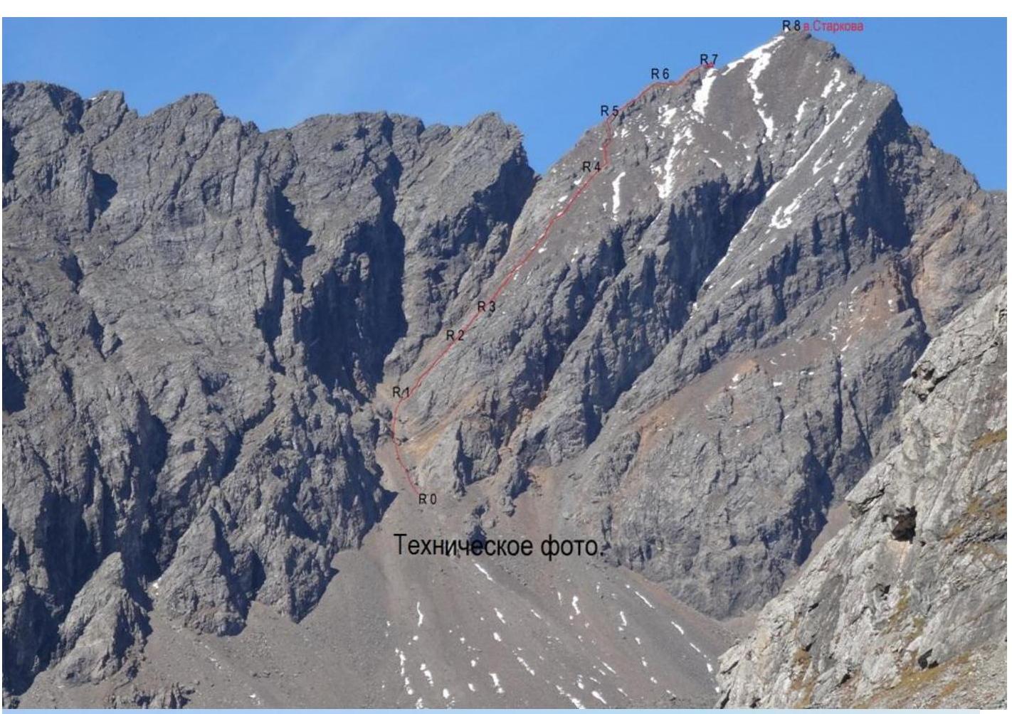
Route description for Starkova peak 3187 m via South-Eastern couloir, cat. 2A diff.
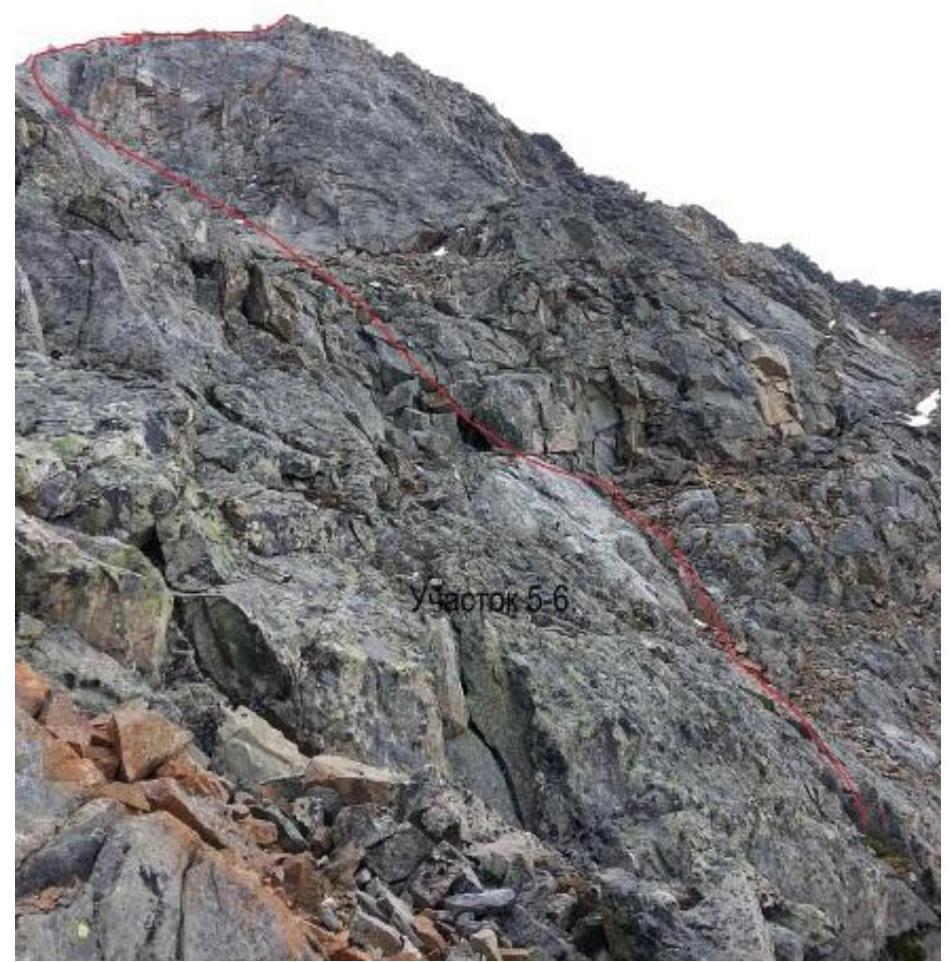
The mountain was named in honor of a student of the Irkutsk Aviation Technical School Starkov, who in early November 1963 was the first to ascend it and, breaking away along with a snow cornice, fell about 600 meters vertically into the circus of the Bilyuta valley (V. Bryansky "Kray okrylenny" [Winged Edge], Irkutsk, 2007). Starkov's first name could not be established. The mountain is located directly north along the Ganga-Khairyim valley at its head. The name of the mountain is marked on the map. The approach from the base camp at the lake to the route takes 2 hours. The route begins in line with the south-eastern couloir. Sec. 0–1, 100 m, 40°, I — scree in the couloir with overcoming 2 steps. At the end of the section, turn right. Sec. 1–2, 90 m, 60°, IV — rocks in the gully of the couloir. Rappel anchors. Ropes. Sec. 2–3, 20 m, 55°, II+ — rocks, transition to talus. Sec. 3–4, 180 m, 50°, II+ — steep loose scree. The first one spends a lot of time on organizing reliable stations. Sec. 4–5, 80 m, 50°, III — rocks. Exit to the ridge. Sec. 5–6, 100 m, 40°, II+ — exit to the first pre-summit. Sec. 6–7, 50 m, 40°, II — exit to the second pre-summit. Sec. 7–8, 150 m, 35°, I — gentle ridge to the summit. Descent via the ascent route. The group initially chose the simplest route to Starkova mountain from the Ganga-Khairyim valley. It is assumed that the first ascender climbed exactly this path. However, in dense fog, the group possibly did not notice alternative paths for some sections. In conditions of almost complete absence of snow on the slopes, the route became more complicated. Instead of usual steep snow shelves, the group encountered rock slabs with fine gravel, which required movement on ropes to prevent slipping along with the scree. This increased the time spent on the mountain. As a result, only the first member of the group reached the pre-summit before evening darkness. From the pre-summit to the summit, there is a simple snow-scree flat ridge, cat. 1-. Due to the group being stretched out on two ropes, it was decided to return. The ascent took 11 hours. The group did not reach the summit, but the description is complete for the entire route. The ascent and leadership for all participants were not counted. The coaching council of the event decided to submit for classification the route to Starkova peak via the South-Eastern couloir, cat. 2B diff. After descending, the instructor and participants agreed that the route, given the conditions, corresponded to cat. 2B diff. In snowy conditions, the couloir and shelves would have been frozen, simplifying the route.
The area is expeditionary and rarely visited.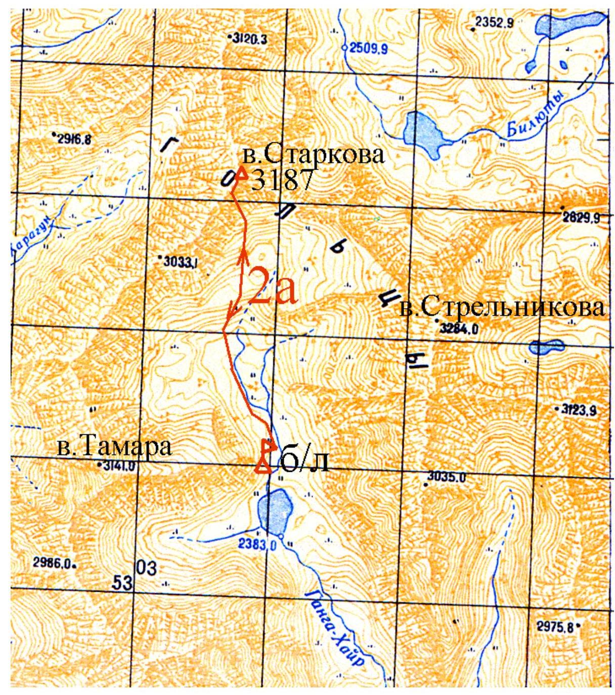
3187 m.
Starkov
 v.
Starkov
v.
Starkov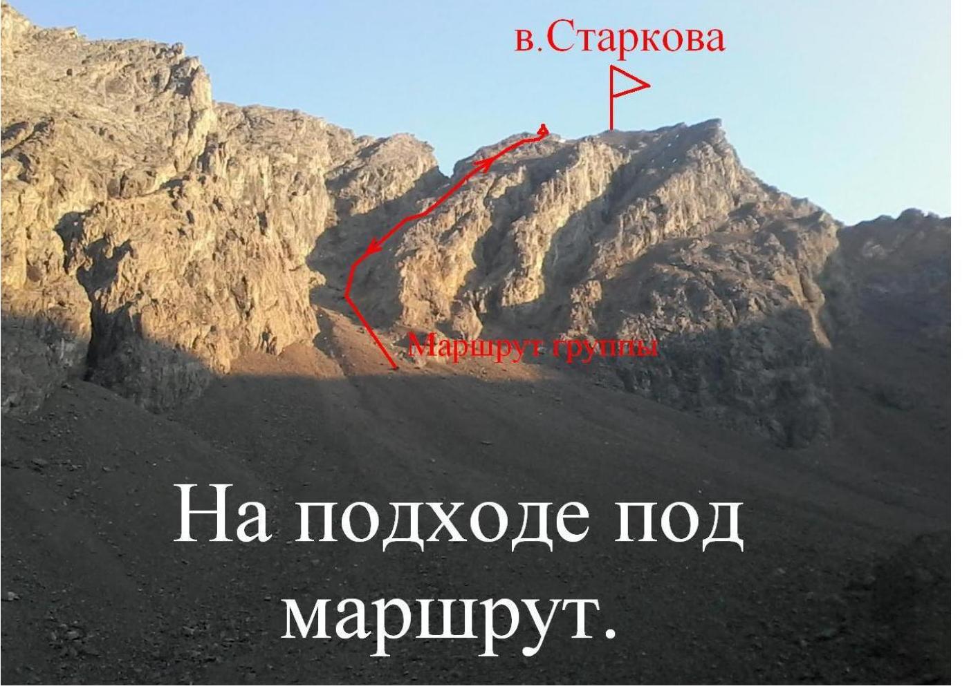

Fog is rising.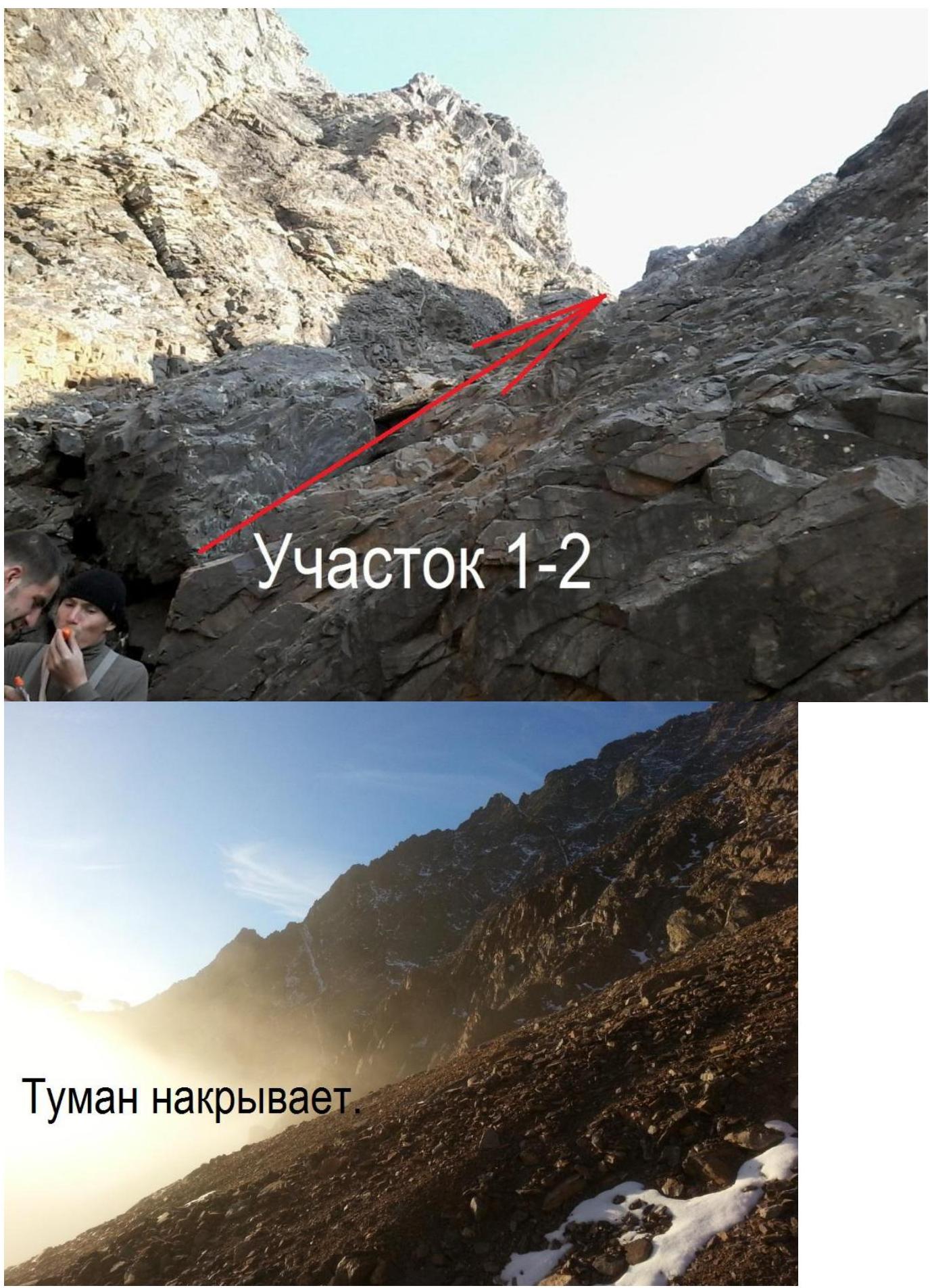
Fog is coming
On section R2–R3.
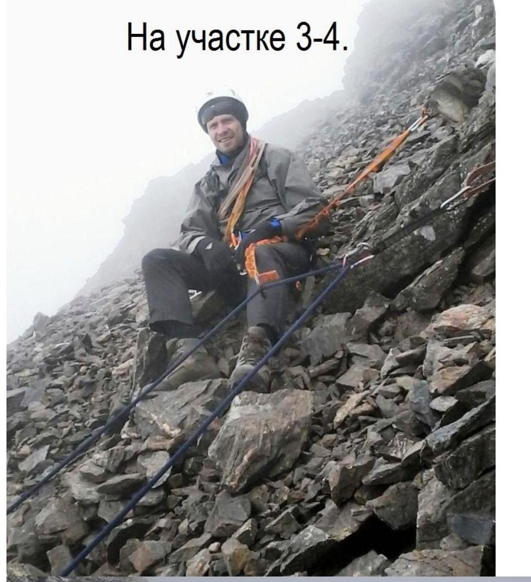
Section R3–R4
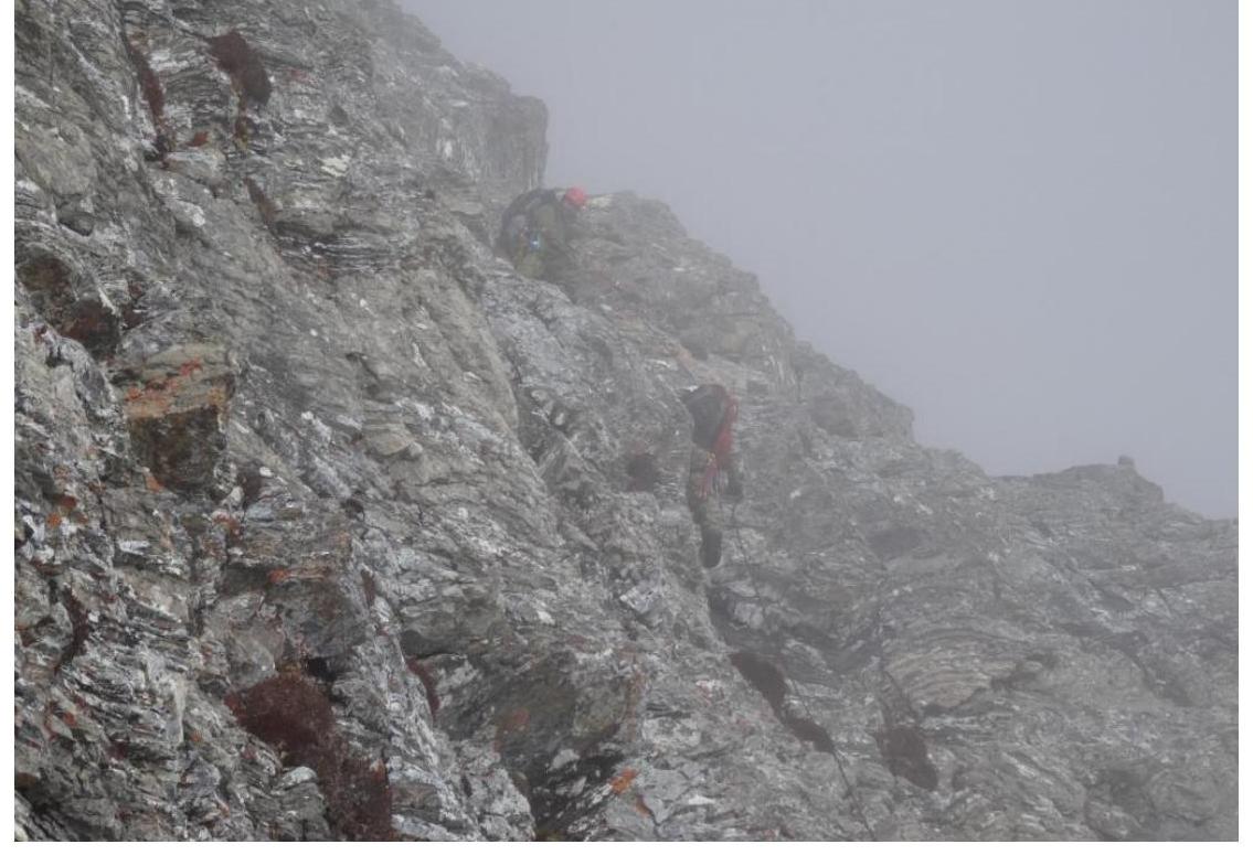
Section R4–R5.
At the highest point reached, section R6.
Footnotes
-
2986.0. ↩