
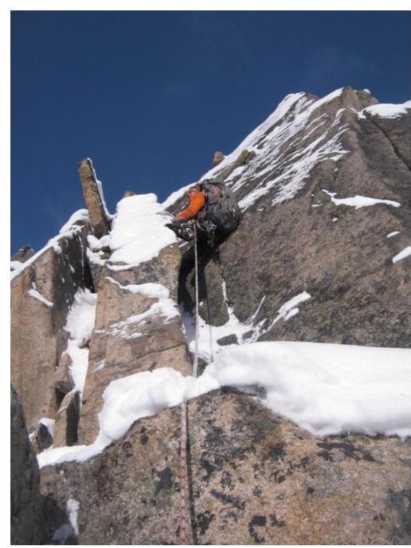
Passing the section
R4–R5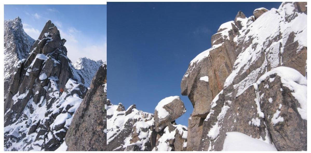
Passing the crux R5–R6. The "fly swatter" on
the crux.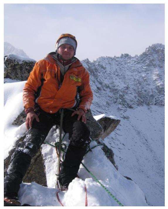
The summit, station behind a boulder
Approaches.
From the hut on the lake, we ascend to the moraine cushion, leaving the peaks Neftehimik, Monah, and Ch. Zori to the left. Further along the moraine ridge, we bypass the lower lake and gain altitude, heading to the right towards the peaks Baruun and Uzlovaya. The entire path from the hut to the upper lake can be traversed without venturing onto the talus slopes.
The start of the route is from the upper lake. It is necessary to move upwards along the talus slope, which narrows into a couloir between p. Uzlovaya and p. 2676.
The approach from the hut on the lake takes 2 hours, from the camp on the forest edge — 3 hours to 3 hours 20 minutes.
Logic and beauty of the route.
The route is easily readable and logical. The line of movement is initially bounded by the couloir walls, and higher up — by the ridge, and it ascends along a logical path to the summit.
The abundance of gendarmes and the sharp ridge on the route force athletes to think through their tactics several steps ahead.
Recommendations for groups.
The route is a ridge route and has a lowering in its middle part, which does not allow for rappelling down. The descent is made by climbing down the same way as the ascent. Also, based on our observations, this is the simplest option for ascending to this summit. Consequently, the summit does not have an emergency pedestrian descent. It is necessary to consider this and the remoteness of the summit from the camp when planning the time for completing the route.
The presence of a large number of pitches and gendarmes on the route does not allow the second and subsequent participants to fully jumar up. Most of the route is traversed by climbing.
We recommend this route for a "two-person" team.
Map-scheme
of the area.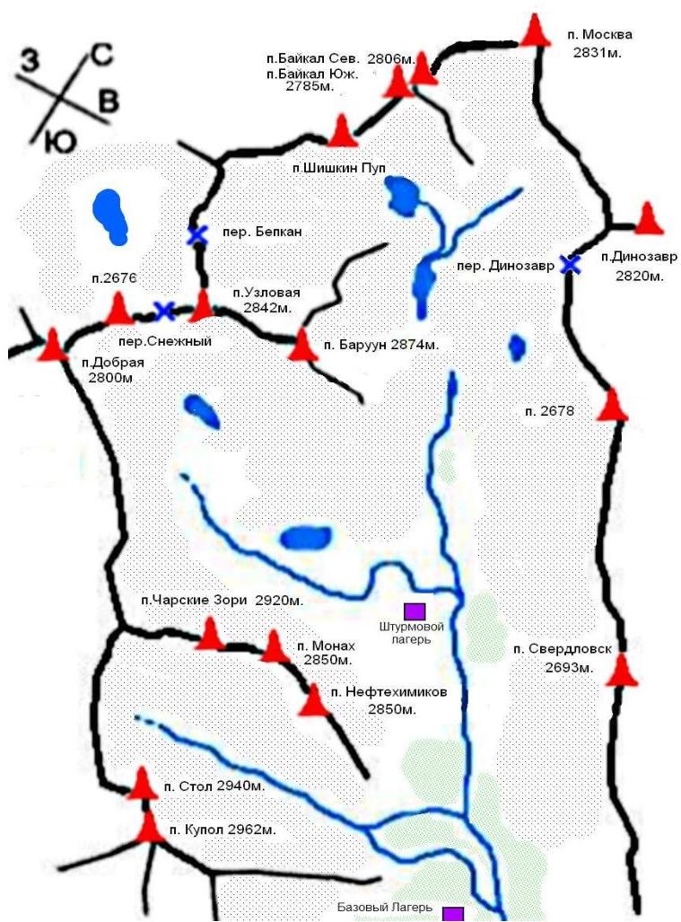
Map-scheme of the Baruun-Handagai (Barun-Handagai, Burun-Handagai) area — a river and a valley of the same name on the southern side of the Tunka Goltsy ridge (Eastern Sayan). A popular place among alpinists and rock climbers. The peaks in the valley have classified alpinist routes from 1B to 6A inclusive and prepared rock climbing multipitches.
The word "baruun" or "barun" means "western" in Buryat. The word "handagai" means elk, i.e., a place where elks are found.
Tunka Goltsy (Buryat: Түнхэнэй һарьдагууд) (Tunka Alps) — a mountain ridge located in the Okinsky and Tunkinsky districts of Buryatia, is the easternmost spur of the Eastern Sayan. Composed of crystalline schists and granites. A dissected mid-mountain relief prevails. In the near-summit part, an alpine-type relief is observed. The peaks of the ridge reach 3000–3300 m, the highest point of the ridge — Peak Strelnikov (3284 m), the height difference between the ridges reaches 2000 m.
The slopes are overgrown with light coniferous taiga. Above 2000 m — mountain tundra.
In connection with the 250th anniversary of the birth of G. I. Shelikhov, by a decision of the Geodesy Committee of Russia, one of the mountain peaks (2811 m) of the Tunka Goltsy officially received the name Peak Shelikhova, and in July 1997, a memorial sign was installed on the peak.
To the southeast, at the foot of the ridge, is the balneological resort Arshan.
Peaks of the valley:
- Baykal Severny
- Baykal Yuzhny
- Barun
- Dinozaur
- Dobraya
- Kupol
- Monah
Moskva, Neftehimikov, Sverdlovsk, Stol, Uzlovaya, Charskie Zori, Shishkin, Pup 2678
To the nearest populated area — the settlement Arshan — can be reached by any vehicle on asphalt or by a scheduled bus from the city of Irkutsk (250 km). To the entrance to the valley, one can only drive using a passable vehicle through the settlement Tagarhay, which is 5 km from the settlement Arshan. The hike from the entrance to the valley takes 6–7 hours along a trail with a section bypassing the cliffs.
Comments
Sign in to leave a comment