Report
ON THE FIRST ASCENT TO THE SUMMIT SHKOLNAYA, VIA THE NORTHERN RIDGE ROUTE, APPROXIMATELY CATEGORY 1B DIFFICULTY, BY THE INITIAL TRAINING SCHOOL TEAM OF THE CLUB "GORY BAIKALA" FROM OCTOBER 15, 2018 TO OCTOBER 15, 2018
Irkutsk 2018
I. Ascent Passport
| № | 1. General Information | |
|---|---|---|
| 1.1 | Full name, sports rank of the leader | Glazunov Evgeny Vladimirovich (Master of Sports) |
| 1.2 | Full names, sports ranks of the participants | Badryzlova Ksenia Sergeevna, Medvedeva Anna Gennadievna, Lavellina Natalia Vladimirovna, Kalashnikov Andrey Yurievich, Kozyreva Alena Timofeevna, Belskaya Anna Andreevna, Mishin Alexander Yurievich, Donicheva Nadezhda Sergeevna, Sergelen Dugerjav, Ivanne Sanchez, Plyatsko Olga Vasilievna, Pozhitkov Sergey Igorevich |
| 1.3 | Full name of the coach | Glazunov Evgeny Vladimirovich (Master of Sports) |
| 1.4 | Organization | Irkutsk Regional Public Organization "Club of Active Recreation and Alpinism 'Gory Baikala'", project "Impossible is Not Forever" |
| 2. Characteristics of the Ascent Object | ||
| 2.1 | Region | Eastern Sayan, Tunka Goltsy ridge |
| 2.2 | Valley | Chertolen-Gorkhon |
| 2.3 | Section number according to the 2013 classification table | 6.1.2 |
| 2.4 | Name and height of the summit | Shkolnaya, 2580 m |
| 2.5 | Geographical coordinates of the summit (latitude/longitude), GPS coordinates | 51.840374 101.609710 |
| 3. Characteristics of the Route | ||
| 3.1 | Route name | Krutyak, via the northern ridge |
| 3.2 | Proposed category of difficulty | 2A |
| 3.3 | Degree of route exploration | First ascent |
| 3.4 | Nature of the route terrain | Rocky |
| 3.5 | Height difference of the route (data from altimeter or GPS) | 540 m |
| 3.6 | Route length (in meters) | 1720 m |
| 3.7 | Technical elements of the route (total length of sections of various difficulty categories) | non-technical - 500 m, category 1 rock - 1077 m, category 2 rock - 137 m. |
| indicating the nature of the terrain (ice-snow, rocky) | category 3 rock - 6 m, category 4 ice/rock/combination - 0 m. Movement on closed glacier - 0 m. Rappelling (on descent) - (number of ropes and total meters) | |
| 3.8 | Descent from the summit | Category 1B difficulty, to Chertolen-Gorkhon valley |
| 3.9 | Additional characteristics of the route | Lack of water |
| 4. Characteristics of the Team's Actions | ||
| 4.1 | Time of movement (team's walking hours, in hours and days) | 6 hours |
| 4.2 | Overnights | - |
| 4.3 | Departure on the route | 07:00, October 15, 2018 |
| 4.4 | Reaching the summit | 11:00, October 15, 2018 |
| 4.5 | Return to base camp | 14:00, October 15, 2018 |
| 5. Person Responsible for the Report | ||
| 5.1 | Full name, e-mail | Medvedeva Anna Gennadievna belochka83@mail.ru |
II. Description of the Ascent
1. Characteristics of the Ascent Object
1.1. General photo of Shkolnaya summit
Shkolnaya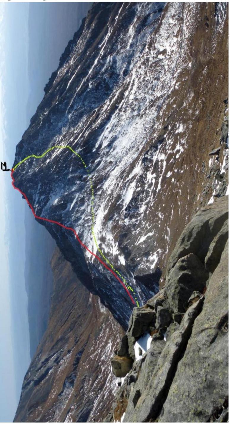 October 17, 2018, view from Mt. Optimist. Red line - ascent route. Green line - descent from the summit.
1.2. Photo of the route profile October 17, 2018, on the way to Mt. Dragon.
1.3. Panoramic photo of the area October 16, 2018, view from Mt. Obmanchivaya.
1.4. Map of the Summit
The summit is located in the Chertolen-Gorkhon valley, Tunka Goltsy ridge, Eastern Sayan.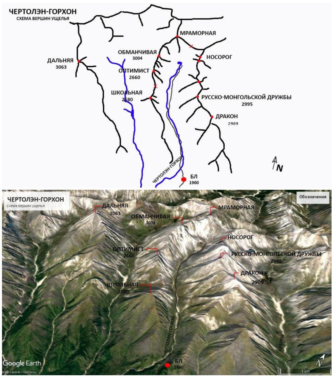
Approach: from Nilova Pustyn settlement (Tunka district, Republic of Buryatia) to Khoito-Gol village, then follow the signs to "Sukhoy Ruchey" tourist base.
From the tourist base:
- motorized transport with high clearance is possible
- hiking along the forest road to Chertolen-Gorkhon river, from where a good trail leads to the valley, through an abandoned wintering hut (base camp).
Approximate time "Sukhoy Ruchey" - base camp: 5-9 hours. Distance: 12 km.
It is also possible to arrange horseback transportation with locals.
From base camp:
- follow the horse trail towards the valley to the starting point of the route - 1 hour 20 minutes, about 2 km
- several river crossings along the trail
The mountain is the first on the left side of the valley.
2. Characteristics of the Route
2.1. Technical photo of the route.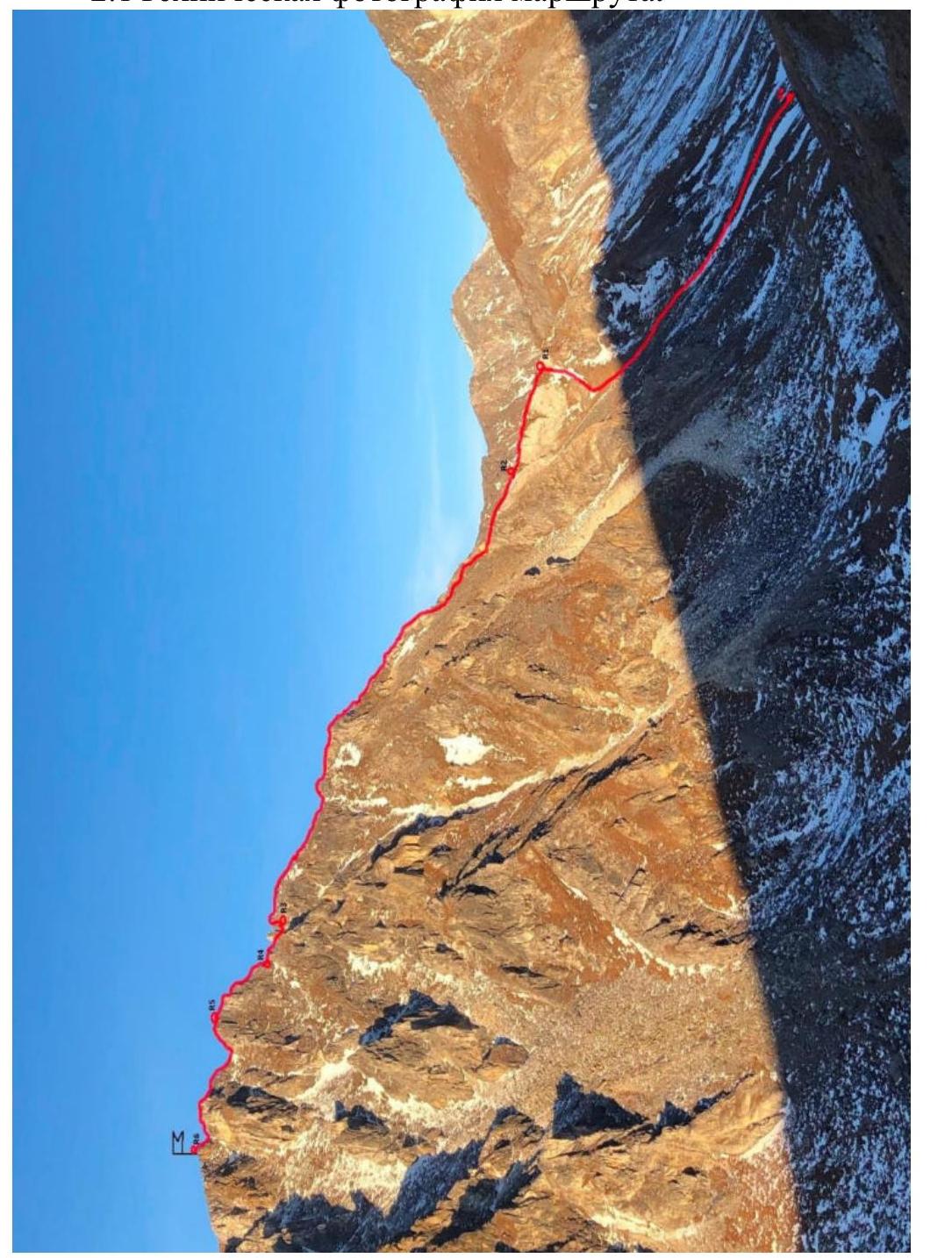 2.2. Section numbers on the technical photo correspond to the section numbers in paragraph 2.3.
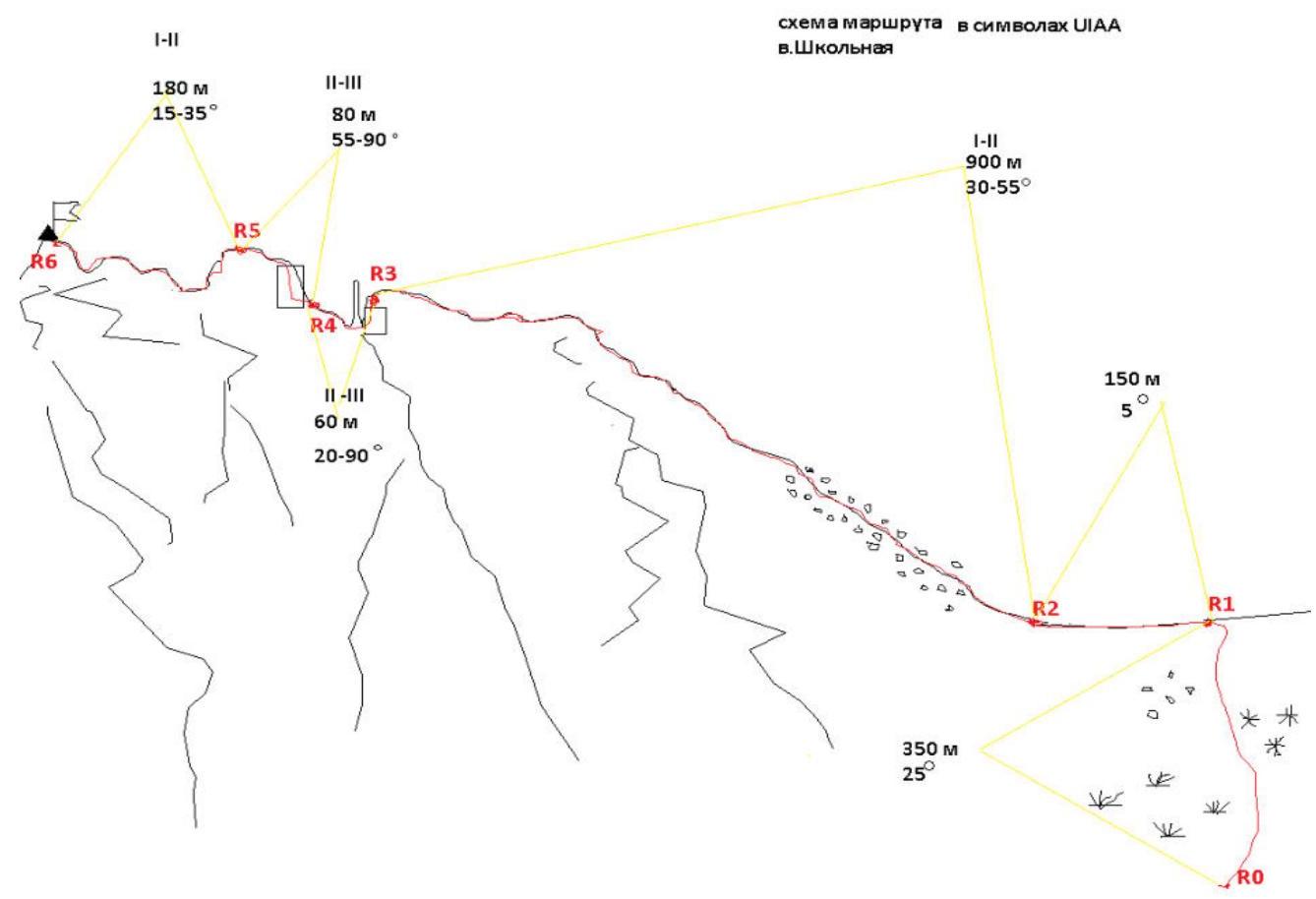
2.3. Technical characteristics of the route sections in symbols
3. Characteristics of the Team's Actions
3.1. Brief description of the route passage
| Section | Description | Photo number |
|---|---|---|
| R0-R1 | Ascent to the pass, without special equipment. | Photo 3.1.1. |
| R1-R4 | Movement along the pass in crampons, and further along the entire route in crampons. | Photo 3.1.2 |
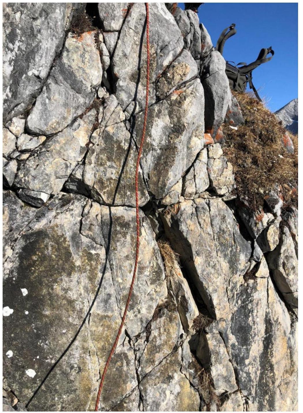
| R2-R3 | Movement along the ridge, in rope teams. On some sections, including alternate belays are used. | Photo 3.1.3 Photo 3.1.4 |
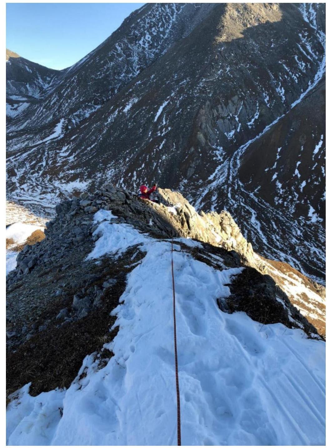
| R3-R4 | "Paltsev" (rock formation). We bypass it on the left, but since there is a drop on the approach, we need to descend. We organize alternate belays for descending the wall, there is a good anchor. The wall is small, about 2.5 m, after descending we bypass the "paltsev" on the left and reach the sub-summit. | Photo 3.1.5 Photo 3.1.6 |
| R4-R5 | Sub-summit. Height about 25 m. We pass it head-on. There are loose rocks, which appear reliable but are deceptive. Climbing is active. Belays are alternate. After passing a small wall, about 3 m (good handholds), we move left through an angle between two rocks. | Photo 3.1.7 |
| R5-R6 | Descent from the sub-summit, a little more, and we are at the goal. | Photo 3.1.8 |
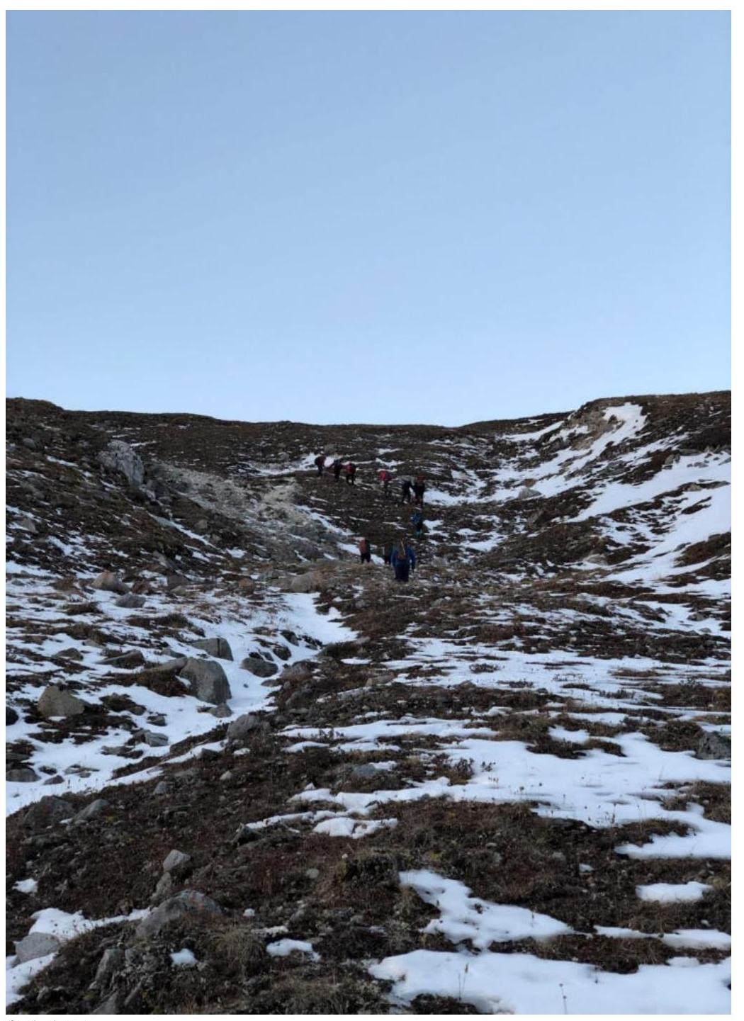
- 3.1.1. Ascent to the pass
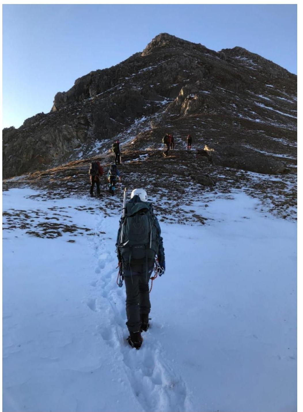
- 3.1.2. Movement along the pass to the start of the ascent
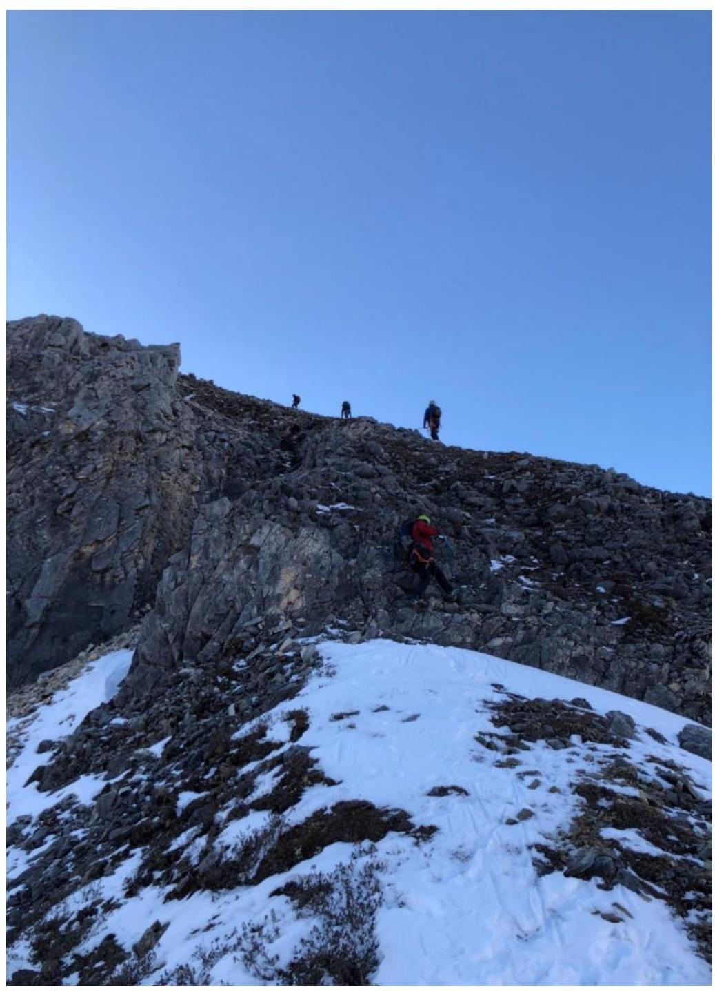
- 3.1.3. Movement in rope teams along the ridge
- 3.1.4. Movement in rope teams along the ridge
- 3.1.5. Section of the wall
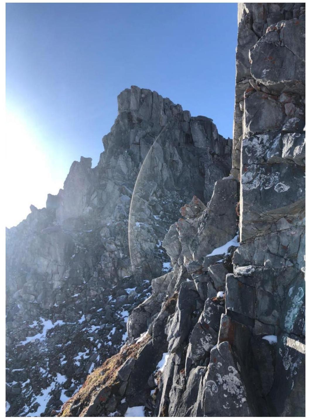
- 3.1.6. Bypassing the "paltsev" - view of the sub-summit
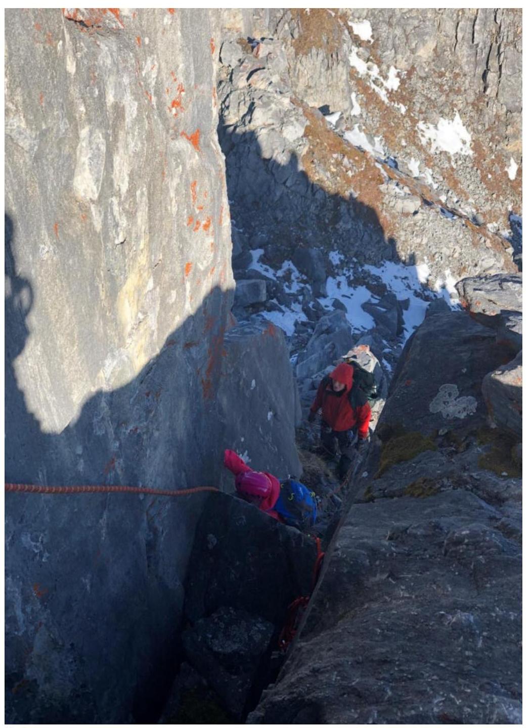
- 3.1.7. On the sub-summit
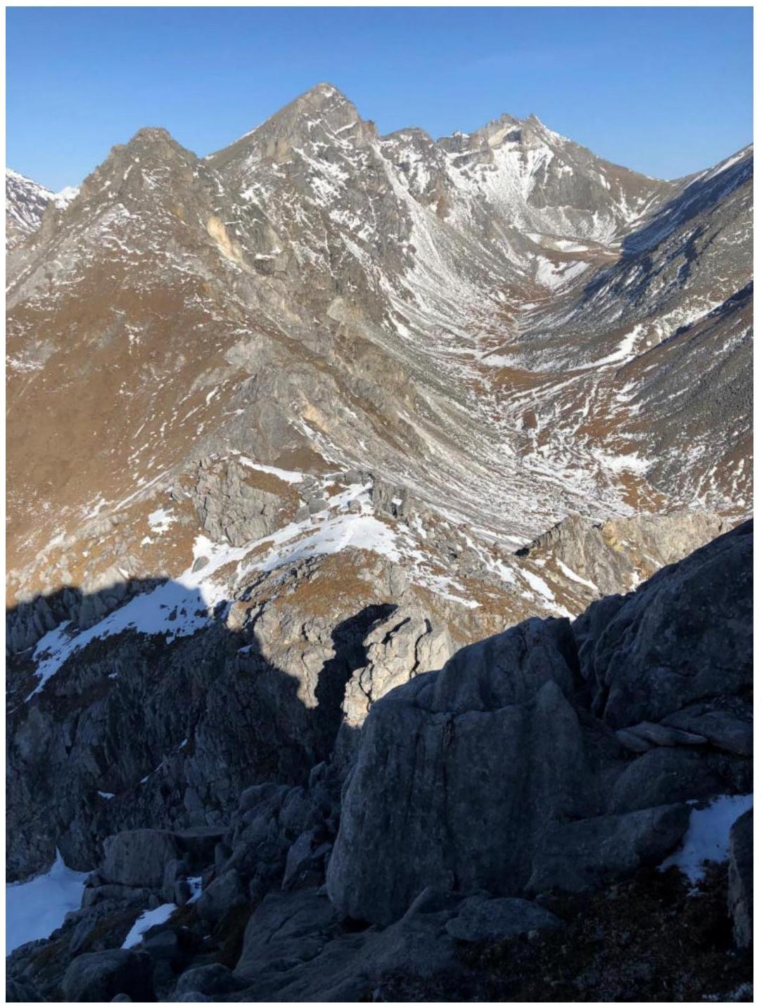
- 3.1.8. View of the valley and ridge on section R5-R6
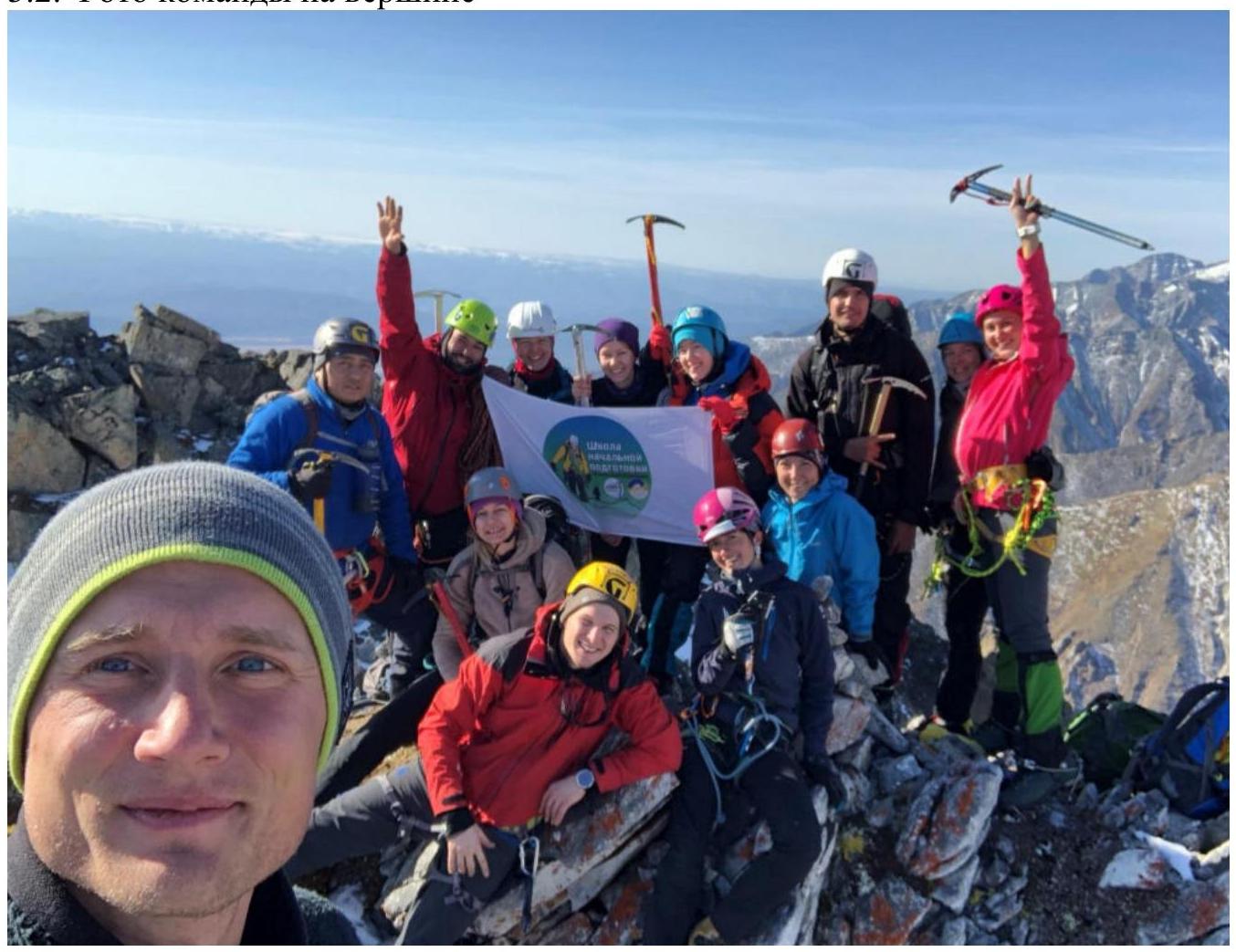
3.2. Photo of the team on the summit
3.3.
The absence of registered routes, cairns, notes, or any other signs of human presence on the summit allows us to consider the route as a first ascent.
We propose:
- to name the summit "Shkolnaya".
- The first ascenders were the initial training school team of the "Gory Baikala" club.
- to name the route "Krutyak" because it is rich in varied terrain.
Descent from the summit is along the western slope towards the pass. On the descent, there is loose rock, so caution is necessary. Descent to the pass, then follow the ascent route.
The route's difficulty category is 1B. However, the presence on the route of:
- two climbing walls, about 3 m high,
- several short rocky sections requiring belays,
makes the route more challenging than 1B; we consider it possible to classify it as 2A.