
Report
On the first ascent to the summit of Pik Shishkina via the center of the South Face route, category 5A, by the team of the "Gory Baikala" club, from May 6, 2018, to May 6, 2018.
I. Climbing Report
| 1. General Information | ||
|---|---|---|
| 1.1 | Full name, sports rank of the leader | Glazunov Evgeny Vladimirovich (MS) |
| 1.2 | Full name, sports rank of the participants | Panova Alena Mikhailovna 1st sports rank |
| 1.3 | Full name of the coach | Glazunov Evgeny Vladimirovich (MS) |
| 1.4 | Organization | Irkutsk Regional Public Organization "Club of Active Recreation and Alpinism 'Gory Baikala'" |
| 2. Characteristics of the Climbing Object | ||
| 2.1 | Region | Eastern Sayan, Bolshoi Sayan Ridge |
| 2.2 | Valley | Barun-Khandagai |
| 2.3 | Section number according to the 2013 classification table | 6.1.2 |
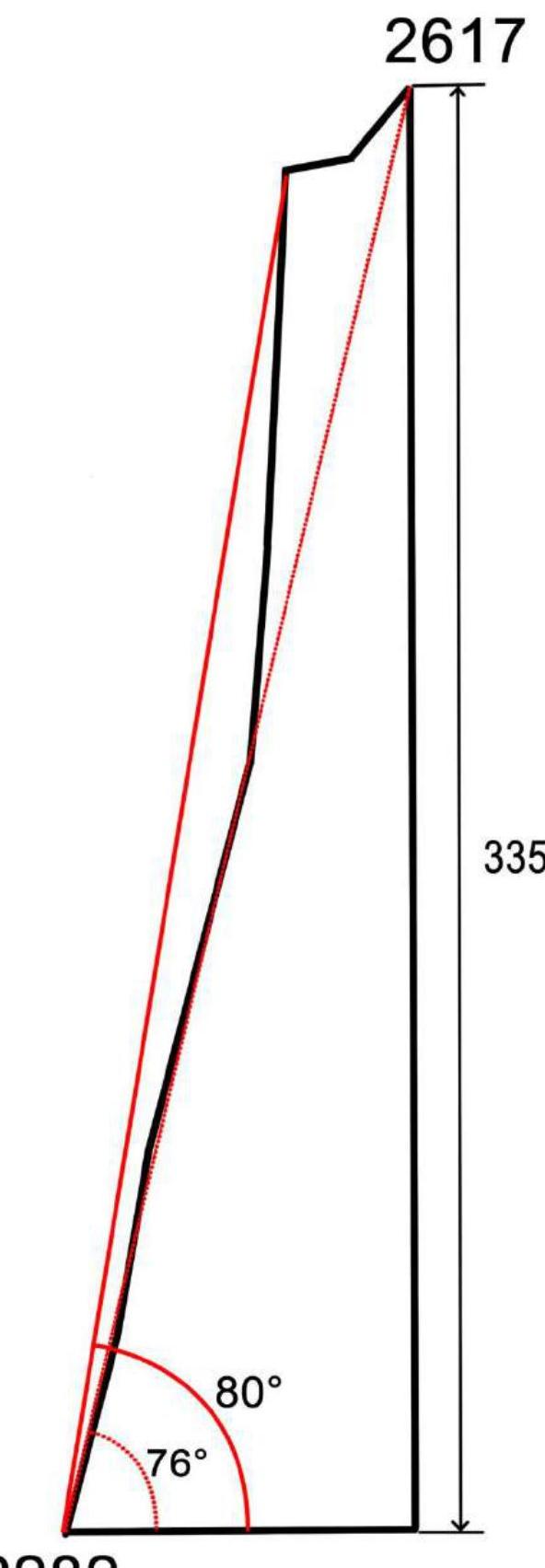
| 2.4 | Name and height of the summit | Pik Shishkina, 2617 m |
| 2.5 | Geographical coordinates of the summit (latitude/longitude), GPS coordinates | 51°57′1.25″ N 102°9′48.41″ E |
| 3. Characteristics of the Route | ||
| 3.1 | Route name | Through the center of the South Face |
| 3.2 | Proposed category of difficulty | 5A |
| 3.3 | Degree of route exploration | First ascent |
| 3.4 | Relief characteristics of the route | Rocky |
| 3.5 | Elevation gain of the route (data from altimeter or GPS) | 335 m |
| 3.6 | Route length (in meters) | 520 m |
| 3.7 | Technical elements of the route (total length of sections of various difficulty categories with indication of relief character (ice-snow, rocky)) | Category I ice/rock/combination — 0 m. Category II ice/rock/combination — 0 m. Category III ice/rock/combination — 80 m. Category IV ice/rock/combination — 0 m. Category V ice/rock/combination — 108 m. Category V-VI ice/rock/combination — 176 m. Category VI ice/rock/combination — 140 m. Rock VI, A3 — 0 m. Rock VI, A4 — 0 m. |
| 3.8 | Average steepness of the route, (°) | 76° |
| 3.9 | Average steepness of the main part of the route, (°) | 80° |
| 3.10 | Descent from the summit | Category I, to Barun-Khandagai valley |
| 3.11 | Additional route characteristics | Lack of water |
| 4. Characteristics of Team Actions | ||
| 4.1 | Time of movement (team's walking hours, in hours and days) | 9 h 20 min |
| 4.2 | Overnights | – |
| 4.3 | Route preparation time | – |
| 4.4 | Start of the route | 5:00, May 6, 2018 |
| 4.5 | Summit arrival | 17:00, May 6, 2018 |
| 4.6 | Return to base camp | 23:30, May 6, 2018 |
| 5. Weather Conditions | ||
| 5.1 | Temperature, °C | – |
| 5.2 | Wind speed, m/s | – |
| 5.3 | Precipitation | – |
| 5.4 | Visibility, m | – |
| 6. Responsible for the Report | ||
| 6.1 | Full name, e-mail | Glazunov Evgeny Vladimirovich baikalmountain@mail.ru evgenii-glazunov@mail.ru +79500843341 |
II. Climbing Description
1. Characteristics of the Climbing Object
1.1. General photo of Pik Shishkina summit.
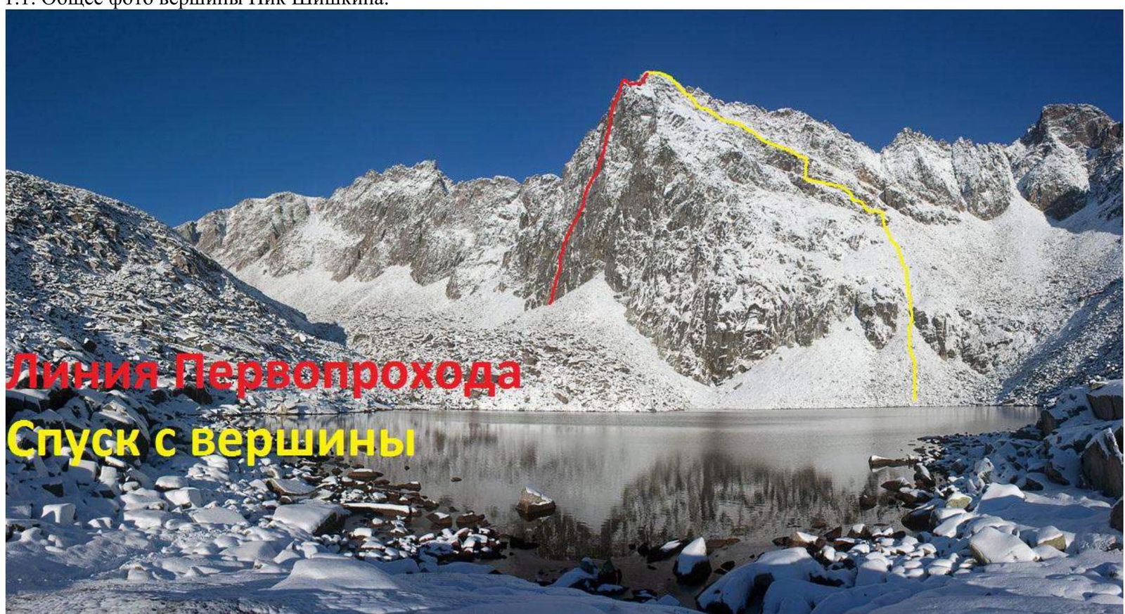
Taken from the lake on September 27, 2012.
1.2. Photo of the route profile.
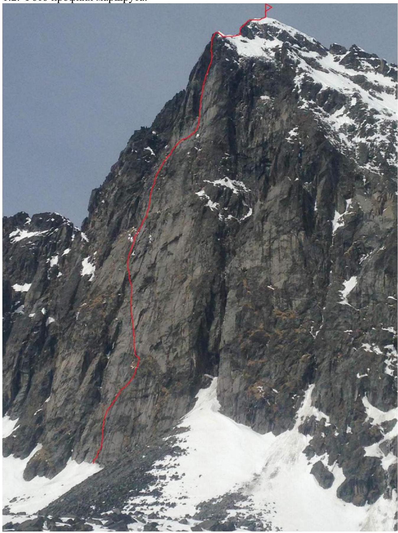
Photo of the route taken by the team on the right, taken from the lake on May 5, 2018.
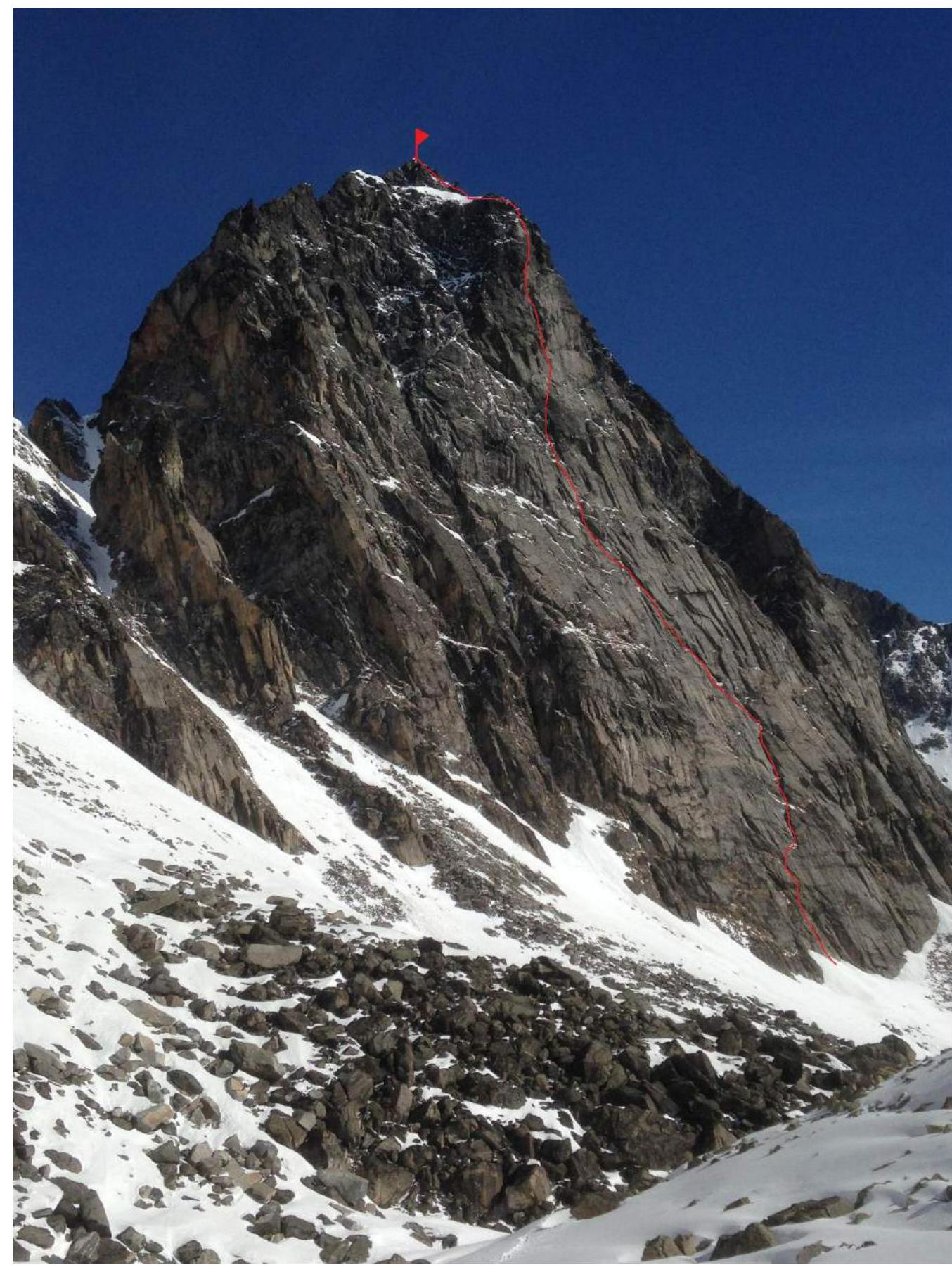
Photo of the wall profile on the left, taken from the slopes of the Bepkan pass on May 5, 2018.
1.3. Drawn profile of the route.
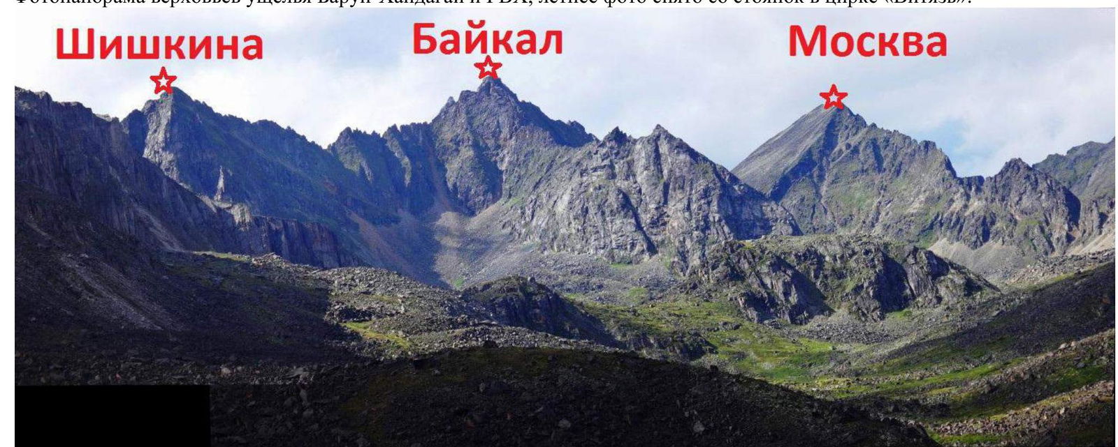
1.4. Photopanorama of the upper reaches of the Barun-Khandagai valley from the Bepkan pass.

Photopanorama of the upper reaches of the Barun-Khandagai valley and the Main Watershed Ridge, summer photo taken from the campsites in the "Vityaz" cirque.
1.5. Map of the area.
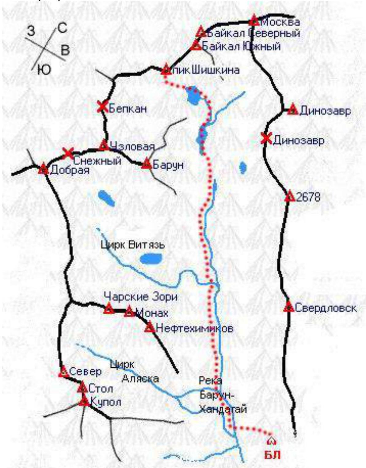
Pik Shishkina or Shishkin Pup is located in the Main Watershed Ridge of the Barun-Khandagai river valley, Tunkinskie Goltsy, Eastern Sayan mountain system. There were no classified routes to it. Nevertheless, this summit is interesting both as an object for first ascents and as a reflection of different eras in the development of alpinism in the Eastern Sayan.
We know of two ascents made by A. Shishkin's groups (non-classified route along the ridge, category 4A). The summit was named Shishkin Peak and is marked as such on all maps and catalogs of summits by tourists in reference materials on the mountains of South Baikal.
We propose to name this summit Pik Shishkina — in honor of the alpinist and pioneer of summits and routes in Tunkinskie Goltsy, one of the first alpinism instructors in Irkutsk, and the first ascender to this beautiful peak. We provide all diagrams, tables, and photos based on this proposal. If this name is not possible, we request that the "historical" name "Shishkin Pup" be retained.
The approach from the base camp takes about two to three hours via the nast or summer trail, depending on the amount of snow, as observed by A. Dulsky's group in 1998 (non-classified route along the South Face, category 5A, to the left of our route). The time of approach can be significantly longer.
2. Characteristics of the Route
2.1. Technical photograph of the route.
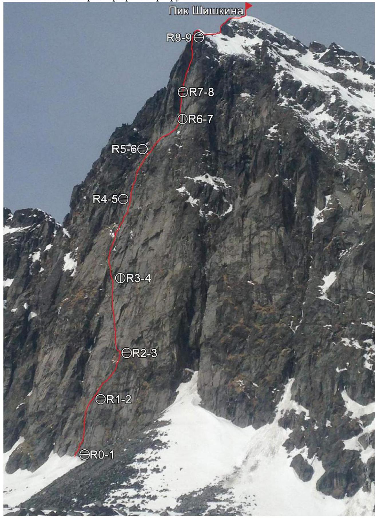 2.2. Section numbers on the technical photograph correspond to the section numbers on the UIAA symbol route diagram.
2.3. Route diagram in UIAA symbols.
2.2. Section numbers on the technical photograph correspond to the section numbers on the UIAA symbol route diagram.
2.3. Route diagram in UIAA symbols.
| Section | Hooks | Stop. El. | Pit. hooks for belay/ETO | ETO | Length, m. | Steepness, ° | Difficulty |
|---|---|---|---|---|---|---|---|
| R8–R9 | 80 | 50 | III | ||||
| R7–R8 | 9 | 14 | 60 | 90 | VI | ||
| R6–R7 | 6 | 8 | 30 | 90 | VI | ||
| R5–R6 | 9 | 3 | 58 | 90 | V–VI | ||
| R4–R5 | 7 | 5 | 58 | 85 | V–VI | ||
| R3–R4 | 6 | 3 | 58 | 75 | V | ||
| R2–R3 | 9 | 2 | 60 | 75–80 | V–VI | ||
| R1–R2 | 3 | 8 | 2 | 50 | 80 | VI A1 | |
| R0–R1 | 8 | 3 | 50 | 75–80 |
View of the UIAA in the form of an outline of the route on the mountain.
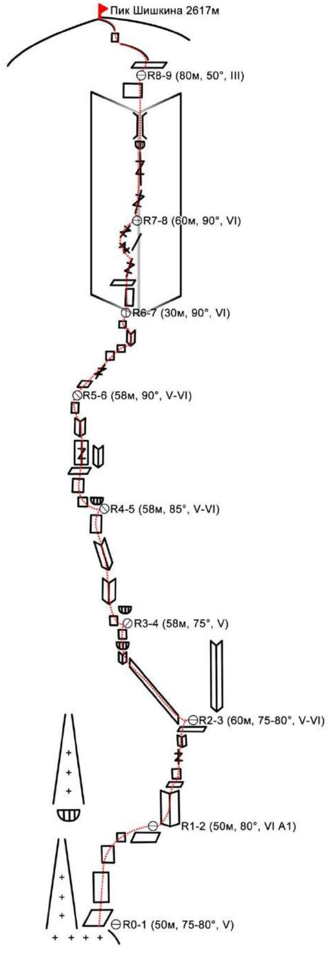 Pik Shishkina 2617 m.
- R8–R9 (80 m, 50°, III)
- R7–R8 (60 m, 90°, VI)
- R6–R7 (30 m, 90°, VI)
- R5–R6 (58 m, 90°, V–VI)
- R4–R5 (58 m, 85°, V–VI)
- R3–R4 (58 m, 75°, V)
- R2–R3 (60 m, 75–80°, V–VI)
- R1–R2 (50 m, 80°, VI A1)
- R0–R1 (50 m, 75–80°, V)
3. Characteristics of Team Actions
3.1 Approach to the start of the route via the distant lake, veering right onto a cushion of scree. Approach under the wall to the left, to the base of a large destroyed internal corner with cornices in the right part of the wall. The start of the route is 20 m to the right of the corner on rock slabs.
| Section | Description | Photo number |
|---|---|---|
| R0–R1 | Move up the slabs and system of crevices, veering right in the middle part in the direction of a system of vertical internal corners. At the end of the section, a laborious traverse to the right onto a large ledge at the base of the vertical internal corner. Free climbing. Station on anchors and stoppers on the ledge. 50 m, 75–80°, V | Photo 2 |
| R1–R2 | A series of internal corners with ledges. At the beginning of the section, a crevice in the corner, wet, which complicates climbing. In the middle of the section, ledges with walls, then the corner continues. At the end of the section, a narrow wet crack in the corner, 2 steps on ETO on stoppers. Exit onto a ledge, station on a large stone and camalot No.2. 50 m, 80°, VI A1 | Photo 3–4 |
| R2–R3 | Up and left along an inclined corner, by the most logical path. The corner is overgrown with grass, which requires attention and careful passage. At the end of the section, carefully pass the destroyed cornice belt with complicated belay, exit onto an inclined slab. On the slab, an uncomfortable station on anchors. Free climbing. 60 m, 75–80°, V–VI | Photo 5, 6 |
| R3–R4 | From the station, traverse left 5 m along the slabs. Then move up through a system of internal corners. Station under a cornice at the end of the corner on anchors. Free climbing. 58 m, 75°, V | Photo 7 |
| R4–R5 | From the station, traverse left, then up along ledges to a gray vertical wall with a crevice, move up along it until it flattens out, then along a corner overgrown with grass, to a station on a rocky ridge at the base of a vertical bastion on anchors. 58 m, 85°, V–VI | Photo 8 |
| R5–R6 | Move right along a system of cracks and ledges. Pass a vertical wall, then traverse right along a ledge into a giant internal corner, clearly visible from below. Station is inconvenient on anchors at the base of the corner, but after 5 m there is a convenient ledge — which we did not have enough rope length to reach. Free climbing. 58 m, 90°, V–VI | |
| R6–R7 | 5 m up to a ledge, then along a vertical crevice in the corner. Difficult climbing. Then move into the left part of the corner, along crevices, exit onto the top of a large slab on the left. Here it is convenient to make a station on a ledge on a large stone and stoppers. Key section. Free climbing. 30 m, 90°, VI | |
| R7–R8 | Continuation of the corner. 10 m along a slightly overhanging crevice, then the corner turns into a destroyed vertical chimney with small cornices. Requires careful and cautious climbing. On exiting the corner, the rocks are wet due to melting snow above. Belay on anchors. Exit from the corner, pass the wall 5 m. Station on a large stone, the rope is just long enough. Very rockfall-prone section. Free climbing. 60 m, 90°, VI | |
| R8–R9 | Pass the snowy ridge towards the summit, then a simple wall 10 m, followed by easy rocks to ascend to the summit. There is a cairn on the summit, but no record or container. 80 m, 50°, III |
3.2 Photo of the team on the summit at the control cairn.
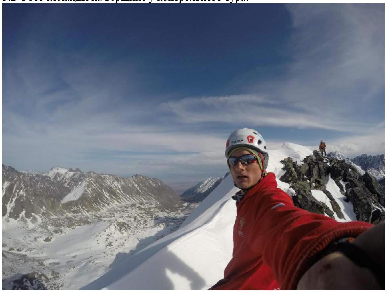
Photo 1. 3.3. Descent from the summit: along the eastern ridge, the ridge is a "knife-edge" about 50 m to the first notch in the ridge, followed by a 30 m rappel. Then, veering towards the lake, descend along the edge of the snow ledges with careful alternate belay and a 30 m rappel in the middle, to a couloir leading to the lake.
Attention!!! The underlying layer of snow ledges is grass and rocky slabs; a large amount of snow on them creates a high avalanche danger. Therefore, we recommend that subsequent climbers carefully study and examine all descent options. In case of high avalanche danger, a descent option is possible: — to the West, rappelling onto the Belorussia pass.
The route we chose passes through the center of the South Face and represents a series of crevices, corners, and "ram's foreheads." The route is logical, clearly tied to the relief, and in the upper part passes through a giant internal corner visible to the naked eye from almost any observation point of the wall. The rocks on the route are monolithic, partially destroyed, with a sufficient number of crevices and cracks for belay organization. A disadvantage is the presence of a large amount of grass on the wall, due to its southern exposure and lighting conditions over a prolonged period. We assessed this route as a strong category 5A — one of the strongest 5A routes in the Eastern Sayan, stronger than the 5A routes on v. Bronenosets, in the SOAN, and in Opasnaya. The route is climbed free, except for 2 m along a wet crevice. The line remained clean after passage.
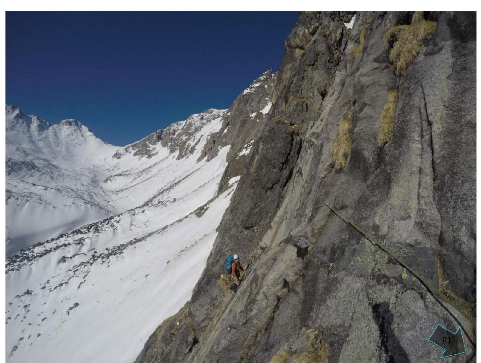
Photo 2. Section R0–R1
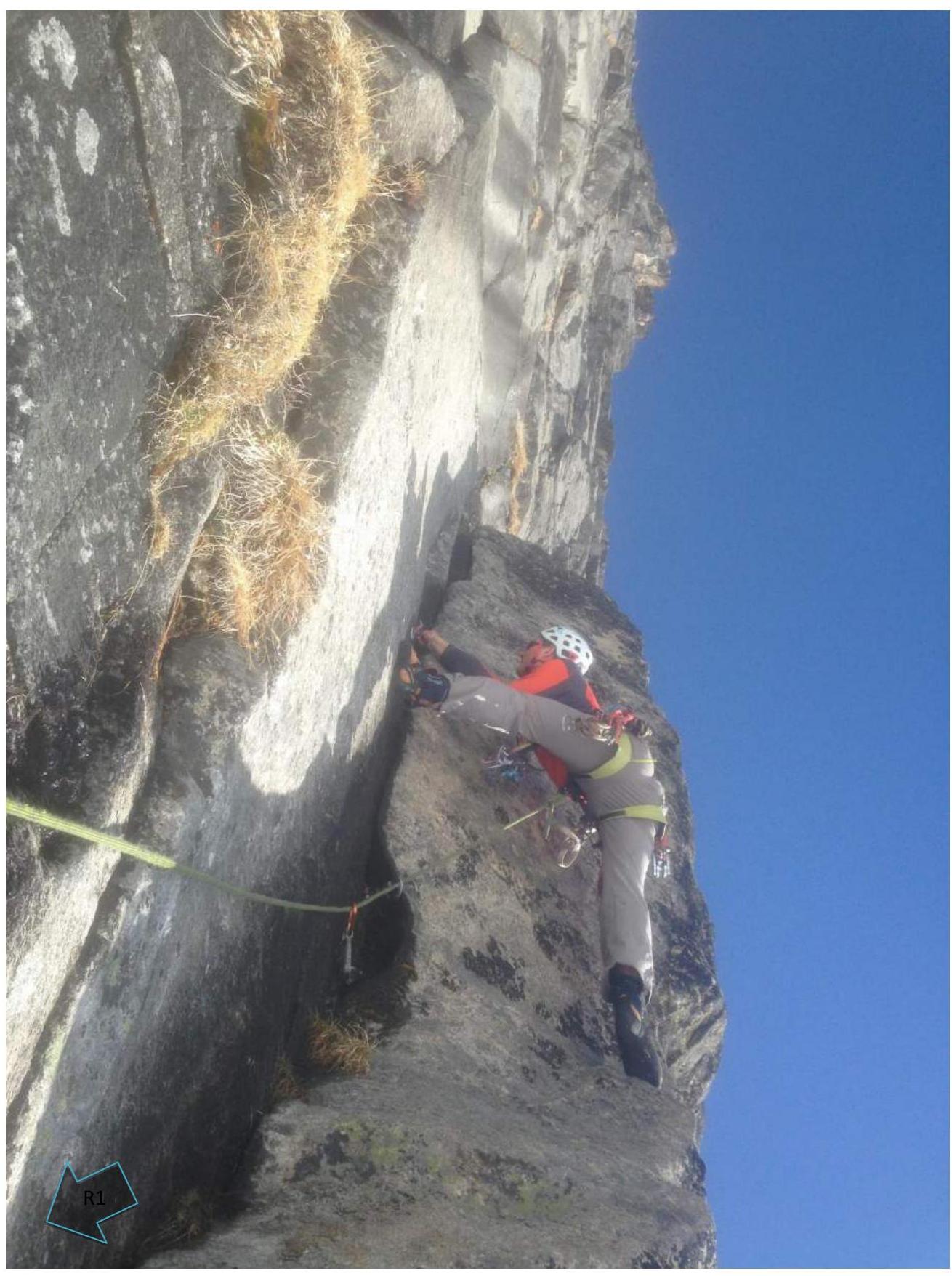
Photo 3. Beginning of section R1–R2
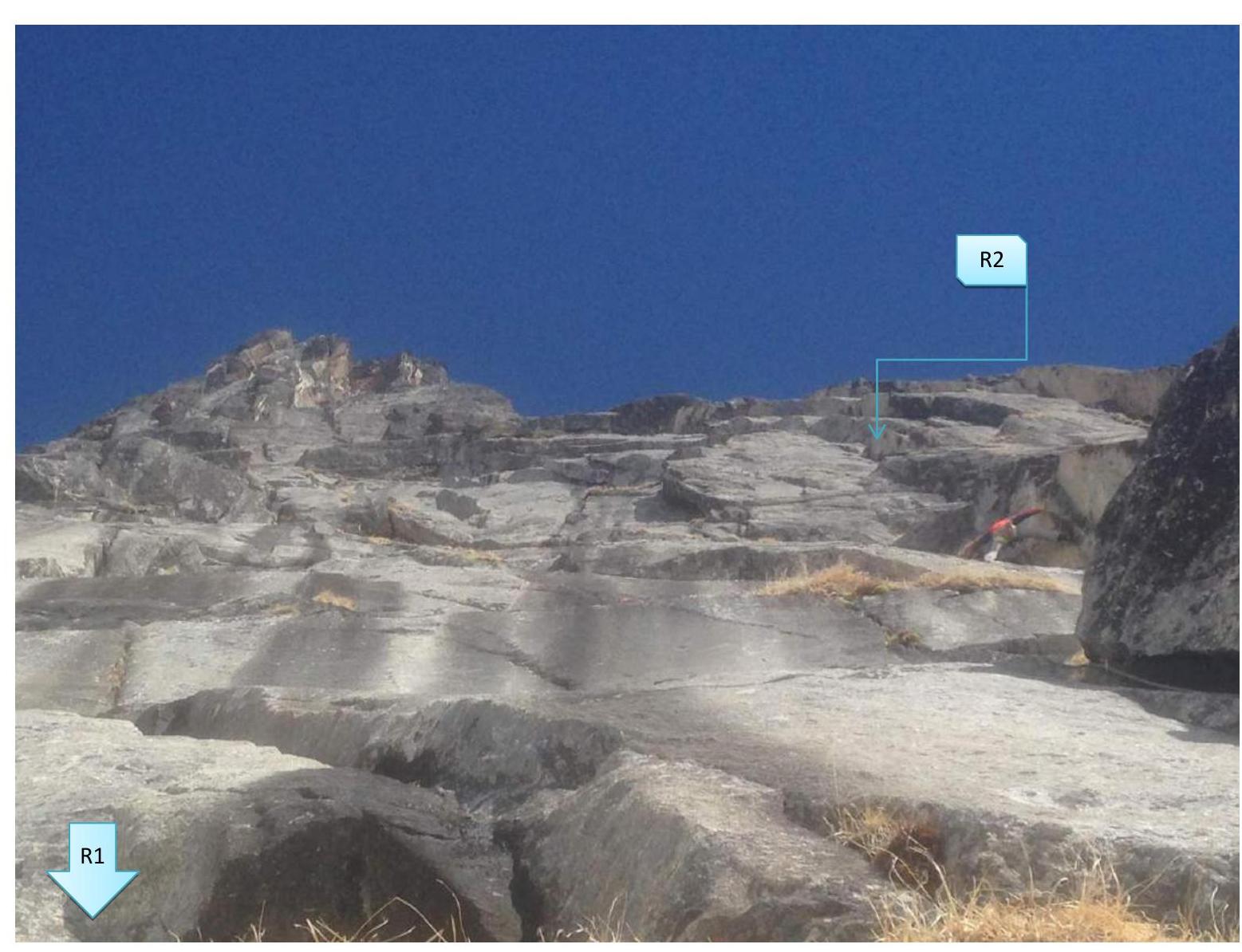
Photo 4. End of section R1–R2
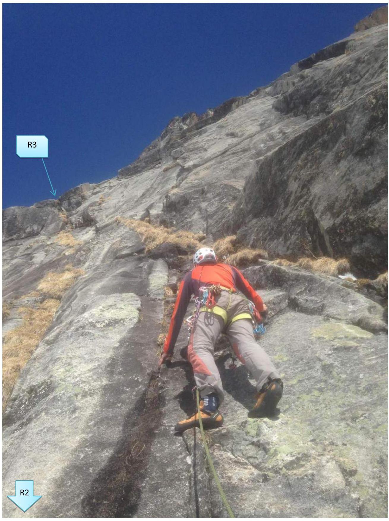
Photo 5. Beginning of section R2–R3
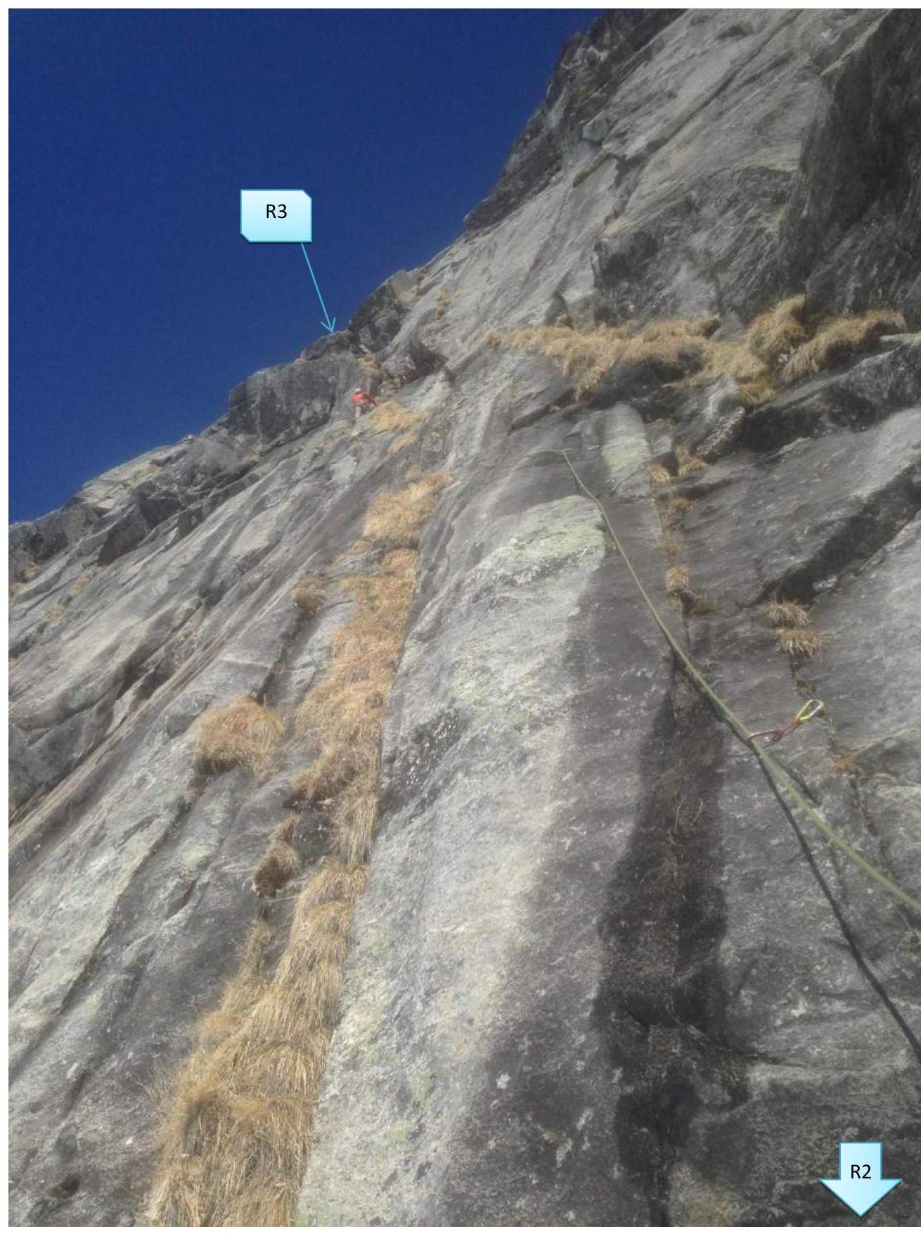
Photo 6. Middle of section R2–R3 — exit to the cornice belt
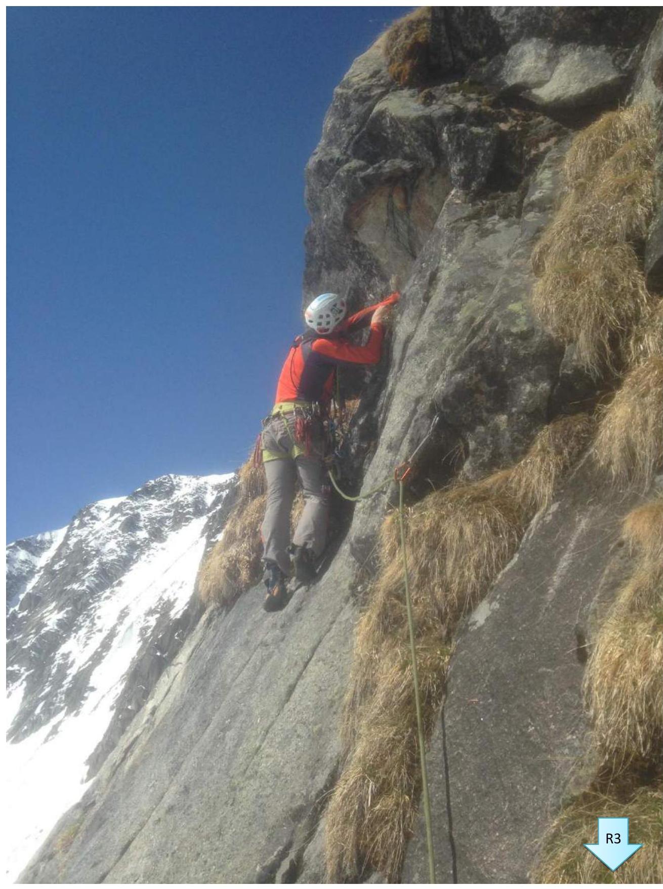
Photo 7. Beginning of section R3–R4

Photo 8. Beginning of section R4–R5
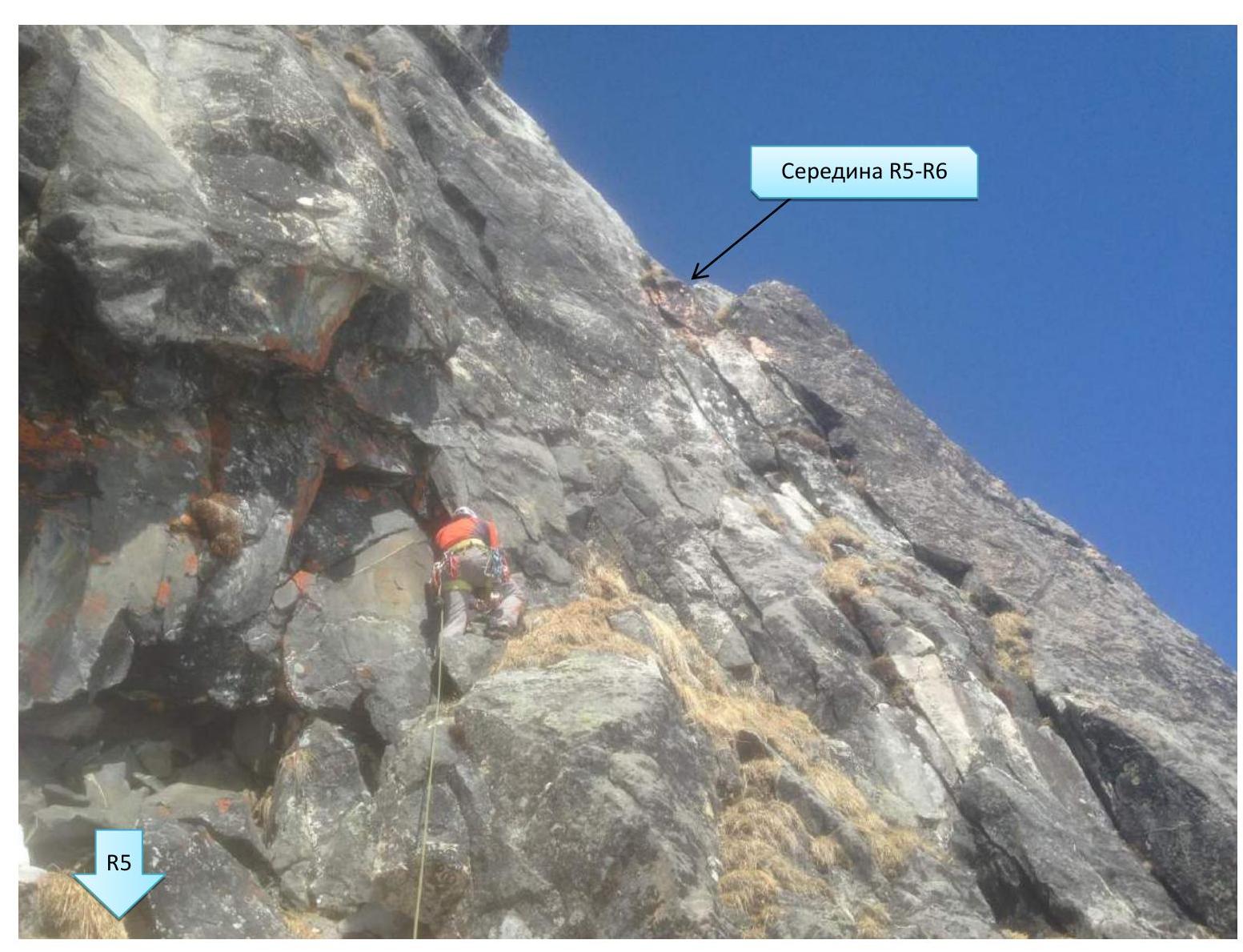
Photo 9. Beginning of section R5–R6
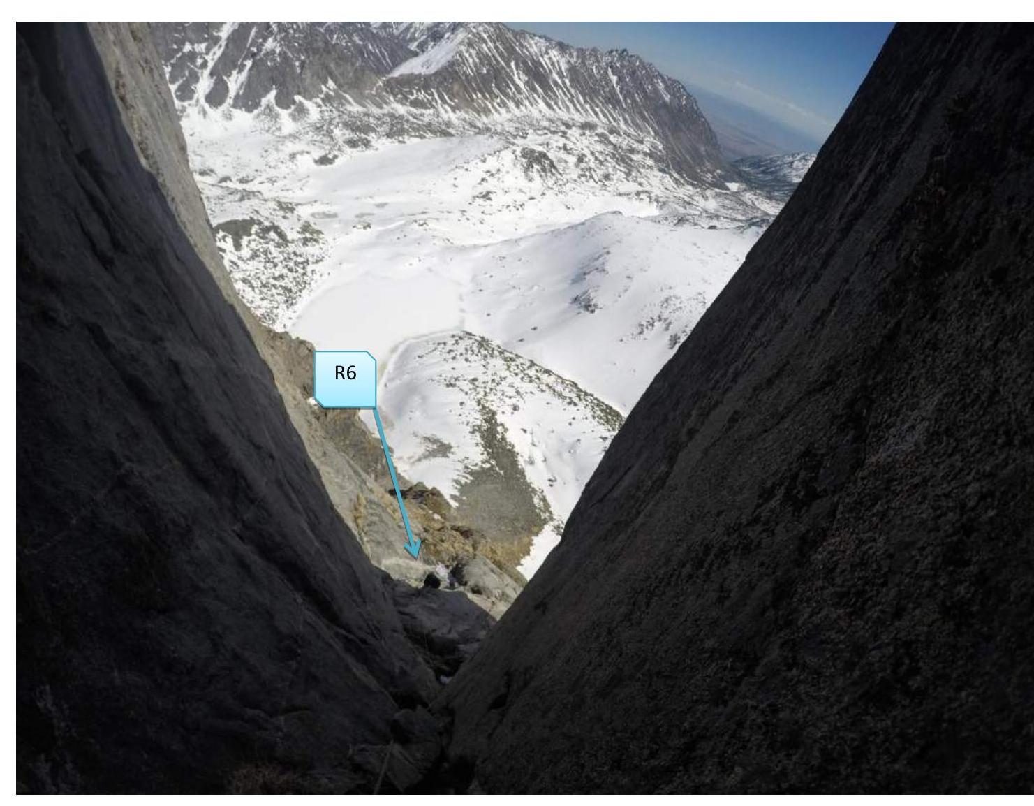
Photo 10. View of station R6 and beginning of section R6–R7
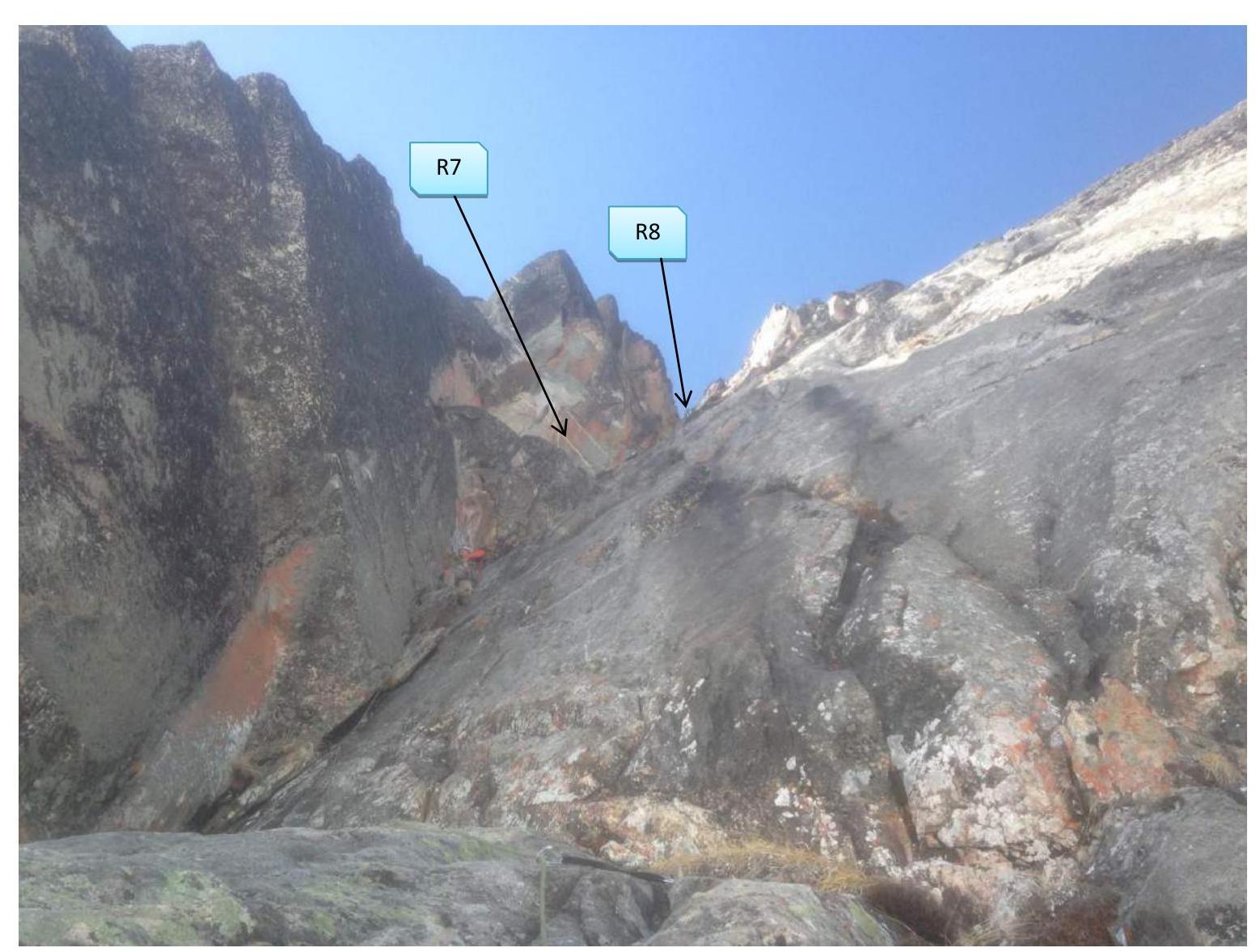
Photo 11. View of the beginning of section R6–R7 from station R6.
Comments
Sign in to leave a comment