6.1 Eastern Sayan
Charskiye зори, 2920 m 3Аz from North by 3 ridge Zhigalov А.V. October 23, 2012
Ascent Passport
- Ascent class — combined
- Region — Eastern Sayan, Baruun-Khandagai
- Peak Charskiye зори, 2920 m from North by 3 ridge
- Supposed — first ascent
- Route characteristics:
- height difference — 680 m.
- total length 1900 m.
- length of sections 4 cat. diff. — 200 m, 3 cat. diff. — 800 m, 2 cat. diff. — 500 m.
- average steepness: total route — 48°.
6. On the route used:
- stoppers — 9,
- pitons — 0,
- including on ITO — 0,
- left — 0.
- Number of climbing hours — 10 ч
8. Team composition:
- Team leader: Zhigalov Alexander Vladimirovich — 1st sports category
- Team member: Katanaev Stanislav Yurievich — 1st sports category
9. Team coach:
- Obednin Konstantin Alexandrovich
10. Departure date:
- On the route August 23, 2012, 7:00
- Summit 13:45
- Return 17:00
-
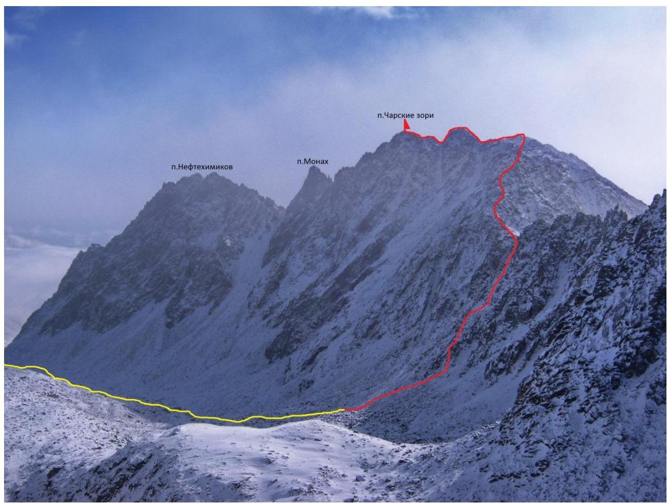
Organized by: Krasnoyarsk City Alpinism Federation, within the framework of Barun-Khandagai 2012 training camp. General photo of the route
UIAA Scheme
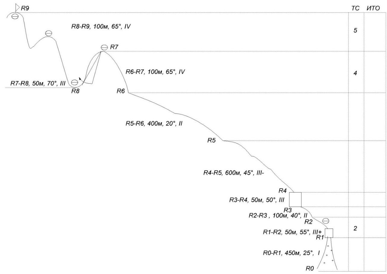
Scheme 1. UIAA Scheme
Route description by sections:
- R0–R1: ascent along a snowy scree slope.
- To the right of the wall onto the ridge.
- Simultaneous movement.
R1–R2. The wall on the ridge is climbed with alternate belay.
Further up the ridge — simultaneous movement.
R2–R3. Along a simple ridge, we move left into a couloir.
R3–R4. A wall of large boulders, exit to a saddle in the lowest part of the ridge. On the saddle, a cairn is built.
R4–R5. Long ridge with climbing on boulders. Alternate belay.
R5–R6. Simple ridge, simultaneous movement.
R6–R7. Ridge, climbing on large boulders forming walls and inside corners. Alternate belay. Exit to a gendarme.
R7–R8. Descent from the gendarme by rappel. R8–R9. Ridge with boulders. Climbing on small inside corners and walls. Alternate belay. Many loose rocks. Exit to the summit. A cairn is built under the summit boulder from the west side towards p. Dobraya.


Passage of section
R0–R1.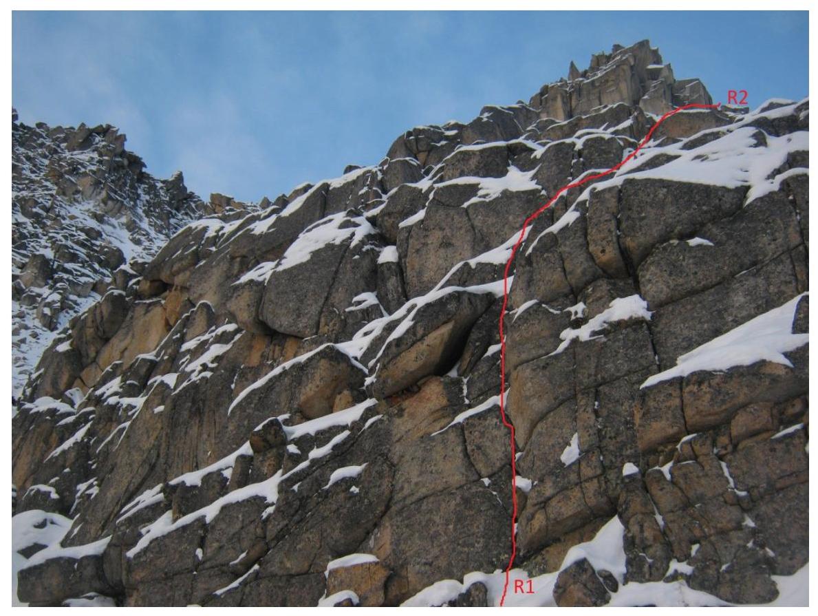 Wall on the ridge
R1–R2.
Wall on the ridge
R1–R2.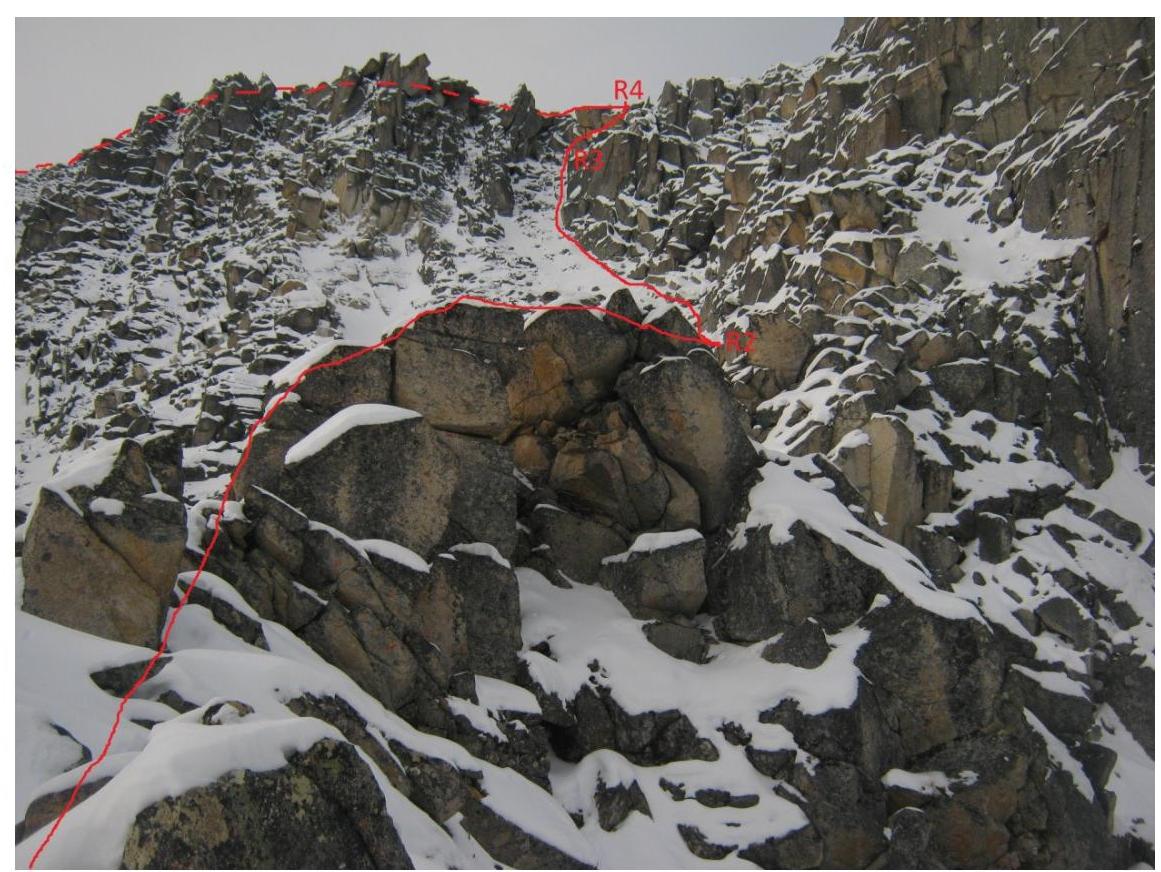
Sections R2–R3–R4,
saddle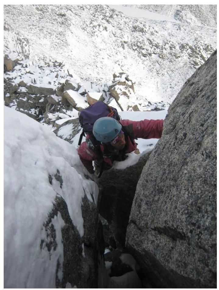
Passage of ridge section
R4–R5.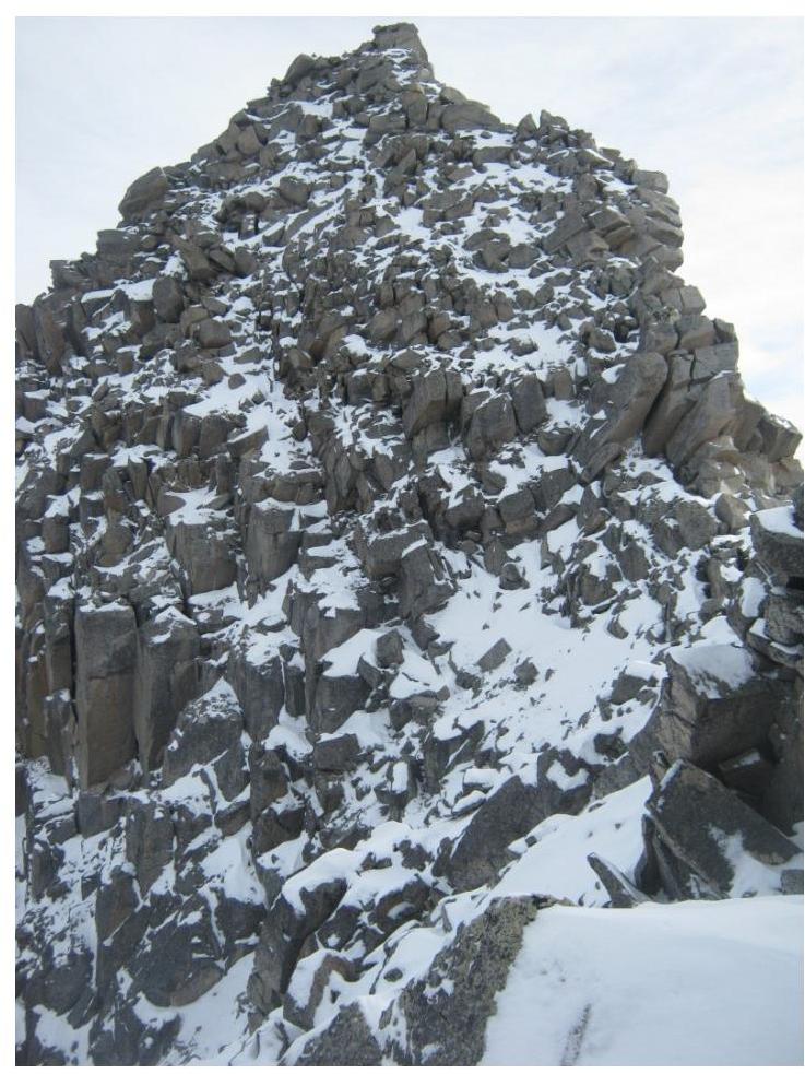
Sections R6–R7
Gendarme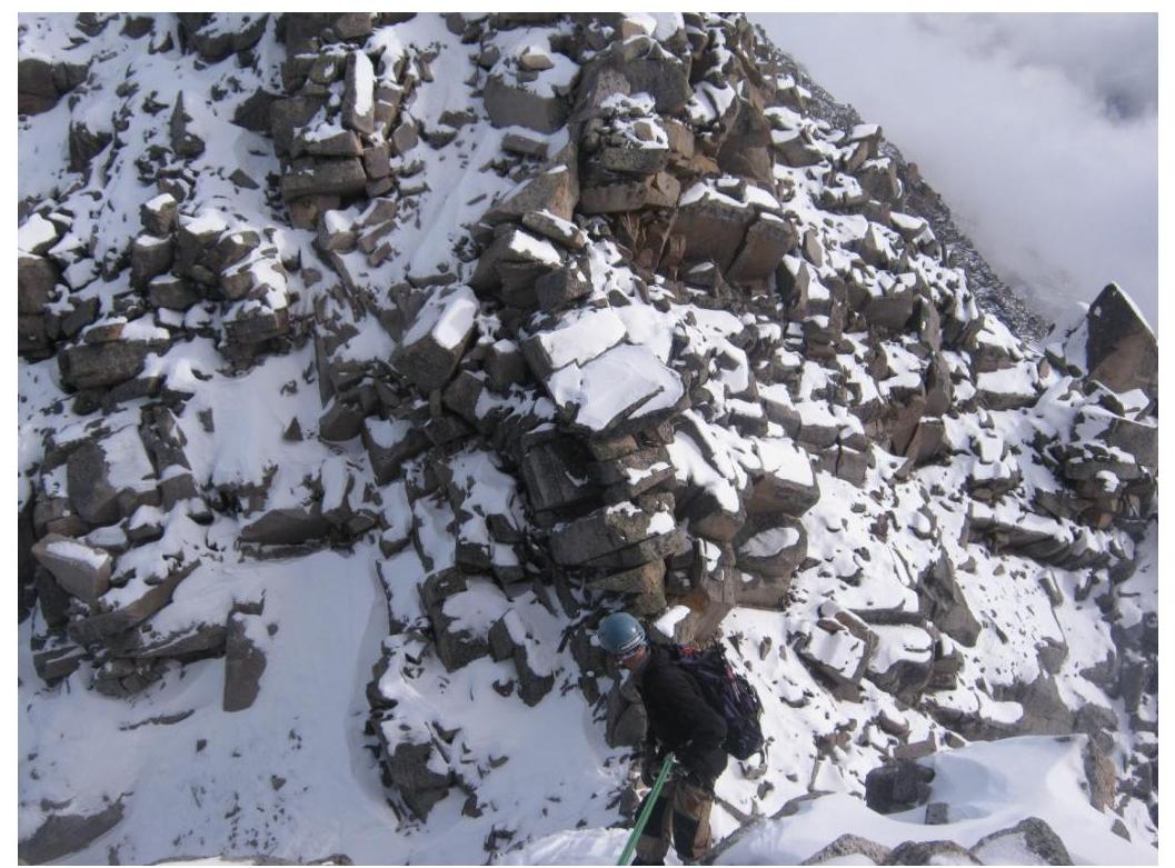
Descent on section R7–R8, in the background ridge section
R8–R9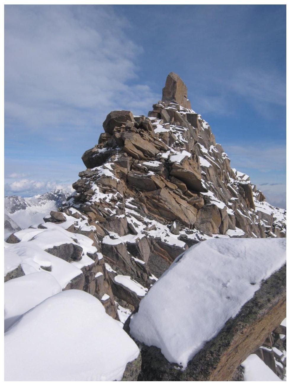
Section R8–R9 and summit p. Charskiye зори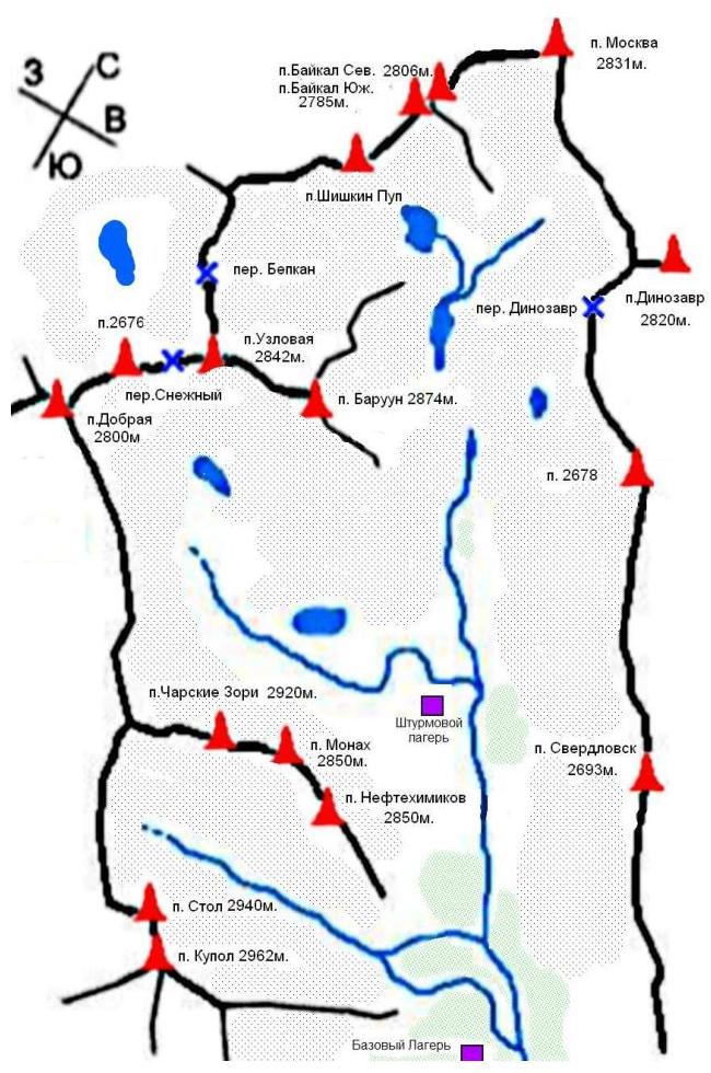
Map-scheme of the region
Approaches.
From the hut on the lake, we ascend to the old moraine cushion, bypassing peaks Neftehimik, Monah, and Ch. Zori to the right. At the end of the old moraine, before the turn to the upper lake, a wide scree slope opens up. The beginning of the movement is along the right part of the slope. The slope gradually narrows and turns into a couloir. Having reached the rock step, you need to turn right and climb onto the ridge. This is the start of the route.
The approach from the hut on the lake takes 50 minutes, from the camp on the edge of the forest — 1 hour 30 minutes–2 hours.
Logic and beauty of the route: The route is easily readable and logical. The line of movement is limited by the walls of the couloirs at the beginning and the ridge above. The route goes up along a logical path to the summit. This allows us to recommend the route not only to experienced athletes but also to groups starting to climb routes of 3 cat. diff. The route's location on the main ridge allows athletes to pass it in conditions of poor visibility.
Recommendations for groups: The route passes along a fairly long ridge. Descent from the route towards the hut is quite difficult. And the main descent follows the route of 3А cat. diff. As a result, climbers need to competently calculate their strength and daylight hours.
On the route, it is necessary to have a large supply of climbing ropes. Emergency descent is best carried out along the ascent path or towards p. Kupol.
Baruun-Khandagai (Barun-Khandagai, Burun-Khandagai) — a river and a valley of the same name on the southern side of the Tunka Goltsy ridge (Eastern Sayan). A popular place among climbers and rock climbers.
The peaks of the valley have:
- classified climbing routes from 1B to 6A inclusive;
- prepared rock climbing multipitches.
The word "baruun" or "barun" in Buryat means "western". The word "khandagai" — elk, i.e., a place where elks are found.
Tunka Goltsy (Buryat: Түнхэнэй һарьдагууд) (Tunka Alps) — a mountain range on the territory of Okinsky and Tunkinsky districts of Buryatia, is the easternmost spur of the Eastern Sayan. Composed of crystalline schists and granites.
A dissected mid-mountain relief prevails. In the near-summit part, an alpine-type relief is observed.
Heights of the ridge:
- Peaks reach 3000–3300 m
- Highest point — Peak Strelnikov (3284 m)
- Height difference between ridges reaches 2000 m.
Slopes are covered with light coniferous taiga. Above 2000 m — mountain tundra.
In connection with the 250th anniversary of the birth of G. I. Shelikhov, by the decision of the Geodesy Committee of Russia, one of the mountain peaks (2811 m) of the Tunka Goltsy officially received the name Peak Shelikhov, and in July 1997, a memorial sign was installed on the peak.
To the southeast of the foot of the ridge is the balneological resort Arshan.
Peaks of the valley:
- Baikal
- Severny Baikal
- Yuzhny Barun
- Dinosaur
- Dobraja
- Kupol
- Monah
Moskva Neftehimikov Sverdlovsk Stol Uzlovaya Charske Zori Shishkin Pup 2678
To the nearest settlement — Arshan village — you can get by any car on asphalt or by bus from Irkutsk city (250 km). To the entrance to the valley, you can drive only on a passable vehicle through the village of Tagarhay, which is 5 km from Arshan village. The approach from the entrance to the valley takes 6–7 hours along a trail with a section bypassing the pinches.