Irkutsk Regional Public Organization "Club of Active Recreation and Alpinism"
Gory
Baikal
Report on the First Ascent
To the peak Charskie Zori 2920 m via the western ridge. Approximately 2B category of difficulty.
Irkutsk, 2016. Passport of the Ascent
-
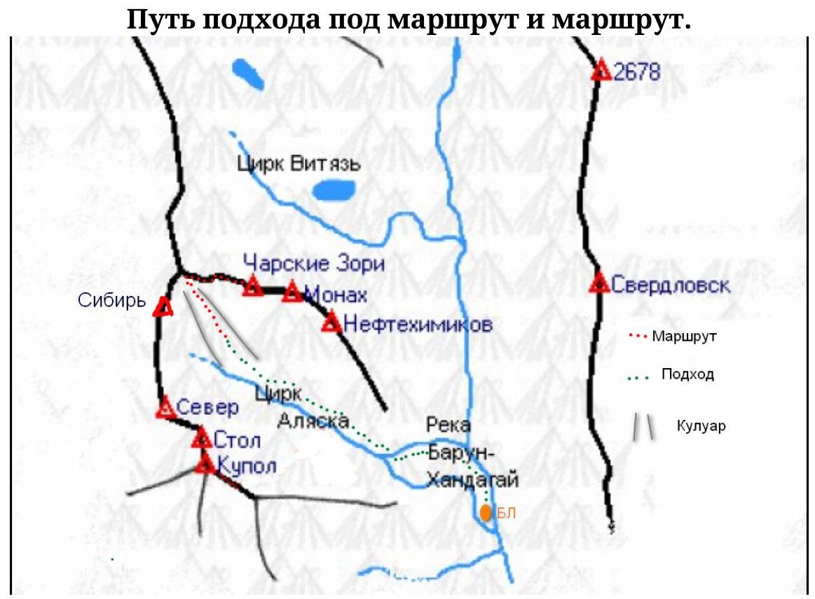
(Eastern) Sayan, Tunkin Goltsy, Barun-Khandagai river gorge. Section number according to the classification table (6.1.2).
-
Charskie Zori 2920 m via the western ridge.
-
Category of difficulty: proposed 2B, first ascent
-
Character of the route: Rocky.
-
Elevation gain of the route: 440 m
Route length: 710 m
Average steepness:
- Total route — 52°
- Number of "hooks" left on the route: total 0
Used on the route: chocks 0/0
- Team's walking hours: 5 h 15 min, No overnight stays
- Leader: Glazunov Evgeny Vladimirovich (Master of Sports)
Participants:
- Smirnova Marina, 3rd sports category
- Gainutdinov Artur, 3rd sports category
- Neverova Nina Mikhailovna, 3rd sports category
- Coach: Glazunov Evgeny Vladimirovich (Master of Sports)
- Departure to the route: 6:00, August 31, 2016. To the summit — 11:15, August 31, 2016. Return to the base camp — 15:20, August 31, 2016.
- Irkutsk Regional Public Organization "Club of Active Recreation and Alpinism" Gory Baikal
Overview of the ascent area, sports characteristics, and tactical actions of the team
General information about the area
Barun-Khandagai — a river and a gorge of the same name on the southern side of the Tunkin Goltsy ridge (Eastern Sayan). The ridge is composed of crystalline schists and granites. A dissected mid-mountain relief prevails. Alpine-type relief is observed in the near-ridge part. The peaks of the ridge reach 3000–3300 m, the highest point being Peak Strelnikova (3284 m), the height difference between the ridges reaches 2000 m.
The Barun-Khandagai gorge is interesting for alpinists and rock climbers. Rock climbing multipitches (6b+–7a) have been prepared.
Classified alpine routes have been laid out on the peaks of the gorge:
- 1B
- 2A
- 3A
- 4A
- 5A
- 6B
There is an opportunity to make first ascents.
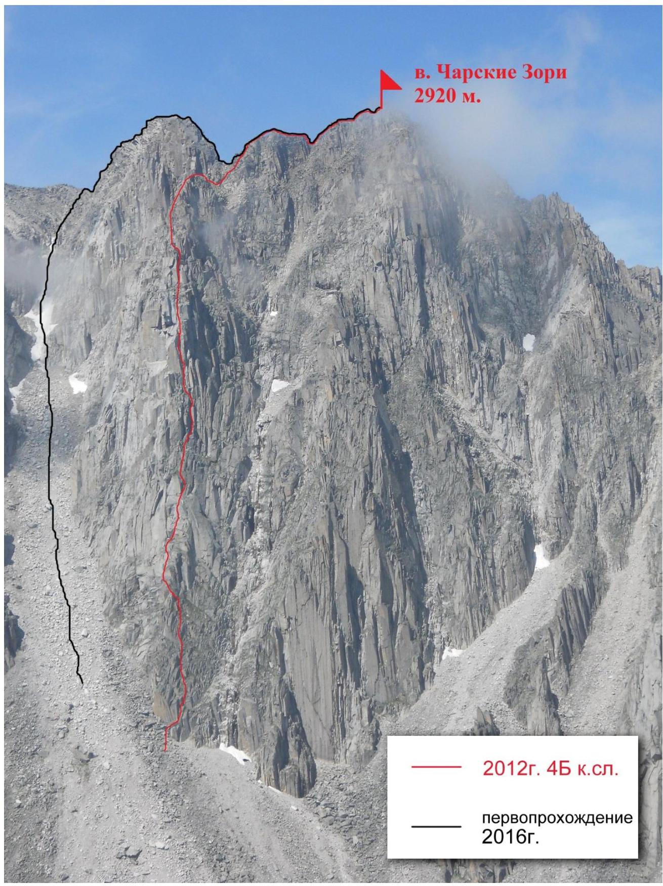
The peak Charskie Zori is located between the peaks Monakh from the East and peak Sibir from the Southwest. By now, two routes have been laid out on it:
- one classified route of 4B category of difficulty, which was climbed for the third time this season;
- a first ascent (proposed) of 2B category of difficulty (described in this report).
This route starts in a couloir that leads to a saddle between peak Sibir and peak Charskie Zori. In terms of technical difficulties, elevation gain, and length, it corresponds to similar routes of 2B category of difficulty.
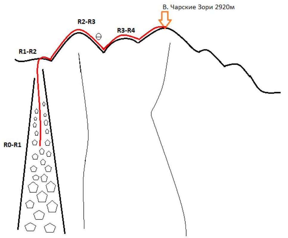
General view of peak Charskie Zori with the routes marked.
UIAA Scheme
Description of the route by sections
Approach to the start of the route from the Kupola (Alaska) cirque. Need to reach the end of the cirque.
Climb a long couloir (very wide at the bottom, then narrows), leading to a saddle between peak Sibir (to the left of the couloir) and peak Charskie Zori (to the right of the couloir).
R0–R1 Couloir, with large, compacted scree at the bottom, and monolithic rocks in the middle and small, loose scree on the sides in the upper part. From the middle of the couloir, alternating movement in teams of two. 160 m, 40° I
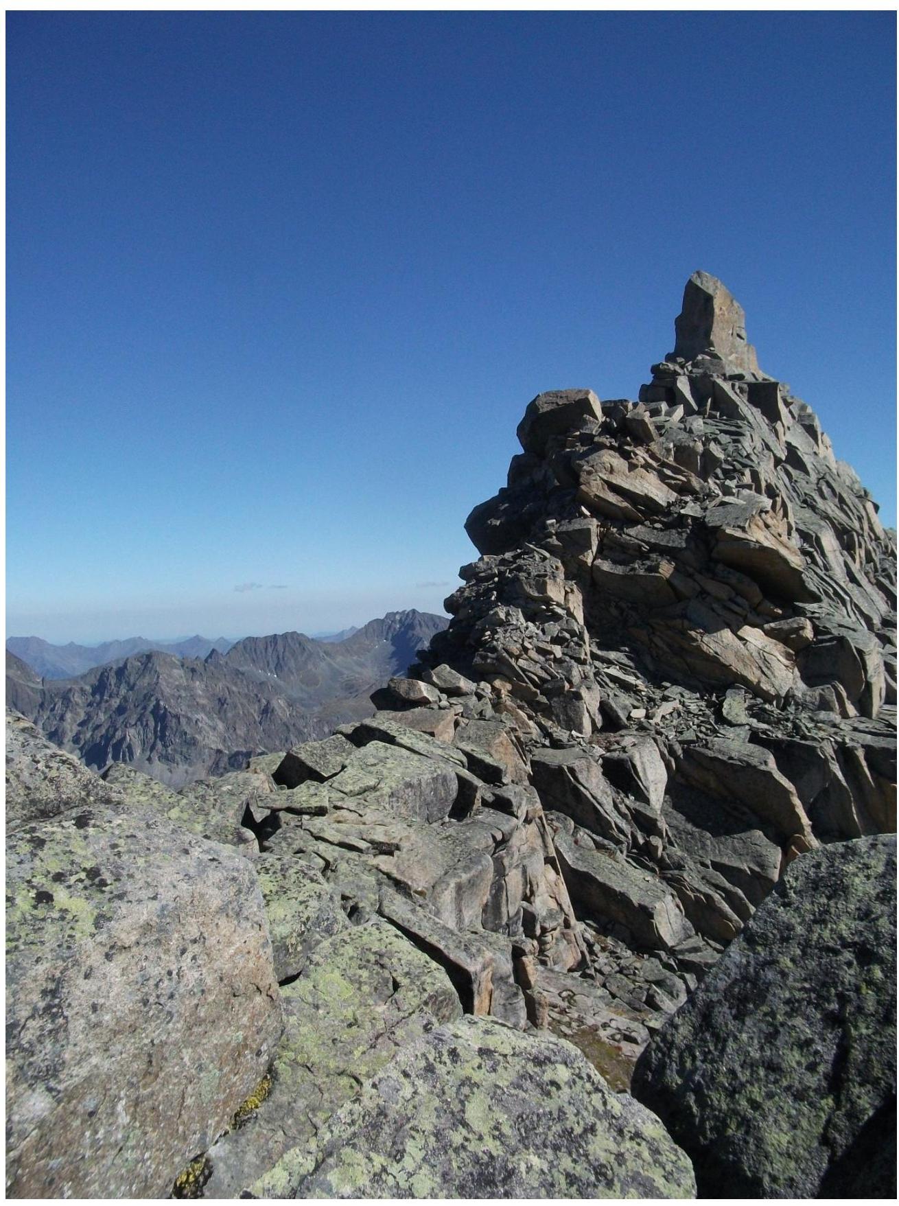
1–2. Exit to the saddle and movement along the ridge to the east, directly to the summit of a gendarme. 150 m, 60° III. 2–3. Descent from the gendarme, with a rappel (15 m) at the end — descent to a saddle. 100 m, 55° III. 3–4. Ascent to a sub-summit. 120 m, 50° II–III.
4–5. Descent along the ridge to a saddle between the sub-summit and the summit. Ascent to the summit of Charskie Zori. 180 m, 45–50° II–III
Descent via the ascent route.
Photos taken in the Kupola cirque, and the couloir to be followed.
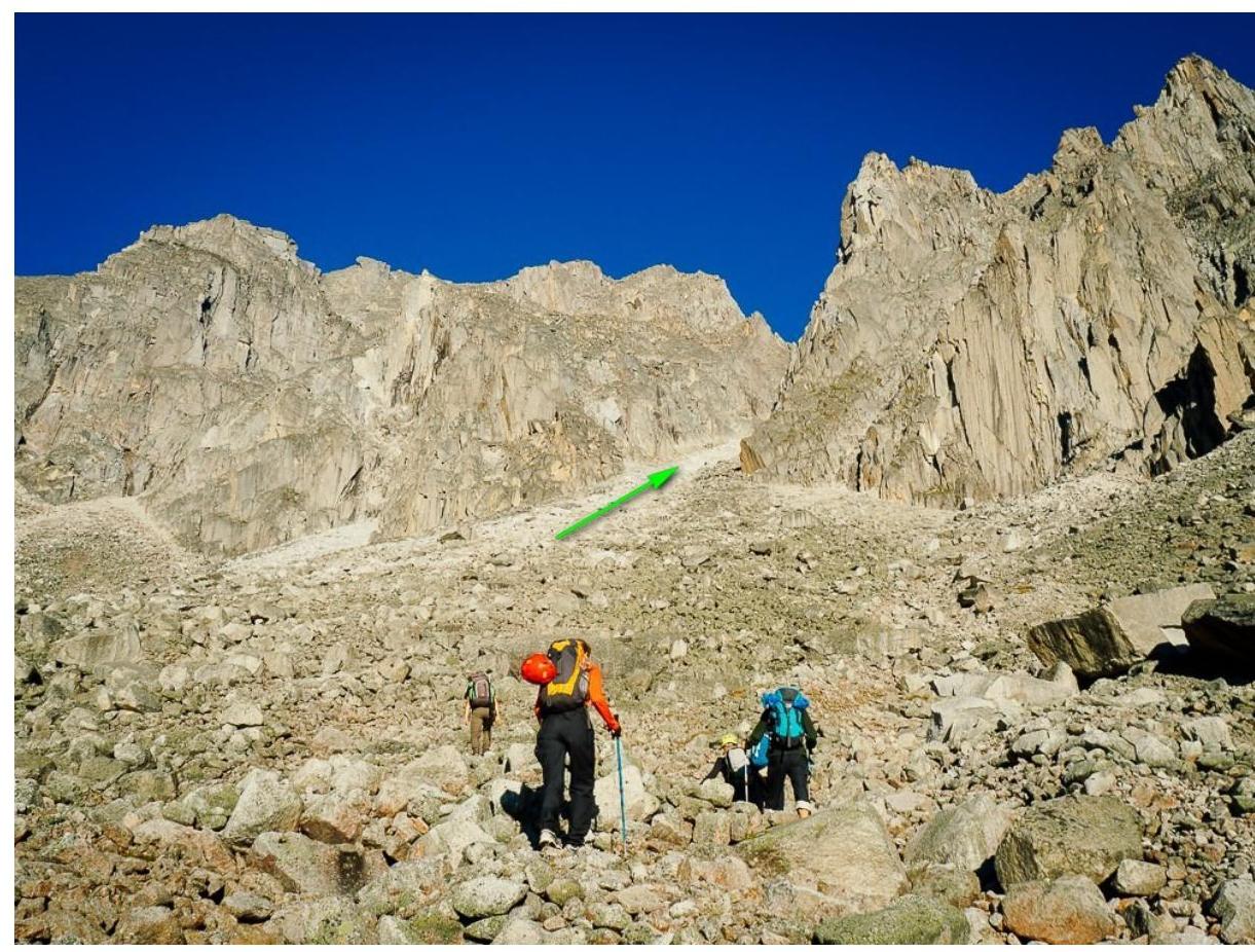
Photo from the route. Start of section R1–R2. Exit to the
saddle. Section
R1–R2, ascent to the
gendarme
Section
R1–R2, ascent to the
gendarme
Second part of section
R1–R2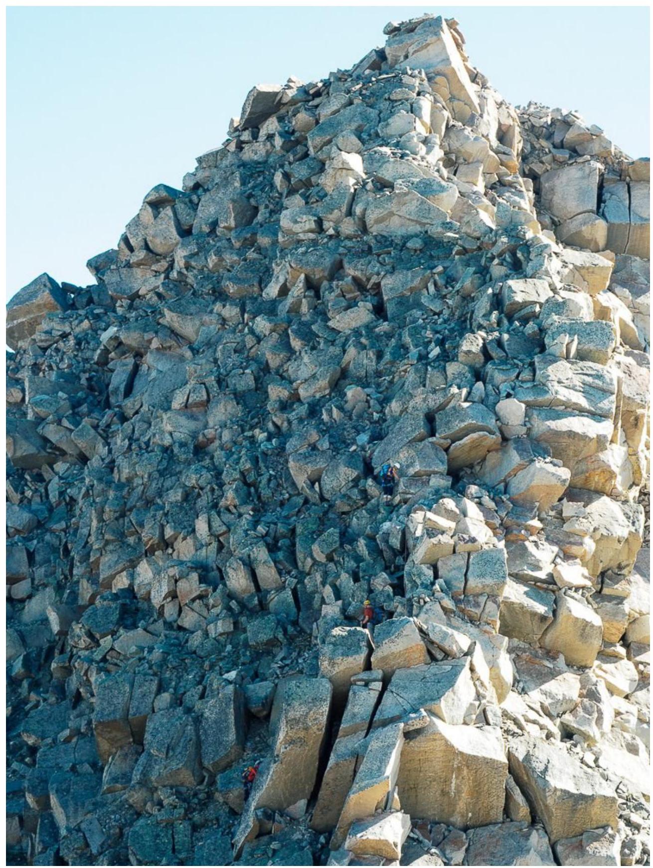
Section R2–R3, rappel on the
descent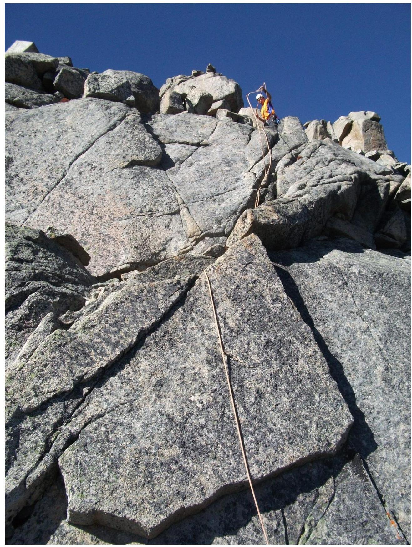 Section
R4–R5, descent from the
sub-summit
Section
R4–R5, descent from the
sub-summit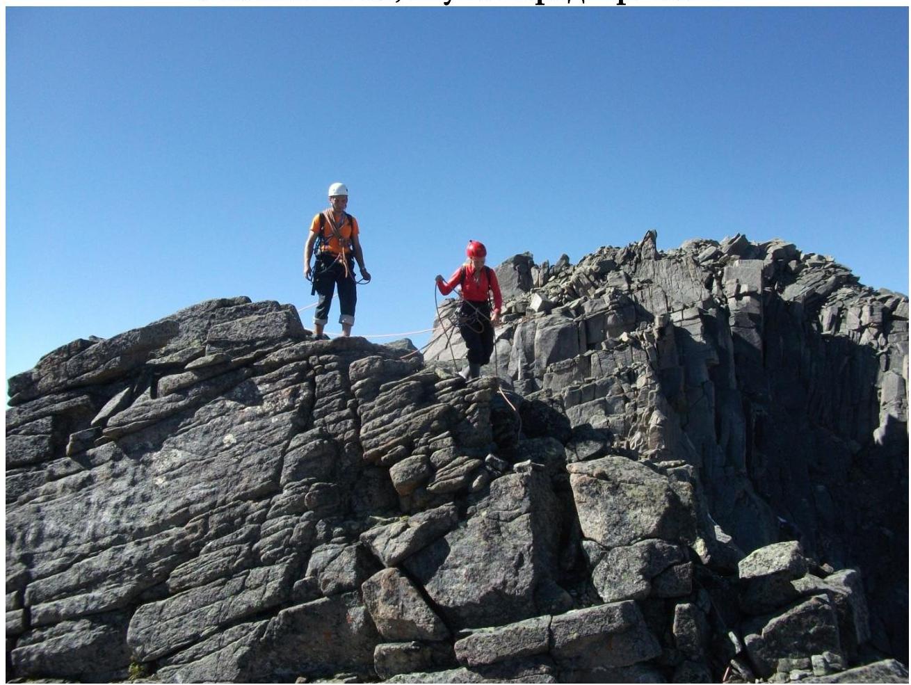 Summit