DESCRIPTION OF THE FIRST ASCENT TO THE SUMMIT "FLIBUSTIER" VIA THE SOUTHEAST RIDGE, CATEGORY 3B DIFFICULTY, 2860
Group Composition
KUZNETSOV YU.A. — 2nd sports category, 4A, 4A, 4B, 4B, 5A, 5A — team leader MUKHORTOV M.V. — 2nd sports category, 9 ascents of 4th category difficulty, 5A — participant KUPRINA N.S. — 2nd sports category, 4A, 4A, 4B, 5A MIKHAILOV A.A. — 2nd sports category, 4A
Irkutsk, 1971
Brief Geographical Characteristics
The summit "Flibustier" is located in the southern lateral spur of the Tunka ridge. Its eastern slope drops into the valley of the Moygota river, and the western slope — into the valley of the Biron river. The described route is laid from the Moygota river gorge. The entrance to the gorge is located 25–30 km from the Arshan resort. A dirt road allows driving to the gorge by truck.
The approach through the gorge to the base camp (1750 m, forest boundary) takes 8–10 hours.
Organized mountaineering development of the peaks in the Moygota river gorge began with the November mountaineering event in 1970 by teams from the "Trud" Sports Society from Irkutsk and Bratsk.
Route Description
Approach. From the camp at the forest boundary:
- Overcome the first steep ascent.
- After it, turn towards a steep slope with rock outcrops, covered in large and medium scree, 500–600 m later.
- Ascend the slope to a hanging valley (2250 m).
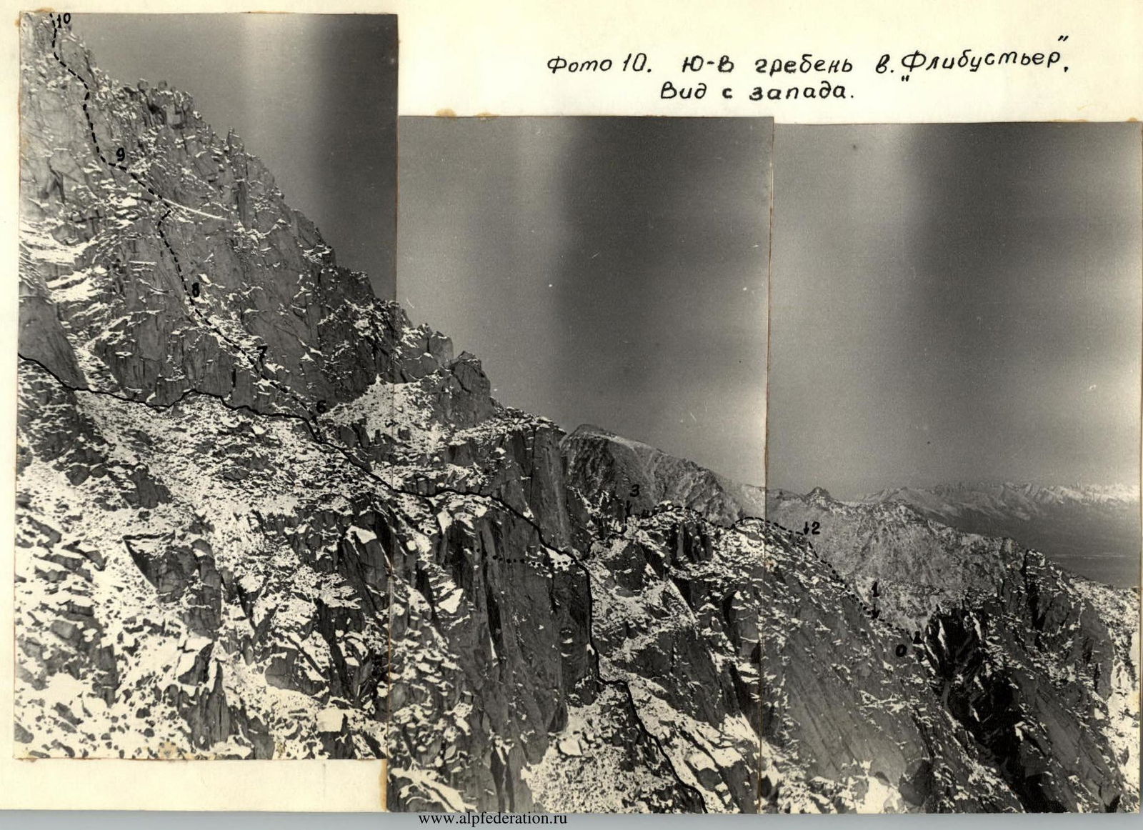
- Cross the valley towards a rectangular window visible in the southeast ridge of "Flibustier" (see photo 11 and the area map).
- Ascend to the window (2430 m).
Route. See the table and its supplements.
Supplements to the Route Characteristics Table
Section 4
After R3, movement along the ridge is impossible due to sheer walls. Artificial handholds and drilled pitons (photos 10 and 3). The section is bypassed via a steep, scree-covered ledge to a wide (12–15 m) couloir, which narrows after 60–80 m and turns into walls.
Notes: The group had an altimeter and reference height marks. Heights are indicated with an accuracy of ± 15–20 m.
Section 5
Movement through the couloir is impossible due to extreme rockfall danger and difficulty exiting the upper part of the couloir; thus, R5 is overcome via the outer corner of the couloir's right edge (photo 5).
Sections 7–10: Ascending to the ridge before R11 is impractical due to numerous overhanging sections on the ridge.
Section 11 (photo 8)
The photo shows a participant; the rope goes right behind the "balduishiny" in the foreground, bypassed on the right.
Section 12 (photo 9)
Traverse along a steep slab with a crack for toeholds.
Explanations for photo 10:
- Part of the route is obscured by a nearby ridge (outlined) in the photo, so R5 and R6 are not visible.
- The end of a steep couloir turning into walls is visible on the left.
- Additionally, the photo does not show the summit part of R12–R15.
Conclusion
The route passes along the southeast ridge and southern slopes, is well heated by the sun, and due to this and the steepness of many sections, is not heavily snow-covered. The rocks are monolithic, predominantly slab-like.
The route was completed by the group in clear, sunny weather; the group believes that under these conditions, the route is category 3B difficulty. In case of snow cover and bad weather, the difficulty of passage will significantly increase.
Table of Main Route Characteristics
- Ascent Route: southeast ridge of summit "Flibustier", category 3B difficulty
- Route Height Difference — 350 m
- Time on Route — 7 hours
- Approach — 2.5 hours
- Descent — 2 hours
- Average Route Steepness — 50°
- Total: 11.5 hours
| № | Average Steepness of Section | Length of Section | Character of Relief | Technical Difficulty | Method of Overcoming and Belaying | Number of Pitons |
|---|---|---|---|---|---|---|
| 1 | 50° | 30 m | Slabs | 3 | Free climbing, belaying via ledges | |
| 2 | 55° | 60 m | Narrow, broken couloir | — | ||
| 3 | — | 100 m | Ridge | 2 | Simultaneous movement | |
| 4 | — | 40 m | Steep ledge | Traverse under a vertical wall | ||
| 5 | 60° | 50 m | Outer corner | 3 | Alternating movement, belaying via ledges | |
| 6 | 35° | 20 m | Scree-covered ledge | Simultaneous movement | ||
| 7 | 60° | 30 m | Slabs | 3 | Alternating movement, belaying via ledges | |
| 8 | 40° | 30 m | — | 2 | — | |
| 9 | 20° | 90 m | — | 4 | Belaying via ledges, pitons | 4 |
| 10 | 60° | 90 m | — | 3 | Belaying via ledges | |
| 11 | 50° | 30 m | Ridge | — | ||
| 12 | 80° | 20 m | Slab with a crack | 4 | Traverse, pitons, ledges | 2 |
| 13 | 60° | 30 m | Slabs | 3 | Alternating movement, belaying via ledges | |
| 14 | 40° | 60 m | Ridge | 2 | Simultaneous movement | |
| 15 | 35° | 100 m | Scree, broken rocks | 1 | — |
 View of the southeast ridge from the saddle, at the start of the route. The initial part of the ridge is in the foreground. The summit is in the background, marked with a flag.
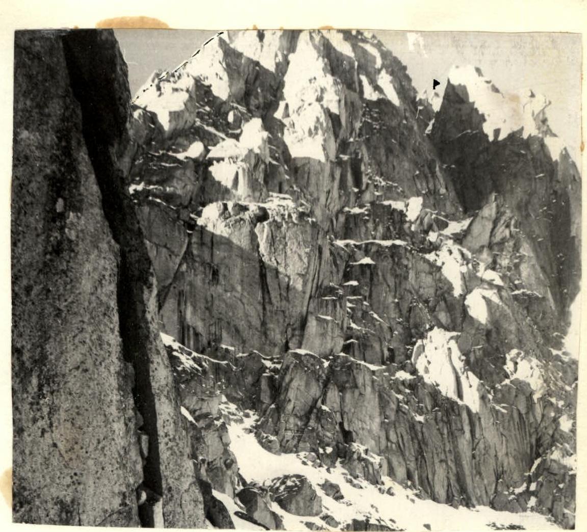 Photo 10. Southeast ridge of summit "Flibustier", view from the west.
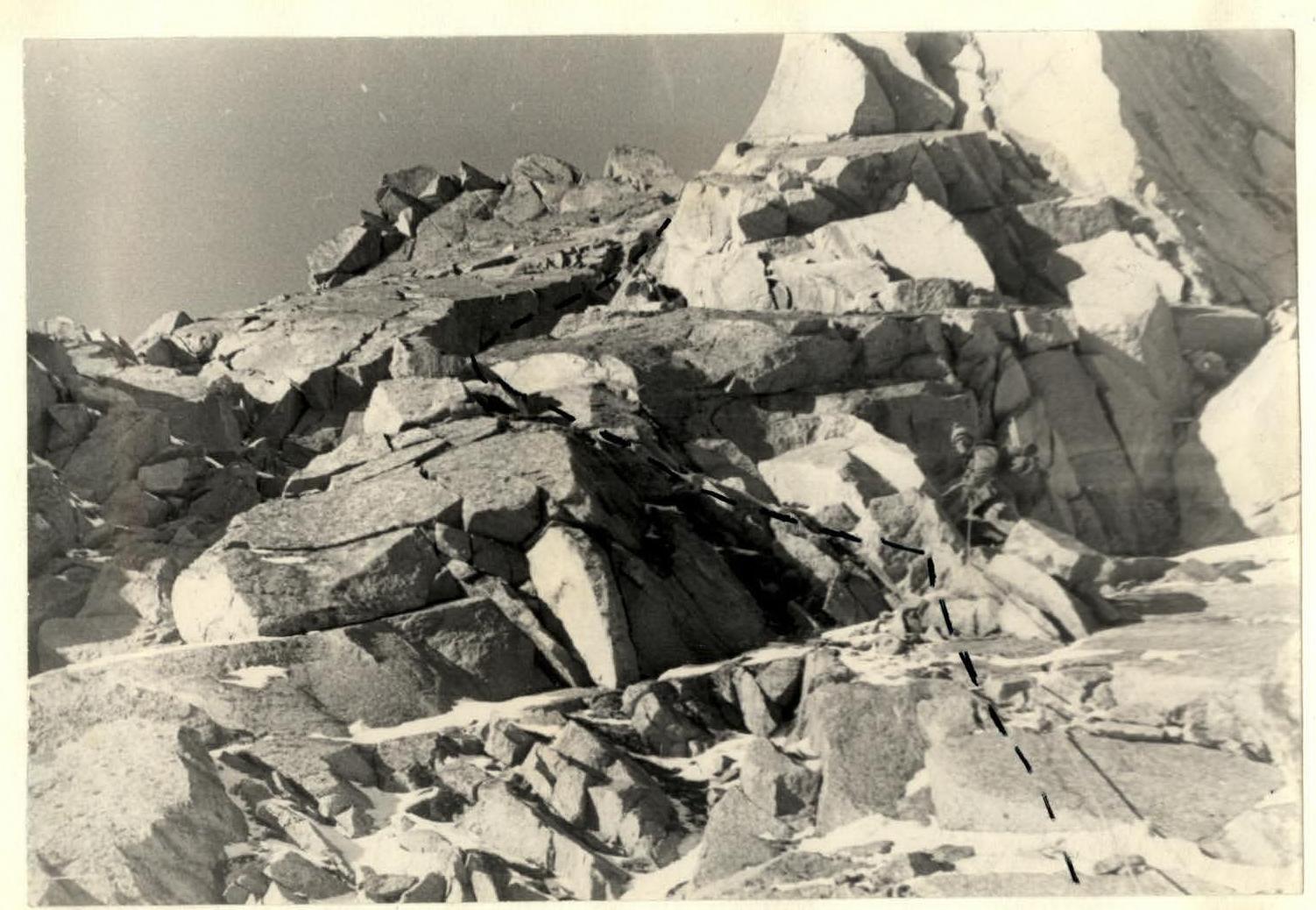 Photo 1. Initial section of the route — the root, the beginning of a narrow couloir going upwards is visible on the left. (Section 1 and start of 2)
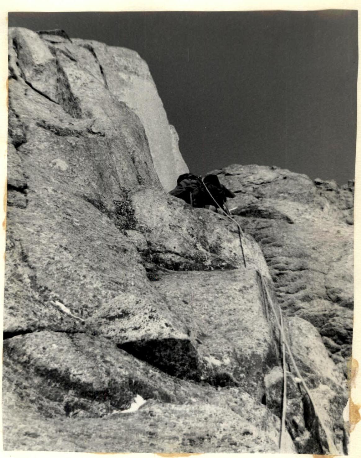
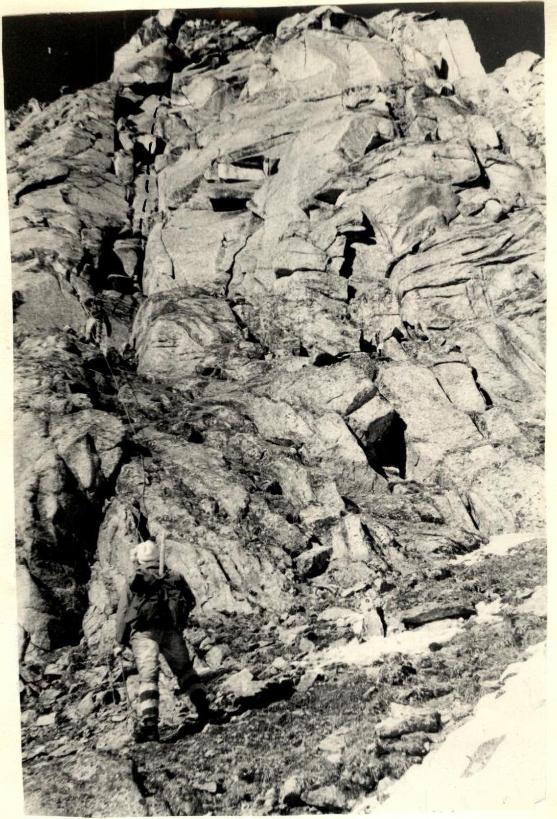 Photo 6. Initial part of the summit tower. Slabs 60–70° (section 8 and start of 9–20)
 Map — scheme of the area. Descent from the summit via the northwest ridge, category 1B difficulty.