Ascent record of v. Trenirovochnaya ZK, 2213 m, via North Ridge, cat. 2A
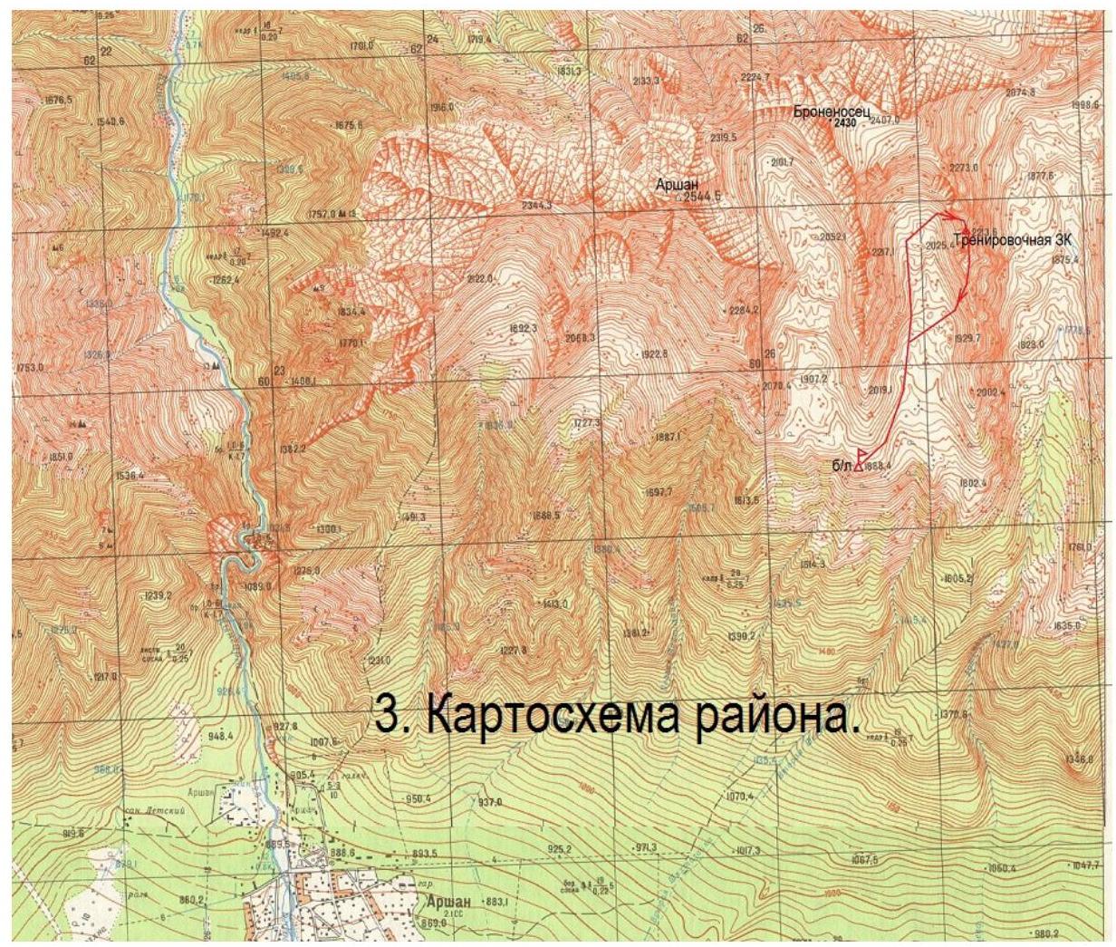
- East Sayan, Tunkinskiye Goltsy ridge, Vtoraya Shikhtolayka valley, section
6.1.2. 2. Trenirovochnaya ZK peak, 2213 m, via North Ridge. 3. Proposed category: 2A, first ascent. 4. Route type: rock. 5. Height difference 100 m, length 117 m, average slope 60°. 6. Pitons hammered: rock and chock stones 17 pcs. 7. Team's walking hours — 5 h. 8. No overnight stays on the route. 9. Team:
Afanasiev A.E. MS Zhambalov Ts.B. badge Karelov P.S. 3rd class Lisov M.A. 3rd class Lipendin I.A. badge Makarov R.V. 3rd class Shvetsov I.V. 3rd class
- Coach Afanasiev A.E. MS
- Ascent to the summit and descent on August 24, 2015.
Route description to v. Trenirovochnaya ZK, 2213 m, via North Ridge, cat. 2A
From the base camp at the forest boundary between Dozhdevoye and 2nd Shikhtolayka valleys to the saddle from the north of the mountain (Zachyotny pass) — 1.5 hours walk.
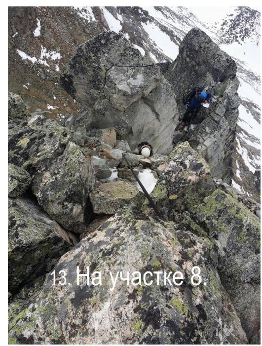
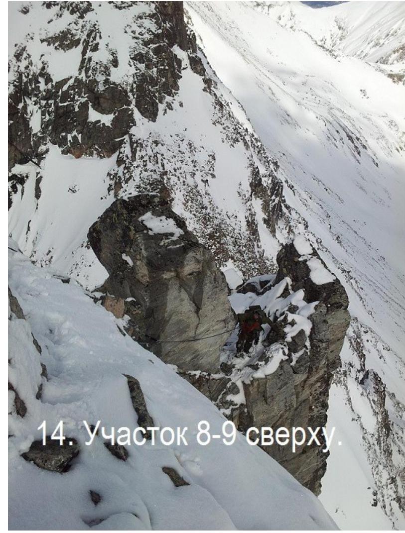
Here, at an altitude of 2100 m, the route begins. Section 0–R1 10 m, 55°, III- category. Start of the route is to the right of the ridge. Intermediate protection points — behind ledges. Section R1–R2 7 m, 80°, IV+ category. Inner corner. Loose rocks. Transition left to a ledge. 2 pitons. Section R2–R3 10 m, 75°, IV- category. Inner corner. Transition right to a ledge. 2 pitons. Section R3–R4 15 m, 70°, IV- category. Wide inner corner to the right. Station. Section R4–R5 15 m, 80°, IV+ category. Along the right narrow inner corner. 4 pitons. Section R5–R6 17 m, 55°, II+ category. Destroyed rocks like shelves to the right, leftward. Transition to the left side of the crest. 2 pitons. Station. Section R6–R7 15 m, 55°, II+ category. Along the ridge: destroyed inner corner with a gap. Exit to a ledge to the right of the ridge. 3 pitons. Section R7–R8 15 m, 50°, II- category. Rock slab. Exit to the right to a sharp saddle. 2 pitons. Section R8–R9 13 m, 55°, III+ category. Left of a 10-meter bulging ledge above the Eastern abyss. 2 pitons. Exit to the summit of Trenirovochnaya ZK. No human presence signs found on the summit. A cairn is built. Summit height according to GPS — 2197 m, according to altimeter — 2210 m, according to map — 2213 m.
Descent from the summit first southward along the wide South Ridge and then along the West slope into Vtoraya Shikhtolayka valley and from there to the base camp.
The route is suitable for training complex group work on a saturated rock route: organization and execution of insurance, rope work in a group, peril belaying and interaction on perils, command training, etc.
The entire route is logically divided into 3 rope lengths from ledge to ledge, with a change of leader on each segment. Recommended for training groups.
Also, in the area, a pass trek was worked out through:
- Uchebny pass
- Zachyotny pass
for military personnel of the 1st level of mountain training.
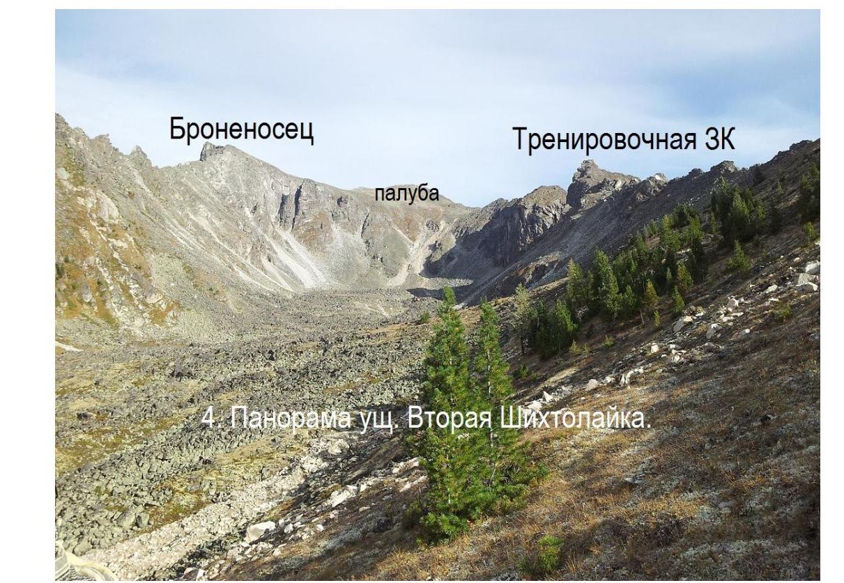
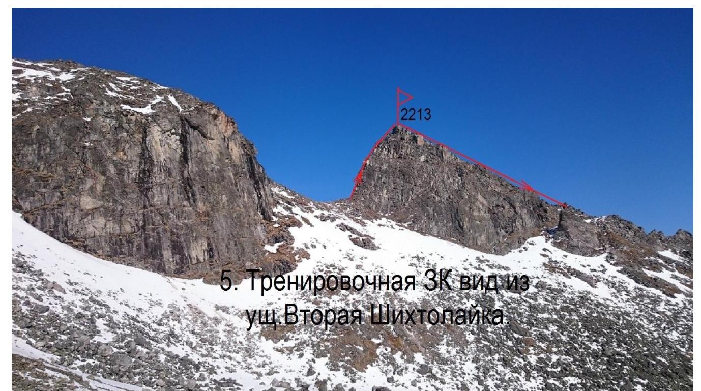
- Trenirovochnaya ZK, view from Vtoraya
Shikhtolayka valley

- Trenirovochnaya ZK
34: east view.
Energetik.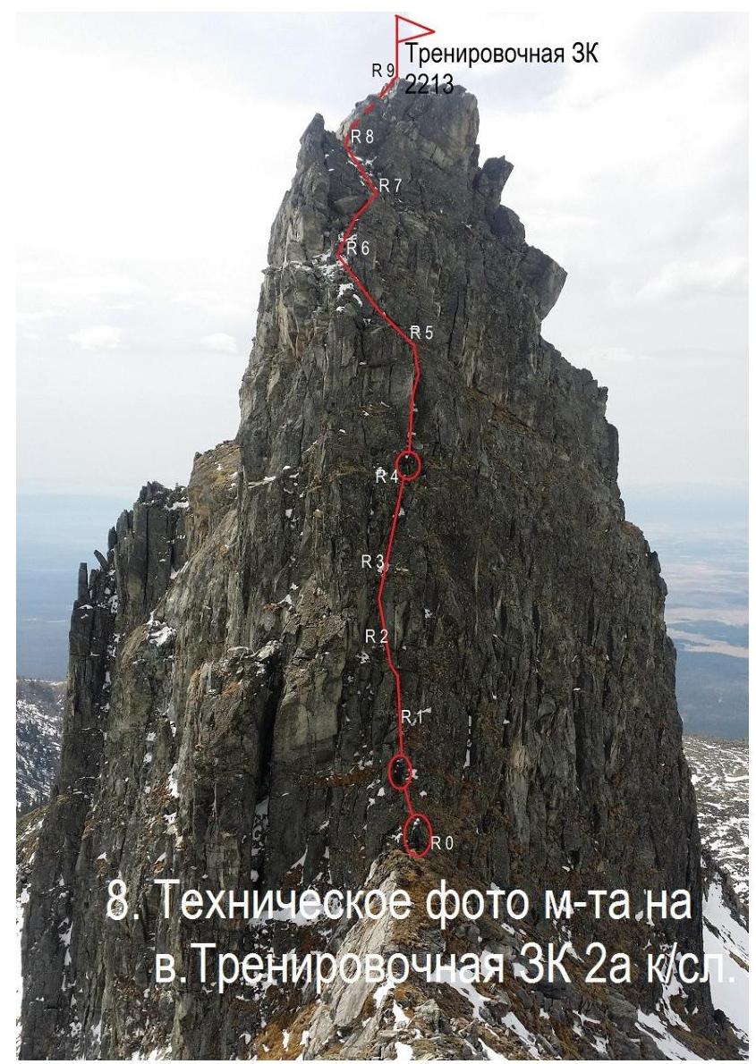 view.
Technical (route topography on v. Trenirovochnaya ZK 2A
category)
view.
Technical (route topography on v. Trenirovochnaya ZK 2A
category)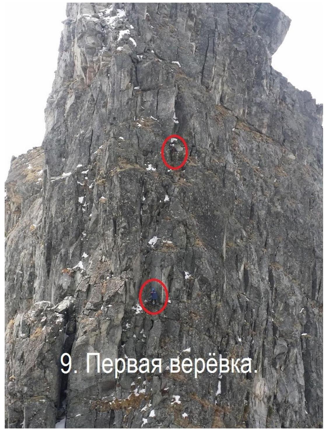
37: First
rope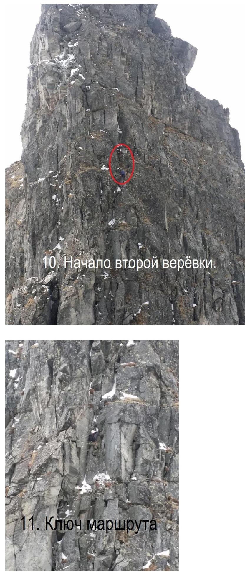
- Crux
of the route
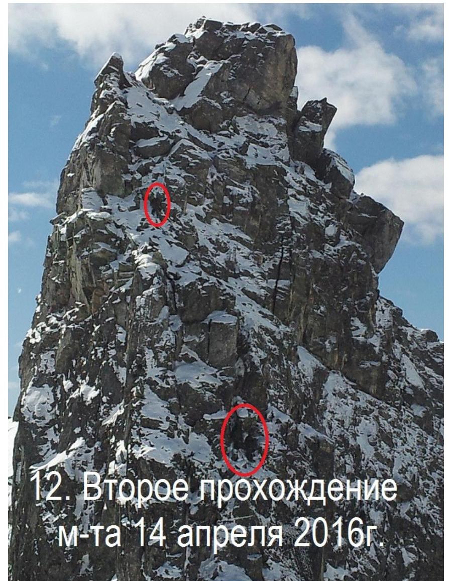 12.
Second ascent of the route on April 14, 2016
12.
Second ascent of the route on April 14, 2016
 □
□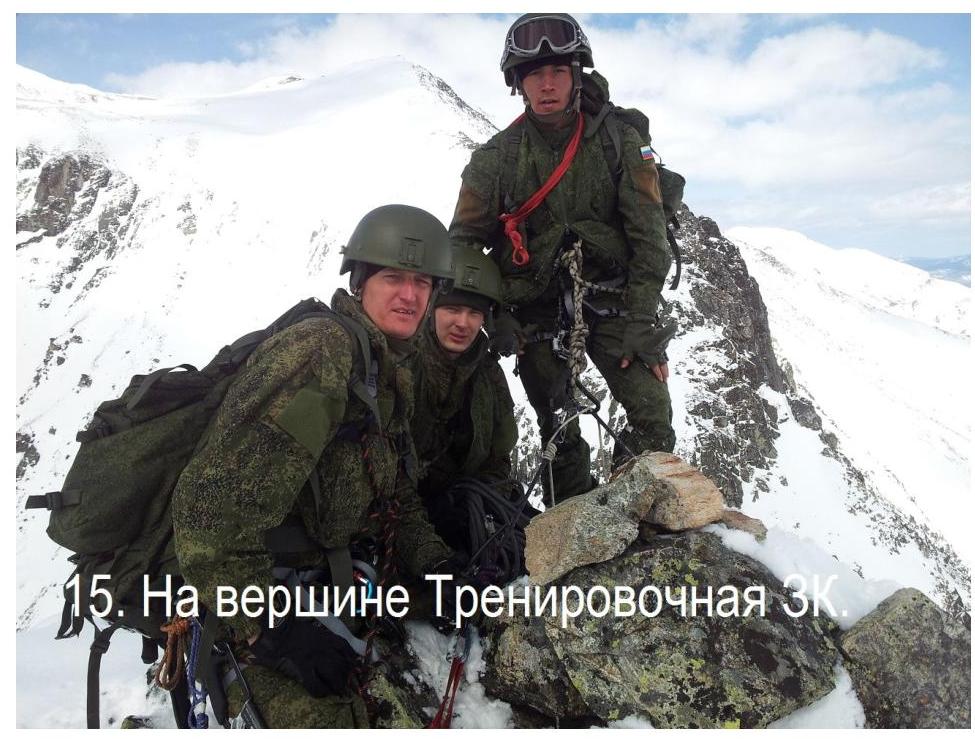 15.
On the summit of Trenirovochnaya
15.
On the summit of Trenirovochnaya


