Brief historical and geographical outline of the Ganga Khairym valley.
The Ganga Khairym valley has attracted mountaineers since the very beginning of the development of the Tunkin Goltsy.
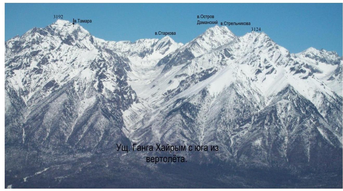
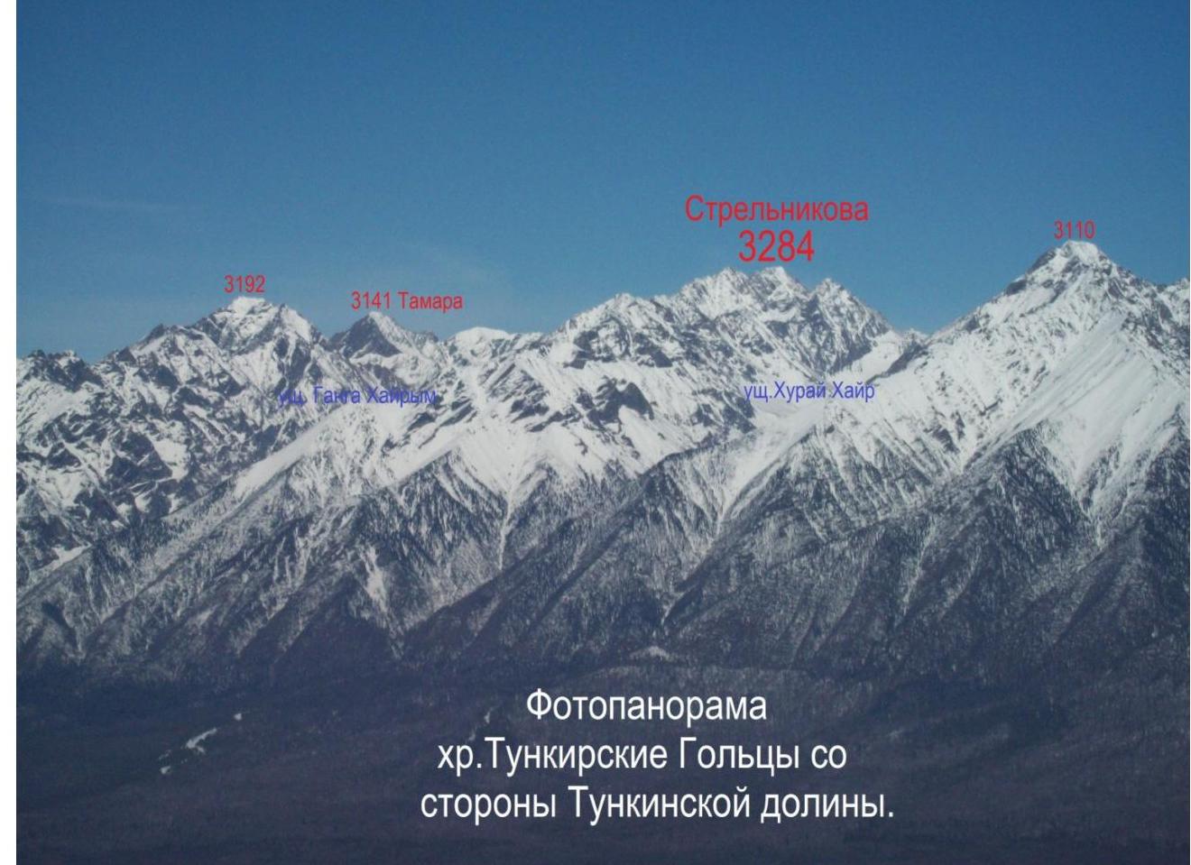
Here is located the highest point of the ridge — 3284 m, Mount Strelnikova, named after one of the border guards who died during the military conflict on Damansky Island in 1969. Who was the first to ascend it is not established.
The valley is referred to by different names on various maps:
- Ganga Khairym,
- Ganga Khairym.
In the mountaineering community, the valley has historically been known as Khairym.
In the 1960s, a group of Irkutsk mountaineers made the first ascent of the 3187 m peak. The first to reach the summit was Starkov, and with his arms raised and the exclamation: "The summit is ours!", he fell flat on the summit snowdrift. (V. "Desirable, ferocious, beautiful".) The snowdrift was a wind-blown cornice that collapsed into the Bi valley cirque along with the first ascendant. 3187 came to be known as Starkov Peak.
Between 1970 and 1979, there were several mountaineering events in the Ganga Khairym valley. In November 1974, the last mountaineering event took place in this area. In 1974, during a mountaineering event on the peak named after Stanevich A.M. (who made the first ascent in 1973), Rabnovskaya Tamara Alyussanovna (Propltagas) died in an avalanche.
Ascent passport to the summit
Strelnikova, 3284 m, via the Western ridge
cat. 16 difficulty level. 1. East Sayan, Tunkin Goltsy ridge, Khairym valley, section 6.1.2.
- Strelnikova peak 3284 m, via the Western ridge 1
- Proposed category: 16 difficulty level, first ascent description.
- Nature of the route: rocky.
- Height difference 300 m,
length 500 m, average slope 40°
- Number of pitons: rock and wired 2 pcs.
- Team's travel time — 4 hours.
- No overnight stays on the route.
cat. 1B difficulty level.
length 500 m, average slope 40°. Number of pitons: rock and wired 2 pcs. Team's travel time — 4 hours. No overnight stays on the route.
-
Group: Afanasyeva A.A. CMS, Belov A.A. signif., Zhambalov Ts.B. signif., Kuchumov S.N. signif., Mordovin A.A. 3rd sports category, Nomokonov D.V. 3rd sports category, Potapov R.A. signif., Rasskazov D.V. 3rd sports category
Description of the ascent route to Strelnikova peak 3284 m, via the Western ridge
cat. 1B difficulty level.
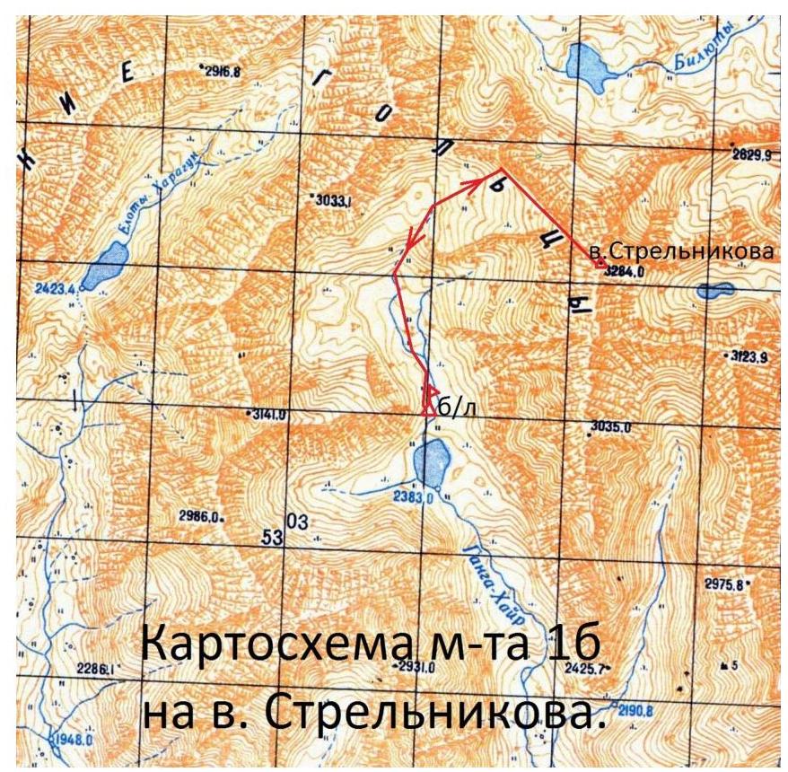
Approach along the Ganga-Khairym valley along the main stream straight north. At the source of the stream, on the left (orographic) side, with a western exposure, are located 6 glacier patches — remnants of a relict glacier. The first three lenses are small, the fifth is the largest, up to 20 m in size.
Further to the right along a gentle, small scree — exit to Irkutyanin pass, height according to GPS — 2918 m. From the base camp above Ganga Biryuzovoye Lake to the pass — 2 hours of walking. The start of the route is at the pass.
Along the western slope of Strelnikova peak, to the right of the ridge, the path to the summit is quite straightforward, corresponding to a weak 1B category in the summer and hazardous with snow cover.
The first mountaineers to ascend this peak were Irkutsk students in 1966, according to V. Bryansky's book "Kray okrylenny" (Winged Edge). The names of the leader and participants are not specified. However, they were not the first to reach the summit.
Climbers on the summit found a triangulation point made of logs. This means that the first to ascend the peak were Soviet geodesists, presumably in the post-war years.
This route is regularly used by tourists who ascend the peak from Irkutyanin pass. The peak is named in honor of Hero of the Soviet Union Senior Lieutenant Strelnikov, who died on Damansky Island in March 1969. The name was given by an Irkutsk group led by M. Tarakanov on May 1, 1969 (V. Bryansky "Kray okrylenny" Irkutsk 2007).
We found a cairn on the summit, but no signs of a triangulator were noticed. We retrieved a note left by Irkutsk tourists in 2012, who made a trip in memory of seven-time Olympic champion gymnast Oxana Kostina.
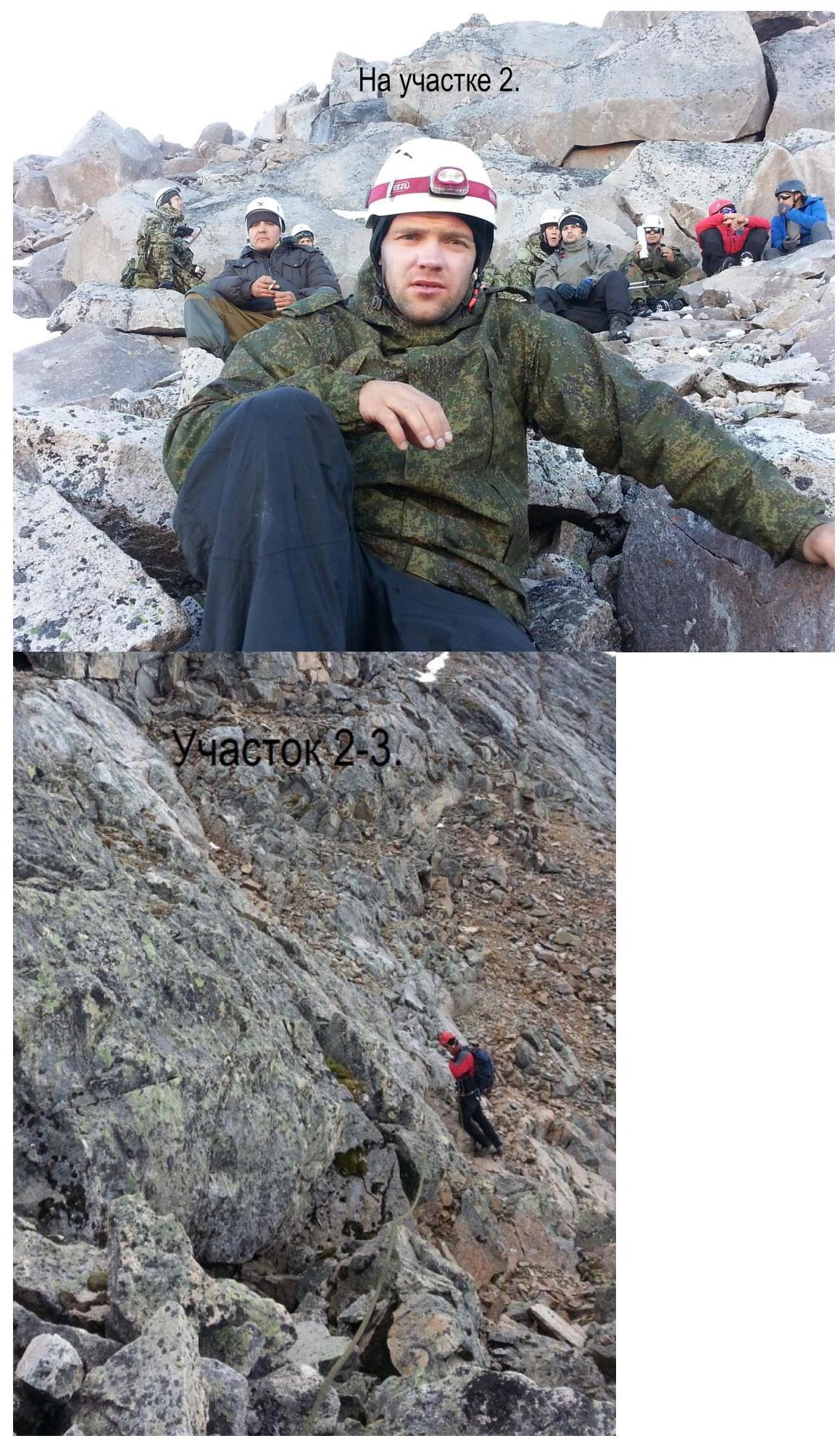
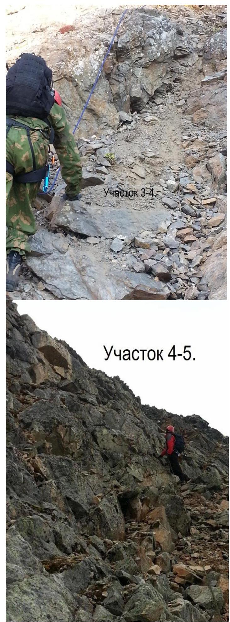
Sec. 0–1 200 m. 30° I– Along the scree slope of the western ridge. Sec. 1–2 90 m. 35° I– To the right of the rocky ridge along loose scree. Sec. 2–3 60 m. 40° I+ Large-block rocks. Rappel rope, station on a ledge. Sec. 3–4 70 m. 40° I– To the right of the ridge along a couloir with small scree. Alternating movement. Sec. 4–5 80 m. 45° I+ Along weathered rocks with snow bands to the summit of Strelnikova. Alternating movement, station on a ledge.
Height according to the map — 3284 m, according to GPS — 3279 m.
Descent via the ascent route, 2 sports descents. The second group traversed the peak using a rappel from the right summit of the Strelnikova massif (3271 m).
Total ascent time — 4 hours.
From camp to camp, 7.5 hours were spent.
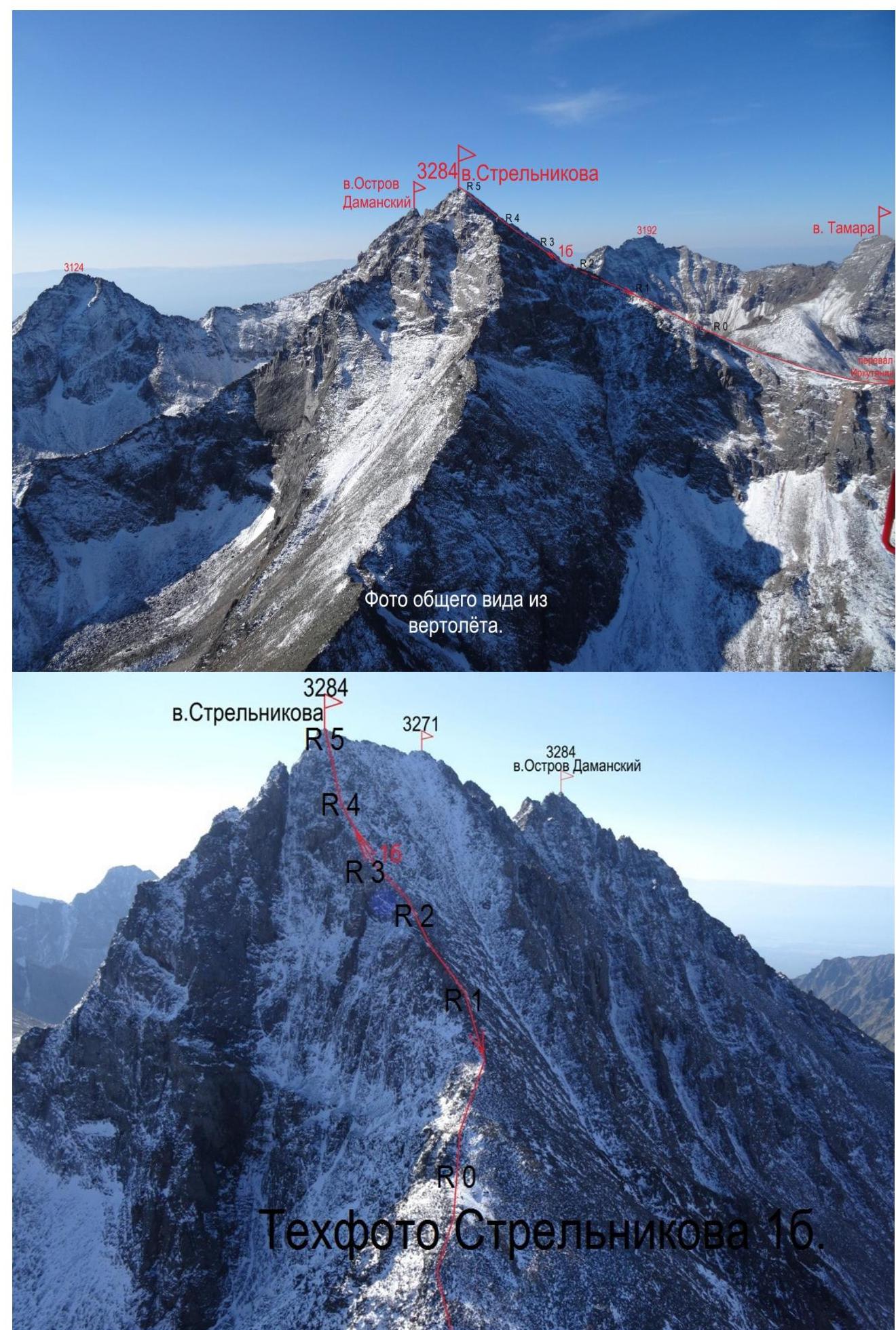
Tech photo — Strelnikova
Strelnikova 3284
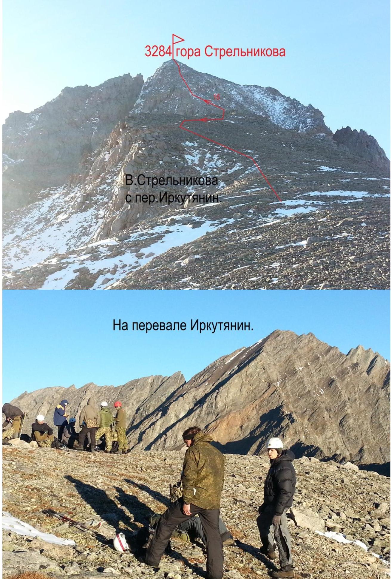
At Irkutyanin pass.
 □
□
Section 4–5.
 □
□