Primorskaya Federation of Alpinism and Mountaineering
Report on the First Ascent
To the peak Sibir 2870 m via the Center of the North Face. Approximately 5A category of difficulty.
I. Ascent Passport
| 1. General Information | ||
|---|---|---|
| 1.1 | Full Name, Sports Rank of the Leader | Rubtsov Vasily Alexandrovich – 1st sports rank |
| 1.2 | Full Name, Sports Rank of Participants | Shatalov Nikita Andreevich – 1st sports rank Kupchik Polina Valerievna – 1st sports rank |
| 1.3 | Full Name of Coach | none |
| 1.4 | Organization | Primorskaya Federation of Alpinism and Mountaineering |
| 2. Characteristics of the Ascent Object | ||
| 2.1 | Region | Eastern Sayan, Tunkin Goltsy |
| 2.2 | Valley | Valley of the Baruun-Khandagai River |
| 2.3 | Number of Section According to the 2013 Classification Table | 6.12 |
| 2.4 | Name and Height of the Summit | Sibir, height 2870 m |
| 2.5 | Geographical Coordinates of the Summit (latitude/longitude), GPS Coordinates | 51°54′48.53″ N, 102°10′13.40″ E |
| 3. Characteristics of the Route | ||
| 3.1 | Route Name | Via the center of the north face |
| 3.2 | Proposed Category of Difficulty | 5A |
| 3.3 | Degree of Route Exploration | First Ascent |
| 3.4 | Relief Character of the Route | Rocky |
| 3.5 | Height Difference of the Route (data from altimeter or GPS) | 320 m |
| 3.6 | Route Length (in meters) | 890 m |
| 3.7 | Technical Elements of the Route (total length of sections of various difficulty categories with indication of relief character (ice-snow, rocky)) | 2nd cat. diff. rocks – 15 m. 3rd cat. diff. rocks – 80 m. 6th cat. diff. rocks – 90 m. Rocks 6, A1 – 135 m |
| 3.8 | Average Steepness of the Route, (°) | 50° |
| 3.9 | Average Steepness of the Main Part of the Route, (°) | 85° |
| 3.10 | Descent from the Summit | Via 2A cat. diff. to the Alaska Cirque |
| 3.11 | Additional Route Characteristics | Water on the route is absent |
| 4. Characteristics of Team Actions | ||
| 4.1 | Time of Movement (team's working hours, in hours and days) | 8 hours |
| 4.2 | Overnights | – |
| 4.3 | Time of Route Preparation | – |
| 4.4 | Departure to the Route | 08:30, May 5, 2018 |
| 4.5 | Arrival at the Summit | 16:30, May 5, 2018 |
| 4.6 | Return to the Base Camp | 20:00, May 5, 2018 |
| 5. Characteristics of Weather Conditions | ||
| 5.1 | Temperature, °C | −5 °C |
| 5.2 | Wind Speed, m/s | 5 m/s |
| 5.3 | Precipitation | – |
| 5.4 | Visibility, m | 30 000 m |
| 6. Responsible for the Report | ||
| 6.1 | Full Name, e-mail | Kupchik Polina Valerievna, tundra86@mail.ru |
II. Ascent Description
1. Characteristics of the Ascent Object
1.1 Photograph with the Route Line
The photo was taken on the day of the ascent, May 5, 2018.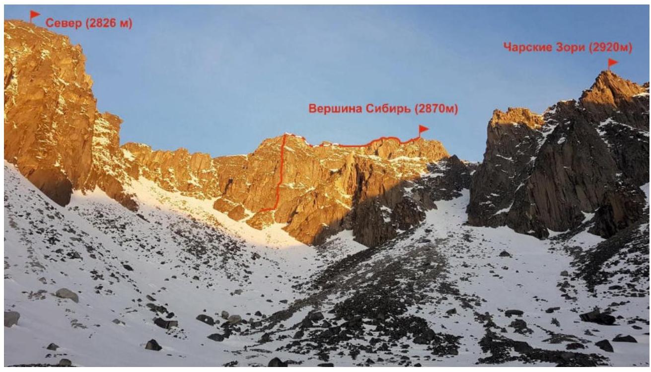
1.2 Schematic Diagram of the Area with the Route Line
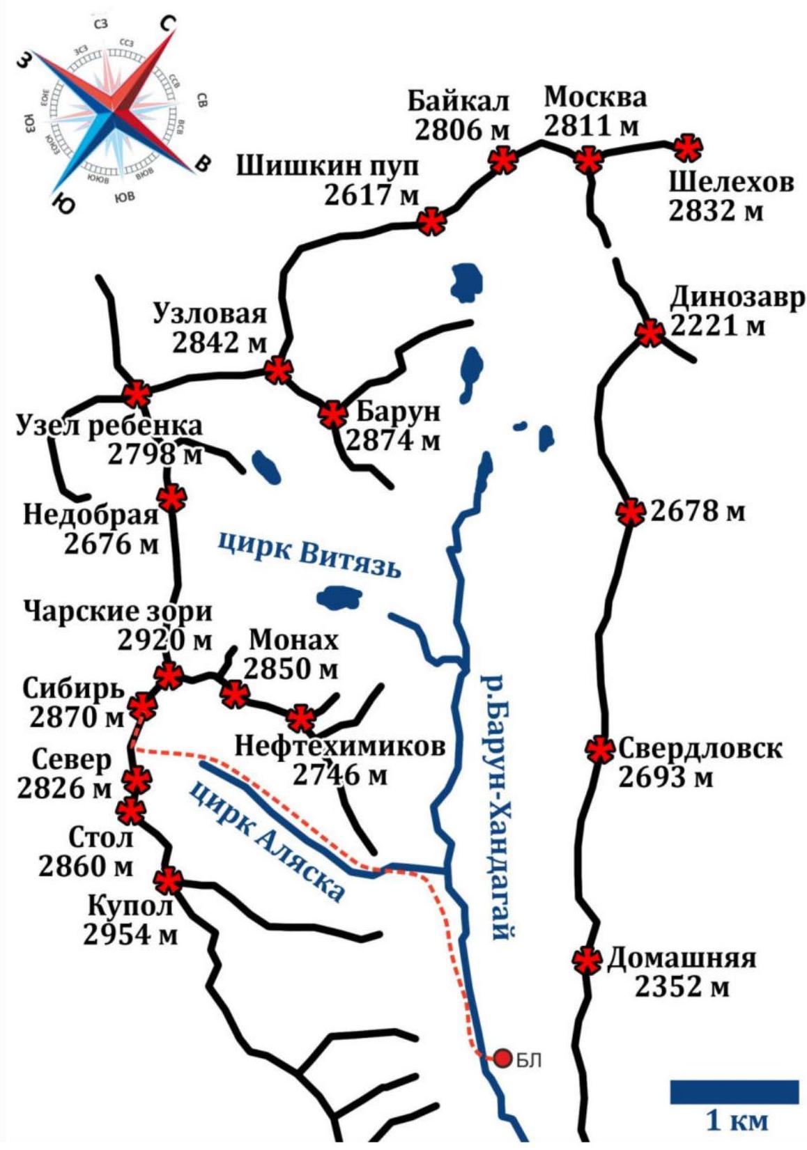
The Baruun-Khandagai Valley is one of the most promising areas in the Eastern Sayan for sports mountaineering. The peak Sibir is located in the Tunkinsky District of the Republic of Buryatia. The nearest large settlement is the village of Arshan.
From Arshan, you can reach the entrance to the valley by a high-clearance vehicle (about fifteen kilometers). Further, there is a path into the valley, and the area is popular with tourists in the summer. The approach to the Base Camp is approximately 10 km, with a height gain of 1100 m.
The route starts from the Base Camp, located opposite the peak Domashnyaya.
The approach to the route took our team 2 hours 30 minutes (departure from BC at 05:00, start of work on the route at 08:30).
From the camp, the approach to the start of the route is made along the right (or.) bank of the Baruun-Khandagai River, gradually moving left along the grassy fields. Then, ascend along the path with cairns to the "Alaska" cirque and directly into the depths of the cirque to the center of the foot of the monolithic wall of peak Sibir.
2. Characteristics of the Route
2.1 Technical Photograph of the Route

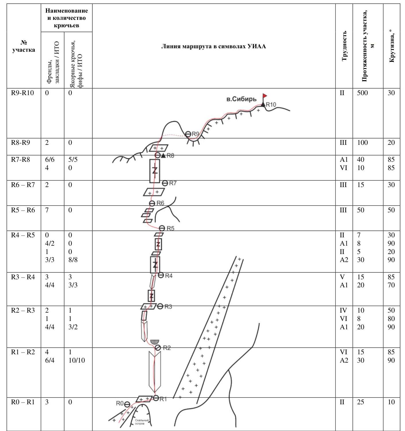
2.2 Technical Characteristics of Route Sections
3. Characteristics of Team Actions
The rocky island at the start of the route is bypassed on the left. The route begins along a logical internal angle in the right part of the rocky ledge, to the left of the beginning of the steep couloir, which probably leads to the summit.
R0–R1 25 m from the upper part of the rocky island, approach to the right along a steep ledge to the internal angle (belay required).
R1–R2 45 m, steepness 85–90°. Move straight up along a small internal angle under a cornice, where it is convenient to make a belay station. Difficult climbing with the use of artificial technical means (ITM), possible presence of loose rocks. 70% ITM (30 m A2).
R2–R3 38 m:
- 20 m – 90°
- 8 m – 80°
- 10 m – 50°
Bypassing the cornice on the left, move up along a series of cracks to a gentle ledge. At the top of the ledge, at the base of a long crack, make a belay station. 30% ITM (20 m A1).
R3–R4 35 m: 20 m – 85°, 15 m – 70°. Move straight up along a crack turning into an internal angle, which ends with a convenient ledge for a belay station. ITM 20 m A1.
R4–R5 50 m: 30 m – 90°, 5 m – ledge 2, 8 m – 90°, 7 m – 30° 2.
Move up along a series of cracks 30 m to a wide rocky ledge. Having passed the ledge, climb 8 m along a wide crack on a vertical wall. Behind it, along easy rocks, approach the next wall, where it is convenient to make a belay station. ITM 30 m A2.
R5–R6 50 m — 50°.
Bypassing the vertical wall on the left, along rocks of the 3rd cat. diff., exit to a series of ledges leading to the last wall of the bastion. 7 points, all are fixed elements.
R6–R7 15 m, 30° — approach along easy rocks to the wall of the bastion to a pronounced internal angle.
R7–R8 50 m — 85°, difficult climbing with the use of ITM. Climbing begins along the cracks of the internal angle and after 10 m moves to the right onto the wall into the next series of cracks. At the top of the bastion — a control cairn. ITM 40 m A1.
R8–R9 100 m — move to the right along the ridge, bypassing the first gendarme on the left side, along rocks of the 3rd cat. diff. The ridge to the right ends in steep drops. It is recommended to stick to the left side of the ridge, which is more gentle. Simultaneous movement.
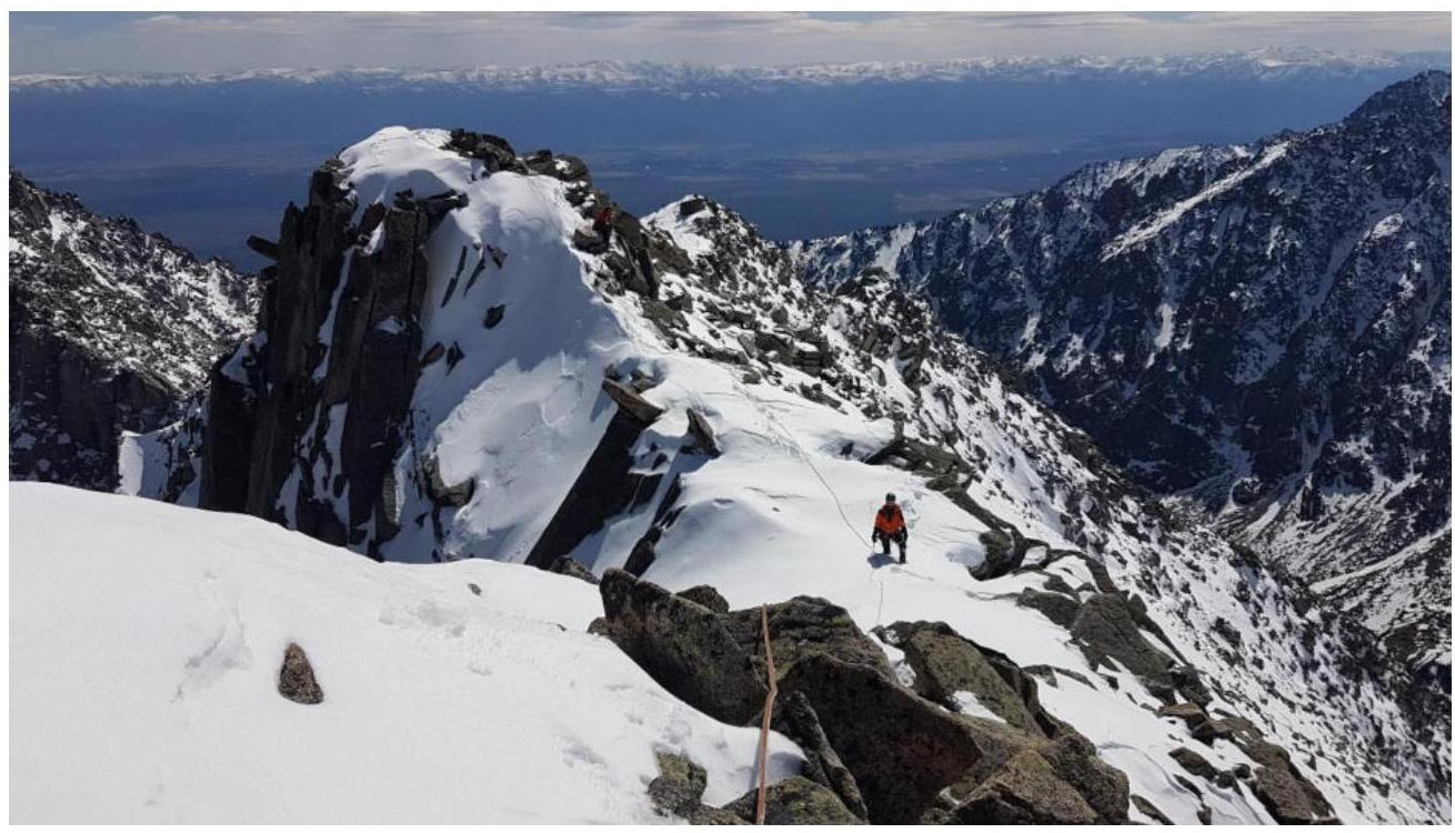
R9–R10 500 m — move simultaneously along an easy ridge to the exit to the summit of peak Sibir.
DESCENT via route 2A "Sibir". Depending on the condition of the route, organization of belay/abseil may be required in the upper part of the couloir.
- Many loose rocks.
- Possible avalanche danger.
4. Photo Report from the Route
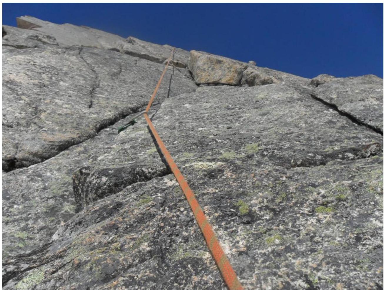
SECTION R1–R2
Vasily Rubtsov working on the route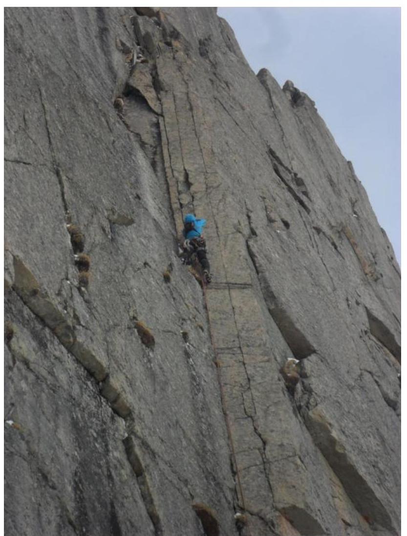
Digitized by Google!
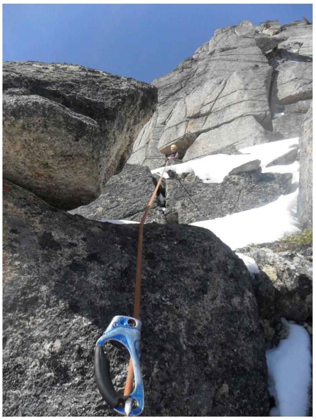
Belay station under the cornice on section R1–R2
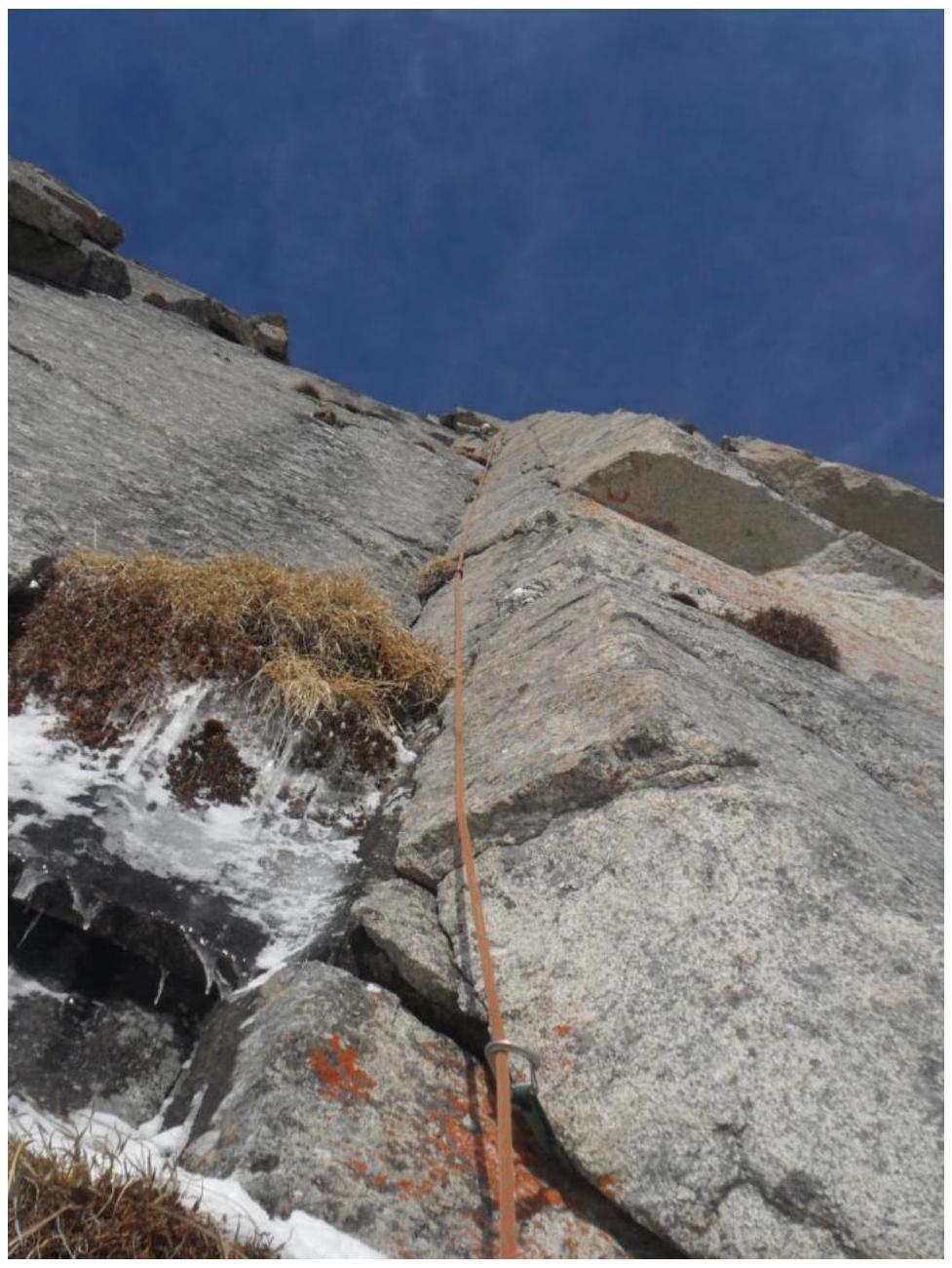
SECTION R2–R3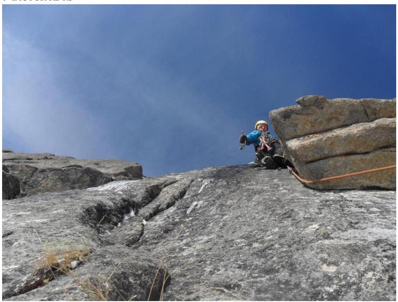
Digitized by Google!
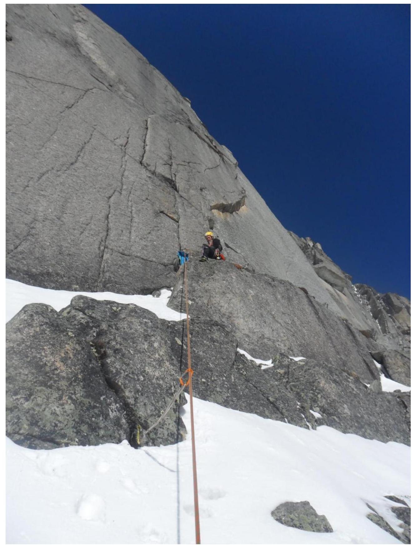
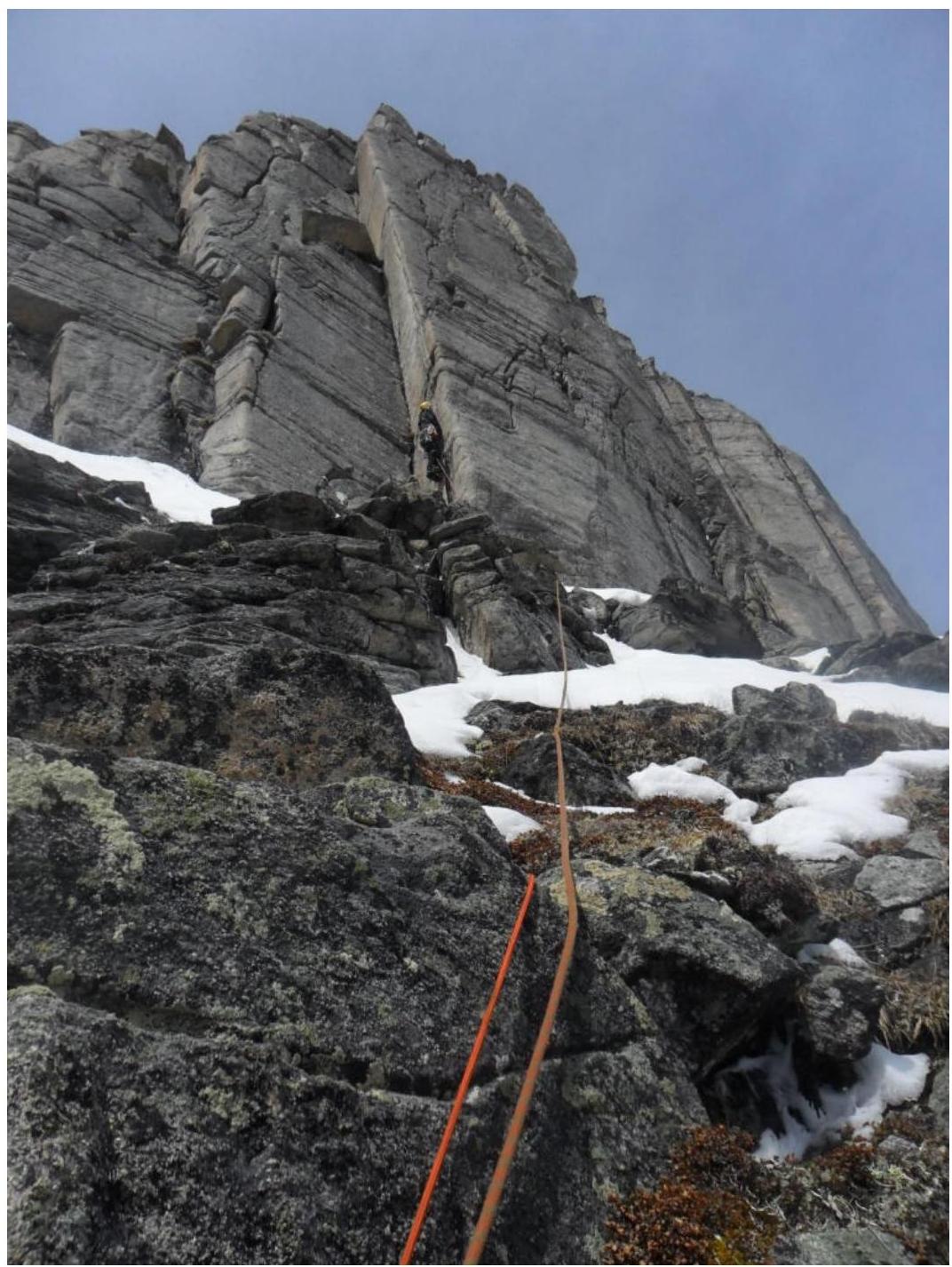
Belay station on the ledge before the start of section R3–R4
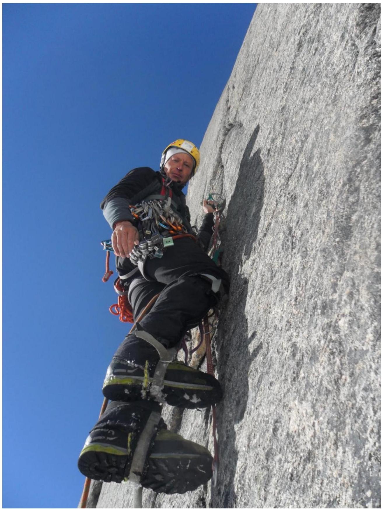
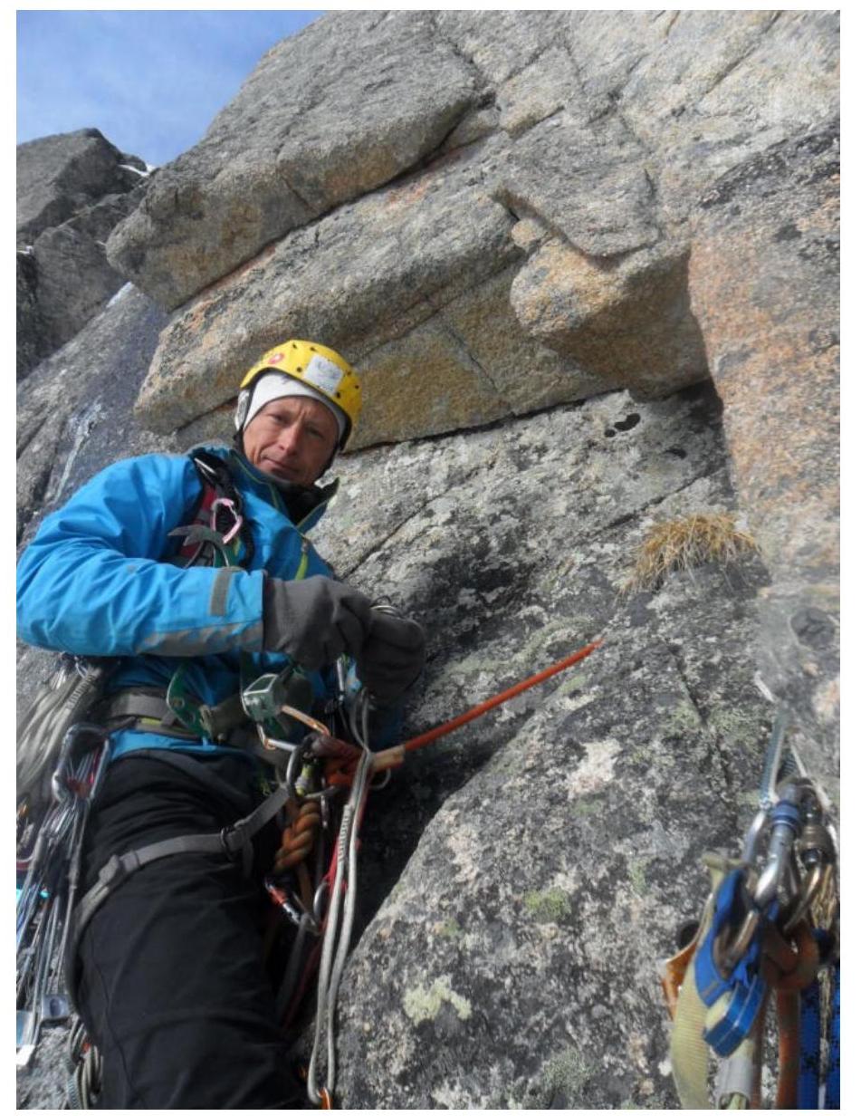
Vasily Rubtsov on section R3–R4
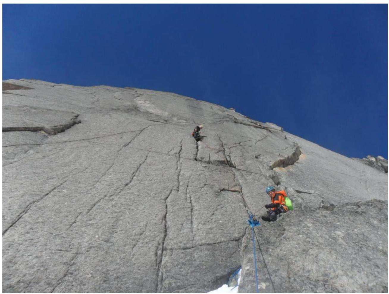
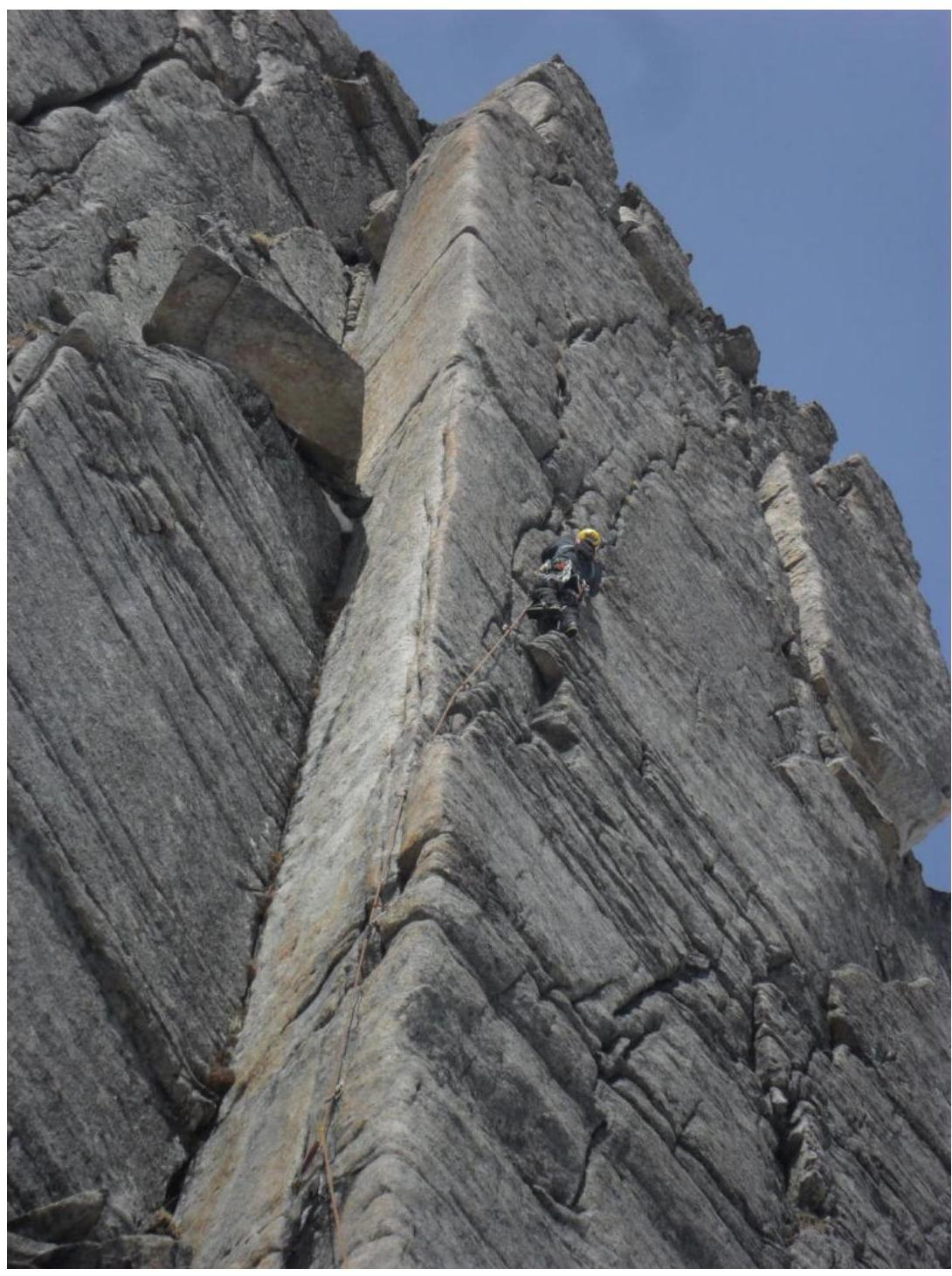
Section R3–R4 and R4–R5 (partially) are visible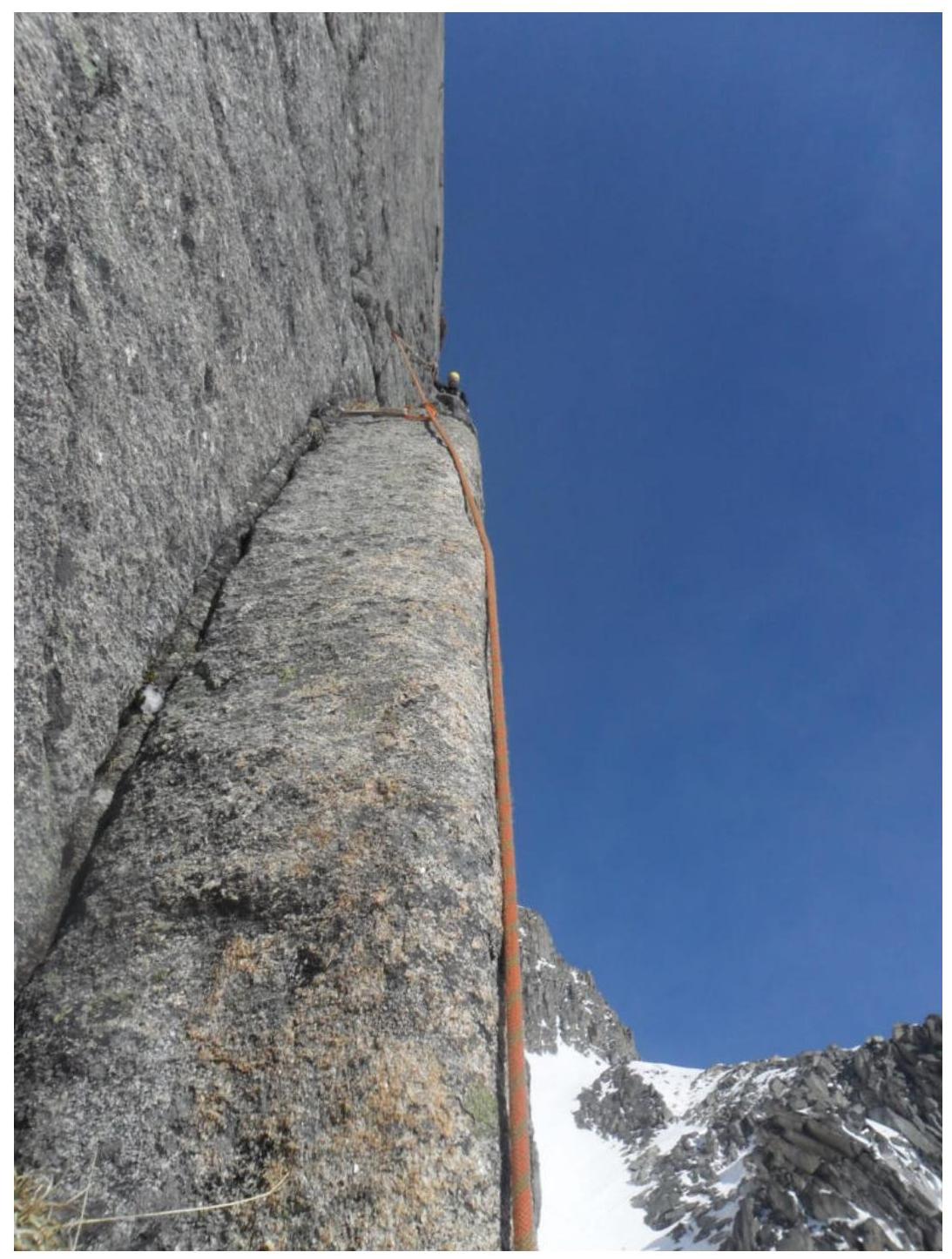
Internal angle and belay station in the upper part of R3–R4
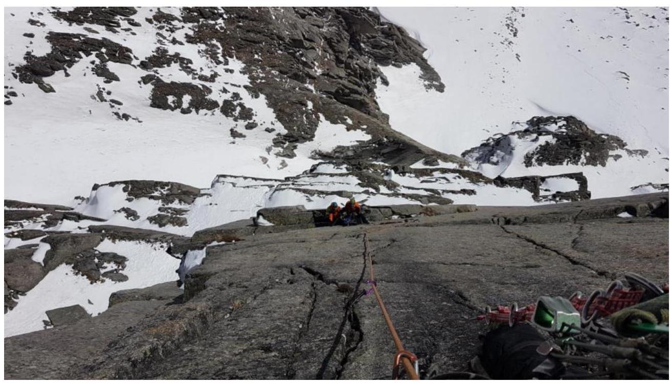
View from the middle of section R4–R5 to the ledge and belay station below
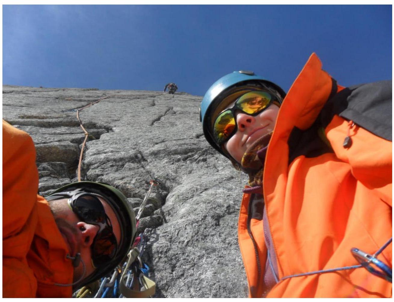
View from the belay station at the beginning of section R4–R5 to the wall of the route (N. Shatalov — on the left, P. Kupchik — on the right, V. Rubtsov — at the top of the photo)
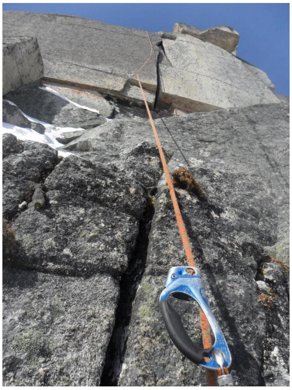
View of the 8-meter wall with a wide crack in the upper part of section R4–R5
Approach to the belay station along easy rocks on section R4–R5

Movement from the belay station to the left along rocks of the 3rd cat. diff.
View of section R5–R6
Approach to the bastion on section R7–R8
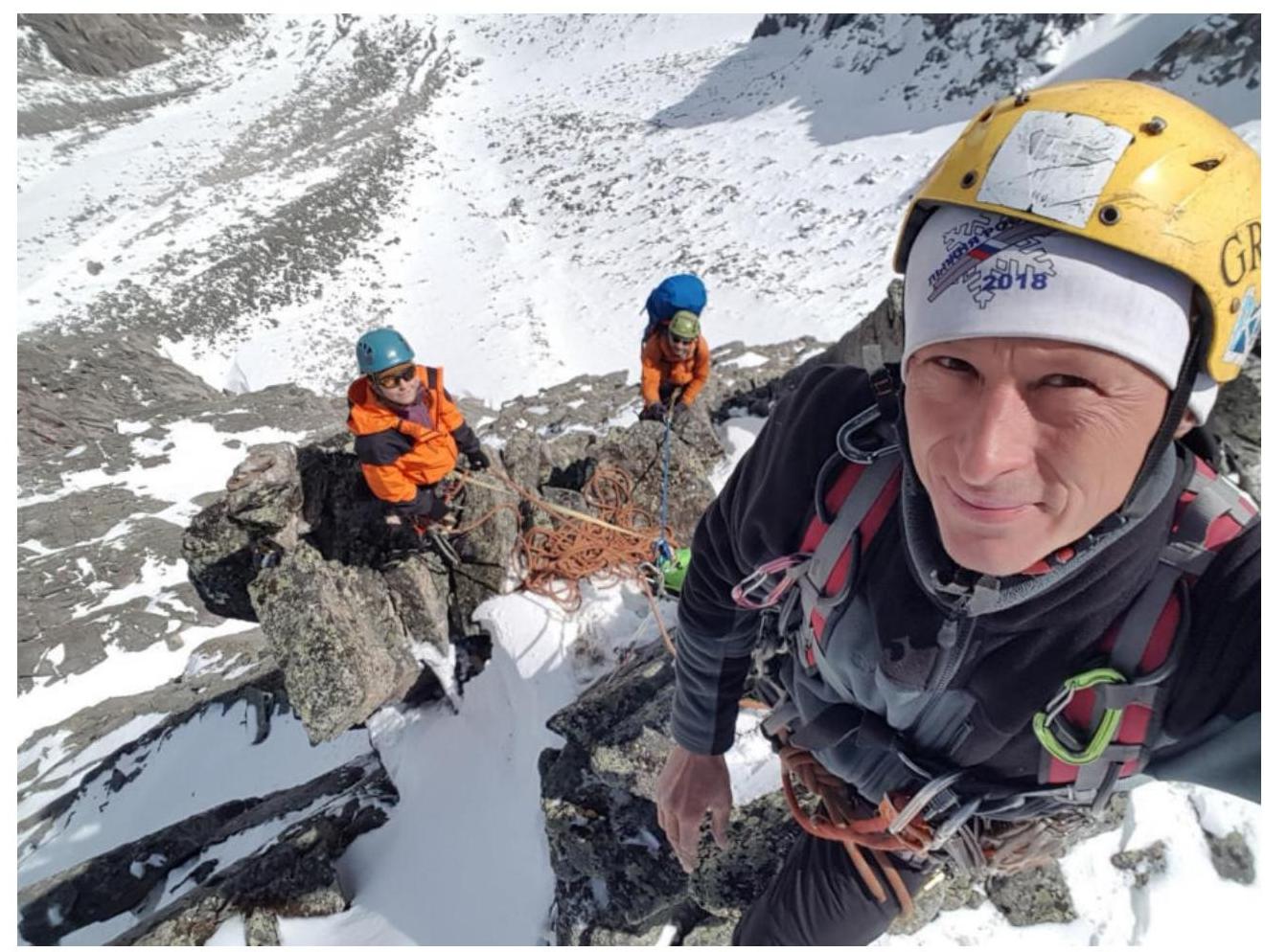
Ascent participants on the control cairn in the upper part of section R7–R8
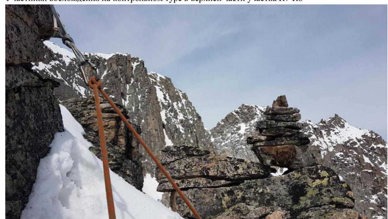
Control cairn on the summit of the bastion
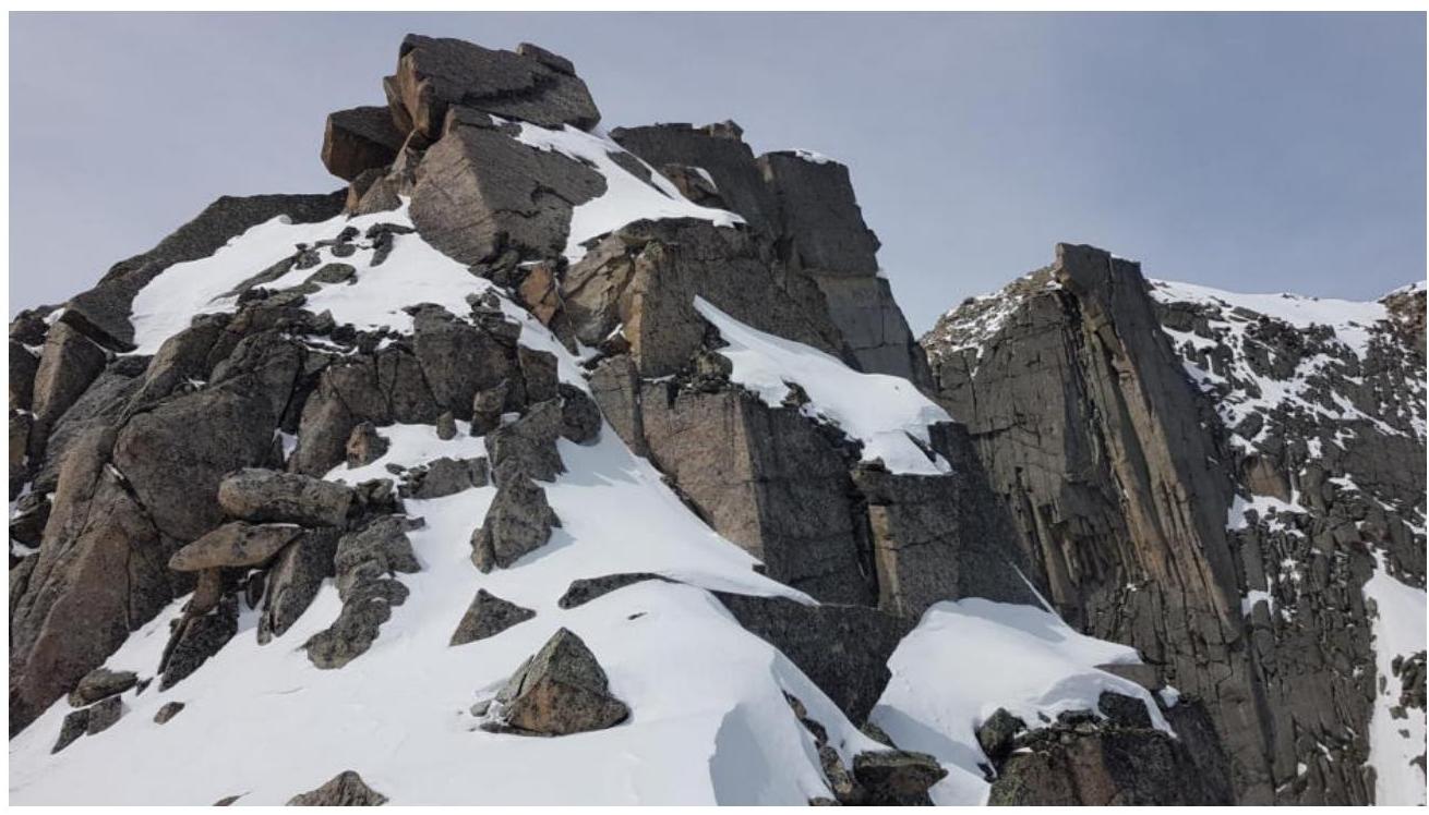
View from the control cairn to the ridge. All rocky outcrops of the ridge are bypassed on the left side
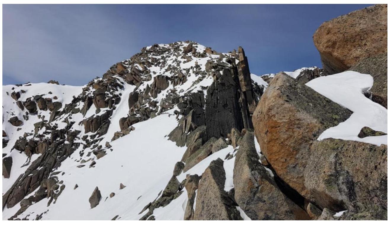
Pre-summit ridge
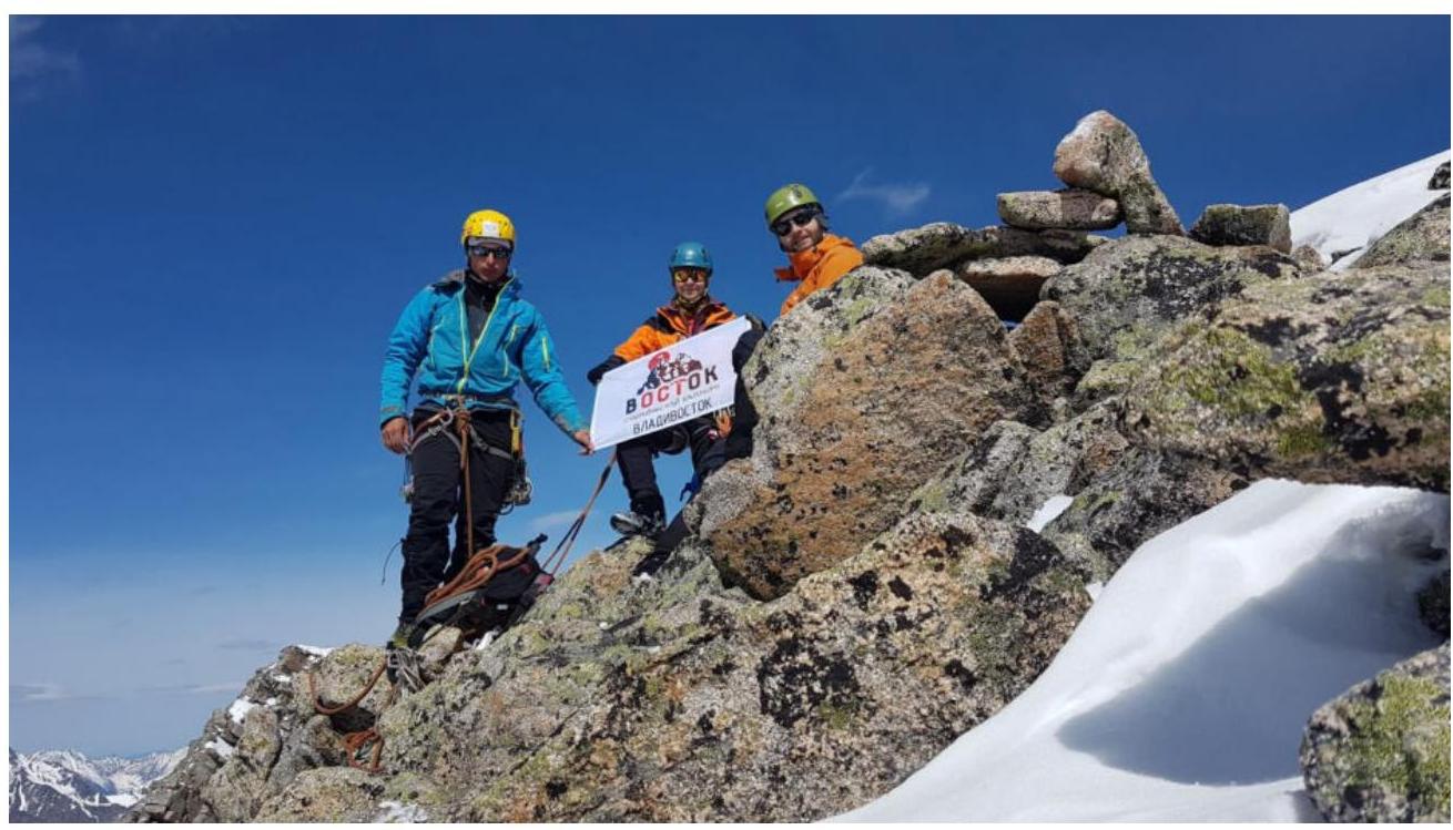
Summit