Report on the First Ascent
On peak Sever 2826 m. Via the center of the North face. Tentatively 5B category of difficulty. Ulan-Ude, 2015
Climbing Passport
- Eastern Sayan, Tunkin Goltsy ridge, Barun-Khandagai river gorge. Section number according to the classification table 6.1.2.
- Sever 2826 m (peak coordinates: 51°55′24.54″ N 102°10′90″ E). Via the center of the North face.
- Category of difficulty: proposed 5B. First ascent.
- Route character — rock climbing.
- Route elevation gain: 400 m. Route length: 600 m. Length of sections:
- V category of difficulty — 200 m
- VI category of difficulty — 120 m Average steepness of the wall section of the route — 80°. Average steepness of the entire route — 60°.
- Pitons left on the route: 1 M8 bolt. Used on the route: anchors: 15/3; nuts: 75/17; bolts: 2/0.
- Team's climbing hours: 8 h 30 min. No overnight stays.
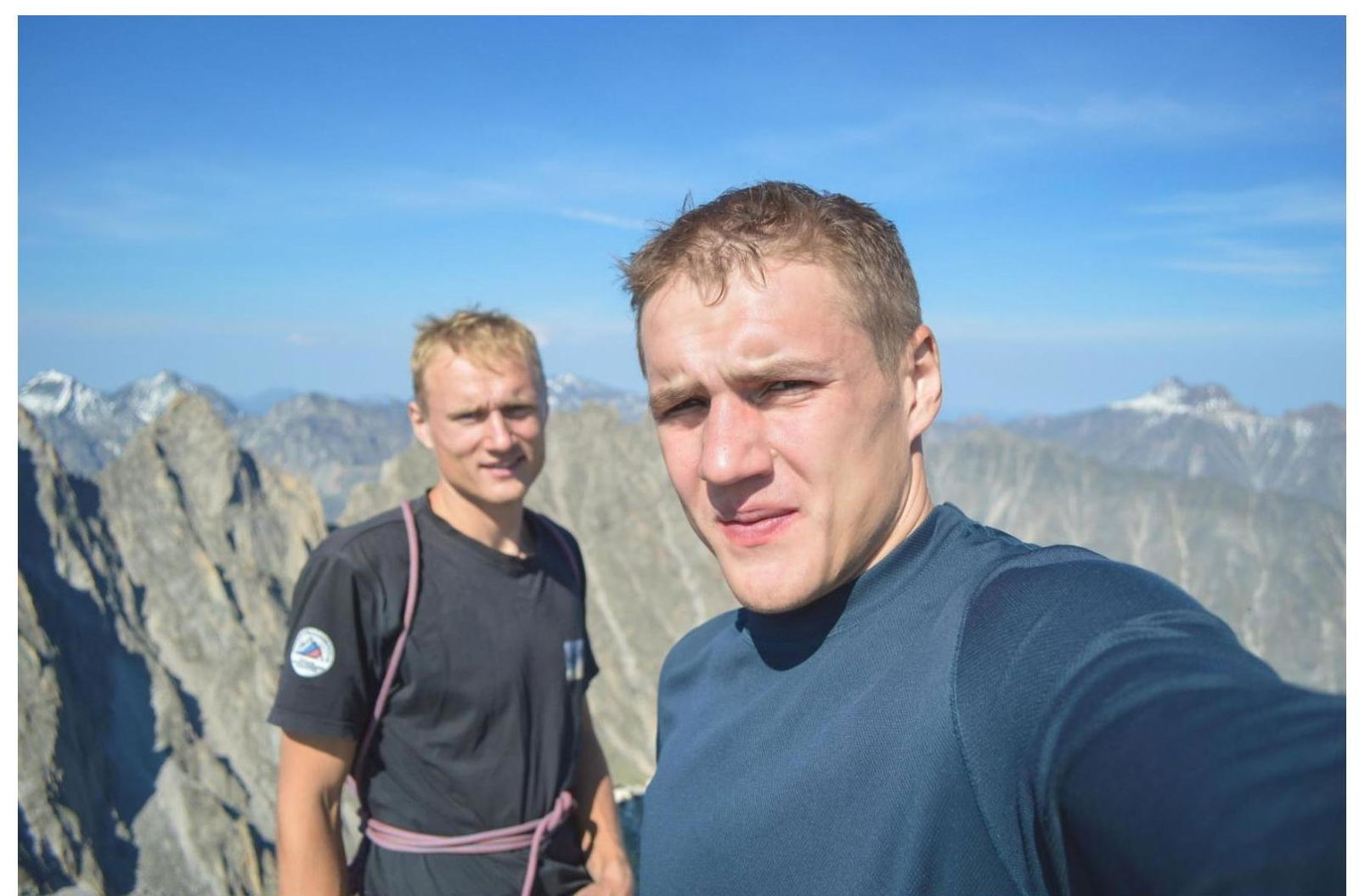
- Leader: Glazunov Evgeny Vladimirovich (Master of Sports). Participant: Glazunov Sergey Vladimirovich (Candidate for Master of Sports).
- Coach: Glazunov Evgeny Vladimirovich (Master of Sports).
- Departure from Base Camp to the route: 6:00, August 20, 2015. Summit: 15:30, August 20, 2015. Return to Base Camp: 17:25, August 20, 2015.
- Federation of Mountaineering of the Republic of Buryatia.
Overview of the Climbing Area, Sports Characteristics, and Tactical Actions of the Team
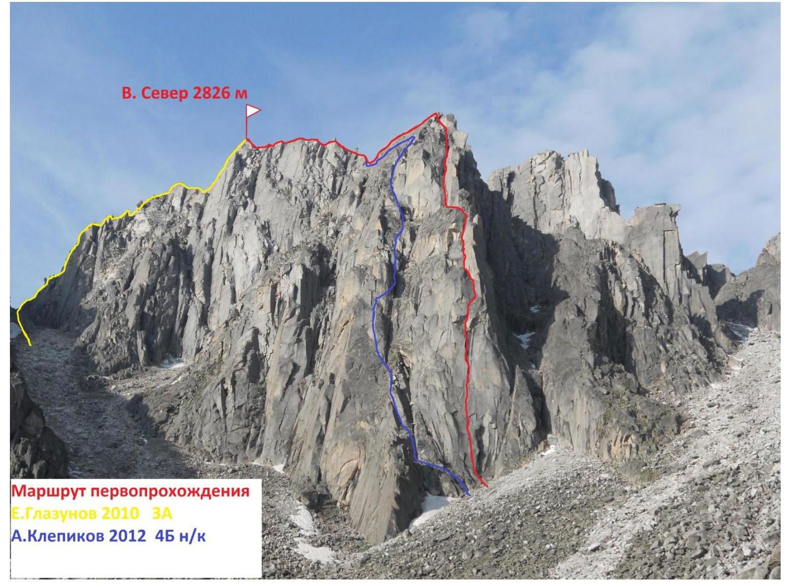
Peak Sever is located in the upper reaches of the Barun-Khandagai gorge, Tunkin ridge of the Eastern Sayan, between the massif of peaks Zima and Sibir (to the West) and peak Stol (to the East). One classified route of 3A category of difficulty and one unclassified route of 4B category have been previously ascended. Our chosen route of the first ascent goes through the center of its North face, via a system of vertical cracks and fissures, through the cornice belt in the middle, from the hanging cirque of peak Kupol. The route is monolithic with a pronounced relief, mainly in the form of cracks and corners, logical, and clearly tied to the terrain. The route involves both strenuous climbing and artificial technical climbing (ITC) on thin cracks and overhanging terrain. According to the team's assessment, the route corresponds to similar routes in the Eastern Sayan of 5B category of difficulty. To pass this route, we recommend having an expanded set of camalots and nut elements, as crack climbing prevails throughout the sections. Climbers should also be prepared to overcome vertical cracks with free climbing and placement of protection.
General View of Peak Sever and the Ascended Route
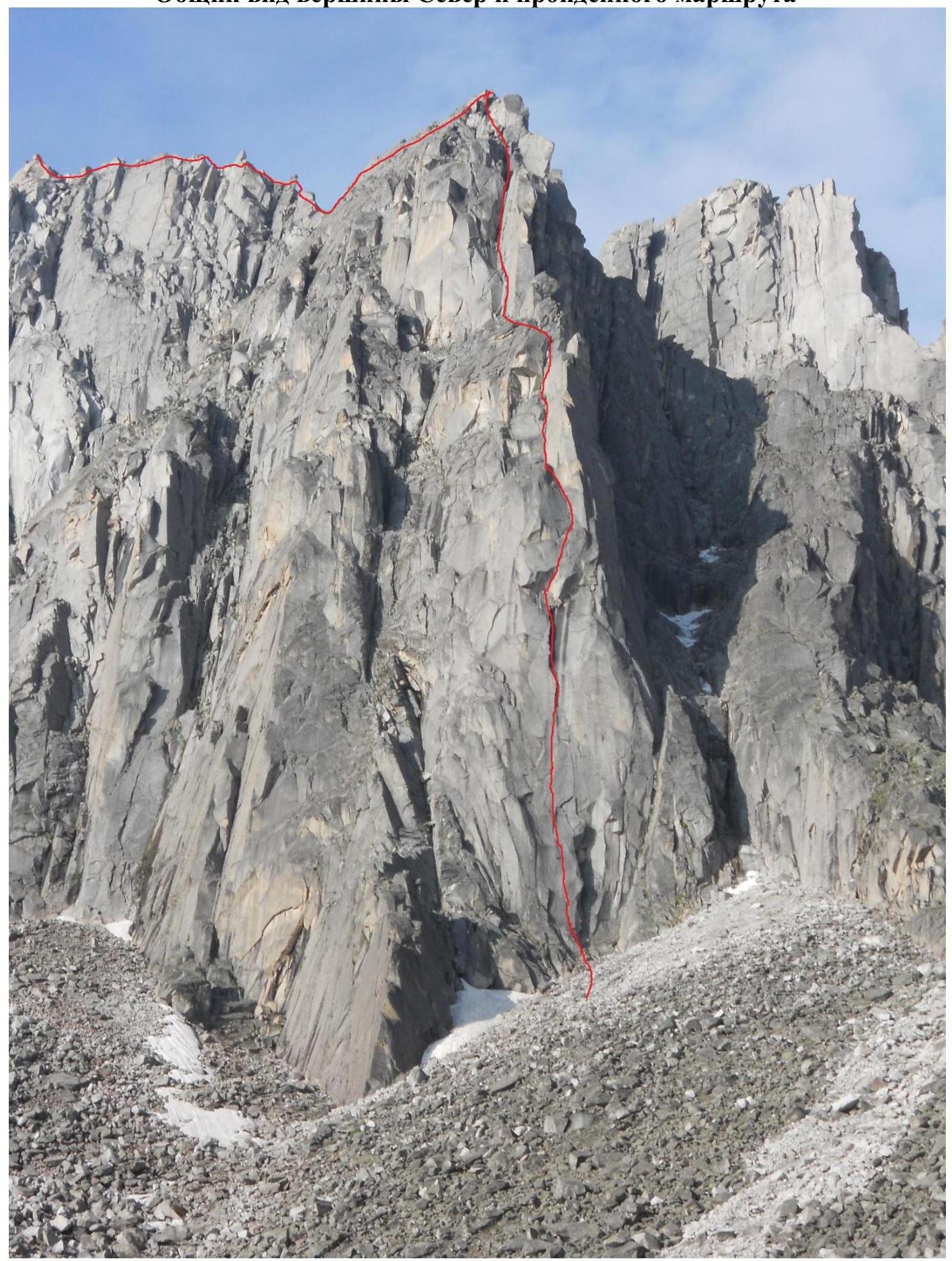
General View of the North Face of Peak Sever and the Ascended Route
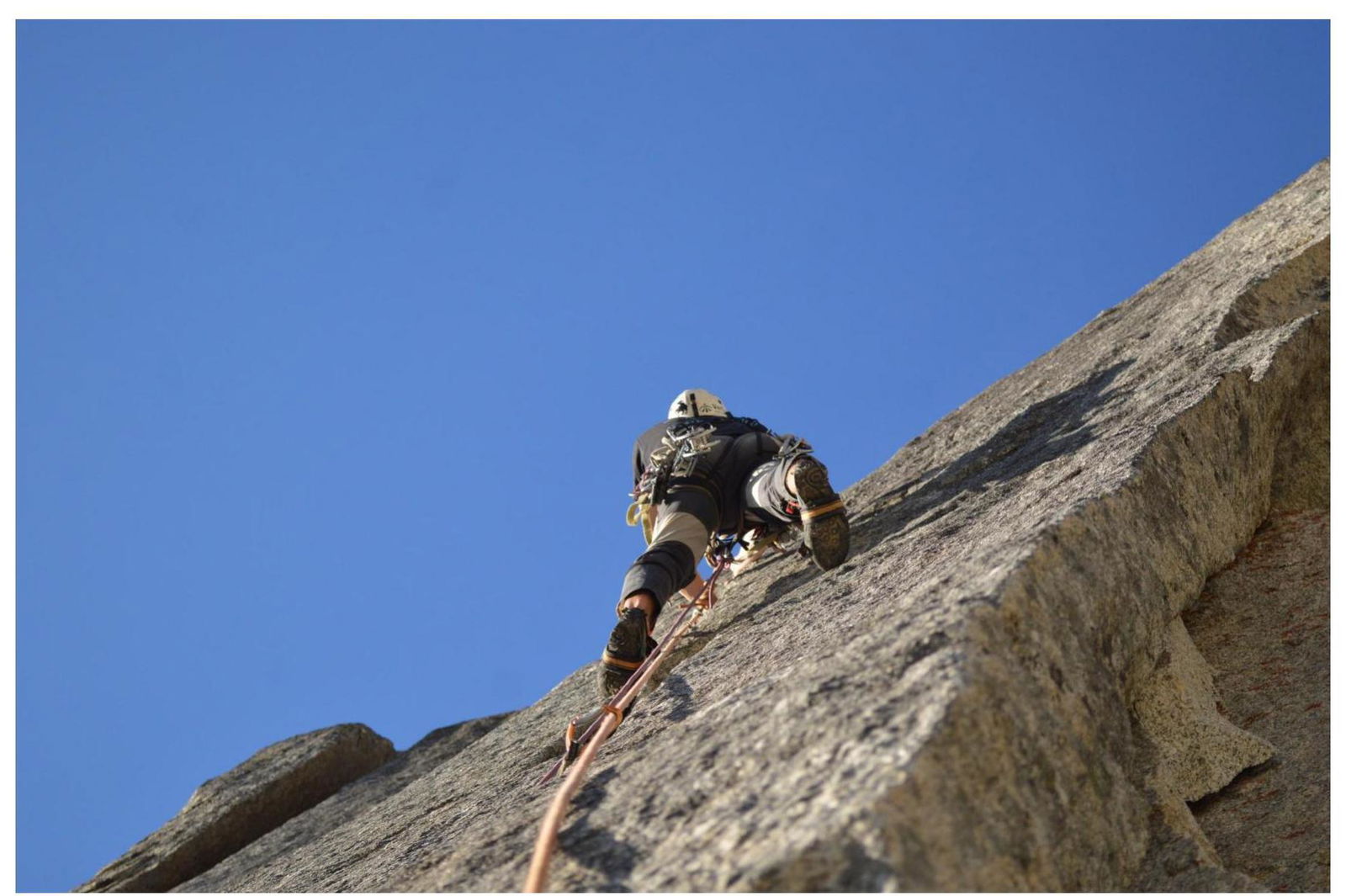
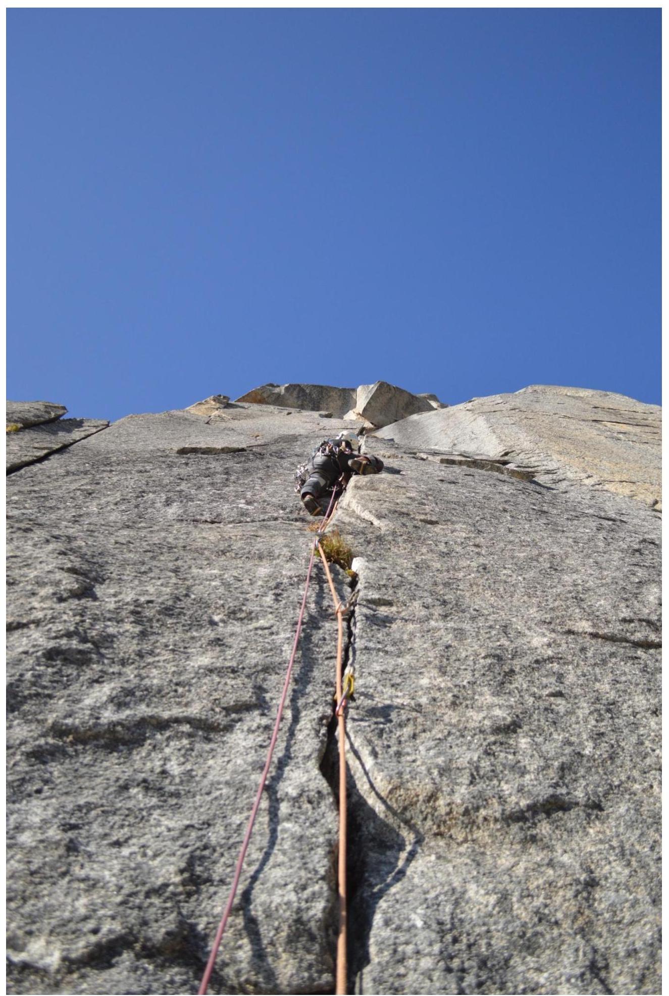
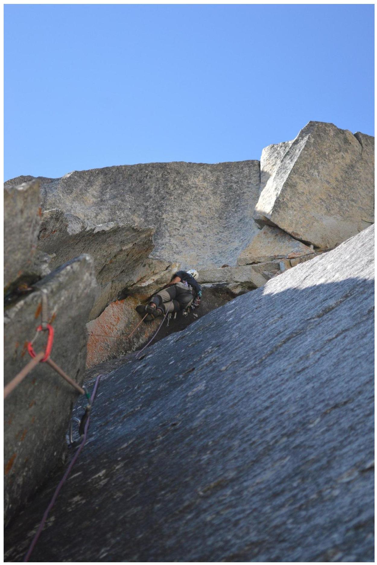
Photos of the Route by Sections
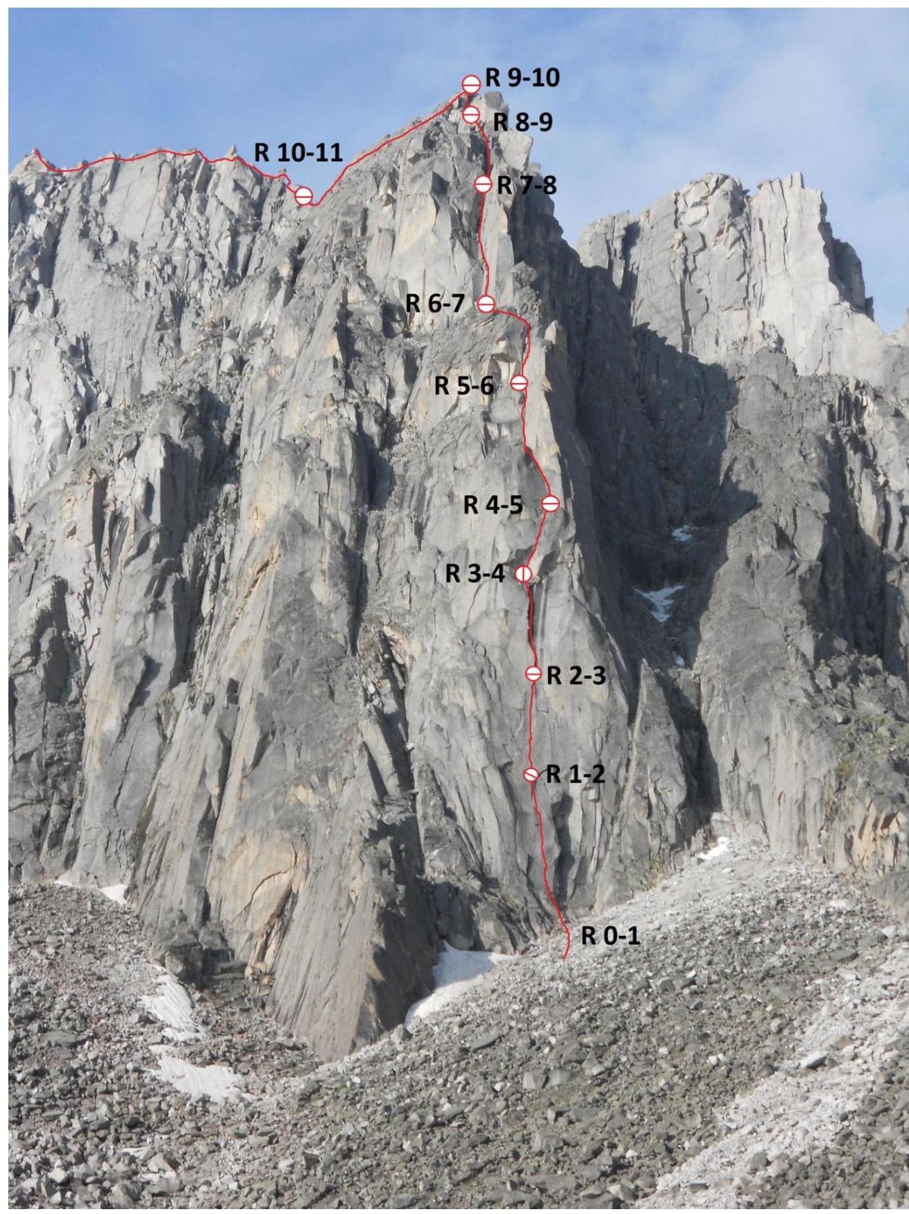
UIAA Scheme
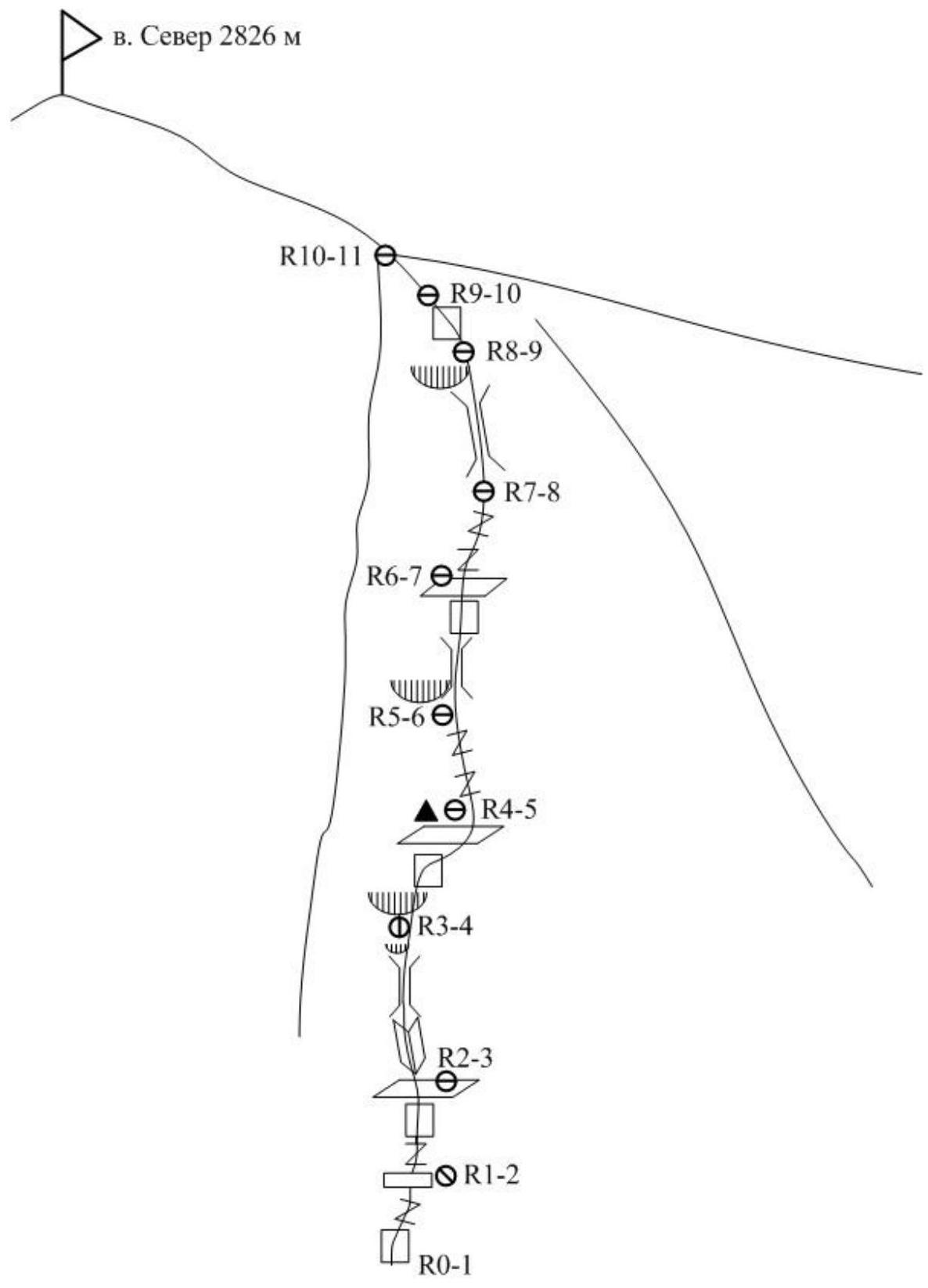
Description of the Route by Sections
R0–R1: The route begins from the lowest part of the wall, from a cairn built at the bottom. Move to a ledge on the left, to a standalone rock. From the rock, climb up a vertical crack. Difficult free climbing, placement of protection, requires a doubled set of camalots. Station on a small sloping ledge on nuts and an anchor. (40 m, 85° VI) R1–R2: From the station, move up and right through a crack, using free climbing until the middle of the crack. Then continue on ITC almost to its end. Exit to a ledge at the base of a wet chimney with black streaks using free climbing. On the ledge, station on anchors and a removable bolt M8. This section requires a doubled set of camalots of all sizes up to #4. (35 m, 85° VI A1e) R2–R3: Continue through a narrow corner with a thin crack on ITC until exiting it. Then move with free climbing to a vertical crack in a wet corner, curving to the right like a scimitar. Requires 2 #3 camalots. Pass the crack and, through a small cornice, about half a meter, exit to a slab under a large cornice (first crux). Here is a hanging station on nuts and a bolt (M8 spike left). Requires an eye and M13 nut. Attention! The half-meter cornice before the station consists of wedged, resonant blocks and requires utmost attention during passage to avoid their fall. (40 m, 90° VI A2e) R3–R4: Traverse right, to a medium-sized crack. Through the crack, pass a one-sided cornice with an outreach of up to 1.5 m (second crux). Behind the cornice, the terrain becomes easier, leading to a ledge. On the ledge, on a rock "Tooth," there is a control cairn in a bottle. (25 m, 95° VI A2) R4–R5: From the ledge, move through an internal corner with a thin crack, then left until reaching a large ledge. From the ledge, climb up a vertical corner to the base of a wide crack, where a station was set. From the beginning of this section to the summit, the route is climbed without ITC. (50 m, 75° V–VI) R5–R6: Climb through a wide crack (it's advisable to have a #5 camlot). The crack ends with wedged stones, which are bypassed on the right through slabs. Exit to a wide terrace at the base of a large vertical internal corner. Station on the terrain. (40 m, 85° V–VI) R6–R7: From the station, climb through a corner with a wide crack to the entrance of a large internal corner. Further movement is through the internal corner — a chimney. Careful climbing; there are loose stones wedged in the corner. Requires cautious movement to avoid dislodging them. In the upper part of the section, the crack widens to the size of a #5 camlot. The corner leads to a saddle at the base of a wet chimney. (50 m, 85° V–VI) R7–R8: Climb the chimney very carefully, as there are loose stones wedged in it. Through a small cornice, exit to a large ledge, from where climb up to the base of an internal corner. Station on the terrain. (40 m, 70°, IV–V) R8–R9: Simultaneous movement through moderately difficult terrain towards the ridge. In the middle of the section, there is a vertical wall, passed with climbing. Station on the terrain. (50 m, 60°, III–IV) R9–R10: Along the ridge, move simultaneously through small walls towards the West ridge of Sever. In the middle of the section, descend slightly, bypassing a monolithic gendarme on the right. On the right, through ledges and terraces, exit to the main ridge. (120 m, 40° III) R10–R11: Along the ridge, through a series of walls, ascend to the summit of Sever. (100 m, 45° III)
Descent from the summit via the 3A category route towards the saddle between peak Sever and peak Stol, and from the saddle down a couloir into the cirque of Kupol.
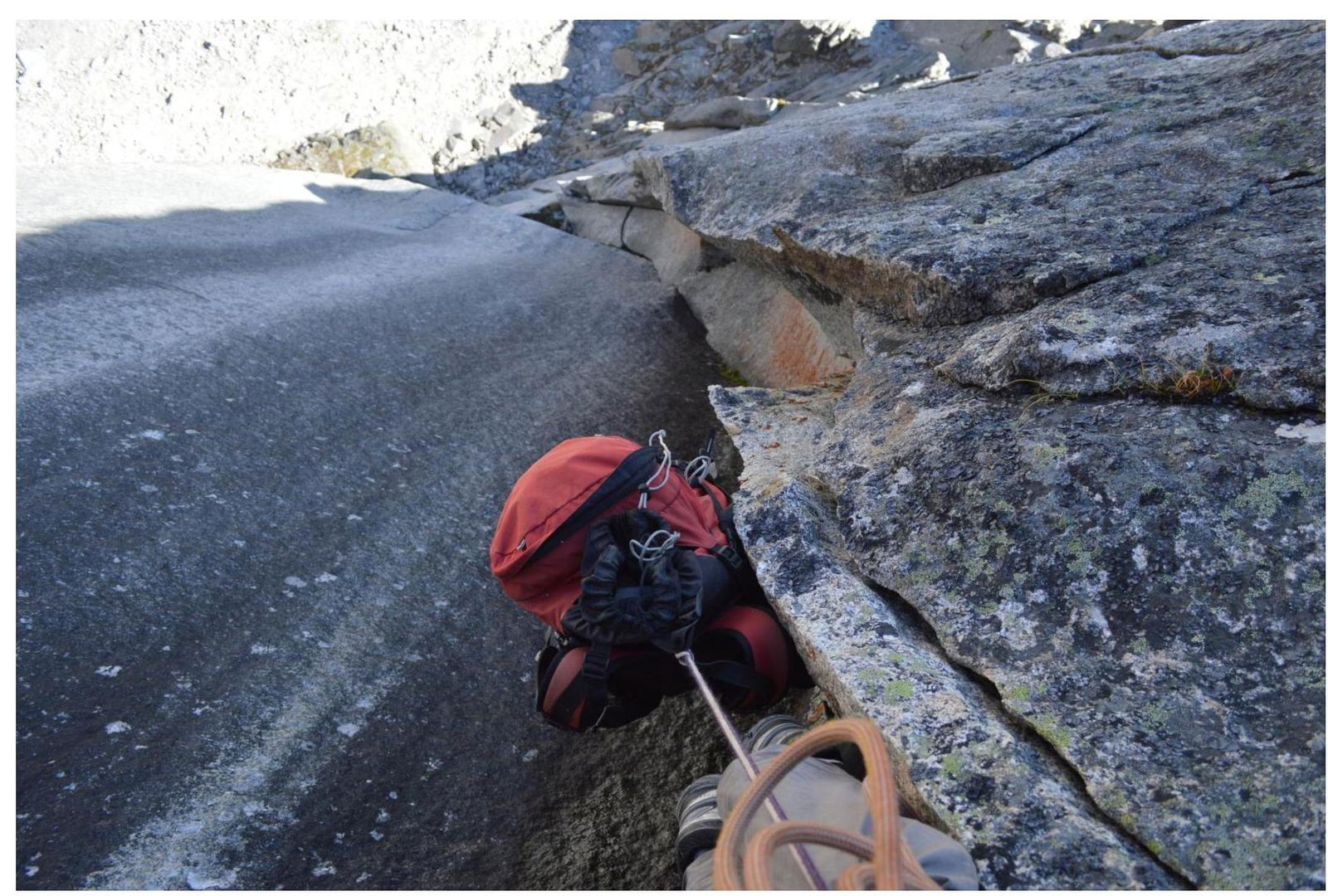
Start of the Route, Section R0–R1
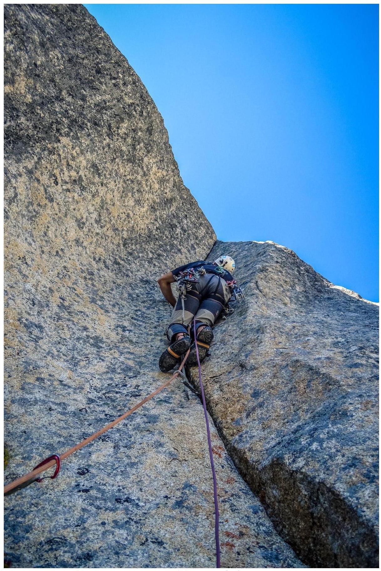
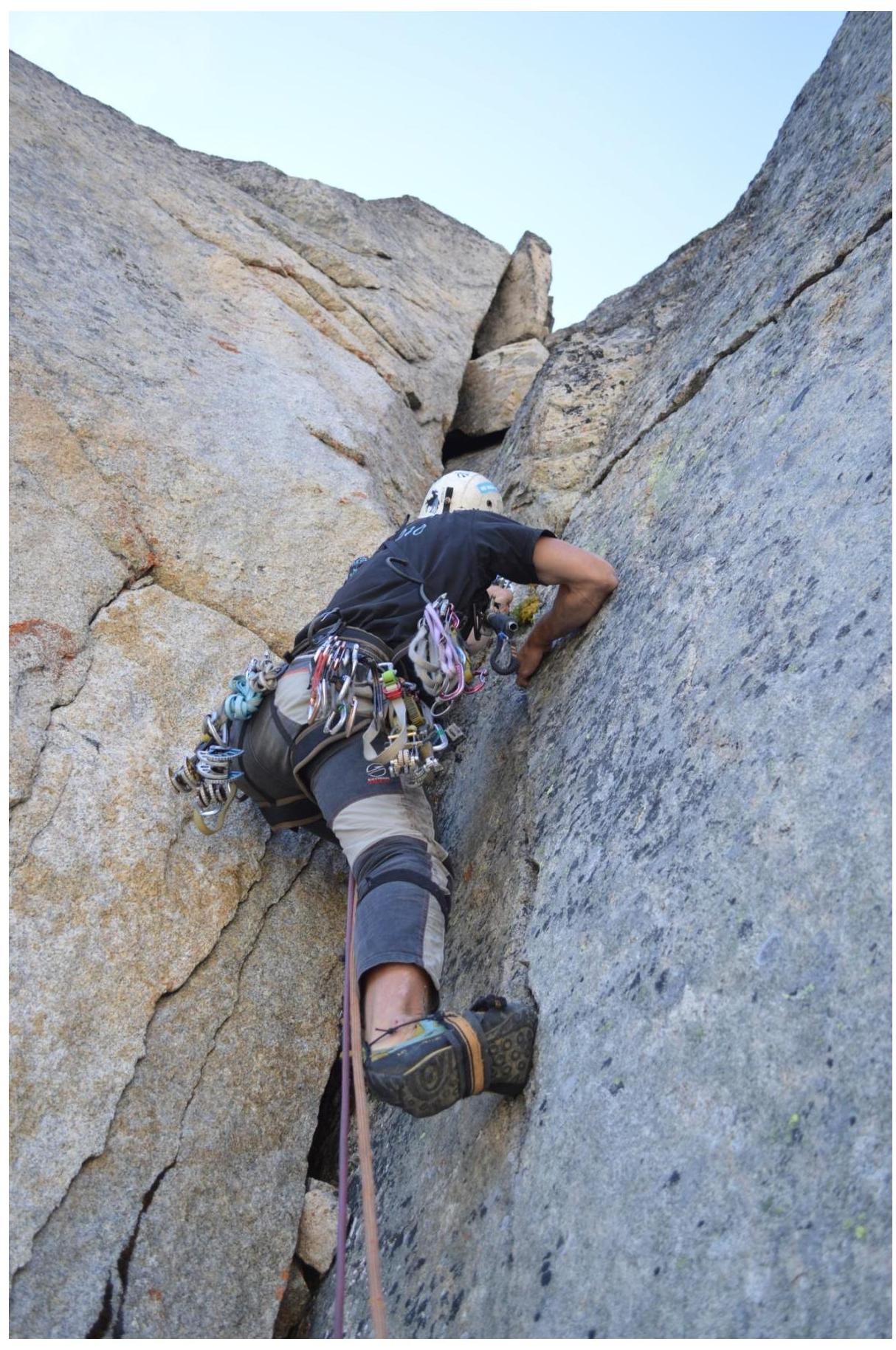
Section R1–R2
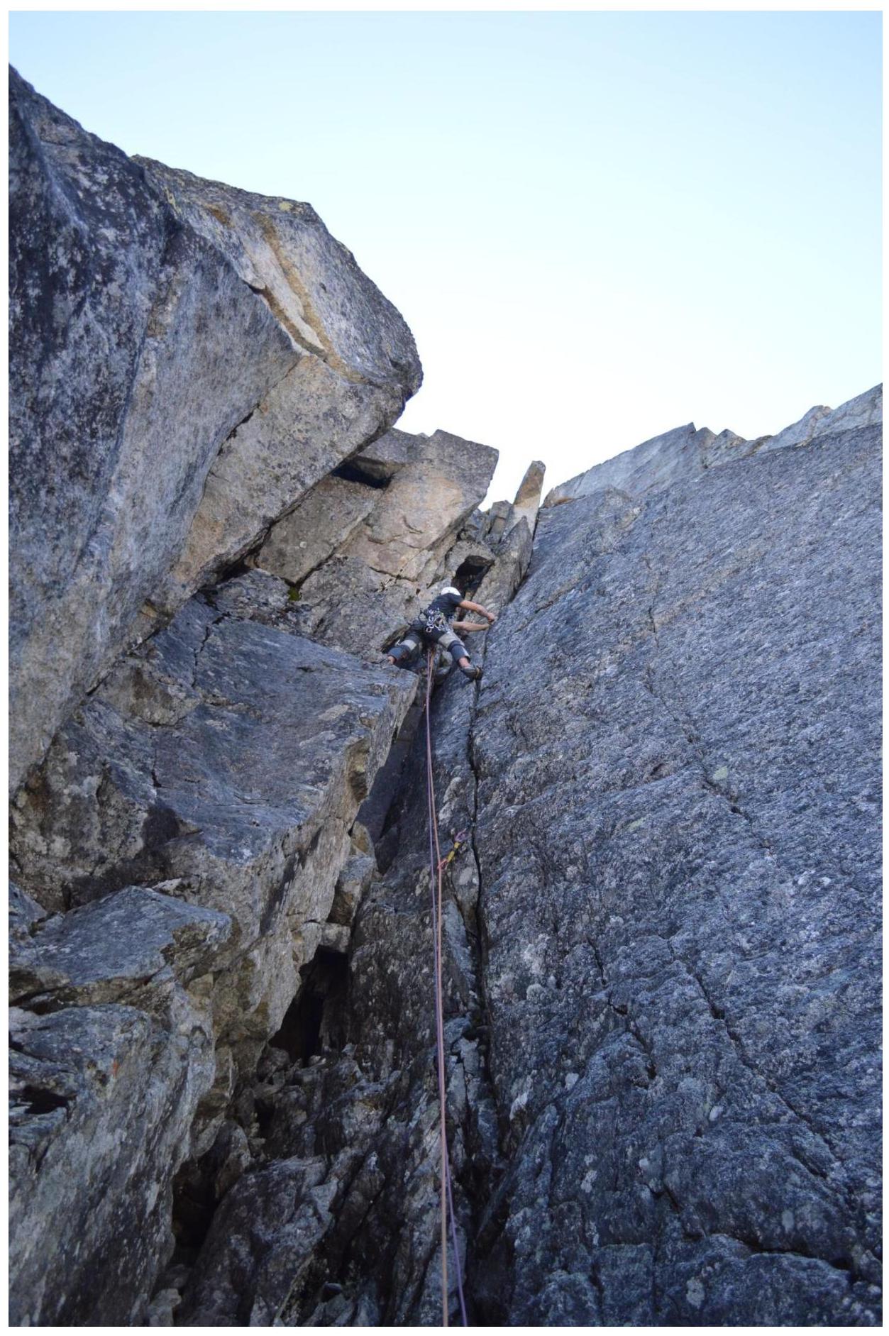
Section R2–R3: Exit to the Station through a Small Cornice. The Outreach of the Cornice on the Next Section is Clearly Visible.
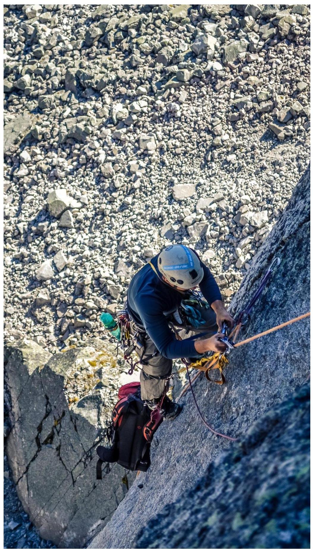
View from the Station Down to Section R2–R3
Passing the Big Cornice. Section R3–R4
End of Section R3–R4
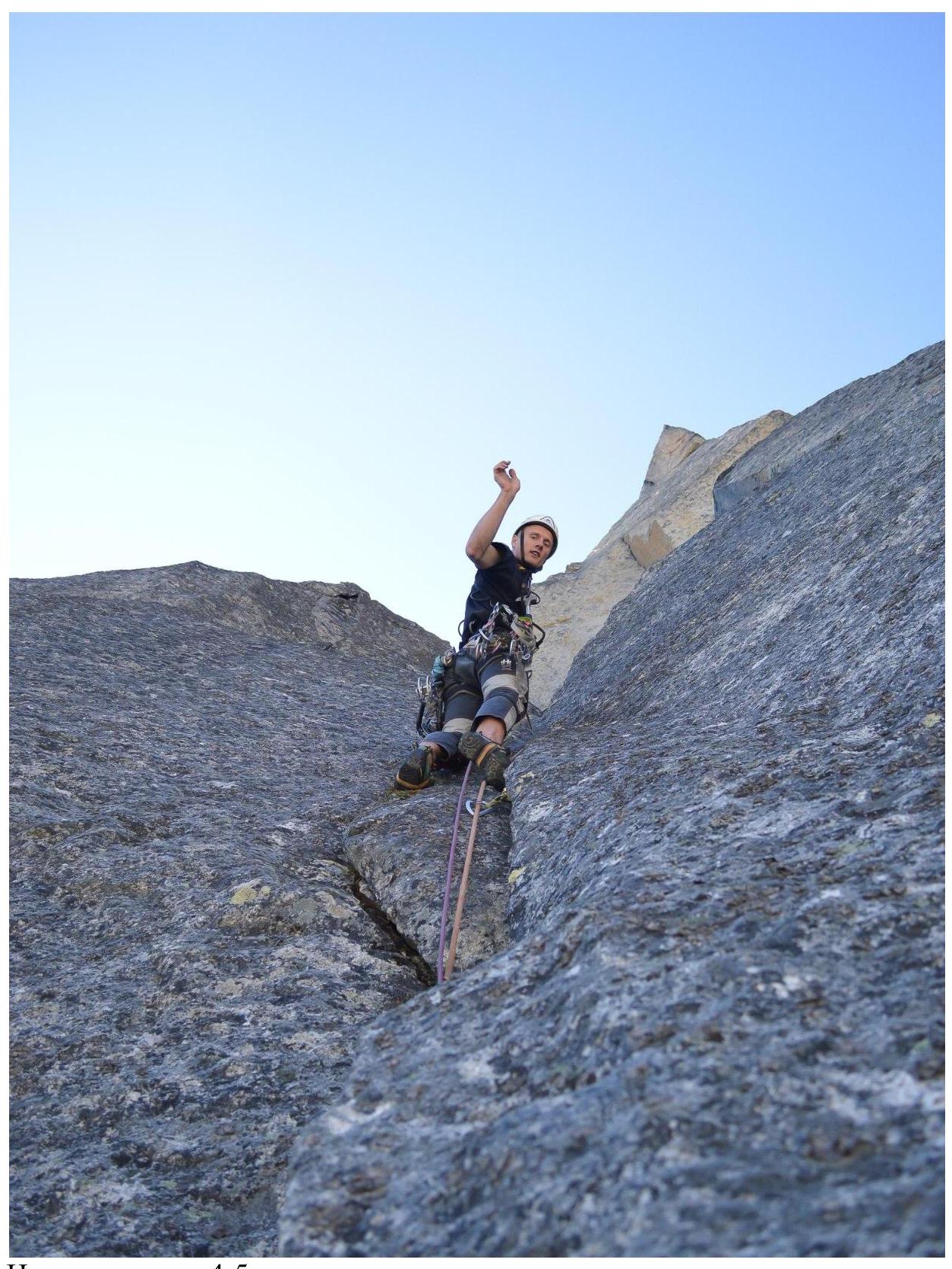
Start of Section R4–R5
Climbing through a Wide Corner on Section R5–R6
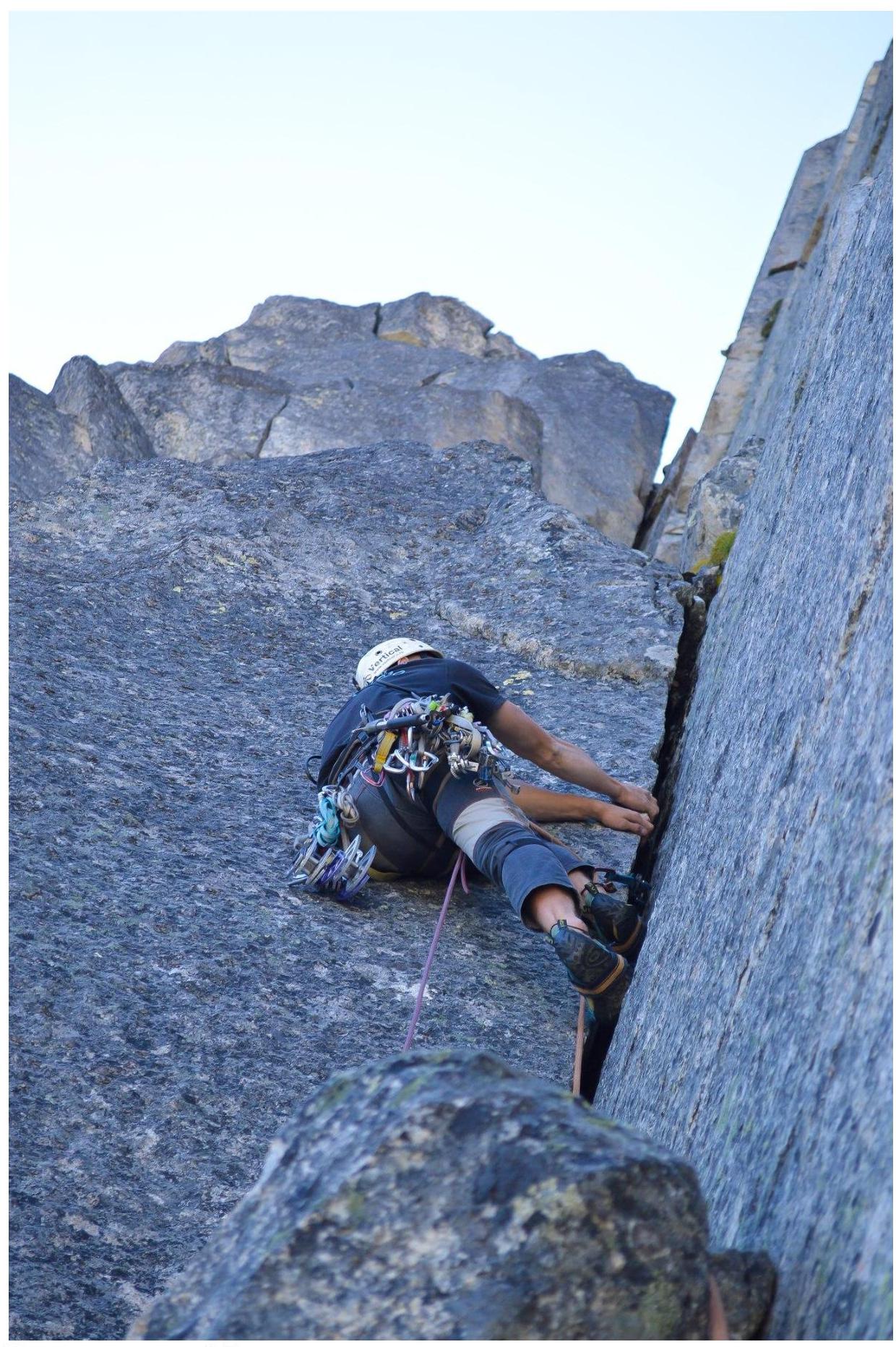
Start of Section R6–R7
Section R7–R8