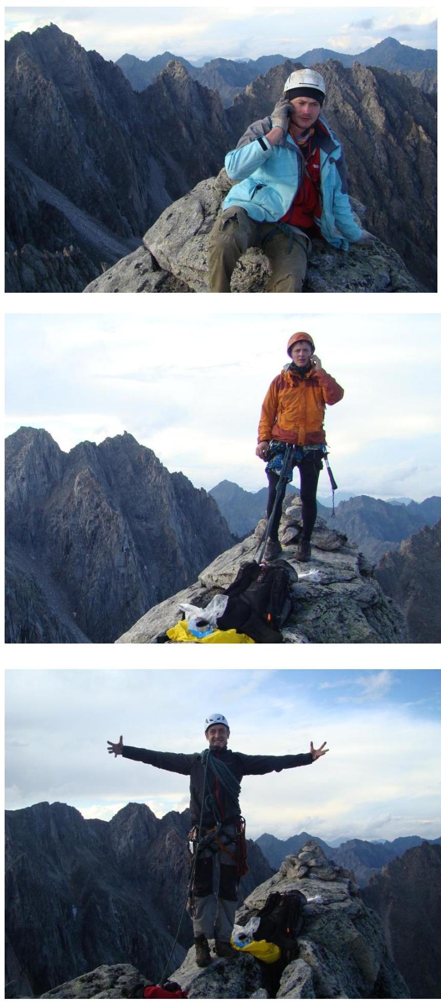
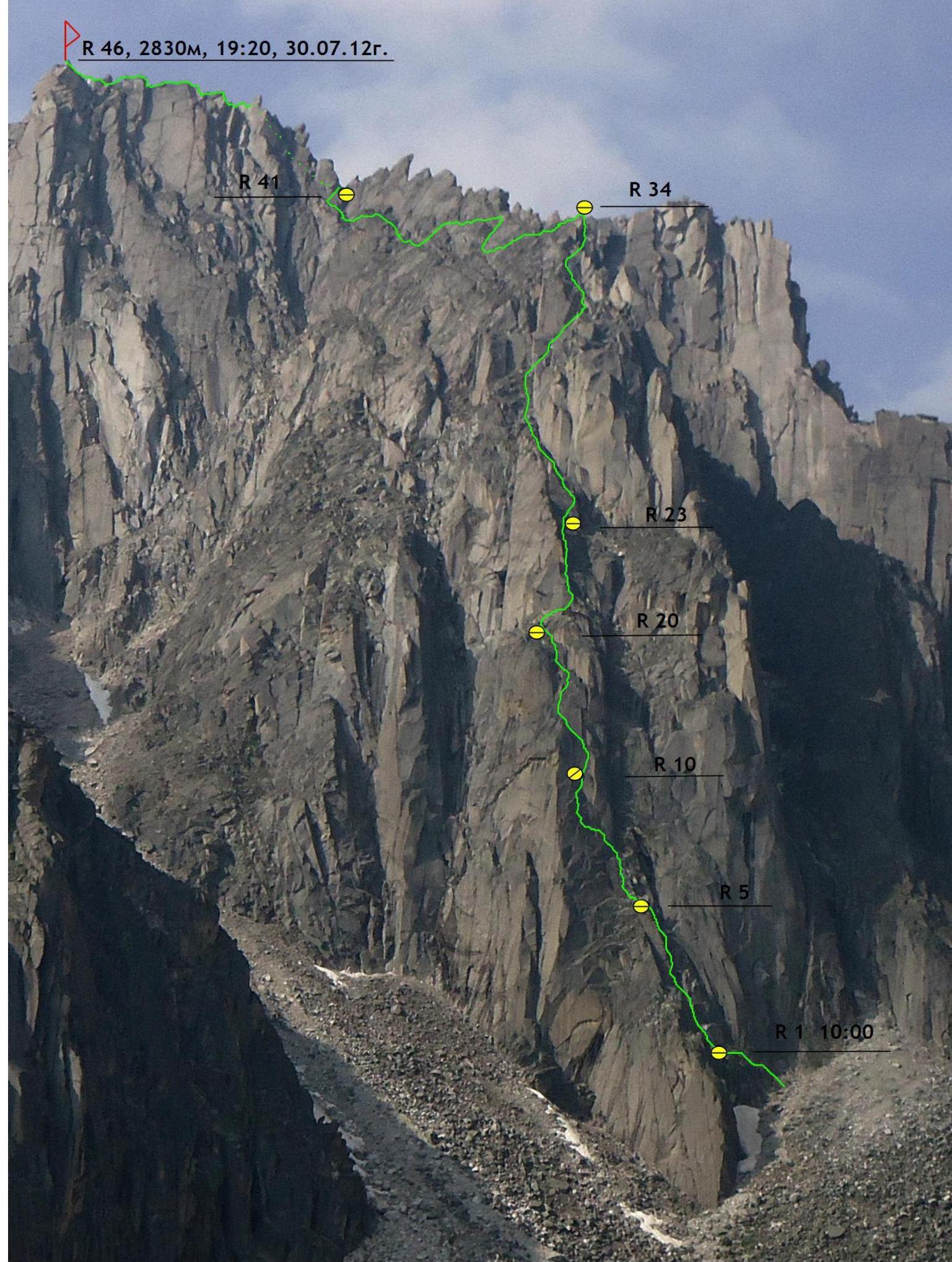
R46, 2830 m, 19:20, July 30, 2012
Report on the First Ascent
R34
Peak Sever (2830 m) via the North face of the Northwest shoulder. Route category 4B (proposed), first ascent. Eastern Sayan, Tunkinskie Goltsy ridge, Barun-Khandagai valley, 6.1.
Team leader: Klepitov A. A.
Participants:
- Ilyinsky V. A.
- Scherbany A. N.
R20–R10
R5–R1, 10:00
- Eastern Sayan, Tunkinskie Goltsy ridge, Barun-Khandagai valley, 6.1.
- Peak Sever (2830 m), via N side of NW shoulder.
- Proposed category 4B, first ascent.
- Route type: rock climbing.
- Route elevation gain: 496 m.
Route length: 724 m. Main section elevation gain: 186 m. Main section length: 217 m. Section lengths:
- Category IV: 160 m
- Category V: 92 m
- Category VI: 15 m
Average slope of the main section: 67°. Total route slope: 44°.
-
Pitons left on the route:
total: 0; including piton hammers — 0. Total used on the route: 36: Total number of belay points — 10.
total: 0; including piton hammers — 0. Used on the route:
- piton hammers — 0
- rock pitons (including anchors) — 21
- chocks — 13
- friends — 36
- sky-hooks (including sky-hook moves) — 6
Total number of belay points: 10. 7. Team's total climbing time (to the summit) — 9:20; days — 1.
Number of nights spent on the route — 0.
- Team leader: Klepitov Alexander Alexandrovich (Master of Sports).
Participants:
- Ilyinsky Vasily Andreevich (1st sports category)
- Scherbany Alexey Nikolaevich (2nd sports category)
-
Team coach: Afanasiev Andrey Evgenievich (Master of Sports), 1st category instructor.
-
Start of the route: 10:00, July 30, 2012.
Reached the summit: 19:20, July 30, 2012.
Returned to Base Camp: 22:00, July 30, 2012.
- Responsible for the report: Klepitov A. A. (Baikalteam@gmail.com).
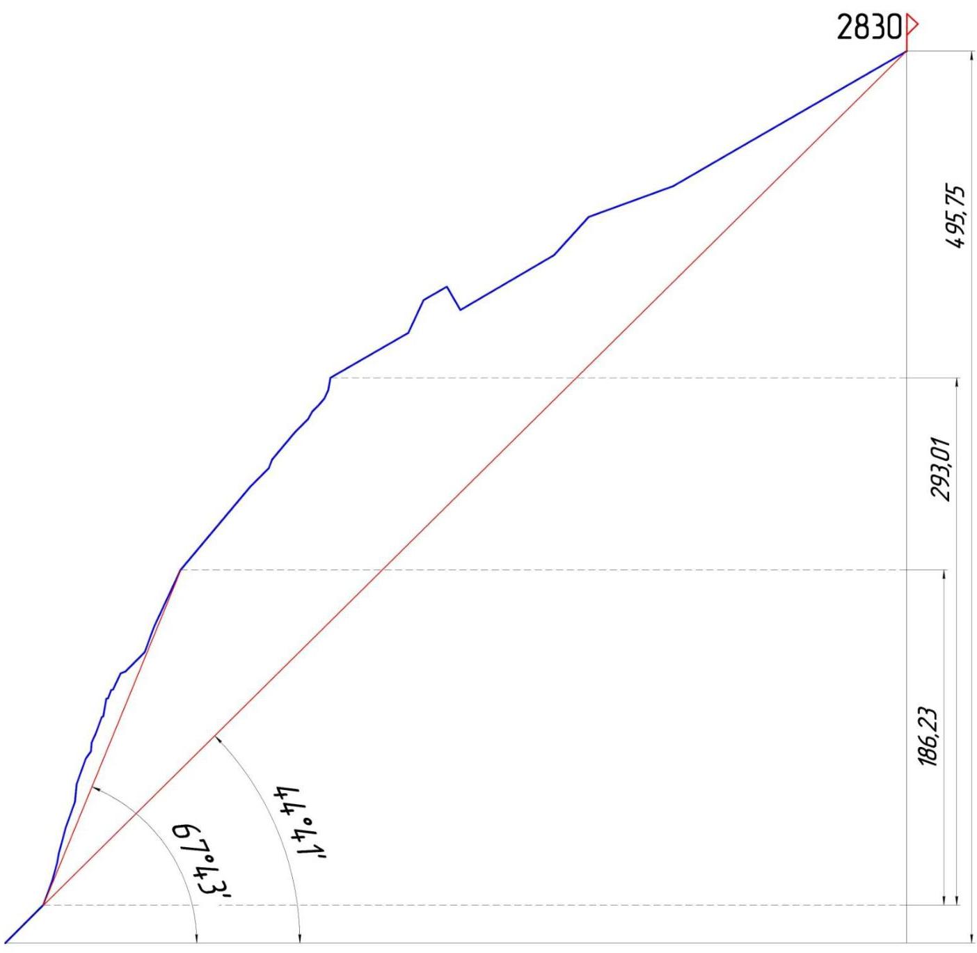
General view photo of the North face of Peak Sever
The photo was taken during the first ascent to Peak Monakh on July 29, 2012. The height of the shot is approximately 2600 m above sea level.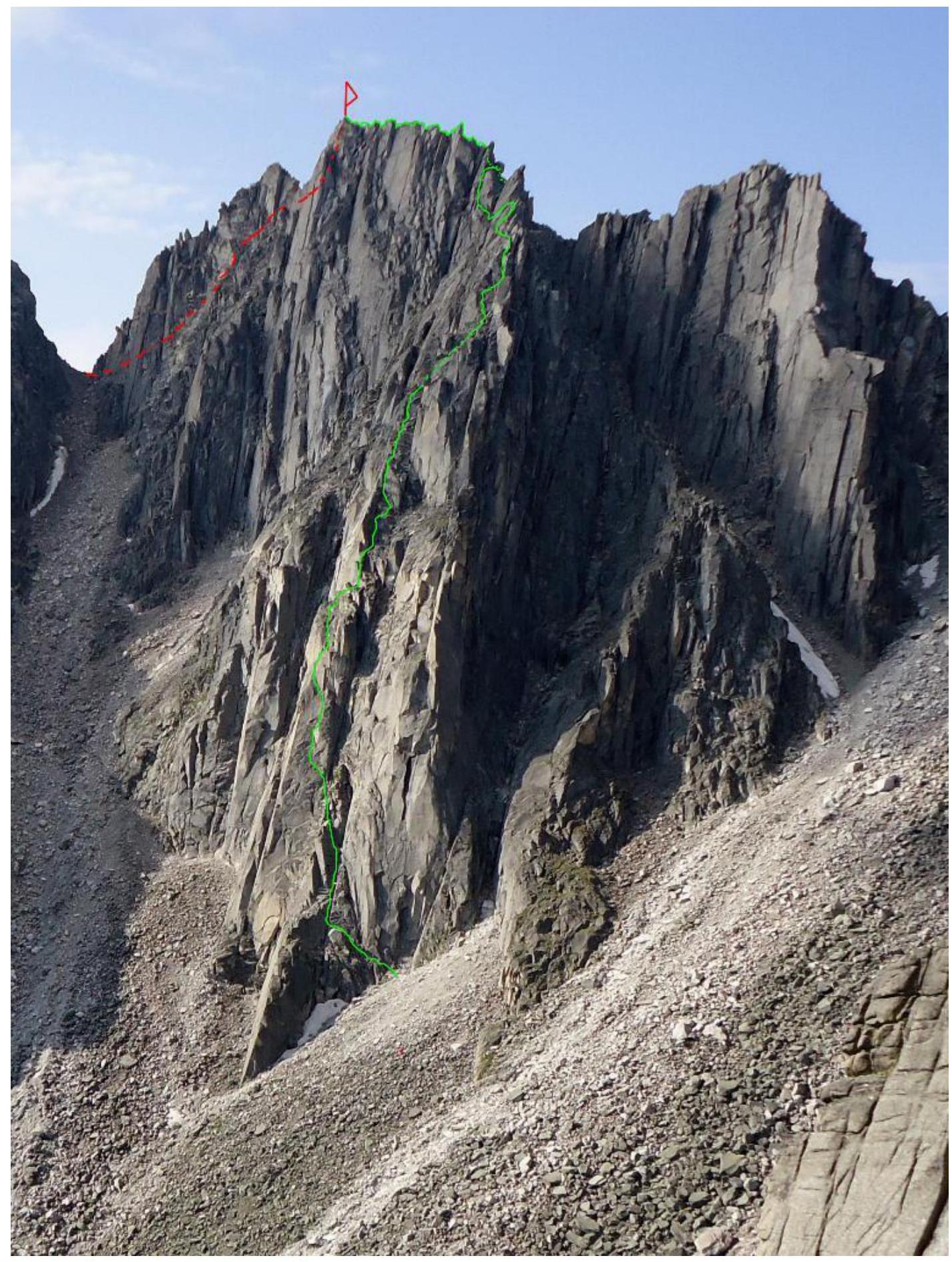
- RED — 1. Glazunov 2010, category 2B.
- GREEN — team's route, category 4B.
Left profile photo of the route (semi-profile)
Right profile photo of the route (lower part)

Drawn profile of the route
Panorama of the Alaska cirque peaks
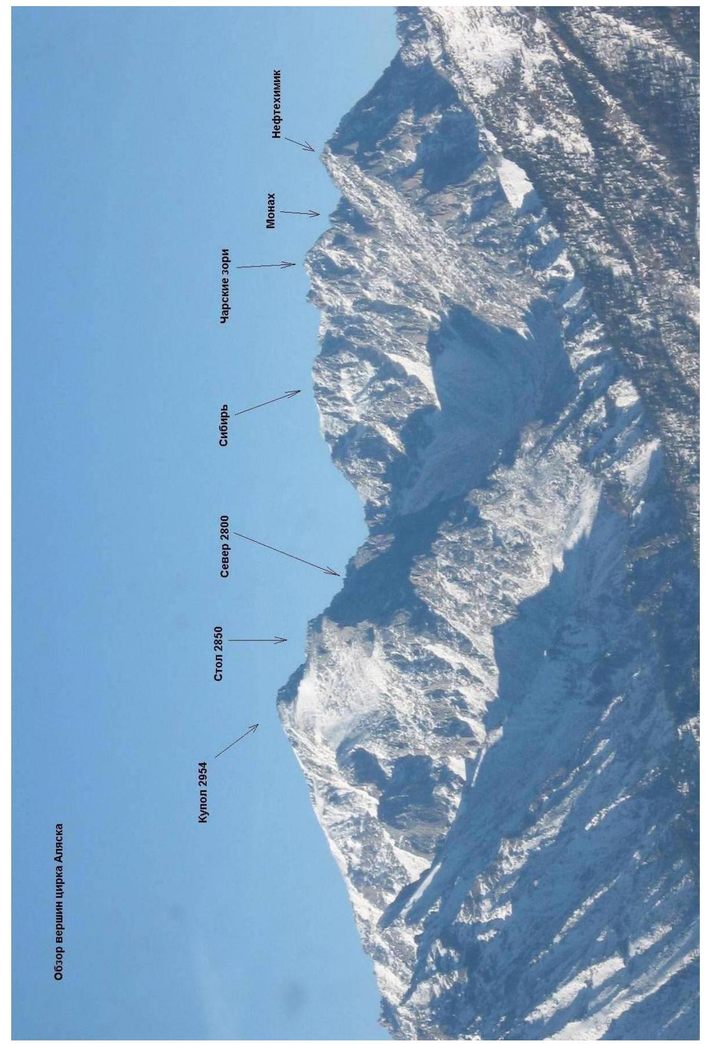
The Barun-Khandagai valley is one of the most promising areas in the Eastern Sayan for sports mountaineering.
Peak Kupol (2954 m) is the dominant peak in the area. It is located in the Tunkinsky district of the Republic of Buryatia. The nearest large settlement is the village of Arshan.
From Arshan, you can reach the entrance to the valley by a high-clearance vehicle — a journey of about 15 km. Further, you proceed on foot through the valley; there is a trail, and the area is popular with tourists during the summer.
The Alaska cirque is located on the left-hand side of the valley. The elevation gain on the approach is 1400 m, and the distance is approximately 15 km.
Approach time:
- Summer — 6–8 hours
- Winter — 5–6 days (due to the large amount of snow)
Peak Sever (2830 m) is located at the top of the Alaska cirque, on the left-hand side, behind Peak Stol (2850 m). The approach from the camp takes around 2 hours at a good pace.
Peak Sever is largely undeveloped due to the presence of more interesting walls on nearby peaks Kupol and Stol.
There is only summarizes classification category 2B route, which is the simplest path to the summit.
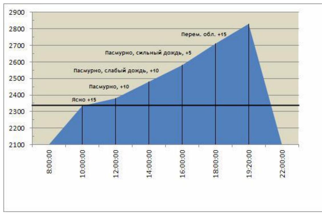
Team's movement schedule on the route
- July 30, 2012 — 8:00 Departure from camp.
- July 30, 2012 — from 10:00 to 15:00 completed the main part of the route to R23. Rain started.
- July 30, 2012 — from 15:00 to 19:20 completed sections R23–R46 (reached the summit).
- July 30, 2012 — 22:00 returned to camp.
Main section route diagram, drawn in UIAA symbols, scale 1:2000, sheet 1
| Section | Chock elem. | Friend | Rock piton | Rock X. Fifs | Piton hammers | Route diagram in UIAA symbols M 1:2000 Sheet 1 | Length (m) | Slope (°) | Climbing | ITO |
|---|---|---|---|---|---|---|---|---|---|---|
| R34–R35 | - | 1 | - | - | - | 50 | 30 | 3− | - | |
| R33–R34 | 1 | 1 | - | - | - | 7 | 80 | 5− | - | |
| R30–R33 | - | 1 | 1 | - | - | (15) | (45–65) | (3+, 4−) | - | |
| R28–R30 | 1 | - | - | - | - | 10 | 45 | 3− | - | |
| R27–R28 | - | 1 | - | 20 | 50 | 3− | ||||
| R26–R27 | - | 1 | - | - | - | 5 | 70 | 4+ | - | |
| R25–R26 | - | 1 | - | 15 | 45 | 2− | ||||
| R24–R25 | 1 | 2 | - | - | - | 30 | 50 | 3− | - | |
| R23–R24 | 1 | 1 | - | - | - | 30 | 50 | 3+ | - | |
| R22–R23 | - | 2 | 2 | - | - | 35 | 65 | 4− | - | |
| R21–R22 | - | 1 | 1 | - | - | 15 | 70 | 5− | - | |
| R20–R21 | - | - | - | 15 | 45 | 2+ | - | |||
| R19–R20 | 1 | - | 2 | - | - | 5 | 10 | 1+ | - | |
| R18–R19 | 1 | 1 | - | 10 | 65 | 4+ | - | |||
| R16–R17 | - | - | - | - | - | 5 | 70 | 4+ | - | |
| R14–R15 | 1 | 1 | - | 10 | 80 | 5+ | - | |||
| R13–R14 | - | 1 | 1 | - | - | 5 | 30 | 3− | - | |
| R12–R13 | - | - | 1 | 6 | - | 10 | 70 | 6+ | A2 | |
| R11–R12 | 1 | 5 | 65 | 5− | - | |||||
| R10–R11 | 2 | 2 | - | - | - | 5 | 85 | 6− | A1 | |
| R9–R10 | 1 | 1 | - | 5 | 55 | 3+ | - | |||
| R8–R9 | - | 1 | 1 | - | - | 15 | 70 | 4+ | - | |
| R7–R8 | - | - | - | 5 | 40 | 3− | ||||
| R6–R7 | - | 1 | 1 | - | - | 10 | 85 | 5+ | - | |
| R5–R6 | - | - | 1 | 15 | 70 | 5− | ||||
| R4–R5 | 1 | 2 | 2 | - | - | 15 | 75 | 5− | - | |
| R3–R4 | 1 | 1 | - | - | 5 | 80 | 5+ | - | ||
| R2–R3 | - | 1 | 1 | 10 | 75 | 5− | - | |||
| R1–R2 | - | - | 2 | - | - | 15 | 70 | 5+ | - | |
| R0–R1 | - | - | - | - | - | 30 | 45 | 2+ | - |
Main section route diagram, drawn in UIAA symbols, scale 1:2000, sheet 2
| Section | Chock elem. | Friend | Rock piton | Rock X. Fifs | Piton hammers | Route diagram in UIAA symbols M 1:2000 Sheet 2 | Length (m) | Slope (°) | Climbing | ITO |
|---|---|---|---|---|---|---|---|---|---|---|
| R45–R46 | - | - | - | - | - | (55) | (20–55) | (2−, 4+) | - | |
| R44–R45 | - | - | - | - | - | 5 | 65 | 4+ | - | |
| R43–R44 | 30 | 40 | 2− | |||||||
| R42–R43 | - | 1 | - | - | - | 20 | 50 | 3− | - | |
| R41–R42 | - | - | - | - | - | 50 | 30 | 2− | - | |
| R40–R41 | - | 2 | - | - | - | 15 | 60 | 4− | - | |
| R39–R40 | - | 1 | 1 | - | - | 15 | 60 | 4− | - | |
| R38–R39 | 1 | 2 | - | - | - | 60 | 30 | 2+ | - | |
| R37–R38 | 1 | 1 | - | - | - | 15 | 60 | 4− | - | |
| R36–R37 | - | 1 | - | - | - | 15 | 60 | 3+ | - | |
| R35–R36 | - | 1 | 1 | - | - | 20 | 65 | 3+ | - | |
| R34–R35 | - | 1 | 1 | 1 | - | 50 | 30 | 3− | - |
Relief description
R0–R1. 30 m, 45°, 2+. Diagonal shelf left. R1–R2. 15 m, 70°, 5+. Upwards. R2–R3. 10 m, 75°, 5−. Chimney with a cork. R3–R4. 5 m, 80°, 5+. Chimney upwards. R4–R5. 15 m, 75°, 5−. Rectangular chimney. R5–R6. 15 m, 70°, 5−. Polished slabs. R6–R7. 10 m, 85°, 5+. Move left on flakes. R7–R8. 5 m, 40°, 3−. Shelf left. R8–R9. 15 m, 70°, 4+. Slab upwards. R9–R10. 5 m, 55°, 3+. Up to the station, under a steep section. R10–R11. 5 m, 85°, 6−, A1. Steep section, a small ledge at the top. R11–R12. 5 m, 65°, 5−. Upwards. R12–R13. 10 m, 70°, 6+, A2. Left on a crack. R13–R14. 5 m, 30°, 3−. Traverse left. R14–R15. 10 m, 80°, 5+. Wide chimney upwards. R15–R16. 1 m. Ledge. R16–R17. 5 m, 70°, 4+. Wall. R17–R18. 1 m. Ledge. R18–R19. 10 m, 65°, 4+. Wall. R19–R20. 5 m, 10°, 1+. Wide ledge. R20–R21. 15 m, 45°, 2+. Steep, crumbling ledge upwards to the right. R21–R22. 15 m, 70°, 5−. Edge upwards. R22–R23. 35 m, 65°, 4−. Chimney. R23–R24. 30 m, 50°, 3+. Up on a system of ledges. R24–R25. 30 m, 50°, 3−. Edge. R25–R26. 15 m, 45°, 2−. Wide, steep, slippery ledge. R26–R27. 5 m, 70°, 4+. Wall. R27–R28. 20 m, 50°, 3−. Wide, steep, slippery ledge. R28–R29. 10 m, 45°, 3−. R29–R30. 5 m, 60°, 4−. R30–R31. 5 m, 45°, 3+. R31–R32. 5 m, 50°, 4−. R32–R33. 5 m, 65°, 4−. R33–R34. 7 m, 80°, 5−. Narrow chimney, exit on a toehold. R34–R35. 50 m, 30°, 3−. Start on a ridge, then left of it for the entire rope length. R35–R36. 20 m, 65°, 3+. Gully with grass, exit on a ridge. R36–R37. 15 m, 60°, 3+. Move left of the ridge. R37–R38. 15 m, 60°, 4−. Descend climbing. R38–R39. 60 m, 30°, 2+. On ledges. R39–R40. 30 m, 60°, 4−. Exit on a ridge. R40–R41. 50 m, 30°, 2−. Traverse on a ridge connecting peaks Sever and Sibir. R41–R46. 100 m, 30–50°, (1+)–(4+). Ridge walk to the summit.
Technical photo of the route
R46, 2830 m, 19:20, July 30, 2012
R34
R10
R11
Route characteristics and team's actions on the wall
The route taken by our team goes up the North face of the Northwest shoulder of Peak Sever. Most of the route follows the external forms of the mountain's macro-relief. As a result, the route has a low risk of rockfall overall. The granite-syenite composition of the mountain also adds to its solidity and monolithic nature, a characteristic common to the entire cirque.
The key part of the route is the lower section, consisting of five pitches with a total length of 217 m and an elevation gain of 186 m.
The route starts to the right of the characteristic "iron" — the lowest part of the North face.
After the second rope length, there is an option to go right through a steep section and chimneys, but they are often wet and pose a risk of rockfall. For this reason, this section was passed on the left.
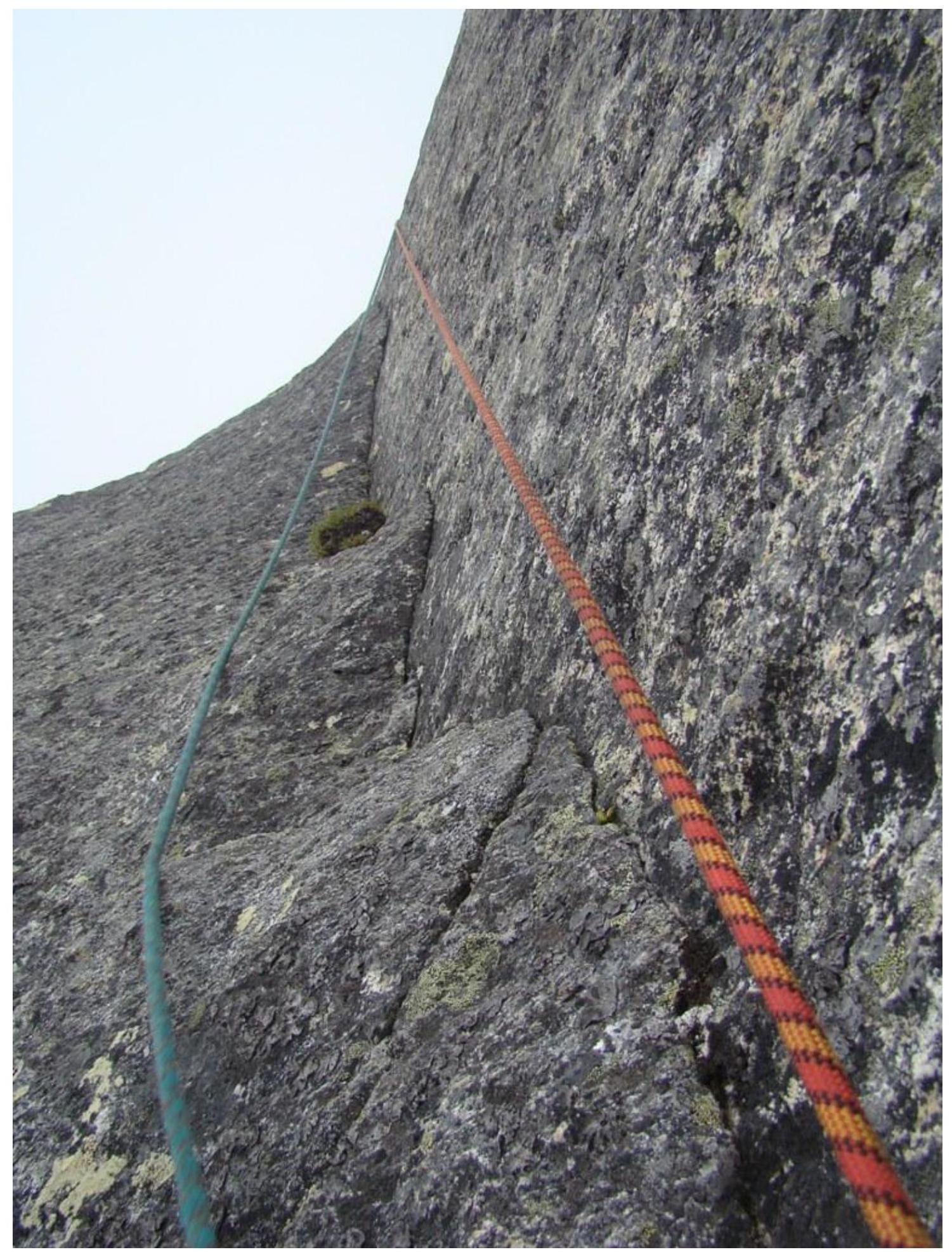
On the section R1–R23, fixed ropes were used.
The climbing difficulty ranges mainly from 4+ to 6+ (Russian grading) or 5a to 6C (French grading).
The upper part of the route is not particularly challenging. After reaching the ridge, it's advisable to stay on the left side, moving along a series of ledges. Only in the upper part does the route turn over the edge to the right and then onto another ridge.
On the section R23–R46, both simultaneous and alternating movement were used.
The descent from the summit is done via the simplest path, category 2B, to the saddle between peaks Stol and Sever, and then down a couloir into the Alaska cirque. The descent can be done by climbing and takes approximately 3 hours from the summit to the camp.
Diagram showing the location of photographic material, with an arrow indicating the visible section

1. First rope length
Section R0–R5. Belayer is at R1, leader is at R2. The photo was taken from the scree, about 20 m from the start of the route.
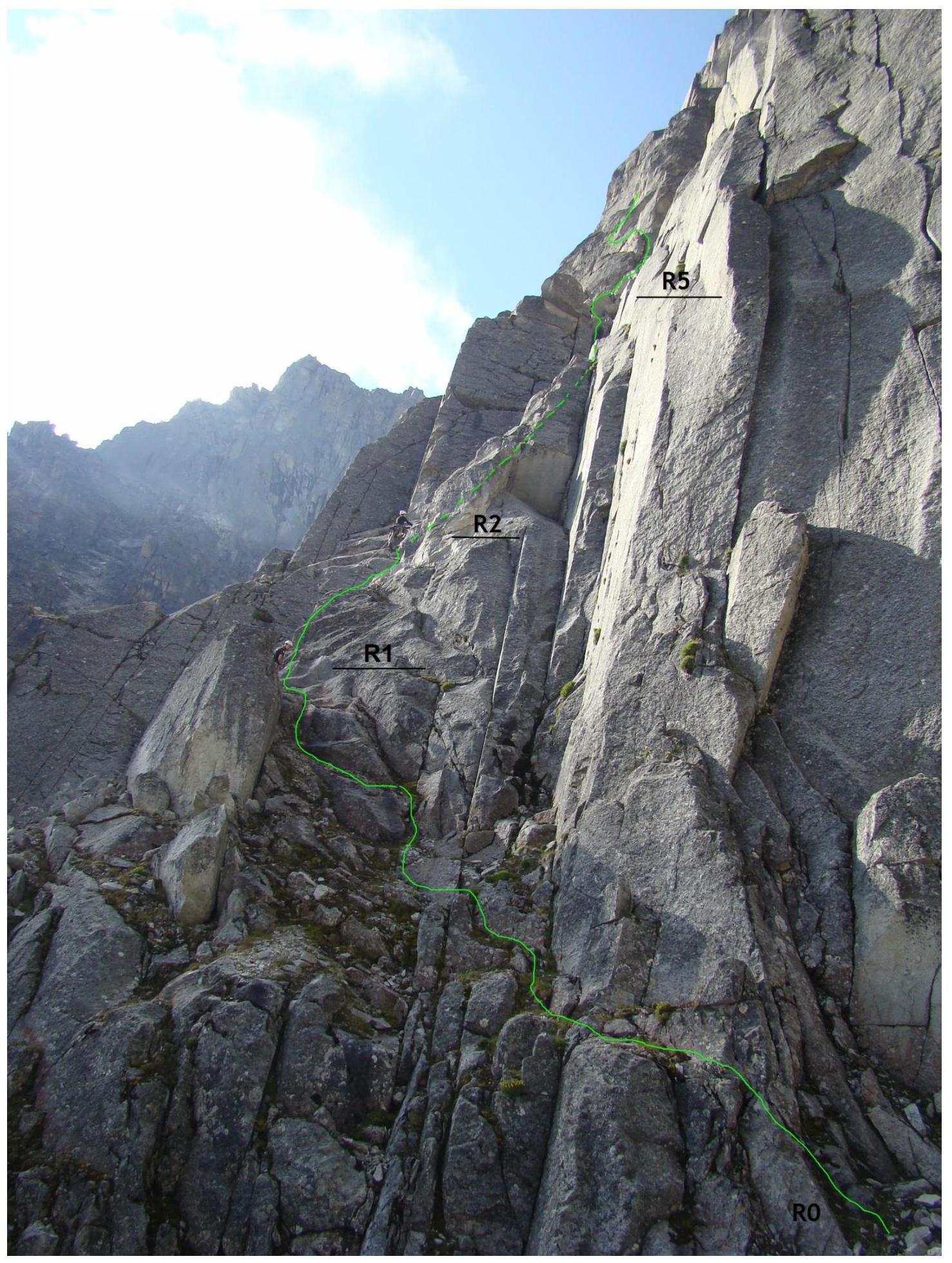
2. Section R2–R3. Chimney with a cork
The photo was taken from R2.
3. Second rope length
Section R5–R7. Climbing 5−, 5+. The photo was taken from the station at R5.
4. Second rope length, top
Section R7–R9. The photo was taken from the station at R5.
5. Third rope length
Section R10–R11. Climbing 6− (6B French), ITO A1. The photo was taken from the station at R10.

6. Third rope length, middle, most difficult section of the route
Section R12–R13. ITO A2, climbing 6+ (6C French). The photo was taken from R12.
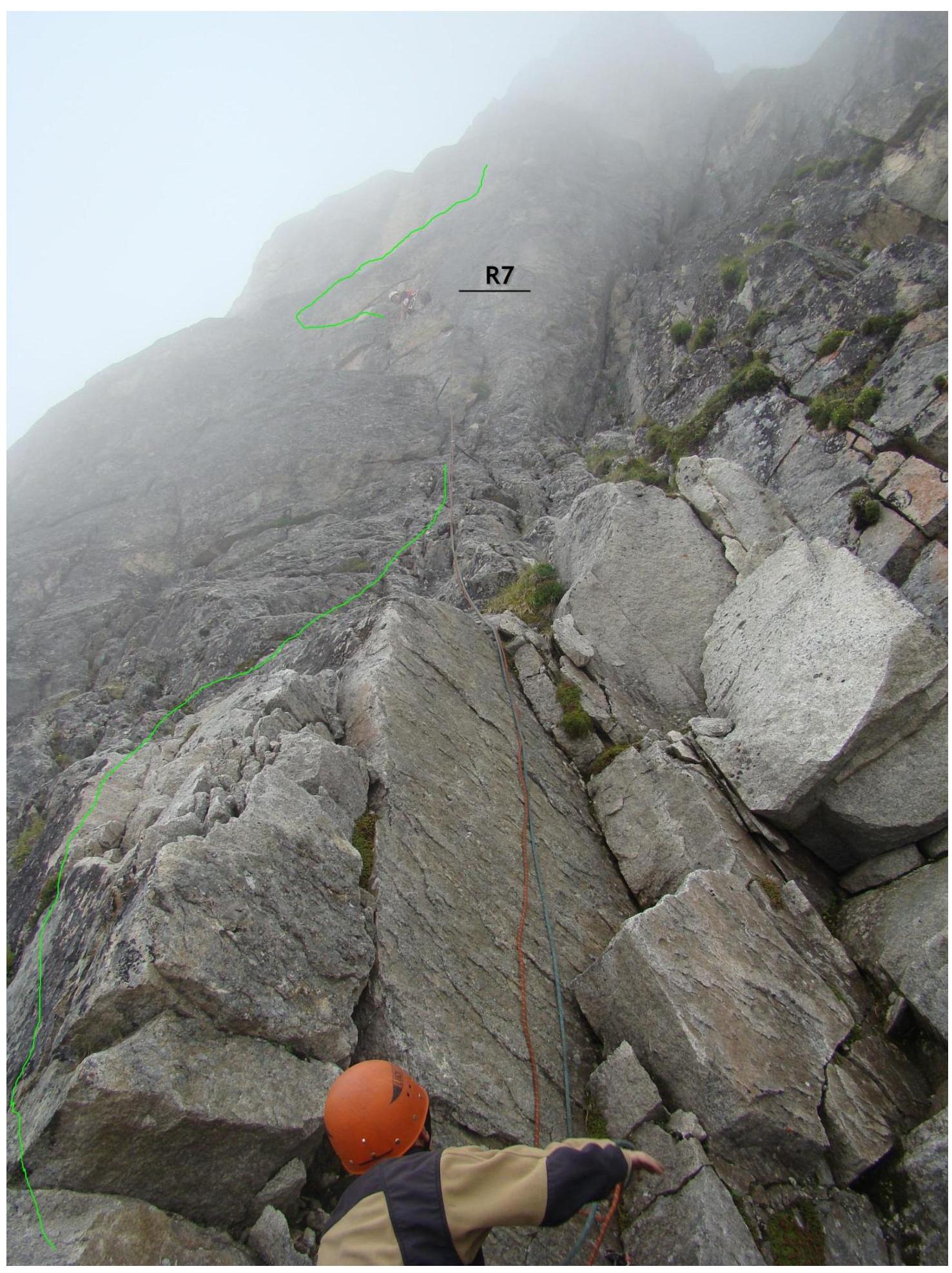
7. Fourth rope length
Sections R21–R23. Second climber overcoming the fixed rope.
The photo was taken from R23.
8. Exit to the ridge
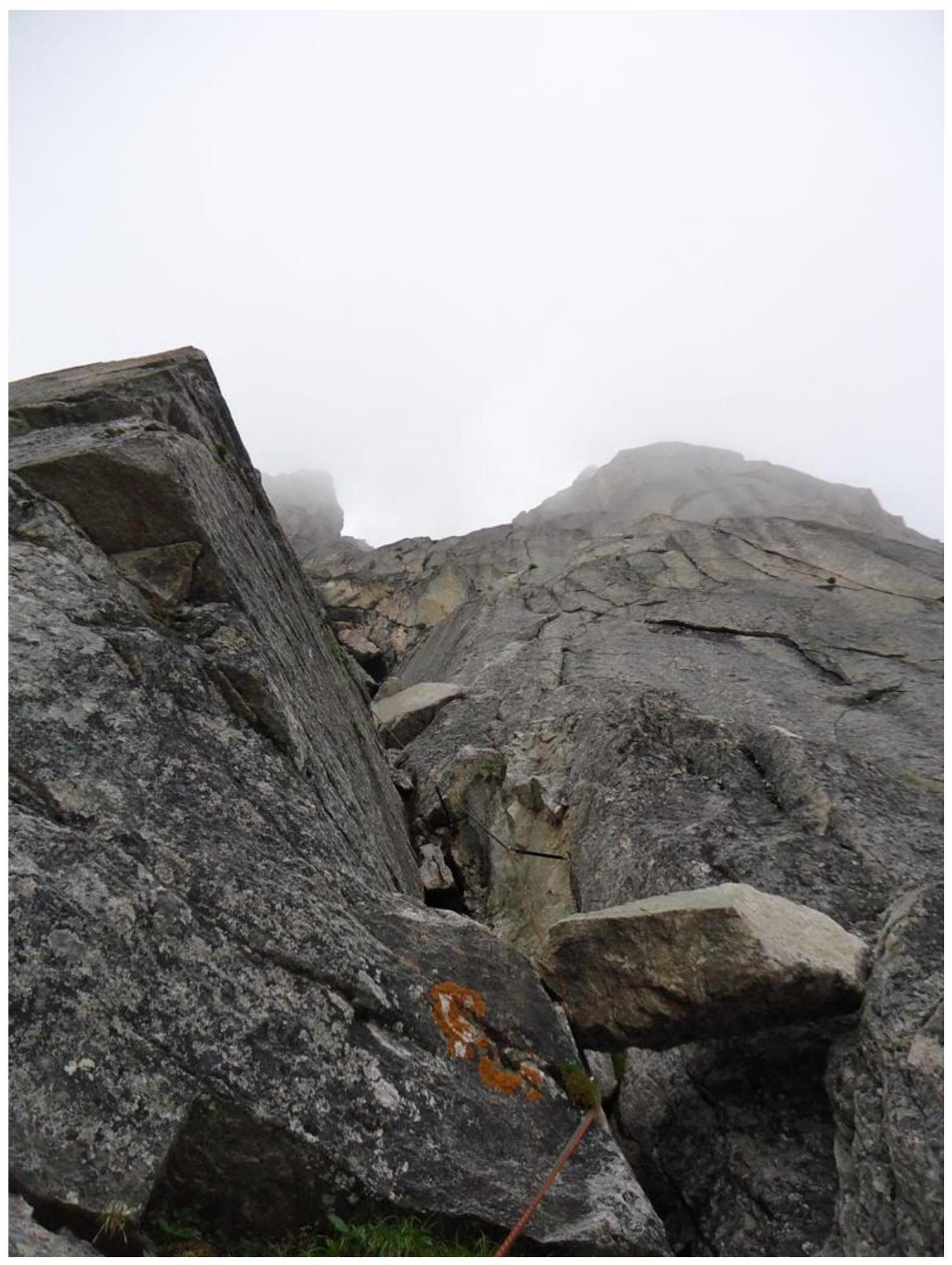
Section R29–R34.
The photo was taken from R34 (station on the ridge).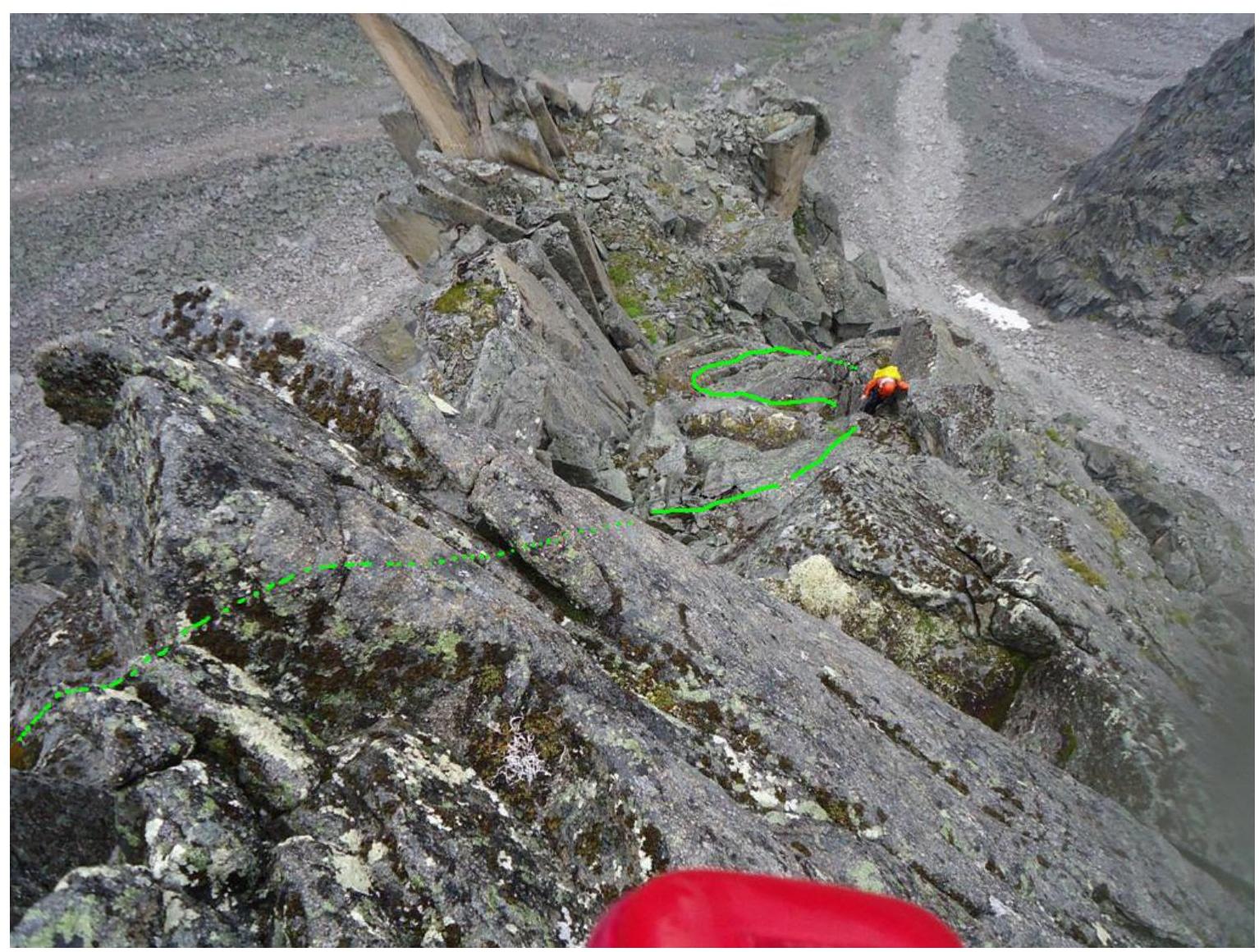
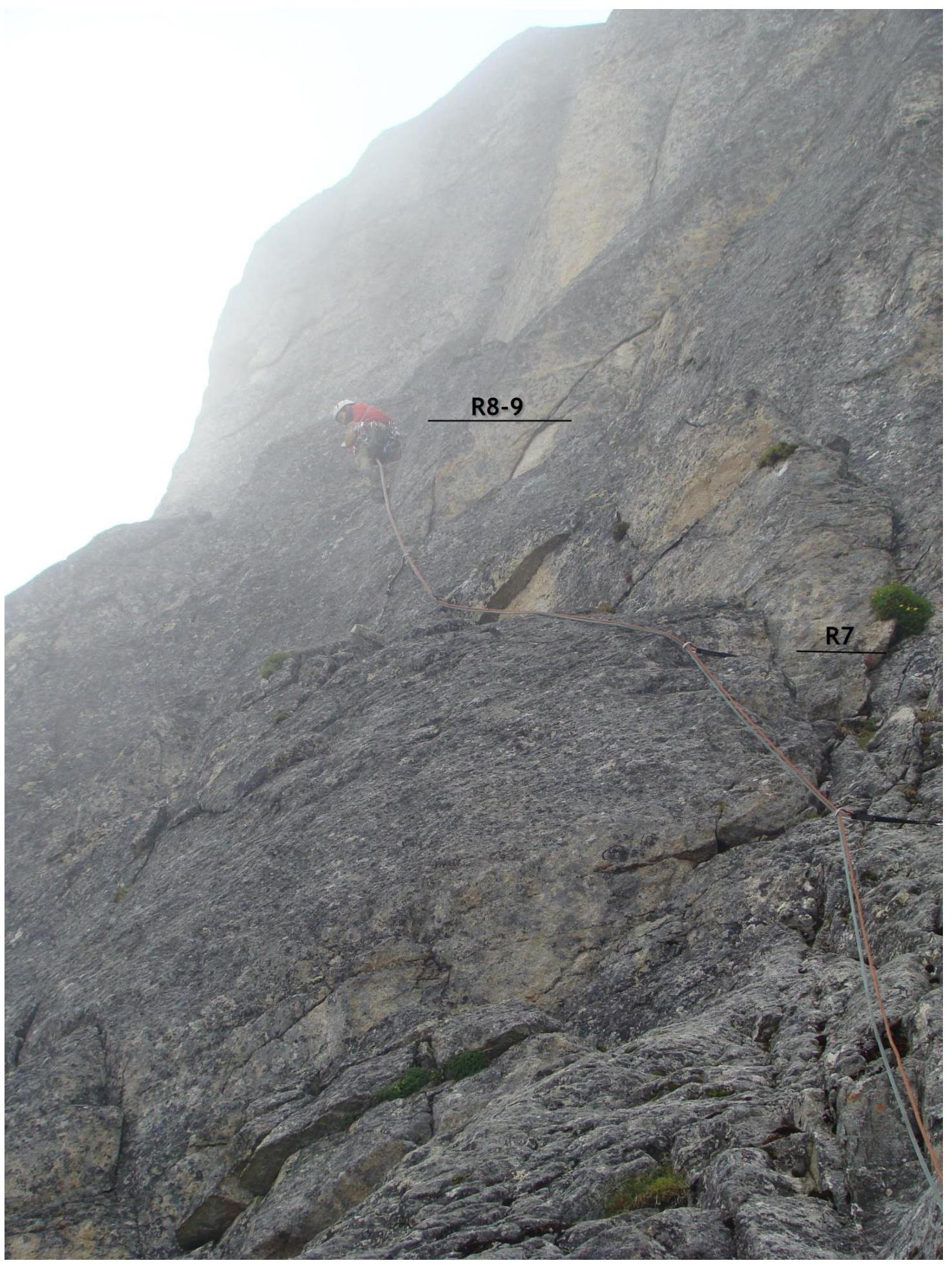
9. Middle of the ridge
Section R37–R39.
The photo was taken from R39.
10. Section R34–R40
Leader is on R39–R40. The photo was taken from R39–R40.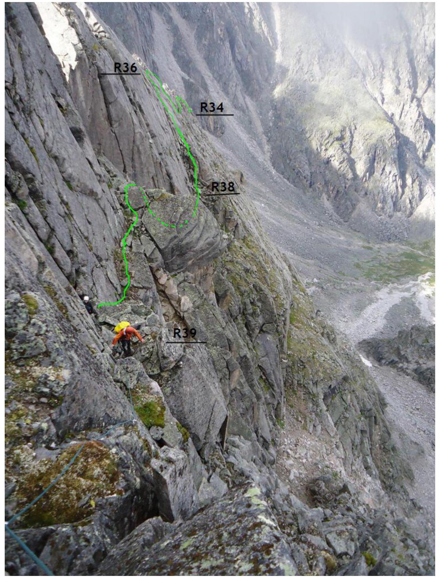
11. Ridge before the summit
Section R44–R46. The photo was taken from R45–R46, 30 m from the summit.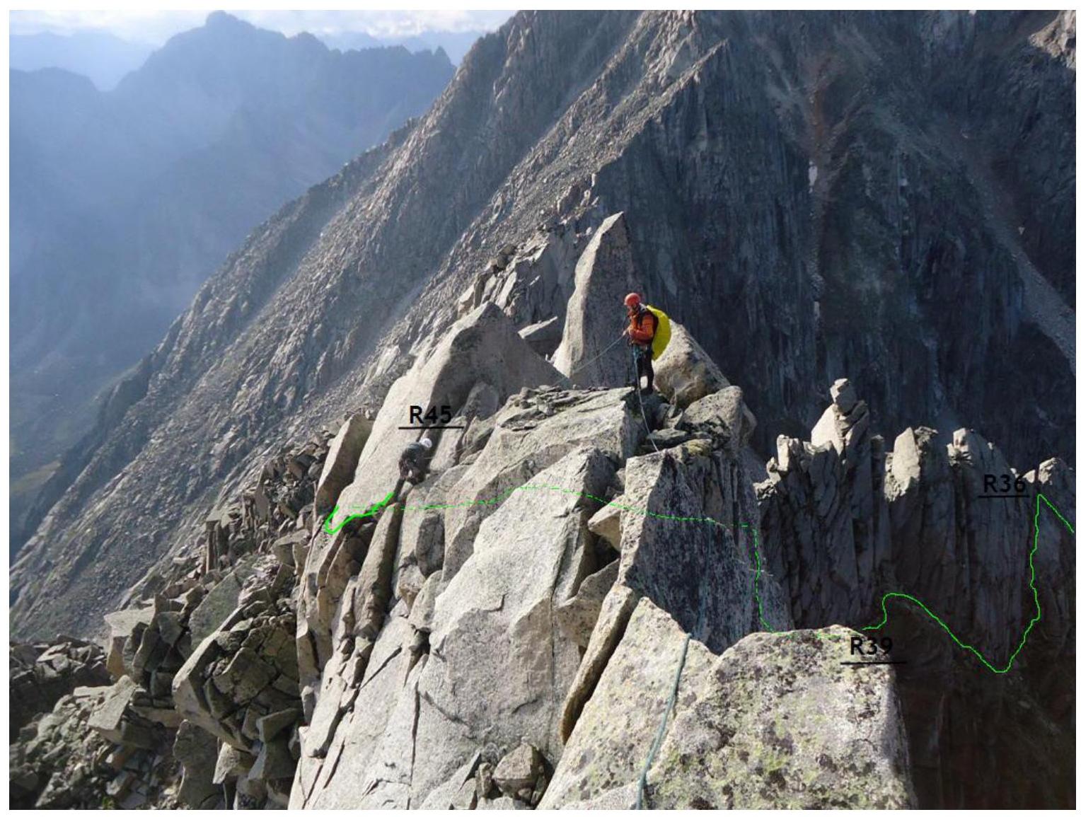
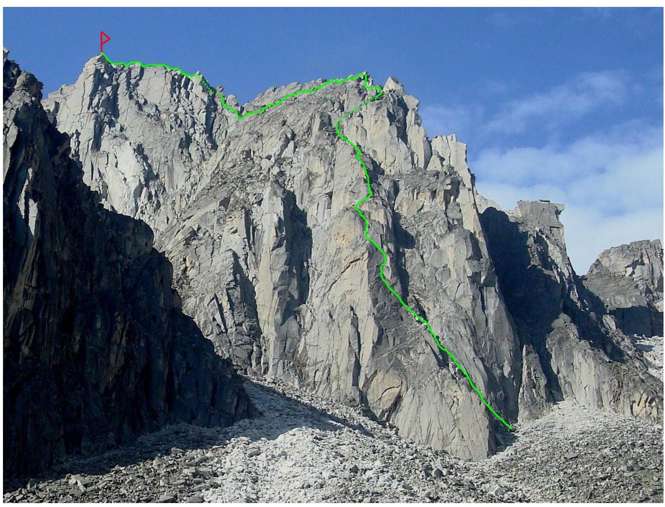
Team members: Klepitov A. A., Ilyinsky V. A., Scherbany A. N.