Report
ON THE FIRST ASCENT TO THE SUMMIT SVERDLOVSK VIA THE WESTERN BUTTRESS OF THE SOUTH RIDGE, CATEGORY 2B DIFFICULTY, BY THE TEAM OF THE "GORY BAIKALA" CLUB FROM 26.04.2018 TO 26.04.2018
I. Climbing Passport
| № | 1. General Information | |
|---|---|---|
| 1.1 | Full name, sports rank of the leader | Panova Alena Mikhailovna (1st sports rank) |
| 1.2 | Full name, sports rank of the participants | Dmitriev Dmitry Vladimirovich, Pyankovskaya Svetlana Petrovna, Shelikov Alexey Ivanovich, Khabdaev Alexey Kirillovich |
| 1.3 | Full name of the coach | Glazunov Evgeny Vladimirovich |
| 1.4 | Organization | Irkutsk Regional Public Organization "Club of Active Recreation and Alpinism 'Gory Baikal'" |
| 2. Characteristics of the Climbing Object | ||
| 2.1 | Region | Eastern Sayan, Tunkinskie Goltsy ridge |
| 2.2 | Valley | Barun-Khandagai |
| 2.3 | Section number according to the 2013 classification table | 6.1.2 |
| 2.4 | Name and height of the summit | Sverdlovsk, 2693 m |
| 2.5 | Geographical coordinates of the summit (latitude/longitude), GPS | 51°55′36.84″N 102°12′58.61″E |
| 3. Characteristics of the Route | ||
| 3.1 | Route name | Via the western buttress of the south ridge |
| 3.2 | Proposed category of difficulty | 2B |
| 3.3 | Degree of route development | First ascent |
| 3.4 | Character of the route relief | Rocky |
| 3.5 | Height difference of the route (altimeter or GPS data) | 570 m |
| 3.6 | Route length (in meters) | 770 m |
| 3.7 | Technical elements of the route (total length of sections of various difficulty categories with indication of relief character (ice-snow, rocky)) | Category I rocky — 500 m. Category II rocky — 260 m. Category III rocky — 12 m. Category IV rocky — 0 m. Movement on closed glacier — 0 m |
| 3.8 | Descent from the summit | Via non-category difficulty down the south ridge into the Barun-Khadagai valley, through the couloir following the route's buttress |
| 3.9 | Additional route characteristics | Lack of water |
| 4. Characteristics of the Team's Actions | ||
| 4.1 | Time of movement (team's walking hours), in hours and days | 5 h 00 min |
| 4.2 | Overnights | – |
| 4.3 | Start of the route | 5:00, April 26, 2018 |
| 4.4 | Reaching the summit | 11:30, April 26, 2018 |
| 4.5 | Return to the base camp | 17:00, April 26, 2018 |
| 5. Person Responsible for the Report | ||
| 5.1 | Full name, e-mail | Panova Alena Mikhailovna, aljonchik1905@mail.ru, 8-999-686-20-78 |
II. Climbing Description
1. Characteristics of the Climbing Object
1.1. General Photo of the Summit
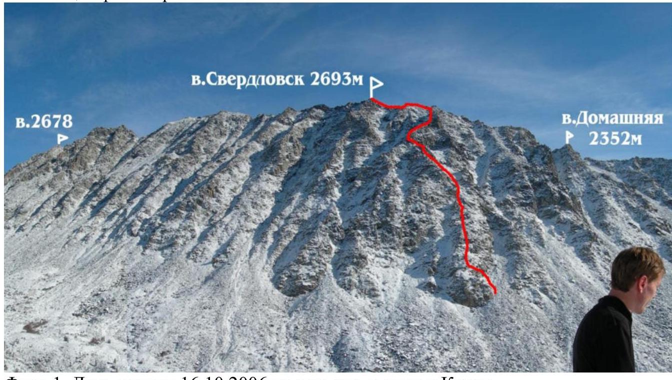
Photo 1. Taken on October 16, 2006, from the ascent to the circus of Mt. Kupol.
1.2. Photo of the Route Profile
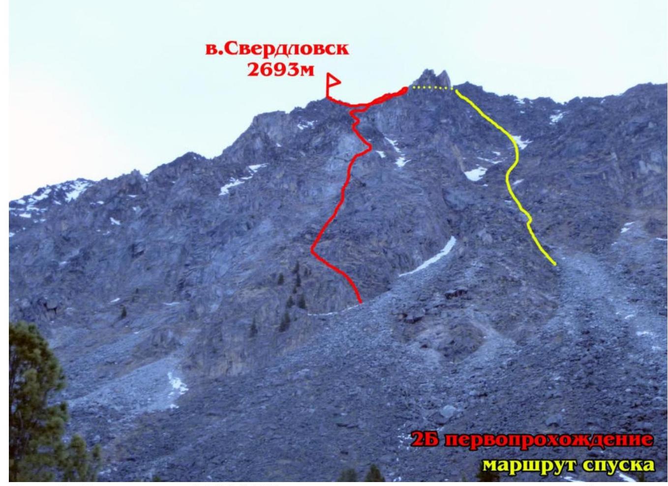
Photo 2. Taken on April 26, 2018, from the trail near the fork leading to the circus of Mt. Kupol and continuing along the valley.
2. Characteristics of the Route
2.1. Technical Photograph of the Route
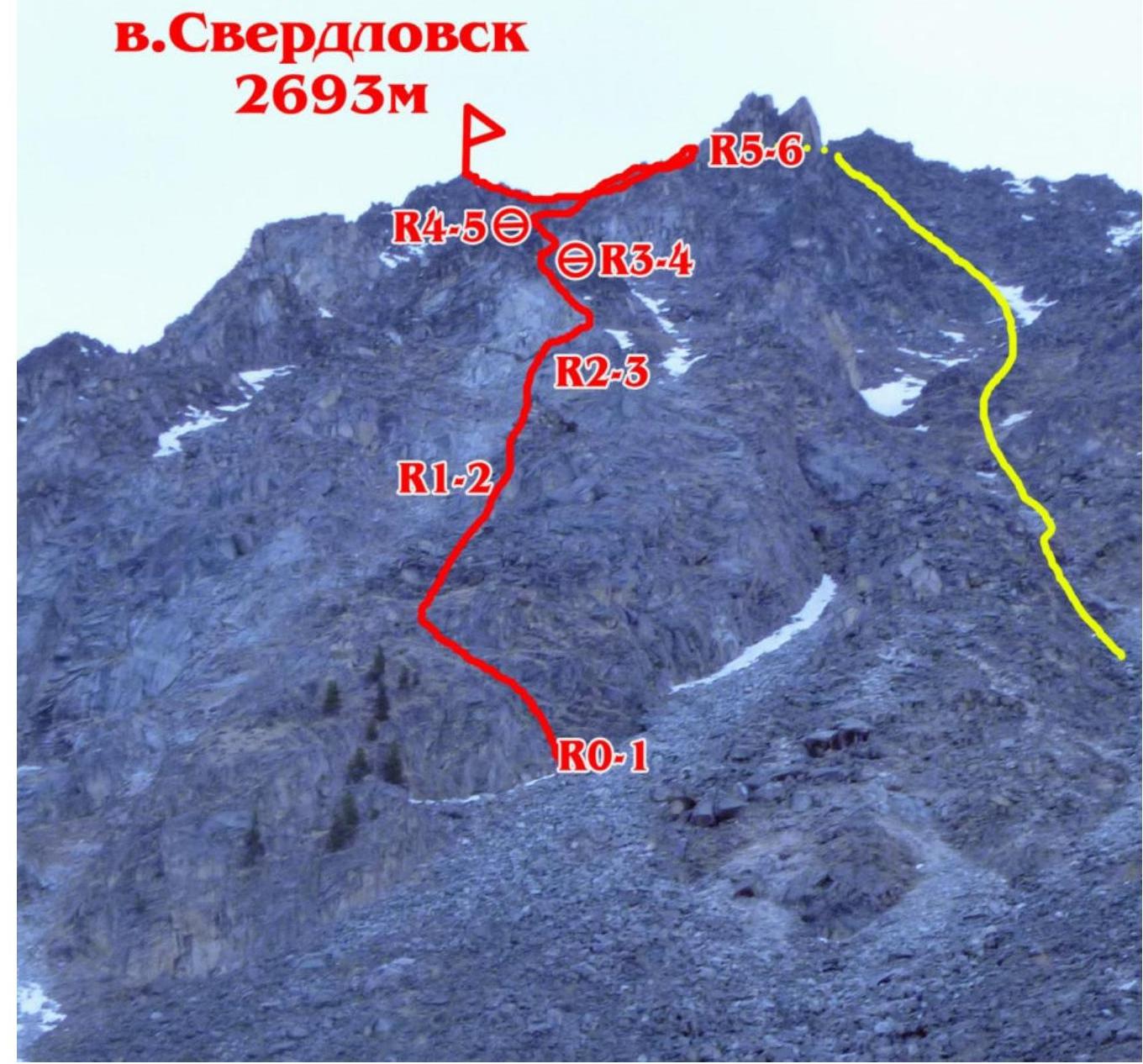
Photo 3.
2.2. Section numbers on the technical photograph correspond to the section numbers in paragraph 2.3.
2.3. Technical Characteristics of the Route Sections.
| Section | Relief Character | Difficulty Category | Length, m | Type and Number of Hooks |
|---|---|---|---|---|
| R0–R1 | Scree ridge | 1 30° | 200 | – |
| R1–R2 | Large blocky talus | 1–2 40° | 150 | – |
| R2–R3 | Rocks | 1–2 40° | 150 | – |
| R3–R4 | Rocks | 3+ 80° | 12 | 5 medium-sized friends |
| R4–R5 | Rocky ridge, snow | 2 | 150 | – |
| R5–R6 | Rocky ridge | 2 | 100 | – |
3. Characteristics of the Team's Actions
3.1. Brief Description of the Route's Passage.
| Section | Description | Photo Number |
|---|---|---|
| R0–R1 | Wide scree, partially grassy ridge. Simultaneous movement. | |
| R1–R2 | 2 m chimney, then through large blocky talus. Approach to grey rocks, detour to the right into the couloir. Simultaneous movement. | Photo 5 |
| R2–R3 | Movement to the right of the ridge, through the left part of the couloir; with more snow, there's a potential avalanche danger. From the couloir onto the rocky ridge to the left. The couloir ends at the rock walls. | |
| R3–R4 | Ascent onto the sharp ridge via a "pechka" (characteristic rock formation resembling brickwork). | Photo 6 |
| R4–R5 | Movement along the ridge, 10 m with alternating belay on the terrain, then simultaneous movement except on snowy sections. Exit onto the south ridge of the summit. | Photo 7 |
| R5–R6 | Simultaneous movement along the ridge. Reaching the summit. | Photo 8 |
3.2. Photo of the Team at the Summit with the Control Tour.
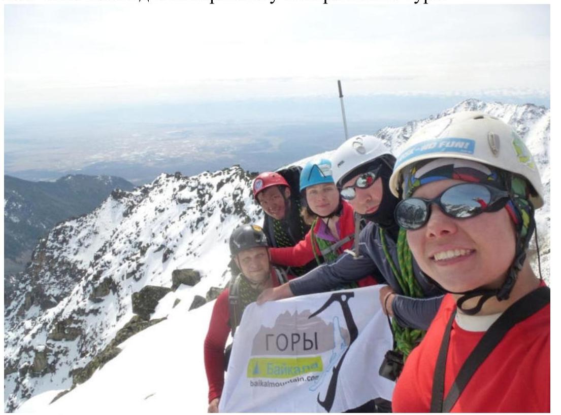
Photo 4. At the summit.
3.3. The route is not rockfall-prone, logical, and the key section, according to the team, corresponds to key sections of category 2B routes in Tunkinskie Goltsy, also matching the route length and overall climbing difficulty of category II.
Snowy sections and couloirs will be avalanche-prone with more snow due to the underlying grassy layer; also, belaying on the terrain in the couloir after the grey rocks is minimal, requiring more placements of protection gear with more snow. The team descended via the pre-summit ridge, bypassing the buttress of the first ascent, into the first grassy couloir in the Barun-Khandagai river valley. Without snow, the descent is not avalanche-prone.
Photos:
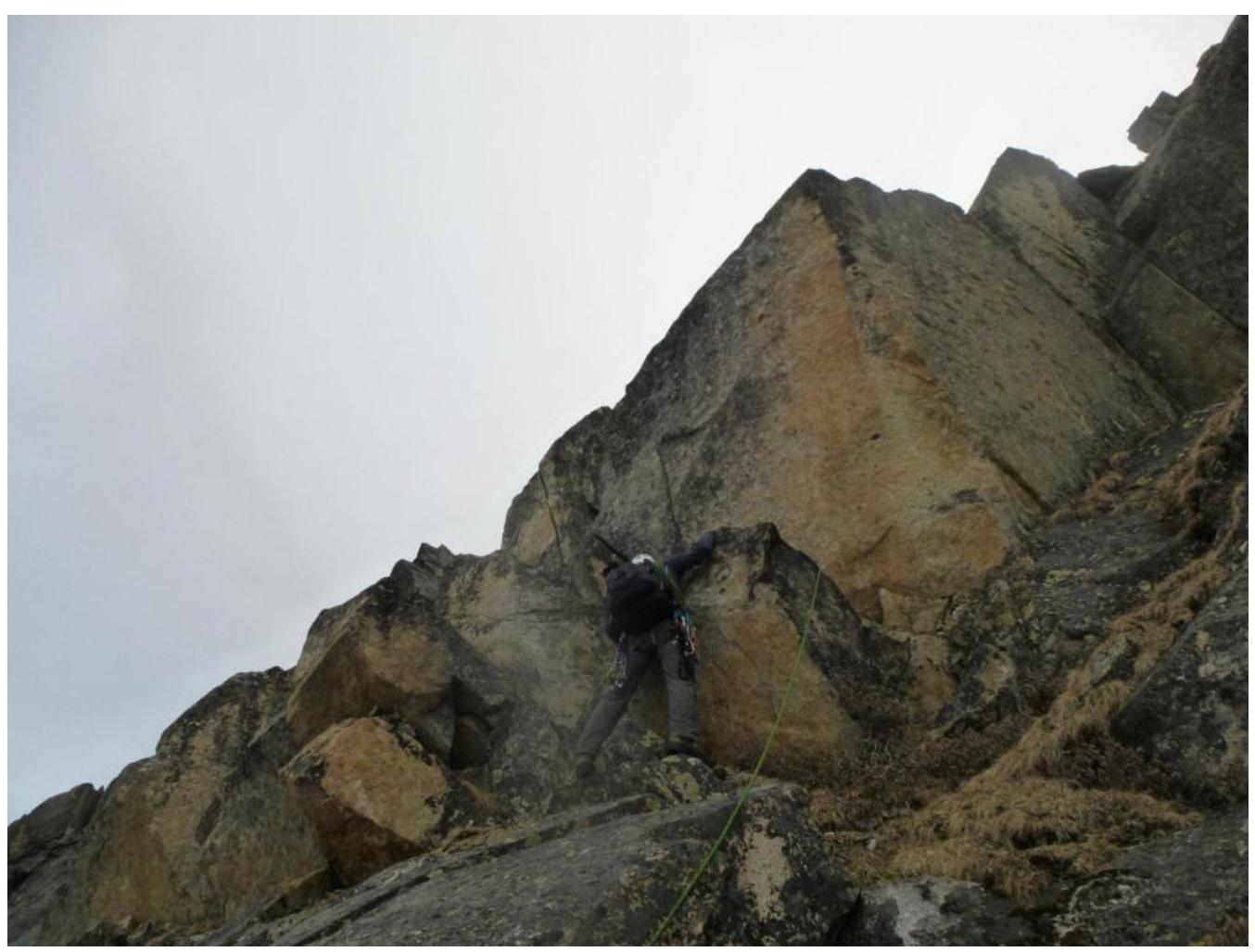
Photo 5. 2 m chimney. Start of section R1–R2.
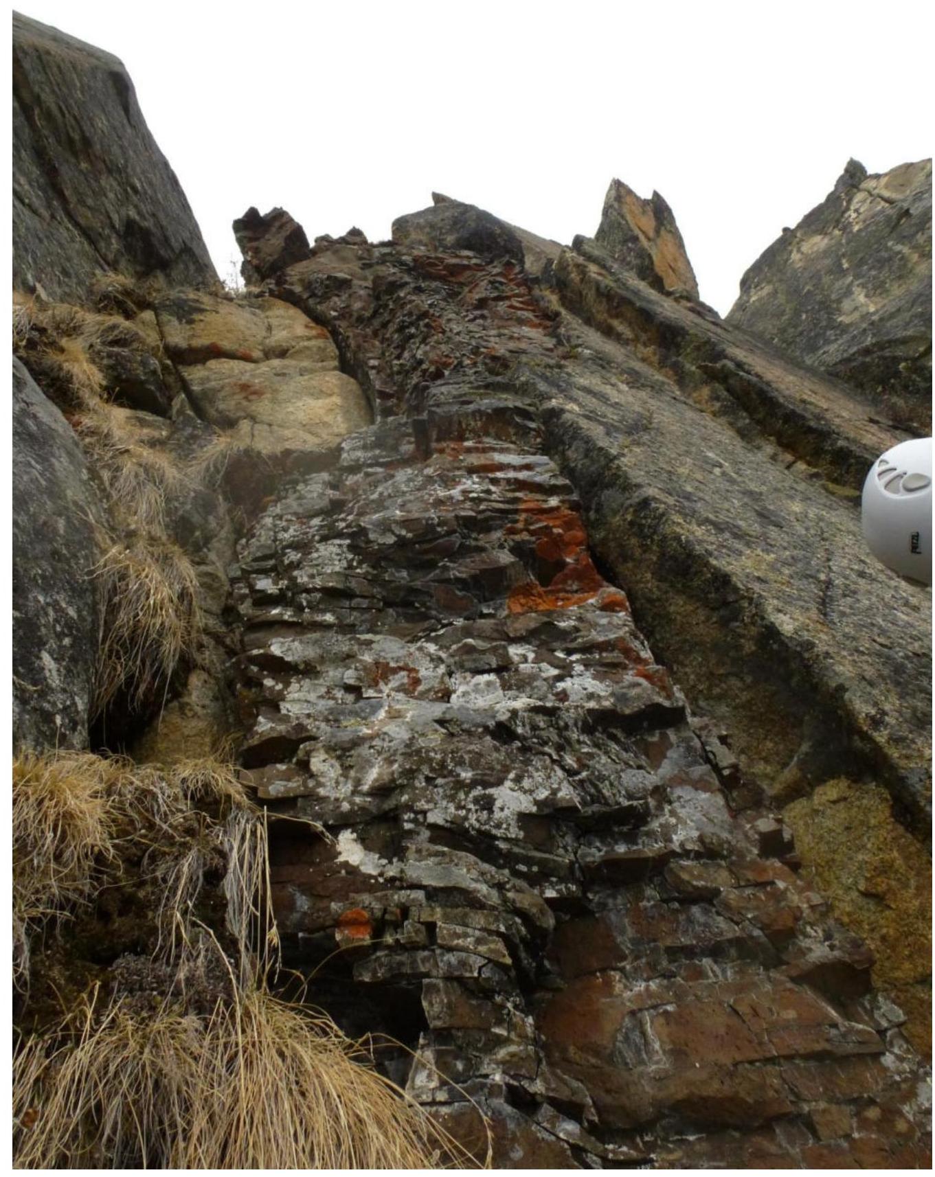
Photo 6. Key section. "Pechka". Section R3–R4.
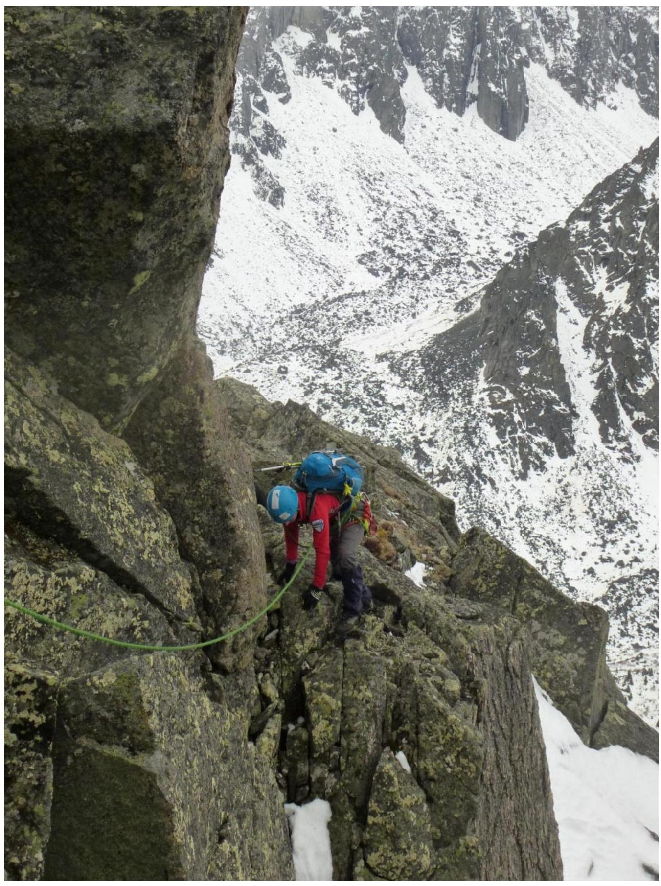
Photo 7. After the key section, 10 m with alternating belay. Section R4–R5.
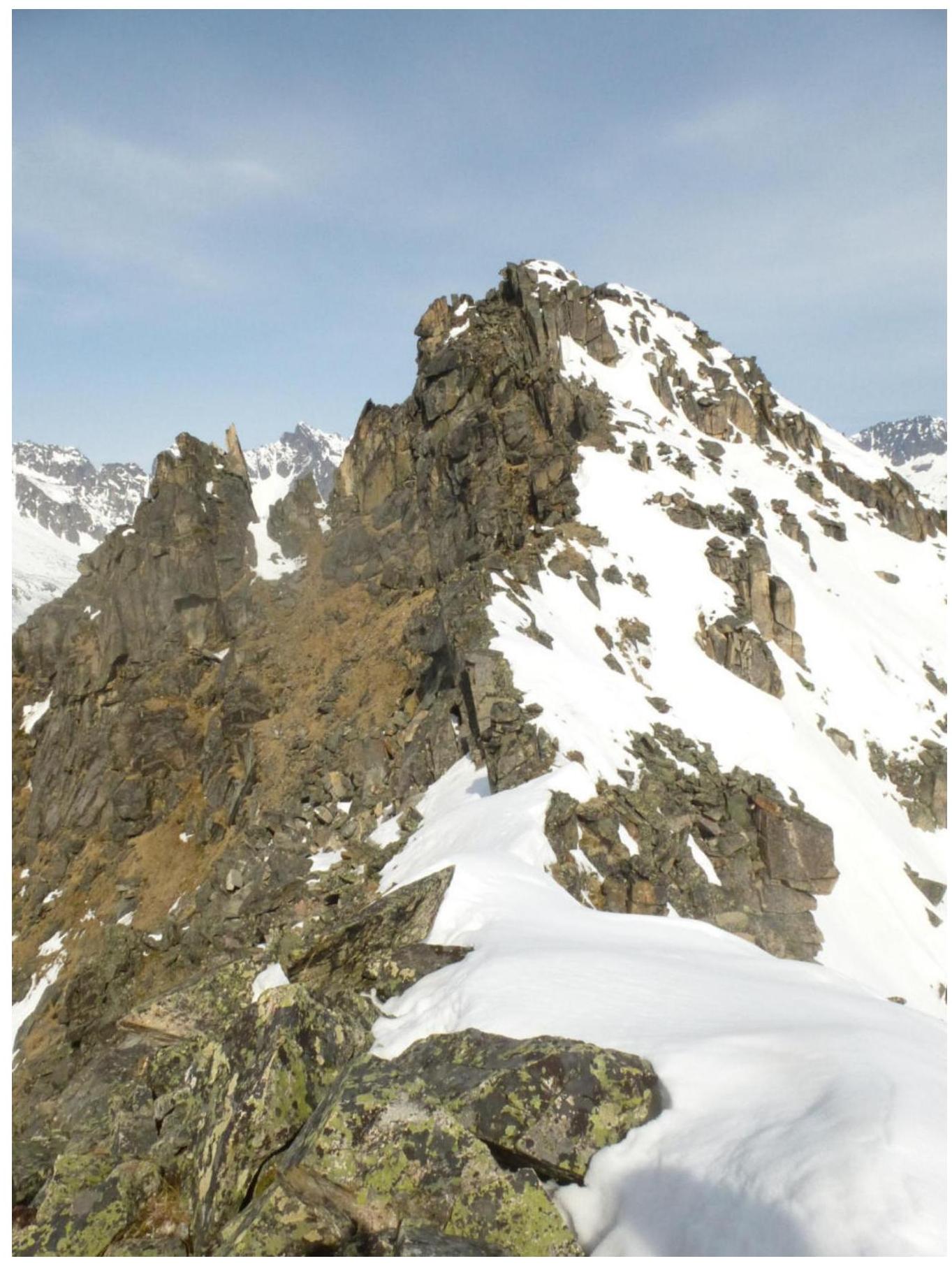
Photo 8. Pre-summit ridge. Section R5–R6.