Report
on the first ascent to the summit Optimist 2660 m via the route on the North wall, approximately 5A category of difficulty, for the period from October 17, 2018 to October 17, 2018.
Perm—Tyumen 2018
I. Climbing Passport
| 1. General Information | ||
|---|---|---|
| 1.1 | Full name, sports rank of the leader | Oleneva Nadezhda Aleksandrovna, CMS |
| 1.2 | Full name, sports rank of participants | Repina Ekaterina Viktorovna, 1st sports rank Tkachenko Pavel Valentinovich, 1st sports rank |
| 1.3 | Full name of coach | Glazunov Evgeny Vladimirovich (MS) |
| 1.4 | Organization | Irkutsk Regional Public Organization Active Recreation and Climbing Club "Gory Baikala", project "Nevozmozhno — eto ne navsegda" |
| 2. Characteristics of the Climbing Object | ||
| 2.1 | Region | Eastern Sayan, Tunkinskie Goltsy ridge |
| 2.2 | Valley | Chertolen-Gorkhon |
| 2.3 | Section number according to the classification table of 2013 | 6.1.2 |
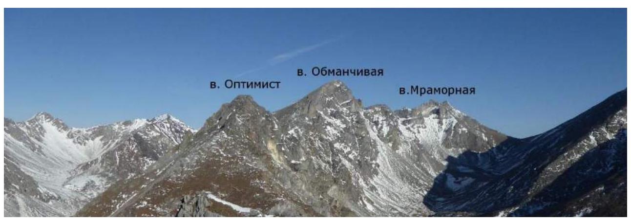
| 2.4 | Name and height of the summit | Optimist, 2660 m |
| 2.5 | Geographical coordinates of the summit (latitude/longitude), GPS coordinates | 51°50′25.78″ N 101°36′35.72″ E |
| 3. Characteristics of the Route | ||
| 3.1 | Name of the route | Via the North wall |
| 3.2 | Proposed category of difficulty | 5A |
| 3.3 | Degree of route exploration | First ascent |
| 3.4 | Nature of the route terrain | Rock |
| 3.5 | Elevation gain of the route (data from altimeter or GPS) | 340 m |
| 3.6 | Length of the route (in meters) | 408 m |
| 3.7 | Technical elements of the route (total length of sections of various difficulty categories with indication of the terrain nature (ice-snow, rock)) | Rock 1st cat. diff. — 60 m. Rock 2nd cat. diff. — 90 m. Rock 3rd cat. diff. — 50 m. Rock 4–5 cat. diff. — 45 m. Rock 5 cat. diff. — 58 m. Rock 6 cat. diff. — 65 m. Rock 6, A1 — 25 m. Rock 6, A2 — 15 m. |
| 3.8 | Descent from the summit | Along the ridge 150 m in the northern direction, rappel descent 20 m to a saddle, descent via a scree gully in the eastern direction into the Chertolen-Gorkhon valley |
| 3.9 | Additional characteristics | Lack of water |
| route | ||
| :--: | :--: | :--: |
| 4. Characteristics of the Team's Actions | ||
| 4.1 | Time of movement (team's climbing hours) | 9.5 hours |
| 4.2 | Overnight stays | No |
| 4.3 | Time at control points | Departure from overnight stay under the summit Optimist — 6:00, Start on R0 — 7:30, Summit — 17:00, Descent into the valley — 18:40, Return to BL — 20:00 |
| 5. Characteristics of Weather Conditions | ||
| 5 | Clear, no precipitation, temperature approximately +10 °C. | |
| 6. Person responsible for the report | ||
| 6.1 | Full name, e-mail | Oleneva Nadezhda Aleksandrovna nady317@mail.ru |
II. Climbing Report
1. Characteristics of the Climbing Object
1.1. General photo of the summit Optimist from NE from the Chertolen-Gorkhon river valley.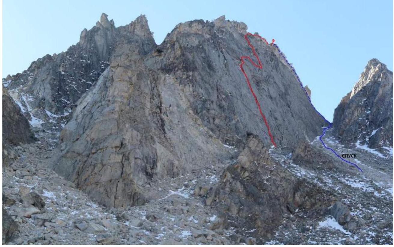
General photo of the north wall of the summit Optimist (photo taken from the Chertolen-Gorkhon river valley)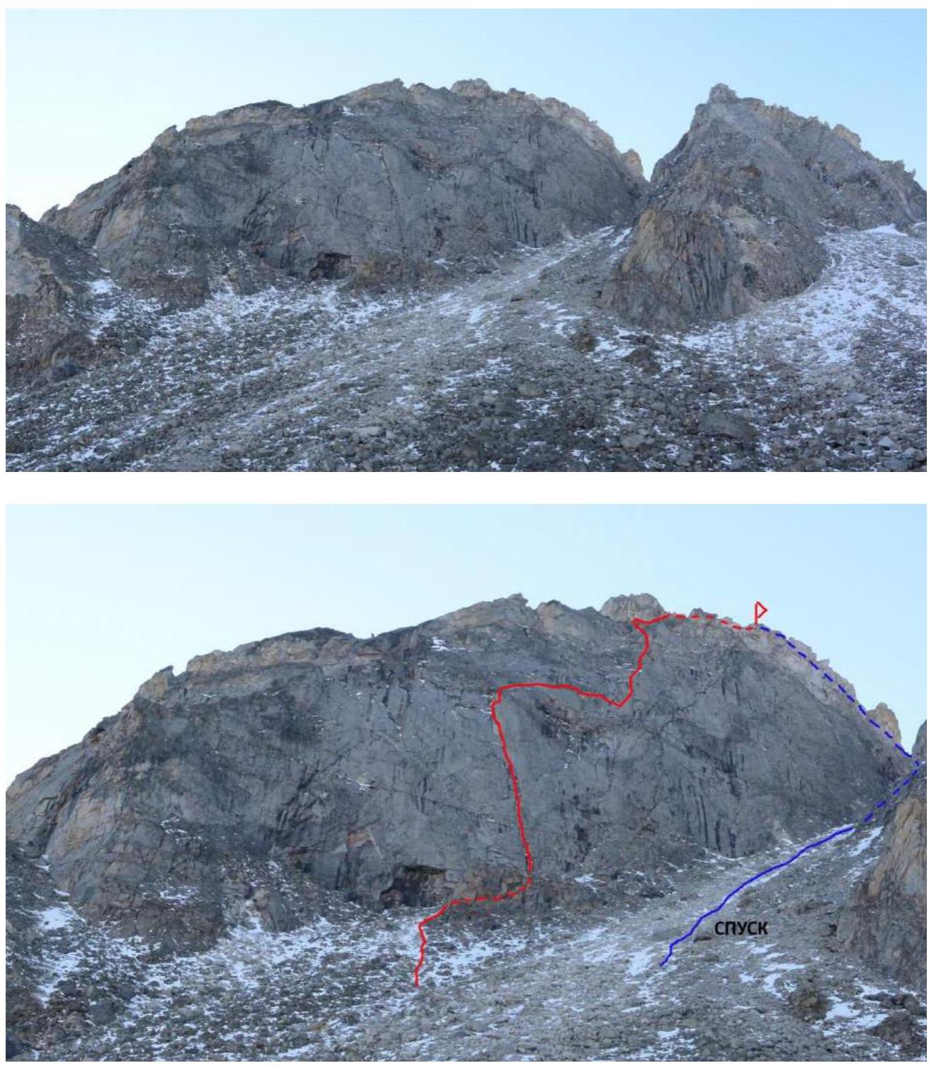
1.2. Photo of the route profile (photo taken from the ridge of Optimist summit)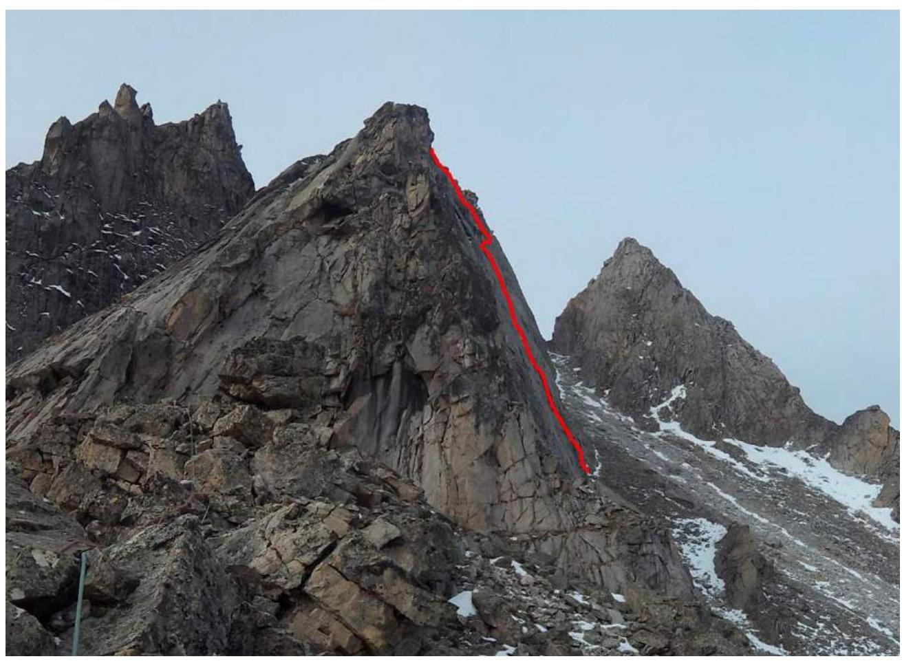
1.3. Photopanorama of the upper Chertolen-Gorkhon valley from the summit Shkolnaya
1.3. Map of the Area
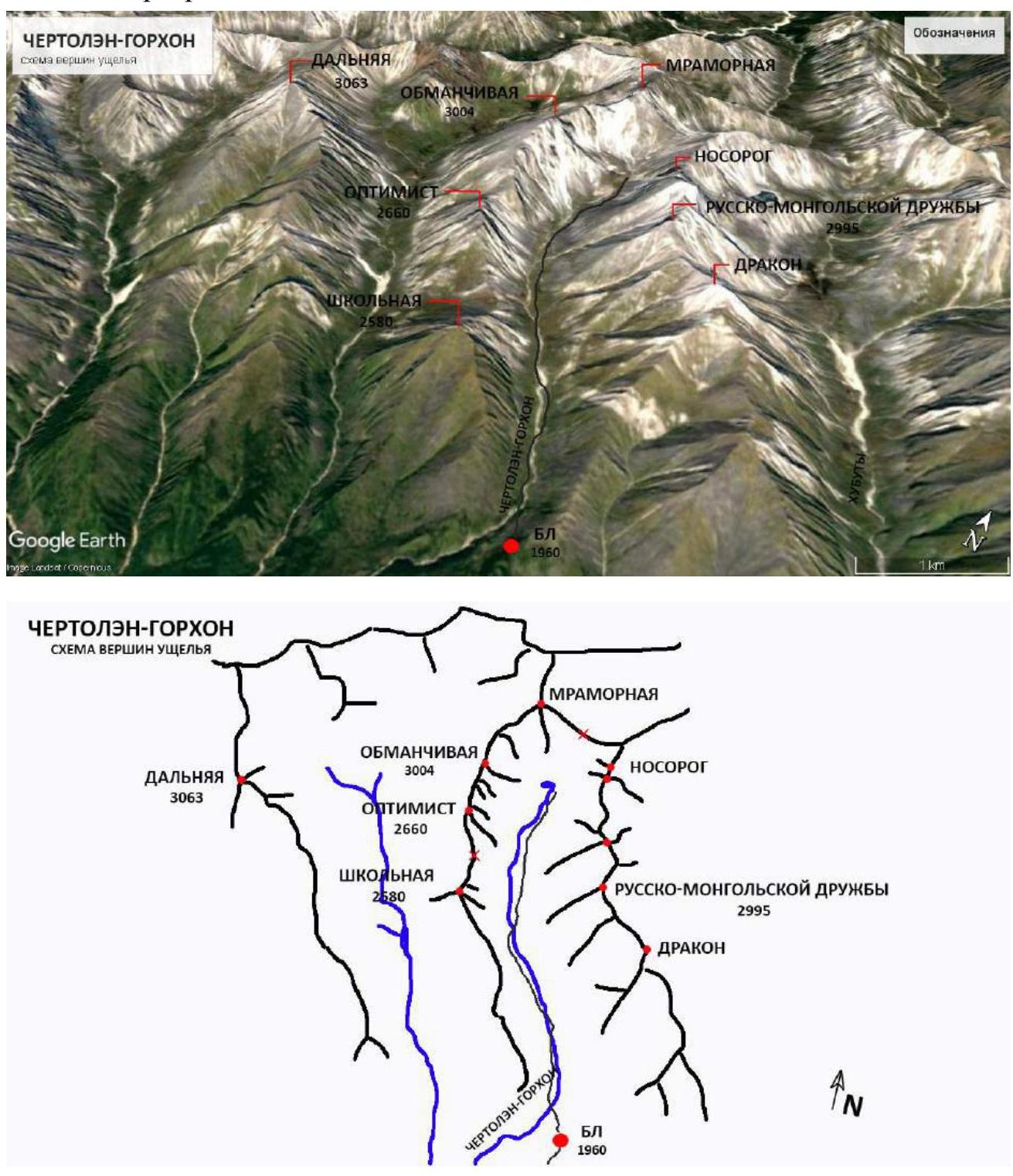
The summit Optimist is located in the upper reaches of the Chertolen-Gorkhon valley, Tunkin ridge of the Eastern Sayan, west of the Khubuta river valley, along which the trail leads to the Shumak mineral springs, a popular tourist route in our region.
Nearest settlements:
- Nilova Pustyn settlement
- Khoito-Gol village, Tunkinsky district, Buryatia Republic (district center Kyren settlement)
Route:
- travel along the old road to the "Sukhoy Ruchey" tourist base
- further transportation by a high-passability vehicle up the road, or on foot to the Chertolen-Gorkhon river
- from there, a good trail leads into the valley
Features of the valley:
- it is a dead-end valley
- regularly visited by local herb and wild food gatherers
- has a very simple approach
- horseback transportation to the base camp is possible along the trail
In terms of mountaineering, the potential of the valley allows for mountaineering events with ascents from 1B to 5A category of difficulty.
The chosen route line on the North wall is beautiful and logical. The first three ropes follow a vertical inner corner, rich in relief and sometimes turning into a narrow chimney. After the inner corner, the wall becomes more gradual, but the path is very ambiguous: smooth slabs — mirrors, cut by cracks and ledges, which sometimes end in nothing. Here, two traverse sections go to the right, each almost a full rope length, the second one slightly descending.
Further:
- along good relief — 3 ropes to the ridge.
Approach to the route:
- from the base camp — 2.5 hours.
Overnight stay is possible under the summit Optimist (no water), from which:
- ascent via scree to the route — 1 hour.
According to the team's assessment, the route corresponds to similar routes in the Eastern Sayan of 5A category of difficulty.
2. Characteristics of the Route
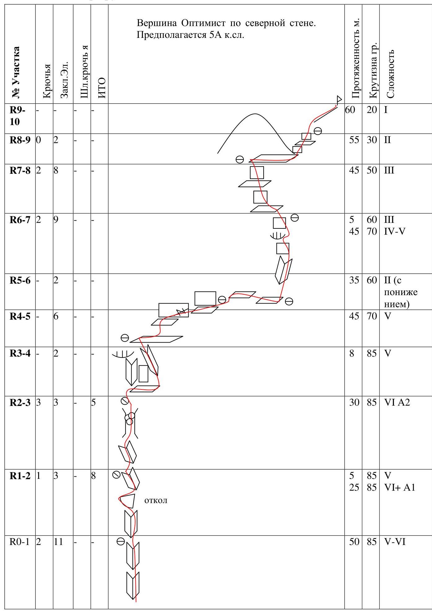
2.1. Technical photograph of the
route.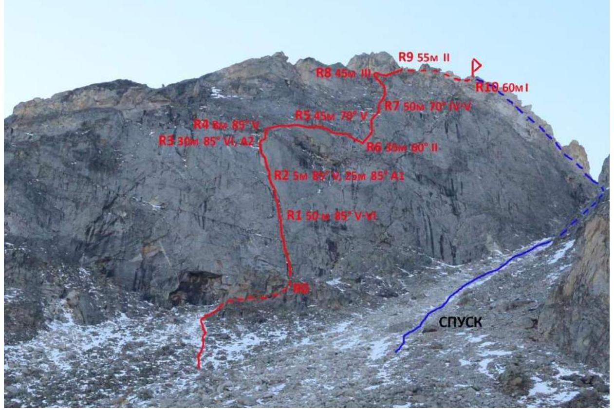
2.2. Section numbers on the technical photograph correspond to the section numbers on the route diagram in UIAA symbols.
2.3. Diagram of the route in UIAA symbols. Summit Optimist via the north wall. Presumably 5A category of difficulty.
| Section | Pitons | Chocks | Bolts | Aids | Length, m | Steepness, deg. | Difficulty |
|---|---|---|---|---|---|---|---|
| R9–R10 | 60 | 20 | 1 | ||||
| R8–R9 | 0 | 2 | 55 | 30 | 2 | ||
| R7–R8 | 2 | 8 | 45 | 50 | 3 | ||
| R6–R7 | 2 | 9 | 5 | 60 | 3 | ||
| 45 | 70 | 4–5 | |||||
| R5–R6 | 2 | 35 | 60 | 2 (descending) | |||
| R4–R5 | 6 | 45 | 70 | 5 | |||
| R3–R4 | 2 | 8 | 85 | 5 | |||
| R2–R3 | 3 | 3 | 5 | 30 | 85 | 6 A2 | |
| R1–R2 | 1 | 3 | 8 | chock | 5 | 85 | 5 |
| 25 | 85 | 6+ A1 | |||||
| R0–R1 | 2 | 11 | 50 | 85 | 5–6 | ||
 |
3. Characteristics of the Team's Actions
3.1. Approach to the summit Optimist from the base camp takes 1–1.5 hours. Along the trail upstream along the river, the trail goes sometimes along the left, sometimes along the right bank.
Under the summit Optimist, we stopped for an overnight stay (no water, there was snow).
From the overnight stay location:
- Ascend via scree to the north wall in the direction of a clearly visible vertical inner corner, going through the entire lower part of the wall.
- The approach from the overnight stay location to the start of the route took 1 hour.
| Section | Description | Photo Number |
|---|---|---|
| R0–R1 | Along the inner corner with good relief or slightly to the right of it via rock V–VI cat. diff. There are wedged and loose blocks, the section requires careful climbing. Belay mainly on friends. Station on a small ledge on 2 friends and 2 anchors. | Photo 1 |
| R1–R2 | Climb upwards along the corner in the direction of a chock, via the chock using aids. Climb onto the chock and further along a narrow chimney-crack to a small ledge, on which is a station. Aids on friends of medium size. Station—friend + 2 anchors. | Photos 2, 3 |
| R2–R3 | Along the corner, transitioning into a chimney with wedged blocks. Aids with transitions to climbing. Belay on friends and anchors. Station on a small ledge, not reaching the cornice (anchor and 2 friends). | Photos 4, 5 |
| R3–R4 | Traverse along a ledge to the right, bypassing a vertical wall, and behind it along an inner corner to a large shelf. Station on the shelf on a chock. Sections R2–R3 and R3–R4 can be climbed as one. | Photo 6 |
| R4–R5 | From the shelf to the right upwards along a small ledge, transitioning into a horizontal inclined crack, 15 m. Further, the ledge widens — along it to the right. Station on a chock. | Photo 7 |
| R5–R6 | Traverse to the right with descent along ledges in the direction of an inner corner with good relief. Station at the base of the corner on 3 friends. | Photo 8 |
| R6–R7 | Upwards along the inner corner. Climb past a large chock to the right. Further along the walls to a small grassy inclined terrace, station above it on a chock. | Photo 9 |
| R7–R8 | Upwards through a series of walls and ledges along simple relief to a large shelf under a gendarme. Station on the shelf on a chock. | Photo 10 |
| R8–R9 | Along the shelf to the right, bypassing the gendarme, exit onto the ridge. | |
| R9–R10 | Along the ridge on foot to the summit. |
3.2. Photo of the team on the summit at the control
tur.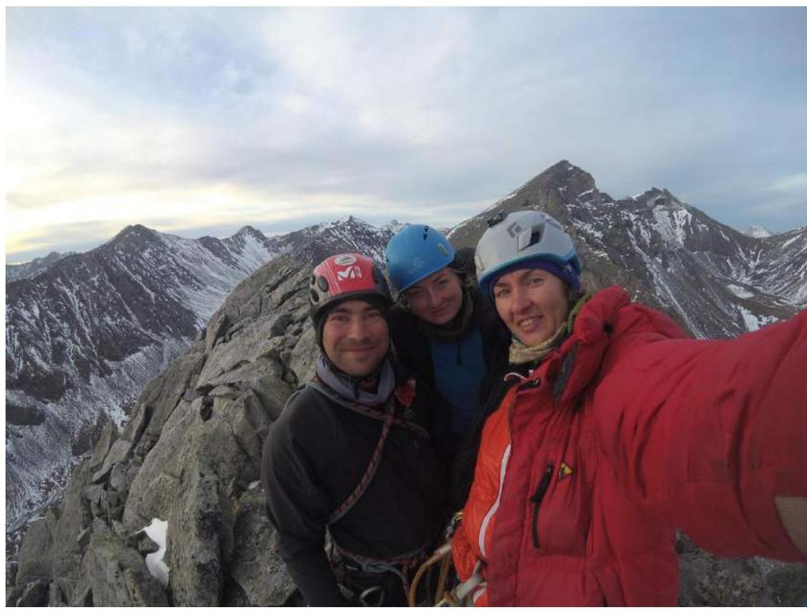
3.3. Descent from the summit in the northern direction along the ridge, bypassing difficult sections to the left (from the west). Along the ridge 150 m. Rappel descent 20 m to a saddle. From the saddle, descent via a scree gully in the eastern direction into the Chertolen-Gorkhon river valley. Return to BLi.
3.4. Photo report by sections
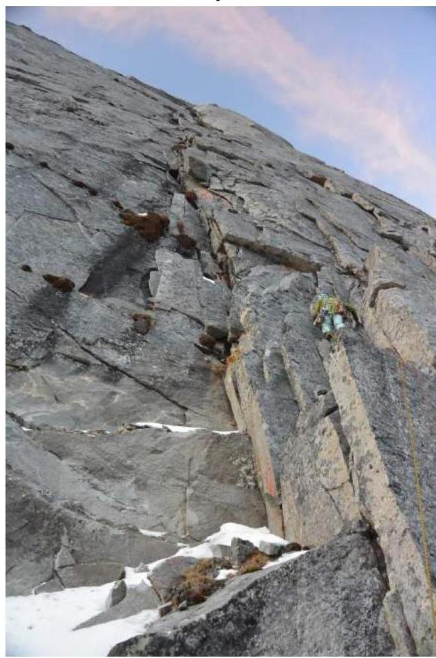
Photo 1. Section R0–R1 from the start of the
route
Photo 2. Section
R1–R2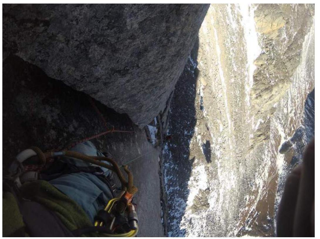
Photo 3. Section
R1–R2
Photo 4. Start of section
R2–R3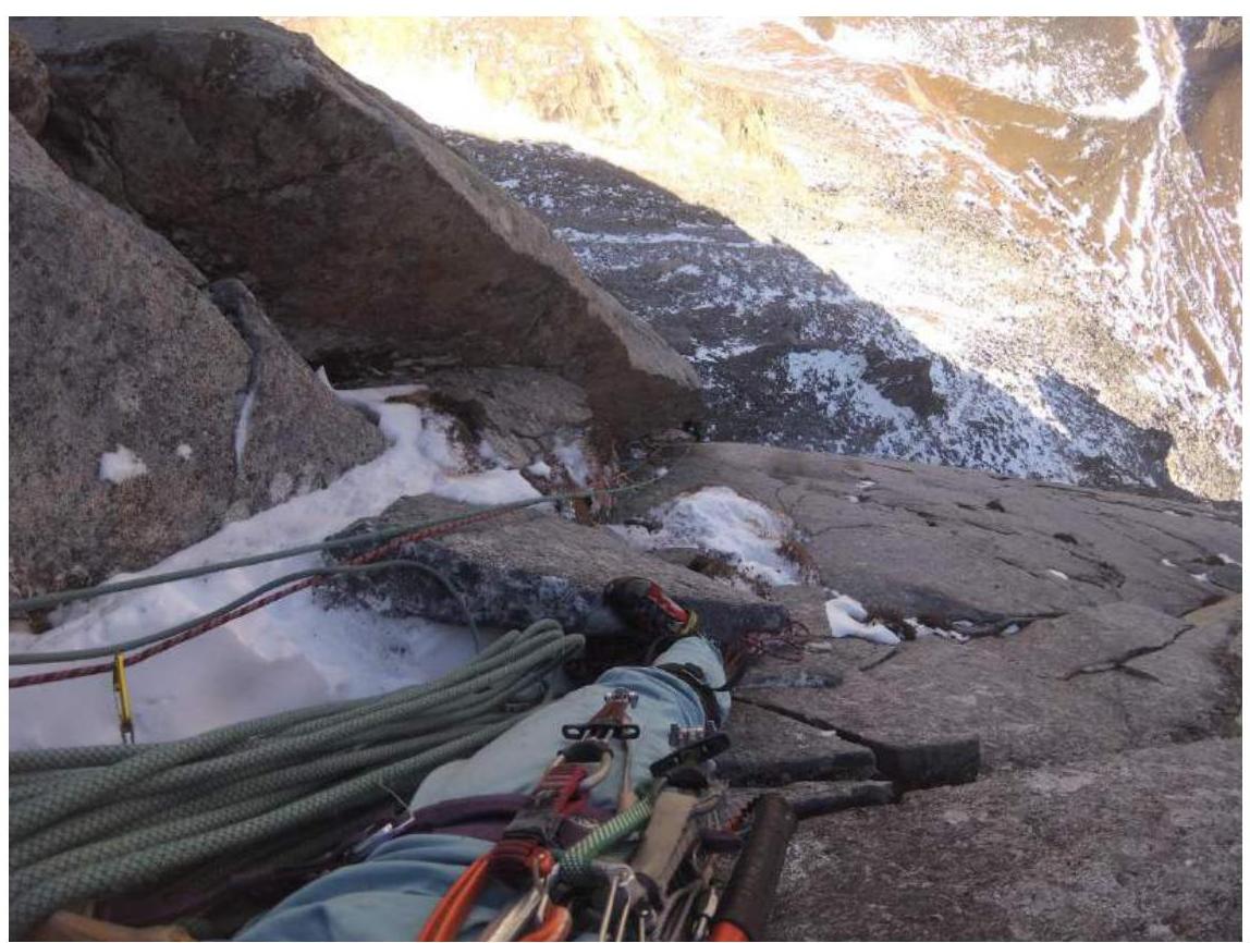
Photo 5. View down from station
R3
Photo 6. Start of section R3–R4, traverse
right.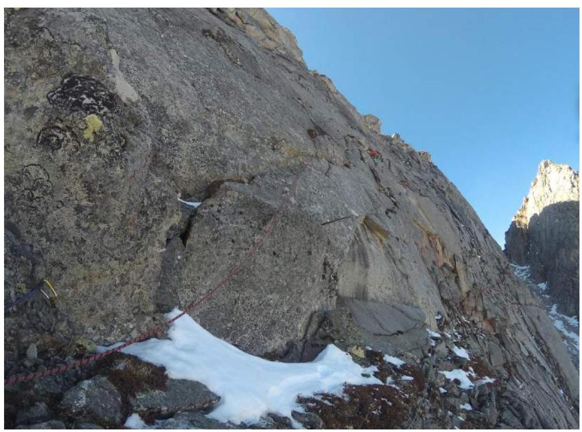
Photo 7. Section
R4–R5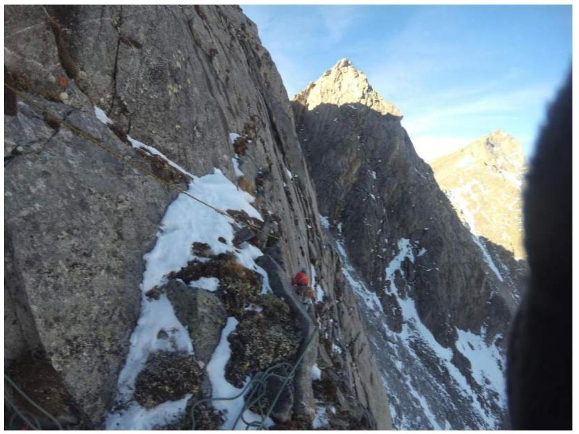
Photo 8. Section
R5–R6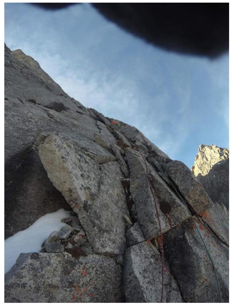
Photo 9. Section R6–R7
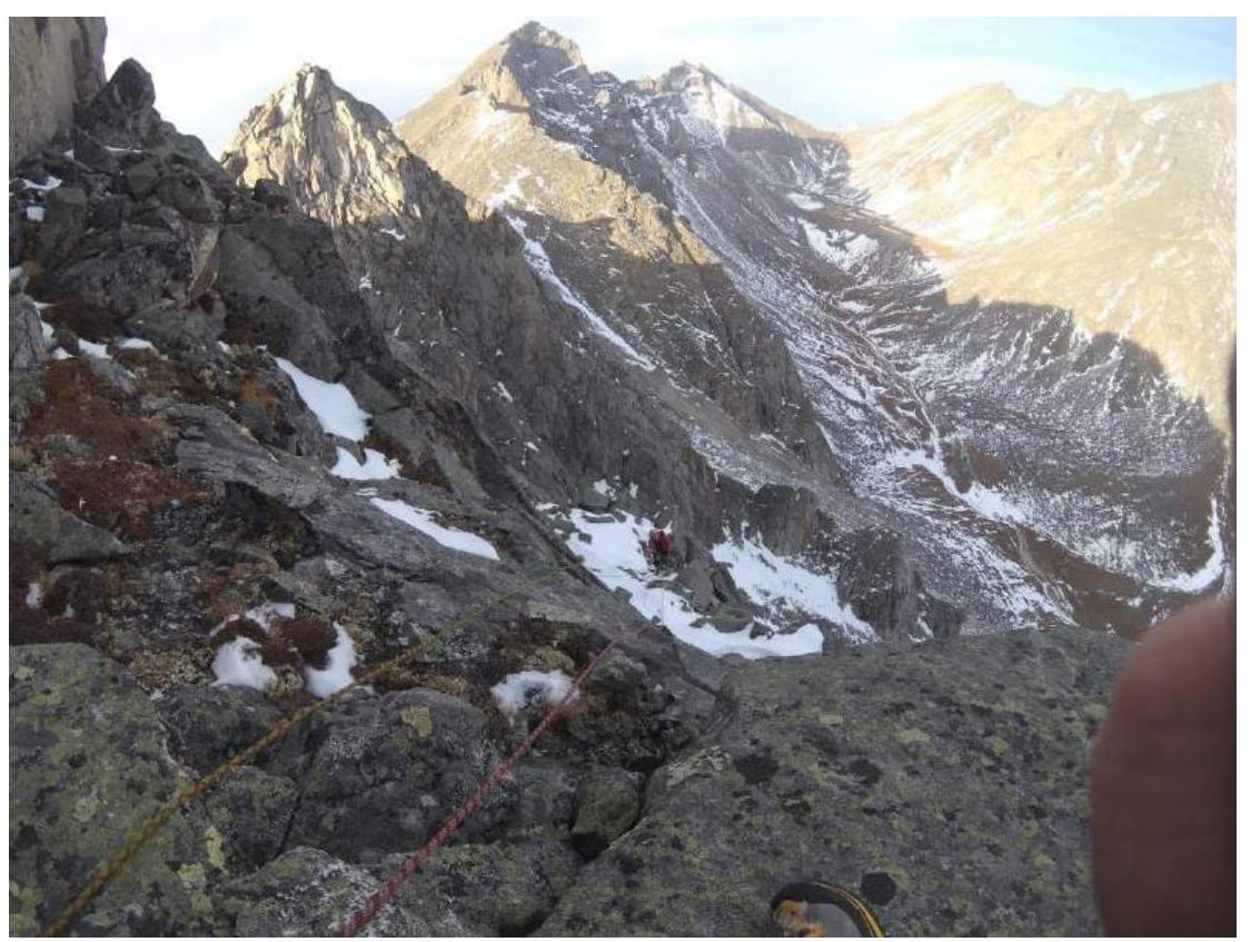
Photo 10. View down on section R7–R8 from station R8