Report
On the first ascent to the summit of Optimist via the northern ridge route, category 2B, by the Gory Baikala team from October 15, 2018, to October 15, 2018.
I. Climbing Report
| № | 1. General Information | |
|---|---|---|
| 1.1 | Full name, sports rank of the leader | Panova Alena Mikhailovna, 1st sports rank |
| 1.2 | Full name, sports rank of the participants | Strochkov Maxim Sergeevich, 2nd sports rank. Mironenko Konstantin Gennadievich, 3rd sports rank. Korotkov Petr, 3rd sports rank. |
| 1.3 | Full name of the coach | Glazunov Evgeny Vladimirovich, Master of Sports |
| 1.4 | Organization | "Nevozmozhno — eto ne navsegda..." Gory Baikala |
| 2. Characteristics of the Climbing Object | ||
| 2.1 | Region | Eastern Sayan, Tunkinskie Goltsy ridge |
| 2.2 | Valley | Chertolen-Gorkhon |
| 2.3 | Section number according to the 2013 classification table | 6.1.2 |
| 2.4 | Name and height of the summit | Optimist, 2660 m |
| 2.5 | Geographical coordinates of the summit (latitude/longitude), GPS coordinates | 51°50′25.78″ N 101°36′35.72″ E |
| 3. Characteristics of the Route | ||
| 3.1 | Route name | Via the northern ridge |
| 3.2 | Proposed category of difficulty | 2B |
| 3.3 | Degree of route exploration | First ascent |
| 3.4 | Character of the route terrain | Rocky |
| 3.5 | Elevation gain of the route (altimeter or GPS data) | 360 m |
| 3.6 | Route length (in meters) | 750 m |
| 3.7 | Technical elements of the route (total length of sections of varying difficulty) | 1st cat. rocky — 500 m. 2nd cat. rocky — 210 m. 3rd cat. rocky — 30 m. 4th cat. rocky — 10 m. Movement on closed glacier — 0 m. Dülfer descent (on descent) — 2 ropes, 75 m. |
| 3.8 | Descent from the summit | Along the southern ridge 150 m, dülfer descent 30 m to the saddle between the summit and the gendarme, bypassing the gendarme to the right (from the west), along the western slope of the southern ridge descent not reaching 400 m to the pass between v. Shkolnaya and v. Optimist into the Gorkhon river valley |
| 3.9 | Additional route characteristics | Lack of water |
| 4. Characteristics of the Team's Actions | ||
| 4.1 | Time of movement (team's walking hours, in hours and days) | 4 hours |
| 4.2 | Overnights | - |
| 4.3 | Start of the route | 06:00, October 15, 2018 |
| 4.4 | Reaching the summit | 11:40, October 15, 2018 |
| 4.5 | Return to the base camp | 16:00, October 15, 2018 |
| 5. Responsible for the Report | ||
| 5.1 | Full name, e-mail | Panova Alena Mikhailovna, aljonchik1905@mail.ru |
II. Description of the Ascent
1. Characteristics of the Climbing Object
1.1. General photo of the summit.
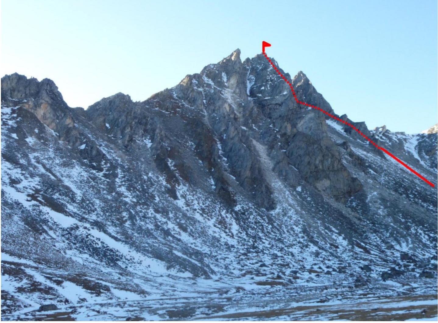
Photo 1. Taken from the SE relative to the summit from the Gorkhon valley. October 14, 2018.
1.2. Photo of the route profile.
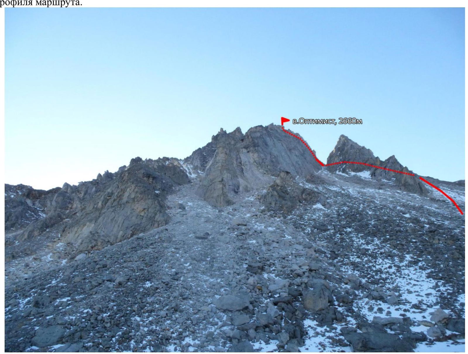
Mt. Optimist, 2660 m Photo 2. Taken from the east. October 15, 2018.
1.3. Photopanorama of the area.
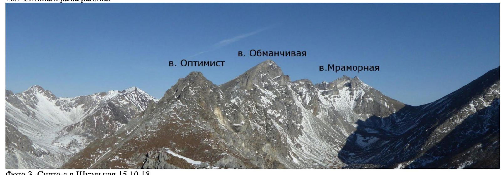
Mt. Obmanschivaya Mt. Optimist Mt. Mramornaya Photo 3. Taken from Mt. Shkolnaya, October 15, 2018.
1.4. Map of the area.
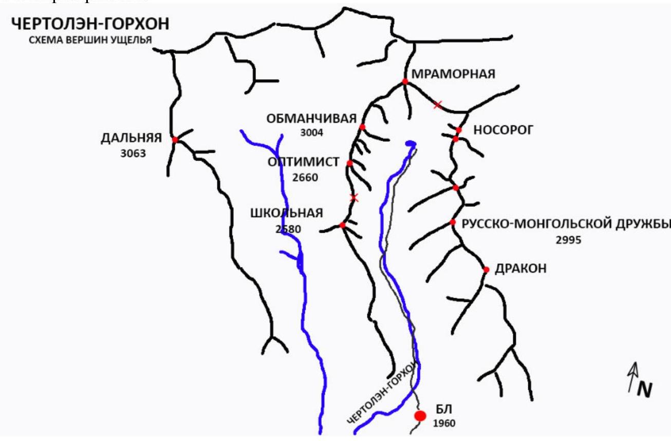
The summit of Optimist is located in the upper reaches of the Chertolen-Gorkhon valley, Tunkinsky ridge of the Eastern Sayan, to the west of the Khubuta river valley, along which the trail leads to the Shumak mineral springs, a popular tourist route in our region. The nearest settlement is Nilova Pustyn and the village of Khoito-Gol, Tunkinsky district, Republic of Buryatia (district center — Kyren settlement).
To get there, you can:
- Travel along the old highway to the "Sukhoy Ruchey" tourist base
- Then — by a high-clearance vehicle up the road, or on foot to the Chertylym-Gorkhon river
- From there, a good trail leads into the valley.
The valley is a dead end, regularly visited by local herb collectors and foragers, and has a very simple approach. It is possible to make a horseback delivery to the base camp along the trail.
In terms of mountaineering, the valley's potential allows for mountaineering events with ascents from 1B to 5A category.
2. Characteristics of the Route
2.1. Technical photo of the route.
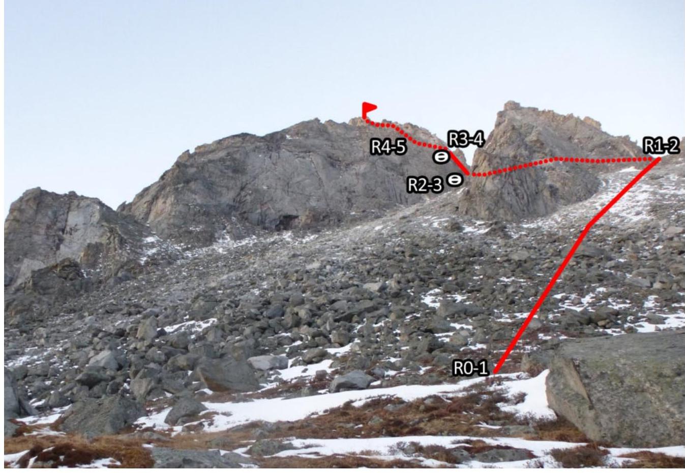
Photo 4. Taken on October 15, 2018.
2.2. The numbers of the sections on the technical photo correspond to the numbers of the sections in paragraph 2.3.
2.3. Technical characteristics of the route sections
| Section № | Character of the terrain | Category of difficulty | Length, m | Type and number of pitons |
|---|---|---|---|---|
| R4–R5 | 3 | 30 | anchor 2, friend 1 | |
| R3–R4 | 2 | 60 | 0 | |
| R2–R3 | 4 | 10 | stopper 1, friend 1 | |
| 2 | 30 | |||
| R1–R2 | 2 | 120 | 0 | |
| R0–R1 | 1 | 500 | 0 |
3. Characteristics of the Team's Actions
3.1. Brief description of the route.
The approach to the start of the route from the base camp takes 1.5-2 hours along a good trail without snow.
The trail leads up along the river, which goes along the left and then the right bank. By passing the summit and the sub-summit of Optimist to the right, the ascent goes between the sub-summit and the rocky tooth.
A rock arch can serve as a landmark, which is visible during the ascent — it remains to the right.
It was decided to inspect the couloir between the summit and the sub-summit from above:
- The width at the top is 7-8 m
- There are many "live" stones on the walls
| Section № | Description | Photo № |
|---|---|---|
| R0–R1 | Wide couloir. Ascent to the saddle between the sub-summit and the rocky tooth. The rock arch is visible to the right. | |
| R1–R2 | The sub-summit is bypassed along the large-block talus to the right in the direction of movement (from the west). The difficulty of the ascent and descent from the sub-summit coincides with the difficulty of section 1-2. Movement to the saddle between the summit and the sub-summit. From the saddle, 30 m to the internal angle along the rocks of 2nd cat., station on a "boulder". | |
| R2–R3 | The angle is passed with alternating insurance. The right side of the angle is 90°+, the left side has a minimal number of holds. There are enough places for organizing insurance. On the ridge after the angle, a station behind a "boulder", live stones! | Photo 6, 7 |
| R3–R4 | Further movement along the ridge along a narrow shelf to the large-block talus. The ridge turns into a wall, which is bypassed to the right (from the west) with a slight decrease. Walk along the wall. | |
| R4–R5 | Wall 60 m with rocks of 3rd cat. upwards and to the left, exit to the summit. | Photo 8 |
3.2. Photo of the team on the summit with the control tour.
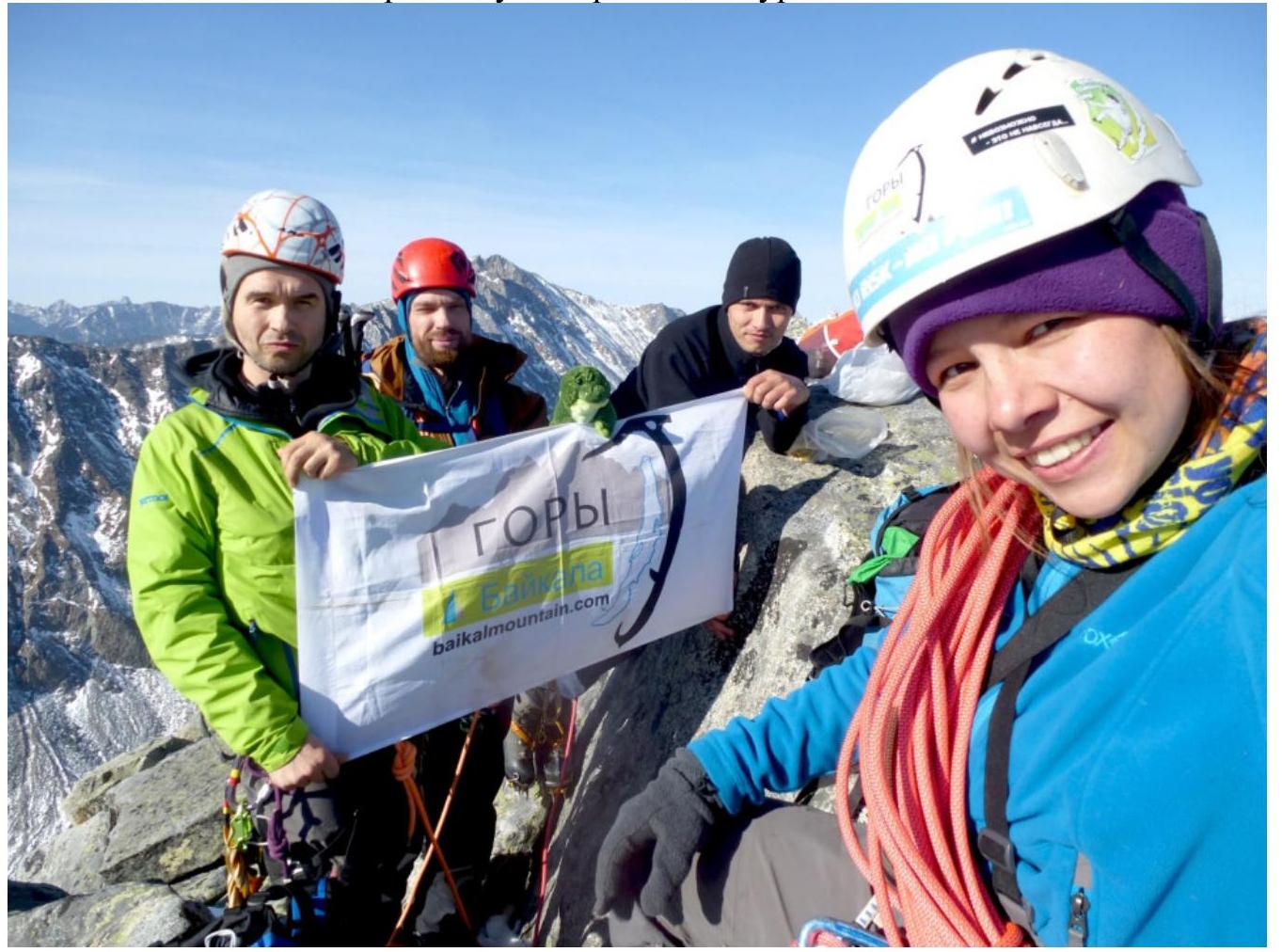
Photo 5.
3.3. The route is monolithic and, when ascending via the couloir to the right of the sub-summit, is relatively safe from rockfall. It corresponds to other routes of 2B category in the Eastern Sayan. The team descended along the southern ridge:
- From the summit, 100 m to the dülfer (30 m) from the rock to the saddle between the summit and the gendarme;
- The gendarme is bypassed to the right (from the west);
- Movement along the western slope of the southern ridge towards the pass between v. Optimist and v. Shkolnaya, not reaching 400-500 m;
- Descent into the Gorkhon valley.
Descent along the ascent route is also possible.
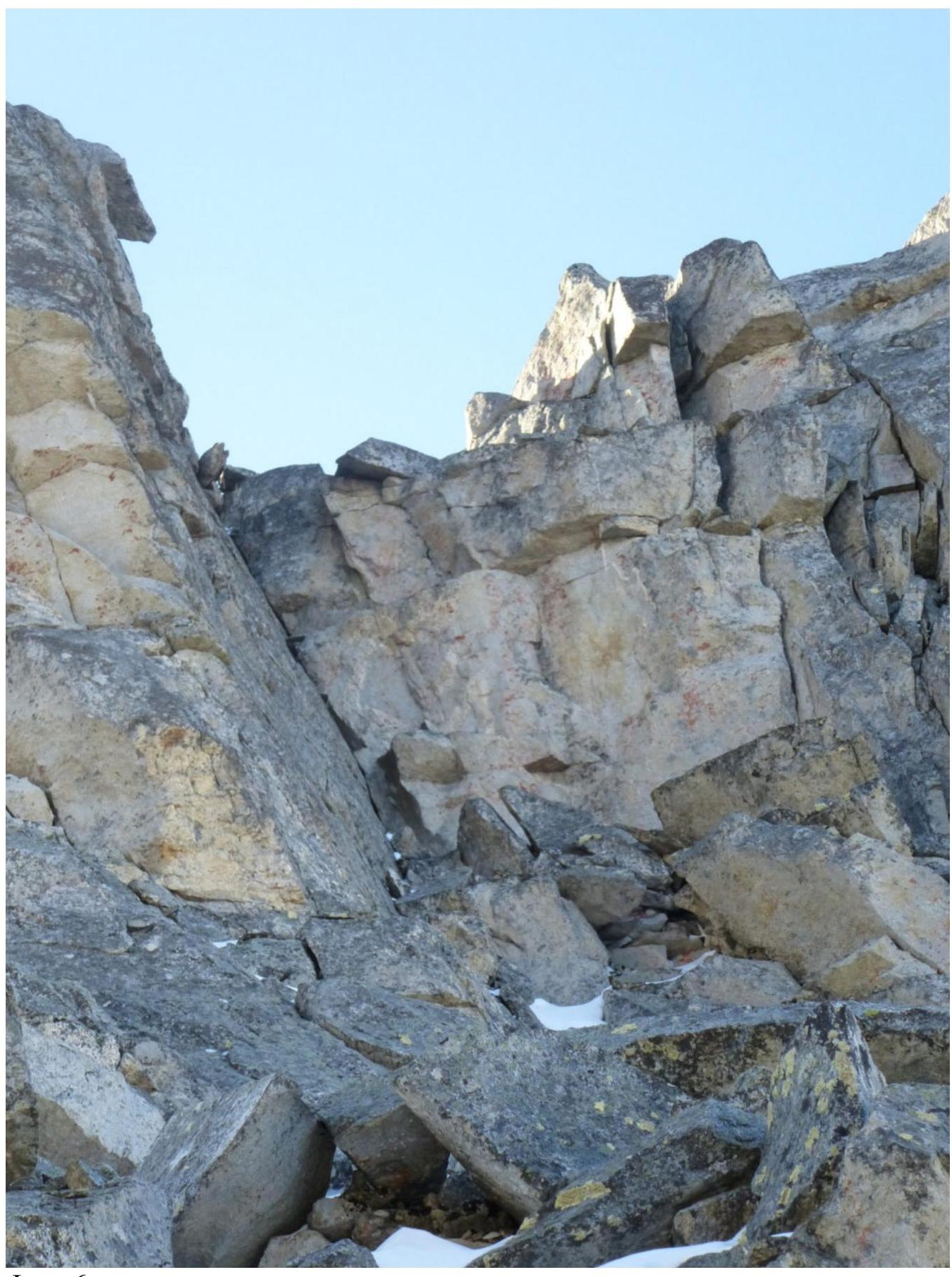
Photo 6.
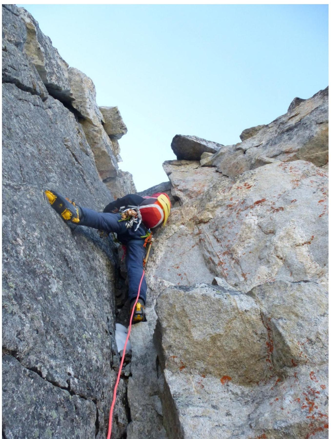
Photo 7.
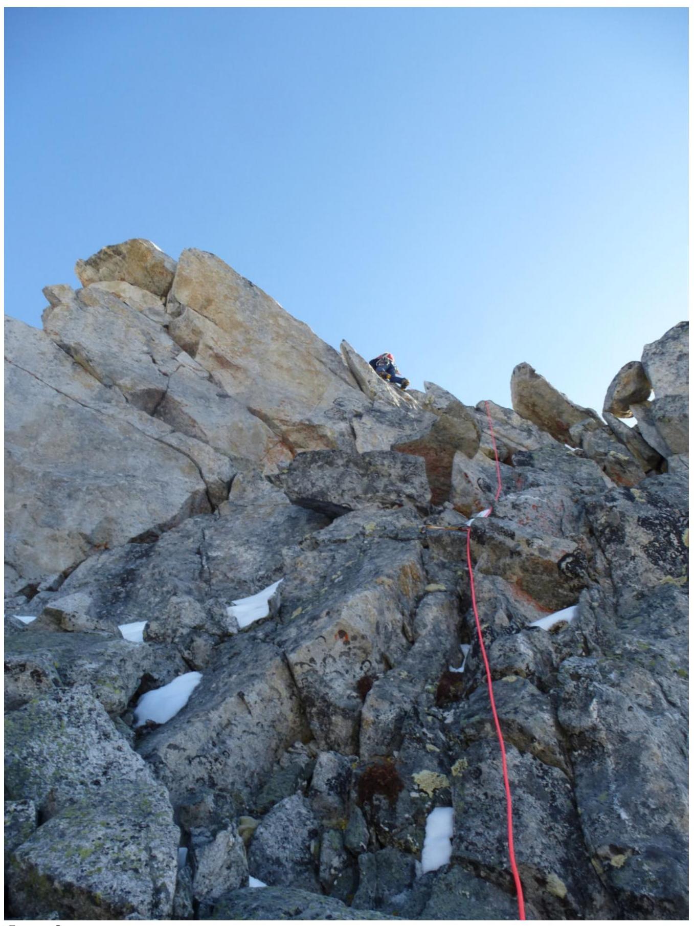
Photo 8.